August 04 , 2023 .
Alaska , Shishaldin :
AVO/USGS Volcanic Activity Notice
Current Volcano Alert Level: WATCH
Current Aviation Color Code: ORANGE
Issued: Thursday, August 3, 2023, 5:36 PM AKDT
Source: Alaska Volcano Observatory
Notice Number: 2023/A1205
Location: N 54 deg 45 min W 163 deg 58 min
Elevation: 9373 ft (2857 m)
Area: Aleutians
Volcanic Activity Summary:
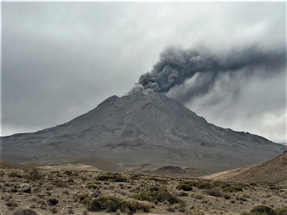
The level of unrest has increased at Shishaldin Volcano. A steady increase in seismic tremor has been observed over the past 7 hours. Despite cloud cover obscuring the volcano, elevated surface temperatures consistent with lava erupting at the summit are evident in the latest satellite data. Based on previous eruption cycles, ash emissions are likely to occur and may increase over the next few hours.
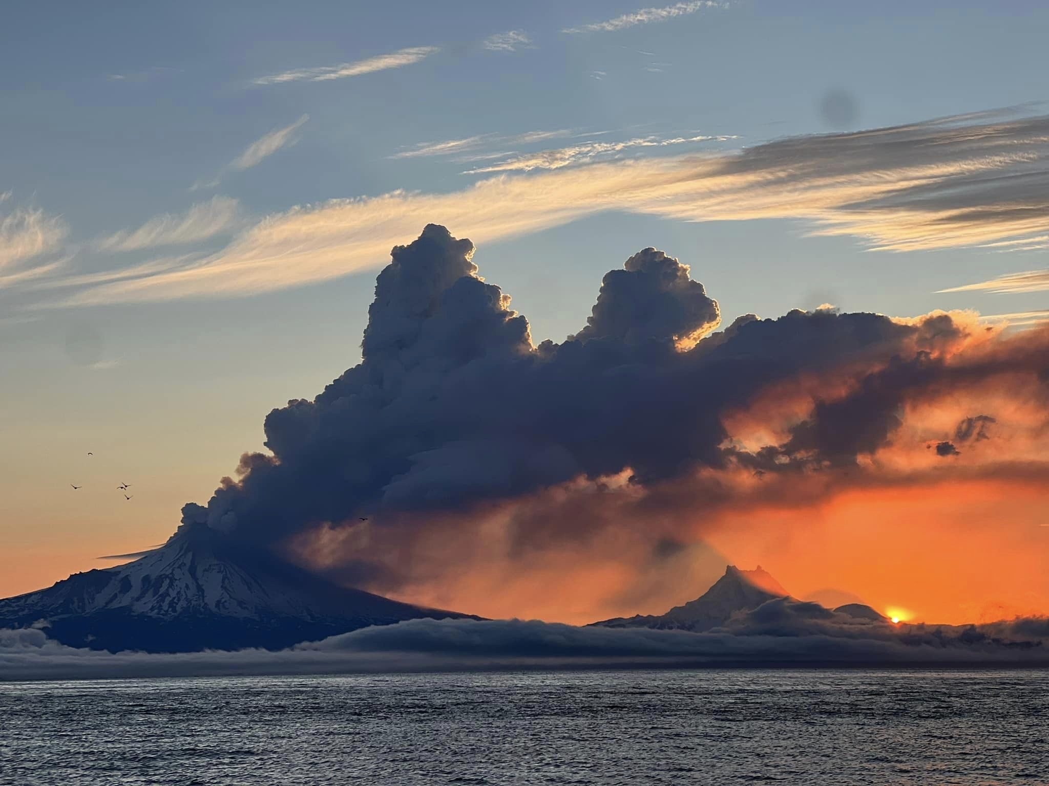
Recent significant ash events during the current eruption resulted in ash clouds with heights up to 40,000 ft (12 km) above sea level. These events can occur with little warning. It is also possible that ash emissions may occur at a lower-level, steady state and be sustained for many hours. AVO is monitoring the volcano closely and will issue additional Volcanic Activity Notice’s to provide notice of significant changes in activity as they occur.
Shishaldin Volcano is monitored by local seismic and infrasound sensors, web cameras, and a telemetered geodetic network. In addition to the local monitoring network, AVO uses nearby geophysical networks, regional infrasound and lighting data, and satellite images to detect eruptions.
Hazard Analysis:
[Mud flow] likely on the immediate flanks of the volcano
Remarks:
Shishaldin Volcano, located near the center of Unimak Island in the eastern Aleutian Islands, is a spectacular symmetric cone with a base diameter of approximately 10 miles (16 km). A 660 ft. (200 m) wide funnel-shaped summit crater typically emits a steam plume and occasional small amounts of ash. Shishaldin is one of the most active volcanoes in the Aleutian volcanic arc, with at least 54 episodes of unrest including over 26 confirmed eruptions since 1824. Most eruptions are relatively small, although the April-May 1999 event generated an ash column that reached 45,000 ft. (14 km) above sea level.
Source : AVO.
Photo : Nick Enloe
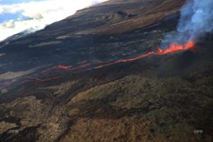
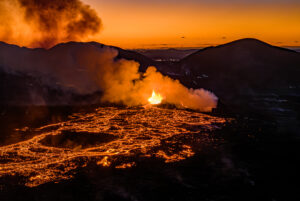
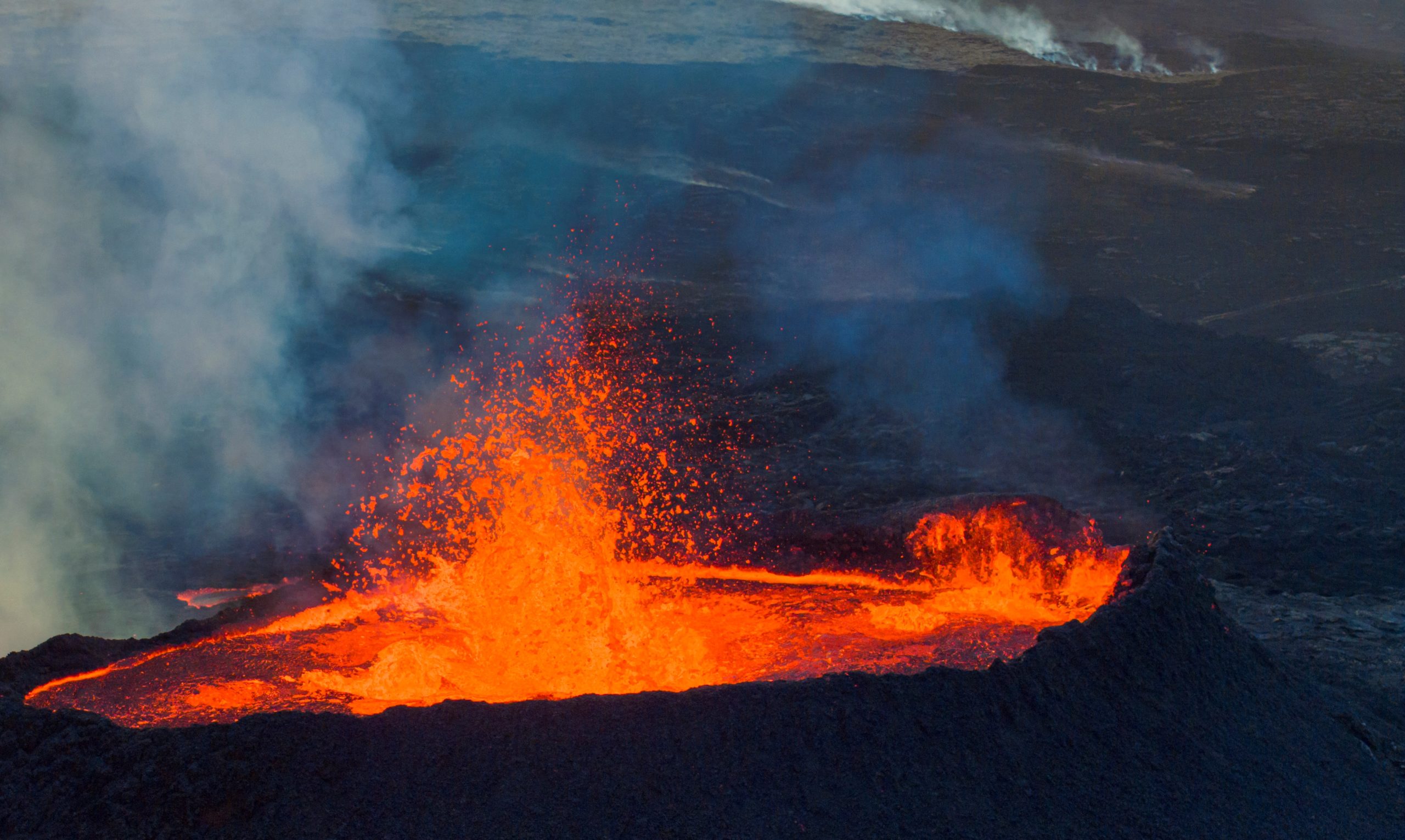
Iceland , Litli Hrútur :
Updated 2 August 2023
New data were acquired on 31 July and the processed results were published yesterday on Earth Science department’s website. The data show an extrusion rate of about 5 m3/s for the period 23-31 July. This estimate is lower than the previous one taken on 18 July which indicated a lava discharge rate of about 9 m3/s, revealing a further reduction in the intensity of the eruption. Considering the averaged discharge rate over the last few days, we could assess that the rate is just 3-4 m3/s as of today, as reported on ES’s website.
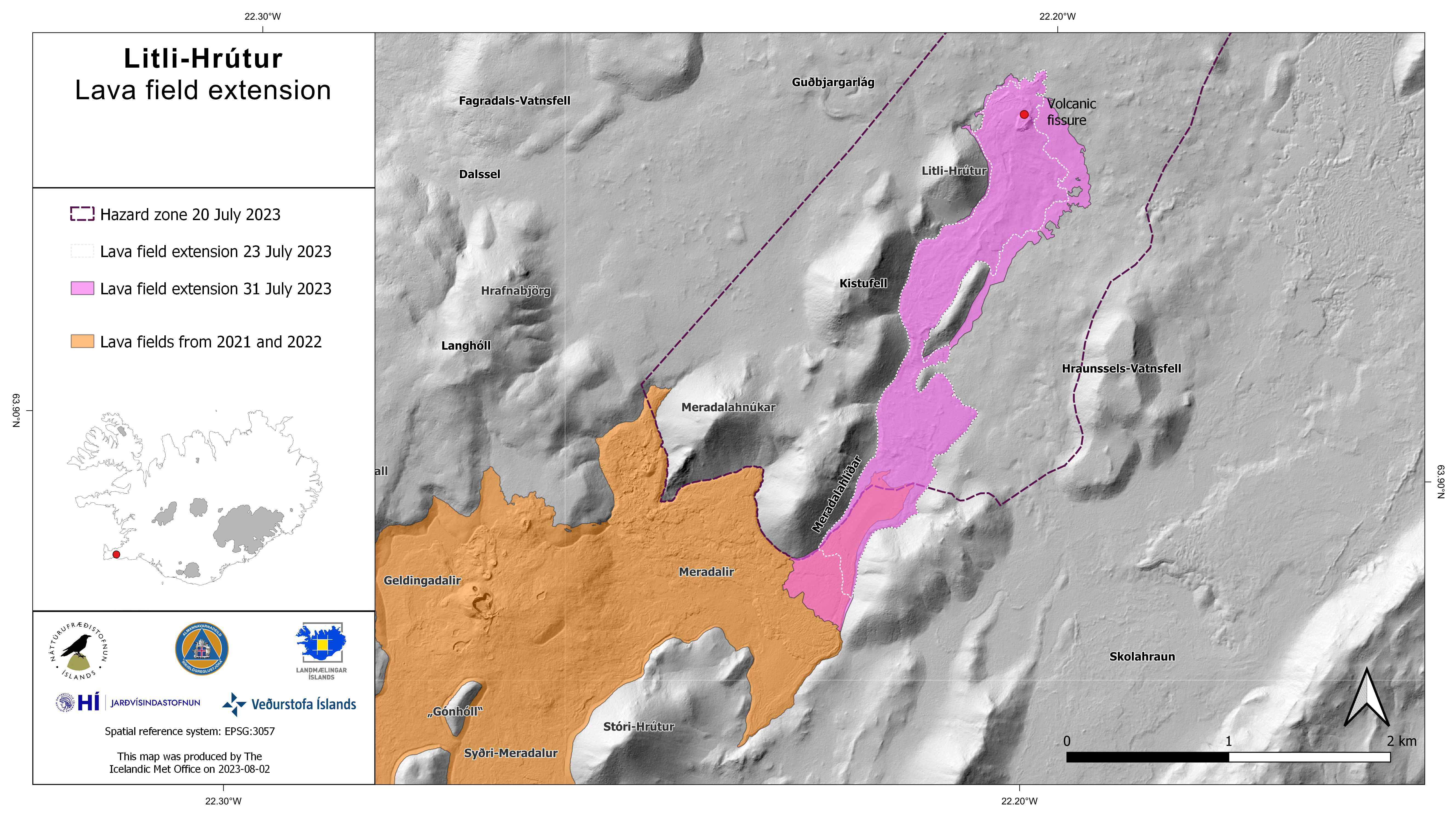
On the 31 July the lava field has extended over an area of 1.5 km2 and a total of 15.9 million m3 of lava has been released.
Since the 26th of july there have been about 150 earthquakes in and around the active area. Activity has been focused by Mt. Keilir which is the northernmost part of the intrusion dike. The largest earthquake during this period was a M2.1 located on the west side of Mt. Keilir. Few earthquakes are being measured at the active eruption area but there is still some activity happening NE of the main activity zone, these are so called trigger earthquakes directly related to the crust deformation due to the dike intrusion.
The GPS data indicates signs of deflation at depth which probably coincides with the deep source feeding the eruption. New InSAR images will be acquired next week, and they will help reassess the ongoing deformation processes occurring in the whole area around the eruption site. (The red line in the image above marks the beginning of the eruption)
Later today a team from IMO will perform a DOAS traverse to provide an updated estimate of SO2 release from the eruption.
The overall dataset confirms that the eruption is slowly decreasing, and it might possibly come to an end in the coming days/weeks.
Source : IMO.
Photo : Hraun Slökkviliðsmenn bruni/ icelanrewiew.
Italy , Vulcano :
WEEKLY BULLETIN, from July 24, 2023 to July 30, 2023, (issue date August 01, 2023)
ACTIVITY STATUS SUMMARY
In the light of the monitoring data, it is highlighted:
1) Temperature of the crater fumaroles: The temperatures recorded on the edge of the crater seem stable.
Along the summit rim, the maximum thermal amplitude recorded during the week is between 338 and 343°C
2) CO2 flux in the crater area: CO2 flux data from the VCS station show average values, remaining last week between 600 and 7000 g/m2/day.
3) SO2 flux in the crater area: at an average level
4) Geochemistry of fumarolic gases: There are no updates from the previous week.
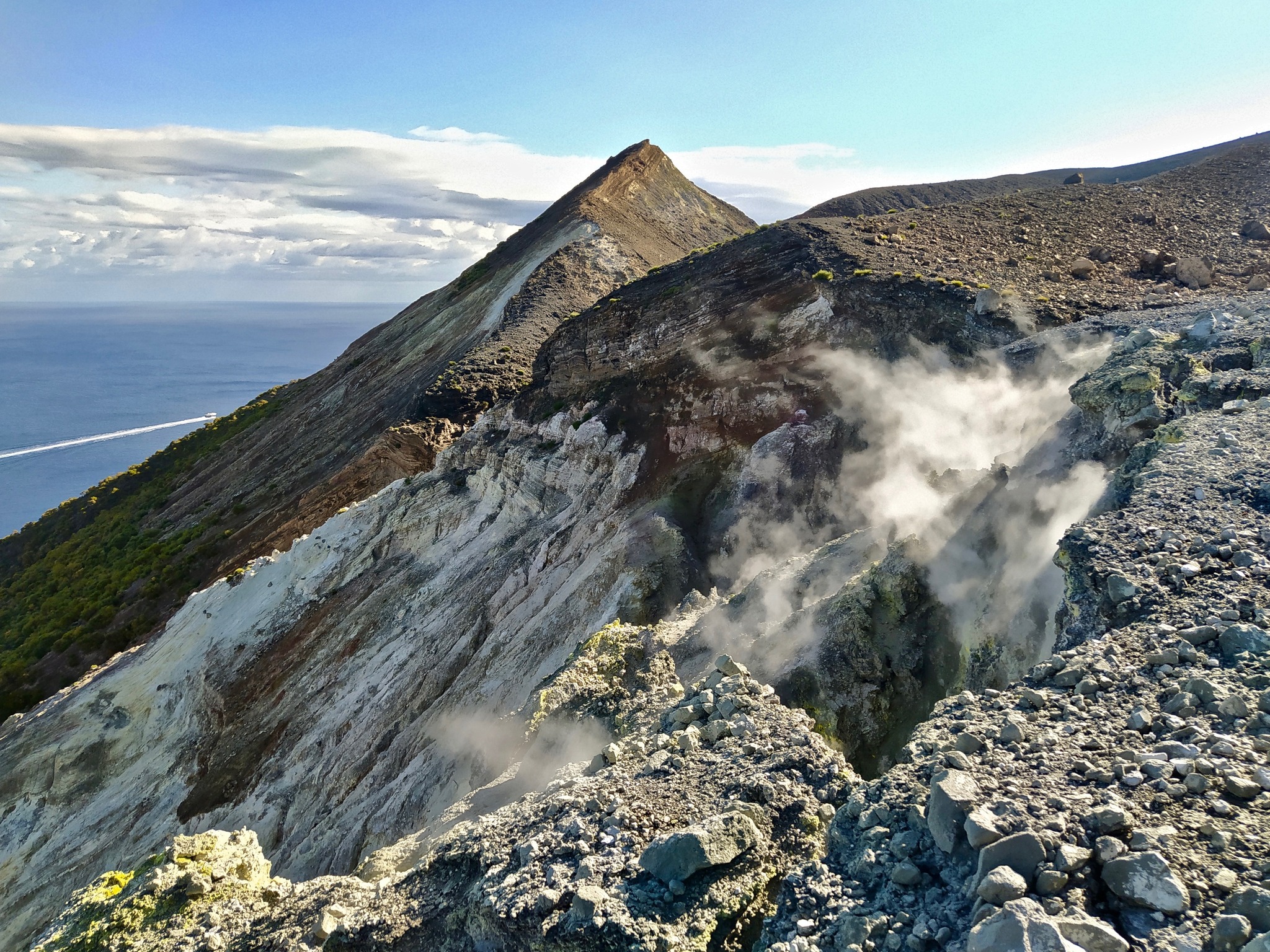
Cone and part of La Fossa crater – N sector.
5) CO2 fluxes at the base of the La Fossa cone and in the Vulcano Porto area: The CO2 fluxes recorded at the sites of Rimessa, Camping Sicilia and Faraglione show stable values, close to the respective levels of the background level. On the P4max site, the CO2 flux shows values at high levels.
6) Geochemistry of thermal aquifers: Pozzo Camping Sicilia: stable temperature values, conductivity decreases slightly; Bambara wells: conductivity at high values.
7) Local seismicity: Low occurrence rate of local micro-seismicity.
8) Regional seismicity: 1 earthquake of ML = 1.3 was recorded located in the southwest of the island.
9) Deformations – GNSS: The network of permanent GNSS stations has not recorded any significant variations.
10) Deformations – Inclinometry: The inclinometric network did not record any significant variations.
REGIONAL SEISMICITY
Fracture seismicity was low during the week in question, with only one earthquake exceeding the local magnitude threshold of 1.0. This earthquake, of ML= 1.3, occurred on the 26th at 8:22 p.m. UTC and was at sea, in an area located to the south-west of the island and at a depth of about 8.0 km below the sea level.
Source : INGV.
Photo: G. De Astis, 2020
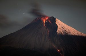
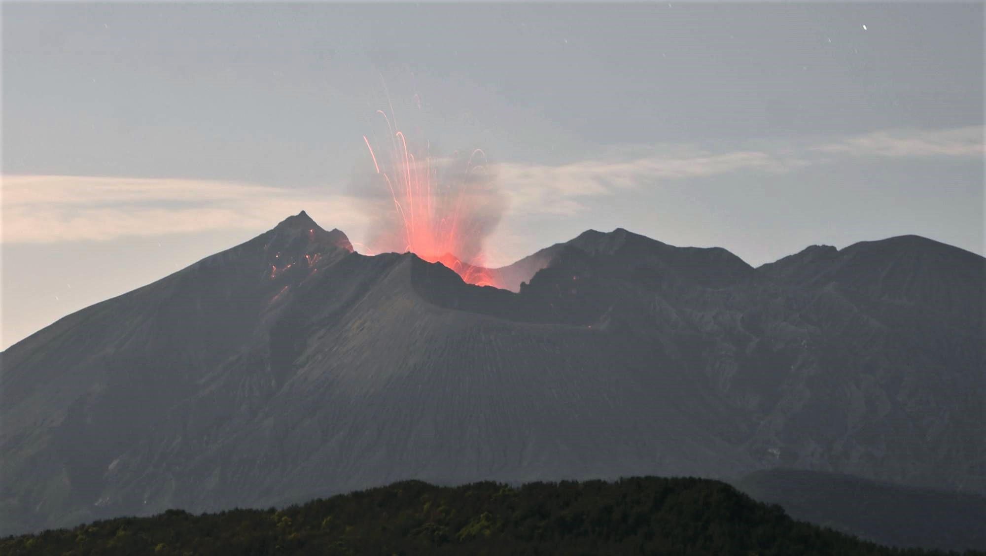
Japan , Sakurajima :
JMA reported ongoing activity at both Minamidake Crater and Showa Crater (Aira Caldera’s Sakurajima volcano) during 24-31 July. A very small eruption was reported on 24 July at Minamidake accompanied by occasional summit crater incandescence. An eruptive event at Showa at 03h49 on 25 July produced an ash plume that rose 1 km above the crater rim and ejected blocks traveled up to 200 m from the vent. No incandescence was observed at this crater. Sulfur dioxide emissions averaged 1,600 tons per day on 26 July. The Alert Level remained at 3 (on a 5-level scale), and the public was warned to stay 2 km away from both craters.
The Aira caldera in the northern half of Kagoshima Bay contains the post-caldera Sakurajima volcano, one of Japan’s most active. Eruption of the voluminous Ito pyroclastic flow accompanied formation of the 17 x 23 km caldera about 22,000 years ago. The smaller Wakamiko caldera was formed during the early Holocene in the NE corner of the Aira caldera, along with several post-caldera cones. The construction of Sakurajima began about 13,000 years ago on the southern rim of Aira caldera and built an island that was finally joined to the Osumi Peninsula during the major explosive and effusive eruption of 1914. Activity at the Kitadake summit cone ended about 4850 years ago, after which eruptions took place at Minamidake. Frequent historical eruptions, recorded since the 8th century, have deposited ash on Kagoshima, one of Kyushu’s largest cities, located across Kagoshima Bay only 8 km from the summit. The largest historical eruption took place during 1471-76.
Source: Japan Meteorological Agency (JMA), GVP
Photo : Kyodo news .
Peru , Ubinas :
UBINAS (PROVINCE OF GENERAL SÁNCHEZ CERRO) – IN ERUPTION PROCESS
o Eruptive process with moderate levels.
o During the last 24 hours, ash emissions have been recorded with heights of up to 2000 m above the summit of the volcano. Likewise, 76 earthquakes associated with rock fracturing processes inside the volcano, 174 seismic signals related to the movement of fluids and gases, as well as 12 cumulative hours of seismic signals related to ash emissions were recorded .
o According to the analysis of satellite images and the SENAMHI dispersion model, the dispersion of ashes and gases took place towards the West, South-West and South sectors, towards the neighborhoods of San Juan de Tarucani, Ubinas, Matalaque and their respective town centers, as well as ranches and pastures.
o The approximate radius affected by ashfall after today’s emissions is within 5 km of the crater, i.e. within the volcano area.
o Satellite systems did not detect any thermal anomalies on the surface of the crater.
o The monitoring of the deformation on the volcanic structure shows variations of less than 7 mm of displacement (slight tendency to inflation).
Conclusion:
The Ubinas volcano has developed an eruptive process of moderate levels, characterized by the recording of significant internal seismic activity and ash emissions. Today, there were ash and gas emissions up to 2000 m above the summit of the volcano. The population must remain attentive to possible ash falls and follow the recommendations issued by the Civil Protection authorities.
Recommendation:
Stay tuned for vulcanological reports and bulletins issued by the IGP via CENVUL.
Current Volcanic Alert Level: Orange
Source : IGP.
Photo : archive ingemmet.
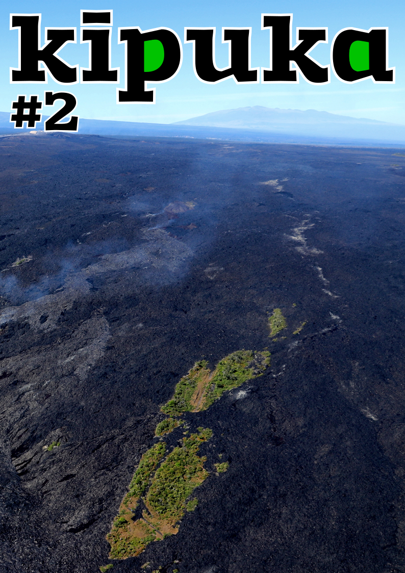
Kipuka , 2nd number :
The second issue of kīpuka, a popular science magazine devoted to volcanoes, has been published. It offers the following summary:
– The eruptive news of the second quarter of 2023
– Scientific news for the second quarter of 2023
– Useful volcanoes: Geothermal cuisine
– The file: kīpukas, when lava preserves life
– History: Volcanism and Christianization of Iceland
– The image: The eruption of Mount Mazama, by Paul Clark Rockwood
– Life: Lava flows and biodiversity at Piton de la Fournaise
– The question: Why are there no volcanoes in certain regions of the Andes?
 kīpuka (Hawaiian term pronounced « ki-pou-ka ») is a quarterly popular science magazine, which focuses on volcanoes through several prisms: that of geology of course, but also those of human and social sciences such as archaeology, history, art… Without forgetting a zoological and/or botanical section. The magazine is aimed at all volcano enthusiasts, whether they are passionate, enthusiastic or simply curious.
Source : Jean Marie Prival . contact@kipuka.fr . https://www.kipuka.fr