September 09 ,2022.
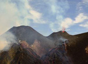
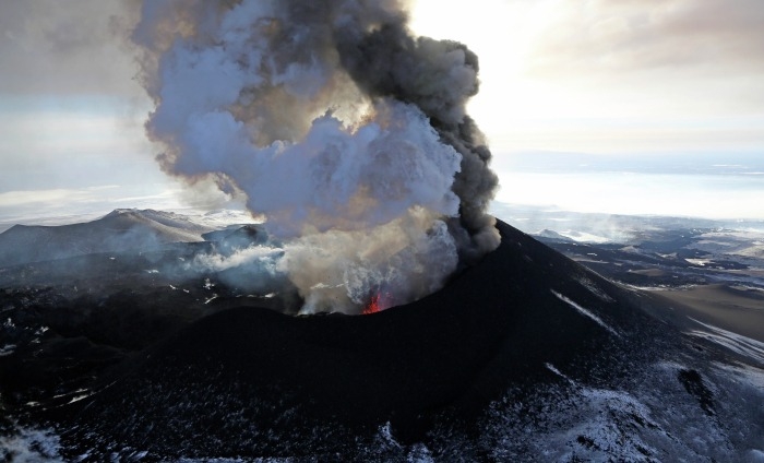
La Réunion , Piton de la Fournaise :
Press release, September 08, 2022 – 3:00 p.m. (local time) – 11:00 a.m. (UTC time)
Following the seismic crisis of September 7, seismicity is still recorded under the summit area of Piton de La Fournaise. However, since 9 a.m. (local time) today, the seismicity rate has decreased sharply with 1 low magnitude earthquake (< 0.5) per hour.

At the same time, the inflation (swelling) of the volcano, observed since the end of the last eruption on January 17, 2022, continues. This testifies to the continued replenishment of the superficial reservoir (located 1.5-2 km deep) by deeper magma. But since the end of the seismic crisis yesterday, and the end of the magma intrusion, no movement of magma from this reservoir to the surface is to be noted.
The recharge process from the depths to the superficial reservoir can take several days to several weeks before the roof of the reservoir weakens again and ruptures, thus giving rise to a new injection of magma towards the surface, but can also stop without giving rise to an eruption in the short term.
Recommended alert level: Vigilance
Source : direction de l’OVPF-IPGP
Photo : OVPF.
Ecuador , Sangay :
DAILY REPORT OF THE STATE OF SANGAY VOLCANO, Thursday September 08, 2022.
Information Geophysical Institute – EPN.
Surface activity level: High, Surface trend: Downward.
Internal activity level: High, Internal trend: No change
Seismicity: From September 07, 2022, 11:00 a.m. to September 08, 2022, 11:00 a.m.:
Explosions (EXP) 687
Emission Tremors (TREMI ) 51.
Rains / Lahars:
No rain recorded. **In the event of heavy rains, these could remobilize the accumulated materials, generating mudslides and debris that would descend on the flanks of the volcano and flow into the adjacent rivers.**
Emission / ash column:
Yesterday afternoon the volcano cleared and an emission of gas and ash was observed at a height of 1000 meters to the west. The Washington VAAC 4 indicates ash emissions with a height of 1770 meters above the summit to the west and south.
Gas:
The MOUNTS system reported 324.8 tons of SO2, measured on 07/09/2022 at 14:07 TL.
Other monitoring parameters.
The FIRMS system records 17 thermal alerts and MIROVA records 1 high alert (354 MW) in the last 24 hours.
Observation:
This morning the volcano woke up clear and an emission of gas and ash was observed, for the moment the volcano is cloudy.
Alert level: Orange.
Source : IGEPN.
Photo : Eqphos_fotografía
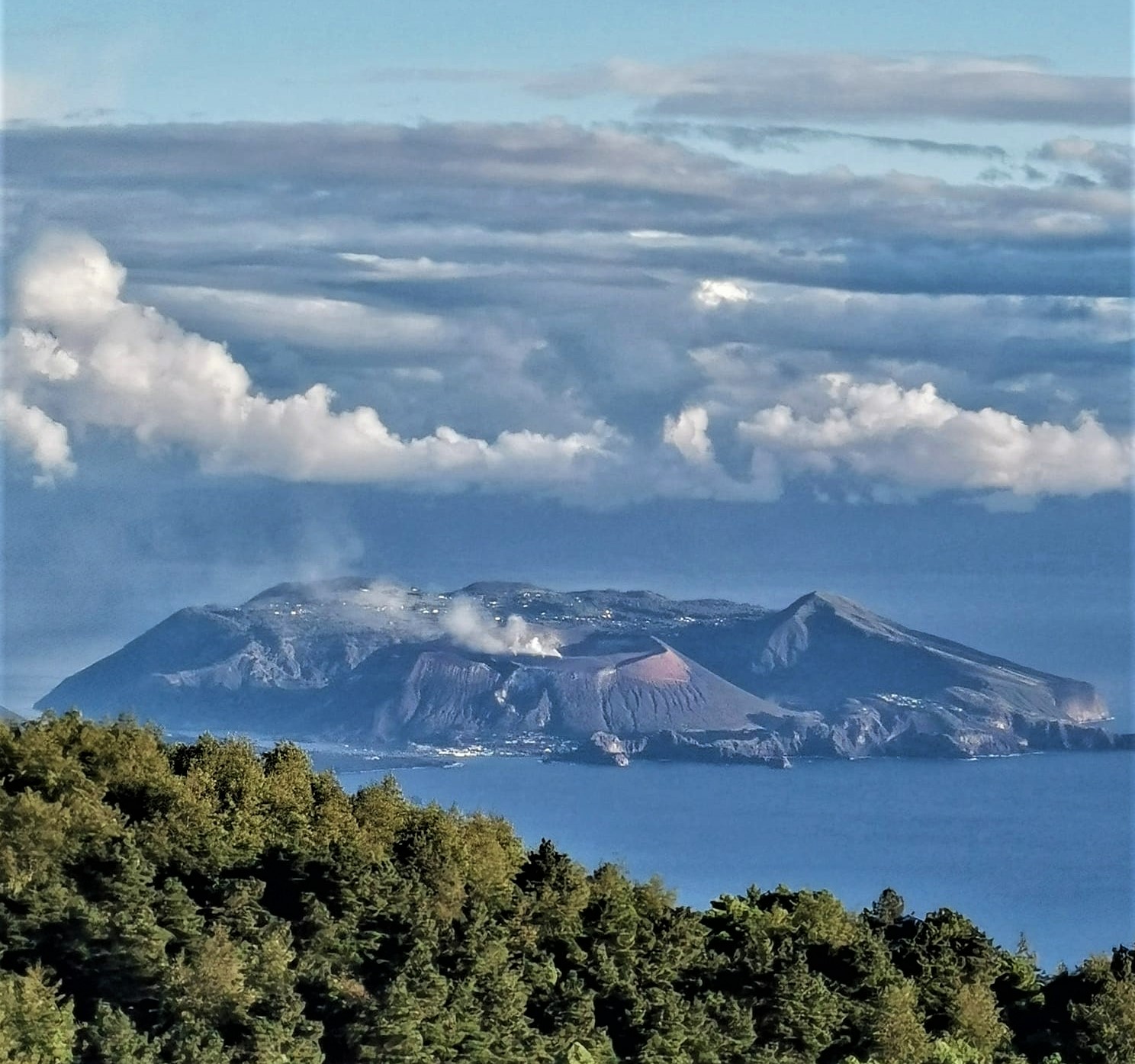
Italy , Vulcano :
WEEKLY BULLETIN, from August 29, 2022 to September 04, 2022. (issue date September 06, 2022)
ACTIVITY STATUS SUMMARY
In the light of the surveillance data, it is highlighted:
1) Temperature of the crater fumaroles: Along the upper edge, temperatures remain stable at high values.
2) CO2 flux in the crater area: The CO2 flux in the crater area shows a slight decrease, still remaining on medium-high values.
3) SO2 flux in the crater area: SO2 flux at a moderately medium-high level
4) Geochemistry of fumarolic gases: No update is available.
5) CO2 fluxes at the base of the La Fossa cone and in the Vulcano Porto area: CO2 flux values stable and above the background of the Rimessa site. On the site of Camping Sicilia and P4max (Palizzi) there is a slight downward trend with values that remain high. In the Faraglione site, stable values close to the background level.
6) Geochemistry of the thermal aquifers: In the waters of the well of Camping Sicilia there are always high temperature values and medium-low conductivity values; in the Bambara well, the level values show a further decrease, while the conductivity values show a slight upward trend.
7) Local seismicity: low occurrence rate of local events.
8) Regional seismicity: No regional event was recorded.
9) Deformations – GNSS: The network of permanent GNSS stations has not recorded any significant changes.
10) Deformations – Inclinometry: There are no significant variations of the inclinometric network
11) Gravimetry: No significant medium-long term variation was recorded.
12) Other Notes: Mobile GNSS. The GNSS mobile network acquires and transmits movements in real time at a frequency of 1 Hz. The historical series acquired so far do not show significant variations around the Porto di Levante area.
CRATER FUMEROLES TEMPERATURE:
Along the upper edge, the maximum emission temperature has very stable values with a weekly average of 373°C (range of values recorded on an hourly basis: 357-375°C). The fumarolic field has equivalent emission temperatures along the entire summit fracture line, confirming a thermal anomaly still maintained by a constant vapor flux. The sensor on the inner side requires maintenance. The update of data from the VSCS summit station concerning the diffused heat flux, shows decreasing surface yield values, however disturbed by recent rains.
CO2 FLOW AT THE BASE OF THE CONE DE LA FOSSA AND IN THE VULCANO PORTO AREA.
The soil CO2 flux at the C. Sicilia site shows a downward trend compared to the previous week; at the Rimessa site, the CO2 flux remains stable at levels higher than the background level; at the Palizzi site (P4max) during the last week there has been an upward trend in the flow rate although it has remained at very high values; at the Faraglione site, stable values close to the background level continue to be recorded.
Source : INGV.
Photo : Viaggi e Vulcani
Colombia , Chiles / Cerro Negro :
Chiles and Cerro Negro volcanoes weekly activity bulletin
Volcano activity continues at YELLOW LEVEL ■ (III): CHANGES IN THE BEHAVIOR OF VOLCANIC ACTIVITY.
From monitoring the activity of the CHILES AND CERRO NEGRO VOLCANOES, the COLOMBIAN GEOLOGICAL SERVICE (SGC) reports that:
For the period assessed between August 30 and September 5, 2022 and compared to previous weeks, fluctuations in the behavior of volcanic activity continued, with a decrease in both the occurrence and the energy of earthquakes . Volcanic seismicity was primarily associated with fracture of crustal material. Of the total earthquakes this week, 515 were located, the vast majority of which were located towards the southern flank of the Chiles Volcano, at epicentral distances not exceeding 4 km and depths up to 6 km from at the volcanic summit (4700 m).

Some earthquakes were located in a scattered manner towards the Southeastern sector of Chiles, at distances and depths of up to 14 and 12 km, respectively. Two events recorded on August 30 stand out, both at 9:56 a.m., with magnitudes of 3.5 and 3.2, reported as felt by residents of Resguardo de Chiles, municipality of Cumbal (Colombia) and Tufiño sector (Ecuador); Also noteworthy are the earthquakes recorded in the early hours of today, September 6, with magnitudes of 2.3 and 2.5, at 1:40 a.m. and 3:11 a.m., respectively.
All these seismic manifestations are part of a process of ground deformation (observed instrumentally) which began at the end of March 2022 and continues to this day.
Based on the current behavior of this seismicity and what has been historically recorded in this active volcanic region, the possibility of the occurrence of more high-energy earthquakes, which can be felt by the inhabitants of the area of volcanic influence, is not excluded.
The COLOMBIAN GEOLOGICAL SERVICE and the GEOPHYSICAL INSTITUTE OF THE NATIONAL POLYTECHNICAL SCHOOL of ECUADOR will continue to monitor the evolution of the volcanic phenomenon and will inform in a timely manner about any changes that may occur.
Source : SGC.
Photo : igepn
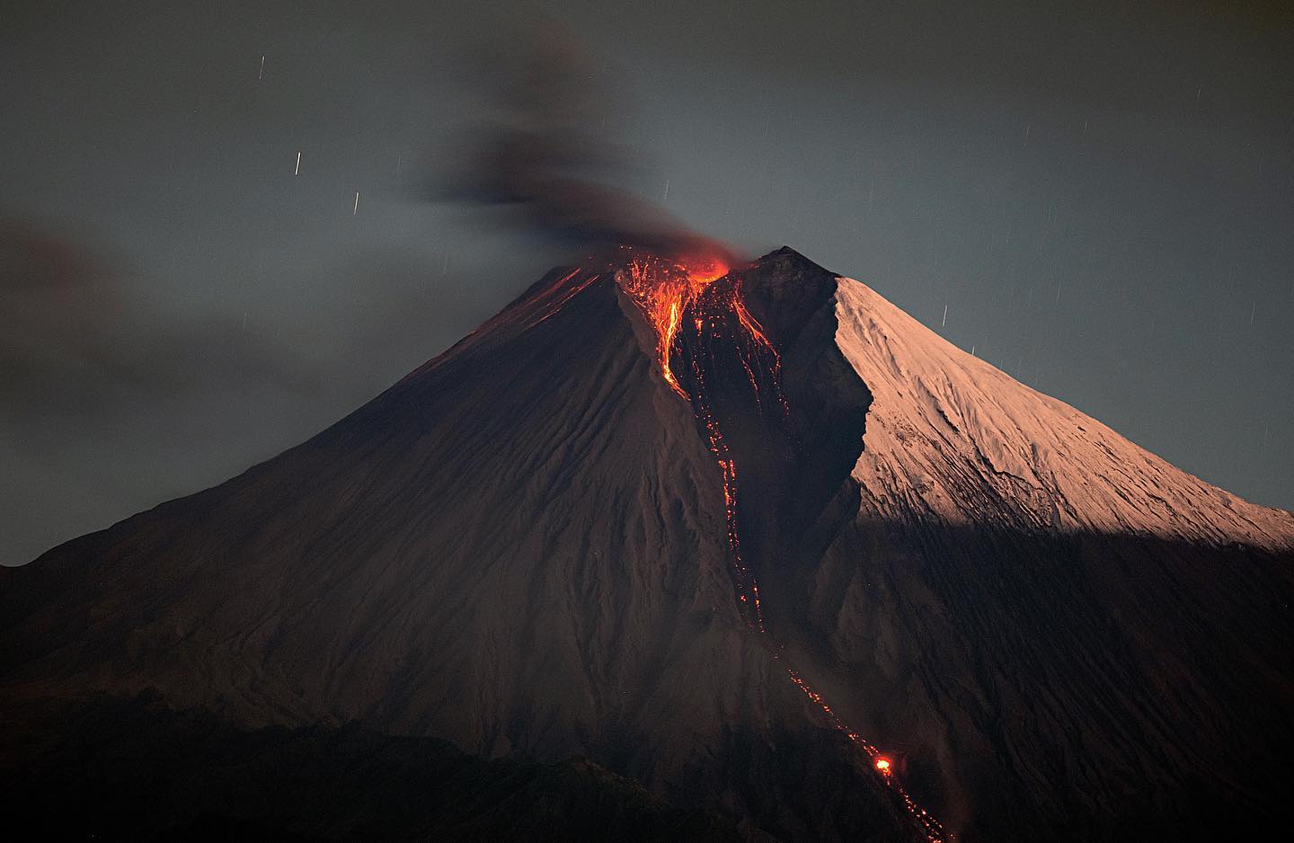
Russia / Kuril Islands , Ebeko :
VOLCANO OBSERVATORY NOTICE FOR AVIATION (VONA)
Issued: September 09 , 2022
Volcano: Ebeko (CAVW #290380)
Current aviation colour code: ORANGE
Previous aviation colour code: orange
Source: KVERT
Notice Number: 2022-111
Volcano Location: N 50 deg 41 min E 156 deg 0 min
Area: Northern Kuriles, Russia
Summit Elevation: 1156 m (3791.68 ft)
Volcanic Activity Summary:
A moderate eruptive activity of the volcano continues. According to visual data by volcanologists from Severo-Kurilsk, explosions sent ash up to 2.6 km a.s.l., an ash plume is drifting to the north-northeast of the volcano.
A moderate eruptive activity of the volcano continues. Ash explosions up to 6 km (19,700 ft) a.s.l. could occur at any time. Ongoing activity could affect low-flying aircraft and airport of Severo-Kurilsk.
Volcanic cloud height:
2600 m (8528 ft) AMSL Time and method of ash plume/cloud height determination: 20220909/0032Z – Visual data
Other volcanic cloud information:
Distance of ash plume/cloud of the volcano: 5 km (3 mi)
Direction of drift of ash plume/cloud of the volcano: ENE / azimuth 70 deg
Time and method of ash plume/cloud determination: 20220909/0032Z – Visual data
Source : Kvert.
Photo : Yuri Demyanchuk
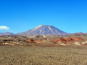
Chile , Laguna del Maule :
Seismology
The seismological activity of the period was characterized by the recording of:
485 VT-type seismic events associated with rock fracturing (Volcano-Tectonics). The most energetic earthquake presented a value of Local Magnitude (ML) equal to 2.2, located 3.6 km east-south-east of the center of the lagoon, at a depth of 7.8 km in reference to the average height of the lagoon.
35 LP-type seismic events, associated with fluid dynamics within the volcanic system (Long Period). The most energetic earthquake exhibited a reduced displacement value (RD) of 207 cm2.
1 TR-type seismic event, associated with sustained dynamics over time of fluids within the volcanic system (TRemor). The size of the earthquake estimated from the reduced displacement (RD) parameter was equal to 4.2 cm2.
3 HB-type seismic events, associated with both rock fracturing and fluid dynamics within the volcanic system (Hybrid). The most energetic earthquake presented a reduced displacement value (DR) of 8.5 cm2 and a local magnitude value (ML) equal to 2.1, located 13.4 km south-southeast of the center of the lagoon, at a depth of 1.4 km in reference to the average height of the lagoon.

Fluid Geochemistry
No anomalies were reported in the emissions of sulfur dioxide (SO2) into the atmosphere in the area near the volcanic complex, according to data published by the Tropospheric Monitoring Instrument (TROPOMI) and the Ozone Monitoring Instrument (OMI) Sulfur Dioxide Group.
Satellite thermal anomalies
During the period, no thermal alert was recorded in the area associated with the volcanic system, according to the analytical processing of Sentinel 2-L2A satellite images, in combination with false color bands.
Geodesy
According to the data provided by 4 GNSS stations and 2 inclinometer stations, which make it possible to measure the deformation in the complex, it is observed that the historically recorded inflationary process is continuing. The maximum uplift rate continues to be recorded at the GNSS MAU2 station, at the center of the geodetic network and to the southwest of the lagoon, estimating displacements of a maximum magnitude of 2.05 cm/month in the vertical component.
Surveillance cameras
The images provided by the fixed camera, installed near the complex, did not record any degassing columns or variations linked to surface activity.
Activity remained at levels considered low, suggesting stability of the volcanic system. The volcanic technical alert is maintained at:
GREEN TECHNICAL ALERT: Active volcano with stable behavior – There is no immediate risk
Observation:
The affected zone is considered to be that contained within a radius of 1 km around the center of passive CO2 degassing.
Source : Sernageomin.
Photo : Dr Katie Keranen.