July 2 , 2023.
La Réunion : Piton de la Fournaise
Press release from the Paris Institute of Earth Physics, Piton de la Fournaise Volcanological Observatory, July 19, 2023 – 11:40 a.m. – 07:40 a.m. UTC
Ongoing eruption
The eruption started on July 02, 2023, around 08:30 local time continues. The amplitude of the volcanic tremor (indicator of an emission of lava and gas on the surface) is always fluctuating over time on the scale of a few tens of minutes, with phases of continuous tremor and phases of intermittent tremor. The amplitude of the tremor nevertheless remains low compared to the start of the eruption.
The fluctuations observed in the tremor are reflected at the level of the eruptive site by variations in intensity in the activity, with projections of lava fountains at the level of the more or less intense eruptive cone.
With the low surface activity, the morphology of the active volcanic cone – located southeast of the Enclos Fouqué at 1720 m altitude – hardly changes.
Lava flow now takes place mainly in lava tunnels in the immediate vicinity of the cone. This morning no flow was visible on the surface in the immediate vicinity of the cone.
Currently the growth of the lava field is mainly by widening and thickening near the eruptive cone at the level of the lava tunnel networks.
During last night, the active flows were at altitudes above 1400 m in the upper part of the Grandes Pentes.
A weak inflation of the summit zone has been recorded for 5 days, indicating a re-pressurization of the volcano’s feeding system with possible transfer of deep magma to the latter.
At the same time, the OVPF-IPGP NOVAC stations located on the edge of the Enclos Fouqué recorded an increase in SO2 fluxes in the air.
The seismic activity recorded under the summit zone remains weak. Thus over the last 24 hours, no superficial volcano-tectonic earthquake has been recorded. This low seismic activity leads to a reduction in the risk of the appearance of a new crack and/or collapse in the crater, but does not mean that it can be excluded.
Alert level: Alert 2-1 (eruption in the Enclos without any particular threat to the safety of people, property or the environment).
Source : OVPF
Photo : Volcanoexplorer.re Tunnels de lave Réunion/ Vincent Cheville.
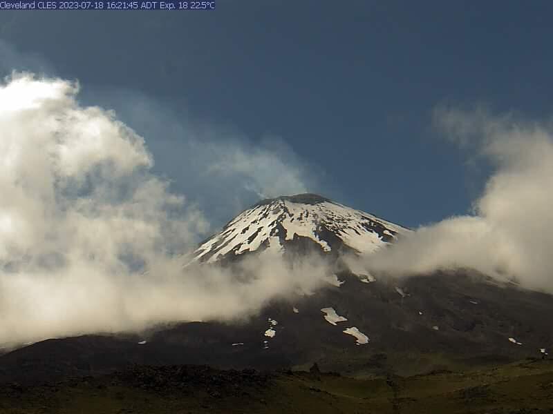
Alaska , Cleveland :
AVO/USGS Volcanic Activity Notice
Current Volcano Alert Level: ADVISORY
Previous Volcano Alert Level: UNASSIGNED
Current Aviation Color Code: YELLOW
Previous Aviation Color Code: UNASSIGNED
Issued: Wednesday, July 19, 2023, 12:18 PM AKDT
Source: Alaska Volcano Observatory
Notice Number: 2023/A1094
Location: N 52 deg 49 min W 169 deg 56 min
Elevation: 5676 ft (1730 m)
Area: Aleutians
Volcanic Activity Summary:
There has been an increase in the number of earthquakes observed near Cleveland volcano over the past week. Numerous earthquakes have been detected and 37 of these were large enough to be located by the local seismic network. Most of the earthquakes from early in the week located in the mid to shallow portions of the Earth’s crust, less than 11 miles (18 km) below the surface, while more recent earthquakes have been located at shallower depths, less than 4 miles (6 km) below the surface. These earthquakes are small (less than magnitude 2), but the frequency of events is unusual for Cleveland. These data along with satellite observations of elevated surface temperatures at the summit crater and continued gas emissions suggest an increased likelihood of a future eruption. In response, the Alaska Volcano Observatory is increasing the Aviation Color Code to YELLOW and the Volcano Alert Level to ADVISORY.
The last eruptive activity at Cleveland volcano was a short-lived explosion during the evening (local time) of June 1, 2020. Despite the current pause, the eruptive period at Cleveland, dating back to 2001, remains ongoing and future explosions are likely. These have occurred without warning and typically generate small clouds of volcanic ash that are a hazard in the immediate vicinity of the volcano, though more significant ash emissions are possible.
Cleveland volcano is currently monitored with a five-station real-time seismic network. Based on past events, explosive eruptions of Cleveland may occur with little or no warning. Rapid detection of an ash-producing eruption may be possible using a combination of seismic, infrasound, lightning, and satellite data.
Remarks:
Cleveland volcano forms the western portion of Chuginadak Island, a remote and uninhabited island in the east central Aleutians. The volcano is located about 45 miles (75 km) west of the community of Nikolski, and 940 miles (1500 km) southwest of Anchorage. The most recent significant period of eruption began in February 2001 and produced 3 explosive events that generated ash clouds as high as 39,000 ft (11.8 km) above sea level. The 2001 eruption also produced a lava flow and hot avalanche that reached the sea. Since then, Cleveland has been intermittently active producing small lava flows, often followed by explosions that generate small ash clouds generally below 20,000 ft (6 km) above sea level. These explosions also launch debris onto the slopes of the cone producing hot pyroclastic avalanches and lahars that sometimes reach the coastline.
Source : AVO.
Photos : Herstand, Malcolm / Alaska Volcano Observatory / Alaska Division of Geological & Geophysical Surveys , Loewen, Matt / Alaska Volcano Observatory / U.S. Geological Survey
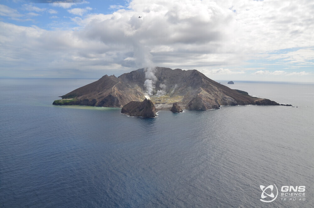
New Zealand , White Island :
Minor steam and gas emissions continue at Whakaari/White Island. Thu Jul 20 2023 11:45 AM
Based on observations over the last month, activity at Whakaari/White Island has been limited to minor steam and gas emissions. There have been no significant changes in the active crater area. The Volcanic Alert Level remains at 2
Observations from the most recent monitoring and gas flights show the steam and gas plume continues to originate from the same vent locations as previously observed, with discharge rates in a similar range. Views from the Whakatane webcam show similar conditions prevail at Whakaari/White Island. There has been no evidence of ash emission or eruptive activity from these vents.
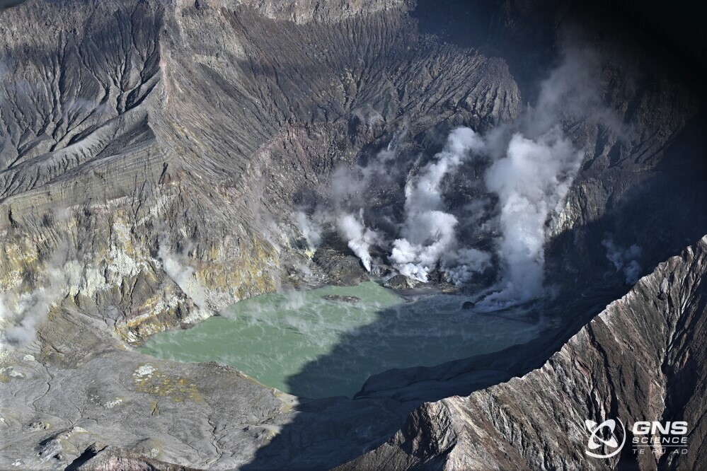
Gas emission rates and steam discharge are low, and broadly like earlier observations this year. Measurements from regular monitoring flights have recorded a decline in the temperatures from the larger vents. In March temperatures were higher than 240 °C, while the latest are only 120 °C.
Following the failure of our last two surviving on-island monitoring sites, we now have no on-island monitoring capability. We continue to make regular observation and gas measurement flights to monitor the status of the island. We obtain satellite-based ground deformation data approximately every 10 days that allows us to observe ground deformation trends. These are complimented by daily satellite-based Sulphur Dioxide (SO2) emission measurements, although this technique is not as sensitive as our gas measurement flights. Neither of these satellite techniques have detected significant changes in the overall activity at the volcano over the past few months.
The Volcanic Alert Level remains at Level 2 (moderate to heightened unrest) and the Aviation Colour Code remains at Yellow, acknowledging the current level of activity, but also continuing to consider the greater level of uncertainty in our interpretation due to the current lack of consistent, useful real-time data.
As the weather allows, we will continue to undertake gas measurement and observation flights over the island until we can service our on-island equipment and power supplies.
Source : Geonet / Steven Sherburn, Duty Volcanologist .
Photos : Geonet , BJ_Scott / Geonet.
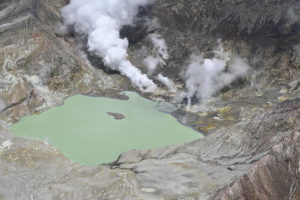
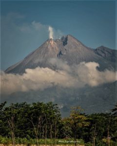
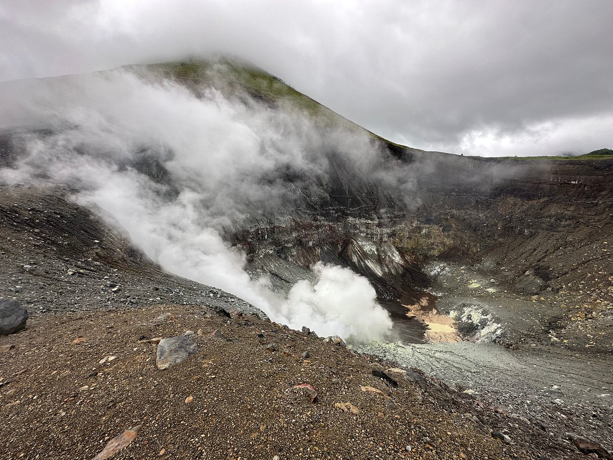
Sulawesi , Lokon – Empung :
Reports of increased level of activity on G. Lokon, from Level II (WASPADA) to Level III (SIAGA)
Visual observation
Visual conditions for the period from July 1 to July 16, 2023 for the Lokon volcano (15,579 m a.s.l.) were generally sunny to rainy, precipitation measured 125 mm for 16 days. Smoke from the crater is white with low to thick intensity, about 25-350 meters high above the summit.
Instrumental observation
Seismicity during the period June 2023 recorded;
171 emission earthquakes,
8 non-harmonic tremors,
225 shallow volcanic earthquakes,
15 deep volcanic earthquakes,
1 local tectonic earthquake
69 distant tectonic earthquakes
7 Continuous Tremors with an amplitude of 0.1 to 25 mm, dominant value of 5 mm.
Seismicity for the period from July 1 to July 16, 2023 recorded;
50 emissions earthquakes,
7 non-harmonic tremors,
151 shallow volcanic earthquakes,
12 deep volcanic earthquakes,
33 distant tectonic earthquakes
6 Continuous Tremors with an amplitude of 0.5-4 mm, dominant value of 0.5 mm.
On July 17, 2023 at 12:00 WITA, a tremor/swarm signal was observed with a maximum amplitude of 16 mm.
Assessment
The seismicity of G. Lokon is dominated by shallow volcanic earthquakes (VB) and emission earthquakes. Judging from the recorded seismic data, there has been a trend of a significant increase since June 13, 2023 at 6:50 p.m. WITA, when tremors began to be detected with a maximum amplitude of 28 mm and a duration of 7200 seconds. The number of earthquakes until July 16, 2023 is even higher than before June 20, 2023. From these data, it is clear that there was an increase in volcanic activity on the surface after the Tremor signal was recorded.
The threat of danger at this time is the occurrence of phreatic to magmatic eruptions with or without being followed by a sudden flow of hot eruption clouds. The rainy season is still ongoing around Mount Lokon.
Source : PVMBG.
Photo : Paul S.
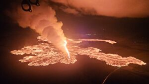
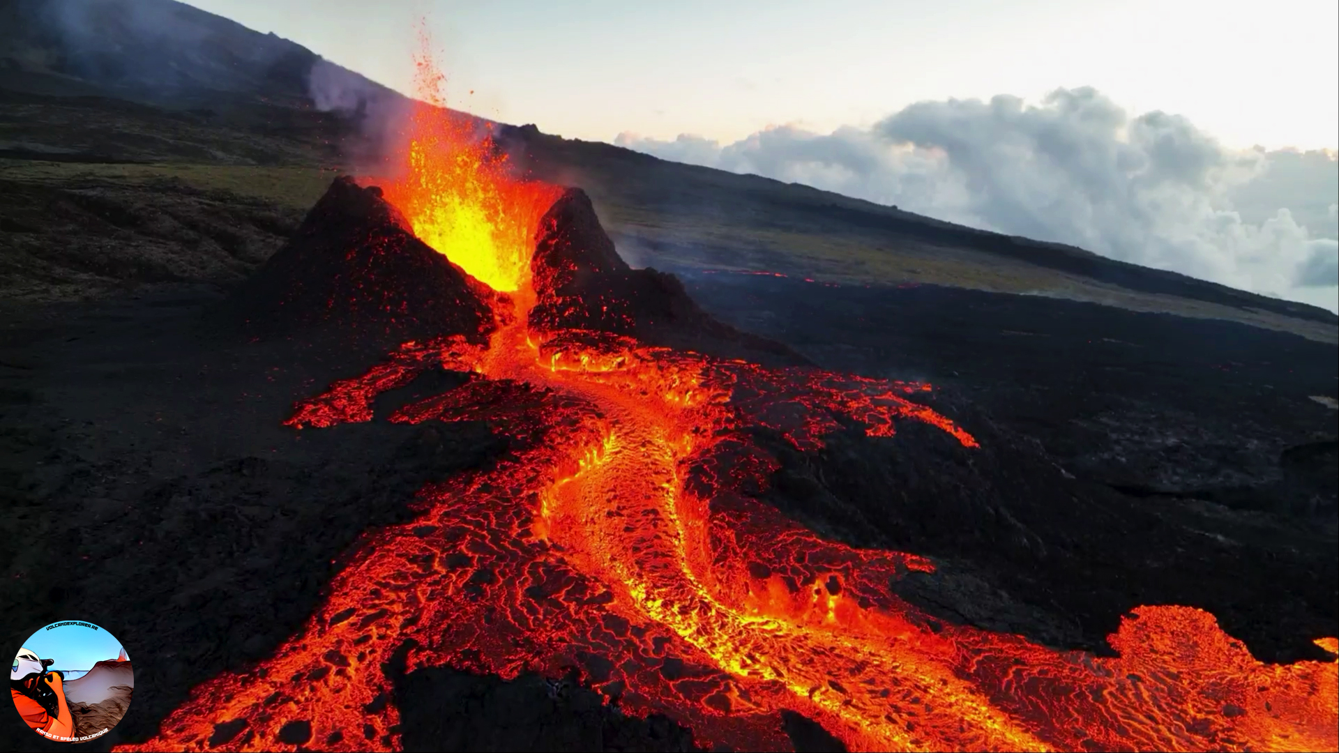
Iceland , Litli Hrútur :
According to the Institute of Earth Sciences lava continues to eruption from main vent at Fagradalsfjall and travel S and SW. On 14 July the advancing edge of the flow connected with the 2021 lava field in the NE part of Meradalir . The main vent was elongated and about 22 m tall on 15 July. During 13-17 July the lava flow rate was an estimated 12.7 cubic meters per second, and by 18 July the total erupted volume was about 8.4 million cubic meters. The flow advanced an average of 300-400 m per day, though the distance was highly variable. Flow thicknesses averaged 10 m, though some areas reached 20 m.
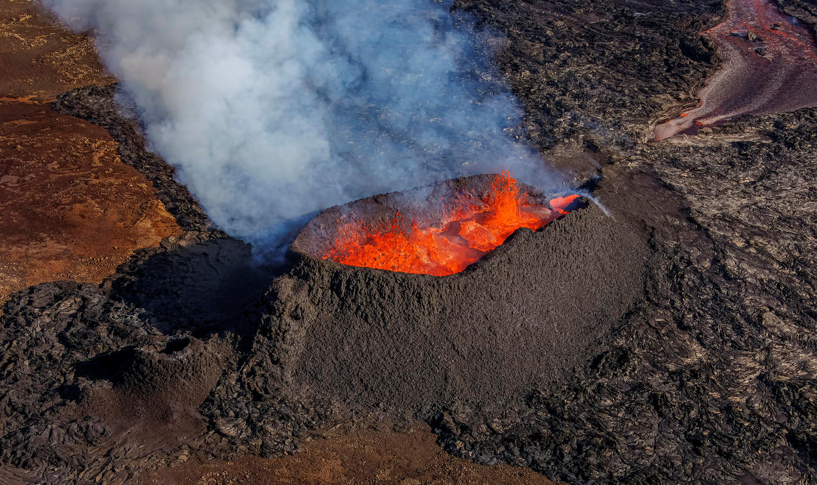
At about 23h30 on 18 July lava filled the main cone and occasionally spilled over onto the flanks. A breach high on the NW rim occurred at around 02h51 on 19 July and lava flowed down the NW flank. Spatter was ejected beyond the crater rim. At around 02h59 lava fountaining increased and lava flowed short distances E. At around 04h12 sections of the NW wall of the cone collapsed, draining the crater, and sending lava flows N and W. According to Almannavarnadeild ríkislögreglustjóra and news sources the police closed the pathway to see the eruption on 13 July, then reopened the path to tourists on 17 July. Firefighters were working to control the burning vegetation set on fire by the lava.
Sources: Almannavarnadeild ríkislögreglustjóra (National Commissioner of the Icelandic Police and Department of Civil Protection and Emergency Management), Institute of Earth Sciences , GVP.
Photo :mbl.is/Árni Sæberg