June 30 , 2023.
Kamchatka , Sheveluch :
VOLCANO OBSERVATORY NOTICE FOR AVIATION (VONA)
Issued: June 3 , 2023
Volcano: Sheveluch (CAVW #300270)
Current aviation colour code: ORANGE
Previous aviation colour code: orange
Source: KVERT
Notice Number: 2023-80
Volcano Location: N 56 deg 38 min E 161 deg 18 min
Area: Kamchatka, Russia
Summit Elevation: 3283 m (10768.24 ft), the dome elevation ~2500 m (8200 ft)
Volcanic Activity Summary:
Video and satellite data by KVERT shows a strong wind lifts ash from the slopes of Sheveluch volcano, and a plume of resuspended ash is extending about 22 km to the west of the volcano.
An extrusive-effusive eruption of the volcano continues. A danger of ash explosions up to 10 km (32,800 ft) a.s.l. is remains. Ongoing activity could affect international and low-flying aircraft.
Volcanic cloud height:
2500-3000 m (8200-9840 ft) AMSL Time and method of ash plume/cloud height determination: 20230630/0234Z – MODIS AQUA 31m32
Other volcanic cloud information:
Distance of ash plume/cloud of the volcano: 22 km (14 mi)
Direction of drift of ash plume/cloud of the volcano: W / azimuth 276 deg
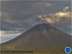
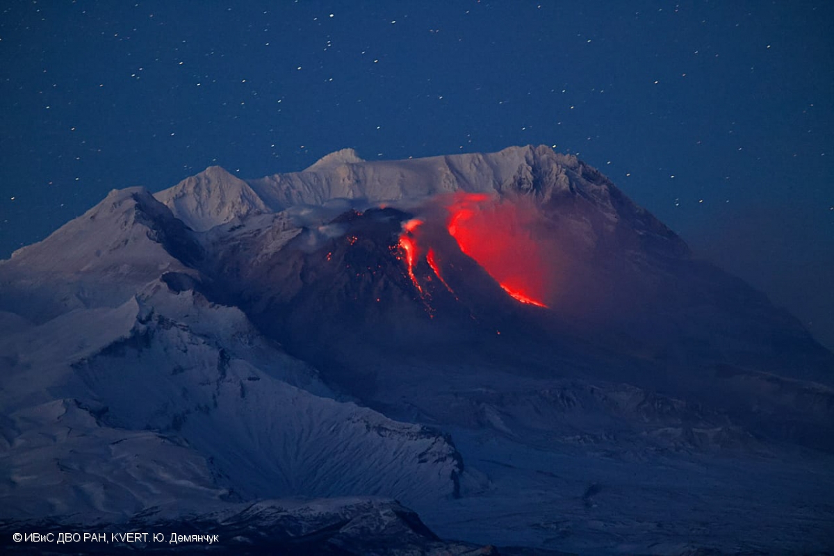
Source : Kvert
Photo : Yu. Demyanchuk, IVS FEB RAS, KVERT ( archive).
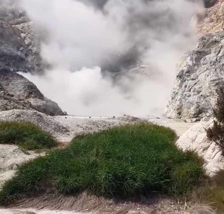
Italy , Campi Flegrei :
Weekly Bulletin, from June 19, 2023 to June 25, 2023. (Date of issue June 27, 2023)
ACTIVITY STATUS SUMMARY
In the light of the monitoring data, it is highlighted:
1) SEISMOLOGY: In the week of June 19 to 25, 2023, 29 earthquakes of magnitude Md≥0.0 (Mdmax=1.6±0.3) were located in the Campi Flegrei area.
2) DEFORMATIONS: Since January 2023, the average lifting speed value in the maximum deformation zone is about 15±3 mm/month. The uplift recorded at the RITE GPS station is about 104 cm from January 2011. In recent weeks there seems to be a reduction in the uplift speed, the actual trend of which can be assessed with the data
the next few weeks.
3) GEOCHEMISTRY: There are no significant changes in the geochemical parameters monitored during the reference period. The temperature sensor installed in a fumarolic emission 5 meters from the main Pisciarelli fumarole showed an average value of ~96°C, the condensation temperature of the fumarolic fluid.
GEOCHEMISTRY
The values of the ground CO2 flux recorded continuously by the FLXOV8 station, in the Pisciarelli area (north-eastern outer slope of Solfatara), highlight the persistence of the multi-annual trends already identified previously. Soil CO2 fluxes measured last week showed no significant changes from previous periods.
The temperature sensor installed in the main fumarole is no longer functional and will have to be replaced, but due to the macroscopic variations of the fumarolic zone and the stability of the ground, in compliance with the precautionary principle and in order to operate in complete security, site maintenance activities are currently suspended. During the last week, the temperature of the fumarole did not show significant variations, with an average measured value of ~96°C, the temperature of condensation of the fumarolic fluid.
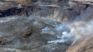
Source : INGV
Photos : Quelli della zona rossa del vulcano Campi Flegrei.
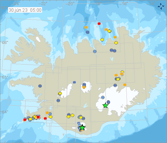
Iceland , Mýrdalsjökull :
Today June 30th at 01:18 an earthquake swarm started in Mýrdalsjökull. Over 60 earthquakes have been detected. Five earthquakes over M3 have been detected and one over M4, the largest M4.4 at 02:46. No volcanic tremor has been detected.
Yesterday June 29th at 07:48 a M3.1 earthquake was detected in Þórðarhyrnu in southwestern part of Vatnajökull. Earthquakes of this magnitude are not common in Þórðarhyrna.
The Þórðarhyrna central volcano has been moderately active during the Holocene, with the last eruption occurring in 1903 CE. It is the second and less active central volcano on the Grímsvötn-Laki volcanic system, located about 20 km SW of the more active Grímsvötn central volcano and connected to it by a subglacial mountain ridge. The central volcano has a diameter of 15 km, rising to 1650 m a.s.l. It is covered by 100-600 m thick ice within the Vatnajökull glacier.
Yesterday, at 09:21 a M3.2 earthquake was detected in Kleifarvatn. Several aftershocks have followed. The IMO has received a couple of reports that the earthquake was felt in the capital area.
Source et photo : IMO
Colombia , Galeras :
San Juan de Pasto, June 27, 2023, 5:45 p.m.
Galeras Volcano Weekly Activity Bulletin
Regarding the monitoring of the activity of the GALERAS VOLCANO, the MINISTRY OF MINES AND ENERGY through the COLOMBIAN GEOLOGICAL SERVICE (SGC) informs that:
During the period from June 20 to 26, 2023, an increase in seismic activity was observed compared to the previous week, both in the occurrence and in the energy released, with predominance of events related to the fracture of the rock inside the volcanic edifice. .
Most of the earthquakes were located towards the northeast sector of the volcano, at epicentral distances between 0.5 and 15.0 km, with depths less than 15 km from the summit (4200 m above sea level ) and a maximum magnitude of 1.4.

There were recordings of gas emissions from the main crater and the « Las Chavas » and « El Paisita » fumarolic fields to the west and north of the crater respectively, with white columns, low outlet pressure and a direction of variable dispersion due to the action of the winds.
No significant variation was observed in the other geophysical and geochemical parameters of volcanic monitoring.
The activity level of the volcano remains at YELLOW LEVEL (III): CHANGES IN THE BEHAVIOR OF VOLCANIC ACTIVITY
Source et photo : SGC
Peru , Ubinas :
Analysis period: June 26-28, 2023 Arequipa, June 29, 2023.
Alert Level: YELLOW
The Geophysical Institute of Peru (IGP) reports that the geophysical processes that allow to know the dynamic behavior of the Ubinas volcano (Moquegua region) continues to record significant seismic activity thermal anomalies in its crater and the recording of slight emissions of ashes. For this, it is suggested to the authorities to maintain the volcanic alert level at the Yellow level.
During the analysis period, the occurrence of 98 volcano-tectonic (VT) type earthquakes was detected, associated with rock rupture processes that occur inside the volcano with maximum magnitude. of M2.2. In addition, 52 seismic signals of the long period type (LP), associated with the movements of volcanic fluids (gas and magma), with a significant energy peak of 1.4 Megajoules. In addition, the earthquakes associated with ash emissions observed since June 22 have decreased, indicating the end of the phreatic phase of the eruption, and the short or medium term development of the magmatic phase (volcanic explosions).
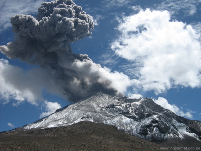
Monitoring of the deformation of the volcanic structure does not show any significant changes at this time. Satellite monitoring shows 2 thermal anomalies in the Ubinas crater with a maximum value of 7 MW. Surveillance cameras identified columns of gas and ash that reached heights up to 1.0 km above the summit of the volcano, which were dispersed mainly to the western, southwestern and Northwest of the Ubinas volcano.
PERSPECTIVE:
The recent activity observed on the Ubinas volcano poses two possible scenarios for the next few days or weeks:
-1/ That activity continues at its current level.
-2/ That seismic events increase in number and energy and that a greater ascent of magma towards the surface is recorded, which could give rise to volcanic explosions with ash emissions, with heights greater than 2 km . These can affect the populations of the Ubinas Valley, such as the district of San Juan de Tarucani, in the Arequipa region.
RECOMMENDATIONS
• Maintain the volcanic alert level at the Yellow level.
Source : IGP.
Photo : Roxanna Amache