March 27 , 2023.
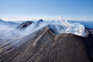
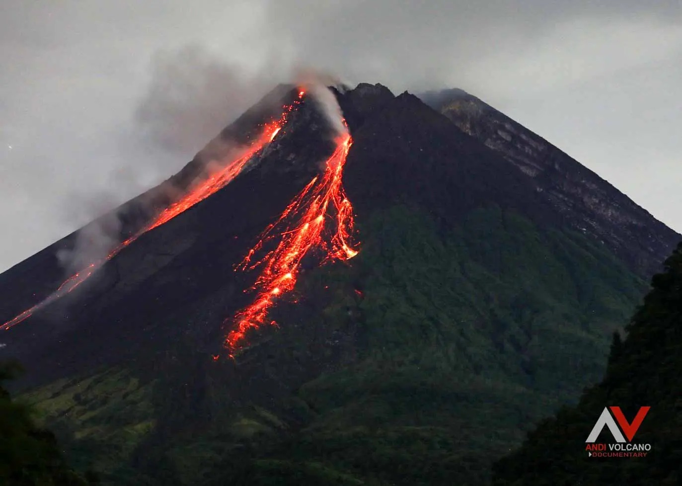
Italy , Stromboli :
Statement on Stromboli activity, March 24, 2023, 01:09 (00:09 UTC).
The National Institute of Geophysics and Volcanology, Osservatorio Etneo, communicates that from the analysis of the images recorded by the surveillance cameras, it can be observed that from about 21:40 UTC there is an overflow of lava from the North Crater area.
Currently, the lava flow front is settling in the upper sector of the Sciara del Fuoco.
From a seismic point of view, during the last 24 hours, the average amplitude of the volcanic tremor showed oscillations in the range of average values. There are no significant variations in the rate of occurrence and in the amplitude of the explosion tremors.
The analysis of the ground deformation data does not show any significant variations on the series of the GNSS and inclinometric networks associated with the event.
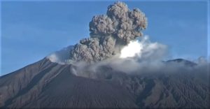
Statement on the activity of Stromboli, March 25, 2023, 16:33 (15:33 UTC).
The National Institute of Geophysics and Volcanology, Osservatorio Etneo, communicates that at 14:49 UTC an explosion with an intensity greater than ordinary activity was observed from the images of the video surveillance network. The event was produced by the Center-South zone of the crater terrace and was followed by two explosions of minor intensity. The effusive activity of the North Zone lava overflow communicated on March 24 with press release number 22 continues.
At 2:47 p.m. the seismic network stations recorded a sequence of certain events associated with the explosion with high values. Subsequently the amplitude of the volcanic tremor showed a slight increase compared to what was recorded before the explosive episode while remaining in the level of average values.
The analysis of the inclinometer data shows an impulsive variation at 14:49 UTC of about 0.2 microradians on the N185E component of the TDF station. Analysis of the GNSS data does not show any significant variations associated with the event.
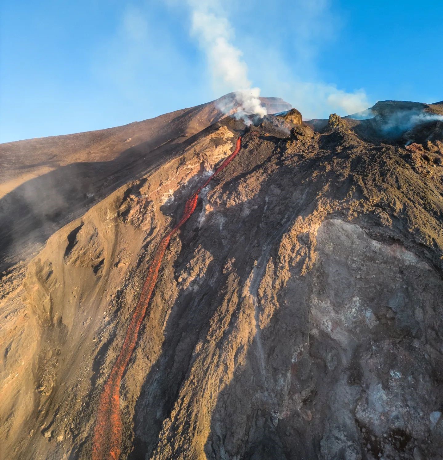
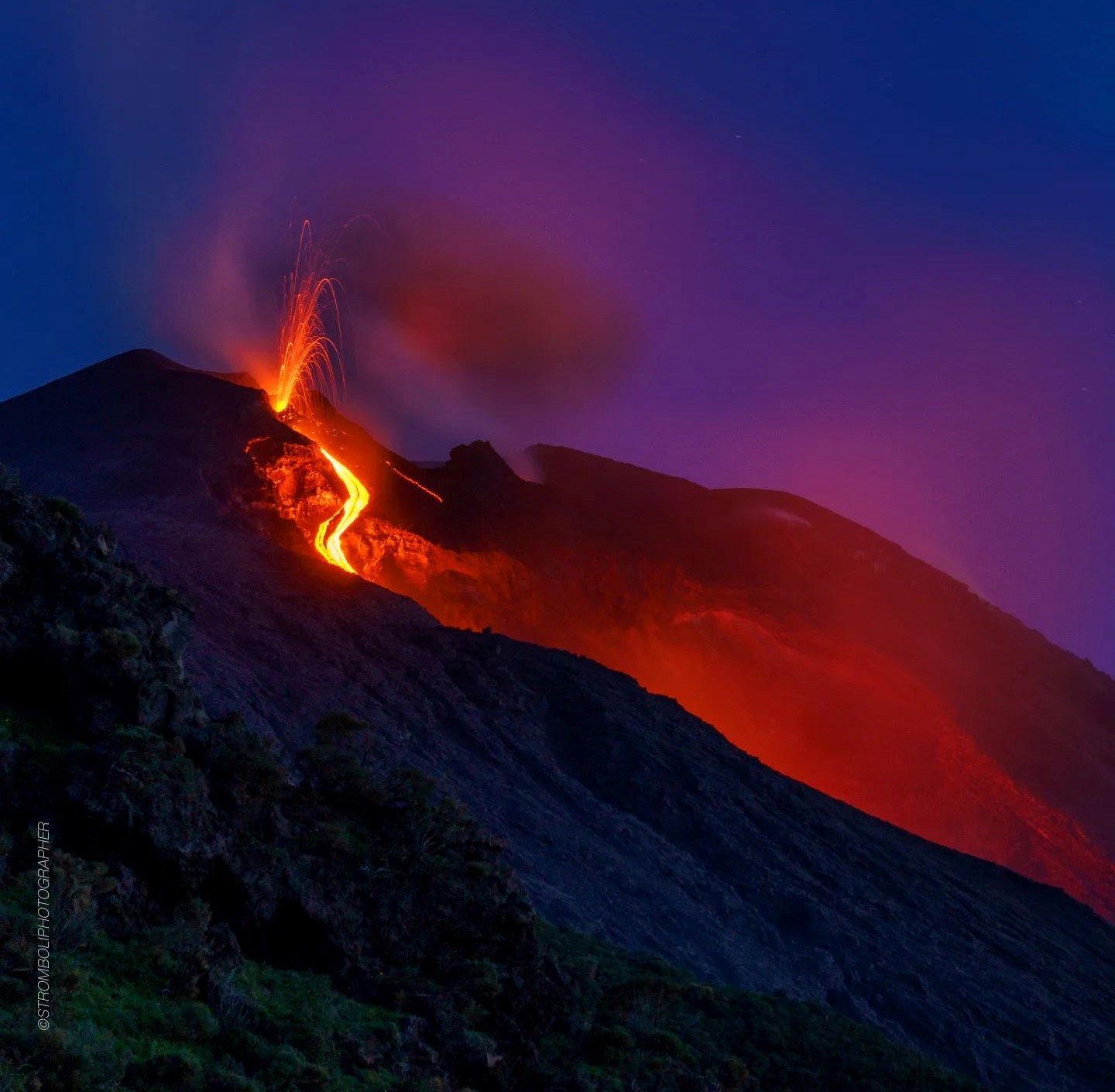
Statement on Stromboli activity, March 26, 2023, 22:51 (20:51 UTC).
The National Institute of Geophysics and Volcanology, Osservatorio Etneo, communicates that from the analysis of the images of the surveillance cameras, it has been observed that, from the early hours of the afternoon, the activity effusive described in press release number 22 of March 24 showed a gradual decrease in the rate of feeding until it stopped, and at this time the lava field is cooling. There remains moderate spattering activity in the North Zone, coupled with ordinary explosive activity in both the North and Center-South crater zones.
From a seismic point of view, over the past 24 hours, the average amplitude of the volcanic tremor has remained within the range of average values. We note the appearance of some seismic transients linked to material rolling phenomena and no significant variation in the rate of occurrence and the amplitude of the earthquakes of explosions.
Analysis of the data from the inclinometer and GNSS networks does not show any significant variations.
Further updates will be communicated soon.
Source : INGV.
Photo : Stromboli Stati d’animo.
Indonesia , Merapi :
Report on the activity of Mount Merapi from February 17, 2023 to February 23, 2023, Published on February 24, 2023
RESULTS OF OBSERVATIONS
Visual
The weather around Mount Merapi is usually sunny in the morning and afternoon, while the evening is foggy. White, fine to thick, low to medium pressure, 4500 m high white smoke was observed from the Mount Merapi observation post in Babadan on March 18, 2023 at 06:50.
This week, there were 2 southwestward lava avalanches (the main ones towards Kali Bebeng / Kali Krasak) with a maximum slip distance of 1300 m. The sound of avalanches was heard 7 times from Pos Babadan with low to medium intensity
On the Central dome and the South-West dome no significant change was observed. According to an aerial photo dated March 13, 2023, the measured volume of the Southwest dome is 1,686,200 m3 and that of the central dome is 2,312,100 m3.
Seismicity
This week, the seismicity of Mount Merapi showed:
2 earthquakes of hot cloud avalanches,
1 deep volcanic earthquake (VTA),
1 low frequency earthquake ( LF),
41 deep volcanic earthquakes (VTB),
821 avalanche earthquakes (RF),
1 emission earthquakes (DG),
5 tectonic earthquakes (TT).
201 multi-phase (MP) earthquakes
The intensity of this week’s seismicity is still quite high.
Deformation
Mount Merapi’s deformation that was monitored using EDM and GPS this week showed a shortening rate of 0.3 cm/day.
Rain and lahars:
This week, it rained at the G. Merapi observation post with a rain intensity of 53 mm/hour for 90 minutes at the Ngepos post on March 18, 2023. . No increase in the flow of the rivers descending from Mount Merapi has been reported.
Conclusion
Based on the results of visual and instrumental observations, it is concluded that:
-The volcanic activity of Mount Merapi is still quite high in the form of effusive eruption activity. The state of the activity is defined at the « SIAGA » level.
Source : BPPTKG
Photo : Andi Volcanist.
Chile , Villarica :
The seismological activity of the period was characterized by the recording of:
10 VT-type seismic events, associated with rock fracturing (Volcano-Tectonics). The most energetic earthquake presented a value of local magnitude (ML) equal to 1.9, located 4.5 km east-south-east of the volcanic edifice, at a depth of 4.5 km from the crater.
11385 LP-type seismic events, associated with fluid dynamics within the volcanic system (Long Period). The size of the largest earthquake assessed from the Reduced Displacement (DR) parameter was equal to 69 cm2.
1326 TR-type seismic events, associated with fluid dynamics within the volcanic system (TRemor). The size of the largest earthquake assessed from the Reduced Displacement (DR) parameter was equal to 32 cm2.
Satellite thermal anomalies
During the period, 7 thermal alerts were recorded in the area associated with the volcano, with a maximum Volcanic Radiative Power (VRP) of 21 MW on March 5, a value considered moderate according to the data processed by the Medium Infrared Observation Volcanic Activity (MIROVA).
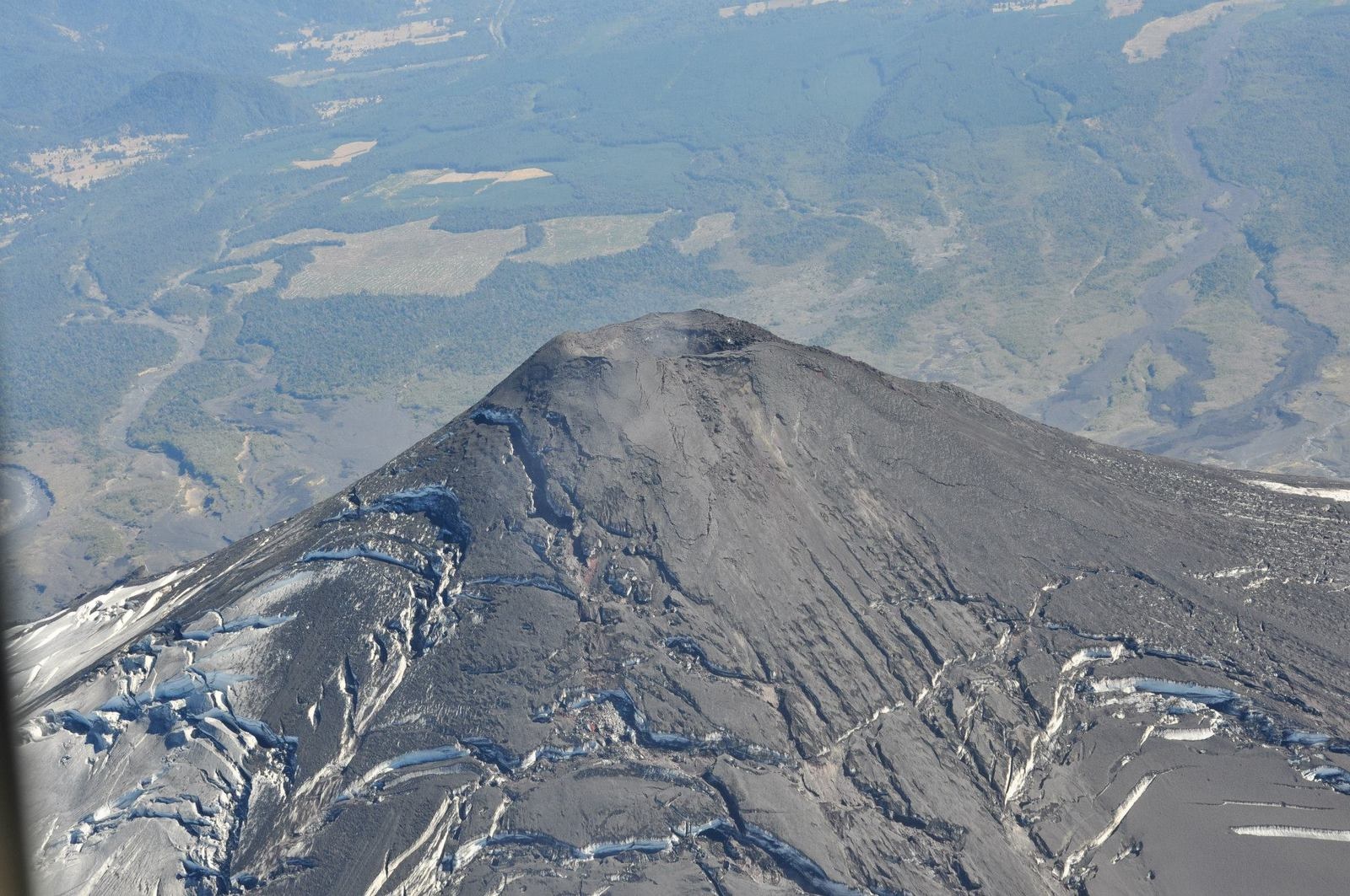
Surveillance cameras
Daytime activity was characterized by constant whitish passive degassing, which reached a maximum height of 400 m above the crater. Nocturnal activity was evidenced by degassing with a constant incandescence not exceeding 100 m in height, and with episodes of minor Strombolian explosions, on March 3, 10 and 13 where the maximum height of the incandescent material was lower at 100 m, with emissions of ballistic pyroclasts whose range has been estimated in the proximal zone of the crater; however, larger spans are not excluded.
Satellite geomorphological analysis
Thanks to the photo-interpretation of the Skysat Collect satellite image of March 2, it was possible to identify two exposed melting zones of 44 and 73 m2 respectively, which implies an increase in area, compared to the estimate previous (56 m2). In addition, a zone of pyroclast accumulation with an abrupt edge could be observed in the eastern zone of the active crater.
The volcano remains in an intermittent eruptive period, linked to the presence of an unstable lava lake near the surface. Seismically, high signal productivity is maintained
related to the transit and dynamics of volcanic fluids, and more specifically, associated with small explosions from the surface part of the conduit by collapses of gas bubbles contained in the magma column. The seismic energy levels (RSAM) are maintained with a general upward trend and with relevant point variations, similarly, the incandescence phenomena are permanent and some Strombolian explosions have been identified which have affected the area near the crater.
Therefore, the system remains above its baseline threshold.
The technical alert is maintained in: YELLOW TECHNICAL ALERT: Changes in the behavior of volcanic activity.
Source et photo : Sernageomin.
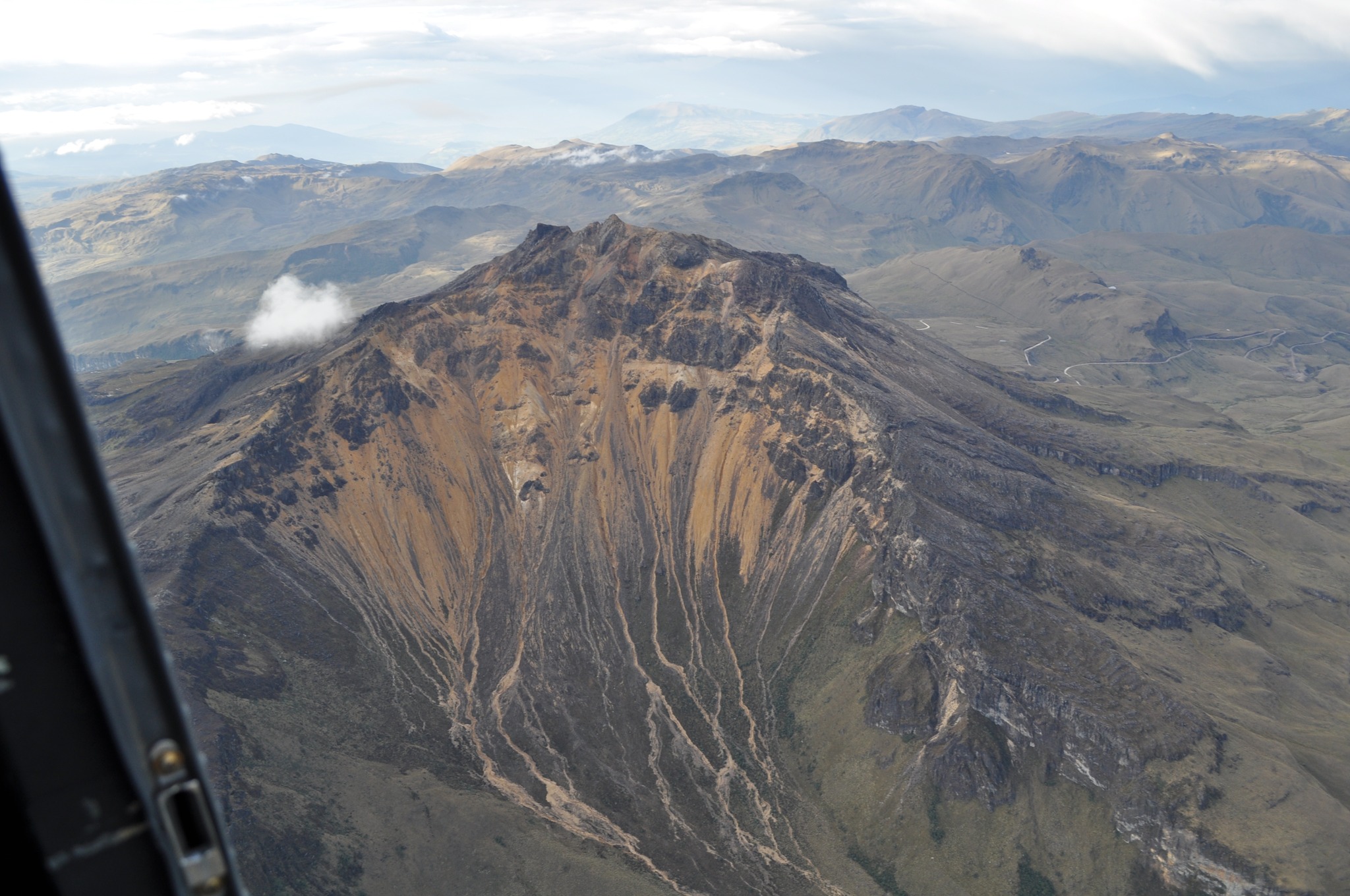
Colombia , Chiles / Cerro Negro :
Chiles and Cerro Negro Volcanic Complex (CVCCN) Weekly Activity Bulletin
Regarding the monitoring of the activity of the VOLCANOES CHILES AND CERRO NEGRO, the MINISTRY OF MINES AND ENERGY through the COLOMBIAN GEOLOGICAL SERVICE (SGC) informs that:
During the week of March 14 to 20, 2023 and compared to what was reported the previous week, the activity in the Chiles and Cerro Negro volcanoes region gradually decreased in both occurrence and energy, from 37 690 to 17,698 earthquakes.
Although this general downward trend is present, the seismicity continues at high levels, with fluctuations and the maintenance of the predominance of earthquakes associated with the fracture of the rock, although earthquakes related to the movement fluids within the volcanic system have also been recorded. This activity is always accompanied by a deformation of the surface of the CVCCN.
There was a report of 3 earthquakes felt, with magnitudes of 3.1, 2.3 and 2.4 on March 17, 18 and 19 at 11:00, 5:06. and 8:11 p.m. respectively. From the point of view of the daily record, for this week the daily occurrence of earthquakes was between 1,740 and 3,715 events.
The possibility of earthquakes with greater energy that can be felt by the inhabitants of the area of influence is not excluded.
The activity level of volcanoes remains at: YELLOW LEVEL ■ (III): CHANGES IN THE BEHAVIOR OF VOLCANIC ACTIVITY.
Source et photo : SGC.
Kamchatka , Sheveluch :
VOLCANO OBSERVATORY NOTICE FOR AVIATION (VONA)
Issued: March 27 , 2023
Volcano: Sheveluch (CAVW #300270)
Current aviation colour code: ORANGE
Previous aviation colour code: orange
Source: KVERT
Notice Number: 2023-35
Volcano Location: N 56 deg 38 min E 161 deg 18 min
Area: Kamchatka, Russia
Summit Elevation: 3283 m (10768.24 ft), the dome elevation ~2500 m (8200 ft)
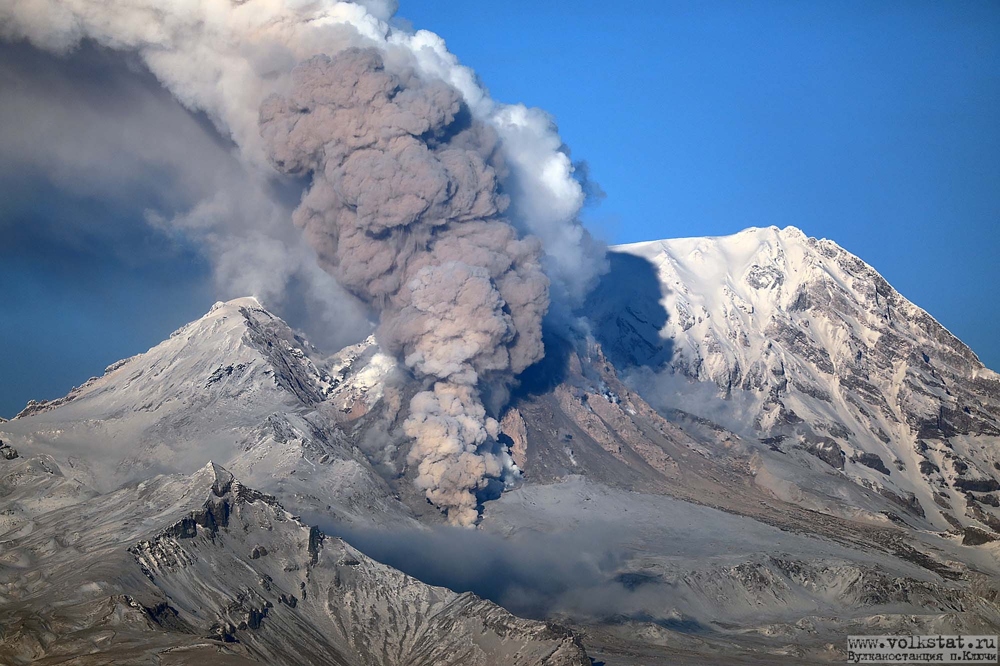
Volcanic Activity Summary:
The growth of the lava dome continues, a strong fumarole activity, an incandescence of the lava dome, sometimes explosions, and hot avalanches accompanies this process. Video data by KVERT showed an ash cloud from hot avalanches rose up to 3.5 km a.s.l. and is drifting to the east of the volcano.
The extrusive eruption of the volcano continues. Ash explosions up to 10-15 km (32,800-49,200 ft) a.s.l. could occur at any time. Ongoing activity could affect international and low-flying aircraft.
Volcanic cloud height:
3500 m (11480 ft) AMSL Time and method of ash plume/cloud height determination: 20230327/0315Z – Video data
Other volcanic cloud information: Distance of ash plume/cloud of the volcano: 100 km (62 mi)
Direction of drift of ash plume/cloud of the volcano: E / azimuth 97 deg
Time and method of ash plume/cloud determination: 20230327/0204Z – JPSS-1 15m16
Source : Kvert.
Photo : volkstat ru