February 24 , 2023.
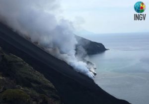
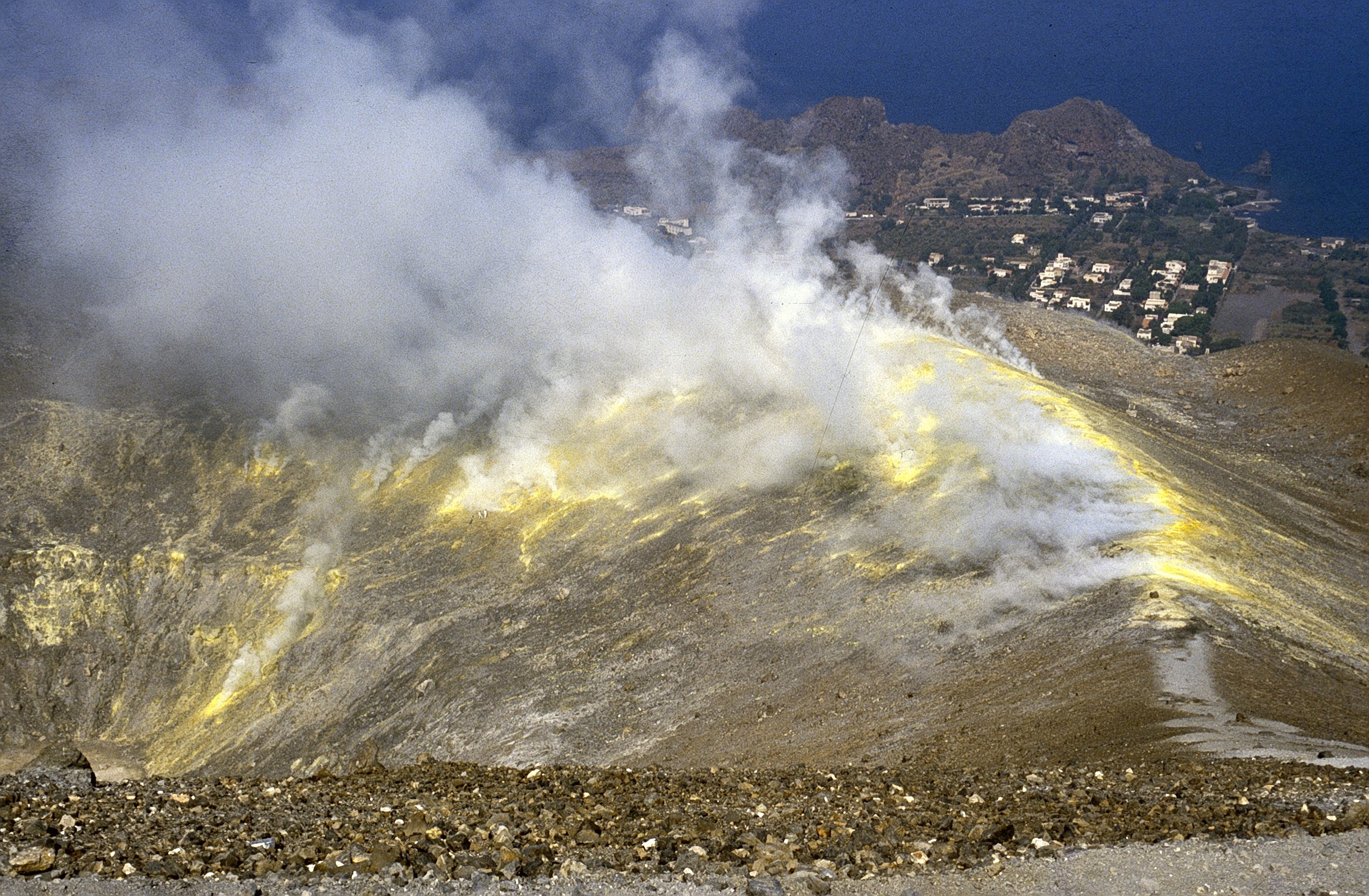
Italy , Vulcano :
WEEKLY BULLETIN, from February 13, 2023 to February 19, 2023. (issue date 21 February 2023)
ACTIVITY STATUS SUMMARY
In the light of the monitoring data, it is highlighted:
1) Temperature of the crater fumaroles: The temperatures recorded on the edge of the crater are stable at high values.
2) CO2 flux in the crater area: Ever increasing values on high degassing levels.
3) SO2 flux in the crater area: at a slightly medium-high level and decreasing
4) Geochemistry of fumarolic gases: There are no updates.
5) CO2 fluxes at the base of the La Fossa cone and in the Vulcano Porto area: In the Camping Sicilia and Rimessa sites, the CO2 fluxes show stable values but always above background levels; on the P4max site, the flows are slightly increasing, while on the Faraglione site the values recorded are close to the background level with a slight upward trend.
6) Geochemistry of thermal aquifers: Stable temperature and conductivity values are observed in the Camping Sicilia well; in the Bambara well, decreasing level values and stable conductivity values are observed.
7) Local seismicity: Low occurrence rate of local microseismicity.
8) Regional seismicity: 2 events with Ml>=1.0 were recorded during the week in question.
9) Deformations – GNSS: The permanent GNSS network has not recorded any significant variations.
10) Deformations – Inclinometry: The inclinometric network did not record any significant variations.
11) Gravimetry: No significant change was recorded.
SO2 FLOW IN THE CRATER AREA
During the week, the total flux of SO2 emitted by the fumarolic field of the crater indicated values which remain at the limit between the average and medium-high level with a slow and progressive downward trend towards the average degassing value. typical of Vulcano ~20-30 tpd.
Source : INGV.
Photo : Boris Behncke
Alaska , Semisopochnoi :
AVO/USGS Volcanic Activity Notice
Current Volcano Alert Level: ADVISORY
Previous Volcano Alert Level: WATCH
Current Aviation Color Code: YELLOW
Previous Aviation Color Code: ORANGE
Issued: Wednesday, February 22, 2023, 9:47 AM AKST
Source: Alaska Volcano Observatory
Notice Number: 2023/A188
Location: N 51 deg 55 min E 179 deg 35 min
Elevation: 2625 ft (800 m)
Area: Aleutians
Volcanic Activity Summary:
Although the active north cone of Mount Young continues to produce a robust steam plume, no ash emissions or explosive activity have been detected at Semisopochnoi volcano since late January. The level of seismic activity has also decreased, with no significant seismic tremor observed since January 25th. Thus, we are lowering the Aviation Color Code to YELLOW and Volcano Alert Level to ADVISORY.

Small eruptions producing minor ash deposits within the vicinity of the active north crater of Mount Young, and ash clouds usually under 10,000 ft (3 km) above sea level, have characterized the recent activity at Semisopochnoi. More ash-producing events could occur again with little warning.
Semisopochnoi is monitored by a local seismic and infrasound network, local web cameras, regional lightning and infrasound sensors, and satellite data.
Remarks:
Remote Semisopochnoi volcano occupies the largest, young volcanic island in the western Aleutians. The uninhabited island is part of the Alaska Maritime National Wildlife Refuge. It is located 65 km (40 mi) northeast of Amchitka Island and 200 km (130 mi) west of Adak, Alaska. Semisopochnoi volcano is dominated by an 8-km (5-mile) diameter caldera that contains a small lake and several post-caldera cones and craters. The age of the caldera is not known with certainty but is likely early Holocene. The north cone of Mount Young, in the southwest part of the caldera, is the site of the current eruption, which began in 2018. The last known eruption prior to 2018 was in 1987 from Sugarloaf Peak on the south coast of the island.
Source et photo : AVO/USGS.
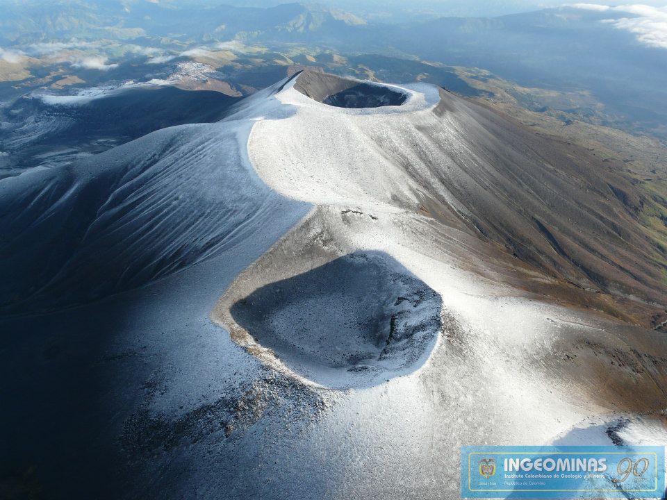
Colombia , Puracé / Los Coconucos volcanic Chain :
Weekly activity bulletin Volcan Puracé-Volcanic chain Los Coconucos.
The level of activity of the volcano continues in Yellow Level of activity or (III): changes in the behavior of volcanic activity.
From the analysis and evaluation of the information obtained through the monitoring network of the Puracé volcano – Los Coconucos volcanic chain, during the week of February 14 to 20, 2023, the COLOMBIAN GEOLOGICAL SERVICE – Volcanological and Seismological Observatory of Popayán reports that:
• During the week evaluated, a total of 960 seismic events were recorded, of which 195 were associated with rock fracturing processes (type VT) and 765 with fluid dynamics in volcanic conduits.
• The geodetic network of GNSS (Global Navigation Satellite System) stations for monitoring ground deformation continues to record a process associated with inflation.
• By monitoring the surface activity with the images obtained during the week thanks to the web cameras of Mina, Lavas Rojas and Cerro Sombrero, a degassing of the volcanic system was highlighted, with a white column preferentially oriented towards the North -West.
• The monitoring of volcanic gases showed a maximum flow of 3,995 t/day for SO2 and a concentration greater than 10,000 ppm for CO2, relevant values in the degassing process of this volcanic system.
• Electromagnetic field and infrasound wave monitoring sensors did not record variations associated with changes in volcanic activity.
In conclusion, variations in volcanic activity continue to be recorded, consistent with the behavior expected in a level of activity III (yellow level), which could evolve towards states of greater activity.
Source : SGC.
Photo : Ingeominas.
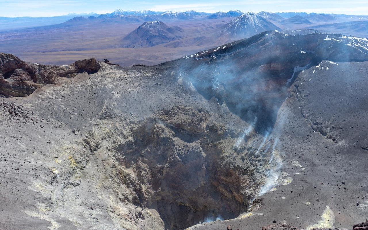
Chile , Lascar :
Special report on volcanic activity (REAV), Antofagasta region, Lascar volcano, February 23, 2023, 3:45 p.m. local time (mainland Chile).
The National Service of Geology and Mines of Chile (Sernageomin) publishes the following PRELIMINARY information, obtained through the monitoring equipment of the National Volcanic Monitoring Network (RNVV), processed and analyzed at the Volcanological Observatory of the Southern Andes ( Ovdas):
On Thursday February 23, 2023, at 15:06 local time (18:06 UTC), the monitoring stations installed near the Lascar volcano recorded a « Tornillo » type earthquake associated with the resonance of the interaction of fluids in the volcanic system (type TO).
The characteristics of the earthquake after its analysis are as follows:
ORIGINAL TIME: 5:06 local time (18:06 UTC)
REDUCED DISPLACEMENT: 163.7 (cm*cm)
MAXIMUM HEIGHT OF THE COLUMN: 200 meters above the point of emission
SPREAD DIRECTION: East (E)
On Thursday February 24, 2023, at 01:30 local time (04:30 UTC), the monitoring stations installed near the Lascar volcano recorded a « Tornillo » type earthquake associated with the resonance of the interaction of fluids in the volcanic system (type TO).
The characteristics of the earthquake after its analysis are as follows:
ORIGINAL TIME: 01:30 local time (04:30 UTC)
REDUCED DISPLACEMENT: 70.3 (cm*cm)
COMMENTS:
Following the event, a weak degassing was recorded in relation to the seismic event, with an East direction.
The volcanic technical alert remains at the Orange level.
Source : Sernageomin
Photo : Volcanopro.
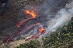
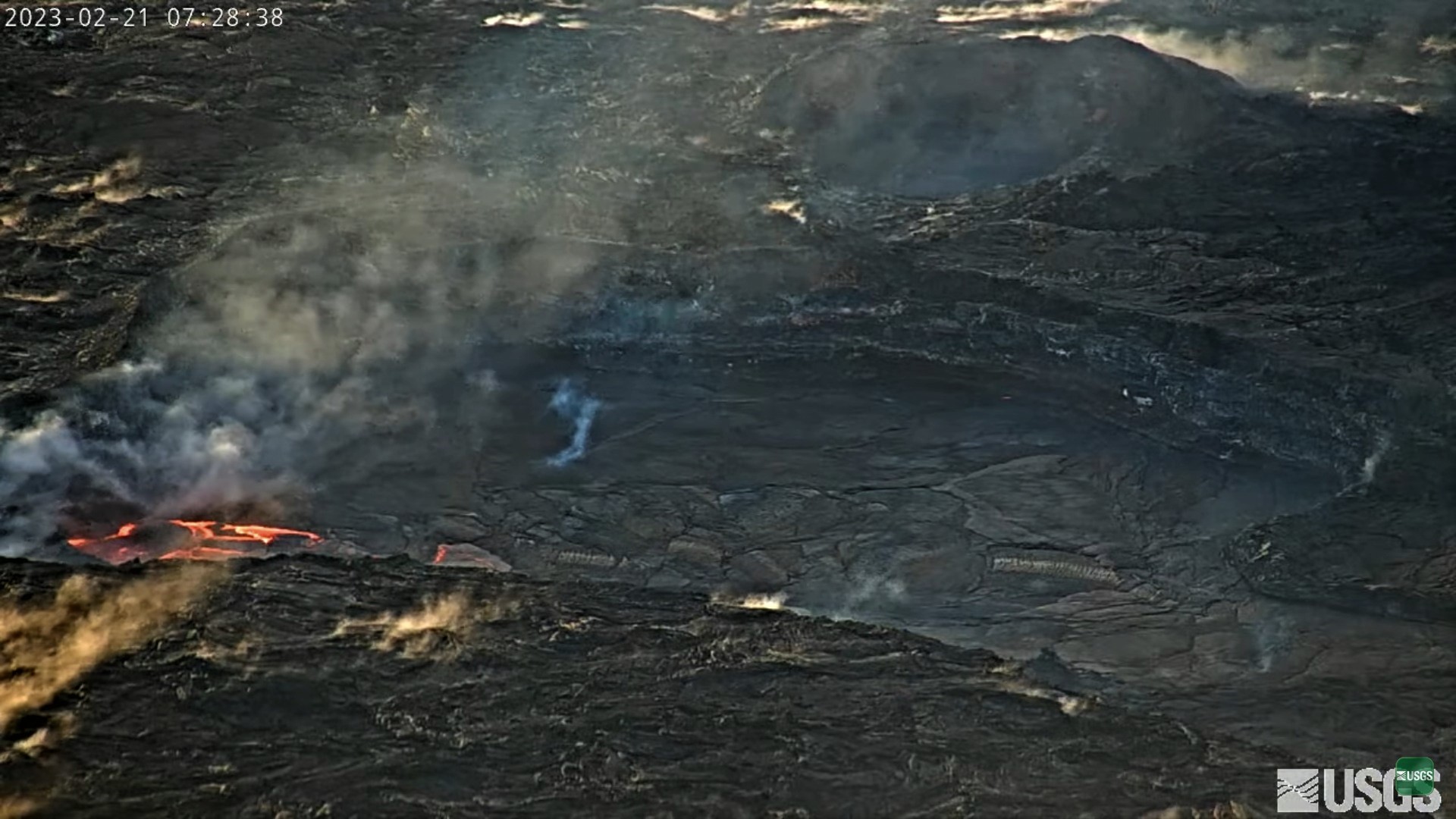
Hawaii , Kilauea :
Thursday, February 23, 2023, 9:01 AM HST (Thursday, February 23, 2023, 19:01 UTC)
19°25’16 » N 155°17’13 » W,
Summit Elevation 4091 ft (1247 m)
Current Volcano Alert Level: WATCH
Current Aviation Color Code: ORANGE
Activity Summary:
The summit eruption of Kīlauea Volcano, within Halemaʻumaʻu crater, continues to be greatly diminished over the past 3 days. All recent eruptive activity has been confined to the crater. No significant changes have been observed in either rift zone.
Halemaʻumaʻu crater Lava Lake Observations:
Eruption of lava on the Halemaʻumaʻu crater floor continues to be greatly diminished over the past 3 days. The eastern and central vents are not erupting. The western lake in the basin of the 2021–22 lava lake remains active but with weak lava flows. Very little lava is circulating within the lake, which is mostly crusted over with intermittent crustal overturns. The reduction in activity is related to the larger deflationary tilt drop that began in the early morning of February 17. Tilt is presently on a new deflationary trend over the past 24 hours. Surface eruptive activity is expected to resume when the summit re-inflates to the levels observed in the prior week.
Summit Observations:
Over the past 3 days summit tiltmeters showed small scale deflation/inflation cycles but have not returned to the levels seen prior to Feberuary 17th. Volcanic tremor has dropped slightly but remains above background levels. A sulfur dioxide (SO2) emission rate of approximately 2,000 tonnes per day (t/d) was measured on February 13, 2023.
Rift Zone Observations:
No unusual activity has been noted along the East Rift Zone or Southwest Rift Zone; steady rates of ground deformation and seismicity continue along both. Measurements from continuous gas monitoring stations downwind of Puʻuʻōʻō in the middle East Rift Zone have been below detection limits for SO2, indicating that SO2 emissions from Puʻuʻōʻō are negligible.
Source : HVO
Photo : USGS Via Rolf Dieter Jacke.