February 10 , 2023.
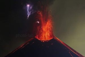
Italy , Campi Flegrei :
During the month of January 2023, 217 earthquakes were recorded in the Campi Flegrei region with a maximum magnitude=2.6±0.3. Of these, 206 events (approximately 95% of the total) had an amplitude less than 1.0 or could not be determined, due to the low amplitude of the signal which was not clearly distinguishable from the background noise. 7 events (about 3% of the total) had a magnitude between 1.0 and 1.9 and 4 events (about 2% of the total) had a magnitude greater than or equal to 2.0. A total of 97 events were located (about 45% of those recorded) located mainly between Pozzuoli, M. Olibano, the Solfatara-Pisciarelli area and the Gulf of Pozzuoli, with depths concentrated in the first 2 km and a maximum depth of about 4.5 km.
Ground deformation monitoring networks confirm a radial geometry of uplift centered in the Pozzuoli region with a maximum velocity of about 15 ± 3 mm/month. The uplift recorded at the Rione Terra GPS station (RITE), from November 2005, is about 103.5 cm including about 70 cm from January 2016. Thermographic measurements in the monitored areas show temperature trends down in the Solfatara area and up in the Pisciarelli area. The geochemical parameters confirm the multi-year trends of warming and pressurization of the hydrothermal system. The ground CO2 flux in the Solfatara area is confirmed at around 3000t/d, values comparable to those found in the plume of active volcanoes with persistent degassing.
Source : INGV.
Photo : Stanley-goodspeed.
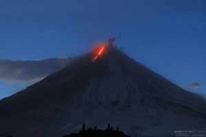
Italy , Vulcano :
WEEKLY BULLETIN, from January 30, 2023 to February 05, 2023. (issue date 07 February 2023)
ACTIVITY STATUS SUMMARY
In the light of the monitoring data, it is highlighted:
1) Temperature of the crater fumaroles: The temperatures recorded on the edge of the crater are stable at high values.
2) CO2 flux in the crater area: The CO2 flux in the crater area remains at high values, even if it shows a slight downward trend
3) SO2 flux in the crater area: at a moderately medium-high level and decreasing
4) Geochemistry of fumarolic gases: CO2 for FO and F5AT fumaroles displays values around 15%.
The helium isotope ratio shows slightly decreasing values.
5) CO2 fluxes at the base of the La Fossa cone and in the Vulcano Porto area: In the Camping Sicilia and Rimessa sites, the CO2 fluxes show values above the background level and stable levels; at the P4max site, the flows are slightly decreasing, while at the Faraglione site the values recorded are close to the background level.
Monthly CO2 flux campaign: CO2 emissions in the Vulcano Porto area remain stable at values slightly above the background level.
6) Geochemistry of thermal aquifers: Stable temperature values are observed in the Camping Sicilia well; in the Bambara well, a slight upward trend is observed in the parameters monitored.

Monthly drilling campaign: in general, a stabilization of the supply of fumarolic fluids to the thermal groundwater is observed, which however still remains at abnormal levels in certain sites for some monitored parameters.
7) Local seismicity: Low occurrence rate of local micro-seismicity.
8) Regional seismicity: Low seismic activity due to fracturing.
9) Deformations – GNSS: The permanent GNSS network has not recorded any significant variations.
10) Deformations – Inclinometry: The inclinometric network did not record any significant variations.
11) Gravimetry: No significant change was recorded.
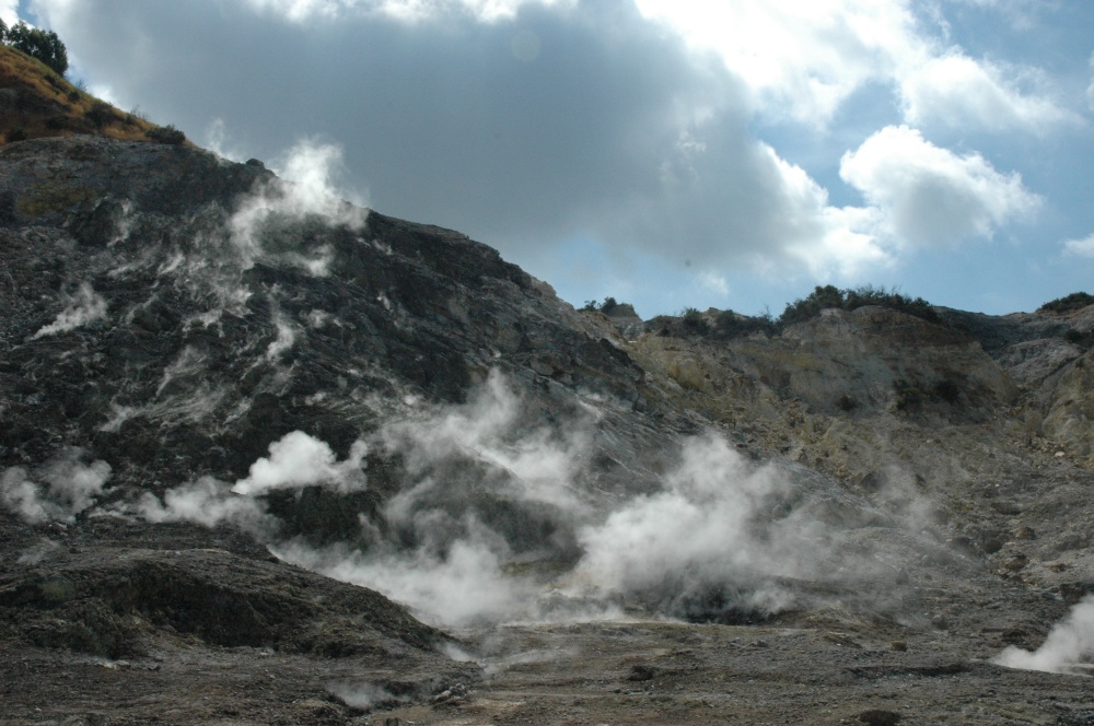
GEOCHEMISTRY OF FUMEROLIAN GAS
The analysis of samples taken from the fumaroles of the crater on 01/23/2023 shows that the concentration of species indicative of a magmatic input (CO2, He) is relatively stable, with values between 13 and 17% for CO2 , and 1.6 -1.7 ppmv for He, and remain in an average level.
The values of the carbon isotopic composition of CO2 do not show any significant variations.
Helium isotope ratio values decrease slightly.
Source et photo : INGV.
Guatemala , Fuego :
Activity:
The OVFGO Fuego volcano observatory reports white degassing at an altitude of 4,500 m, which disperses to the southwest. There were 5 to 10 low and moderate explosions per hour. Following the explosions, columns of ash were generated 4,500 to 4,800 meters above sea level (14,763 to 15,748 feet) which disperse over 12 km in a southwesterly direction. Weak and moderate rumblings are reported which generated a weak shock wave which vibrates the roofs and windows of houses near the volcano. At night and early in the morning, incandescent pulses 100 meters above the crater are observed. Weak to moderate avalanches were also observed around the crater and towards the ravines of Santa Teresa, Taniluya, Ceniza and Trinidad.
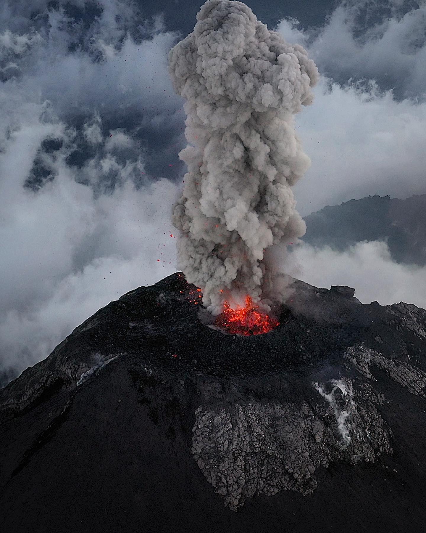
INSIVUMEH reported that 4-12 explosions per hour were recorded at Fuego during 31 January-6 February, generating ash plumes that rose as high as 1.1 km above the crater rim and drifted as far as 20 km SW, WSW, and W. Ashfall was recorded during 2-4 February in areas downwind including Morelia (9 km SW), Panimaché I and II (8 km SW), Santa Sofía (12 km SW), El Porvenir (8 km ENE), San Pedro Yepocapa (8 km NW), and Finca Palo Verde. Daily block avalanches descended various drainages including the Ceniza (SSW), Seca (W), Trinidad (S), Taniluyá (SW), Honda, Las Lajas (SE), and El Jute (ESE), and often reached vegetated areas. Daily shock waves rattled structures in communities around the volcano and rumbling was often heard. Explosions ejected incandescent material 100-200 m above the summit each day. Resuspend ash deposits from high winds during 3-4 February formed “curtains” of ash on the S flank.
Sources :Insivumeh , GVP
Photo : Diego Rizzo.
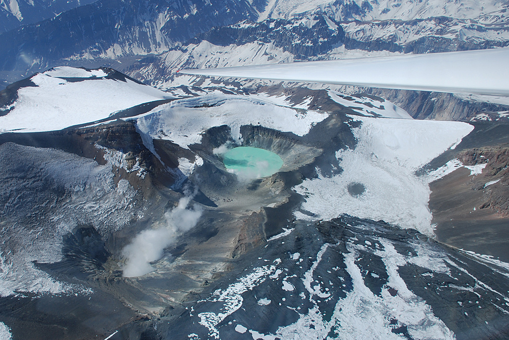
Chile , Tupungatito :
Seismology
The seismological activity of the period was characterized by the recording of:
439 VT-type seismic events, associated with rock fracturing (Volcano-Tectonics). The most energetic earthquake presented a value of local magnitude (ML) equal to 3.5, located 3.4 km east-northeast of the volcanic edifice, with a depth of 15.5 km with reference to the crater.
143 LP-type seismic events, associated with fluid dynamics within the volcanic system (Long Period). The size of the largest earthquake assessed from the Reduced Displacement (DR) parameter was equal to 4 cm2.
6 seismic events of the TR type, associated with the dynamics maintained over time of the fluids within the volcanic system (TRemor). The size of the largest earthquake assessed from the Reduced Displacement (DR) parameter was equal to 6 cm2.
3 HB-type seismic events, associated with both rock fracturing and fluid dynamics within the volcanic system (hybrid). The size of the largest earthquake assessed from the reduced displacement parameter (DR) was equal to 1 cm2. No event presented enough energy to be localized.
Fluid Geochemistry
No anomalies in sulfur dioxide (SO2) emissions in the atmosphere have been reported in the area close to the volcanic system, according to data published by the Tropospheric Monitoring Instrument (TROPOMI) and the Ozone Monitoring Instrument (OMI) Sulfur Dioxide Group.
Satellite thermal anomalies
During the period, no thermal alert was recorded in the area associated with the volcanic edifice, according to the analytical processing of Sentinel 2-L2A satellite images, in combination with false color bands.
Activity remained at levels considered low, suggesting stability of the volcanic system.
The volcanic technical alert is maintained at the level of GREEN TECHNICAL ALERT: Active volcano with stable behavior – There is no immediate risk.
Source et photo : Sernageomin.
Hawaii , Kilauea :
Thursday, February 9, 2023, 8:19 AM HST (Thursday, February 9, 2023, 18:19 UTC)
19°25’16 » N 155°17’13 » W,
Summit Elevation 4091 ft (1247 m)
Current Volcano Alert Level: WATCH
Current Aviation Color Code: ORANGE
Activity Summary:
The summit eruption of Kīlauea Volcano, within Halemaʻumaʻu crater, continued over the past 24 hours. All recent eruptive activity has been confined to the crater. No significant changes have been observed at the summit or in either rift zone.
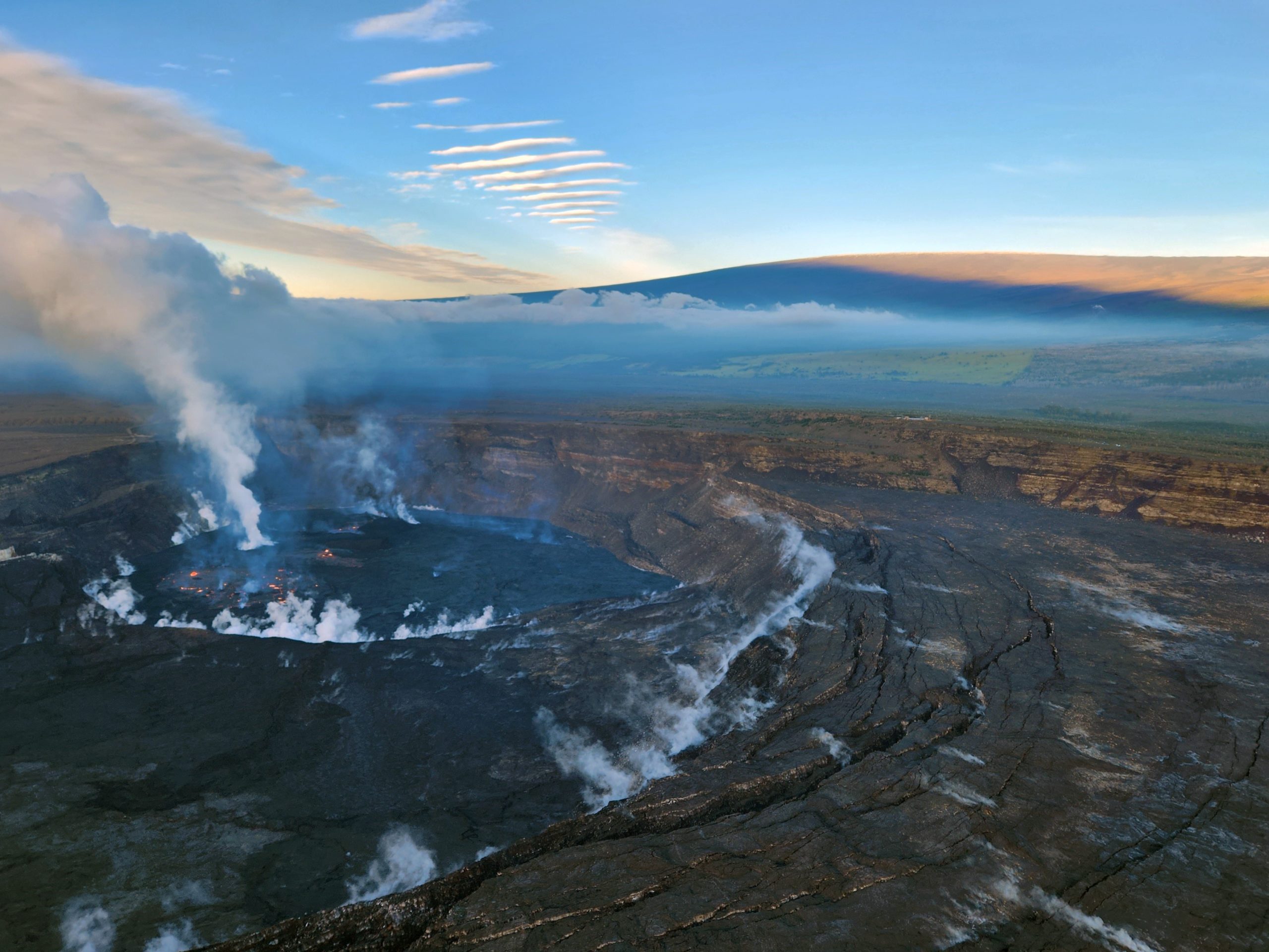
During a Kīlauea summit morning monitoring overflight on February 2, 2023, HVO scientists documented activity in the ongoing Halema‘uma‘u eruption, shown in this photo looking to the SW at 7:30 a.m. HST. Mauna Loa is visible in the background.
Halemaʻumaʻu crater Lava Lake Observations:
Eruption of lava in three locations of Halemaʻumaʻu crater floor continued over the past 24 hours. The eastern lake remains stable and activity within this lake remains about 25 acres in size. The small southern lava fountain within the eastern lake is active and remains at normal heights of 1-2 m (3-6 ft). The smaller western lake in the basin of the 2021–2022 lava lake remains active. The smaller lava pond in the central portion of the crater floor also remains active with intermittent fountaining and several overflows in the last day. The southern small lava pond’s activity is diminished.
Summit Observations:
Summit tiltmeters remain mostly flat over the past 24 hours with a typical deflationary trend starting early this morning. Volcanic tremor remains above background levels. A sulfur dioxide (SO2) emission rate of approximately 2,800 tonnes per day (t/d) was measured on February 6, 2023.
Rift Zone Observations:
No unusual activity has been noted along the East Rift Zone or Southwest Rift Zone; steady rates of ground deformation and seismicity continue along both. Measurements from continuous gas monitoring stations downwind of Puʻuʻōʻō in the middle East Rift Zone have been below detection limits for SO2, indicating that SO2 emissions from Puʻuʻōʻō are negligible.
Source : HVO
Photo : USGS / K. Lynn