December 20 , 2022.
Italy , Stromboli :
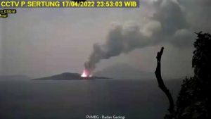
Statement on Stromboli activity, December 19, 2022, 10:20 (09:20 UTC).
The National Institute of Geophysics and Volcanology, Osservatorio Etneo, communicates that surveillance cameras are observing an overflow of lava from the area of the North crater. The phenomenon is still ongoing.

From a seismic point of view, no significant variation is reported: the average amplitude of the volcanic tremor shows variations in the range of average values, defining a substantially stationary trend.
The GNSS network does not detect significant variations.
Further updates will be communicated soon.
Source et photo : INGV.
Peru , Sabancaya :
Analysis period: from December 12, 2022 to December 18, 2022, Arequipa, December 19, 2022.
Alert level: ORANGE
The Geophysical Institute of Peru (IGP) reports that the eruptive activity of the Sabancaya volcano remains at moderate levels, that is to say with the recording of an average of 47 daily explosions, with columns of ash and gas up to 4.0 km altitude above the summit of the volcano and their consequent dispersion. Therefore, for the following days, no significant change is expected in eruptive activity.
The IGP recorded and analyzed the occurrence of 331 earthquakes of volcanic origin, associated with the circulation of magmatic fluids inside the Sabancaya volcano. An average of 47 explosions was recorded daily, in addition to recording Volcano-Tectonic (VT) type events associated with rock fracturing inside the Sabancaya volcano.

Monitoring the deformation of the volcanic structure using GNSS techniques (processed with fast orbits) does not show any significant anomalies. However, in general, an inflation process was observed in the northern sector (surroundings of the Hualca Hualca volcano). Visual surveillance identified columns of gas and ash up to 4.0 km above the summit of the volcano, which were dispersed towards the West, South, North-West, South, South sectors. -East, East and North of Sabancaya. Satellite recordings have identified the presence of 1 thermal anomalies, with a maximum value of 4 MW, associated with the presence of a lava body on the surface of the volcano’s crater.
RECOMMENDATIONS
• Keep the volcanic alert level orange.
• Do not approach within a radius of less than 12 km from the crater.
Source : Cenvul
Photo : Benjamin Bernard .
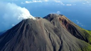
Chile , Lascar :
Today, seismic signals of moderate energy were recorded, located in the area surrounding the crater and at superficial depths.
This corresponds to the most significant recording since the eruptive pulse of December 10th.
This internal activity could be linked to a response of the volcanic system after the eruptive impulse, although the possible occurrence of new episodes with the emission of pyroclastic material is not excluded.
Maintains current Yellow Alert level.
The Láscar volcano corresponds to a composite stratovolcano, elongated in an East-West direction, active for about 240 ka and located on the western margin of the altiplanic plain. It is composed of andesitic lavas, which reach more than 10 km in length, and powerful dacitic lavas which extend up to 5 km, which were emitted from the northwest to southwest flanks. The most recent lava is estimated to be 7,000 years old.
Source : Sernageomin.
Photo : 80 jours voyages / Sylvain Chermette.
Ecuador , Cotopaxi :
Information on the activity of the Cotopaxi volcano, TUESDAY DECEMBER 20, 2022
From 00:20 local time, the beginning of a seismic signal (emission tremor) was observed at the seismic station BREF, which has been maintained until now. Through satellite images (GOES-16) a plume with a weak ash load associated with this signal is observed, the emission reaches 1000 meters above the crater and is directed northwest. There are low probabilities of ashfall in southern Pichincha province associated with this small event, similar to others that have occurred in recent days.
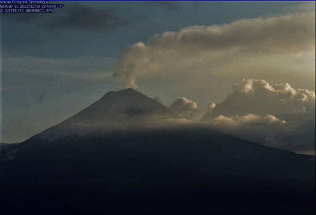
The IG-EPN will inform in a timely manner in case of detection of significant changes in the activity of the volcano. It is recommended to take appropriate measures and receive information from official sources.
Source : IGEPN
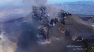
Guatemala , Fuego :
Activity :
4 to 7 weak to moderate explosions are recorded per hour which generate columns of ash from 4,500 to 4,800 meters above sea level (14,763 to 15,748 feet) dispersing over 10 to 15 km to the west. Some strong explosions generate abundant ash emissions. As a result of the explosive activity, low and moderate rumblings are also generated with a weak shock wave which vibrates the roofs and windows of houses around the volcano.
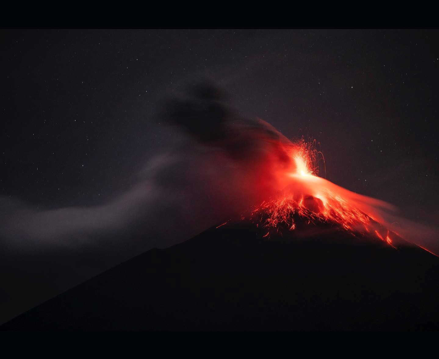
In addition, weak, moderate and strong avalanches, mainly in the direction of the Ceniza and Las Lajas ravines, extend to the edge of the vegetation. At night and early in the morning, incandescent pulses are observed from 100 to 200 meters high. Due to the direction of the wind, fine ash falls are reported at Panimaché I and II, Morelia, El Porvenir, Santa Sofia, Finca Palo Verde, Yepocapa and others. Due to the direction of the wind at different heights, there is a probability of ash fall in communities northwest of the volcano, such as Santa Isabel, Quisaché and Acatenango.
Source : Insivumeh .
Photo : Diego Rizzo