December 02, 2022.
Hawaii , Mauna Loa :
Thursday, December 1, 2022, 5:00 PM HST (Friday, December 2, 2022, 03:00 UTC)
19°28’30 » N 155°36’29 » W,
Summit Elevation 13681 ft (4170 m)
Current Volcano Alert Level: WARNING
Current Aviation Color Code: RED
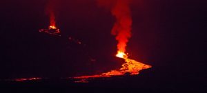
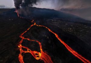
The Northeast Rift Zone eruption of Mauna Loa continues, with two active fissures feeding lava flows downslope. Fissure 3 remains the dominant source of the largest lava flow. The fissure 3 lava flows are traveling to the north toward the Daniel K. Inouye Highway (Saddle Road) but have reached relatively flatter ground and have slowed down significantly as expected. Advance of the largest flow slowed over the past 24 hours to a rate of about 0.025 miles per hour (40 meters per hour). As of 1:00 p.m. HST today, the flow front is about 3.2 miles (5.2 km) from the Daniel K. Inouye Highway (Saddle Road). Advance rates may be highly variable over the coming days and weeks due to the way lava is emplaced on flat ground. At the rate observed over the past 24 hours, the earliest the lava flow might be expected to reach the Daniel K. Inouye Highway (Saddle Road) is one week. However, there are many variables at play and both the direction and timing of flow advance are fluid and are expected to change over periods of hours to days.

Aerial photograph taken during an overflight of the Northeast Rift Zone eruption of Mauna Loa at approximately 5-6:30 p.m. HST on November 28, 2022. Fissure vents above 10,000 ft on the Northeast Rift Zone generate lava fountains and lava flows to the northeast and parallel to the rift zone.
Fissure 4 is still active with lava flows moving toward the northeast. The small lobe that was moving to the east from fissure 4 has stalled. Volcanic gas plumes are lofting high and vertically into the atmosphere. Pele’s hair (strands of volcanic glass) is falling in the Humu‘ula Saddle area.
Our seismic monitoring detects tremor (high rates of earthquakes) in the location of the currently active fissures. This indicates that magma is still being supplied, and activity is likely to continue as long as we see this signal.
There is no active lava within Moku’āweoweo caldera, and the Southwest Rift Zone is not erupting. We do not expect any eruptive activity outside the Northeast Rift Zone. No property is at risk currently.
Source : HVO.
Photo : Civil Air Patrol.
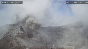
Ecuador , Sangay :
Information on the activity of the SANGAY volcano, Quito, Wednesday, November 30, 2022
During the night of today 30/11/2022, reports of « explosion » and « vibration of windows » type noises were received in various areas of the Province of Guayas such as: Naranjal, Samborondón and Daule , as well as in the North of Macas, Province of Morona Santiago. These sounds would be linked to the activity of the Sangay volcano, which is high, and which during this night was characterized by explosions and the emission of ballistic blocks and incandescent material. This audible phenomenon is produced by particular conditions of the atmosphere which allow the propagation of sound through preferential zones to finally reach great distances. On the other hand, satellite observations indicate that the ash emissions from the Sangay volcano for this evening are quite weak and limited only to the vicinity of the volcano.
The Geophysical Institute is monitoring and any new or changed activity will be notified in a timely manner.
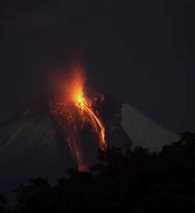
Information on the activity of the SANGAY volcano, Quito, Thursday, December 1, 2022
During the morning of 12/01/2022, the Sangay volcano showed gas emissions with a moderate ash content. The same that have been confirmed by IG-EPN surveillance cameras and satellite images (GOES-16). Currently the plume is reaching an altitude above 2500m in a southwesterly direction. Therefore, there is a low probability of ash fall in the provinces of Morona Santiago and Chimborazo, especially in the nearest towns located southwest of the volcano. This phenomenon has been persistent during the current eruptive period which began in May 2019.
The IG-EPN continues to monitor the event and will report in a timely manner if any changes in the seismic signals are detected.
Information on the activity of the SANGAY volcano, Quito, Thursday, December 1, 2022
During the morning of 12/01/2022, gas and ash emissions were observed at the Sangay volcano, as indicated in the Sangay volcano newsletter n ° 2022-118.
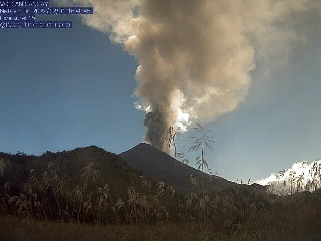
According to satellite images (GOES-16) and surveillance cameras, a significant growth of the ash cloud is observed, which currently reaches about 3 km in altitude with a sustained emission. Therefore, given the direction and speed of the wind, there is a high probability of ash fall in areas located southwest of the volcano, in the provinces of Morona Santiago, Chimborazo and it could also reach areas more remote in the provinces of Cañar and Azuay. It is recommended to take appropriate measures and receive information from official sources.
Source : IGEPN
Photos : Diego Cardenas. IGEPN.
Colombia , Puracé – Los Coconucos volcanic Range :
Puracé Volcano Weekly Activity Bulletin – Los Coconucos Volcanic Range
The activity level of the volcano continues at the yellow Activity Level or (III): changes in the behavior of volcanic activity.
From the analysis and evaluation of the information obtained through the monitoring network of the Puracé volcano – Los Coconucos volcanic chain, during the week of November 22 to 28, 2022, the COLOMBIAN GEOLOGICAL SERVICE – Volcanological and Seismological Observatory of Popayán reports that:
• With regard to the seismic activity recorded, there were no notable variations in terms of the number of events and the energy released. During the week, 633 seismic events were recorded, of which 92 were associated with rock fracturing processes (VT type) and 541 with fluid dynamics in volcanic conduits.
• The geodetic network of GNSS (Global Navigation Satellite System) stations monitoring ground deformation continues to record a process associated with inflation.
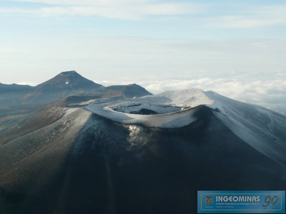
• By monitoring the surface activity with the images obtained during the week thanks to the web cameras of the Mine, Lavas Rojas, Cerro Sombrero and Curiquinga, a degassing of the volcanic system was highlighted, with a white column preferentially oriented to the northwest.
• Concerning the monitoring of volcanic gases, sulfur dioxide (SO2) measurements continue to show changes with a maximum flow of 583 t/day for the week assessed. The other instruments for measuring the concentration of carbon dioxide (CO2) and radon gas (222Rn) in the recorded a considerable increase for the period evaluated in the context of this active volcanic system.
• Electromagnetic field and infrasound wave monitoring sensors did not record variations associated with changes in volcanic activity.
It is concluded from the above that variations in volcanic activity continue to be recorded, consistent with the behavior expected in a level of activity III (yellow level), which could evolve towards states of greater activity. The Colombian Geological Service continues to monitor the evolution of the volcanic phenomenon and will report any changes that may occur in due course.
Source : SGC
Photo : Ingeominas
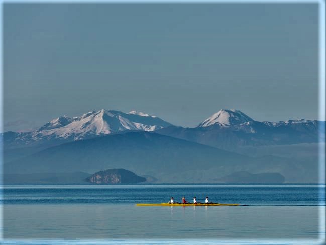
New Zealand , Lake Taupo :
A strong M5.6 earthquake occurred beneath Lake Taupō on 30 November. The earthquake was widely felt, causing minor damage and a small tsunami in the lake. Numerous aftershocks have been recorded, with many felt locally. The activity is consistent with ongoing minor volcanic unrest at Taupō volcano. The Volcanic Alert Level remains at 1.
The recent earthquake activity is in the range that had previously been anticipated, and is consistent with minor volcanic unrest. The activity does not warrant a move to a higher volcanic alert level. Minor volcanic unrest has been ongoing at Taupō volcano since May 2022. Prior to 30 November, the unrest had been characterised by hundreds of small typically non felt earthquakes and a few larger events (M3.5 to M4.2) that had been felt.
The M5.6 earthquake caused ground movement measured at sensitive GNSS positioning instruments around Lake Taupō. At least 100 mm of horizontal movement was observed at an instrument at Horomatangi Reef. Further analysis of this data set is underway.
Experts are assessing earthquake-related lake wave activity that occurred as a result of the M5.6 quake. This caused run up along the lakeshore between Wharewaka Point and Taupō township. The wave action is likely the result of a lake based tsunami, however, we are unsure what has generated it. Earthquake activity can cause landslides and displacement of the lake floor, generating unusual wave activity. If people feel strong ground shaking, hear a loud boom, or notice unusual lake conditions, they should move away from the lake shore.
GNS is carrying out further analysis of existing data and looking at what additional observations can be collected and analysed. These will give us a better insight into the November 30 earthquake sequence and it’s importance in understanding the ongoing volcanic unrest at Taupō.
The M5.6 earthquake has been followed by over 350 located aftershocks. The largest was M4.5, with two others above M4. The magnitude and rate of aftershocks has started to decline but is expected to continue for several weeks. Within the next 7 days, there is a 26% chance of one or more earthquakes of M5 or larger. Within the next 30 days, there is a 35% chance of one or more earthquakes of M5 or larger.

Earthquakes larger than M5 beneath Lake Taupō have occurred only four times since 1952, including a M5.0 earthquake that occurred on 4 September 2019 as part of a previous period of volcanic unrest.
The number of earthquakes located beneath Lake Taupō during 2022 has now risen significantly with the additional aftershocks from the M5.6 event. The earthquake count now exceeds those located during the previous period of volcanic unrest in 2019.
Source : Geonet .
Photos : Barekiwi , Geonet.
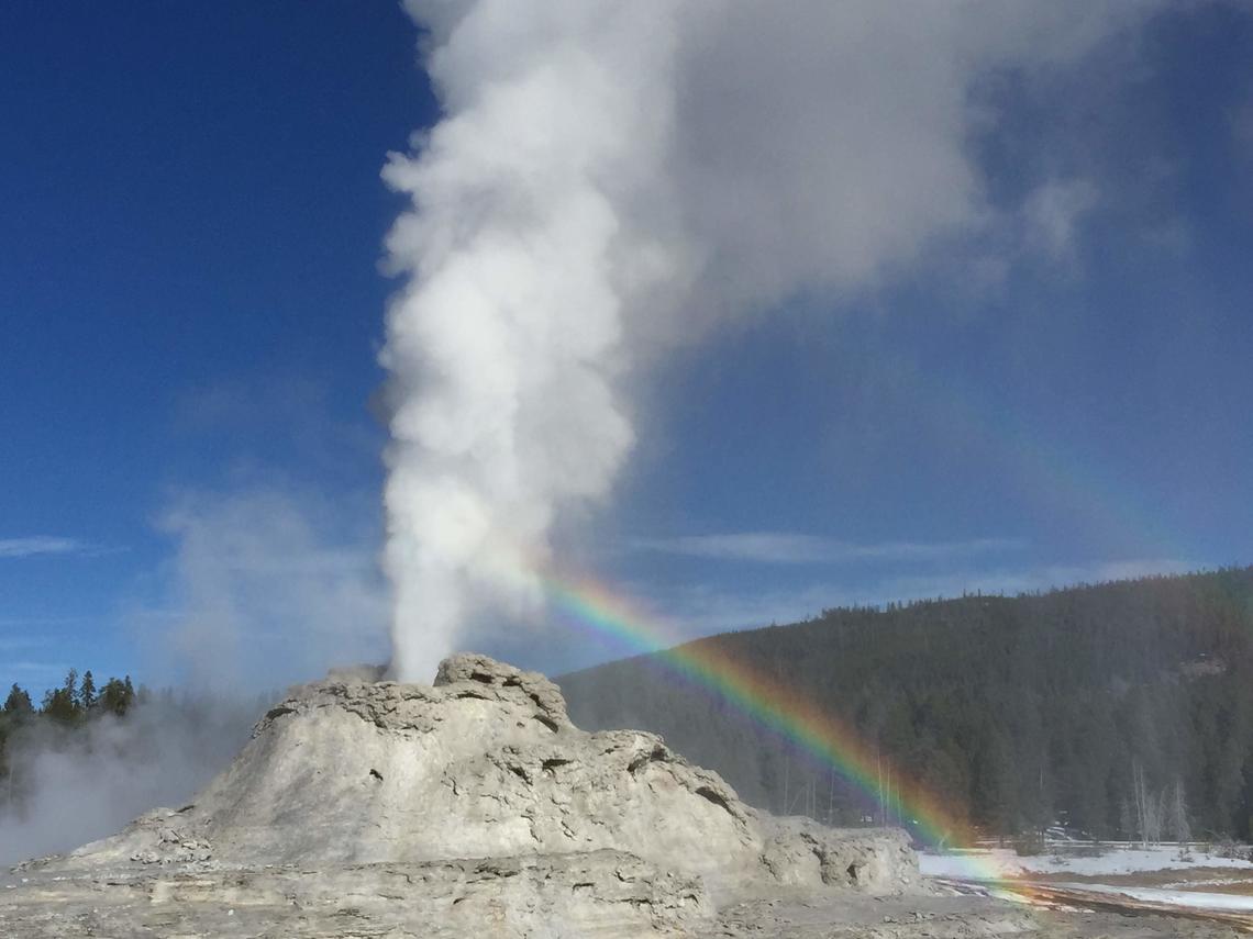
United-States , Yellowstone :
44°25’48 » N 110°40’12 » W,
Summit Elevation 9203 ft (2805 m)
Current Volcano Alert Level: NORMAL
Current Aviation Color Code: GREEN
Recent Work and News
Winter has arrived in Yellowstone! There have been seismic experiments in the Park during the past month, aimed at better understanding geyser systems, but heavy snow has limited the ability to do field work.
Steamboat Geyser had one major water eruption during the past month, on November 5, bringing the total number of eruptions in 2022 to 10. After a lull, minor eruptions at the geyser resumed on November 20, so hopefully another major water eruption will occur during the coming month!
Seismicity
During November 2022, the University of Utah Seismograph Stations, responsible for the operation and analysis of the Yellowstone Seismic Network, located 174 earthquakes in the Yellowstone National Park region. The largest event of the month was a minor earthquake of magnitude 2.6 located about 14 miles south-southwest of Mammoth Hot Springs in Yellowstone National Park on November 14 at 8:45 AM MST. This event is part of ongoing seismicity that began in the area on July 29. In November, 123 earthquakes were added to the sequence, and seismicity continued through the end of the month. Earthquake sequences like these are common and account for roughly 50% of the total seismicity in the Yellowstone region.
Yellowstone earthquake activity is currently above background levels.
Ground Deformation
Early November saw a winter storm that disrupted some of the GPS data collected in Yellowstone National Park. Snow accumulation on GPS antennas caused a several-day signal of apparent subsidence of 1-2 cm (less than an inch), which reversed itself by the middle of the month. Little net deformation has been recorded over the past few months at Yellowstone owing to artifatcs from the heavy snowfall coupled with signals related to seasonal groundwater recharge that, during summer and fall months, can pause, and even reverse, the subsidence that has been ongoing since 2015.
Source : YVO
Photo : Shaul Hurwitz / USGS ( Castle Geyser, near Old Faithful, )