November 22 , 2022.
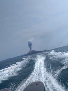
Ecuador , Sangay :
DAILY REPORT OF THE STATE OF SANGAY VOLCANO, Monday November 21, 2022.
Information Geophysical Institute – EPN.
Surface Activity Level: High, Surface Trend: No changes.
Internal activity level: High, Internal trend: No changes.
Seismicity: From November 20, 2022, 11:00 a.m. to November 21, 2022, 11:00 a.m.:
The level of seismic activity recorded is permanently high.
Explosion (EXP) 1150
Emission Tremors (TREMI ) 62
Rains / Lahars:
There were light rains in the area. No lahar was recorded. **In case of heavy rains, secondary lahars can be generated in the Volcán, Upano rivers and other tributaries**
Emission / Ash Column:
Two ash emission statements were issued by the Washington VAAC, with heights of 570 m and 1170 m above crater level in a northwesterly direction. An emission of gas and ash was observed between the clouds, with an approximate height of 700m above the level of the crater in a northerly direction.
Other Monitoring Parameters:
There are no thermal alerts recorded in the FIRMS or MIROVA systems for today.
Gas:
The MOUNTS system recorded 308.7 tons of SO2, measured on 2022-11-20 at 19:21 UTC.
Observation:
At night, an incandescence was observed at the level of the summit and a descent of material from the southeast flank. In the morning today, gas and ash emissions could be observed. The area is cloudy and partly cloudy until the end of this bulletin.
Alert level: Orange.
Source : IGEPN
Photo : Eqphos fotografía
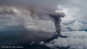
Philippines , Mayon :
MAYON VOLCANO BULLETIN , 21 November 2022 , 8:00 AM.
In the past 24-hour period, the Mayon Volcano Network did not detect any volcanic earthquake. Moderate emission of white steam-laden plumes that crept downslope before drifting to the west and west-northwest was observed. Sulfur dioxide (SO2) emission was last measured at an average of 276 tonnes/day on 03 November 2022. Based on ground deformation parameters from EDM, Precise Leveling, electronic tilt, and continuous GPS monitoring, Mayon Volcano has been slightly inflated since 2020.
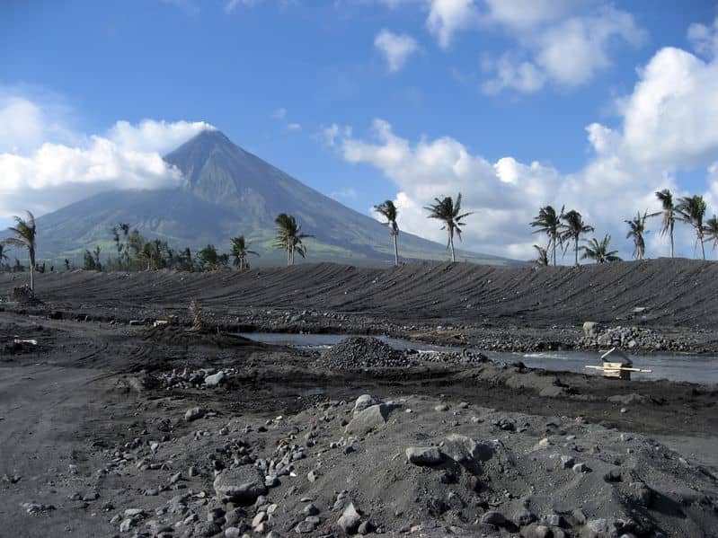
Alert Level 2 (Increased Unrest) prevails over Mayon Volcano. The public is reminded that there is current unrest driven by shallow magmatic processes that could eventually lead to phreatic eruptions or even precede hazardous magmatic eruptions. Entry into the six (6) kilometer-radius Permanent Danger Zone (PDZ) is strictly prohibited to minimize risks from sudden explosions, rockfalls, and landslides. In case of ash fall events that may affect communities downwind of Mayon’s crater, people should cover their nose and mouth with a damp, clean cloth, or dust mask. Civil aviation authorities must also advise pilots to avoid flying close to the volcano’s summit as ash from any sudden eruption can be hazardous to aircraft.
DOST-PHIVOLCS maintains close monitoring of Mayon Volcano and any new development will be communicated to all concerned stakeholders.
Source : Phivolcs.
Photo : Auteur inconnu.
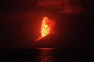
Peru , Sabancaya :
Analysis period: from November 14, 2022 to November 20, 2022, Arequipa, November 21, 2022.
Alert level: ORANGE
The Geophysical Institute of Peru (IGP) reports that the eruptive activity of the Sabancaya volcano remains at moderate levels, that is to say with the recording of an average of 36 daily explosions, with columns of ash and of gas up to 3.5 km altitude above the summit of the volcano and their subsequent dispersion. Therefore, for the following days, no significant change is expected in eruptive activity.
The IGP recorded and analyzed the occurrence of 333 earthquakes of volcanic origin, associated with the circulation of magmatic fluids inside the Sabancaya volcano. An average of 36 explosions was recorded daily, in addition to recording Volcano-Tectonic (VT) type events associated with rock fracturing inside the Sabancaya volcano.
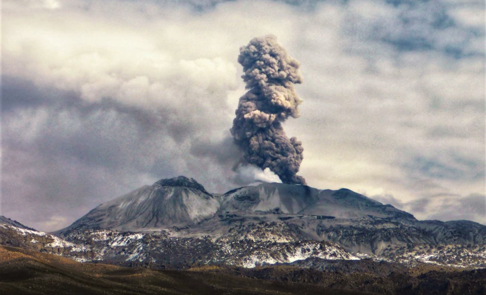
Monitoring the deformation of the volcanic structure using GNSS techniques (processed with fast orbits) does not show any significant anomalies. However, in general, an inflation process was observed in the northern sector (surroundings of the Hualca Hualca volcano). Visual surveillance identified columns of gas and ash up to 3.5 km above the summit of the volcano, which were scattered towards the North-West, North, North-East and South sectors. -West of Sabancaya. Satellite recordings have identified the presence of 4 thermal anomalies, with a maximum value of 12 MW, associated with the presence of a lava body on the surface of the volcano’s crater.
RECOMMENDATIONS
• Keep the volcanic alert level orange.
• Do not approach within a radius of less than 12 km from the crater.
Source : Cenvul
Photo : Andina
Colombia , Nevado del Huila :
Weekly activity bulletin of the Nevado del Huila volcano
The activity level of the volcano continues at the yellow Activity Level or (III): changes in the behavior of volcanic activity.
From the analysis and evaluation of the information obtained through the monitoring network of the Nevado del Huila volcano during the week of November 8 to 14, 2022, the COLOMBIAN GEOLOGICAL SERVICE – Volcanological and Seismological Observatory of Popayán reports that:
• During the evaluated period, the seismic activity continued to show stable behavior. 357 seismic events were recorded, of which 99 were associated with rock fracturing processes (VT type) and 258 with fluid dynamics in volcanic conduits.
• The images obtained during the week thanks to the web cameras Tafxnú, Caloto, Maravillas and La Palma showed low levels of degassing in the system, with a white column directed preferentially towards the North-West.
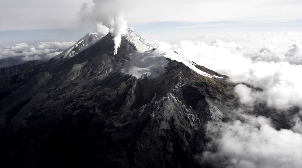
• On November 9, sulfur dioxide (SO2) was measured with a value of 971 t/day detected between the localities of Tunia and Mondomo (Cauca). This value is considered low according to the values recorded for this volcano.
• Sensors monitoring ground deformation, magnetic fields and infrasonic waves did not record variations associated with changes in volcanic activity.
It is concluded from the above that during the evaluated period, the volcano continued to exhibit stable behavior.
The Colombian Geological Service continues to monitor the evolution of the volcanic phenomenon and will report any changes that may occur in due course.
Source : SGC
Photo : Parque Nacional
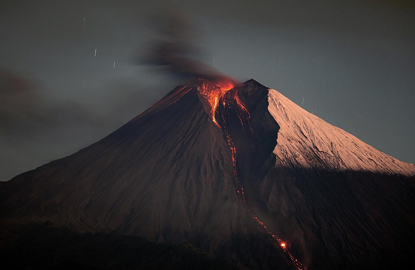
Guatemala , Santiaguito :
Activity:
The Santiaguito volcano observatory reports a white degassing on the crater with heights between 300 and 600 m which disperses in a west and east direction. Weak to moderate explosions are also recorded which, in clear periods, are observed in the form of a column of water vapor and ash. Some of these explosions generate a low, moderate, and sometimes loud rumble. Weak and some moderate avalanches continue to be recorded at the front and in the middle of the lava flow towards the ravines of San Isidro and El Tambor.

On the path of this lava flow, we observe an emanation of steam due to its high temperature. By observing the front of this flow, a degassing disperses towards the East. It is recommended not to approach the lava flow, due to the intense heat it gives off and the constant collapses that occur on its edges, which could cause burns and other serious injuries to those who come close.
The volcano maintains high activity due to the extrusion of blocky lava into the cupola of the Caliente dome, in a west-southwest direction and also due to the unstable nature of the material within the crater. There is a likelihood of moderate to strong pyroclastic flows, so one should not stay near or in riverbeds near the slopes of the volcano.
Source : Insivumeh .
Photo : Armando Pineda