November 10 , 2022.
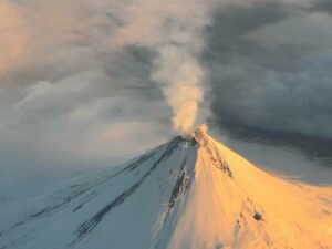
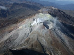
Chile , Nevados de Chillan :
Seismology
The seismological activity of the period was characterized by the recording of:
57 volcano-tectonic (VT) earthquakes associated with brittle rupture processes; the most energetic earthquake had a local magnitude (ML) equal to 2.0, the location of which was estimated at a depth of 4 km and an epicentral distance of 4.5 km to the East-South-East by relative to the active crater.
Long period (LP), explosion (EX) and tremor (TR) seismicity continued to be recorded, associated with fluid dynamics within the volcanic system. 312 LP-type earthquakes were classified, of which 7 were related to explosions at surface level, due to the presence of acoustic waves and/or gaseous emissions, specifying that the recording of the two characteristics mentioned is difficult due to adverse weather conditions, which may lead to a decrease from the ideal count for this type of event. The size of the largest LP earthquake estimated from the Reduced Displacement (DR) parameter reached a value equal to 961 cm2 on October 17, whose seismic energy corresponds to one of the largest recorded in the entire eruptive process. current . In addition, this event marks the end of the explosive process observed in recent weeks, giving way to a period of very low energy for a fluid seismicity comparable to the levels observed in the first eruptive phases, but with an upward trend, which initially suggests an internal system in recovery.
Regarding TR type seismicity, only 11 episodes were recorded, the most important of which reached a DR of 11 cm2. After the largest explosion, no such event was observed.

Satellite thermal anomalies
1 thermal alert was recorded in the area associated with the volcanic complex during the period, with a maximum Volcanic Radiative Power (VRP) of 3 MW on October 17, a value considered low according to data processed by the Middle Infrared of Observation of Volcanic Activity (MIROVA, http://www.mirovaweb.it/). A decrease in thermal alerts is observed, both in their recurrence and in their power during the reported period.
At the same time, according to the analytical processing of satellite images (Sentinel 2-L2A in combination of false color bands), no luminance anomaly was reported during the period evaluated.
Satellite geomorphological analysis
From the geomorphological observations carried out on the Planet Scope and Sentinel 2 L2A satellite images, the effects of the intense explosive activity that occurred in the first days of this period were observed, with the identification of pyroclastic deposits falling towards North-East, North-West directions. and South-East, and pyroclastic flows on the North, North-North-East, North-East, East, North-West and West flanks. However, no relevant morphological variation is observed after these events.
The Nevados de Chillán volcanic complex has entered a very low energy phase with levels similar to those observed in the early stages of this eruption in 2016, or during the minimum levels of the magmatic pause after L4 lava in 2019. This with the absence of TR, indicates a higher level of sealing of the surface system and/or a magmatic depletion sufficient to terminate the immediately preceding explosive process. Despite the above, the volcanic system continues with a lower seismicity, with a subtle upward trend, which could suggest, as has happened on other occasions, reactivations of the magmatic process. Other monitoring parameters such as deformation, SO2 emissions and thermal anomalies remain low and stable. As for the surface activity, it was mainly concentrated on October 16 and 17, with the emission of vigorous eruptive columns, where pyroclastic flows were generated in various directions with significant ranges towards the North-East flank. A possible assignment zone with a radius of 2 km around the active crater is maintained.
YELLOW TECHNICAL ALERT: Changes in the behavior of volcanic activity.
Source : Sernageomin.
Read the article : https://rnvv.sernageomin.cl/rnvv/TI_Santiago_prod/reportes_LB/2022/RAV_20221109_%C3%91uble_v20.pdf
Photos : Explora turismo , Sernageomin.
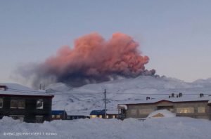
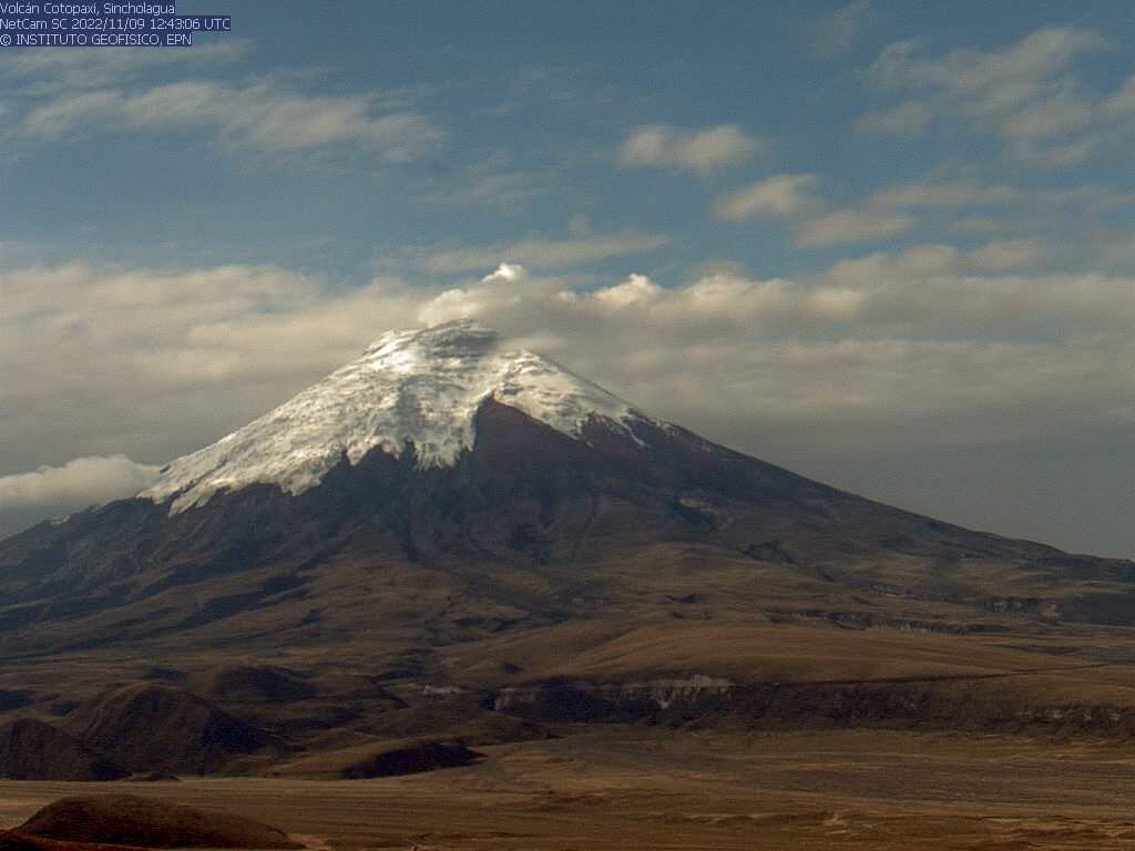
Ecuador , Cotopaxi :
DAILY REPORT OF THE STATE OF COTOPAXI VOLCANO, Wednesday November 09, 2022.
Information Geophysical Institute – EPN.
Surface Activity Level: Low, Surface Trend: Ascending
Internal activity level: Low, Internal trend: No change.
Seismicity: From November 08, 2022, 11:00 a.m. to November 09, 2022, 11:00 a.m.:
There was no interruption in the transmission of data from the BREF reference station for seismic statistics.
Long Periods (LP): 75
Rains / Lahars:
Rains were recorded in the volcano area yesterday.
Emission / ash column:
In the morning hours, a continuous emission of gas and water vapor could be observed up to about 200 meters above the level of the crater, oriented towards the West.
Observation:
Currently the area of the volcano is cloudy.
Gas:
The gas measurements observed in the DOAS network installed on the flanks of the volcano reflect an increase in the degassing trend from November 5.
Niveau d’alerte: Jaune .
Source et photos : IGEPN.
Iceland , Grímsvötn :
On 9 November Icelandic Meteorological Office (IMO) lowered the Aviation Color Code for Grímsvötn to Green (the lowest level on a four-color scale) noting no short-term increases in activity, though long-term trends remained above background levels. Seismicity continued to be characterized as unusual, with an increasing number of earthquakes that were also intensifying over the past months. The levels of deformation had already exceeded the level measured before the last eruption in 2011.
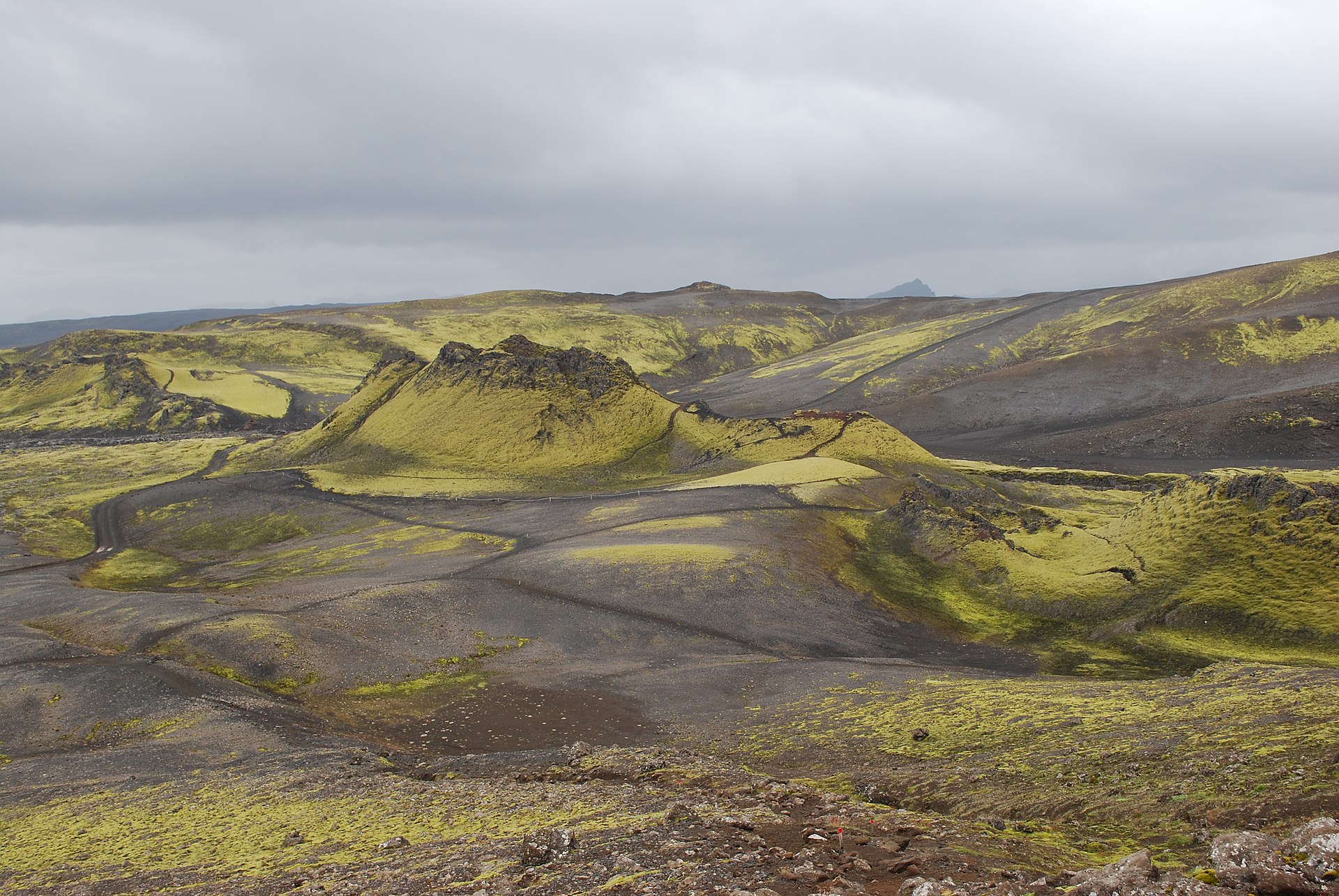
Grímsvötn, Iceland’s most frequently active volcano in recent history, lies largely beneath the vast Vatnajökull icecap. The caldera lake is covered by a 200-m-thick ice shelf, and only the southern rim of the 6 x 8 km caldera is exposed. The geothermal area in the caldera causes frequent jökulhlaups (glacier outburst floods) when melting raises the water level high enough to lift its ice dam. Long NE-SW-trending fissure systems extend from the central volcano. The most prominent of these is the noted Laki (Skaftar) fissure, which extends to the SW and produced the world’s largest known historical lava flow in 1783. The 15 km3 basaltic Laki lavas were erupted over a 7-month period from a 27-km-long fissure system. Extensive crop damage and livestock losses caused a severe famine that resulted in the loss of one-fifth of the population of Iceland.
Source: Icelandic Meteorological Office (IMO) , GVP
Photo : Laki , / Wikipedia.
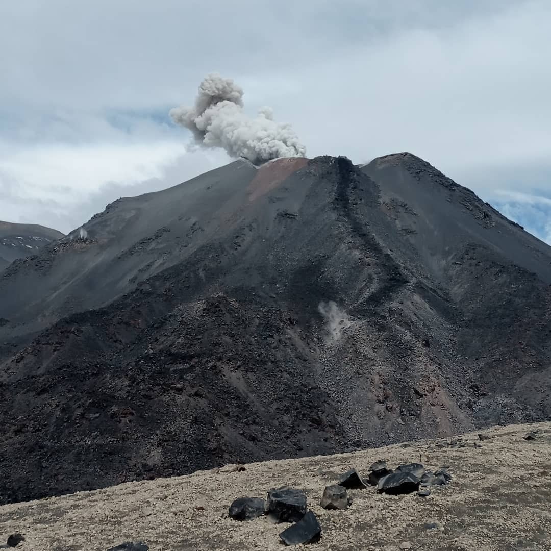
Japan , Suwanosejima :
JMA reported that the eruption at Suwanosejima’s Ontake Crater continued during 31 October-7 November and crater incandescence was visible nightly. An explosion at 0137 on 4 November produced an eruption plume that rose 2.4 km above the crater rim and ejected large blocks 200 m from the vent. Ashfall was reported in Toshima village (3.5 km SSW). The Alert Level remained at 2 and the public was warned to stay 1 km away from the crater.
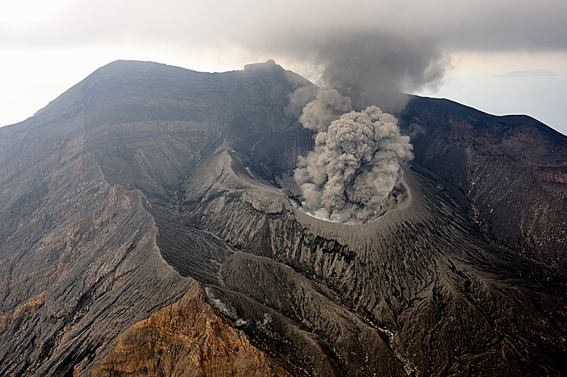
The 8-km-long island of Suwanosejima in the northern Ryukyu Islands consists of an andesitic stratovolcano with two historically active summit craters. The summit is truncated by a large breached crater extending to the sea on the east flank that was formed by edifice collapse. One of Japan’s most frequently active volcanoes, it was in a state of intermittent Strombolian activity from Otake, the NE summit crater, between 1949 and 1996, after which periods of inactivity lengthened. The largest recorded eruption took place in 1813-14, when thick scoria deposits blanketed residential areas, and the SW crater produced two lava flows that reached the western coast. At the end of the eruption the summit of Otake collapsed, forming a large debris avalanche and creating the open Sakuchi caldera, which extends to the eastern coast. The island remained uninhabited for about 70 years after the 1813-1814 eruption. Lava flows reached the eastern coast of the island in 1884. Only about 50 people live on the island.
Source: Japan Meteorological Agency (JMA), GVP
Photo : N. Geshi. Geological Survey of Japan, H.Seo
Alaska , Great Sitkin :
AVO reported that slow lava effusion continued at Great Sitkin during 2-8 November and seismicity was low. Satellite images were often cloudy, though elevated surface temperatures were identified almost daily. The flow field continued to grow, with lobes of lava extending more than 600 m E and around 430 m S. The Volcano Alert Level remained at Watch (the second highest level on a four-level scale) and the Aviation Color Code remained at Orange (the second highest level on a four-color scale).
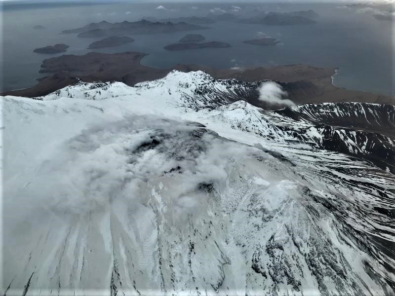
52°4’35 » N 176°6’39 » W,
Summit Elevation 5709 ft (1740 m)
Current Volcano Alert Level: WATCH
Current Aviation Color Code: ORANGE
Lava continues to erupt in the summit crater of Great Sitkin Volcano. Seismicity was low over the past day. Elevated surface temperatures were observed in satellite imagery twice during the last 24 hours. Web camera views were obscured by clouds.
Great Sitkin Volcano is monitored by local seismic and infrasound sensors, satellite data, web cameras, and regional infrasound and lightning networks.
Source : GVP , AVO.
Photo : First Officer Joseph Leman, submitted by Captain Dave Clum.