November 05 , 2022.
Italy , Campi Flegrei :
Weekly Bulletin, from October 24, 2022 to October 30, 2022. (Date of issue November 1, 2022)
ACTIVITY STATUS SUMMARY
In the light of the surveillance data, it is highlighted:
1) SEISMOLOGY: In the week of October 24 to 30, 2022, 163 earthquakes were recorded in the Campi Flegrei region (Mdmax = 2.3±0.3).
2) DEFORMATIONS: The average value of the lifting speed in the maximum deformation zone from mid-June 2022 has been recalculated as about 7 ± 1 mm/month. Over the past week, there appears to be an increase in the strain rate, the actual trend of which can be assessed with the data for the next few weeks. The lift recorded at the RITE GPS station is about 94 cm since January 2011.
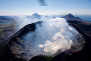
3) GEOCHEMISTRY: The soil CO2 fluxes measured last week did not show any significant changes. The temperature sensor installed in a fumarole emission 5 meters from the main Pisciarelli fumarole showed an average value of ~90°C, below the condensation temperature of the fumarole fluid (~95°C).
GROUND DEFORMATIONS / GNSS.
From mid-June 2022, the average lifting speed value in the maximum deformation zone is about 7 ± 1 mm / month. The recalculation was done based on a larger data set.

Over the past week, in conjunction with greater seismic activity in the area, there appears to be an increase in the rate of deformation. This variation, whose real trend can be assessed with the data of the next few weeks, seems to affect both the vertical components (variations in altitude of the RITE station) and the planimetric components (variations in length of the ACAE-Line of ARFE database).
Source : INGV.
Photos : Pisciarelli / Tullio Ricci, INGV.
Vanuatu Archipelago , Ambae :
The volcanic activity on Ambae Island is continuing in the major unrest state. The Volcanic Alert Level remains at Level 2.
The volcanic activity on Ambae is continuing in the major unrest state, with a lower level of activity, consistent with the Volcanic Alert Level 2. The Ambae Volcanic Alert Level was in Level 2 since 14th December 2021. New analysis suggest that the volcanic activity is likely to pursue in this lower level of activity of major unrest state but could increase to a high level of activity of major unrest state. Volcanic hazards remain at the summit area and creeks (e.g., remobilization of remaining ash from 2017 and 2018 eruption and current activity).
Latest seismic and observation data from the monitoring system confirmed the ongoing volcanic activity and the cone built up (at end December 2021) inside Lake Voui remains. The volcano continues to emit volcanic gas and possible ashes that is quasi contained within Lake Vui. These observations of the current activity is consistent with the activity of the Ambae volcano under Volcanic Alert Level 2 indicating ‘Major level of unrest; the Danger area remains at 2 km around the volcanic vents and within the area of flowing creeks. With this current volcanic activity, it is a useful reminder that eruptions can occur at any level of unrest with little or no warnings.
Source :Geohazard.
Photo : Air Taxi Vanuatu.
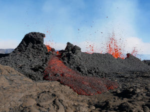
Kamchatka , Sheveluch :
VOLCANO OBSERVATORY NOTICE FOR AVIATION (VONA)
Issued: November 05 , 2022
Volcano: Sheveluch (CAVW #300270)
Current aviation colour code: ORANGE
Previous aviation colour code: orange
Source: KVERT
Notice Number: 2022-164
Volcano Location: N 56 deg 38 min E 161 deg 18 min
Area: Kamchatka, Russia
Summit Elevation: 3283 m (10768.24 ft), the dome elevation ~2500 m (8200 ft)
Volcanic Activity Summary:
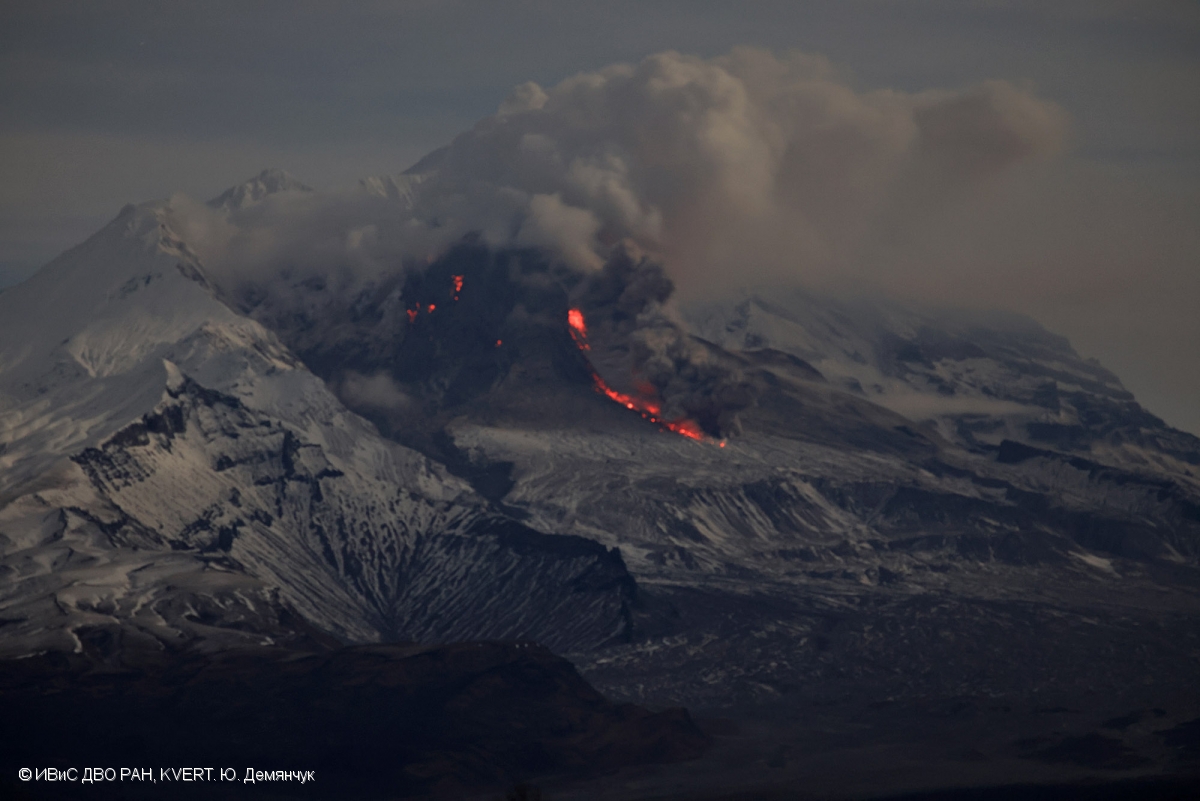
A growth of the lava dome continues, a strong fumarole activity, and an incandescence of the lava dome, explosions, and hot avalanches accompanies this process. Video and satellite data by KVERT show: an ash plume from hot avalanches collapsing from the parts of the lava dome is extending for 10 km to the north-east of the volcano.
An extrusive eruption of the volcano continues. Ash explosions up to 10-15 km (32,800-49,200 ft) a.s.l. could occur at any time. Ongoing activity could affect international and low-flying aircraft.
Volcanic cloud height:
3500-4000 m (11480-13120 ft) AMSL Time and method of ash plume/cloud height determination: 20221105/0550Z – Visual data
Other volcanic cloud information:
Distance of ash plume/cloud of the volcano: 10 km (6 mi)
Direction of drift of ash plume/cloud of the volcano: NE / azimuth 51 deg
Source : Kvert.
Photo : Yu. Demyanchuk, IVS FEB RAS, KVERT
Indonesia , Merapi :
Report on the activity of Mount Merapi from October 28, 2022 to November 03, 2022, Published on November 05, 2022
RESULTS OF OBSERVATIONS
Visual
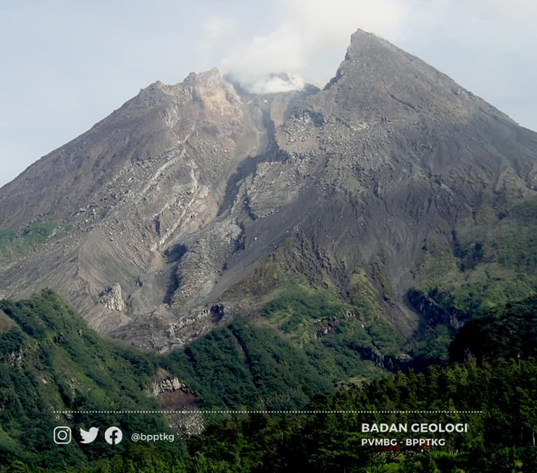
The weather around Mount Merapi is usually sunny in the morning and afternoon, while the evening is foggy. White smoke, thin to medium thickness, low pressure and 450 m high was observed from the Mount Merapi observation post of Babadan on November 03, 2022 at 06:00 WIB.
This week, 1 lava avalanche was observed in the Southwest, descending the Sat River with a maximum sliding distance of 1200 m. The sound of the avalanche was heard from Pos Babadan with medium intensity
On the southwest and central dome still growing, but no significant morphological changes are observed. Based on photo analysis, the volume of the dome is calculated at 1,626,000 m3, and for the central dome it is 2,772,000 m3.
Seismicity
This week, the seismicity of Mount Merapi showed:
271 deep volcanic earthquakes (VTA),
50 multi-phase earthquakes (MP),
277 avalanche earthquakes (RF),
8 emission earthquakes (DG),
6 tectonic earthquakes (TT).
1 shallow volcanic earthquake (VTB)
The intensity of this week’s seismicity is still quite high.
Deformation
The deformation of Mount Merapi that was monitored using EDM and GPS this week shows no significant changes.
Rain and lahars:
This week, there was rain at Kaliurang observation post with a rain intensity of 36 mm/h for 20 minutes on November 03, 2022. It is reported that there was no increase in the flow in the rivers having their source on the Merapi..
Conclusion
Based on the results of visual and instrumental observations, it is concluded that:
-The volcanic activity of Mount Merapi is still quite high in the form of effusive eruption activity. The state of the activity is defined at the « SIAGA » level.
-The current potential dangers are lava avalanches and hot clouds in the South-South-West sector including the Boyong River up to 5 km, the Bedog, Krasak, Bebeng Rivers up to 7 km. In the South-East sector, they cover the Woro River with a maximum of 3 km and the Gendol River for 5 km. While the ejection of volcanic materials during an explosive eruption can reach a radius of 3 km around the summit.
Source et photo : BPPTKG.
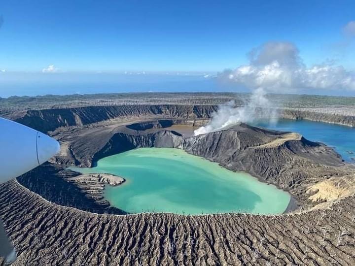
Ecuador , Sangay :
DAILY REPORT OF THE STATE OF SANGAY VOLCANO, Friday November 04, 2022.
Information Geophysical Institute – EPN.
Surface activity level: High, Surface trend: Ascending.
Internal activity level: High, Internal trend: Ascending.
Seismicity: From November 03, 2022, 11:00 a.m. to November 04, 2022, 11:00 a.m.:
The seismic statistics were carried out at the SAGA reference station, which did not present any cuts in the transmission of data. In addition, from 05:20 TL the signal of a continuous emission tremor is recorded until the close of the report
Explosion (EXP) 780
Emission Tremors (TREMI ) 40
Rains / Lahars:
There are no reports of rain in the area in the last 24 hours **In the event of heavy rains, these could remobilize the accumulated materials, generating mudslides and debris that would descend on the sides of the volcano and flow into adjacent rivers.**
Emission / ash column:
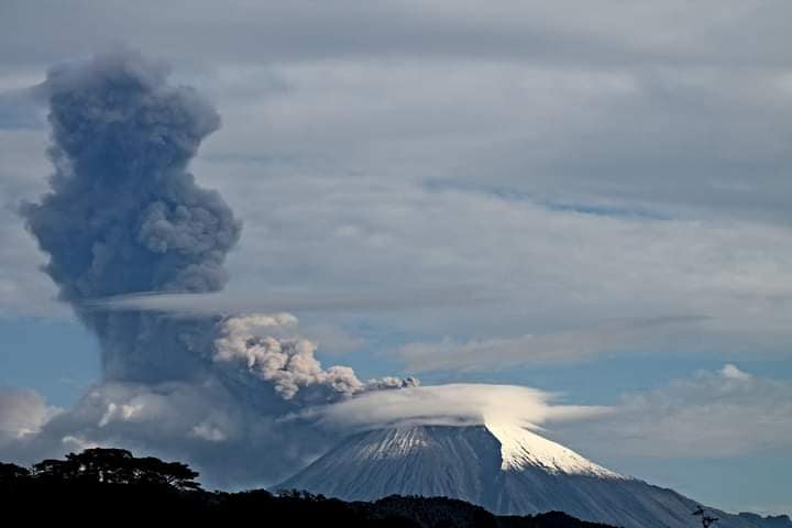
Thanks to satellite images (GOES-16), an ash cloud was seen from 05:20 TL. The emission intensified, forming a column which reached a height of 8,300 meters above the crater around 8:40 am. The ashes were carried by the winds to the northwest, west and southwest. So far, according to the report published by SNGRE, light to moderate ash falls have been recorded in the cities of Riobamba, Guamote, Colta, Alausí, Pallatanga, Chambo and Chunchi.
Other Monitoring Parameters:
The FIRMS satellite system records 4 thermal anomalies, while MIROVA recorded 1 moderate thermal anomaly in the last 24 hours.
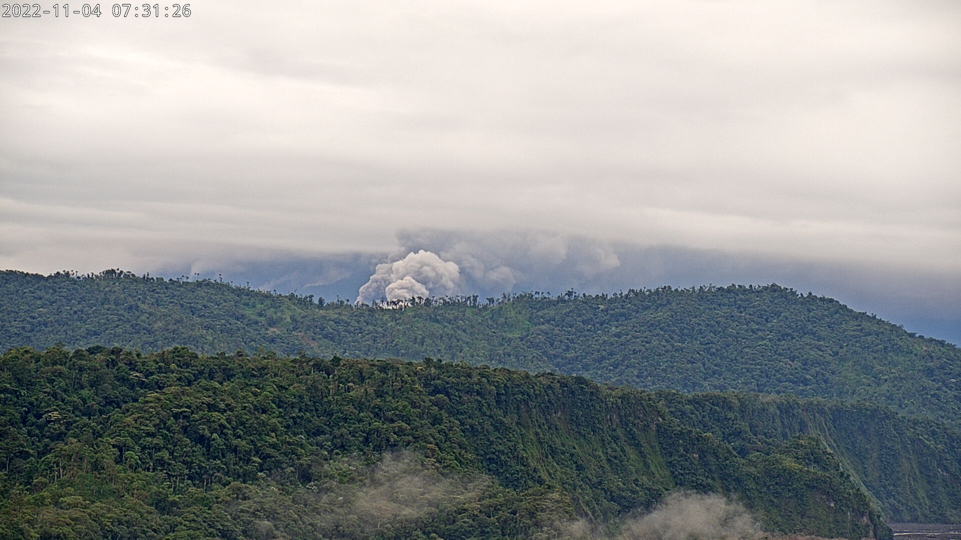
Camera image of the Sangay volcano, descent of pyroclastic flows
Gas:
The MOUNTS system reported 133 tons of SO2, measured on 03/11/2022 at 5:57 p.m. TL.
Observation:
During the night, an incandescence was observed in the crater. In the visual camera, the descent of pyroclastic flows on the Volcán River has been observed since 7:00 a.m.
Alert level: Orange.
Informative VOLCAN SANGAY, Friday, November 4, 2022
Since about 07:00 today, the descent of pyroclastic flows towards the Volcán River has been observed by the visual cameras. The accumulation of this material with the flow of the Upano River, or associated with heavy rains, could cause flooding in the Upano River downstream, affecting its banks. The Geophysical Institute is monitoring and any news will be informed.
Informative VOLCAN SANGAY, Friday November 04, 2022
For the moment, the tremor signal has decreased, as has the height of the volcanic cloud observed on the satellite images (less than 3 km snc). However, ash emission continues to occur towards the northwest of the volcano. The IG-EPN will maintain its vigilance and give notice in the event of a further increase in activity. It is recommended to take the necessary measures and to keep informed by official sources.
Source : IGEPN
Photos : Washo Ruiz , IGEPN