July 14 , 2021.
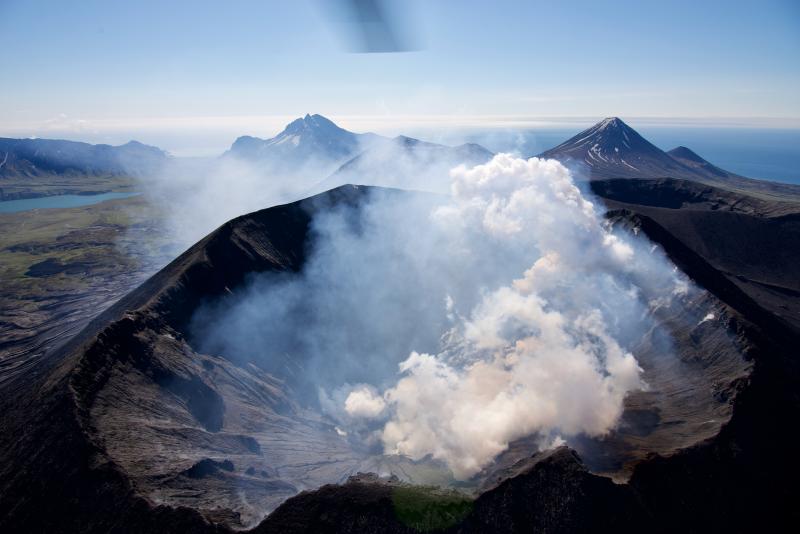
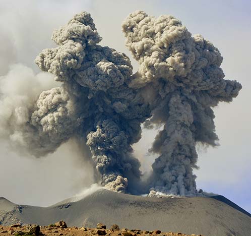
Alaska , Semisopochnoi :
AVO/USGS Volcanic Activity Notice
Current Volcano Alert Level: WATCH
Previous Volcano Alert Level: ADVISORY
Current Aviation Color Code: ORANGE
Previous Aviation Color Code: YELLOW
Issued: Monday, July 12, 2021, 4:14 PM AKDT
Source: Alaska Volcano Observatory
Notice Number: 2021/A490
Location: N 51 deg 55 min E 179 deg 35 min
Elevation: 2625 ft (800 m)
Area: Aleutians
Volcanic Activity Summary:
Continuous volcanic tremor (constant shaking) began to be observed at ~2000 UTC (12 pm AKDT) and continues through the present time. Ash emissions were visible in satellite data beginning around 2100 UTC (1 pm AKDT) to an altitude of less than 5,000 feet asl (based on wind direction). Satellite observations from yesterday afternoon showed a robust steam plume and sulfur dioxide gas emissions. These observations indicate an increase in unrest and the Aviation Color Code is being increased to ORANGE, and the Volcano Alert Level is being increased to WATCH. Additional ash emissions are probable, but not certain.
When occurring, small eruptions producing minor ash deposits within the vicinity of the active north crater of Mount Cerberus and ash clouds under 10,000 ft above sea level are typical of activity at Semisopochnoi.
Recent Observations:
[Volcanic cloud height] Less than 5,000 ft asl.
[Other volcanic cloud information] Observed in GOES-17 satellite
Remarks:
Semisopochnoi is monitored by a local seismic and infrasound network, regional lightning and infrasound sensors, and satellite data.
Source : AVO .
Photo : Read, Cyrus / Alaska Volcano Observatory / U.S. Geological Survey.
Italy / Sicily , Etna :
Weekly Bulletin, from July 05, 2021 to July 11, 2021 (issue date July 13, 2021)
SUMMARY STATEMENT OF ACTIVITY
In view of the monitoring data, it is highlighted:
1) VOLCANOLOGICAL OBSERVATIONS: Strombolian activity with two eruptive episodes at the Southeast Crater; ordinary degassing at the Bocca Nuova Crater, the Voragine Crater and the Northeast Crater.
2) SEISMOLOGY: Seismic activity of weak fracturing. Large and sudden variations in the amplitude of the volcanic tremor are correlated with paroxysmal episodes.
3) INFRASOUND: high infrasound activity in conjunction with the lava fountain episodes at the Southeast Crater, low in the remaining period.
4) DEFORMATIONS: During the last week, the inclinometric network recorded significant changes in correspondence with the events of the lava fountains.
Analysis of the GNSS data acquired at high frequency did not show any significant changes.
5) GEOCHEMISTRY: The flow of HCl occurs at a low level. SO2 flux at medium level, with high values during eruptive phases
The flow of CO2 from the soil decreases, settling on average values.
The partial pressure of dissolved CO2 does not show significant changes.
There are no updates for the C / S report.
The isotopic ratio of helium remains stable on average values (last update of 06/21/2021).
6) SATELLITE OBSERVATIONS: The thermal activity in the summit area was high to very high in correspondence with the lava fountains.
VOLCANOLOGICAL REMARKS
During the week, the monitoring of the volcanic activity of Etna was carried out by analyzing the images of the network of surveillance cameras of the INGV Section of Catania, of the Osservatorio Etneo (INGV-OE), the analysis of images acquired by satellite and two inspections carried out on July 7 and 9 by INGV staff.
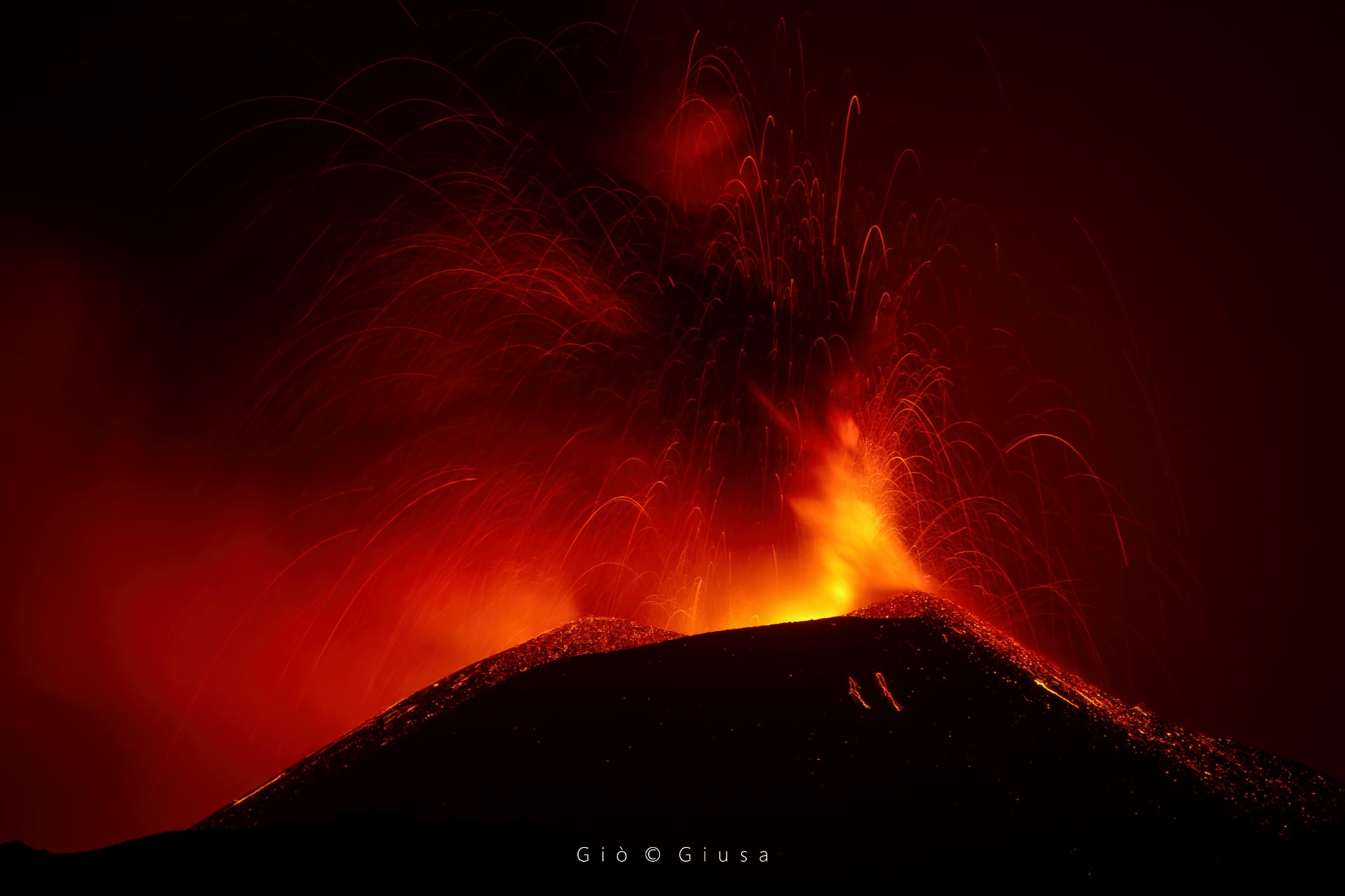
The week was characterized by Strombolian activity with two eruptive episodes at the Southeast Crater (SEC) and ordinary degassing at the Bocca Nuova (BN) crater, at the Voragine crater (VOR) and at the Northeast Crater ( NEC).
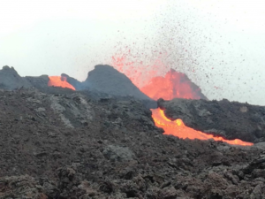
On the 6th, starting around 21:30 UTC, the resumption of Strombolian activity was observed at the level of the Southeast Crater. The intensity and frequency of the explosions gradually increased until they gradually reached the stage of a lava fountain. An eruptive cloud formed which reached a height of about 5000 m above sea level, dispersing in a southerly direction. A relapse of volcanic material was reported on the villages of the southern slope of the volcano. The eruptive activity also produced a small lava flow from the southern flank of the Southeast Crater cone that headed southwest, stopping at an altitude of around 2,800 m above sea level.
During the morning inspection of July 7, it was observed that the explosive activity had produced abundant fallout of coarse material in the area around the Southeast Crater. In particular, on the northern flank of Mount Barbagallo had fallen bombs with dimensions of up to one meter, while UHF bombs were visible over a large area east of Mount Barbagallo, up to an estimated altitude of around 2,700 m. altitude.
The second eruptive episode of the Southeast Crater occurred on July 8 when, from around 7:00 p.m. UTC, the resumption of Strombolian activity was observed, which intensified to gradually pass into the lava fountain stage. . The eruptive cloud reached a height of about 11,000 m above sea level, dispersing to the south-east and causing a fall of volcanic material on the countries of the south-eastern slope of the volcano. During the eruptive episode, a lava flow formed in a southwest direction, the most advanced front of which descended to an altitude of 2350 m, as observed during the inspection on July 9 in the locality of Galvarina.
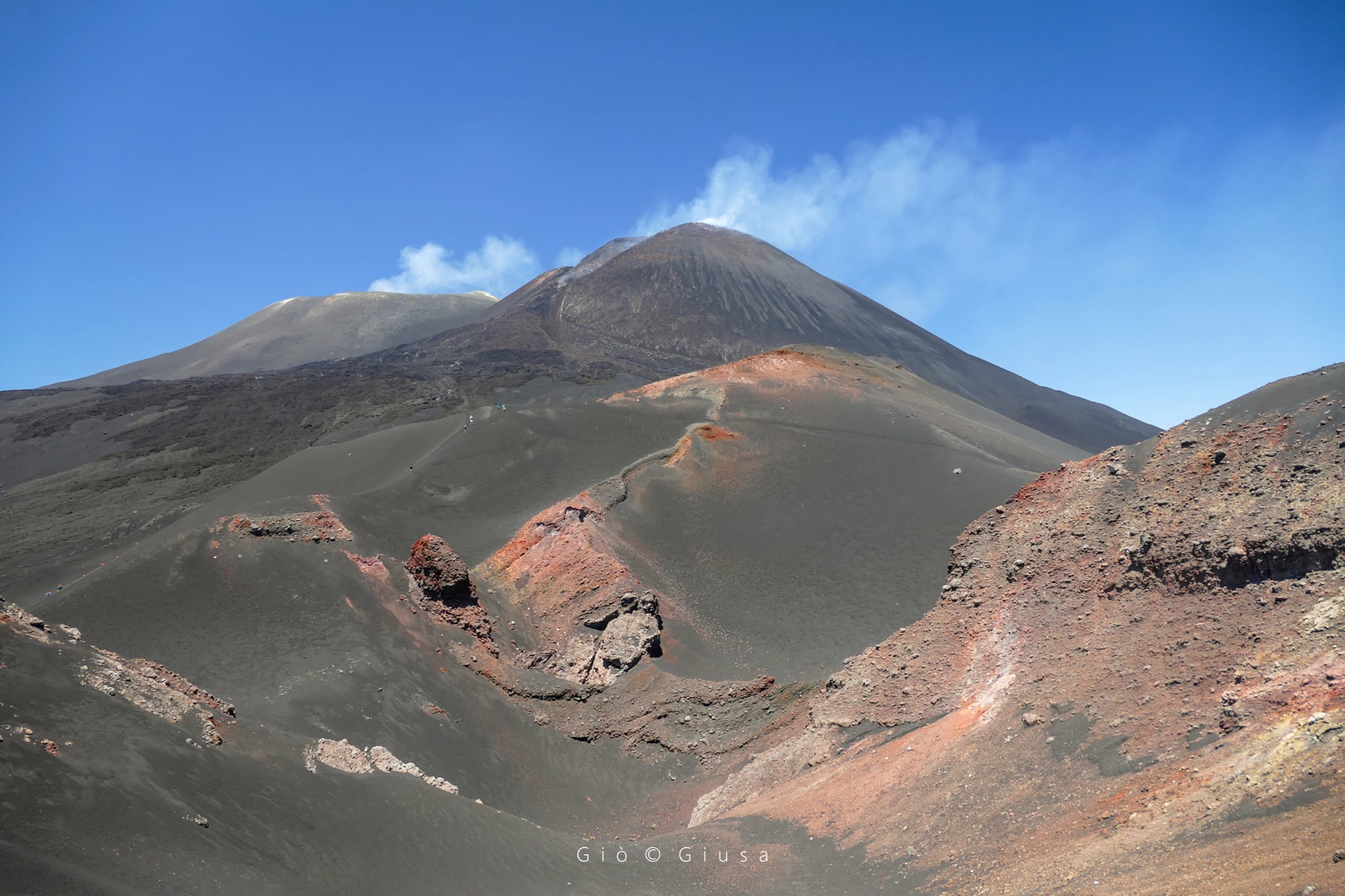
Finally, during the week, the Northeast crater, the Bocca Nuova crater and the Voragine crater were affected by degassing activities.
Source : INGV.
Photos : Gio Giusa.
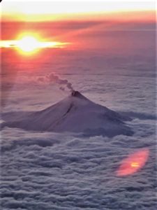
Indonesia , Semeru :
VOLCANO OBSERVATORY NOTICE FOR AVIATION – VONA
Issued : July 14 , 2021
Volcano : Semeru (263300)
Current Aviation Colour Code : ORANGE
Previous Aviation Colour Code : orange
Source : Semeru Volcano Observatory
Notice Number : 2021SMR41
Volcano Location : S 08 deg 06 min 29 sec E 112 deg 55 min 12 sec
Area : East java, Indonesia
Summit Elevation : 11763 FT (3676 M)
Volcanic Activity Summary :
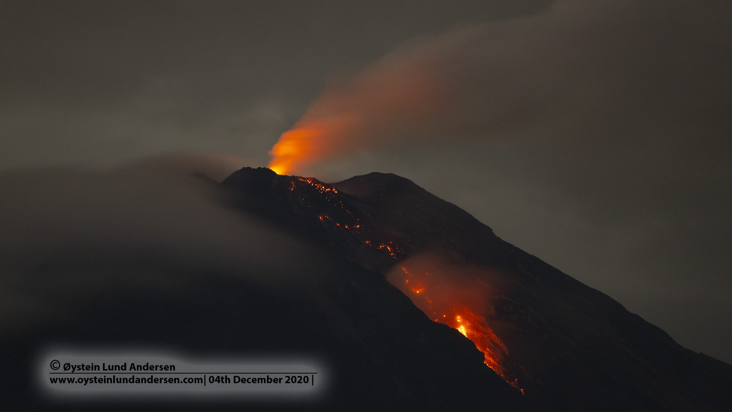
Eruption with volcanic ash cloud at 04h46 UTC (11h46 local). Eruption and ash emission is continuing.
Volcanic Cloud Height :
Best estimate of ash-cloud top is around 13043 FT (4076 M) above sea level, may be higher than what can be observed clearly. Source of height data: ground observer.
Other Volcanic Cloud Information :
Ash-cloud moving to southwest.
The level of activity has been level II (WASPADA) since May 2, 2012. Mount Semeru (3,676 m above sea level) has experienced intermittent eruptions. There are explosive and effusive eruptions, producing lava flows towards the south and south-eastern slopes, as well as ejections of incandescent rocks around the summit crater.
The volcano was clearly visible until it was covered in fog. An eruption occurred but the rash column was not observed. No smoke from the crater was observed. The weather is sunny, the wind is weak in the south. The air temperature is around 22-29 ° C.
According to the seismographs of July 13, 2021, it was recorded:
53 eruption / explosion earthquakes
7 earthquakes of emissions
2 distant tectonic earthquakes
Sources : Magma Indonésie , PVMBG.
Photo : Oystein lund Andersen .
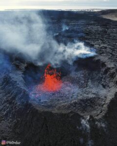
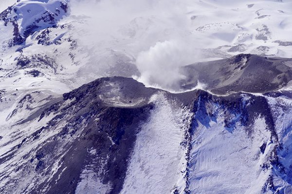
Chile , Nevados de Chillan :
Special Report on Volcanic Activity (REAV), Ñuble region, Nevados de Chillán volcanic complex, July 13, 2021, 12:40 p.m. local time (Continental Chile).
The National Service of Geology and Mines of Chile (Sernageomin) publishes the following PRELIMINARY information, obtained thanks to the monitoring equipment of the National Volcanic Monitoring Network (RNVV), processed and analyzed at the Volcanological Observatory of the Southern Andes ( Ovdas):
On Tuesday, July 13, at 12:11 local time (16:11 UTC), monitoring stations installed near the Nevados de Chillán volcanic complex recorded an earthquake associated with fluid dynamics (long period type) in the volcanic system.
The characteristics of the earthquake after its analysis are as follows:
ORIGINAL TIME: 12:11 local time (16:11 UTC)
LATITUDE: 36.866 ° S
LONGITUDE: 71.392 ° W
DEPTH: 0.2 km
REDUCED DISPLACEMENT: 673 (cm2)
ACOUSTIC SIGNAL: 15.26 Pascals (Pa) reduced to 1 km.
The characteristics of the surface activity are as follows:
Maximum column height: 740 m above the emission point.
Direction of dispersion: South.
OBSERVATIONS:
At the time of this report, no changes in volcanic activity are observed. In addition, it should be noted that these types of signals are part of the expected activity for this alert level.
The volcanic technical alert remains at the Yellow level.
Source : Sernageomin.
Photo : ingemmet.
Peru , Sabancaya :
Analysis period: July 05, 2021 to July 11, 2021, Arequipa, July 12, 2021.
Alert level: ORANGE
The Geophysical Institute of Peru (IGP) reports that the eruptive activity of the Sabancaya volcano remains at moderate levels, that is, with the recording of an average of 90 daily explosions, with columns of ash and gas up to 2.5 km altitude above the summit of the volcano and their consequent dispersion. Therefore, for the following days, no significant change is expected in eruptive activity.
The IGP recorded and analyzed the occurrence of 1,101 earthquakes of volcanic origin, associated with the circulation of magmatic fluids within the Sabancaya volcano. An average of 90 explosions was recorded daily. During this period, Volcano-Tectonic (VT) earthquakes associated with rock fractures were located mainly in the North-East and North-West of Sabancaya and presented magnitudes between M2.0 and M3.9.
The monitoring of the deformation of the volcanic structure using GNSS techniques (processed with fast orbits) does not show any significant anomalies. However, in general, an inflation process was observed in the northern sector (around the Hualca Hualca volcano). The visual surveillance made it possible to identify columns of gas and ash up to 2.5 km altitude above the summit of the volcano, which were scattered towards the South-East, East, West-South-West and North sectors. – East of Sabancaya. Satellite recordings identified the presence of 11 thermal anomalies (maximum value of 95 MW) associated with the presence of a lava body on the surface of the volcano’s crater, the maximum value recorded in 2021. .
RECOMMENDATIONS
• Keep the volcanic alert level in orange.
• Do not approach within a radius of 12 km from the crater.
Source : IGP.
Photo : IGP