July 11 , 2022.
Russia / Kuril Islands , Ebeko :
VOLCANO OBSERVATORY NOTICE FOR AVIATION (VONA)
Issued: July 10 / 11 , 2022
Volcano: Ebeko (CAVW #290380)
Current aviation colour code: ORANGE
Previous aviation colour code: orange
Source: KVERT
Notice Number: 2022-64
Volcano Location: N 50 deg 41 min E 156 deg 0 min
Area: Northern Kuriles, Russia
Summit Elevation: 1156 m (3791.68 ft)

Volcanic Activity Summary:
A moderate eruptive activity of the volcano continues. According to visual data by volcanologists from Severo-Kurilsk, an explosion sent ash up to 2.7 km a.s.l., an ash cloud is drifting to the south-east of the volcano.
A moderate eruptive activity of the volcano continues. Ash explosions up to 6 km (19,700 ft) a.s.l. could occur at any time. Ongoing activity could affect low-flying aircraft and airport of Severo-Kurilsk.
Volcanic cloud height:
2700 m (8856 ft) AMSL Time and method of ash plume/cloud height determination: 20220710/0541Z – Visual data
1500 m (4920 ft) AMSL Time and method of ash plume/cloud height determination: 20220711/0346Z – Visual data
Other volcanic cloud information: distance of ash plume/cloud of the volcano: 5 km (3 mi)
Direction of drift of ash plume/cloud of the volcano: ESE / azimuth 110 deg
Time and method of ash plume/cloud determination: 20220710/0541Z – Visual data
Source : Kvert
Photo : S. Lakomov ( archive)
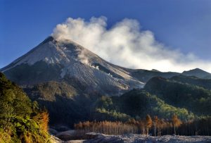
Guatemala , Fuego :
SPECIAL VOLCANOLOGICAL BULLETIN
The instrumental recording of seismic and acoustic stations around the Fuego volcano shows an increase in degassing activity from the crater since Saturday evening. This was reported by OVFGO observers at Panimaché I, with low to moderate sounds similar to a train locomotive, which went from intermittent periods of between 1 and 5 minutes, to remaining constant since early today.
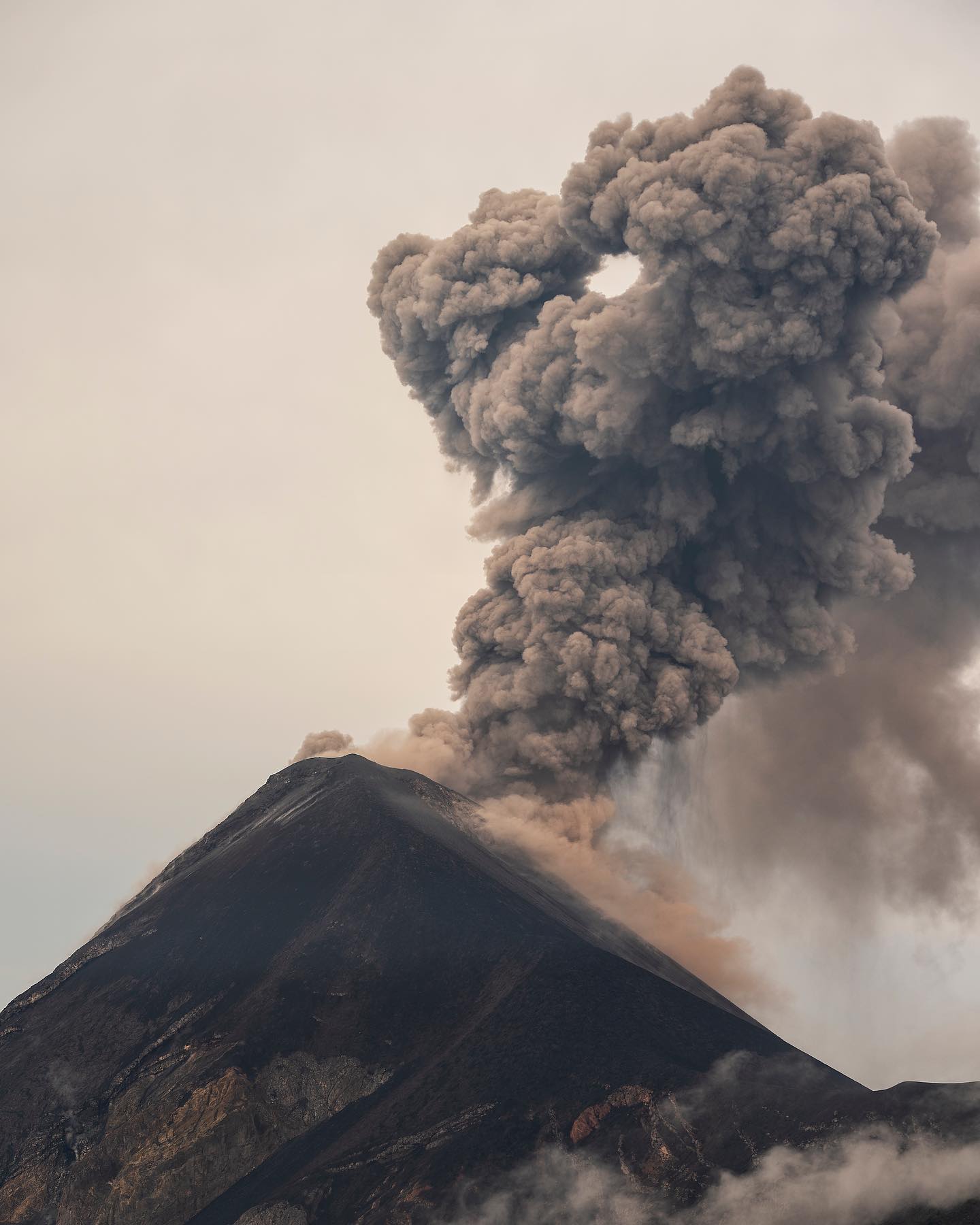
Currently, 2 to 5 weak explosions per hour are observed, as well as moderate to strong avalanches towards the Ceniza ravine. This activity raises a curtain of ash above the ravine, and the wind disperses this material over distances between 10 and 15 kilometers to the west and southwest. Some weak avalanches were also observed towards other ravines such as Santa Teresa and Las Lajas. All this favors the fall of fine ash in the communities of the Southwest flank such as Panimaché I and II, Morelia, Santa Sofia, Yucales, Palo Verde, El Porvenir, La Asunción and La Rochela.
This increase in activity may precede the formation of a lava flow towards the Ceniza ravine, as well as the appearance of strong avalanches and pyroclastic density currents similar to those that occurred on July 4th. However, it could happen in any of the volcano’s other canyons, such as Santa Teresa and Las Lajas.
Source : Insivumeh
Photo : Diego Rizzo / @diegorizzophoto .
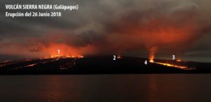
Chile , Hudson:
Seismology
The seismological activity of the period was characterized by the recording of:
513 VT type seismic events, associated with rock fracturing (Volcano-Tectonic type). The most energetic earthquake presented a value of Local Magnitude (ML) equal to 3.4, located 5.0 km south-south-east of the volcanic edifice, at a depth of 5.5 km from the crater; Due to this event, a Special Volcanic Activity Report (REAV) was released on June 21.
75 LP-type seismic events, associated with fluid dynamics within the volcanic system (Long Period type). The size of the largest earthquake assessed from the reduced displacement parameter (RD) was equal to 67 cm2. No event presented the minimum energy to be located
11 HB-type seismic events, associated with both rock fracturing and fluid dynamics within the volcanic system (Hybrid type). The most energetic earthquake had a reduced displacement (RD) value of 109 cm2 and a local magnitude (ML) value of 2.0, located 2.6 km east-northeast of the volcanic edifice, at a depth of 5.8 km from the crater.
Fluid Geochemistry
No anomalies were reported in the emissions of sulfur dioxide (SO2) into the atmosphere in the area near the volcano, according to data published by the Tropospheric Monitoring Instrument (TROPOMI) and the Ozone Monitoring Instrument (OMI) Sulfur Dioxide Group.
Satellite thermal anomalies
During the period, no thermal alert was recorded in the area associated with the volcanic edifice, according to the analytical processing of Sentinel 2-L2A satellite images, in combination with false color bands.
Geodesy
According to data provided by 3 GNSS stations, no relevant changes were observed and displacement trends have been maintained since February, with a slight increase in horizontal displacement, reaching rates of 0.5 cm/month. The maximum vertical displacement rate was estimated at 0.2 cm/month, for the station located on the southeast (SE) flank of the caldera.
Surveillance cameras
The images provided by the fixed camera, installed near the volcanic edifice, did not record any degassing columns or variations linked to surface activity.
Activity remained at levels considered low, suggesting stability of the volcanic system. The volcanic technical alert is maintained at:
GREEN TECHNICAL ALERT: Active volcano with stable behavior – There is no immediate risk
Source : Sernageomin
Photo : Norm Banks.
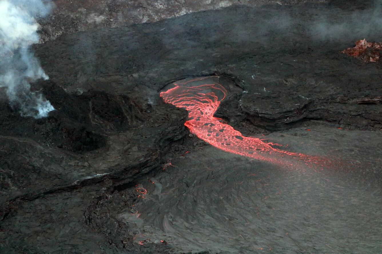
Hawaii , Kilauea :
19°25’16 » N 155°17’13 » W,
Summit Elevation 4091 ft (1247 m)
Current Volcano Alert Level: WATCH
Current Aviation Color Code: ORANGE
Activity Summary:
The summit eruption of Kīlauea Volcano, within Halemaʻumaʻu crater, has continued over the past 24 hours. All recent lava activity has been confined to the crater, and current data indicate that this scenario is likely to continue. No significant changes have been noted at the summit or in either rift zone.
Summit Observations:
Eruption of lava from the Halemaʻumaʻu western vent into the active lava lake has continued over the past 24 hours. The lava level in the lake has dropped about 2 meters (7 feet) this morning in association with summit deflation. Lava ooze-outs have been effusing near the eastern, northeastern, and northwestern edges of the crater floor. Overnight webcam views showed low-level spattering at the western vent, reaching heights no more than 10 meters (33 feet) above the vent. Measurements from an overflight on June 17, 2022 indicated that the crater floor had seen a total rise of about 120 meters (394 feet) . Summit tiltmeters began tracking sharp deflation late yesterday evening, which continues this morning. A sulfur dioxide (SO2) emission rate of approximately 2,800 tonnes per day (t/d) was measured on July 8, 2022.
Rift Zone Observations:
No unusual activity has been noted along the East Rift Zone or Southwest Rift Zone; steady rates of ground deformation and seismicity continue along both. Measurements from continuous gas monitoring stations downwind of Puʻuʻōʻō in the middle East Rift Zone remain below detection limits for SO2, indicating that SO2 emissions from Puʻuʻōʻō are negligible.
Source : HVO.
Photo : USGS / K. Mulliken
Canary Islands , Tenerife :
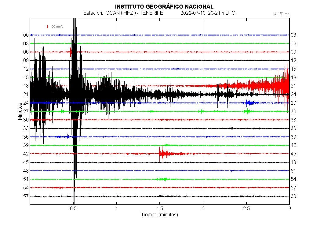
10:30 p.m. EXCEPTIONAL SEISMICITY IN THE CENTER OF TENERIFE.
An earthquake of magnitude 2.1 in the upper part of the Orotava valley in Fasnia, 7 km deep, which is of tectonic type and shows regional tensions in the area of the North-East ridge very close to the Arafo volcano.
A few hours later, something unexpected happened: the area of the phonolithic chamber of the Caldera de Ucanca responded to these efforts with a typical volcanic and quite intense earthquake of M 2.1 or more, at 18.2 km deep for what we’ve had so far. It occurs as a triad of hybrid signals, which contains several earthquakes of long period LP type, rock rupture and tectonic type.
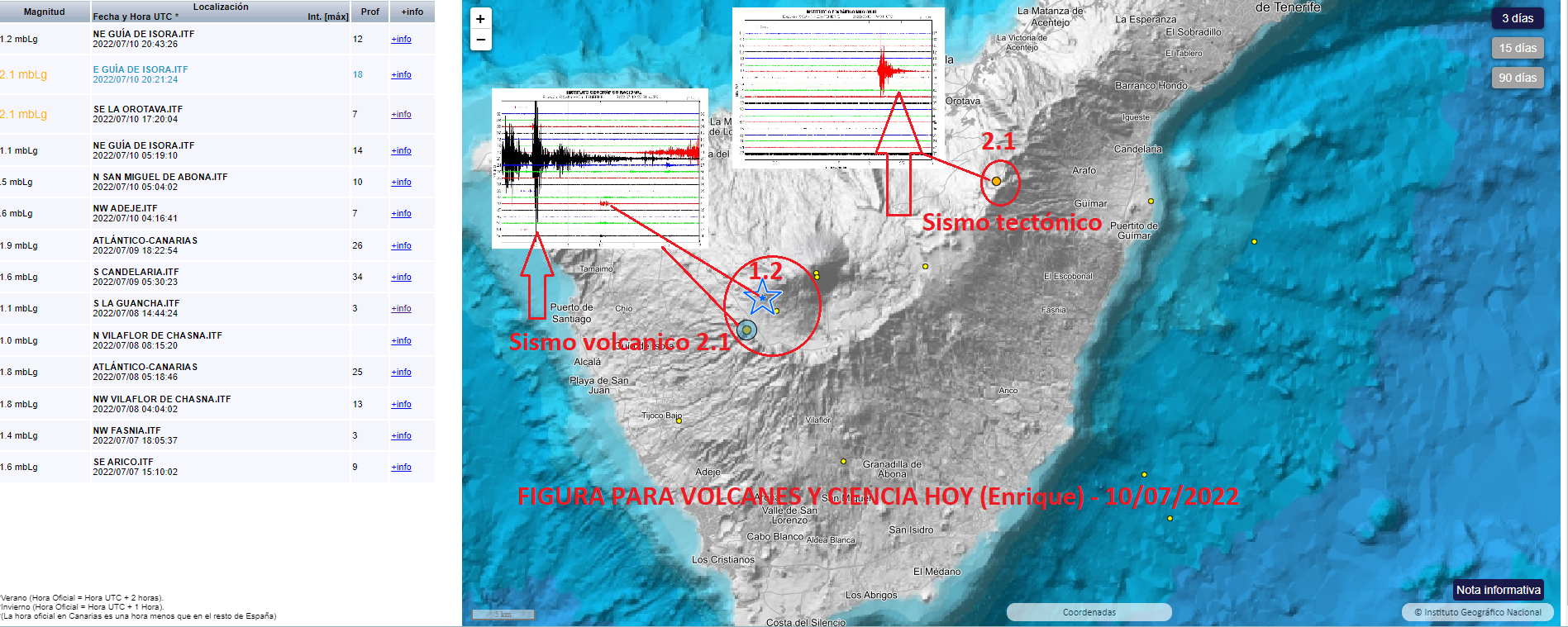
It is presented as a triple « tornillo » type event which does not bode well, since it opens the key to the magma in this area for it to move in the next few days, so it is not excluded that we have a swarm with pressurization included in the next few days/weeks. In some stations, such as the Rajada hill station, it had a magnitude of up to 3 and could therefore be slightly felt by the population.
This event did not come alone. There has been more tremor in the upper caldera area which responds to what is happening below.
There have been some additional efforts and all have affected areas where we have had magma inflows or accumulations due to very recent intrusions, both the Ucanca caldera and the Adeje region, as well as the region of Vilaflor de Chasna, in the southern ridges and which indicate many regional efforts affecting the island of Tenerife.
The curve of the accumulated seismic energy released continues to rise and shows a reactivation of the volcanic system of Tenerife… and we don’t know how long it will continue like this, it can stop, it can continue or it can accelerate, no one knows, the moment it is reactivated, which is no small feat.
Source : Enrique / Volcanes y Ciencia Hoy