July 01 , 2022.
Alaska , Aniakchak :
56,54’21 » N 158,12’32 » W,
Summit Elevation 4400 ft (1341 m)
Current Volcano Alert Level: NORMAL
Current Aviation Color Code: GREEN
Strong winds blowing to the northwest in the region northwest of Aniakchak and east of Port Heiden have picked up loose volcanic ash and carried it to the northwest today. A dense cloud of possible resuspended volcanic ash was observed near ground levels in a web camera at Port Heiden. The height of this cloud is not known, but resuspended ash clouds are typically from sea level up to 5 km in altitude.
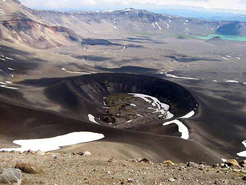
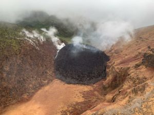
Looking into Aniakchak Caldera across the dark tephra cone produced during the May – June 1931 eruption, one of the largest eruptions in Alaska in the last 100 years. In the bottom of the cone is a moss-dappled lava and spatter field produced during the last stages of eruption. In the distance is the exposed wall of Half Cone, (another site of explosive activity) and the turquoise Surprise Lake.
This phenomenon is not the result of volcanic activity and usually occurs seasonally in the spring and fall during times of high winds and dry snow-free conditions in volcanic areas of Alaska. No eruption is in progress. Aniakchak remains at GREEN.
Resuspended volcanic ash should be considered hazardous and could be damaging to aircraft and health.
Source : AVO.
Photo : Plucinski, T. A./ Alaska Volcano Observatory / U.S. Geological Survey.
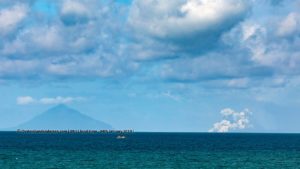
Italy , Vulcano :
WEEKLY BULLETIN, from June 20, 2022 to June 26, 2022. (issue date June 28, 2022)
ACTIVITY STATUS SUMMARY
In the light of the surveillance data, it is highlighted:
1) Temperature of the crater fumaroles:
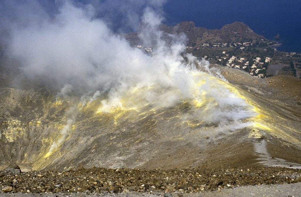
Along the upper edge, the maximum emission temperature has very stable values with a weekly average of 380°C (calculated on hourly data and unchanged from the previous week).
The fumarolic field presents equivalent emission temperatures over the entire summit fracture line, confirming a thermal anomaly still maintained by a substantial vapor flux (t 380-378°C). The sensor placed on the inner side requires additional field verification to identify the cause of the temperature drop.
Updated data from VSCS summit station for diffused heat flux still shows anomalous values in the range 51-63 watt/m2, but with a negative trend from April.
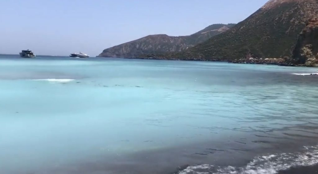
The color change of the sea on Vulcano is still in progress.
From May 22, the inhabitants of the island of Vulcano began to notice a significant change in the color of the sea water present near Levante beach, in the northeast part of the island. This variation was caused by an impulsive degassing event that affected the numerous fumaroles present in the area in front of the beach, an area already historically well known for its gas and/or fluid emissions.
2) CO2 flux in the crater area: The CO2 fluxes in the summit area show a slight upward trend and settle again on values around 10000 g m2/g
3) SO2 flux in the crater area: SO2 flux at a high and increasing level
4) Geochemistry of fumarolic gases: There are no updates.
5) CO2 fluxes at the base of the La Fossa cone and in the Vulcano Porto area: The CO2 fluxes recorded in the sites of C. Sicilia, Rimessa and P4max continue to show a slight downward trend, but remain at medium-high values; in the Faraglione site, there are values close to the background level.
6) Geochemistry of thermal aquifers: The temperature measured in the Camping Sicilia well is at high and stable values. The electrical conductivity shows low values, although slightly increasing.
Regarding C. Sicilia, it should be noted that from 23/6/2022 there are communication problems with the station and restoration work is expected shortly.
The level values measured in the Bambara well show a moderate upward trend. Conductivity values continue to show a gradual decrease even though they remain at medium-high levels.
7) Local seismicity: Low occurrence rate of local micro-seismicity.
8) Regional seismicity: Low fracturing seismicity associated with earthquakes with Ml >= 1.0.
9) Deformations – GNSS: The network of permanent GNSS stations has not recorded any significant changes
10) Deformations – Inclinometry: The inclinometric network has not recorded any significant changes.
11) Other observations: Monthly CO2 flux campaign: CO2 emissions in the Vulcano Porto area show no significant change compared to May and still remain at abnormal levels.
Monthly drilling campaign: we generally observe a stabilization of the supply of fumarolic fluids to the thermal aquifer, which still remains at abnormal levels in certain sites for certain monitored parameters.
Gravimetry: No significant change was recorded.
CRATER FUMEROLES TEMPERATURE:
Along the upper edge, the maximum emission temperature has extremely stable values, with an hourly maximum of 380°C and a weekly average of 378°C (T1). The fumarolic field presents homogeneous emission temperatures all along the summit fracture line, confirming a thermal anomaly still maintained by a stable vapor flow.
The thermal signal from sensor T3 (fumarole F5) overlaps the temperatures recorded in T2 (fusarole F5AT) while the site on the internal side after June 6 has a non-negative stationary trend (Dtemperature/Dtempo = 0.0035°C/day).
REGIONAL SEISMICITY
In the week of June 20-26, a single event of local magnitude greater than or equal to 1 was recorded in the Vulcano Island area. In particular, the event that occurred on 06/25/2022 at 22:15 UTC, of ML = 1.0, is located about 6.1 km southeast of Porto di Ponente (Vulcano) (ME) at a depth of about 9 km.
Source : INGV
Photos : Il Mondo dei Terremoti , Boris Behncke.
Colombia , Nevado del Ruiz :
Bulletin of activity level of the Nevado del Ruiz volcano.
The activity level continues at the Yellow Activity Level or (III): changes in the behavior of volcanic activity.
Regarding the monitoring of the activity of the Nevado del Ruiz volcano, the COLOMBIAN GEOLOGICAL SERVICE reports that:
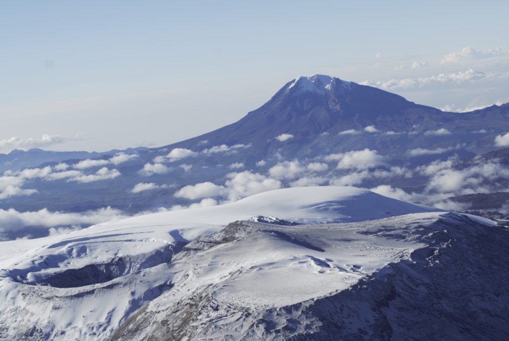
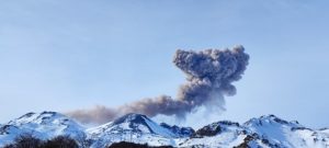
Seismicity related to fluid dynamics within volcanic conduits increased in terms of the number of earthquakes and seismic energy released, compared to the previous week. This seismic activity was characterized by the occurrence of continuous volcanic tremors, tremor pulses, long and very long period type earthquakes. In general, these signals exhibited moderate to low energy levels, variable spectral content, and were located primarily within Arenas Crater. According to cameras installed in the volcano area and reports from Los Nevados National Natural Park officials, gas and ash emissions associated with some of these seismic signals have been confirmed. Likewise, thanks to the FLIR cameras (thermographic cameras) of the volcanic monitoring network, changes in the relative temperature of the emitted material have been observed.
Seismicity associated with rock fracturing increased in terms of the number of earthquakes and maintained similar levels in released seismic energy, compared to the previous week. This seismic activity was located mainly in the Arenas crater and the South-West sector and, to a lesser extent, in the North-East and North-West sectors. The depth of the earthquakes varied between 0.4 and 6.6 km.
The maximum magnitude recorded during the week was 1.3 ML (Local Magnitude), corresponding to the earthquake that occurred on June 28 at 08:27 (local time), located 1.8 km northeast of the Arenas crater, at a depth of 3.5 km. It should be noted that during the week, this type of seismicity was recurrent in the form of seismic increases in the Southwest sector and during the last hours these signals continue to appear. The maximum magnitude recorded during this increase was 1.1 ML (Local Magnitude), corresponding to the earthquake that occurred on June 28 at 08:46 (local time), located 4.3 km southwest of the Arenas crater, at a depth of 3.64 km.
Source : SGC.
Photo :SGC
Indonesia , Ili Lewotolok :
VOLCANO OBSERVATORY NOTICE FOR AVIATION – VONA
Issued : July 01 , 2022
Volcano : Ili Lewotolok (264230)
Current Aviation Colour Code : ORANGE
Previous Aviation Colour Code : orange
Source : Ili Lewotolok Volcano Observatory
Notice Number : 2022LEW21
Volcano Location : S 08 deg 16 min 19 sec E 123 deg 30 min 18 sec
Area : East Nusa Tenggara, Indonesia
Summit Elevation : 4554 FT (1423 M)
Volcanic Activity Summary :
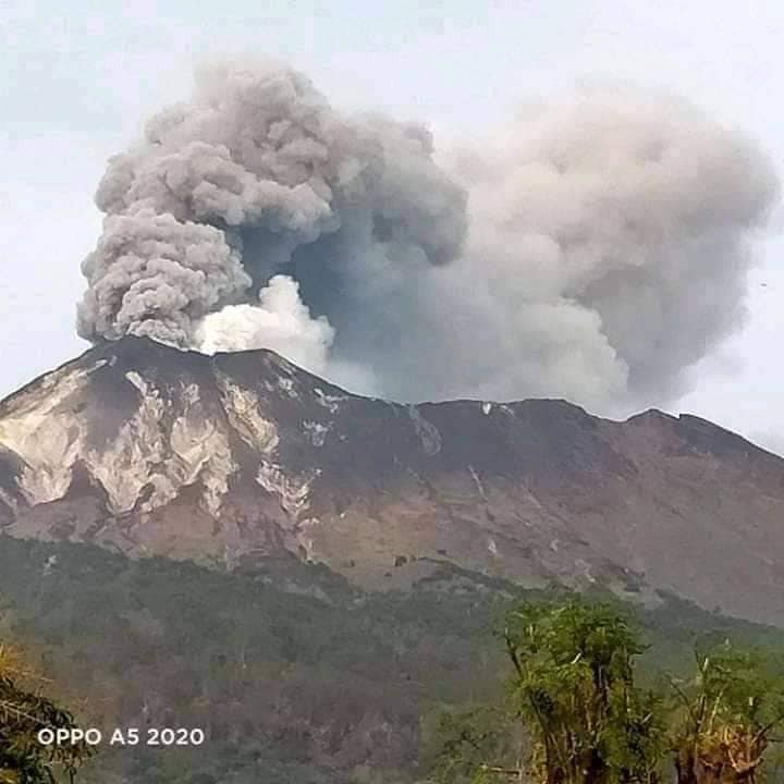
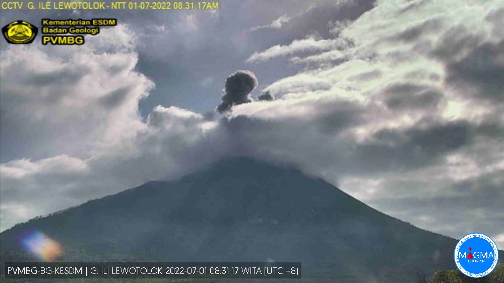
Eruption with volcanic ash cloud at 00h30 UTC (08h30 local). Eruption and ash emission is not continuing.
Volcanic Cloud Height :
Best estimate of ash-cloud top is around 7114 FT (2223 M) above sea level, may be higher than what can be observed clearly. Source of height data: ground observer.
Other Volcanic Cloud Information :
Ash-cloud moving to Northwest
Remarks :
Seismic activity is Dominated by hembusan (gas emission) and Volcanic tremor earthquake.
VISUAL OBSERVATIONS
The volcano is clearly visible until it is covered by fog. Smoke from the main crater was observed to be white, gray and black with moderate to thick intensity about 200-800 meters above the summit. The weather was clear to cloudy, the wind weak towards the west. The air temperature is about 20.2-30.2 ° C. Humidity 57-83.6%.
Eruptions of incandescent material were observed up to 500 meters above the summit, oriented to the northeast.
SEISMICITY OBSERVATIONS
4 earthquakes of eruptions with an amplitude of 5.9 to 33.3 mm and a duration of 41 to 77 seconds.
2 avalanche earthquakes with an amplitude of 11.8 to 12.7 mm and a duration of 113 to 178 seconds.
15 emission earthquakes with an amplitude of 1.9 to 9.9 mm and a duration of 22 to 87 seconds.
1 harmonic tremor with an amplitude of 5.5 mm and a seismic duration of 85 seconds.
7 non-harmonic tremors with an amplitude of 2-10.3 mm and a duration of 89-526 seconds.
2 deep volcanic earthquakes with amplitudes of 7.9-16.4 mm, S-P 1.2-3.2 seconds and duration of 12-16 seconds.
1 continuous earthquake with an amplitude of 0.5-1 mm, dominant 0.5 mm.
Source : Magma Indonésie.
Photos : PVMBG , Kodi Setiawan.
Ecuador , Sangay / Reventador :
DAILY REPORT OF THE STATE OF SANGAY VOLCANO, Thursday June 30, 2022.
Information Geophysical Institute – EPN.
Surface Activity Level: High, Surface Trend: No change.
Internal activity level: High, Internal trend: No change.
Seismicity: From June 29, 2022, 11:00 a.m. to June 30, 2022, 11:00 a.m.:
Explosion (EXP) 41
Long Periods (LP) 95
Emission Tremors (TREMI ) 1
Rains / Lahars:
No rain was recorded in the area. **In the event of heavy rains, they could remobilize the accumulated materials, generating mudslides and debris that would descend on the flanks of the volcano and flow into the adjacent rivers.**
Emission / ash column:
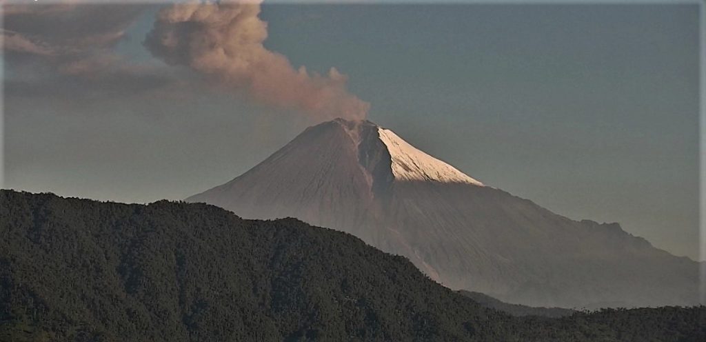
The Washington VAAC reported 3 alerts for gas and ash emissions with a height of 870 meters above crater level in a westerly direction.
Other Monitoring Parameters:
The MIROVA system recorded 2 moderate and 1 high thermal alerts (194 MW) and the FIRMS system recorded 6 thermal alerts in the last 24 hours.
Observation:
For most of the time, the volcano remained cloudy, preventing observations of surface activity. At the end of this report, the volcano remains cloudy.
Alert level: Orange.
——————————————————————————————
DAILY REPORT OF THE STATE OF THE REVENTADOR VOLCANO, Thursday June 30, 2022.
Information Geophysical Institute – EPN.
Surface Activity Level: Moderate, Surface Trend: No change.
Internal activity level: Moderate, Internal trend: No change.
Seismicity: From June 29, 2022, 11:00 a.m. to June 30, 2022, 11:00 a.m.:
Explosions (XP) 83
Long Periods (LP) 54
Emission Tremors (TREMI ) 3
Rains / Lahars:
There is no record of rain in the area.
Emission / ash column:
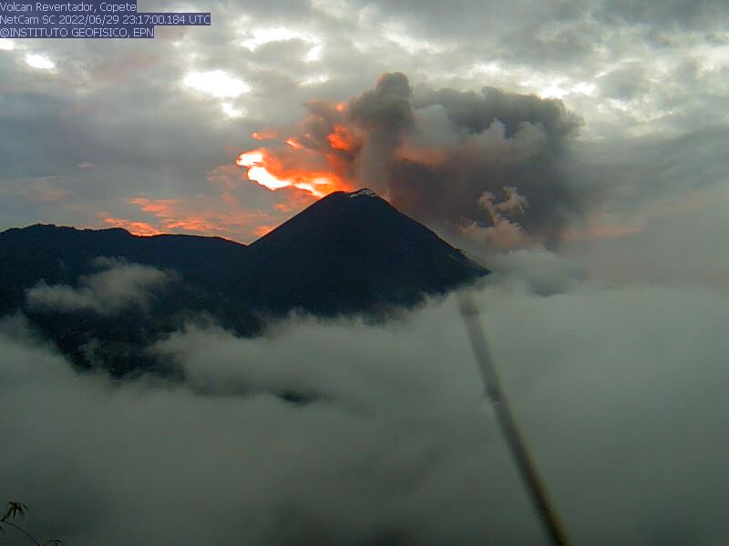
The Washington VAAC reported 5 gas and ash emission alerts, with heights between 388 and 1000 meters above crater level with North and Northwest directions.
Other Monitoring Parameters:
The FIRMS system recorded 8 thermal alerts in the last 24 hours.
Observation:
At various times in the afternoon and early in the morning, an incandescence could be observed at the level of the crater. In the morning, the volcano remained cloudy.
Alert level: Orange.
Source : IGEPN
Photos : archives IGEPN .

