February 09 , 2022.
Italy , Vulcano :
WEEKLY BULLETIN from January 31, 2022 to February 06, 2022 (issue date February 08, 2022)
ACTIVITY BULLETIN SUMMARY:
In the light of the surveillance data, it is highlighted:
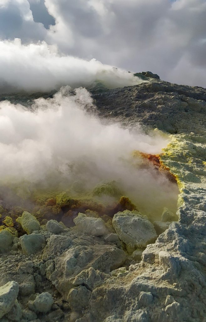
1) Temperature of the crater fumaroles: The temperatures recorded on the edge of the crater show a strong variability linked to atmospheric phenomena, while on the internal side they continue to remain stable.
2) CO2 flux in the crater area: The CO2 flux in the crater area remains at high values.
3) SO2 flux in the crater area: SO2 flux at a high and decreasing level
4) Geochemistry of fumarolic gases: No update is available.
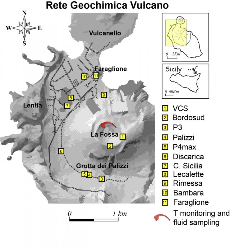
5) CO2 fluxes at the base of the La Fossa cone and in the Vulcano Porto area: The CO2 fluxes at the base of the crater remain at medium-high values with a tendency to decrease with the exception of the Faraglione site, where the values are close to the bottom level.
6) Geochemistry of thermal aquifers: The physico-chemical parameters recorded in the Camping Sicilia and Bambara wells remain stable.
7) Local seismicity: low event occurrence rate.
8) Regional seismicity: No earthquake with Ml >= 1.0 was located in the area of the island of Vulcano.
9) Deformations – GNSS: The GNSS monitoring network did not show any significant changes.
10) Deformations – Inclinometry: The inclinometric network does not show any significant variations.
11) Other observations: Gravimetry: The continuous gravimetry stations did not record any significant variations.
GB-RAR: The GB-RAR monitoring results referring to the period December 14, 2021 – February 08, 2022, show a general stability of the area, with deformations along the LOS of less than 1 mm.
Mobile GNSS: Mobile GNSS stations do not appear to show significant changes over the reporting period.
CO2 FLOW IN THE CRATER AREA
The CO2 flux values in the soil in the summit zone (daily average) are high, around 13340 g/m2/day, still on an order of magnitude higher than the averages recorded over the past 10 years. The average value of the CO2 flux (monthly average) in January 2022 is 13354 g/m2/day.
A stabilization of degassing at high values is therefore observed on a monthly scale, with an increase compared to the previous month.
SO2 FLOW IN THE CRATERIC ZONE
Average daily values recorded over the past week indicate a moderate decrease from data updated around January 20th. Since January, a slow return of the SO2 flux to a medium-high level has been observed.
CO2 FLOW AT THE BASE OF THE CONE DE LA FOSSA AND IN THE PORTO VULCANO AREA
The soil CO2 fluxes, acquired automatically by the VULCANOGAS network, show high values, although decreasing compared to the crisis values. The Faraglione site is an exception, where the values are always close to the background level.
Source : INGV
Photo : INGV , G. De Astis (INGV-Rome1).
Italy / Sicily , Etna :
WEEKLY BULLETIN from January 31, 2022 to February 06, 2022 (issue date February 08, 2022)
ACTIVITY BULLETIN SUMMARY:
In the light of the surveillance data, it is highlighted:
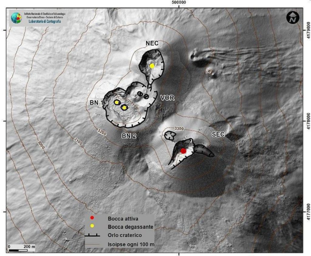
1) VOLCANOLOGICAL OBSERVATIONS: Discontinuous Strombolian activity and slight discontinuous emissions of volcanic ash at the level of the Southeast Crater, degassing activity at the level of the other summit craters.
2) SEISMOLOGY: Modest fracturing seismic activity; average amplitude of the volcanic tremor on the low level.
3) INFRASONO: Low infrasonic activity.
4) GROUND DEFORMATIONS: There are no significant variations during the last week.
5) GEOCHEMISTRY: SO2 flux at a low level
The soil CO2 flux does not show significant variations, remaining on average values.
The partial pressure of CO2 dissolved in the aquifer shows values in seasonal variability
The isotope ratio of helium shows a slight increase reaching high values (data from 01/25/2022).
6) SATELLITE OBSERVATIONS: The thermal activity in the summit area observed by satellite was at a low level.
VOLCANOLOGICAL OBSERVATIONS
The monitoring of the volcanic activity of Etna, during the week in question, was carried out by analyzing the images of the network of surveillance cameras of the INGV, Osservatorio Etneo (INGV-OE). Due to unfavorable weather conditions, remote observation of volcanic activity, mainly during the first days of the week, was discontinued. In the period under consideration, the activity of Etna was characterized by a weak Strombolian activity with the formation of weak and discontinuous volcanic ash emissions at the level of the Southeast Crater (SEC) and by a variable degassing activity at the level of the Northeast Crater (NEC), the Bocca Nuova (BN) and the Voragine Crater (VOR).
During the period under review, the weak Strombolian activity of the Southeast Crater (SEC) indicated in the bulletin Rep. N. 05/2022 continued. This activity, observed only on January 31, was very weak and produced light and discontinuous emissions of volcanic ash which quickly dispersed in the atmosphere. During the day on February 1, observation of the summit craters was discontinued due to cloud cover. The analysis of the images from the INGV-OE video surveillance cameras showed that on the morning of February 2, the explosive activity and the Strombolian activity at the level of the Southeast Crater had definitively ceased. Finally, a weak variable degassing activity was observed from the other craters NEC, BN and VOR
Source : INGV
Photos : INGV , Gio Giusa.
Indonesia , Ili Lewotolok :
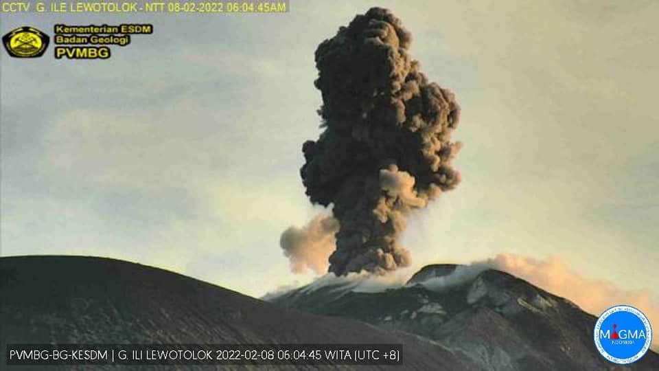
The volcano is clearly visible until it is covered in fog. Smoke from the crater is white / gray with low, medium to thick intensity, about 25-500 meters above the summit. The weather is sunny to rainy, the wind is weak in the East. The air temperature was around 24-37.7°C. An eruption occurred accompanied by a rumbling sound, a weak deflagration and an explosion throwing incandescent material up to 300 m above sea level facing southeast.
Volcanic earthquakes are related to magmatic activity as well as tectonic activity. we record:
– 28 earthquakes of eruptions/explosions
– 74 emission earthquakes
– 10 harmonic tremors
– 17 non-harmonic tremors
– 3 deep volcanic earthquakes
– 2 local tectonic earthquakes
– 4 distant tectonic earthquakes
Continuous tremor with an amplitude of 0.5-2 mm, mostly 0.5 mm.
Source et photo : Magma Indonésie , PVMBG .
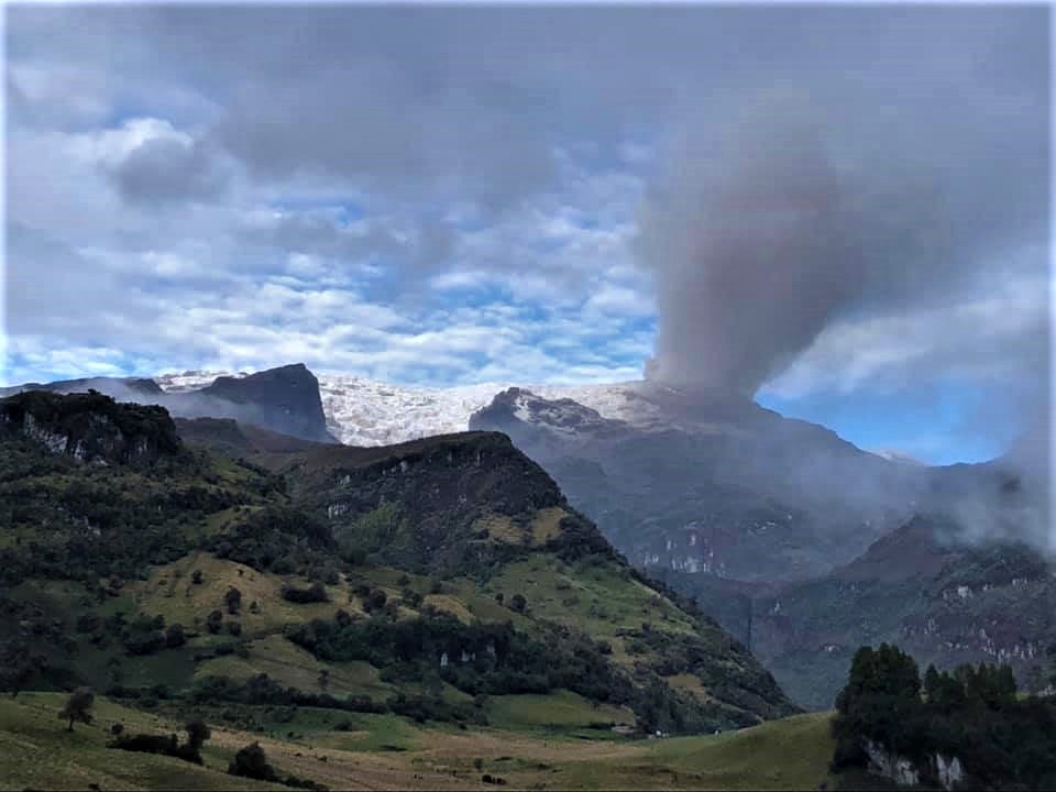
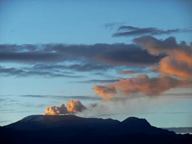
Colombia , Nevado del Ruiz :
Subject: Nevado del Ruiz volcano activity level bulletin.
The level of activity continues at the Yellow Activity Level or (III): changes in the behavior of volcanic activity.
Regarding the monitoring of the activity of the Nevado del Ruiz volcano, the COLOMBIAN GEOLOGICAL SERVICE reports that:
The seismicity generated by the fracturing of the rocks showed a slight decrease in the number of earthquakes, although a slight increase in the seismic energy released was observed, compared to the previous week. This seismic activity was located mainly in the Southeast and Arenas crater sectors. The depth of the earthquakes varied between 0.63 and 7.56 km. The maximum magnitude recorded during the week was 1.9ML (Local Magnitude) corresponding to an earthquake recorded on February 7 at 12:38 p.m. (local time), located 3.0 km southeast of the Arenas crater, at a depth of 3.75 km.
During the week, there were several episodes of « drumbeat » type seismicity on February 2, 3 and 4, with low energy levels. This seismicity has been linked to the processes of ascent, emplacement, growth and evolution of a lava dome at the bottom of the Arenas crater.
Seismicity related to fluid dynamics inside volcanic conduits showed a slight increase in the number of earthquakes and released seismic energy, compared to the previous week. This seismic activity was characterized by the occurrence of continuous volcanic tremors, tremor pulses, earthquakes of long and very long period types, which had moderate energy levels and variable spectral content.
These earthquakes were located mainly in the Arenas crater. Some of these signals were associated with ash emissions and / or incandescence confirmed by the cameras installed in the volcano area. On the night of February 3 to 4, two small explosions were observed through FLIR cameras belonging to the volcanic monitoring network. The recording of new seismic signals of this type which could be associated with gas and ash emissions cannot be excluded, which will be dispersed according to the prevailing wind regime at the time of emission, and/or small emissions of volcanic material that may be deposited inside the crater and surrounding areas
Source : Ingeominas.
Photos : Ramirez Jorge , Auteur inconnu .
Guatemala , Santiaguito :
SPECIAL VOLCANOLOGICAL BULLETIN
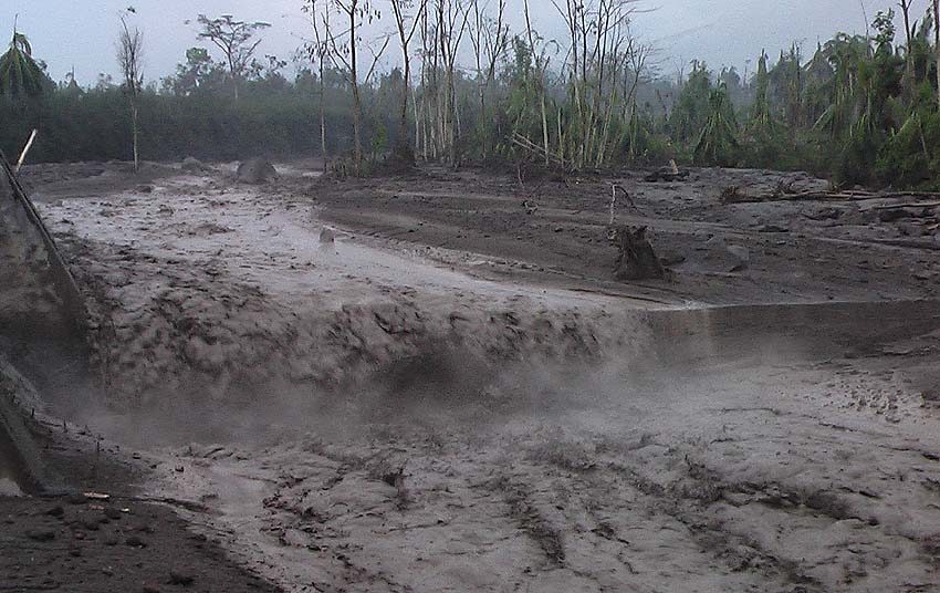
LAHAR IN THE SAN ISIDRO RIVER TRIBUTARY TO THE TAMBOR RIVER
Precipitation on the Santa María-Santiaguito volcanic complex is currently generating the descent of lahars in the course of the San Isidro River, a tributary of the Tambor River to the south-southwest of the volcano. This lahar can carry a pasty mixture of water which can be at a high temperature due to the high activity that the volcano has had on this flank, blocks of rock up to 3 meters in diameter and finer sediments, as well only branches and trees. The lahar on its way produces vibrations in the ground which are recorded in the seismic stations close to the bed of the river, in this case the STG8 station.
If these rainy conditions persist in the region, the possibility of lahars descending into one of the other ravines of this volcano is not excluded.
INSIVUMEH maintains visual and instrumental monitoring of volcanic activity through its field observers, seismic stations and web cameras.
Source : Insivumeh.
Photo : Caroline Sarrazin , Rés-EAUx .


