February 01 , 2022.
Italy / Sicily , Etna :
COMMUNICATION ON THE ACTIVITY OF ETNA, January 31, 2022, 12:59 (11:59 UTC).
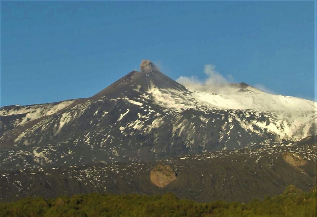
The National Institute of Geophysics and Volcanology, Osservatorio Etneo announces that the weak Strombolian activity of the Southeast Crater continues. This activity produces light and discontinuous ash emissions which disperse rapidly in the atmosphere.
The amplitude of the tremor is almost stationary and reaches average values. The sources are located southeast of the Southeast Crater at a level of about 3000 m above sea level
Infrasound activity is generally weak.
The stations of the ground deformation monitoring networks (GPS and tilt) operating on the volcano do not show significant variations.
Further updates will be communicated soon.
Source et photo : INGV.
United-States / Central Oregon , Three Sisters :
44°6’11 » N 121°46’5″ W,
Summit Elevation 10358 ft (3157 m)
Current Volcano Alert Level: NORMAL
Current Aviation Color Code: GREEN
USGS scientists have detected an increase in the rate of uplift of the ground surface in the Three Sisters volcanic region of the central Oregon Cascade Range. The volcanoes’ status remains normal/green, and there is no sign of an imminent eruption. Episodes of increased uplift have been observed in this area before and are attributed to small pulses of magma moving deep into the volcanic region.
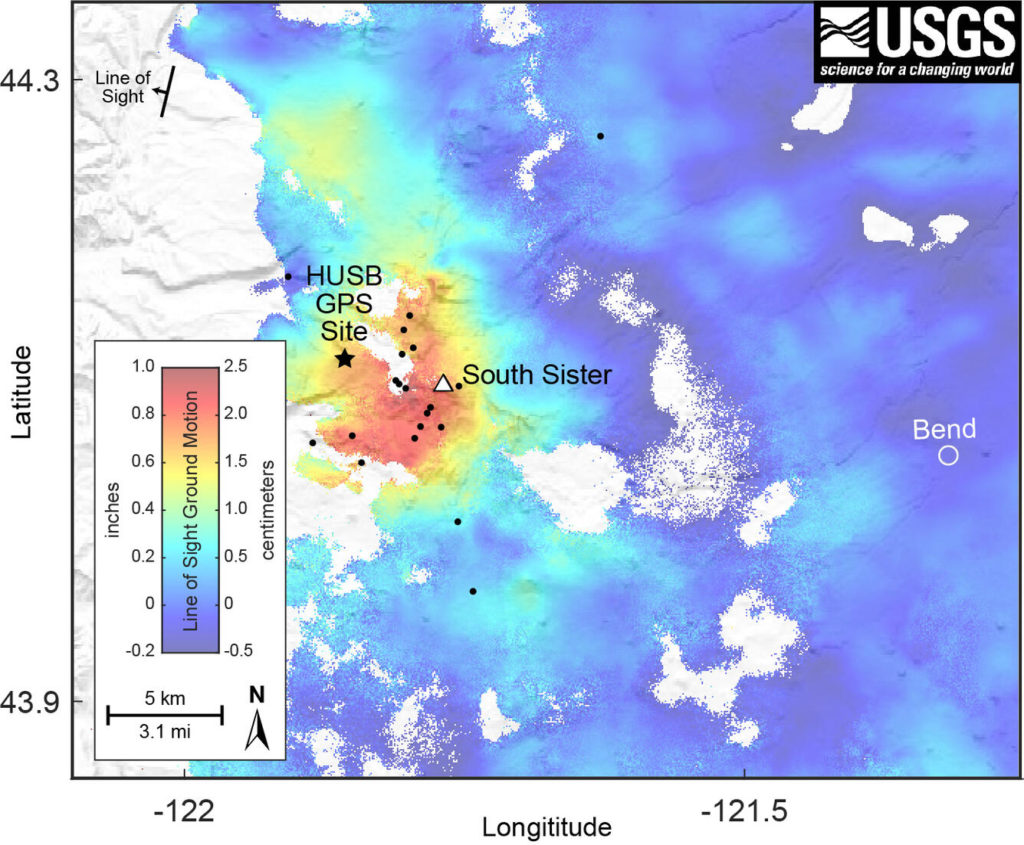
Satellite radar images detected an increased rate of uplift of a 12-mile (20-km) diameter area centered about 3 miles (5 km) west of South Sister volcano. The data indicate uplift of up to 0.9 inches (2.2 cm) between June 2020 and August 2021. GPS data from a nearby continuously recording station show that the deformation has continued to the present. Additionally, seismologists observed brief bursts of small earthquakes in October 2021, December 2021, and January 2022. Most of these shallow earthquakes are too small to locate; those located are inside the uplifted area.
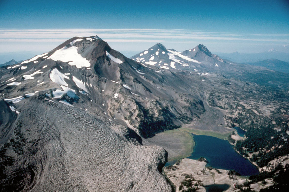
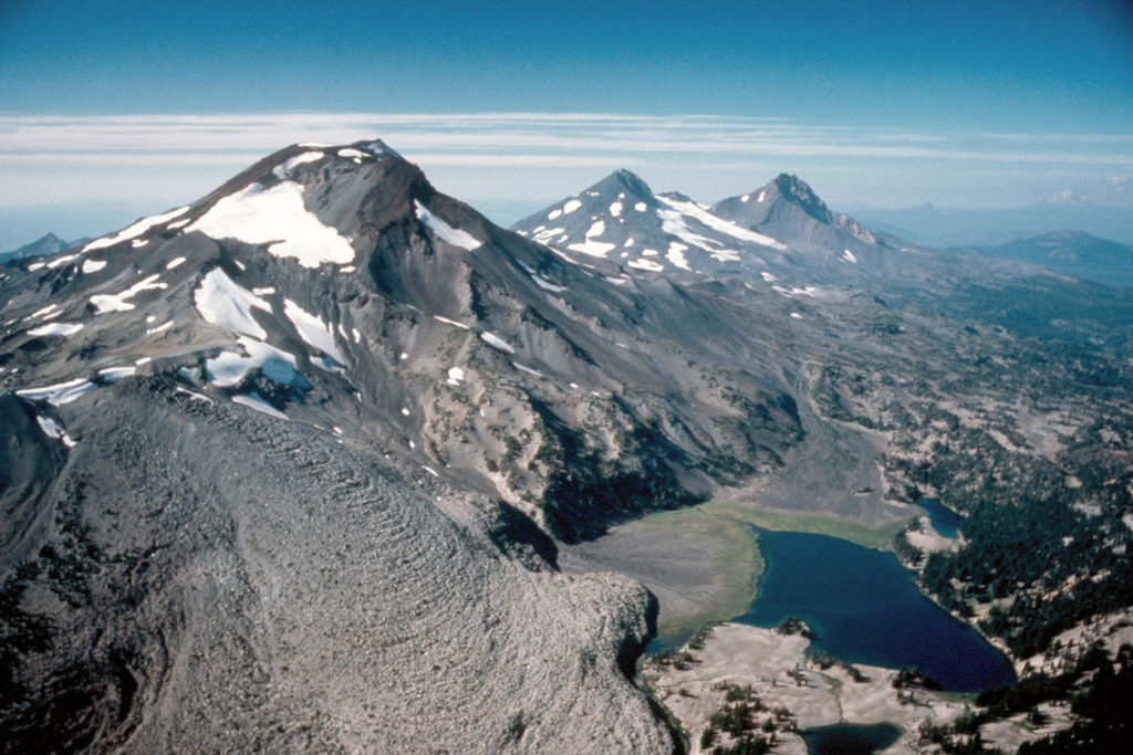
Three Sisters volcanoes (left to right – South, Middle, and North) viewed from the south, Oregon. Foreground rhyolite Newberry flow is one of the most recent eruptive units (2,200 years old).
The present uplift area is in the same general location where uplift was first seen in the mid-1990s and has continued at a generally slowing rate through 2020. This increased inflation appears to be a continuation of an extended period of uplift that is attributed to small pulses of magma accumulating at roughly 4 miles (7 kilometers) below the ground surface. From 1995 to 2020, the area rose approximately 12 inches (30 centimeters) at its center. Although the current uplift rate is slower than the maximum rate of about 2 inches per year (5 cm per year) measured in 1999-2000, it is distinctly faster than the rate observed for several years before 2020.
The specific cause of the uplift is uncertain. Because the Three Sisters region is a volcanic area (the most recent eruption was about 2,000 years ago near South Sister), the uplift may reflect a small amount of magma emplaced at around 4 miles (7 km) deep. The idea of repeated intrusions at Three Sisters is supported by a USGS study in 1990 that found evidence that heat and gases from magma had influenced water temperature and chemistry of springs located in the uplifted area. This research was published before satellite volcano monitoring began and well before the current uplift episode. In that context, we view periods of increased uplift like the current one as a continuation of episodic, deep magmatic intrusions that have likely been occurring for centuries or millennia in the Three Sisters area.
Satellite radar interferogram spanning June 19, 2020, to August 13, 2021, and showing the ground motion in the direction of the satellite. The maximum uplift, indicated by the red color, is about 2.2 centimeters (0.85 inches), and it is located to the west of South Sister. The HUSB continuous GPS site is marked by the large black dot. Earthquakes that occurred during the time period spanned by the interferogram are indicated by small black dots.
While any magmatic intrusion could eventually lead to a volcanic eruption, an eruption would likely be preceded by detectable and more vigorous earthquakes, ground movement (deformation), and geochemical changes. In general, as magma moves upward during an intrusion, it causes continued or accelerated uplift, fractures rock to generate swarms of earthquakes, and releases significant amounts of volcanic gases, such as carbon dioxide. We do not detect any of these signs currently.
Source et photo : USGS
Peru , Sabancaya :
Analysis period: from January 24, 2022 to January 30, 2022, Arequipa, January 31, 2022.
Alert level: ORANGE
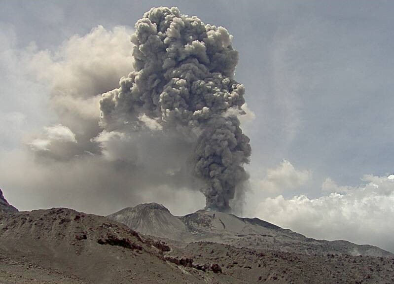
The Geophysical Institute of Peru (IGP) reports that the eruptive activity of the Sabancaya volcano remains at moderate levels, that is to say with the recording of an average of 28 daily explosions, with columns of ash and of gas up to 2.5 km altitude above the summit of the volcano and their subsequent dispersion. Therefore, for the following days, no significant change is expected in eruptive activity.
The IGP recorded and analyzed the occurrence of 275 earthquakes of volcanic origin, associated with the circulation of magmatic fluids inside the Sabancaya volcano. An average of 28 explosions was recorded daily. During this period, Volcano-Tectonic (VT) type earthquakes associated with rock fracturing were located mainly in the northwest and southwest of Sabancaya and presented magnitudes of M 2.9.
Monitoring the deformation of the volcanic structure using GNSS techniques (processed with fast orbits) does not show any significant anomalies. However, in general, an inflation process was observed in the northern sector (surroundings of the Hualca Hualca volcano). Visual surveillance identified columns of gas and ash up to 2.5 km above the summit of the volcano, which were scattered towards the western, northwest, south and southwest sectors of the volcano. Sabancaya. Satellite records have not identified the presence of thermal anomalies.
RECOMMENDATIONS
• Keep the volcanic alert level orange.
• Do not approach within a radius of less than 12 km from the crater.
Source : IGP
Photo : Ingemmet 2017.
Vanuatu Archipelago , Ambrym :
AMBRYM VOLCANO ALERT BULLETIN , 27th January 2022 , 5:38 pm:
This is a reminder that the Ambrym volcanic activity is continuing at the major level of unrest. The Volcanic Alert Level remains at Level 2.
The volcano activity consists of emission of steam, gas and lava glow observed at night on Benbow crater. New scientific analysis suggest that the Ambrym volcano activity is likely to continue in the major unrest level. The lava lakes that used to appear in Benbow and Marum craters emerged again but only on Benbow crater.
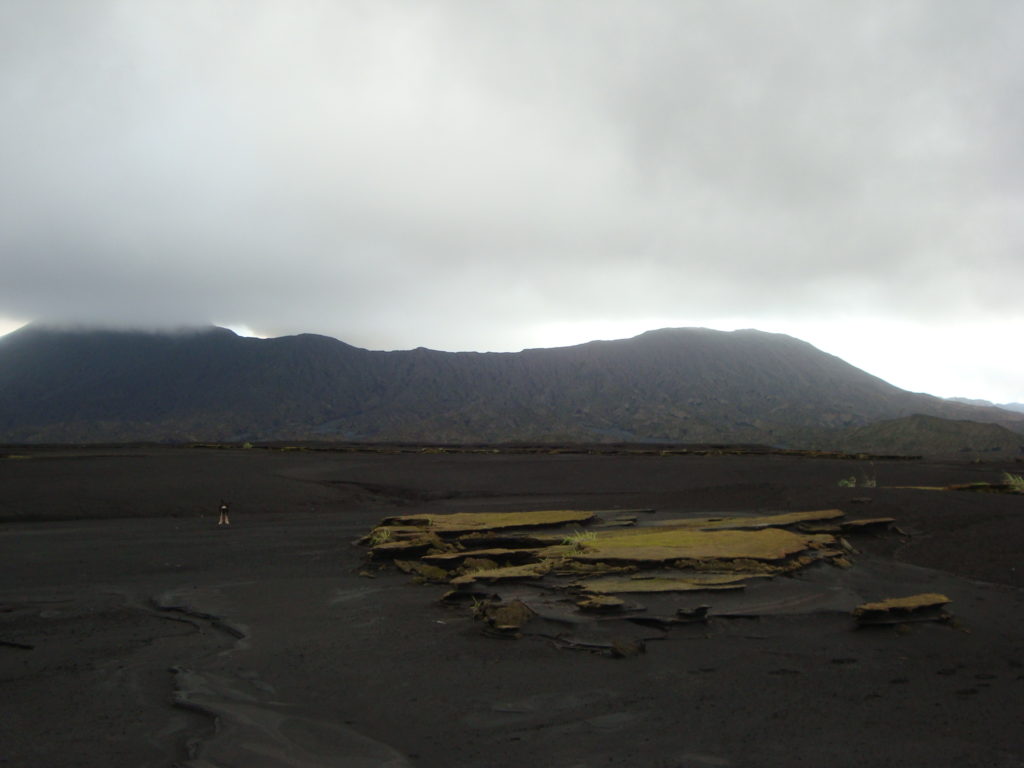
The Bembow plume, seen from the caldera.
People from Ambrym and neighboring islands will start to see the volcanic glow at nights. With this current volcanic activity, it is a useful reminder that eruptions can occur at any level of unrest with little or no warning.
Volcanic hazards remain about the summit craters area and the South East part of Ambrym Island (e.g. major cracks from 2018). These are related to the presence of cracked areas. The presence of active rifts and faults (major ground cracking) at the South-East area of Ambrym are also hazardous, they will continue to be eroded and affected by earthquake activity.
Source : Geohazard.
Photo : Georges Vitton.
Guatemala , Santiaguito :
SPECIAL VOLCANOLOGICAL BULLETIN, UPDATE OF ACTIVITY DUE TO THE DESCENT OF PYROCLASTIC FLOWS.
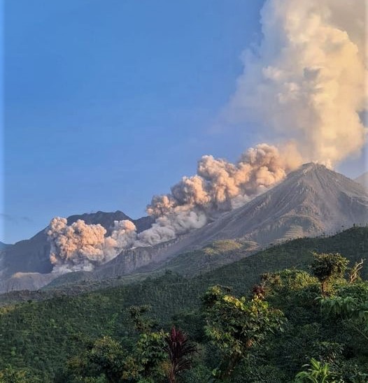
Following the activity that the volcanic complex of Santa María-Santiaguito presented, the seismic stations and observers of the OVSAN (Observatory of the Santiaguito volcano) continue to record the descent of avalanches of moderate to strong characteristics, mainly on the western and southwestern flanks, and the descent of weak to moderate pyroclastic flows in the same direction. This is a consequence of the collapse of the lava flow on the southwest flank and contributes to causing suspended ash in the volcanic perimeter.
From the early hours of Sunday January 30 until 6 p.m. today (01/31/2022), 10 pyroclastic flows of moderate characteristics have been recorded and taken into account through the use of seismic sensors and surveillance cameras volcanic. Abundant and sustained degassing is also continuously observed above the crater of the Caliente dome at a height of 600 meters, and at certain periods with noises similar to that of an aircraft turbine.
Pyroclastic flow generated on January 31 at 7:23 a.m.
It is expected that in the next few hours, the Santiaguito volcano will continue with more material collapses that generate moderate to strong pyroclastic flows, even on other flanks of Dome Caliente. It is therefore recommended not to stay near its ravines, mainly those located on the western and southwestern flanks.
Source : Insivumeh.
Photo : Edgar Cabrera / CONRED

