January 31 , 2022 .
Italy / Sicily , Etna :
COMMUNICATION ON ETNA ACTIVITY, January 30, 2022 05:11 (04:11 UTC).
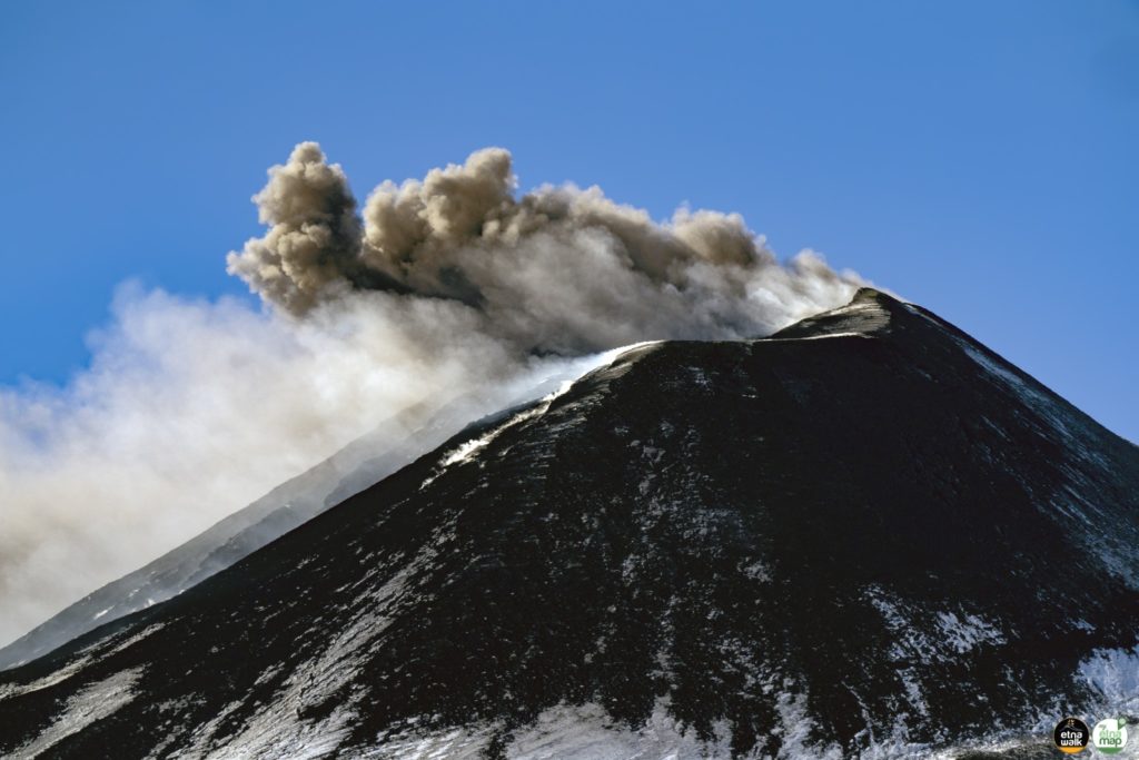
The National Institute of Geophysics and Volcanology, Osservatorio Etneo announces that from 00:15 GMT we observe the resumption of a modest and sporadic explosive activity at the level of the Southeast Crater. The activity produces weak ash emissions which disperse quickly in the summit area.
The amplitude of the volcanic tremor is on medium-low values. The source of the volcanic tremor is located in correspondence with the Southeast crater at an altitude of approximately 2500 m above sea level. The rate of occurrence of infrasonic events is low.
The stations of the soil deformation monitoring networks operating on the volcano do not show any significant variations.
Further updates will be communicated soon.
Source : INGV.
Photo : Etna Walk.
Hawaii , Kilauea :
19°25’16 » N 155°17’13 » W,
Summit Elevation 4091 ft (1247 m)
Current Volcano Alert Level: WATCH
Current Aviation Color Code: ORANGE
Activity Summary:
Eruption of lava from the west vent within Halemaʻumaʻu crater, at the summit of Kīlauea, remains essentially paused, though a small amount of active lava may remain visible at the surface. All recent lava activity has been confined to the crater, and there are no indications of activity migrating elsewhere on Kīlauea.
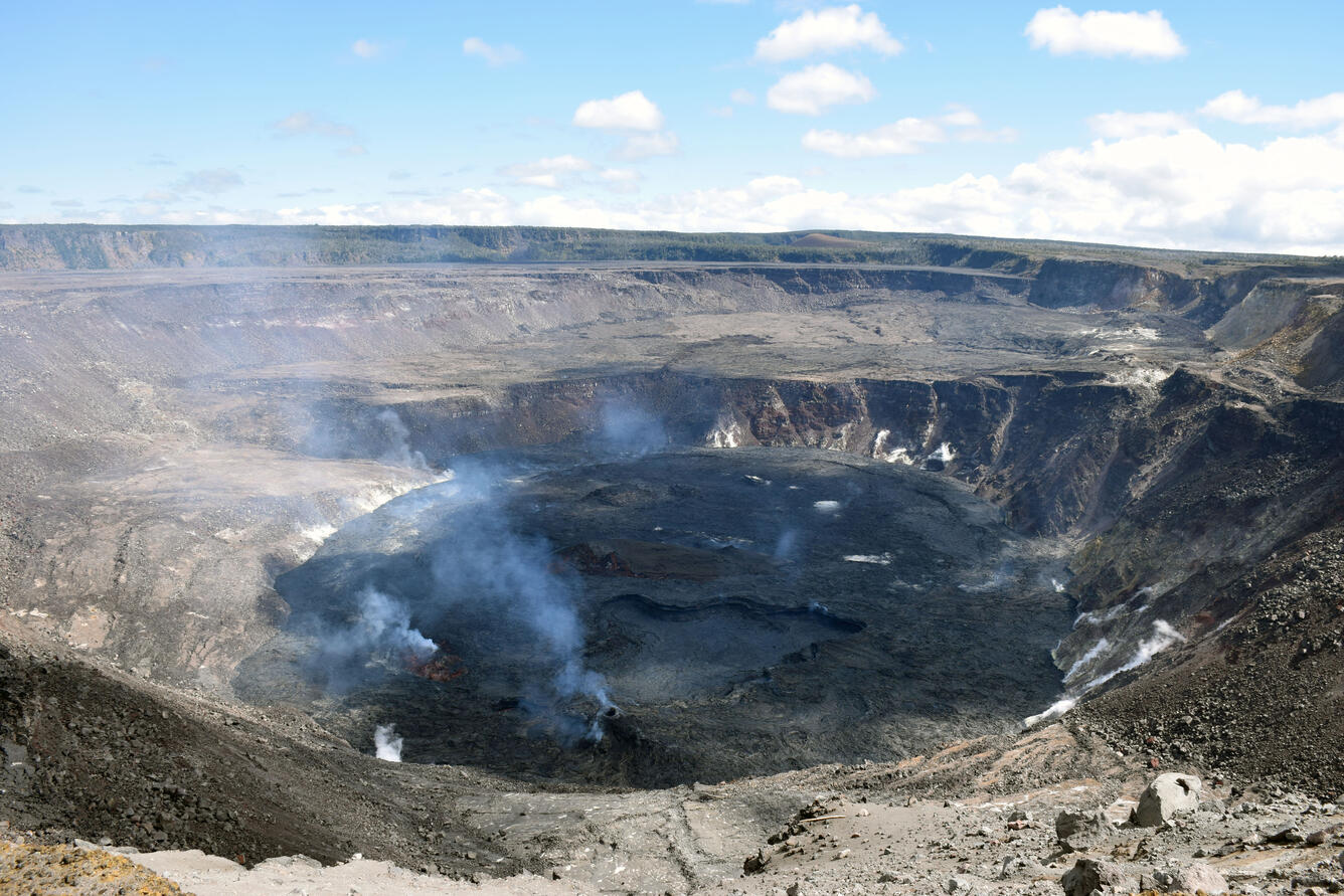
A view of the Halema‘uma‘u lava lake, at Kīlauea summit, from the western crater rim. Lava within the main western lava lake (lower center) drained overnight, and now all active surface lava is confined to the small lava pond north (left) of the west vent.
Halemaʻumaʻu Lava Lake Observations:
As of 8 a.m. HST this morning, no active lava is visible in Halema‘uma‘u crater. Over the past 24 hours, active lava was visible in the west vent cone and the small pond north of the west vent cone, within Halema‘uma‘u crater. A small lava flow along the north margin of the crater was occasionally active over the past day. Field crews working within Kīlauea caldera yesterday noted that loud gas-jetting sounds continued from the small and steep spatter cone in the eastern section of Halema‘uma‘u. The lava lake depth has very gradually decreased less than one meter (3 ft) over the past 24 hours. At approximately 8 a.m. this morning, the lava lake depth was 77 meters (253 feet) deep relative to when lava emerged on September 29, 2021. Measurements on January 25, 2022, indicated that the total lava volume effused since the beginning of the eruption was approximately 45 million cubic meters (12.0 billion gallons) at that time.
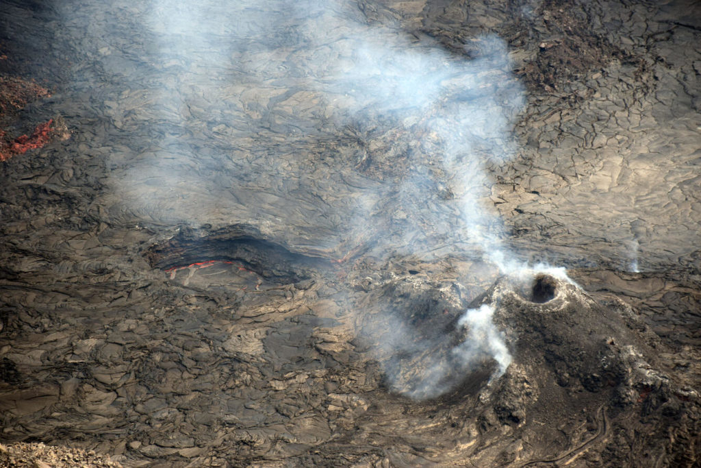
A telephoto view of the west vent and lava pond within Halema‘uma‘u crater, at Kīlauea summit. On January 28, HVO field crews only observed active lava within the small lava pond to the north (upper left) of the west vent (lower right). A diffuse volcanic gas plume was being emitted from the west vent.
Summit Observations:
Summit tiltmeters recorded very little ground deformation over the past 24 hours. Volcanic tremor, associated with the eruption of lava at the west vent, is at almost non-eruptive levels, which correlates with very little lava activity at the west vent. Earthquake activity in the summit region remains low, with only a few earthquakes occurring over the past 24 hours. The most recent sulfur dioxide (SO2) emission rate of approximately 2,800 tonnes per day (t/d) was measured on January 25, 2022, when lava was being erupted by the west vent; current SO2 emissions are likely significantly decreased and comparable to emission rates measured on January 24, 2022, during the most recent eruptive pause, of about 100 t/d.
Source : HVO.
Photos : USGS / L. DeSmither .
Alaska , Semisopochnoi :
51°55’44 » N 179°35’52 » E,
Summit Elevation 2625 ft (800 m)
Current Volcano Alert Level: WATCH
Current Aviation Color Code: ORANGE
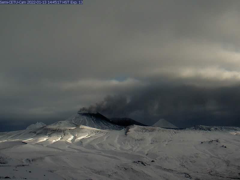
Low-level eruptive activity continues at Semisopochnoi from the North Cerberus cone. Seismicity remains elevated. Steam and low-level ash emissions were observed in web camera images and local seismic and infrasound sensors have recorded numerous small explosions over the past day.
Small eruptions producing minor ash deposits within the vicinity of the active north crater of Mount Cerberus and ash clouds usually under 10,000 ft (3 km) above sea level have characterized the recent activity. Small explosions and associated ash emissions may continue and could be difficult to detect, especially when thick cloud cover obscures the volcano.
Semisopochnoi is monitored by local seismic and infrasound sensors, satellite data, web cameras, and remote infrasound and lightning networks.
Source : AVO.
Photo : Alaska Volcano Observatory / U.S. Geological Survey.
Russia / Kurils Islands , Chikurachki :
VOLCANO OBSERVATORY NOTICE FOR AVIATION (VONA)
Issued: January 31 , 2022 .
Volcano: Chikurachki (CAVW #290360)
Current aviation colour code: ORANGE
Previous aviation colour code: green
Source: KVERT
Notice Number: 2022-10
Volcano Location: N 50 deg 19 min E 155 deg 27 min
Area: Northern Kuriles, Russia
Summit Elevation: 1816 m (5956.48 ft)
Volcanic Activity Summary:
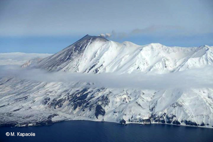
A strong gas-steam activity of the volcano continues from 01:00 UTC on 31 January. Probably a gas-steam plume containing some amount of ash; such plume extended for 75 km to the southwest of the volcano at 02:00 UTC on 31 January. Activity of the volcano continues.
The strong gas-steam activity of the volcano continues. Ash explosions up to 6 km (19,700 ft) a.s.l. could occur at any time. Ongoing activity could affect low-flying aircraft.
Volcanic cloud height:
4500-5000 m (14760-16400 ft) AMSL Time and method of ash plume/cloud height determination: 20220131/0318Z – JPSS-1 (14m15)
Other volcanic cloud information:
Distance of ash plume/cloud of the volcano: 80 km (50 mi)
Direction of drift of ash plume/cloud of the volcano: SSW / azimuth 209 deg
Time and method of ash plume/cloud determination: 20220131/0318Z – JPSS-1 (14m15)
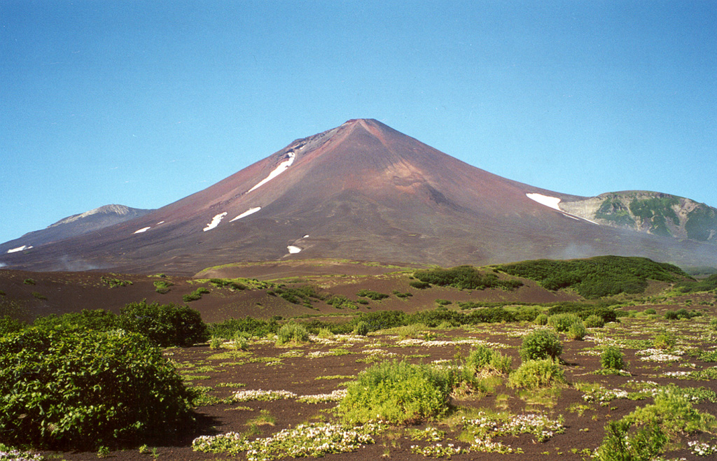
The tephra deposits in the foreground at the eastern base of Chikurachki were emplaced during a major explosive eruption in 1986. The eruption began on 18 November and reached its peak on 20-21 November when maximum ash plume heights of 10-11 km were reported. Pyroclastic flows traveled down the ESE flank. On 22 November lava flow extrusion began and continued through to 7 December, descending to 560 m elevation on the SE flank
Chikurachki, the highest volcano on Paramushir Island in the northern Kuriles, is actually a relatively small cone constructed on a high Pleistocene volcanic edifice. Oxidized basaltic-to-andesitic scoria deposits covering the upper part of the young cone give it a distinctive red color. Frequent basaltic plinian eruptions have occurred during the Holocene. Lava flows from 1781-m-high Chikurachki reached the sea and form capes on the NW coast; several young lava flows also emerge from beneath the scoria blanket on the eastern flank. The Tatarinov group of six volcanic centers is located immediately to the south of Chikurachki, and the Lomonosov cinder cone group, the source of an early Holocene lava flow that reached the saddle between it and Fuss Peak to the west, lies at the southern end of the N-S-trending Chikurachki-Tatarinov complex. In contrast to the frequently active Chikurachki, the Tatarinov volcanoes are extensively modified by erosion and have a more complex structure. Tephrochronology gives evidence of only one eruption in historical time from Tatarinov, although its southern cone contains a sulfur-encrusted crater with fumaroles that were active along the margin of a crater lake until 1959.
Source : Kvert , GVP.
Photos : M. Karasev , Alexander Belousov, 2000 (Institute of Volcanology, Kamchatka, Russia).
Ecuador / Galapagos , Wolf :
DAILY REPORT OF THE STATE OF WOLF VOLCANO. January 30, 2022.
Surface Activity Level: High, Surface Trend: Downward
Internal activity level: High, Internal trend: Downward
Seismicity: From January 29, 2022, 11:00 a.m. to January 30, 2022, 11:00 a.m.:
Long Periods (LP) 1
Rains / Lahars:
No rain was detected thanks to the satellite images of the WINDY application.
Emission / ash column:
In the past 24 hours, Washington’s VAAC has not recorded any satellite-observed emissions.
Other Monitoring Parameters:
WORLDVIEW applications recorded 18 thermal anomalies and MIROVA recorded 1 high thermal anomaly (672 MW) at Wolf Volcano in the past 24 hours. Around 19:52 UTC, through the MOUNTS project, a measurement of 2173 t is recorded for the Wolf volcano.
Observation:
The thermal anomalies observed by the GOES-16 satellite over the past 24 hours are maintained
Source : IGEPN.
Photo : Parque Nacional Galápagos.
Costa Rica , Rincon de la Vieja :
Rincón de la Vieja volcano activity report, January 30, 2022.
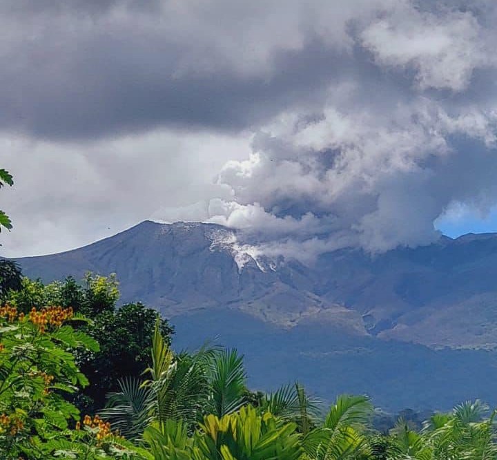
On January 30, 2022 at 1:08 p.m. local time, an eruption was recorded at the level of the Rincón de la Vieja volcano, the height reached by the column is unknown due to the visibility conditions of the site.
Duration of the activity: 4 minutes.
Ash fall reported: No ash fall is reported
Sulfur Odor Reported: No sulfur odor reported.
Comments:
Eruption of the Rincón de la Vieja volcano at 1:08 p.m. The height of the plume is unknown due to cloud cover at the top of the volcano. So far, no damage has been reported. The tremor remains segmented and fluctuating in amplitude. Few low frequency volcanic earthquakes are recorded. No appreciable deformation of the volcanic edifice is recorded.
Source : Ovsicori.
Photo : Volcanes sin Fronteras

