January 02 , 2022 .
Indonesia , Merapi :
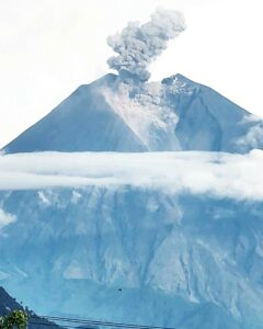
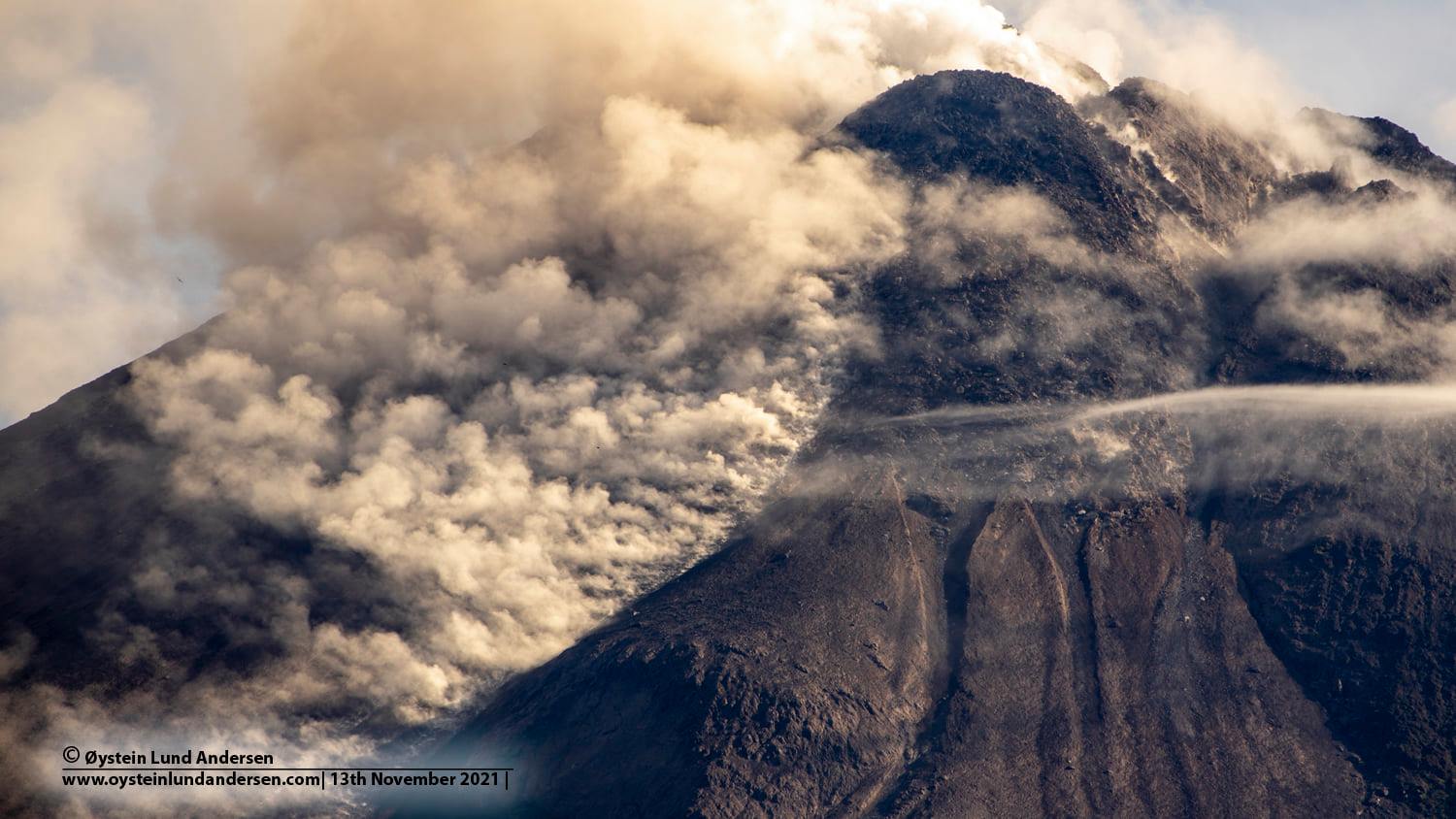
Merapi activity report from December 24 to 30, 2021.
– The weather around Mount Merapi is generally sunny in the morning and evening, while it is foggy in the afternoon.
– This week, 2 hot clouds of hot avalanches were observed upstream of the Bebeng River with a maximum sliding distance of 1,800 m. Lava avalanches have been observed 175 times southwest, dominating the Bebeng River with a maximum slide distance of 2,000 m.
– We observe a decrease in the height of the southwest dome of ± 3 m. The volume of the southwest lava dome is 1,630,000 m3 and the central dome is 3,007,000 m3.
The intensity of the seismicity this week is still quite high. We notice :
– 144 avalanche earthquakes
– 6 hybrid / multi-phase earthquakes.
The deformation of Mount Merapi, which was monitored using EDM this week, showed a distance shortening rate of 0.2 cm / day.
– The rainfall intensity was 83 mm / hour for 50 minutes at the Kaliurang post on December 25, 2021. No additional lahar or flow was reported in the rivers that originate on Mount Merapi.
Conclusion:
– The volcanic activity of Mount Merapi is still quite high in the form of effusive eruption activity. The status of the activity is defined in the “SIAGA” level.
– The current potential danger consists of lava avalanches and hot clouds in the South-East-South-West sector over a maximum of 3 km to the Woro river and 5 km to the Gendol and Kuning rivers , Boyong, Bedog, Krasak, Bebeng and Putih. During this time, the ejection of volcanic material in the event of an explosive eruption can reach a radius of 3 km from the summit.
Sources : BPPTKG , PVMBG.
Photo : Oystein Lund Andersen
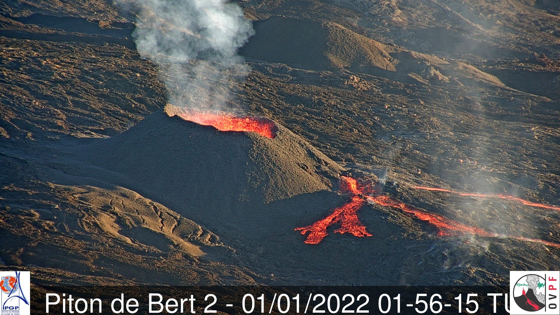
La Réunion Island , Piton de la Fournaise :
Press releases of January 01 and 02, 2022.
The eruption that began on December 22, 2021 at around 3:30 a.m. local time continues. Over the last 24 hours the amplitude of the eruptive tremor (indicator of an emission of lava on the surface) still shows fluctuations. The fluctuations observed can be linked either to:
– the cone under construction which undergoes construction and dismantling phases, thus influencing the speed of the lava flows at the level of the vent;
– or to punctual releases of pockets of gas trapped in the supply ducts which can be released suddenly leading to an increase in the tremor.
The average amplitude of the tremor is (over the last few hours) about 80% of its initial amplitude (60% on January 02).
Although better than the previous days, the meteorological conditions present on the volcano continue to disrupt observations of the eruptive site. However, thanks to clearings during the morning today, observations could be made. These latest observations still show lava fountain activity within the cone that has built up since the start of the eruption. Videos from the OVPF-IPGP-IRT webcams last night show activity with lava fountains occasionally exceeding the height of the cone. Numerous resurgences of lava flows were visible on the roof of the lava tunnel that developed downstream from the cone. These numerous resurgences of lava flows are still visible and are sporadic. They can last from a few minutes to a few hours.
Over the last 24 hours:
– A single volcano-tectonic earthquake of low magnitude (<0.5) was recorded under the summit.
– The surface deformations show a slight deflation at the level of the summit zone, linked to the emptying of the magma reservoir located under the summit (at about 2-2.5 km deep) and
feeding the eruptive site. These surface deformations no longer show significant signals today.
– The CO2 concentrations in the soil in the Gîte du volcan sector have been increasing for several days. This parameter will be monitored over the next few days because it may be linked to the arrival of new magma, coming from deeper areas, at the level of the surface reservoir.
– Despite “imperfect” meteorological conditions at the eruptive site, lava flows could be estimated by satellite method with the HOTVOLC platform (OPGC – Clermont Auvergne University). They were between 2 and 21 m3 / sec. These variations are explained by the method, which is based on the infrared radiation of the flow, the perception of which by the satellites can be largely influenced by the weather conditions above the flows as well as the conditions of.
surface of the castings.
Due to the poor weather conditions at the site this morning, no assessment of the position of the flow front could be made.
Alert level: Alert 2-1 (eruption in the Enclos )
Source and photo : OVPF.
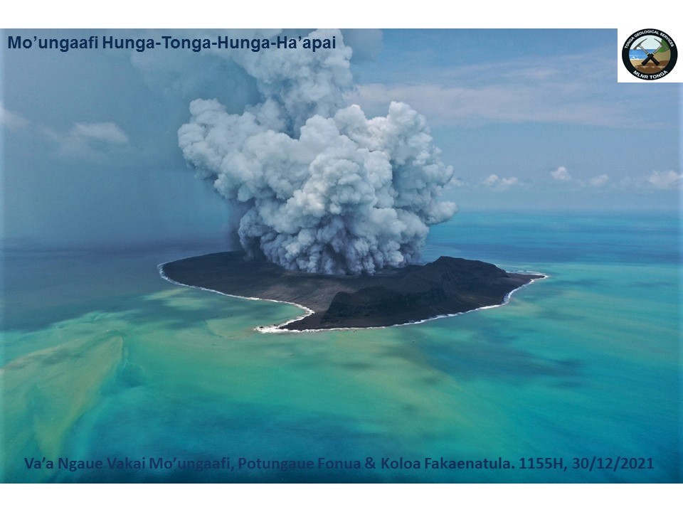
Tonga Islands , Hunga-Tonga-Hunga-Ha’apai :
This is a Public Notice regarding the Hunga-Tonga-Hunga-Ha’apai Eruption issued at 8:00AM, 2/1/2022.
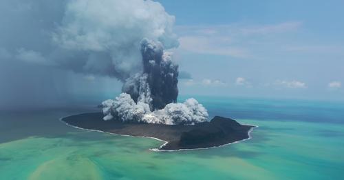
The eruption continues intermittently at Hunga-Tonga-Hunga-Ha’apai Island. The volcanic plume/clouds observed on satellite images captured between 12:00PM 1/01/2022 yesterday and 6:30AM 2/01/2022 this morning are as follows. (photo) :
 The volcanic steam/gas intermittent eruptions continued at 2:40pm yesterday, forming plumes drifting Eastward from HTHH across the ‘Otu Mu’omu’a Islands of Ha’apai Group at estimated altitude 12km ASL . The steam/gas plumes by 7:00pm yesterday up to 6:00am this morning drifted East-Southeastward across the northern Tongatapu waters . The last volcanic steam/gas plume detected at 6:00am this morning drifting East-Southeast across the Tongatapu waters.
Steam and gas from Hunga-Tonga-Hunga-Ha’apai Island can travel at higher elevation and is not expected to be noticeable from ground level. In the event of local rain, however, some traces of ash or acid rain could be experienced. If this occurred, the sailors in the seas between Tongatapu and the ‘Otu Mu’omu’a Islands of Ha’apai Islands are advised to take precaution during this time and cover water reservoirs.
An aerial view of the eruption site was taken on 30/12/2021 . The discolouration of the sea shows a significant discharge of volcanic fluids (steam, condensates laden with chemical elements) into the sea and contaminating the seawater. It is advised to assume fish in these waters are poisoned or poisonous if consumed.
Source : Tonga Geological Services, Government of Tonga.
Iceland , Reykjanes Peninsula / Fagradalsfjall :
Experts from the Bureau of Meteorology say a new satellite image, received today, suggests that the magma beneath Mount Fagradalsfjall is still heading towards the surface and is now at a depth of about sixteen hundred meters.
This means that the magma has risen four hundred meters in the past three days, but last Monday it was thought to be at a depth of about two thousand meters.
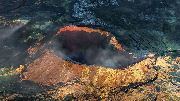
The main crater of Mount Fagradalsfjall earlier this week. The magma was last seen in mid-September.
If the magma continues its upward journey at the same speed, normally around 130 meters per day, a simple calculation indicates that it will take twelve days to reach the surface. As a result, a volcanic eruption could be expected around January 11.
There has also been tremors in the unrest area over the past 24 hours.
Sources : Visir . is ,
Photo : EGILL AÐALSTEINSSON.
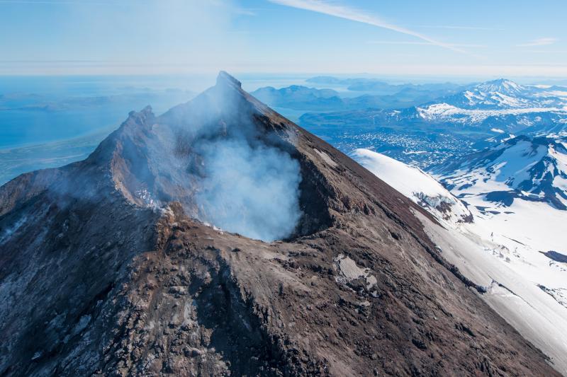
Alaska , Pavlof :
55°25’2″ N 161°53’37 » W,
Summit Elevation 8261 ft (2518 m)
Current Volcano Alert Level: WATCH
Current Aviation Color Code: ORANGE
Low-level eruptive activity continues at Pavlof Volcano. Seismicity remains elevated and is characterized by periods of tremor. No explosions were detected over the past day. Satellite and web camera observations were mostly obscured by clouds over the past day, and no ash emission were observed. Thermal emissions continue to be low, suggesting that lava effusion may have paused or ceased.
Small explosions accompanied by low-level ash emissions could happen at any time, and are typically a hazard in the immediate vicinity of the summit. The level of unrest at Pavlof can change quickly and the progression to more significant eruptive activity can occur with little or no warning.
Pavlof is monitored by local seismic and infrasound sensors, satellite data, web cameras, and remote infrasound and lightning networks.
Source : AVO.
Photo : Waythomas, Chris / Alaska Volcano Observatory / U.S. Geological Survey( 2017).
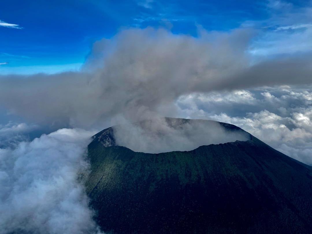
Democratic Republic of Congo , Nyirangongo :
An « intense activity » of the Nyiragongo volcano observed
The Goma Volcanological Observatory (OVG) announced on Friday that it had recorded « intense activity » from the Nyiragongo volcano in the eastern part of the Democratic Republic of the Congo, where the last eruption in May caused the death of 32 people.
« In addition to the activities in the central crater of Nyiragongo, there is an intense activity of volcanic tremor (continuous vibrations) on the southern flank of this volcano between Kibati – Shaheru – Mudjoga », wrote in a statement the director of the ‘OVG, Professor Adalbert Muhindo.
The following phenomena were observed: the temperature measured at different places varies between 65 ° C and 400 ° C; there are fumes of sulfur dioxide and fumaroles; the concentration of carbon dioxide (CO2) varies between 4 and 10% in different places; and collapses of the order of 50 cm were noted, he listed.
« Given this intense volcanic activity currently observed in the central crater of the Nyirangongo volcano and on its southern flank, scientists from the Goma Volcanological Observatory are continuing field activities, » he said.
Moreover, after the population reported having observed ash falls, the OVG asked the inhabitants of Goma (DRC) and Gisenyi (Rwanda) « to observe strict hygiene measures and not to consume the water rain ».
Despite this situation, the OVG considers that « the alert level of the Nyirangongo volcano remains yellow », however calling for « vigilance ».
Sources : lalibre.be , OVG.
Photo : Goma Fleva ( archive 2021) .