March 31 , 2021 .
Italy / Sicily , Etna :
Weekly bulletin from March 22, 2021 to March 28, 2021 (issue date March 30, 2021)
SUMMARY OF THE STATE OF ACTIVITY
In the light of surveillance data, it is highlighted:
1) VOLCANOLOGICAL OBSERVATIONS: Paroxysmal episode at the Southeast Crater; Strombolian intracrater activity at the Northeast Crater, the Bocca Nuova Crater and the Voragine Crater with occasional and diluted volcanic ash emissions.
2) SEISMOLOGY: Moderate rate of occurrence of fracturing earthquakes. The amplitude of the tremor varied from medium-low to high levels recorded during the paroxysmal event of March 23 and 24.
3) INFRASON: From March 24, moderate infrasound activity.
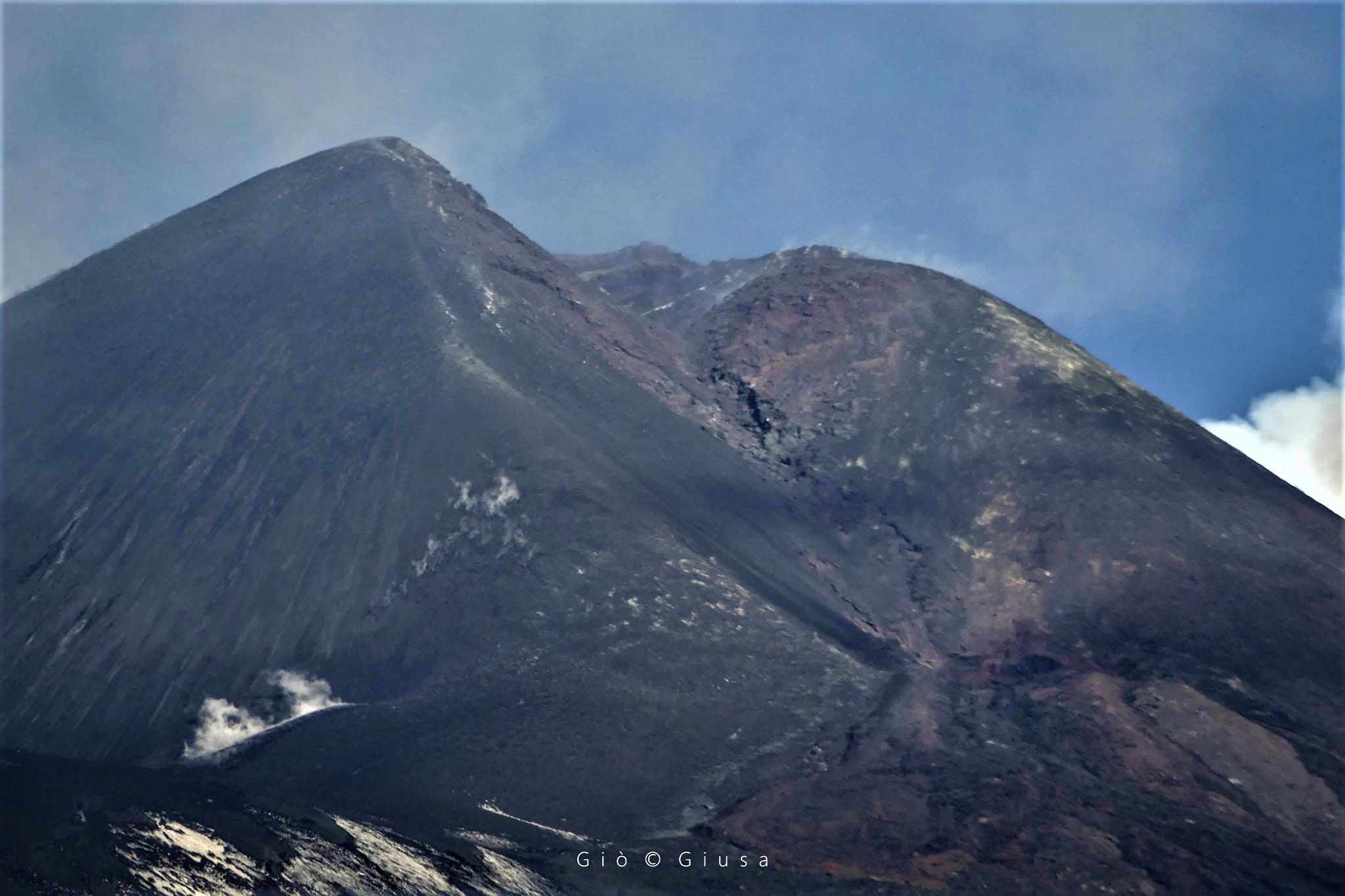
The Southeast Crater.
4) DEFORMATIONS: The slowing phase of the deflationary tendency of the volcanic building continues, which began with the sequence of the episodes of the lava fountain.
5) GEOCHEMISTRY: The flow of HCl occurs at an average level.
The flow of SO2 at an average level.
Soil CO2 flux remains at medium-low values as observed in previous weeks.
The partial pressure of dissolved CO2 in groundwater is at low values.
No new data from the C / S ratio is available.
We do not have updated values for the helium isotope ratio (last update 03/11/2021).
6) SATELLITE OBSERVATIONS: The thermal activity in the summit area is at a high level.
VOLCANOLOGICAL OBSERVATIONS
The monitoring of the volcanic activity of Etna, during the week in question, was carried out by analyzing the images of the network of surveillance cameras of the INGV, Etneo Observatory (INGV-OE) and thanks to the observations of field carried out by INGV-OE staff. Due to unfavorable weather conditions, it was not possible to observe continuous volcanic activity.
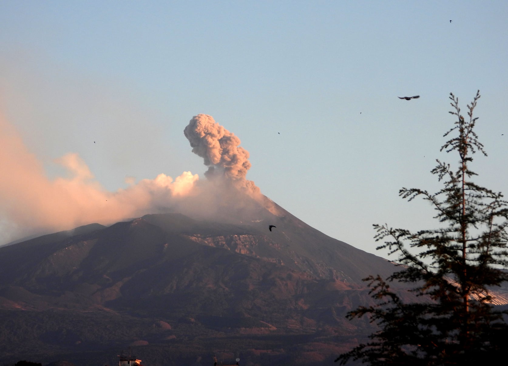
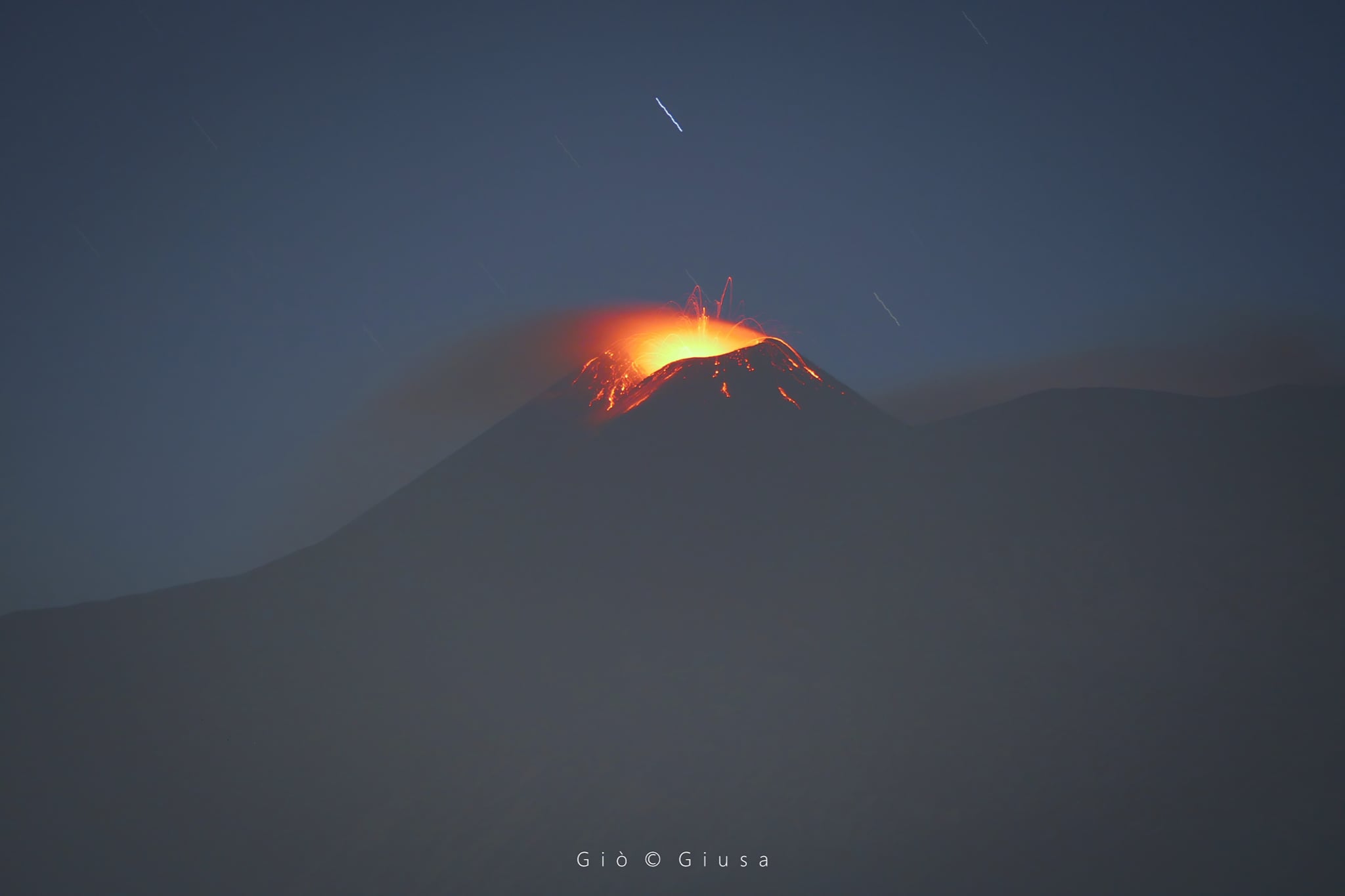
A single and powerful explosion, followed by a beautiful wave of shock and compression, at 07:07 local time today, March 30, 2021, at the Southeast Crater of Etna. It seems he wanted to wake up after 6 days of calm; instead, he became calm again, for the time being. Instead, explosive activity continues inside the other summit craters, especially with frequent ash puffs from Voragine Crater.
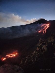
Between March 22 and 28, the Southeast Crater (SEC) produced a lava fountain episode.
From 19:05 GMT, the analysis of video surveillance images from the INGV-OE showed the resumption of weak Strombolian activity at the Southeast Crater. This activity has evolved gradually
into a lava fountain reaching its maximum intensity around 02:30 GMT. At 02:35 GMT, a lava overflow was observed, followed at 02:36 GMT by a pyroclastic flow. During this time, the overflow formed two streams, one well fed towards the Valle del Bove which reached an altitude of between 2000 and 1900 m around 06:00 GMT, and another, formed by the mouth of the saddle of the Crater South-East, less fed, which started from the summit at 2900 m and headed towards the South-East. The activity of the lava fountain gradually waned from 06:00 GMT and at 08:45 GMT it could be considered to be over.
On March 29, an inspection was carried out in the summit area with drones. The orthophoto of the upper southern part of the cone was superimposed on the shaded model of the Southeast Crater in which a system of fractures with a sub direction parallel to the crater rim with an East – West trend and of equal length is clearly visible on about 220 m with variable width from 20-30 cm to 1 m. This system is intersected by a second family of fractures which are perpendicular to it. The main fracture is hot and covered with fumaroles. In the detailed RGB images of the southern fractures, the presence of sulfur can be appreciated. The northern part of the cone is also affected by hot fractures visible on the thermal image.
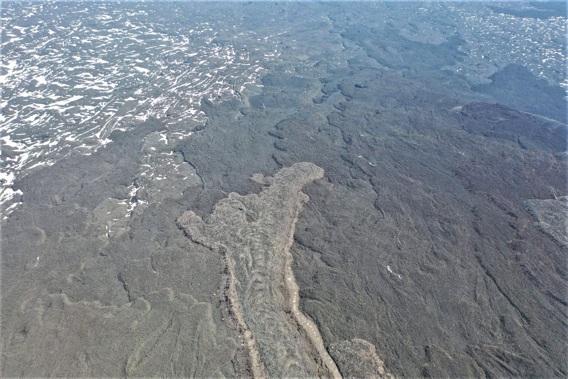
The surveys on the deposits of the 16th peak of Etna which took place on March 23-24 are continuing. In these clear photos, the deposit of the pyroclastic flow in the Bove valley is visible.
The lava fountain also produced a volcanic cloud which dispersed mainly towards the South-South-East, forming a pyroclastic deposit on the southern slope of the volcano which also dissipated towards the city of Catania. The maximum height estimated by satellite data and INGV-OE surveillance images of about 6-7 km.
Finally, the activity of the Northeast crater (NEC), of the Bocca Nuova (BN) and of the Voragine (VOR) had a behavior comparable to that observed the previous week, characterized by a strombolian activity mainly intracrater of variable intensity accompanied by sporadic and weak ash emissions quickly dispersed by high altitude winds.
PRESS RELEASE on the activity of ETNA, March 30, 2021, 8:30 p.m. (6:30 p.m. UTC).
The National Institute of Geophysics and Volcanology, Etneo Observatory, reports that a weak resumption of Strombolian activity is observed at the Southeast Crater. Intra-crater explosive activity continues at Bocca Nuova crater, Northeast Crater and Voragine. The latter also produces discontinuous ash emissions which are dispersed
quickly in the summit area.
The mean amplitude of the volcanic tremor currently remains at an average level, although the location of the center of gravity of the volcanic tremor sources has been located at the Southeast Crater from 1:30 p.m. (UTC).
The infrasound activity, after a first increase observed at 09:30 (UTC) today, in the last hours shows a new increase and is located at the level of the Southeast Crater.
There is no significant change in the time series of tilt and GNSS stations.
Further updates will be communicated shortly.
Source : INGV.
Photos : Gio Giusa , Boris Behncke , INGV.
La Réunion , Piton de la Fournaise :
Bulletin for Wednesday, March 31, 2021 at 8:15 a.m. (local time) – felt earthquake
On Wednesday March 31, 2021, 12:09 am (local time – 8:09 pm UT), an earthquake was felt by residents of the island, mainly in the Plaine des Cafres region. This earthquake was recorded by the entire network of seismometers of the Volcanological Observatory of Piton de la Fournaise.
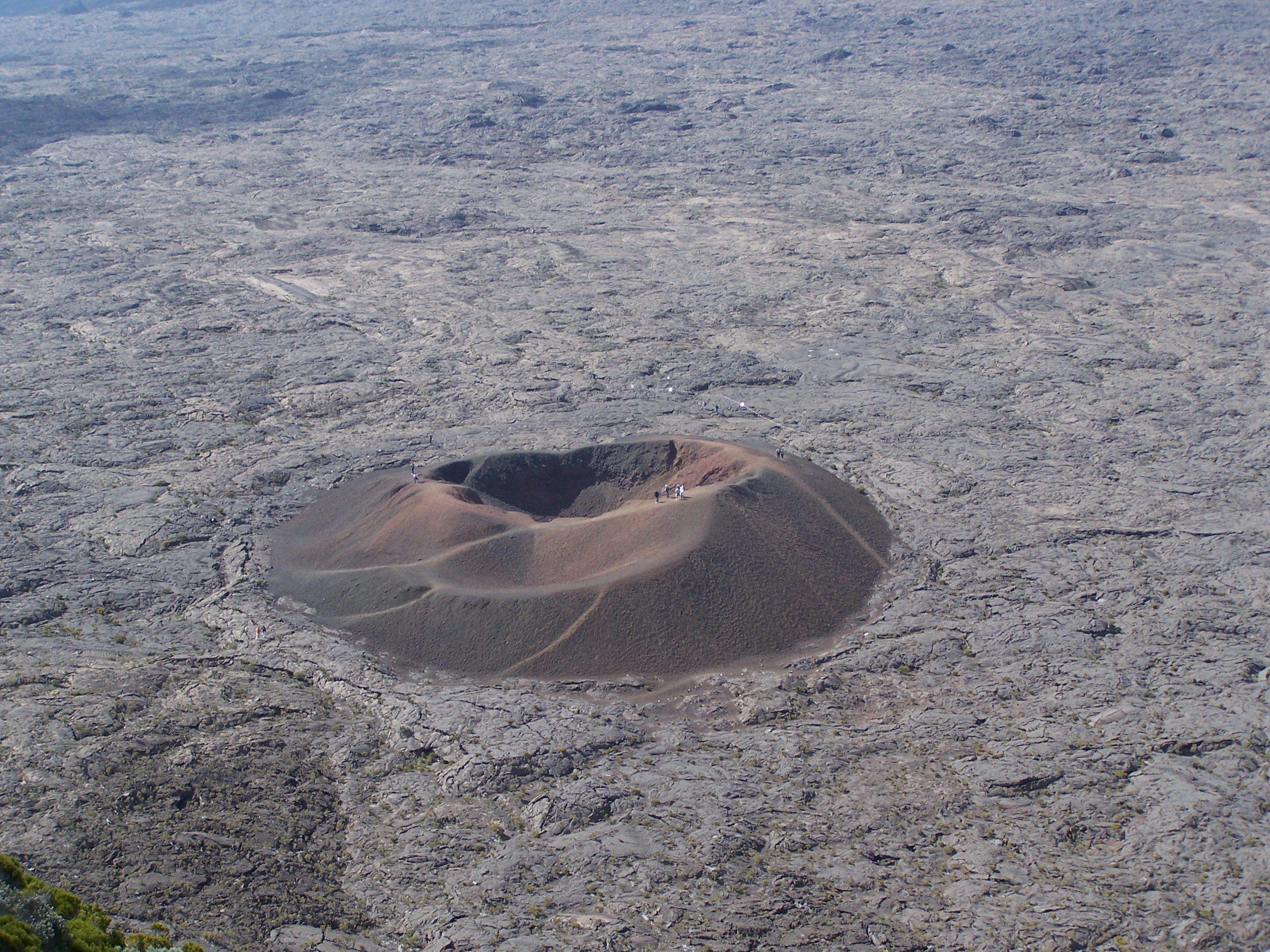
The first analyzes of this earthquake made it possible to locate it, 24 km below sea level, at a distance of 1 km east of the Plaine des Cafres. Its magnitude was measured at 2.3 on the Richter scale. This type of event, felt by the population, is recorded several times a year. This event is currently isolated.
Call for testimonies on the earthquakes felt: the real intensities (effects of an earthquake in a given place) can only be correctly determined by collecting testimonies.
Source : Ovpf.
Photo : G Vitton.
Indonesia , Sinabung :
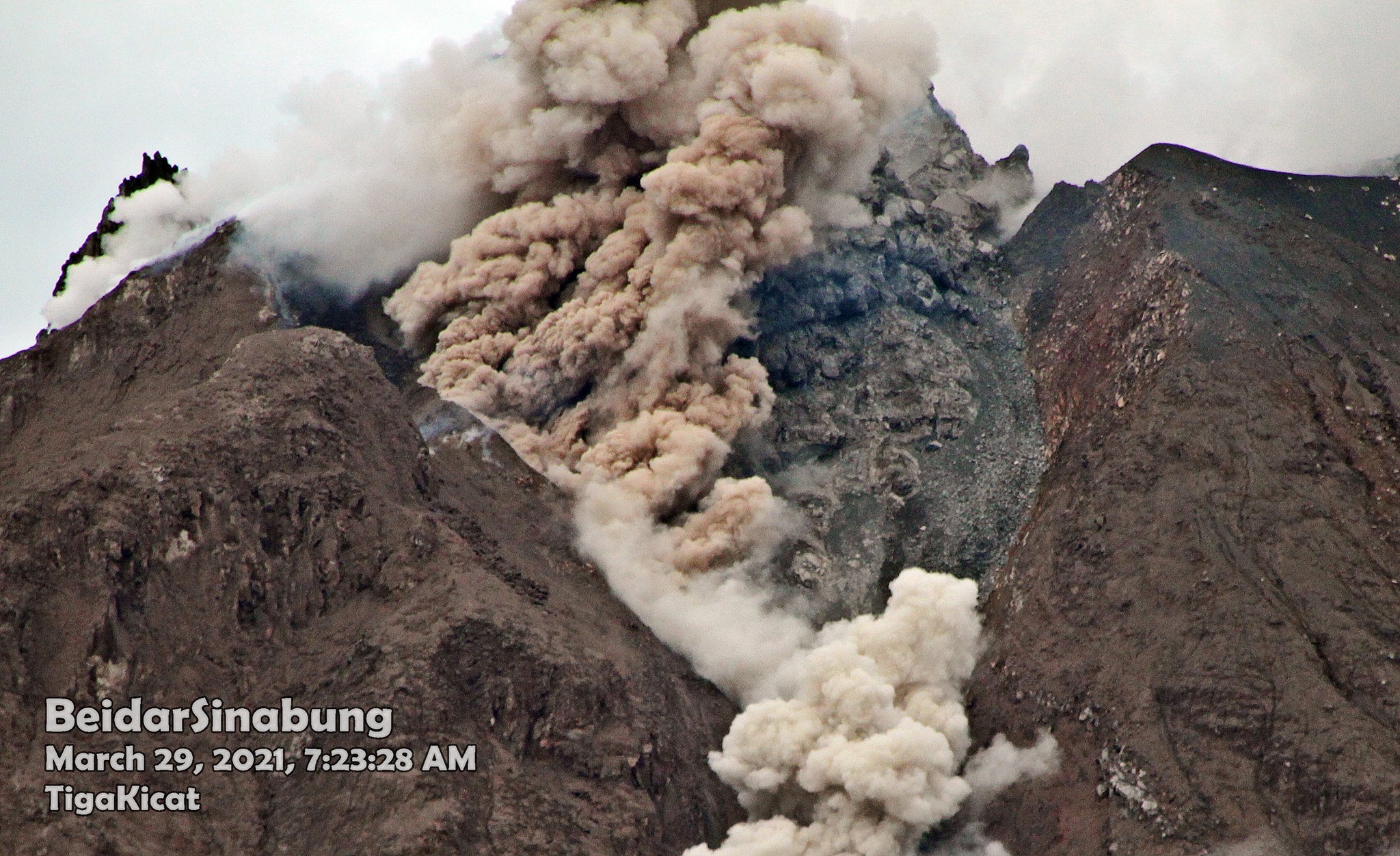
The activity level has been at level III (SIAGA) since May 20, 2019 at 10:00 a.m. WIB. Mount Api Sinabung (2460 m above sea level) has been erupting since 2013. The last eruption occurred on March 30, 2021 with a column height of 1000 meters above the summit.
The volcano was clearly visible until it was covered in fog. We observe that the crater emits white smoke with a strong thickness, about 50-500 meters above the summit. The weather is sunny to cloudy, with weak to strong winds in the northeast, east, west and northwest.
According to the seismographs of March 30, 2021, it was recorded:
2 eruption / explosion earthquakes
83 avalanche earthquakes
13 earthquakes of emissions
1 low frequency earthquake
15 hybrid / multi-phase earthquakes
1 deep volcanic earthquake.
VOLCANO OBSERVATORY NOTICE FOR AVIATION – VONA.
Issued : 30 Mars 2021
Volcano : Sinabung (261080)
Current Aviation Colour Code : ORANGE
Previous Aviation Colour Code : orange
Source : Sinabung Volcano Observatory
Notice Number : 2021SIN30
Volcano Location : N 03 deg 10 min 12 sec E 98 deg 23 min 31 sec
Area : North Sumatra, Indonesia
Summit Elevation : 7872 FT (2460 M)
Volcanic Activity Summary :
Eruption with volcanic ash cloud at 03h35UTC (10h35 local)
Volcanic Cloud Height :
Best estimate of ash-cloud top is around 11072 FT (3460 M) above sea level, may be higher than what can be observed clearly. Source of height data: ground observer.
Other Volcanic Cloud Information :
Ash-cloud moving to E – SE
Remarks :
Seismic activity is characterized by eruption
Source : Magma Indonesie , PVMBG
Photo : Tiga Kicat / Beidar Sinabung.
Japan , Otake / Suwanosejima :
Alert level raised for Otake volcano
The volcano erupted late Tuesday, sending large rocks nearly 1 kilometer from the crater, prompting the weather agency to raise its alert level.
The eruption occurred at the crater of Mt. Otake on Suwanose Island of Kagoshima Prefecture at 10:05 p.m. There were no immediate reports of injuries, according to local authorities.
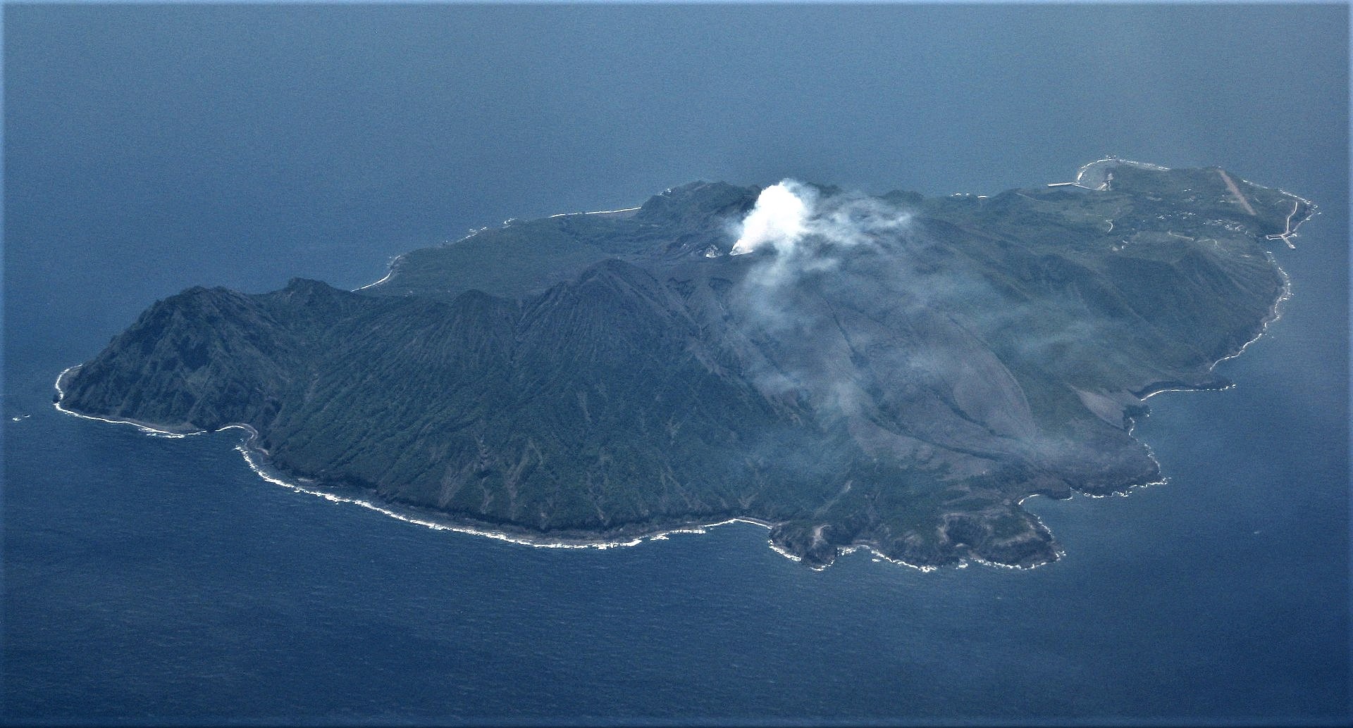
Photo shows Suwanose Island of Kagoshima Prefecture
The Japan Meteorological Agency said early Wednesday that it has raised the volcanic activity alert level by one notch to 3 on a scale of 5, meaning that people should not approach the crater.
Following the eruption on Tuesday night, the volcano erupted again at 2:57 a.m. Wednesday, with large rocks projected nearly 1 km from the crater as before. The agency warned of the potential for big rocks to be hurled into the air within about a 2-km radius of the crater.
Late last year amid intensifying volcanic activity, the agency raised its alert level to 3 on Dec. 28. It was lowered to level 2 on Jan. 14 in the absence of any major changes in volcanic activity data.
Suwanose Island, a volcanic island with a small population, is located about 230 km south-southwest of Kagoshima.
Source : Kyodonews.
Photo : Ray Go.
Guatemala , Pacaya :
Activity:
We record the generation of columns with abundant ash lasting from a few minutes to a few hours, which reach 3000 meters in altitude and travel 7 kilometers to the south. This causes ash to fall in communities south of the volcanic building, such as Finca El Chupadero and Los Pocitos. The effusive activity continues to feed the lava flow on the western flank, with a length of 2400 meters. INSIVUMEH seismic stations constantly record tremors, associated with the rise of magma, as well as continuous degassing in the crater. It is not excluded that more lava flows are generated on other flanks or the generation of degassing columns with abundant ash. Volcanic activity is considered to be at high levels.
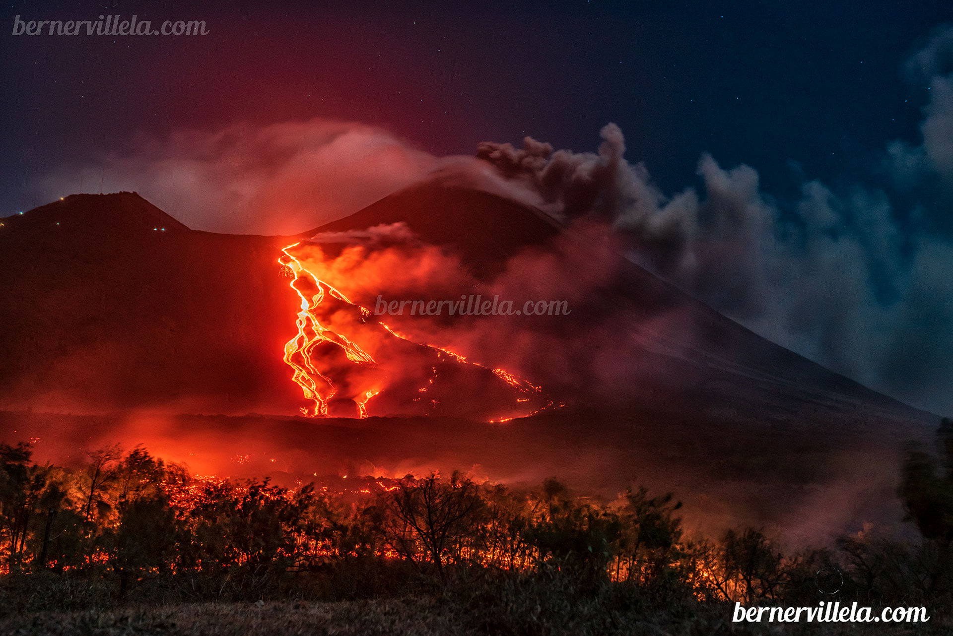
On the afternoon of Monday, March 29, a lava flow from the Pacaya volcano was reported advancing and affecting a house that functioned as a watch area on a farm and sanitary facilities for people visiting the area. The house was not inhabited. The lava flow continues to advance between 50 and 60 meters per day. The next community is El Patrocinio, located 1.5 km from where the lava flow is currently located. In addition, during this March 30, 2021, a visit was carried out in the areas where the volcanic flow moves by CONRED and INSIVUMEH, in order to determine, thanks to the implementation of techniques such as surveys by drones and others techniques, the path of the lava and determining the actions to be used.
Source : Insivumeh , Conred .
Photo : Berner Villela .