March 23 , 2021 .
Alaska , Veniaminof :
56°11’52 » N 159°23’35 » W,
Summit Elevation 8225 ft (2507 m)
Current Volcano Alert Level: WATCH
Current Aviation Color Code: ORANGE
Low-level eruptive activity continues at Veniaminof. Airwaves from small explosions have been observed in local seismic data and distant Infrasound networks over the past day. Minor ash emissions from the small cone within the summit caldera continue and were observed in web camera images during periods of clear weather over the past day. These ash cloud rise hundreds of feel above the cone and dissipate rapidly. The ash cloud is below ~8000 ft asl and minor ash fall is likely confined to the upper flanks of the volcano.
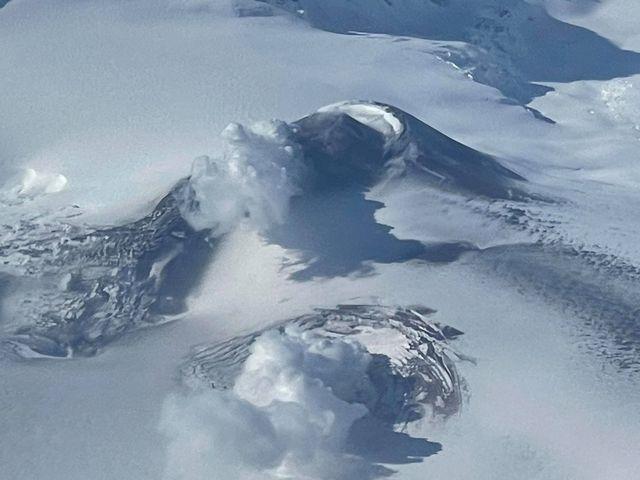
Air photo from ACE Air flight 66, March 11, 2021, 13:30 local time from approximately 21,000 feet showing ash deposits and steam plumes from Mount Veniaminof.
Eruption of lava within the intracaldera glacier at a vent ~1 km (0.6 miles) east of the summit cone continues. Incandescence was observed in web camera images over night, and highly elevated surface temperatures were observed in satellite data. A plume of sulfur dioxide gas associated with the ash emissions and lava eruption were observed in satellite data yesterday afternoon.
Eruptive activity at Veniaminof usually consists of minor ash emissions, lava fountaining and lava flows from the small cone in the summit caldera. Ash emissions are typically confined to the summit crater, but larger events can result in ash fall in nearby communities and drifting airborne ash.
The partial restoration of local seismic data will help the Alaska Volcano Observatory to detect changes in unrest that may lead to a more significant explosive eruption. AVO combines seismic, infrasound, lightning, web camera, and satellite data for rapid detection of such events.
Source : AVO.
Photo : Jacob, Ben David.
Philippines , Taal :
TAAL VOLCANO BULLETIN: 23 March 2021 08:00 A.M.
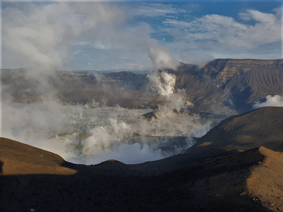
In the past 24-hour period, the Taal Volcano Network recorded one hundred two (102) volcanic earthquakes, including eighty-seven (87) episodes of volcanic tremor having durations of one (1) to eight (8) minutes. Activity at the Main Crater consisted of weak emission of steam-laden plumes from fumarolic vents that rose 5 meters. Sulfur dioxide (SO2) emission that averaged 1,013 tonnes/day was measured yesterday, 22 March 2021.
Temperature highs of 71.8°C and pH of 1.59 were last measured from the Main Crater Lake respectively on 04 March and 12 February 2021. Ground deformation parameters from electronic tilt, continuous GPS and InSAR data analysis indicated a very slow and steady inflation and expansion of the Taal region since after the January 2020 eruption. These parameters may indicate increased magmatic activity at shallow depths beneath the edifice.
Source : Phivolcs
Photo : William Enriquez .
Guatemala , Pacaya :
SPECIAL VOLCANOLOGICAL BULLETIN of March 22, 2021, 5:24 p.m. local time.
UPDATE ON ERUPTIVE ACTIVITY
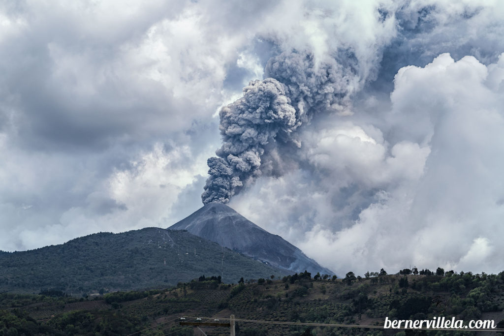
The Pacaya volcano maintains the high level of activity of the last weeks, with impulses of magmatic activity, which generate moderate to strong explosions, with thick columns of ash, with heights of 3,500 to 4,000 meters above sea level. (11,482 to 13,123 feet) moving east, southeast, northeast and north, over distances of approximately 25 to 30 kilometers. Ash falls are reported in the villages of Los Llanos, Los Pocitos, Los Dolores, Mesías Alta and Mesías Baja, Santa Elena Barillas, with probabilities of ash fall in the capital.
It also ejects ballistic projections 500 meters above the crater, these fall at distances of 300 to 600 meters. There are 3 lava flows, one oriented to the southwest, with a length of 1500 meters, another lava flow on the eastern flank with a length of 500 meters, and a more southeast of 300 m long. According to reports from OVPAC observers, CONRED web cameras, GOES-16 satellite imagery, activity in the crater between periods of low and high intensity, generates aircraft turbine sounds and low rumbles. and moderate, audible in villages close to the volcanic building.
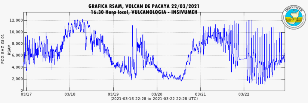
The recording of the seismic stations of PCG, and PCG2, shows the increment pulses in the last hours, which favors the formation of thick ash columns.
GRAPHIC RSAM STATION PCG
Given the behavior that the Pacaya volcano has shown in recent weeks, the activity is considered to continue at high levels and it is not excluded that increasing pulses will continue to appear in the coming hours, generating explosions, ballistic projections and ash falls, and / or the appearance of new lava flows or the increase in their length.
Source : Insivumeh
Video : El Escuintleco.
Photo : Berner Villela .
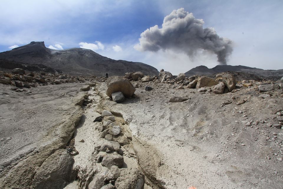
Peru , Sabancaya :
Analysis period: from March 15, 2021 to March 21, 2021, Arequipa, March 22, 2021.
Alert level: ORANGE
The Geophysical Institute of Peru (IGP) reports that the eruptive activity of the Sabancaya volcano remains at moderate levels, that is to say with the recording of an average of 79 daily explosions, with columns of ash and gas up to 2.5 km altitude above the summit of the volcano and their consequent dispersion. Therefore, for the following days, no significant change is expected in eruptive activity.
The IGP recorded and analyzed the occurrence of 1791 earthquakes of volcanic origin, associated with the circulation of magmatic fluids inside the Sabancaya volcano. An average of 79 explosions was recorded daily. During this period, Volcano-Tectonic (VT) earthquakes associated with rock fractures were located mainly in the North-West and South-East of Sabancaya and presented magnitudes between M2.0 and M2 , 2.
The monitoring of the deformation of the volcanic structure using GNSS techniques (processed with fast orbits) does not present any significant anomalies. However, in general, an inflation process was observed in the northern sector (around the Hualca Hualca volcano). Visual surveillance made it possible to identify columns of gas and ash up to an altitude of 2.5 km above the summit of the volcano, which were scattered towards the South-West, West, North-East and North-East sectors. West of Sabancaya. Satellite recordings have identified the presence of 3 thermal anomalies (maximum value of 52 MW) associated with the presence of a lava body on the surface of the volcano’s crater.
RECOMMENDATIONS
• Keep the volcanic alert level in orange.
• Do not approach within a radius of less than 12 km from the crater.
Source : IGP.
Photo : Zintia Roxana Fernández Licla.
Indonesia , Sinabung :
VOLCANO OBSERVATORY NOTICE FOR AVIATION – VONA
Issued : March 22 , 2021
Volcano : Sinabung (261080)
Current Aviation Colour Code : ORANGE
Previous Aviation Colour Code : orange
Source : Sinabung Volcano Observatory
Notice Number : 2021SIN27
Volcano Location : N 03 deg 10 min 12 sec E 98 deg 23 min 31 sec
Area : North Sumatra, Indonesia
Summit Elevation : 7872 FT (2460 M)
Volcanic Activity Summary :
Eruption with volcanic ash cloud at 09h17 UTC (16h17 local)
Volcanic Cloud Height :
Best estimate of ash-cloud top is around 9472 FT (2960 M) above sea level, may be higher than what can be observed clearly. Source of height data: ground observer.
Other Volcanic Cloud Information :
Ash-cloud moving to W – NW
Remarks :
Seismic activity is characterized by eruption
.
The activity level has been at level III (SIAGA) since May 20, 2019 at 10:00 a.m. WIB. Mount Api Sinabung (2460 m above sea level) has been erupting since 2013. The last eruption occurred on March 13, 2021 with a height of the eruption column that had not been observed.
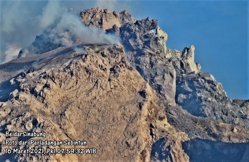
The volcano was clearly visible until it was covered in fog. The crater emits white and gray smoke with thick intensity, about 100-500 meters above the summit. The weather is sunny to rainy, the winds weak to the West and North-West.
According to the seismographs of March 22, 2021, it was recorded:
2 eruption / explosion earthquakes
46 avalanche earthquakes
12 emission earthquakes
3 low frequency earthquakes
16 hybrid / multi-phase earthquakes
3 distant tectonic earthquakes
Source : Magma Indonésie , PVMBG.
Photo : Firdaus Surbakti .

