March 02 , 2021 .
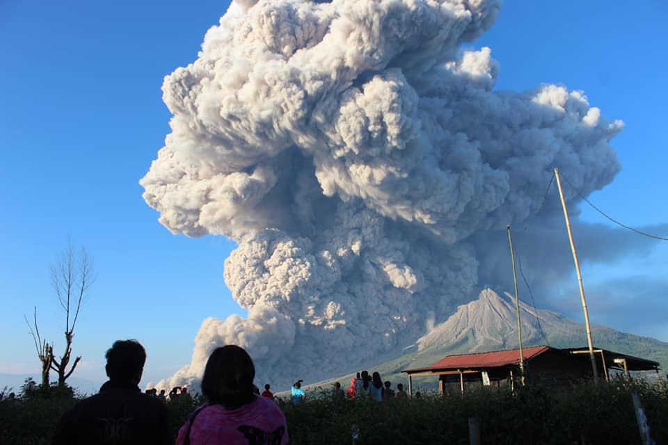
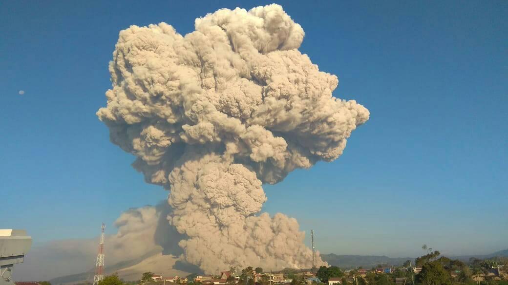
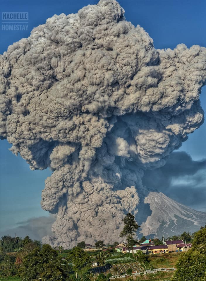
Indonesia , Sinabung :
VOLCANO OBSERVATORY NOTICE FOR AVIATION – VONA .
Issued : March 02 , 2021
Volcano : Sinabung (261080)
Current Aviation Colour Code : RED
Previous Aviation Colour Code : red
Source : Sinabung Volcano Observatory
Notice Number : 2021SIN10
Volcano Location : N 03 deg 10 min 12 sec E 98 deg 23 min 31 sec
Area : North Sumatra, Indonesia
Summit Elevation : 7872 FT (2460 M)
Volcanic Activity Summary :
Hot could avalanches with ash clouds at 01:08 UTC (08:08 local time). The eruption lasted for 327 seconds
Volcanic Cloud Height :
Best estimate of ash-cloud top is around 23872 FT (7460 M) above sea level, may be higher than what can be observed clearly. Source of height data: ground observer.
Other Volcanic Cloud Information :
Ash cloud is moving to West – East
Remarks :
Seismic activity is characterized by the Deep Volcanic Earthquake, Low Frequency Earthquake, and Hybrid Earthquake. Hot clouds is observed through the East-Southeast slope and reaches a distance of 5000 meters from the summit.
Press release on the volcanic activity of G. Sinabung – North Sumatra, March 2, 2021.
Surveillance data:
Visual: From January to March 1, 2021, the crater’s gas emissions are white and gray with low intensity, medium to thick, about 50-1000 meters above the summit. 37 explosive eruptions occurred, causing columns of gray eruptions up to 1000 m maximum. Hot avalanche clouds were observed with a sliding distance of 1500 to 2500 meters from the summit, with a sliding direction to the East, Southeast and South. On March 2, 2021, starting at 6:42 a.m. WIB, there was a series of hot avalanche clouds with a sliding distance of 2000 to 5000 m east-southeast, accompanied by columns of smoke from 4000 to 5000 m above the hot avalanche cloud. Until 08:20 WIB, 13 hot avalanche clouds have occurred.
Seismicity:
The occurrence of avalanche earthquakes, emissions, hybrids and low frequencies during this period are very high. The pattern of the increase in the number of low frequency and hybrid earthquakes was observed significantly during the first week of February 2021, with the onset of warm avalanche clouds.
Analysis:
The hot cloud avalanche series of March 2, 2021 is the character of the Mount Sinabung eruption which has occurred several times since 2013. The hot cloud avalanche mechanism is caused by the formation of a lava dome at the top, followed by a migration of fluid (solid rock, liquid, gas) to the surface pushing the lava dome. This fluid migration is indicated by a high number of low frequency and hybrid earthquakes.
Visual observations and seismicity through March 2, 2021 at 9:00 a.m. WIB showed fluctuations in a still high pattern, but there is no indication of an increase in the potential threat of danger.
Potential danger:
Explosive eruptions still have the potential to occur, but the threat is still within the recommended range of Level III (SIAGA).
Lahars have the potential to occur in the river valleys that originate at Mount Sinabung, mainly due to heavy rainfall.
Conclusion:
Based on the results of visual and instrumental observations up to March 2, 2021, it is estimated that the level of volcanic activity of Mount Sinabung is still at level III (SIAGA).
Sources : Magma Indonesie , PVMBG.
Photos : Gung Pinto News via Sherine France , Rizal M , Nachelle Homestay .
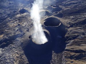
Guatemala , Pacaya :
SPECIAL VOLCANOLOGICAL BULLETIN, March 1, 2021, 9:43 a.m. local time
INCREASE IN STROMBOLIAN ACTIVITY
According to instrumental monitoring, from the early hours of the morning there was a noticeable increase in seismic activity inside the volcano, which was manifested by an increase in Strombolian activity.
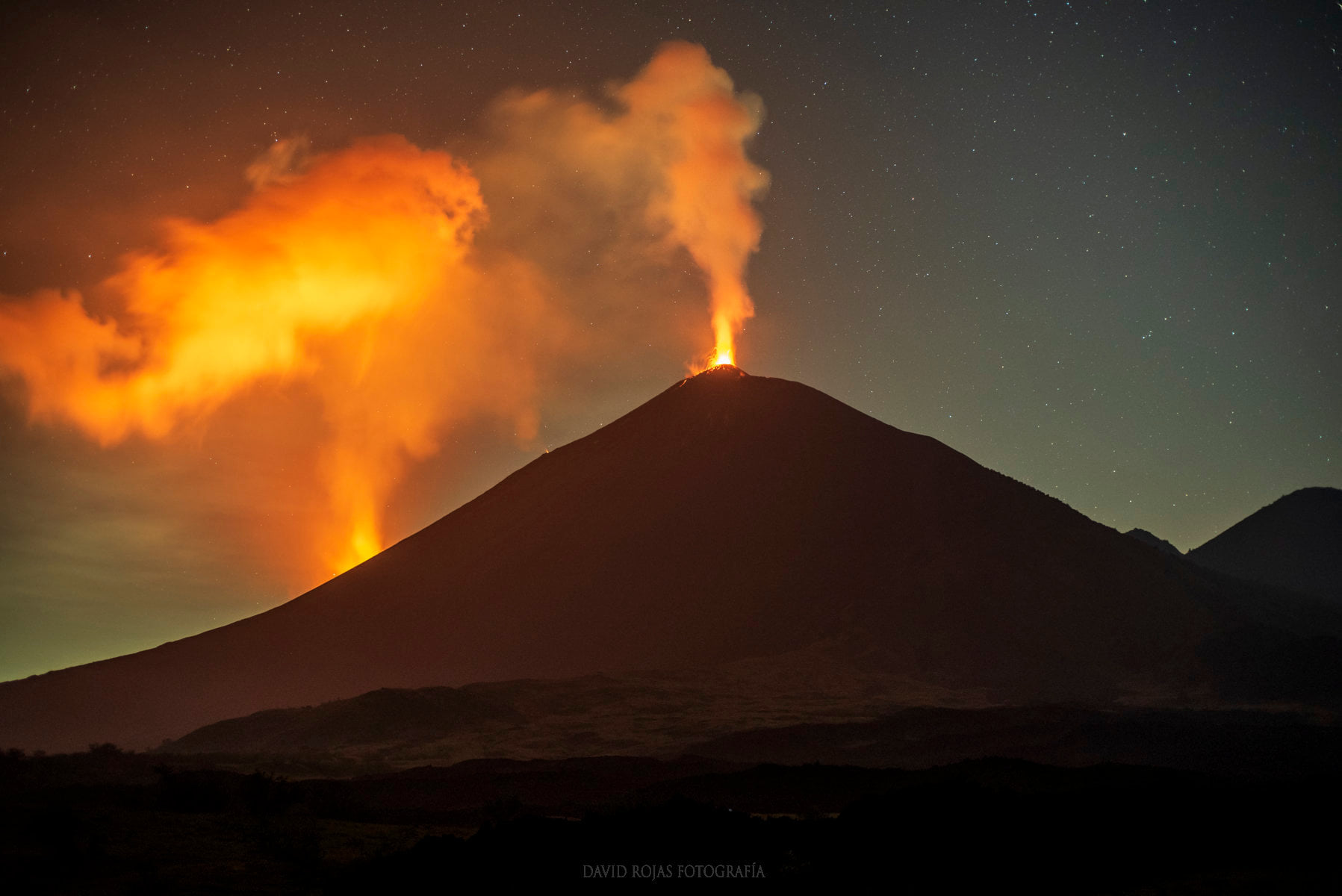
According to reports from OVPCAC observers, moderate to strong explosions occur, which expel ballistic projections to heights of up to 500 meters above the crater, accompanied by emissions of ash columns and magmatic gases. that reach a height of 3,500 meters above sea level (11,483 feet) that move west. In the southwest, ash falls are reported in the village of El Patrocinio with probabilities of ash fall in communities such as Los Ríos, Los Jazmines, El Rodeo, San José and others in this direction.
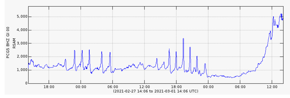
Fig. N ° 1: We observe a notable increase in the RSAM (mean seismic amplitude of the PCG5 station), much greater than that recorded in the increase pulses recorded on the previous days.
It is not excluded that the volcanic activity increases and produces an eruption, or that it continues with this tendency to maintain high impulses of increase during the following hours, maintaining the explosions with ballistic projections and ash emissions and of gas columns, as well as the increase in length or the emergence of new lava flows on the flanks around the volcanic cone.
INSIVUMEH provides visual and instrumental monitoring of volcanic activity through seismic stations and OVPAC observers.
Source : Insivumeh .
Photo : David Rojas .
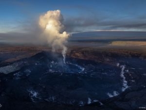
United States , Yellowstone :
44°25’48 » N 110°40’12 » W,
Summit Elevation 9203 ft (2805 m)
Current Volcano Alert Level: NORMAL
Current Aviation Color Code: GREEN
Recent work and news
As was the case in January, Steamboat Geyser had two major water eruptions in the past month, on February 3 and 21. This is typical of winter, when low groundwater levels seem to correlate with longer intervals between Steamboat eruptions.
Seismicity
During February 2021, the University of Utah Seismograph Stations, responsible for the operation and analysis of the Yellowstone Seismic Network, located 67 earthquakes in the Yellowstone National Park region. The largest event was a minor earthquake of magnitude 2.4 located 13 miles north of Pahaska Tepee, WY, on February 2 at 3:08 AM MST.
A swarm of 20 earthquakes, with magnitudes between 0.3 and 2.3, was recorded in the area of West Yellowstone, MT, during February 1–16. The largest event of the swarm occurred on February 4 at 05:30 AM (MST) and was located one mile southwest of West Yellowstone.
Earthquake sequences like these are common and account for roughly 50% of the total seismicity in the Yellowstone region.
Yellowstone earthquake activity remains at background levels.
Ground deformation
Deformation rates and styles at Yellowstone, as recorded by continuous GPS stations, have been steady over the past year. Subsidence of Yellowstone Caldera, which has been ongoing since 2015, continued at an average rate of 2-3 cm (about 1 in) per year. In the area of Norris Geyser Basin, no significant uplift or subsidence has been detected by a nearby GPS station since the start of 2020.
Source : YVO.
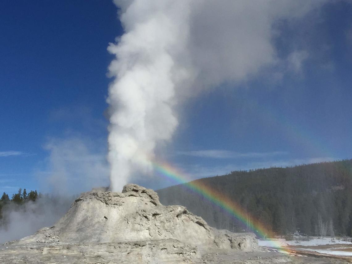
Photo : Shaul Hurwitz / USGS . ( View of Castle Geyser, near Old Faithful, ) .
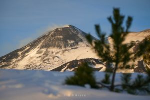
Peru , Sabancaya :
Analysis period: from February 22, 2021 to February 28, 2021, Arequipa, March 01, 2021.
Alert level: ORANGE
The Geophysical Institute of Peru (IGP) reports that the eruptive activity of the Sabancaya volcano remains at moderate levels, that is to say with the recording of an average of 91 daily explosions, with columns of ash and gas up to 2 km altitude above the summit of the volcano and their consequent dispersion. Therefore, for the following days, no significant change is expected in eruptive activity.

The IGP recorded and analyzed the occurrence of 1977 earthquakes of volcanic origin, associated with the circulation of magmatic fluids inside the Sabancaya volcano. An average of 91 explosions was recorded daily. During this period, Volcano-Tectonic (VT) earthquakes associated with rock fractures were located mainly in the North-East and North-West of Sabancaya and presented magnitudes between M1.9 and M2.8.
The monitoring of the deformation of the volcanic structure using GNSS techniques (processed with fast orbits) does not present any significant anomalies. However, in general, an inflation process was observed in the northern sector (around the Hualca Hualca volcano). Visual surveillance made it possible to identify columns of gas and ash up to 2 km altitude above the summit of the volcano, which were scattered towards the southwest, south, northeast and northwest sectors of the volcano. Sabancaya. Satellite monitoring did not identify the presence of thermal alerts on the surface of the volcano ‘s crater.
RECOMMENDATIONS
• Keep the volcanic alert level in orange.
• Do not approach within a radius of less than 12 km from the crater.
Source : IGP.
Photo : Andina.