February 13 , 2021 .
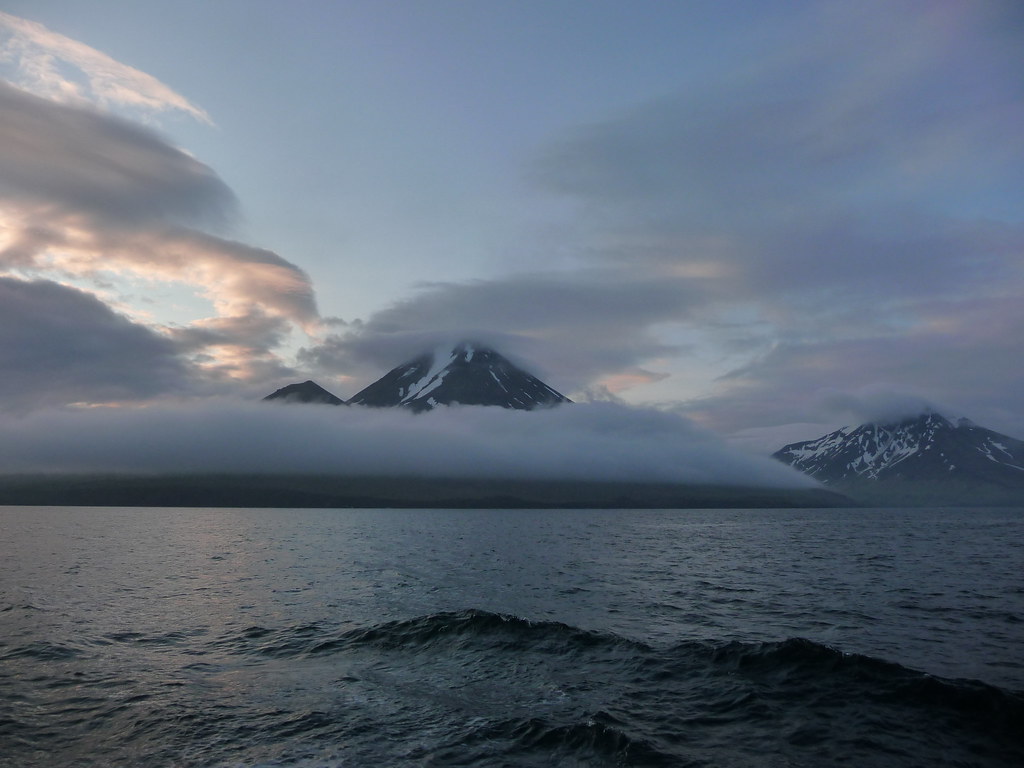
Alaska , Semisopochnoi :
51°55’44 » N 179°35’52 » E,
Summit Elevation 2625 ft (800 m)
Current Volcano Alert Level: WATCH
Current Aviation Color Code: ORANGE
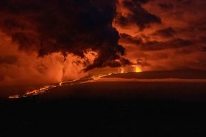
Eruptive activity was observed from Semisopochnoi this week, with local small ash deposits from North Cerberus Crater seen in satellite data. High-resolution satellite images on February 6 showed a small ash deposit extending <3 km (1.9 miles) to the north of the crater and on February 7, a second deposit extending at least 3 km (1.9 miles) to the northeast was observed. Steam emissions obscured views into the crater. Any ash clouds associated with these deposits have not been observed and are likely low-level (<10,000 ft) and short-duration. Cloudy conditions obscured views of the volcano for the rest of the week. No activity was observed in regional infrasound data. After initial detection of the first deposit, the Alaska Volcano Observatory increased the Aviation Color Code to YELLOW and the Volcano Alert Level to ADVISORY on February 6. Because of evidence for recurring low-level ash emissions the next day, the Alaska Volcano Observatory increased the Aviation Color Code to ORANGE and the Volcano Alert Level to WATCH on February 8.
Small eruptions producing minor ash deposits within the vicinity of the volcano are typical of activity during unrest at Semisopochnoi since September 2018. Local seismic stations have been offline since November 11, 2020. New explosions could occur at any time with no warning.
Semisopochnoi is normally monitored by satellite data, and regional infrasound and lightning detection instruments. An infrasound array on Adak Island may detect explosive emissions from Semisopochnoi with a slight delay (approximately 13 minutes) if atmospheric conditions permit.
Remote Semisopochnoi volcano occupies the largest, young volcanic island in the western Aleutians. The volcano is dominated by an 5-mile (8-km) diameter caldera that contains a small lake and a number of post-caldera cones and craters. The age of the caldera is not known with certainty but is likely early Holocene. Prior to 2018, the previous known eruption of Semisopochnoi occurred in 1987, probably from Sugarloaf Peak on the south coast of the island, but details are lacking. Another prominent, young post-caldera landform is Mount Cerberus, a three-peaked cone cluster in the southwest part of the caldera. The island is uninhabited and part of the Alaska Maritime National Wildlife Refuge. It is located 40 miles (65 km) northeast of Amchitka Island and 130 miles (200 km) west of Adak.
Source : AVO.
Photo : Roger Clifford , 11/2012 . Kim F.
La Martinique , Montagne Pelée :
Weekly report on the activity of Mount Pelée for the period from 05 to 12 February 2021.
The seismicity of volcanic origin has decreased over the past week. None of these earthquakes were felt by the population.
Between February 5, 2021 at 4 p.m. UT (local time + 4h) and February 12, 2021 at 4 p.m. UT (local time + 4h), the OVSM recorded at least 6 volcano-tectonic earthquakes of magnitude less than 1, with 1 earthquake located at shallow depth within the volcanic edifice, 700 m below sea level. This volcano-tectonic type seismicity associated with high frequency signals is associated with micro-fracturing in the volcanic edifice.
During this reporting period, the OVSM recorded 1 isolated hybrid type earthquake (earthquake characterized by low and high frequencies). This signal containing low frequencies is associated with the migration of fluids in the volcanic edifice. During this reporting period, the OVSM again recorded seismic signals of long period type contained in a volcanic tremor type signal between 2.20 am and 11.00 pm UT on February 8, 2021. These signals containing low frequencies are also associated with the migration of fluids in the volcanic edifice.
During phases of volcanic reactivation, it is common for periods of higher seismic activity to alternate with phases of weaker seismicity. The seismicity of volcanic origin remains however clearly above the average base level recorded between January 1, 2015 and April 2019 (date of the start of its increase).
A heavily degraded, browned and dead vegetation zone is observed on the southwest flank of Mount Pelée, between the upper Claire River and the Chaude River, above their confluence. An intervention on the ground on February 08, 2021 by the OVSM, with the support of the STIS and the civil protection helicopter confirmed the presence in this zone of a diffuse and passive degassing from the ground, without the presence of fumaroles, carbon dioxide (CO2, an odorless and colorless gas) significantly higher than the basic level and which was measured with specific and calibrated detectors of the OVSM. This area is located less than 200 m from the Claire River, where fumes of hydrogen sulfide (H2S, smell of rotten eggs) have been described in scientific literature for several years, near thermal springs that come from the hydrothermal system. of Mount Pelée.
The alert level remains at the yellow level: Vigilance.
Source : Direction OVSM-IPGP.
Photo : ville-saintemarie
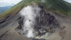
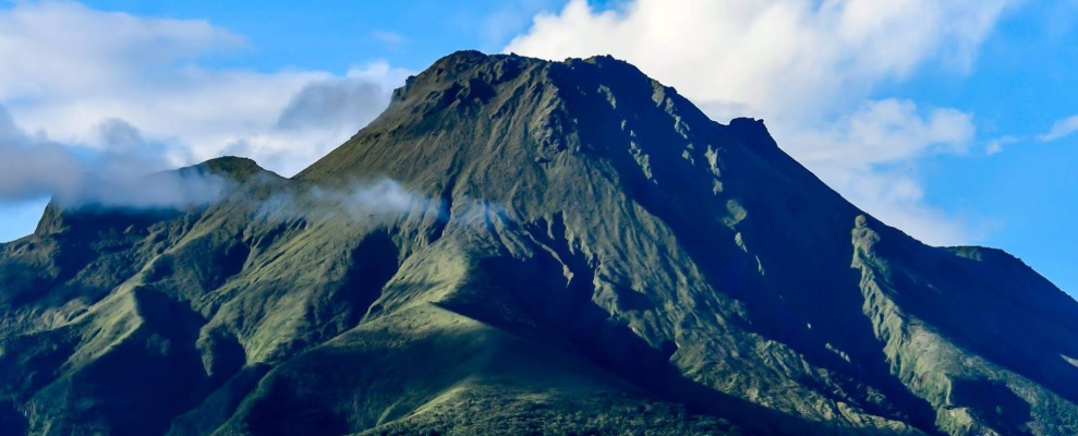
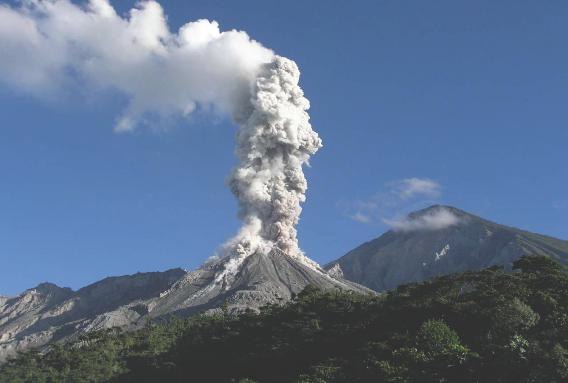
Guatemala , Santiaguito :
Activity type: Pelean
Morphology: Complex of dacitic domes
Geographical location: 14 ° 44 ’33 ˝ Latitude N; 91 ° 34’13˝ Longitude W
Height: 2500msnm
Atmospheric conditions: cloudy.
Wind: south-east
Precipitation: 3.9 mm.
Activity:
the atmospheric conditions did not allow to observe the activity of the Caliente dome. Seismic recording allows us to observe mostly weak explosions, which generate columns of gas and little ash, with probable heights of up to 3600 meters (11,811 feet), dispersing in a westerly direction and South West. Under these conditions, the degassing of the dome should reach heights of 100 to 500 meters above the Caliente dome. In addition, weak to moderate avalanches of boulders and ash are recorded, affecting the different sides of the Caliente dome. The path of these materials reaches the base of the dome and drops fine particles of ash on the volcanic perimeter. Due to the location for several months of the block lava flow on the dome of the Caliente dome, in a West-South-West direction, the appearance of more avalanches of boulders and ash in this same direction does not is not excluded, as well as possible pyroclastic avalanches with long range in different directions. For short periods, it is possible to hear sounds similar to those of an airplane turbine, due to the prolonged degassing of the Caliente dome. The recommendations of the special BESAN bulletin n ° 007-2021 remain in force.
Source : INSIVUMEH.
Photo : La Hora.
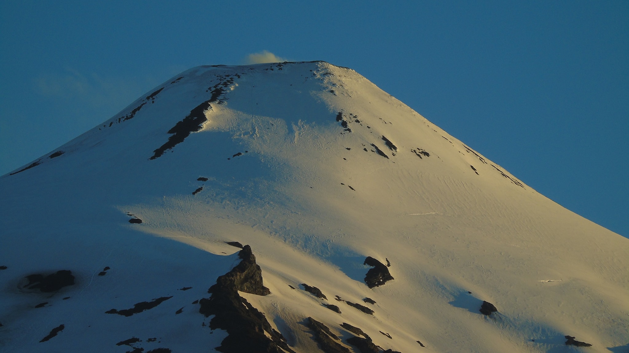
Chile , Villarica :
3,106 long-period (LP) type seismic events were classified, generally associated with fluid dynamics inside the volcanic building, with maximum reduced displacement (DR) values close to 3.3 cm2.
– During the period, 5 earthquakes classified as volcano-tectonic (VT) were recorded, associated with processes of rupture of rocky material. The highest energy event had a local magnitude (ML) of 1.1 and was located 9.6 km east-southeast (ESE) of the active crater, at a depth of 6, 1 km.
– The seismic signal of continuous tremor, also linked to the dynamics of the fluids inside the volcano, had fluctuations of the reduced displacement (DR) reaching average values close to 1.0 cm2.
. The spectral pattern of the seismic signal exhibited dominant frequencies preferably in the range of 1.2 to 1.8 Hz.
– The infrasound sensors installed near the volcano recorded acoustic signals throughout the evaluation period with maximum values of 5.9 Pa (reduced to 1 km as a reference).
– Concerning the surface activity observed from surveillance cameras, gas emissions were recorded with varying intensity, highlighting the column observed on January 20, which reached 1300 m above the level of the crater. In some special cases, a minimum pyroclast content was noted in the columns. In addition, when the weather conditions permitted, it was possible to observe a nocturnal incandescence.
– In the proximal and distal zone, mainly towards the East and the South-East, a marked dark coloration is observed on the snow, the origin of which is associated with the melting of the snow and the exposure of the deposits emitted during the September and October 2020. However, it is not excluded that passive ash emission contributions occurring mainly at night may contribute to the above observations.
– According to the data provided by 4 GNSS stations that help to measure the alterations in the surface deformation of the volcanic sectors, minor variations are observed during the period evaluated, which are not attributable to changes in the internal dynamics of the volcano .

In this period, multi-parameter monitoring records associated with volcanic activity have shown that gaseous emissions of varying intensity continue, linked to the dynamics of the lava lake which remains active and close to the surface, attested by the recording thermal radiation anomalies. The recording of continuous tremor and long period type earthquakes (LP) accompanied by infrasound signals, related to the dynamics of the lava lake in its shallow end, in accordance with the observation of night incandescence, is maintained. However, the impact radius is reduced from 1000 to 500 m, due to the sustained decrease in particle emissions at the crater level. We can deduce from the above that the system still has the capacity to spontaneously generate explosive activity around the crater, as well as the capacity to cause larger and unwanted emissions with current levels of volcanic activity. It is pointed out that the state of the open conduit and the behavior of the fluctuating lava lake located near the surface, can cause explosions that can affect the vicinity of the crater.
Due to the above, the alert is maintained at:
YELLOW TECHNICAL ALERT: Changes in the behavior of volcanic activity.
Source : Sernageomin .
Photos : Franco Vera , AngaritaVPhotography
Iceland , Reykjanes Penisula :
Roughly 1600 earthquakes were detected by the IMO¿s SIL seismic network this week, more then the previous week when around 1000 earthquakes were detected. The activity was mostly focused on the Reykjanes peninsula, where around 1100 earthquakes were detected, and in a swarm that started the 4th of February 10km NNE of Grímsey where around 230 earthquakes have been detected during the period.
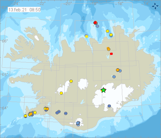
The largest earthquake of the week was M2.9 in Hofsjökull the 5th of February at 20:02. Around 70 earthquakes were detected in Mt. Hengill, there of 50 quakes in Húsmúli during the days of 4.-6th of February. Around 40 earthquakes were measured in Vatnajökull, around half the number that was detected the previous week. Sixteen earthquakes were detected in Bárðarbunga and four in Grímsvötn. One minor earthquake was measured in Hekla.
Source : Vedur is.