January 24 , 2021.
Italy , Stromboli :
PRESS RELEASE ON STROMBOLI’S ACTIVITY [UPDATE n. 5]
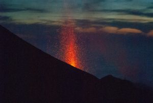
The National Institute of Geophysics and Volcanology, Osservatorio Etneo, announces that analysis of images from INGV-OE CCTV cameras shows that the slow decrease in effusive activity fueled by the lava overflow has continued in the area of the North crater. At the moment, the casting is no longer fed and cools down. There is also splash activity in the North Crater area. There are also no particular variations in the explosive strombolian activity of the areas of the North and Center South craters.
In the morning of January 23, 2021, the amplitude of the tremor slowly decreases.
The magnitude of explosive events remains low and the frequency is also similar to the previous period, with an event every 5-10 minutes.
The deformation data does not show significant changes.
PRESS RELEASE ON STROMBOLI’S ACTIVITY [UPDATE n. 6]
The National Institute of Geophysics and Volcanology, Osservatorio Etneo, announces that the analysis of the images of the cameras INGV-OE shows that the eruptive activity of Stromboli has not undergone any change compared to what was communicated in the update. day n.5. The projection activity continues in the North crater area and ordinary Strombolian activity is present in the North and Center South crater area.

The amplitude of the tremor remains virtually unchanged, but still at medium-low levels. The intensity (low) and frequency of explosive events, one event every 5 to 10 minutes, also remains substantially unchanged.
The deformation data does not show significant changes.
PRESS RELEASE ON STROMBOLI’S ACTIVITY [UPDATE n. 7]
The National Institute of Geophysics and Volcanology, Osservatorio Etneo, reports that the monitoring networks recorded the return of parameters to normal activity at 5:24 pm (4:24 pm UTC).
Further updates will be communicated shortly.
Source : INGV.
Source : INGV , Rosaria Cincotta .
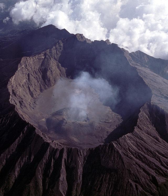
Indonesia , Raung :
VOLCANO OBSERVATORY NOTICE FOR AVIATION – VONA.
Issued : January 23 , 2021
Volcano : Raung (263340)
Current Aviation Colour Code : ORANGE
Previous Aviation Colour Code : orange
Source : Raung Volcano Observatory
Notice Number : 2021RAU07
Volcano Location : S 08 deg 07 min 30 sec E 114 deg 02 min 31 sec
Area : East java, Indonesia
Summit Elevation : 10662 FT (3332 M)
Volcanic Activity Summary :
On 23 januari 2021, eruption with volcanic ash cloud 09h20 UTC ( 16h20 Local Time ), Eruption and ash emission is continuing.
Volcanic Cloud Height :
Best estimate of ash-cloud top is around 12582 FT (3932 M) above sea level, may be higher than what can be observed clearly. Source of height data: ground observer.
Other Volcanic Cloud Information :
Ash emission moving to South-Southwest
Remarks :
Seismic activity is characterized by volcanic tremor.
Since January 20, 2021, non-harmonic discontinuous tremors have been recorded, followed by deep volcanic earthquakes, accompanied by changes in height and color of the gas / ash column of emissions. Thus, since January 21, 2021, the activity level of G. Raung has been raised to level II (Waspada).
The volcano was clearly visible until it was covered in fog. It is observed that the crater emits gray smoke with a medium to thick high at about 200 to 600 meters above the summit. The weather is sunny to rainy, with light to moderate winds to the east and south.
According to the seismographs of January 23, 2021, it was recorded:
• 27 earthquakes of emissions
• 295 non-harmonic tremors
• 2 distant tectonic earthquakes
Source : Magma Indonésie .
Photo : GVP
La Martinique , Montagne Pelée :
Weekly report on the activity of Mount Pelée for the period from January 15, 2021 to January 22, 2021.
The seismicity of volcanic origin has increased slightly over the past week. None of these earthquakes were felt by the population.
Between January 15, 2021 at 4 p.m. UT (local time + 4 hours) and January 22, 2021 at 4 p.m. UTC (local time + 4 hours), the OVSM recorded at least 36 volcano-tectonic earthquakes of magnitude less than or equal to 1 , located at a shallow depth within the volcanic edifice, between 100m below sea level and 1000m above sea level. This volcano-tectonic type seismicity associated with high frequency signals is linked to micro-fracturing in the volcanic edifice.
During phases of volcanic reactivation, it is common for periods of higher seismic activity to alternate with phases of weaker seismicity. The seismicity of volcanic origin remains however clearly above the average base level recorded between January 1, 2015 and April 2019 (date of the start of its increase).
The alert level remains at the yellow level: Vigilance.
Source : Direction de l’OVSM IPG.
Photo : rci.fm
Chile , Villarica :
3562 long period seismic events (LP) were classified, related to the dynamics of the fluids inside the volcanic building, with maximum reduced displacement values (DR) of 16.4 cm2.
– The continuous tremor seismic signal, also linked to the dynamics of the fluids inside the volcano, remained stable during this period, with a maximum DR value equal to 4.0 cm2. The characteristics of the seismic signal in its spectral content, were mainly in the range of 0.8 to 1.8 Hz.
– The volcanic seismicity of the VT type has not been classified during this fortnight.
– Regarding surface activity, a substantial decrease in the number of explosions and episodes with emission of volcanic ash is observed compared to the previous fortnights. The highest column height observed over the period was 700 m, its content preferably being gaseous. From the images provided by the surveillance cameras and when the weather conditions allowed, it was possible to observe a night incandescence and degassing with varying intensity.
– According to data obtained from 4 GNSS stations measuring the surface deformation of volcanic systems, very small variations are observed, with maximum values of 0.1 cm / month during the last period evaluated.
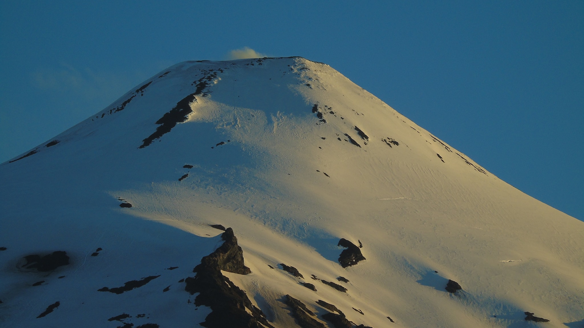
The data on sulfur dioxide (SO2) emissions obtained by means of the Differential Absorption Optical Spectroscopy Unit (DOAS), corresponding to the Tralco and Los Nevados stations, located 6 km to the east-south-east ( ESE) and 10 km East-North-East (ENE) of the active crater, respectively, presented an average value of 318 ± 81 t / d, with a maximum daily value of 789 t / d on January 12. Depending on the activity of the volcano, these values remain at levels considered low.
– Four anomalies were reported in the emissions of sulfur dioxide (SO2) into the atmosphere in the area near the volcanic building, on January 1, 2, 3 and 4, according to data published by the Tropospheric Monitoring Instrument (TROPOMI) .
– During the period, 6 thermal alerts were recorded in the area associated with the volcanic building, with a maximum power of 4 MW on January 14, according to data processed by Middle Infrared Observation of Volcanic Activity (MIROVA). Likewise, analysis of Sentinel 2-L2A satellite images reported 4 radiation anomalies in the area associated with the crater on January 3, 5, 8 and 13.
The antecedents of the multiparametric monitoring during this period make it possible to deduce a stability of the volcanic activity, the lava lake remains close to the surface with a continuous degassing at the level of the crater.
Source : Sernageomin .
Photo : Franco Vera
Hawaii , Kilauea :
19°25’16 » N 155°17’13 » W,
Summit Elevation 4091 ft (1247 m)
Current Volcano Alert Level: WATCH
Current Aviation Color Code: ORANGE
Activity Summary:
Kīlauea Volcano is erupting. Lava activity is confined to Halemaʻumaʻu with lava erupting from a vent on the northwest side of the crater. This morning, January 23, the lava lake was about 205 m (673 ft) deep and only the western half is active. SO2 emission rates remain elevated.
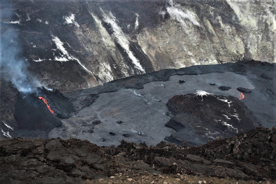
Between overcast and rainy weather, HVO field crews took this photo at 3:34 p.m. HST on January 21, 2021, from the south side of Kīlauea’s summit caldera. The photo shows Halema‘uma‘u’s active west vent, which overflowed its tubed-over lower half at 2:51 p.m. HST that afternoon. It then proceeded to create a pāhoehoe flow (the lighter gray in the photo with a orange, molten leading edge to the east) that flowed to the east around the large rafted island in the middle of the lava lake.
Summit Observations:
The most recent sulfur dioxide emission rate measurements from January 16, are about 2,500 t/d—lower than the emission rates from the pre-2018 lava lake (3,000–6,500 t/d). The summit tiltmeters are on an inflationary trend. Seismicity remains elevated but stable, with steady elevated tremor and a few minor earthquakes.
East Rift Zone Observations:
SO2 and H2S emissions from Puʻu ʻŌʻō were below instrumental detection levels when measured on January 7.
Halemaʻumaʻu lava lake Observations:
Low fountaining from the west vent supplies a channel of lava which is pouring into the lava lake within Halema‘uma‘u crater. At the moment effusion rates correlate, positively, with RSAM activity; higher RSAM values, greater lava effusion.

The active western half of the lava lake was about 205 m (673 ft) deep this morning (Jan. 22) while the stagnant eastern half of the lake remains several meters (yards) lower. The whole lava lake—including the stagnant eastern half—is perched/elevated above the crust between the perched lake and the crater wall. The east side is elevated ~1 m, and the west 4 m, above the solidified lava crust adjacent to the crater wall.
All the islands have been stationary over the past week, frozen in the eastern stagnant portion of the lava lake. The dimensions of the main island remained unchanged with its edges several meters (yards) above the lake surface. On January 22, the south end of the island was measured at 12 m (39 ft) above the lava lake surface, with the highest point at 23 m (75 ft) above the surface.
Source : HVO.
Photos : USGS / D. Downs, Bruce Omori .