December 29 , 2020.
Hawaii , Kilauea :
19°25’16 » N 155°17’13 » W,
Summit Elevation 4091 ft (1247 m)
Current Volcano Alert Level: WATCH
Current Aviation Color Code: ORANGE
Activity Summary:
Lava activity is confined to Halemaʻumaʻu with lava erupting from a vent on the northwest side of the crater. As of 10 pm yesterday (Dec. 27), the lava lake was 177 m (581 ft) deep with a narrow black ledge around it. Reduced SO2 emissions were measured yesterday morning.
Summit Observations:
Preliminary analysis of sulfur dioxide emission rates measured yesterday morning (Dec. 27) show that the rates are still about 5,500 tonnes/day–lower than the 40,000 t/d for the first three days of the eruption, but still elevated. Summit tiltmeters continued to record weak inflationary tilt. Seismicity remained elevated but stable, with steady elevated tremor and a few minor earthquakes.
HVO field crews observed the continuing eruption in Halema‘uma‘u at Kīlauea’s early this morning. Overnight, the western vent in the wall of Halema‘uma‘u continued to erupt, and the northern/eastern vent remained inactive. At approximately 4:30 a.m. HST today (Dec. 28), HVO field crews measured the lava lake as 179 m (586 ft) deep. Note that initial values reported here were incorrect; values reported here were corrected as of 9:30 a.m. HST.
East Rift Zone Observations:
Geodetic monitors also indicate that the upper portion of the East Rift Zone contracted while the summit deflated. This was associated with magma withdrawal to feed the summit vents. There is no seismic or deformation data to indicate that magma is moving into either of Kīlauea’s rift zones.
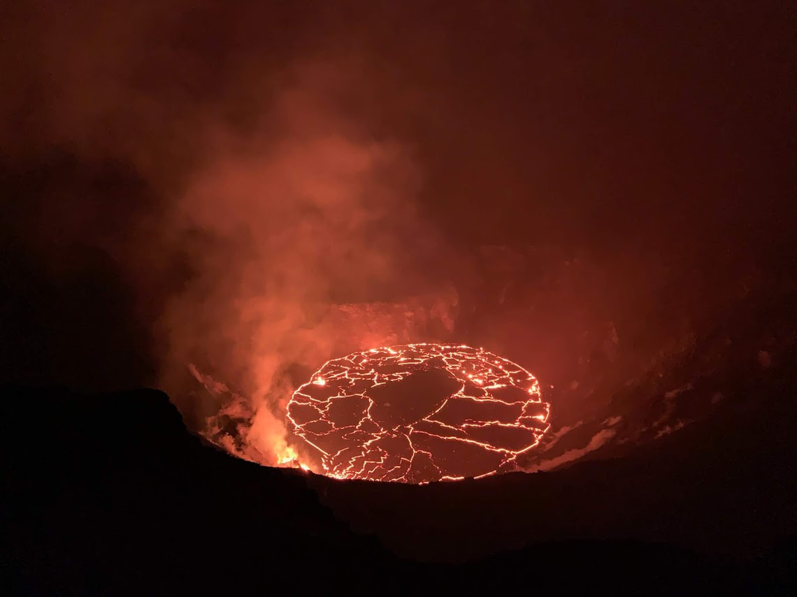
Halemaʻumaʻu lava lake Observations:
The west vent continued erupting lava into a lava lake within Halemaʻumaʻu crater with two or three narrow channels visible this morning.
The lava lake within Halemaʻumaʻu crater has changed little in the past day and was about 177 m (581 ft) deep and about 408 m (1,340 ft) below the south Halemaʻumaʻu rim as of this morning (Dec. 28). The lake volume was about 21.5 million cubic meters (28 million cubic yards or 4.9 billion gallons). The most recent thermal map (Dec. 26) provided the lake dimensions as 790 by 520 m (864 by 569 yds) for a total area of 29 ha (72 acres). The narrow (10-30 m or 11-22 yd) ledge around the lake was about 1-2 m (1-2 yds) above the active lake surface suggesting that the lake surface dropped over the past 2 days
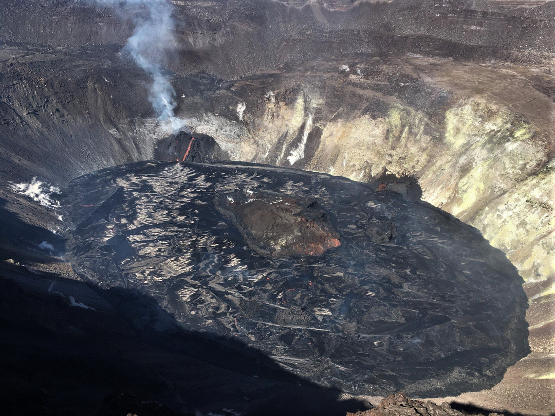
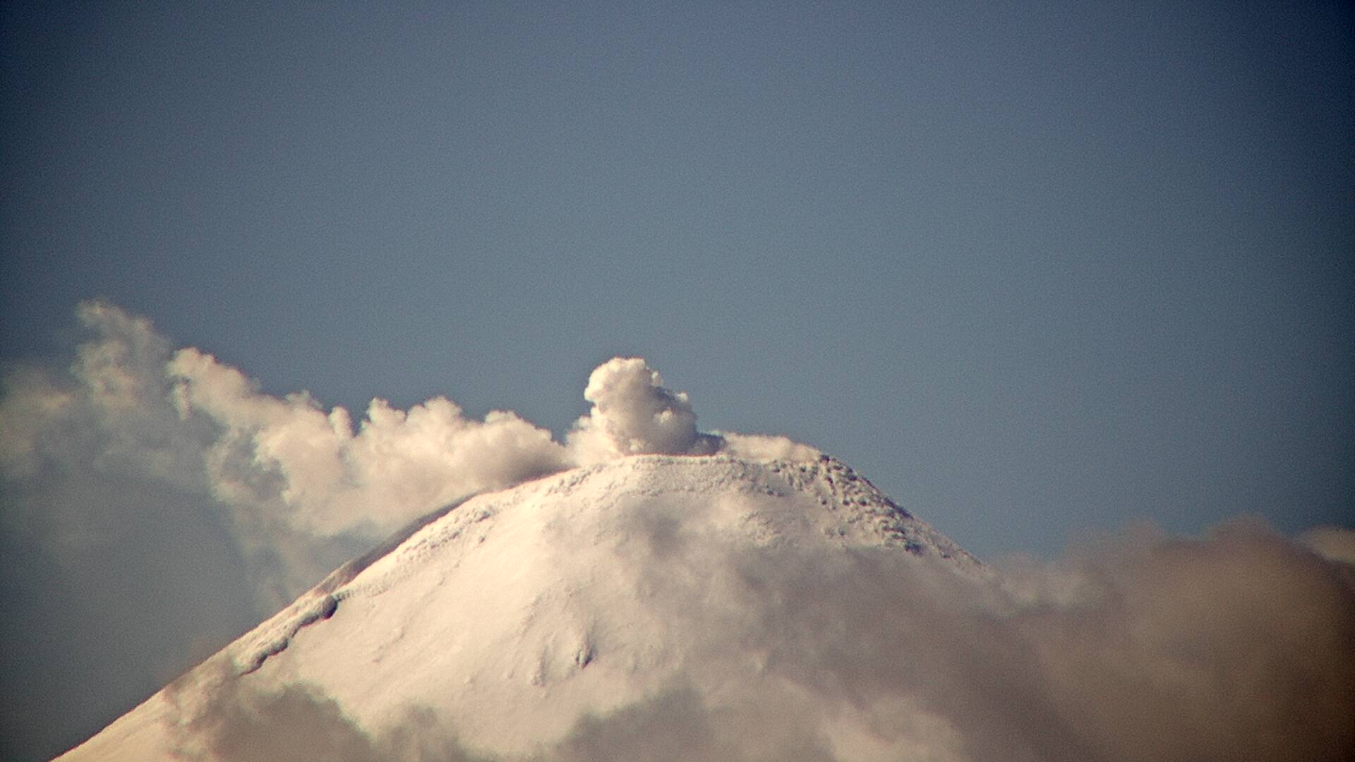
Aerial photograph of Halema‘uma‘u crater, within Kīlauea Volcano, taken from an HVO overflight today (December 28) at approximately 11:00 a.m. HST. There have been no major changes in eruptive activity since this morning and the western vent remains active. The SO2 emissions remain elevated at about 5,500 tonnes/day measured yesterday morning (December 27).
Over the past day, the main island of cooler, solidified lava floating in the lava lake drifted slowly westward in the lake and measured about 225 m (740 ft) in length and 110 m (360 ft) in width based on the Dec. 26 thermal map (https://www.usgs.gov/maps/december-26-2020-k-lauea-summit-eruption-thermal-map). This morning, the island began drifting back to the east. Measurements yesterday evening (Dec. 27) show that the island surface was about 6 m (20 ft) above the lake surface.
Hazard Analysis:
High levels of volcanic gas, rockfalls, explosions, and volcanic glass particles are the primary hazards of concern regarding this new activity at Kīlauea’s summit. Large amounts of volcanic gas—primarily water vapor (H2O), carbon dioxide (CO2), and sulfur dioxide (SO2)—are continuously released during eruptions of Kīlauea Volcano. As SO2 is released from the summit during this new eruption, it will react in the atmosphere with oxygen, sunlight, moisture, and other gases and particles, and within hours to days, convert to fine particles. The particles scatter sunlight and cause the visible haze that has been observed downwind of Kīlauea, known as vog (volcanic smog), during previous summit eruptions. Vog creates the potential for airborne health hazards to residents and visitors, damages agricultural crops and other plants, and affects livestock operations.
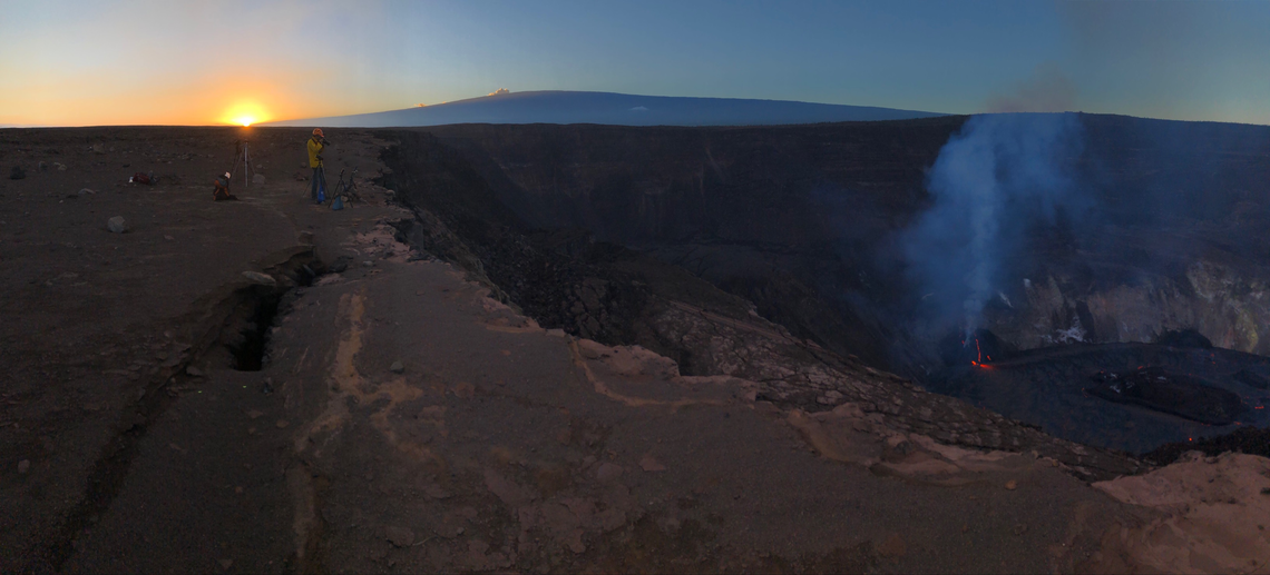
The eruption with Halema‘uma‘u continues on the evening of December 28, 2020. This photo shows an HVO scientist making observations of Kīlauea’s summit lava lake, with Mauna Loa in the background. HVO scientists have been monitoring the eruption from within an area of Hawai‘i Volcanoes National Park that remains closed to the public for safety reasons. No major changes were observed at the eruption site today: the west vent remains active (though slightly diminished in vigor) and continues to feed the lava lake.
Rockfalls and minor explosions, such as the ones that occurred during the 2008–2018 lava lake eruption at Kīlauea summit, may occur suddenly and without warning. This underscores the extremely hazardous nature of Kīlauea caldera rim surrounding Halemaʻumaʻu crater, an area that has been closed to the public since late 2007. Pele’s hair and other lightweight volcanic glass fragments from the lava fountains within Halemaʻumaʻu will fall downwind of the fissure vents and lava lake, dusting the ground within a few hundred meters (yards) of the vent. High winds may waft lighter particles to greater distances. Residents are urged to minimize exposure to these volcanic particles, which can cause skin and eye irritation similar to volcanic ash.
Source : HVO.
Photos : USGS photo by D. Downs. USGS photo taken by M. Patrick , USGS photo by B. Carr.
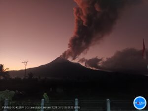
Indonesia , Sinabung :
VOLCANO OBSERVATORY NOTICE FOR AVIATION – VONA .
Issued : December 28 , 2020
Volcano : Sinabung (261080)
Current Aviation Colour Code : ORANGE
Previous Aviation Colour Code : orange
Source : Sinabung Volcano Observatory
Notice Number : 2020SIN37
Volcano Location : N 03 deg 10 min 12 sec E 98 deg 23 min 31 sec
Area : North Sumatra, Indonesia
Summit Elevation : 7872 FT (2460 M)
Volcanic Activity Summary :
Eruption with volcanic ash cloud at 10h51 UTC (17h51 local).
Volcanic Cloud Height :
Best estimate of ash-cloud top is around 9472 FT (2960 M) above sea level, may be higher than what can be observed clearly. Source of height data: ground observer.
Other Volcanic Cloud Information :
Ash-cloud moving to south
Remarks :
Seismic activity is characterized by eruption volcanic event
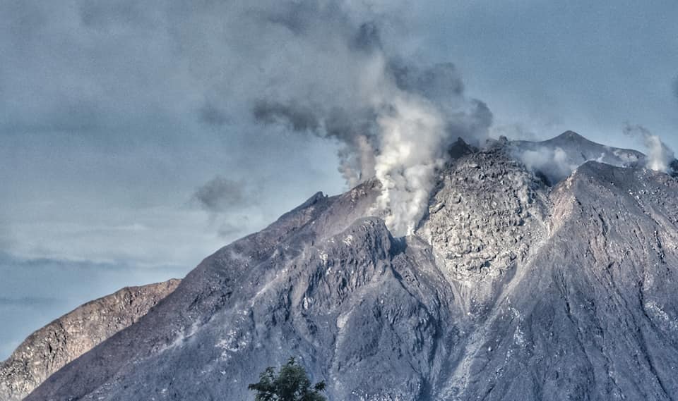
The activity level has been at level III (SIAGA) since May 20, 2019 at 10:00 a.m. WIB. Mount Sinabung (2460 m above sea level) has been erupting since 2013. The last eruption occurred on December 13, 2020, the height of the eruption column not being observed. The volcano was clearly visible until it was covered in fog. The crater emits white smoke with a strong thickness of about 50 to 300 meters above the summit. The weather is cloudy to rainy, with light to moderate winds to the east, south-east, south and west.
According to the seismographs of December 28, 2020, it was recorded:
2 eruption earthquakes
96 avalanche earthquakes
10 emission earthquakes
22 low frequency earthquakes
2 hybrid / multi-phase earthquakes
1 local tectonic earthquake
1 distant tectonic earthquake.
Source : Magma Indonésie , PVMBG.
Photo : Nachelle Homestay
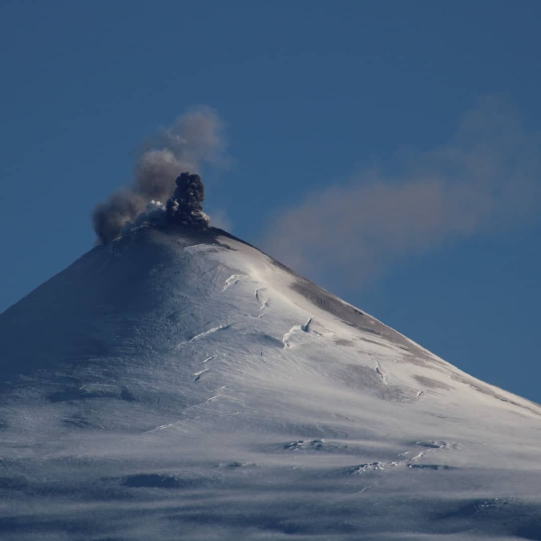
Chile , Villarica :
During the period, 8 seismic events classified as VT type were recorded, associated with fragile rupture processes in volcanic systems. The most energetic event had a local magnitude (ML) of 1.7, located 5.8 km east-south-east (ESE), with a depth of 5.2 km.
– 1302 seismic events of the long period (LP) type were classified, related to the dynamics of the fluids inside the volcanic building, with maximum reduced displacement values (DR) of 3.8 cm2.
– The continuous tremor seismic signal, also linked to the dynamics of the fluids inside the volcano, remained stable during this period, with a maximum DR value equal to 5.0 cm2
. The characteristics of the seismic signal in its spectral content, were mainly in the range of 0.8 to 1.8 Hz.
– Concerning surface activity, there is a decrease in volcanic ash emission episodes compared to the previous fortnight, the highest recorded height being 640 m. From the images provided by the surveillance cameras and when the weather conditions permitted, it was possible to observe a nocturnal incandescence and the presence of a column of whitish gas.
– According to the analysis of Sentinel 2-L2a, Pléiades and SkySat satellite images for remote monitoring, deposits of pyroclastic projections have been identified within a radius of 500 m. However, on the basis of the information gathered during an overflight, ballistic blocks and / or pyroclasts with a maximum diameter of 20 cm were identified at a distance of 800 m.
– According to data obtained from 2 GNSS stations that measure the surface deformation of volcanic systems, minor variations are observed during the last period evaluated, which are not attributable to changes in the internal dynamics of the volcano.
– During the period, 3 thermal alerts were recorded in the area associated with the volcanic building, with a maximum power of less than 1 MW, according to data processed by Middle Infrared Observation of Volcanic Activity (MIROVA) and by thermal monitoring in near real-time global hot-spots (MODVOLC). Similarly, analysis of Sentinel 2-L2A satellite images reported 3 radiation anomalies in the area associated with the crater, on December 1, 4 and 9.
During the last period, the monitoring parameters allow inference that the lava lake remains active and close to the surface, with the recording of small pulses of gas and ash and the recording of thermal radiation anomalies in satellite images (Sentinel). On December 5 at 6:44 p.m. HL, the volcanic seismicity, mainly the tremor, presented a sudden but transient decrease, simultaneously registering an impulse with emission of gas and particles, accompanied by a ballistics projected around the edge of the crater; after this episode, the seismicity gradually and steadily returned to normal levels. Likewise, the surface activity was kept low, with passive degassing of low height. In addition to the above, very low energy acoustic signals were recorded. By the end of the fortnight, the seismicity returned to levels present before the mentioned decline. On the other hand and according to the observations obtained during the overflight, volcanic products up to 20 cm were emitted outside the crater up to a distance of 800 m, suggesting ranges greater than those initially calculated. Therefore, it is inferred that the system still has the capacity to spontaneously generate activity with ballistic emissions around the crater, as well as the capacity to cause larger and unwanted emissions with current levels of volcanic activity. It is pointed out that the state of the open conduit and the behavior of the fluctuating lava lake located near the surface, can cause explosions that can affect the vicinity of the crater.
Due to the above, the alert is maintained at:
YELLOW TECHNICAL ALERT: Changes in the behavior of volcanic activity.
Observation:
Due to the discovery of rolled blocks and / or ballistic pyroclasts with a maximum diameter of 20 cm at a distance of 800 m from the active crater, it was defined to increase the radius of potential damage to 1000 m around the crater. active, in case of minor explosions.
Source : Sernageomin.
Photos : volcanologia en chile, Segemar.
Colombia , Nevado del Ruiz :
Subject: Bulletin of extraordinary activity of the Nevado del Ruiz volcano. The level of yellow activity is maintained at level III: changes in the behavior of volcanic activity.
Regarding the monitoring of the activity of the Nevado del Ruiz volcano, the COLOMBIAN GEOLOGICAL SERVICE reports that:
Since December 28, 2020 at 09:42 a.m. (local time), there has been a significant increase in volcano-tectonic seismic activity, associated with the fracturing of the rock within the volcanic building, located in the sector at North of the volcanic building, 0.7 km average distance from the Arenas crater. The recording of a volcano-tectonic earthquake that occurred at 09:42 (local time) with a magnitude of 3.6 ML (local magnitude), at a depth of 3.0 km, stands out. This earthquake was reported as felt by officials of the Los Nevados National Natural Park and by residents of the municipalities of Manizales and Villamaría.
The Nevado del Ruiz volcano continues at the yellow activity level. It is not excluded that there is an activity that could indicate an acceleration of the process, implying a greater instability of the volcano and consequently changes in its level of activity. Although the instability of the volcano has lasted for more than eight years, it is of vital importance not to get used to its behavior and to be attentive to the official information that will be published by the Servicio Geológico Colombiano. The authorities of the departments of Caldas and Tolima are called upon to take extreme measures focused both on the processes of risk reduction and disaster management, as well as on the preparatory measures for the future activity of the Nevado del Ruiz volcano.
Source : Sernageomin .
Photo : Diana M Bustamante.
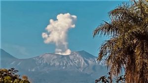
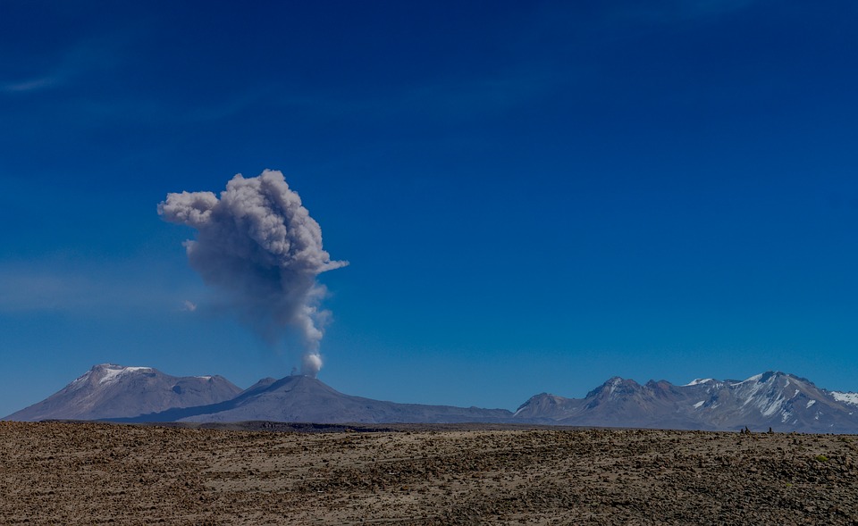
Peru , Sabancaya :
Analysis period: from December 21 to December 27, 2020, Arequipa, December 28, 2020.
Alert level: ORANGE
The Geophysical Institute of Peru (IGP) reports that the eruptive activity of the Sabancaya volcano remains at moderate levels, that is, with the continuous recording of explosions with columns of ash and gas up to 3 km of altitude above the summit of the volcano and their consecutive dispersion. It has been reported the presence of a second lava dome, visible in the crater of the volcano. Therefore, for the following days, no significant change is expected in the eruptive activity.
The IGP recorded and analyzed the occurrence of 1664 earthquakes of volcanic origin, associated with the circulation of magmatic fluids inside the Sabancaya volcano. An average of 40 explosions were recorded daily of low to medium intensity. During this period, Volcano-Tectonic (VT) earthquakes were located mainly in the North-East of Sabancaya and presented magnitudes between M1.2 and M3.5. The most representative earthquake (M3.5) was recorded on December 26 at 07:19 a.m., 15 km north-east of Sabancaya and 9 km deep.
The monitoring of the deformation of the volcanic structure using GNSS techniques (processed with fast orbits) does not present any significant anomalies. However, in general, an inflation process has been observed in the south-eastern sector of Sabancaya and in the north sector (Hualca Hualca volcano). Visual surveillance made it possible to identify columns of gas and ash up to 3 km altitude above the summit of the volcano, which were scattered towards the northwest, west and southwest sectors of Sabancaya. Satellite monitoring has identified the presence of a thermal anomaly with a value of 1 MW, associated with the presence of a new lava dome on the surface of the volcano’s crater.
RECOMMENDATIONS
• Keep the volcanic alert level in orange.
• Do not approach within a radius of less than 12 km from the crater.
Source : IGP.
Photo : Pixabay.