December 15 , 2020.
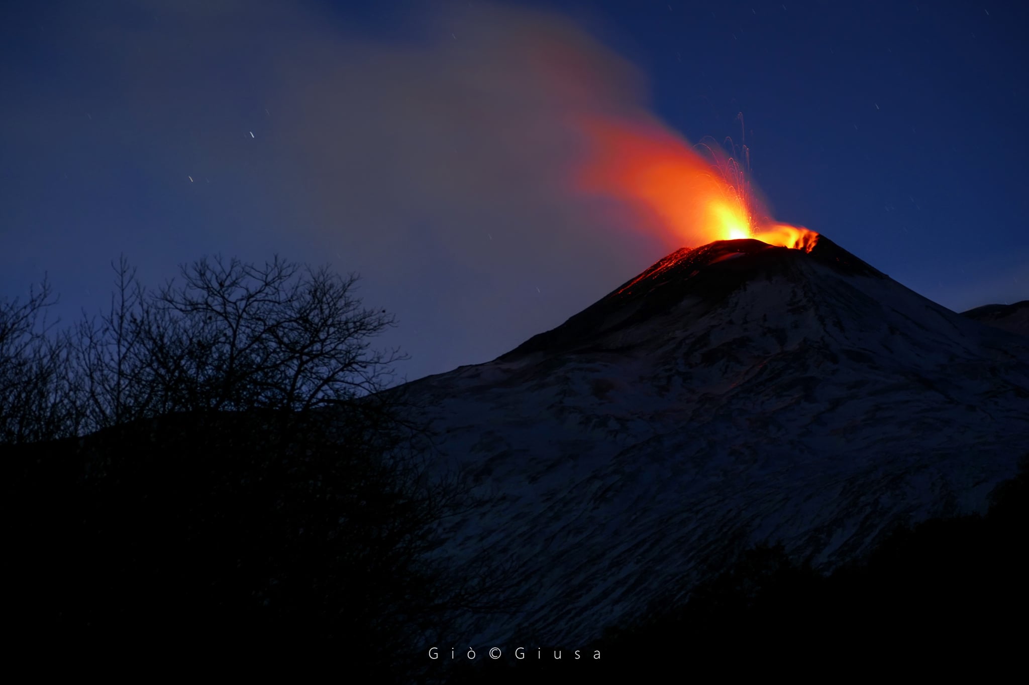
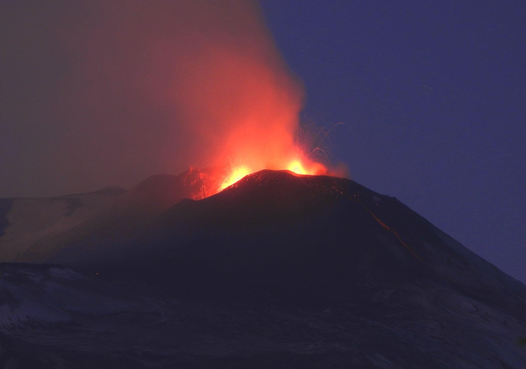
Italy / Sicily , Etna :
ETNA COMMUNICATION [UPDATE n. 94]
The National Institute of Geophysics and Volcanology, Osservatorio Etneo, announces that according to surveillance cameras, a further decrease in explosive activity at the Southeast Crater is observed compared to the last update no. 93, and for the moment the activity remains confined in the crater. Explosive activity produces occasional, weak ash emissions which are quickly dispersed in the summit area. According to camera footage, the lava flow that has spread to the southwest appears to be cooling.
SO2 flux indicates average values and below the attention threshold. As regards the seismic signals, their state is almost stationary.
The average amplitude of the volcanic tremor still shows modest fluctuations, with values that remain at the high level. The position of the center of gravity of the sources of the tremor seems to be located in the area of the Sus-Est crater. The infrasonic activity continues to be sustained: the number and amplitude of infrasonic events remain at a high level, especially during the phases of increasing the amplitude of the tremor.
The GPS and inclinometric networks show no significant deformation in progress.
ETNA COMMUNICATION [UPDATE n. 95]
The National Institute of Geophysics and Volcanology, Osservatorio Etneo, announces that an inspection is underway in the summit area carried out by INGV staff to assess the state of activity and the eruptive theater described in the updates. previous days. The surveys carried out confirm an intracrater Strombolian activity of variable intensity at the level of the South-East crater and the cooling of the South-West lava flow following the cessation of supply by the eruptive vent. From 12:52 UTC, the explosive activity produced an eruptive cloud that dispersed southward to reach a maximum altitude of about 4 km above sea level.
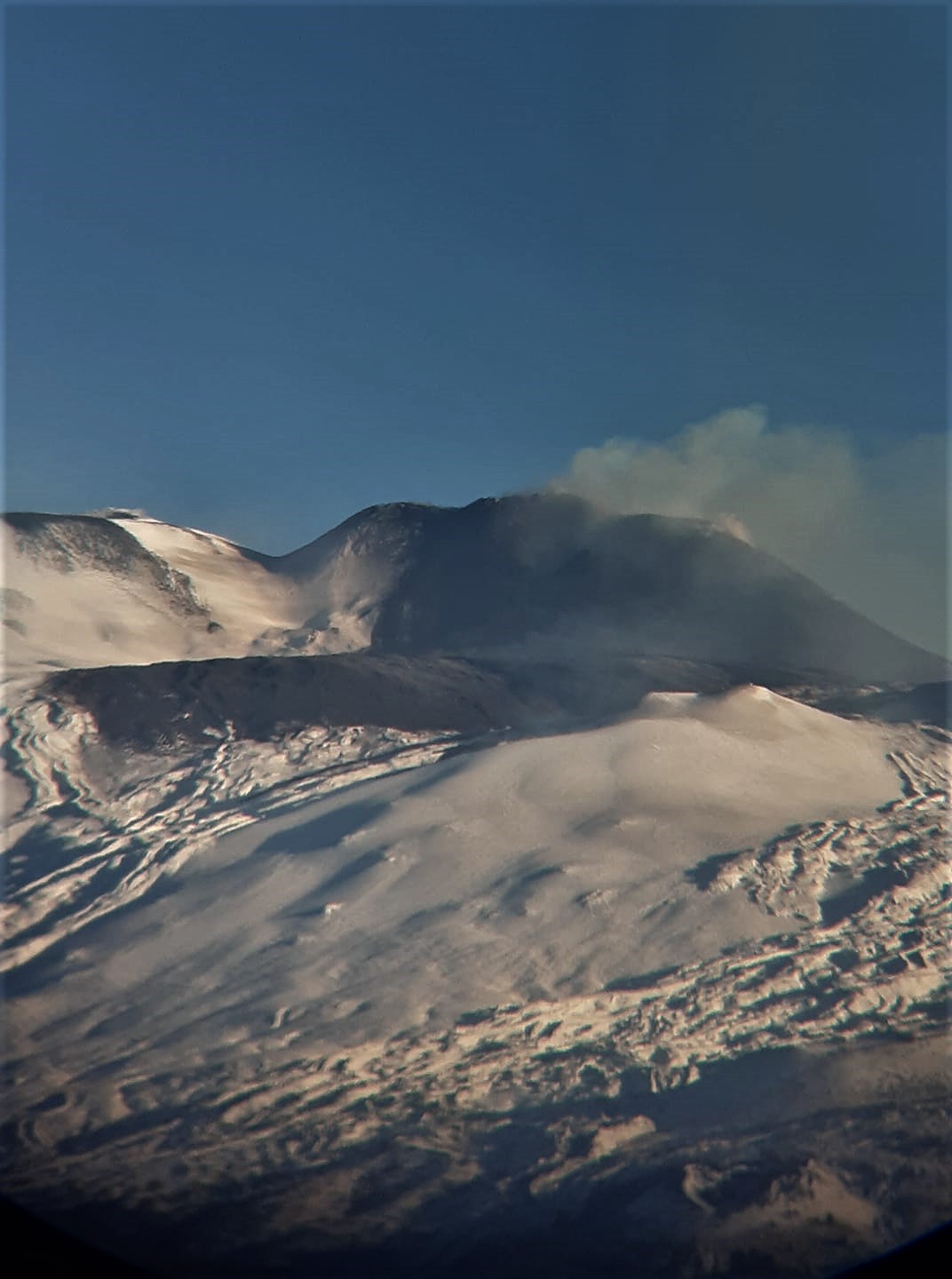
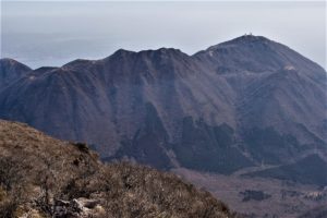
In addition, significant morphological changes on the cone of the Southeast crater were observed from field surveys, in particular the absence of the southwestern part of the crater due to collapse phenomena. The latter on the night of December 13 generated the three pyroclastic flows described in the update of Etna n. 93. The second pyroclastic flow at 22:16 UTC, which was the most energetic, traveled a distance of about 2 km, overcoming Mount Frumento Supino to the west.
Regarding seismic signals, there are no significant changes compared to what was communicated in the last update no. 94
The GPS and inclinometric networks show no significant deformation in progress.
ETNA PRESS RELEASE [UPDATE n. 96]
The National Institute of Geophysics and Volcanology, Osservatorio Etneo, reports that Strombolian activity continues with varying intensity in the Southeast Crater from at least two vents, the most easterly of which produces a jet continuous shreds of lava beyond the edge of the crater. In addition, a discontinuous explosive activity is observed in the crater of Voragine.
From the more detailed observation of the eruptive theater carried out during the inspection carried out today by INGV staff (see Etna Update Notice n.95), the collapse of the southwestern part of the crater cone Southeast is confirmed. This collapse generated the three pyroclastic flows described in previous press releases.
It was also possible to observe that the two lava flows (see Etna Update Notice n.95) were generated from the base of the South-East crater (South flow) and from its lower South-West flank (flow of Southwest lava). In particular, the southern flow widened at the base of the Southeast crater forming at least four main lobes which stopped on the plateau between the base of the Southeast crater and the Barbagallo Mountains. One of the lobes continued to extend in a south-southwest direction, then stopped between Mount Barbagallo and Mount Frumento Supino. The southwest lava flow sets in in the same direction as the southern lava flow, reaching and partially bypassing Mount Frumento Supino to the west, where its front has widened and thickened. In general, from the images recorded during the inspection, it can be seen that the southern flow is considerably narrower than the other, especially near its front. The southwest lava flow, on the other hand, covers a much larger area from the area proximal to the mouth. Upon inspection, the two lava flows were no longer fed and were cooling.
Regarding the explosive activity of the Southeast Crater, as stated in the previous press release, it was intra-crater and produced sporadic rumblings and ash emissions which were quickly dispersed in the summit area until at 12:52 UTC, when the most visible ash emission began. This was produced by an explosive vent located in the eastern sector of the Southeast Crater. Finally, INGV staff in the field also observed two emissions of light ash (at approximately 11:35 and 11:40 UTC) from the Voragine crater which quickly dispersed in the summit area.
From a seismic point of view, the volcanic tremor, even in the last hours, has retained the same characteristics that have impacted much of the day today (see Updates n.94 and n.95). Relative to its average amplitude, the fluctuations in values are still modest, which remain at a high level; the position of the center of gravity of its sources is still located in the area of the Southeast crater. The infrasonic activity continues to be sustained: the number and magnitude of infrasonic events remain at a high level, especially during the phases of increasing tremor magnitude.
The soil deformation data does not show significant variations.
Further updates will be communicated shortly.
Source : INGV.
Read the articles : http://www.ct.ingv.it/index.php/monitoraggio-e-sorveglianza/prodotti-del-monitoraggio/comunicati-attivita-vulcanica
Source : INGV / Marco Neri ,Gio Giusa , Rosalina Corsaro , INGV .
Vidéo : INGV /Boris Behncke.
Peru , Sabancaya :
Analysis period: from December 07 to December 13, 2020, Arequipa, December 14, 2020.
Alert level: ORANGE
The Geophysical Institute of Peru (IGP) reports that the eruptive activity of the Sabancaya volcano remains at moderate levels, that is, with the continuous recording of explosions with columns of ash and gas up to 2.8 km altitude above the summit of the volcano and their consecutive dispersion. It has been reported the presence of a second lava dome, visible in the crater of the volcano. Therefore, for the following days, no significant change is expected in the eruptive activity.
The IGP recorded and analyzed the occurrence of 894 earthquakes of volcanic origin, associated with the circulation of magmatic fluids inside the Sabancaya volcano. An average of 54 explosions were recorded daily of low to medium intensity. During this period, the Volcano-Tectonic (VT) earthquakes were located mainly in the North-East of Sabancaya and presented magnitudes between M2.3 and M3.4. The most representative earthquake (M3.4) was recorded on December 13 at 9:14 a.m., 7 km northeast of Sabancaya and 8 km deep.

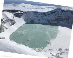
The monitoring of the deformation of the volcanic structure using GNSS techniques (processed with fast orbits) does not present any significant anomalies. However, in general, an inflation process has been observed in the south-eastern sector of Sabancaya and the north sector (Hualca Hualca volcano). Visual surveillance made it possible to identify columns of gas and ash up to 2.8 km altitude above the summit of the volcano, which were scattered towards the North-West, West and South-West sectors of Sabancaya. Satellite monitoring has identified the presence of 8 thermal anomalies with values between 1 MW and 22 MW, associated with the presence of a new lava dome on the surface of the volcano crater, formed in November 2020.
RECOMMENDATIONS
• Keep the volcanic alert level in orange.
• Do not approach within a radius of less than 12 km from the crater.
Source : IGP.
Photo : Ingemmet .
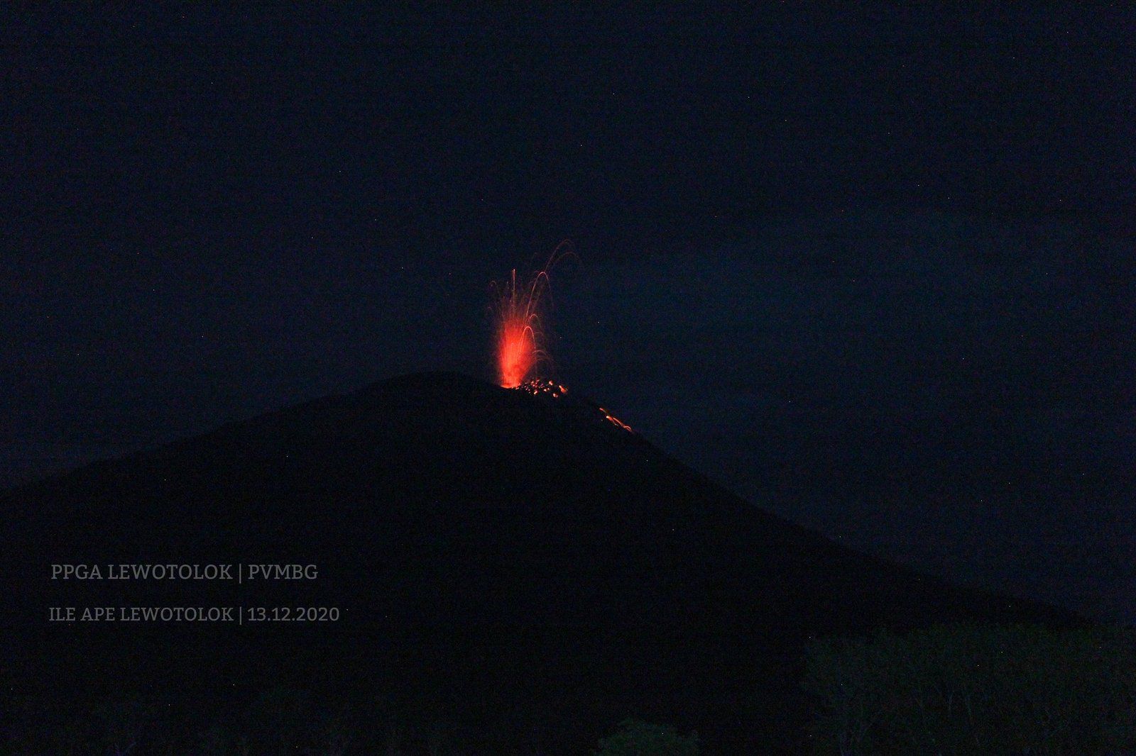
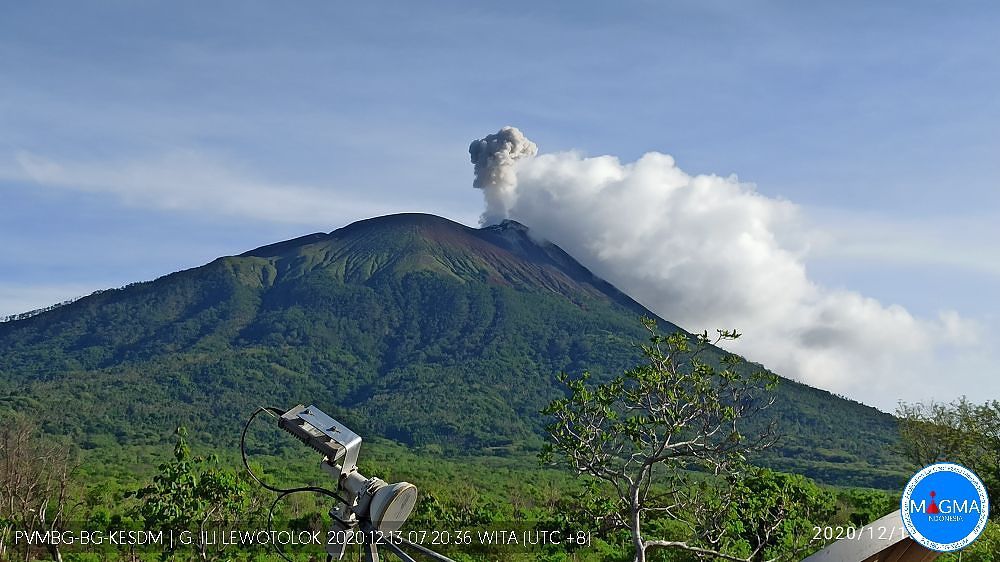
Indonesia , Lewotolok :
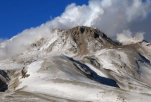
Level of activity at level III (SIAGA) since November 29, 2020 at 1:00 p.m. The increase in activity status was prompted by an eruption on November 27, 2020 at 5:57 a.m. The height of the ash column was observed gray / black, 500 m above the peak (± 1923 m above sea level) with a strong intensity, oriented towards the west. This eruption was recorded on a seismogram with a maximum amplitude of 34 mm and the duration of the eruption was not clearly observed because it was followed by continuous tremors.
The results of the last day’s monitoring, the volcano was clearly visible until it was foggy. White, gray and black smoke emissions were observed above the summit with moderate to high intensity and a height of about 200 to 1000 meters above the summit. The weather is sunny to cloudy, the winds are light to moderate in the east and west. The air temperature is around 26-29 ° C.
According to the seismographs of December 14, 2020, it was recorded:
61 eruption / explosion earthquakes
90 emissions earthquake
8 Harmonic tremors
36 non-harmonic tremors
1 distant tectonic earthquake
Amplitude of continuous tremors: 1 to 3 mm (dominant value 1 mm)
Recommendations:
Communities around G. Ili Lewotolok and visitors / climbers / tourists are recommended not to practice activities within a radius of 4 km around the summit crater.
Considering the potential danger of volcanic ash which can cause acute respiratory problems (ISPA) and other health problems, people around G. Ili Lewotolok should prepare nasal and mouth masks and other equipment to protect their eyes. and their skin.
Source : PVMBG.
Photos : PVMBG , Magma Indonésie.
Russia / Kurile Islands , Ebeko :
VOLCANO OBSERVATORY NOTICE FOR AVIATION (VONA).
Issued: December 15 , 2020
Volcano: Ebeko (CAVW #290380)
Current aviation colour code: ORANGE
Previous aviation colour code: orange
Source: KVERT
Notice Number: 2020-240
Volcano Location: N 50 deg 41 min E 156 deg 0 min
Area: Northern Kuriles, Russia
Summit Elevation: 3791.68 ft (1156 m)
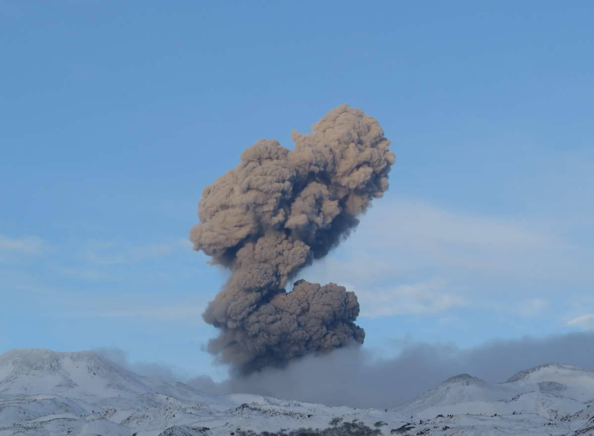
Volcanic Activity Summary:
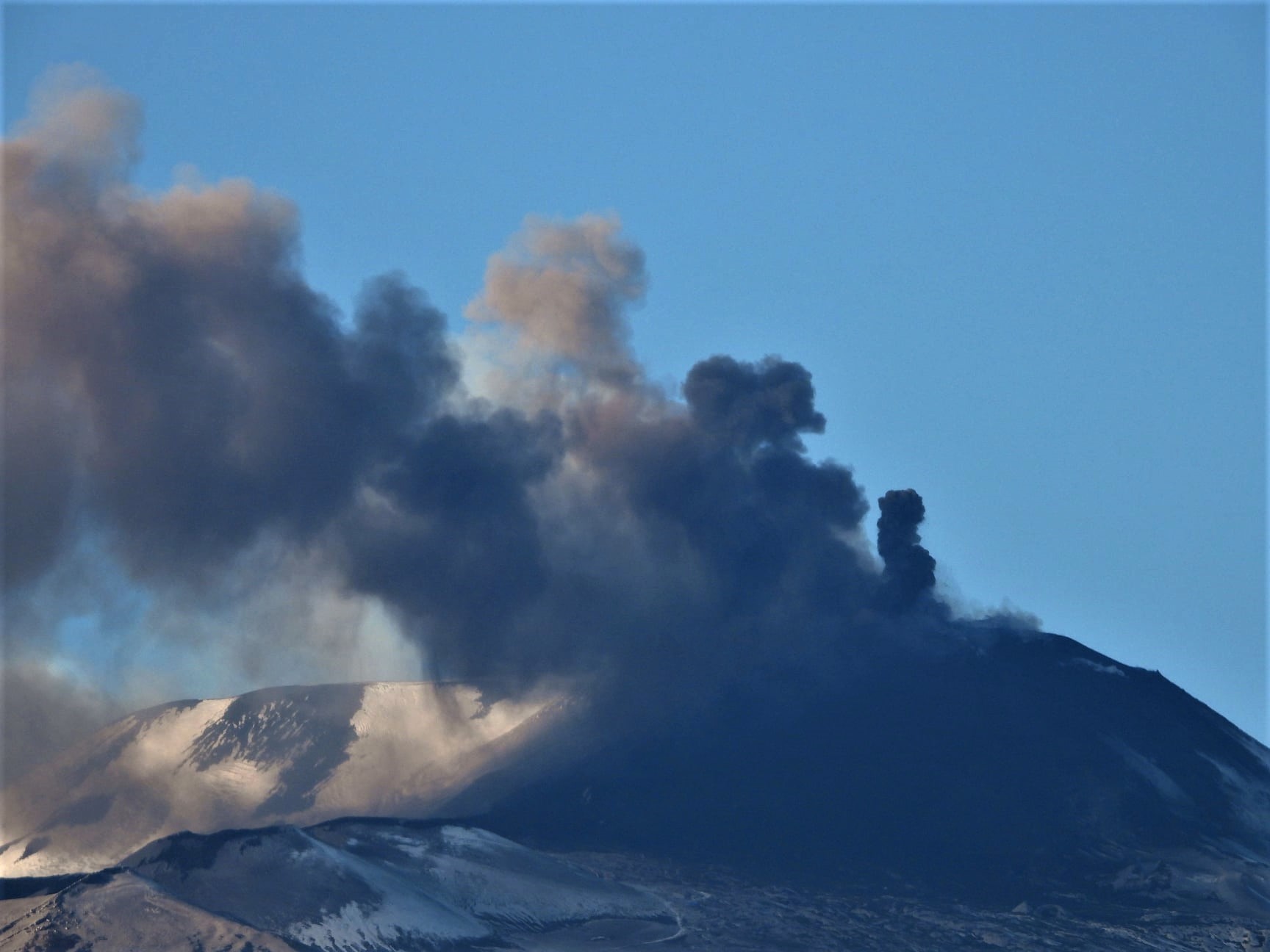
A moderate eruptive activity of the volcano continues. According to visual data by volcanologists from Severo-Kurilsk, explosion sent ash up to 2.4 km a.s.l., an ash cloud is drifting to the north of the volcano.
This activity of the volcano continues. Ash explosions up to 19,700 ft (6 km) a.s.l. could occur at any time. Ongoing activity could affect low-flying aircraft and airport of Severo-Kurilsk.
Volcanic cloud height:
7872 ft (2400 m) AMSL Time and method of ash plume/cloud height determination: 20201215/0213Z – Visual data
Other volcanic cloud information:
Distance of ash plume/cloud of the volcano: 3 mi (5 km)
Direction of drift of ash plume/cloud of the volcano: NNE / azimuth 15 deg
Time and method of ash plume/cloud determination: 20201215/0215Z – Visual data
Source : Kvert.
Photo : S. Lakomov , 29/11/2020.