May 25 , 2020.
Russia / Kuriles Islands , Ebeko :
VOLCANO OBSERVATORY NOTICE FOR AVIATION (VONA).
Issued: May 25 , 2020 .
Volcano: Ebeko (CAVW #290380)
Current aviation colour code: ORANGE
Previous aviation colour code: orange
Source: KVERT
Notice Number: 2020-99
Volcano Location: N 50 deg 41 min E 156 deg 0 min
Area: Northern Kuriles, Russia
Summit Elevation: 3791.68 ft (1156 m)
https://www.facebook.com/kbgsras/videos/675412026362223/
Volcanic Activity Summary:
A moderate eruptive activity of the volcano continues. According to visual data by volcanologists from Severo-Kurilsk, explosion sent ash up to 1.9 km a.s.l., an ash cloud is drifting to the north-east of the volcano.
A moderate eruptive activity of the volcano continues. Ash explosions up to 19,700 ft (6 km) a.s.l. could occur at any time. Ongoing activity could affect low-flying aircraft and airport of Severo-Kurilsk.
Volcanic cloud height:
5904-6232 ft (1800-1900 m) AMSL Time and method of ash plume/cloud height determination: 20200525/0030Z – Visual data
Other volcanic cloud information:
Distance of ash plume/cloud of the volcano: 3 mi (5 km)
Direction of drift of ash plume/cloud of the volcano: NE
Time and method of ash plume/cloud determination: 20200525/0030Z – Visual data
Source : Kvert.
Video : Svert.
Costa Rica , Rincon de la Vieja :
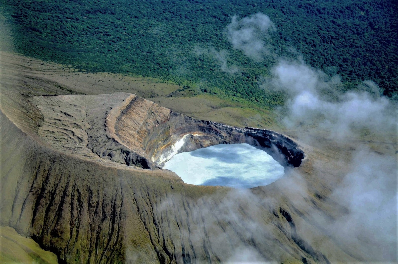
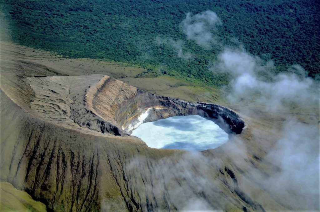
Activity report of the Rincón de la Vieja volcano, May 24, 2020.
On May 24, 2020 at 6:08 am local time, an eruption was recorded on the Rincón de la Vieja volcano, with a column that rose to 1000 meters above the height of the crater and to 2916 meters above from sea level. (9564.48 ft).
Duration of activity: 1 minute.
Ash falls reported in: not reported
Sulfur odor reported in: not reported
Comments: Ground eruption on the Rincón de la Vieja volcano. The released materials rose approximately 800 meters, the height of the gas and vapor plume could not be measured due to weather conditions.
May 24, 2020.
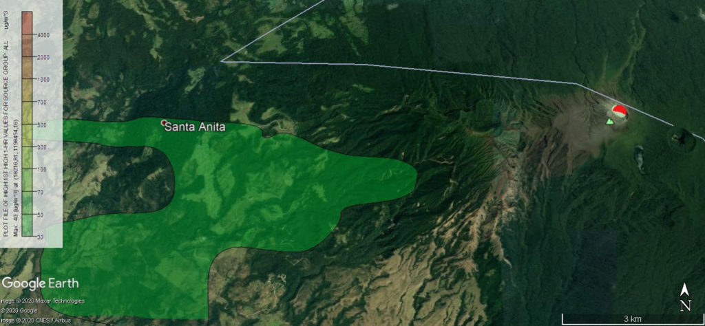
The dispersion of gases emanating from the Rincón de la Vieja volcano, according to the AERMOD computer dispersion model of the LAQAT-UNA Atmospheric Chemistry Laboratory and the OVSICORI-UNA, indicates that today the impact of SO2 emissions would come from ‘Affect areas such as the Rincón de la Vieja Volcano National Park, Santa Anita, among other places nearby. There is no impact for Liberia.
On the scatter map, the most red colors (this is not the case today) refer to the places with the greatest possible impact due to the surface emanations of the volcano, while the yellow tones (this is not the case today) represent a medium assignment, and the greens a weak assignment.
The topography of the country is taken into account, the dispersion of gases emitted up to 50 km around the Rincón de la Vieja volcano, from 3 a.m. to 6 a.m. (local time), had a direction to the West and the Southwest .
The maps are prepared using the Aermod dispersion calculation model of the Atmospheric Chemistry Laboratory (LAQAT-UNA) of the School of Chemistry and the Vulcanological and Seismological Observatory of Costa Rica (OVSICORI), as well as values hourly average weather such as temperature, radiation, wind speed and direction, relative humidity, among others, reported by Windy.
Source : Ovsicori.
Photos : Federico Chavarría-Kopper , Ovsicori .
Mexico , Popocatepetl :
May 24, 11:00 a.m. (May 24, 4:00 p.m. GMT)
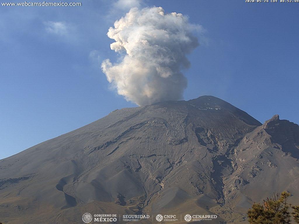
In the past 24 hours, 168 exhalations and 295 minutes of tremors have been identified according to the monitoring systems of the Popocatépetl volcano. These events were accompanied by volcanic gas emissions and sometimes small amounts of ash dispersed east-southeast.
At the time of this report and from the early hours of the morning, we could observe the emission of gases and light amounts of ash dispersed towards the East.
CENAPRED urges not to get near the volcano and especially the crater, because of the danger involved in the fall of ballistic fragments and, in the event of heavy rain, to move away from the bottom of the ravines because of the danger of mud and debris.
The Popocatépetl volcanic alert signaling light is in YELLOW PHASE 2.
Source : Cenapred .
Kamchatka , Karymsky :
VOLCANO OBSERVATORY NOTICE FOR AVIATION (VONA) .
Issued: May 24 , 2020
Volcano: Karymsky (CAVW #300130)
Current aviation colour code: ORANGE
Previous aviation colour code: yellow
Source: KVERT
Notice Number: 2020-98
Volcano Location: N 54 deg 2 min E 159 deg 26 min
Area: Kamchatka, Russia
Summit Elevation: 4874.08 ft (1486 m)
Volcanic Activity Summary:
A moderate gas-steam activity of the volcano sometimes with ash plumes continues. According to satellite data, an ash plume is extending about 30 km to the east-south-east of the volcano.
A moderate gas-steam activity of the volcano sometimes with ash plumes continues. Ash explosions up to 10,000- 13,100 ft (3-4 km) a.s.l. could occur at any time. Ongoing activity could affect low-flying aircrafts.
Volcanic cloud height:
14760-16400 ft (4500-5000 m) AMSL Time and method of ash plume/cloud height determination: 20200524/2250Z – NOAA 18 (4m5)
The explosive activity of Karymsky volcano at 19:20 UTC on 09 September, 2019.
Other volcanic cloud information:
Distance of ash plume/cloud of the volcano: 19 mi (30 km)
Direction of drift of ash plume/cloud of the volcano: ESE / azimuth 102 deg
Time and method of ash plume/cloud determination: 20200524/2250Z – NOAA 18 (4m5)
The Karymsky volcano emitted a column of ash at a height of 5 kilometers
Petropavlovsk-Kamchatsky, May 25 – AiF-Kamchatka. On the Karymsky volcano this morning, according to Kamchatka time, an ash release was recorded at a height of 5 kilometers above sea level, reported the regional department of the Ministry of Emergency Situations.
According to the Kamchatka group for the response to volcanic eruptions of the FEB RAS Institute of Volcanology and Seismology, as well as the Kamchatka branch of the Unified Geophysical Service of the RAS, the ash plume spreads in a southeast direction. There is no population on the way to its dispersal.
Sources : Kvert . kamchatka.aif.ru.
Photo : A. Manevich, IVS FEB RAS, KVERT .

