March 17 , 2020 .
Coronavirus: Protect yourself. Stay at home and watch « Le Chaudron de Vulcain », a site that deserves to be sponsored by the government.
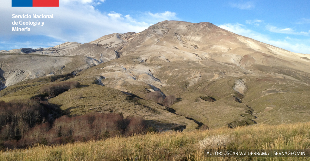
Chile , Puyehue-Cordon Caulle Volcanic Complex :
Special report on volcanic activity (REAV), Los Rios Region, Puyehue-Cordon Caulle Volcanic Complex, March 14, 2020, 08:45 local time (mainland Chile)
The National Geological and Mining Service of Chile (Sernageomin) publishes the following PRELIMINARY information, obtained thanks to the surveillance teams of the National Volcanic Surveillance Network (RNVV), processed and analyzed at the South Andes Volcanological Observatory (Ovdas):
Saturday March 14, from 06:40 local time (09:40 UTC), the monitoring stations installed near the Puyehue-Cordon Caulle CV recorded a swarm of volcano-tectonic type seismicity (VT) associated with fracturing rock. , located 1.6 km north-northwest of the emission center in 2011. At the time of publication of this report, 185 events have been recorded.
The characteristics of the higher energy earthquake after its analysis are as follows:
TIME OF ORIGIN: 06:58 local time (09:58 UTC)
LATITUDE: 40.511 ° S LENGTH: 72.149 ° W
DEPTH: 4.3 km
LOCAL MAGNITUDE: 2.2 (ML)
OBSERVATIONS:
No surface activity is recorded for the event described.
Until now, lower energy events continue to be recorded.
The volcanic technical alert remains at Green level.
The Sernageomin performs online monitoring and reports timely changes in volcanic activity.
Source : Sernageomin .
Guatemala , Fuego :
Special volcanological bulletin, Updated by Jose Jose Leonardo Quexel Hernandez on March 16, 2020 at 01:10 local time.
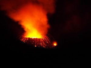
INCREASE IN EFFUSIVE ACTIVITY
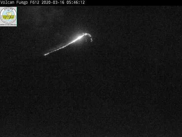
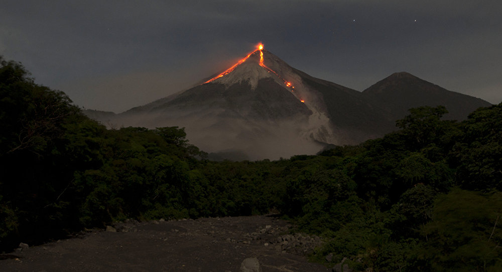
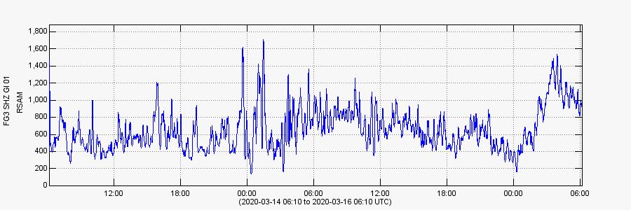
A new change in the eruptive pattern was observed from this morning, with an increase in avalanches in the ravines of Las Lajas, Trinidad and Cenizas. During the night, it was possible to visualize an active lava flow towards the Trinidad ravine, with an approximate length of 600 meters. From 7:24 p.m. The INSIVUMEH instrumental monitoring network signals the start of an increase in degassing which accompanies said lava flow.
Effusive activity is accompanied by explosions, but none of them exceeds 3 Pascals, which is considered to be low explosive activity, but with high effusive characteristics. Seismic activity presents a continuous signal of low amplitude, which is directly linked to the expulsion of the material which feeds the lava flow and to the degassing which accompanies it.
INSIVUMEH’s volcanic surveillance cameras show an active lava flow and the analysis of satellite images shows an incandescence. The front of the lava flow can generate landslides that reach the edge of the vegetation.
This type of activity has been recurrent in recent months, the last of which was reported on February 13 of the current year and lasted 14 days. It is therefore not excluded that this activity is maintained or increases and can reach a greater distance during the hours, so you should be aware of its evolution.
Source : Insivumeh .
Photo : Moises Castillo / Sputnik.
Peru , Sabancaya :
Analysis period: March 9 to 15, 2020. Arequipa, March 16, 2020.
Alert level: ORANGE
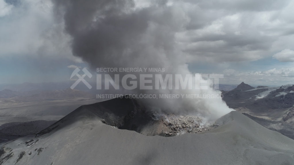
The Peruvian Geophysical Institute (IGP) reports that the eruptive activity of the Sabancaya volcano remains at moderate levels; that is to say with the continuous recording of moderate explosions and consequent emissions of ash and gas. Consequently, for the following days, no significant change is expected regarding its activity.
Between March 9 and 15, the IGP recorded and analyzed the occurrence of approximately 1,384 earthquakes of volcanic origin, associated with the circulation of fluids (magma, gas, etc.) inside the volcano . In addition, 24 medium to low intensity explosions were recorded daily.
Monitoring the deformation of the volcanic structure does not record any significant anomalies. Visual surveillance identified columns of gas and ash up to 3.5 km high above the summit of the volcano, which were mainly dispersed towards the South, South-East and North-East sectors of the Sabancaya. Satellite surveillance identified the presence of 3 thermal anomalies with values between 11 MW and 14 MW, associated with the presence of a body of lava inside the crater of the volcano.
Source : IGP.
Photo : Ingemmet.
Alaska , Shishaldin :
54°45’19 » N 163°58’16 » W,
Summit Elevation 9373 ft (2857 m)
Current Volcano Alert Level: WATCH
Current Aviation Color Code: ORANGE
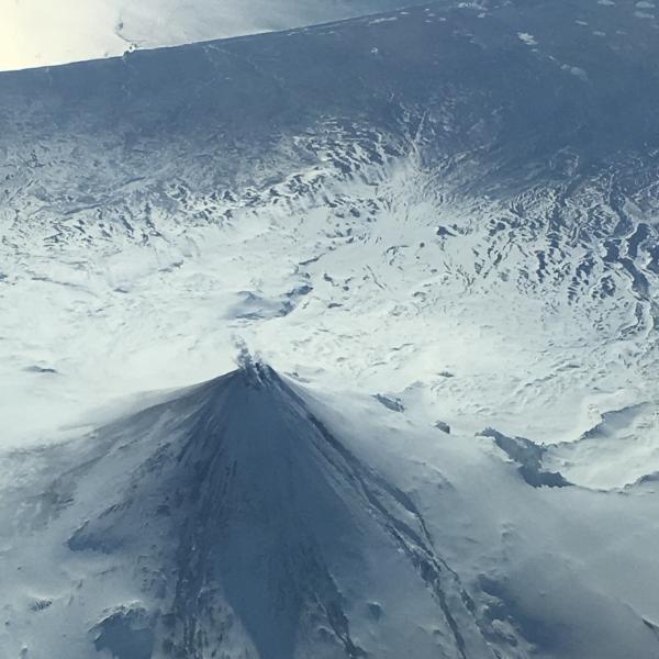
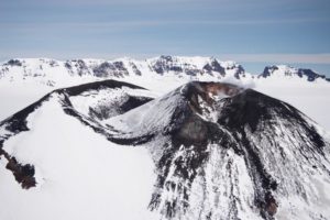
Oblique aerial photo of Shishaldin Volcano taken on March 11, 2020 on and Alaska Airlines flight from Adak to Anchorage, Alaska. Minor steaming from the summit crater is seen. Erosion of the snow and ice on the upper flanks or the volcano can be seen and is the result of lava flows from eruptive activity in late 2019 to early 2020.
Eruptive activity continues at Shishaldin. Seismicity remains elevated, and small explosions have been recorded in seismic and infrasound data for most of the past day. Elevated surface temperatures have been observed in satellite data over the past 24 hours, consistent with lava in the summit crater. At this time, eruptive activity appears confined to the summit area, but activity could increase with little or no warning resulting in lava flows outside of the crater, lahars, and ash emissions.
Shishaldin is monitored by local seismic and infrasound sensors, satellite data, web cameras, a telemetered geodetic network, and distant infrasound and lightning networks.
Source : AVO.
Photo : Fischer, Ed.
Ecuador , Sangay :
Information bulletin, SANGAY volcano No. 023
MONDAY MARCH 16, 2020
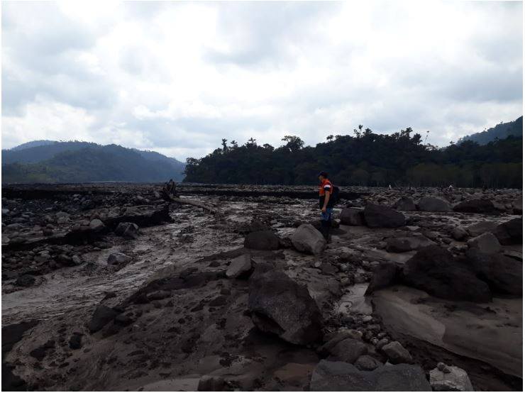
Today, the SNGR reported that the dam at the confluence of the Upano river with the Volcan river has calmed down, resuming its natural channel. This dam was associated with the descent of the mud and debris flows (sequential lahars) of the Sangay volcano. This phenomenon has been recurrent since May 2019 and is due to the fact that the intense rains of the volcano remobilize the material accumulated during these months of activity. It is recommended not to stand in areas close to the river banks.
The Geophysical Institute of the National Polytechnic School monitors activity on the volcano and will inform of any changes that may be recorded.
Source : IGEPN.

