
October 29 , 2019.
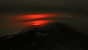
Japan , Shindake :
Alert level raised for island volcano in southwestern Japan following earthquake
The alert level for a volcano on an island in Kagoshima Prefecture was raised Monday after a large-scale earthquake was recorded near the crater the previous night, the Meteorological Agency said.
The volcano warning level for Mount Shindake on Kuchinoerabu Island was upgraded from 2 to 3 on a scale of 5, according to the agency. The new level advises climbers to refrain from scaling the mountain.
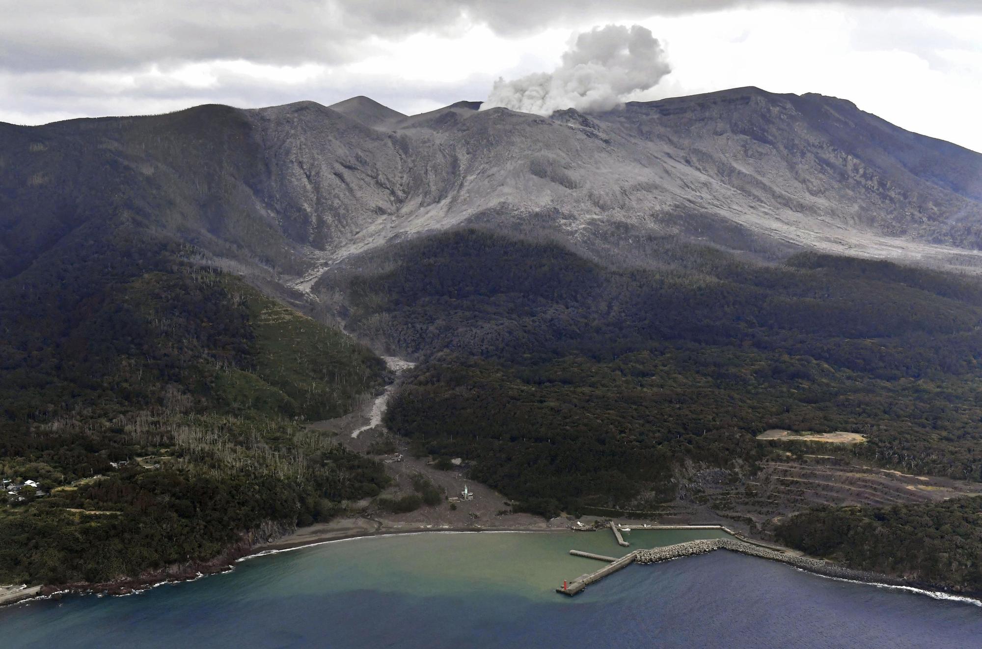
The mountain saw a series of eruptions with pyroclastic flows last December and January, but the alert level was lowered from 3 to 2 in June when no eruptions had been observed since February.
The agency currently warns of risks of flying rocks and pyroclastic flows within 2 kilometers of the crater.
“There is a possibility that an eruption will occur of a magnitude similar to the one in January, when pyroclastic flows reached a point 1.9 km from the crater,” an agency official told a news conference.
In May 2015, all residents of the island were evacuated to Yakushima Island, some 12 km to the east, after the volcano erupted explosively. Kuchinoerabu Island is located approximately 130 km south-southwest of the city of Kagoshima.
Source et photo : japantimes.co.
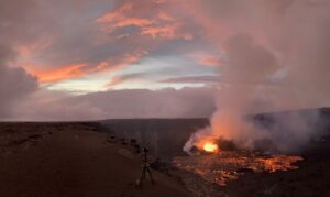
La Réunion , Piton de la Fournaise :
Activity Bulletin from Monday, October 28, 2019 to 10:00 (local time).
The eruptive activity that began on October 25, 2019 at Piton de la Fournaise at 14:40 local time stopped yesterday, October 27, 2019 at 16:30 local time, after a phase of activity in « gas piston » of about 1 hour .
– Since the end of this phase of activity, 2 superficial volcano-tectonic earthquakes have been recorded. No earthquakes were recorded in the area of the eruption.
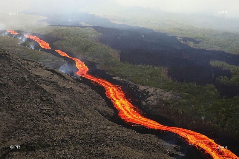
– No deformation of the building is no longer perceptible.
– Since the end of the eruption the SO2 values have returned to normal (emissions low or close to the limit of detection) and the CO2 flows remain low in the upper part of the Furnace and go up in the distant sector.
Alert level currently in progress: Alert 2-2.
Source : OVPF
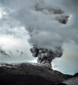
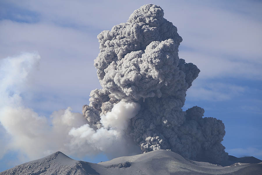
Peru , Sabancaya :
Period of analysis: 21-27 October 2019. Arequipa, October 28, 2019.
Alert level: ORANGE
The Geophysical Institute of Peru (IGP) reports that the eruptive activity of the Sabancaya volcano has remained at moderate levels; that is, with the recording of continuous moderate explosions and the resulting ash emission. Therefore, for the following days, no significant change is expected.
The analysis of records obtained from the seismic network of the Sabancaya volcano for the period from 21 to 27 October 2019 has identified the presence of about 2043 earthquakes of volcanic origin, the highest percentage being associated with the movements fluids (gas and magma). During this week, there were an average of 48 medium to low explosions per day.

The monitoring of the deformation of the volcanic structure, using GNSS data (processed with fast orbits), does not present significant anomalies. The visual surveillance, using surveillance cameras, allowed us to identify the appearance of columns of gas and ash up to 2.5 km high above the top of the volcano, which dispersed in the areas West, South-West and South of Sabancaya. Satellite monitoring has identified the presence of 15 thermal anomalies on the volcano from 5 MW to 24 MW, associated with the presence of a lava body (dome) identified since 2017 in the crater of the volcano. It is worth mentioning that in recent months, the lava body has grown very slowly, filling the northern area of the crater.
LAVA DOME IN THE CRATER OF VOLCANO SABANCAYA
The Ingemmet Geological, Mining and Metallurgical Institute, through its volcanological observatory (OVI), recorded the presence of a large lava dome in the crater of the Sabancaya volcano. The dome filled a large part of the northern sector of the crater with an area of approximately 50,000 m2.
The recording was made possible by the overflight of a drone over the crater of the massif carried out by a field brigade of the vulcanological observatory of Ingemmet (OVI) on October 26, 2019.
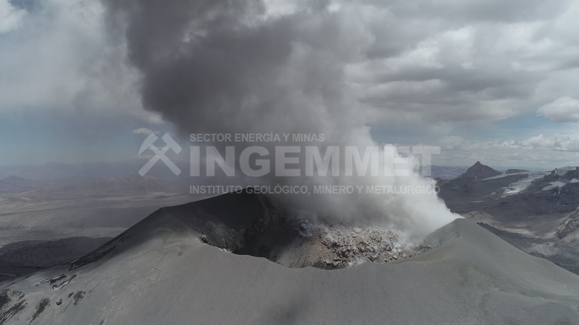
Analysis of the satellite images allowed us to establish that the lava dome began to be located since February 2017, at relatively low rates. Subsequent satellite images (June 2017, September 2018, May and October 2019) show the growth of this dome, which has accelerated in recent months.
According to the latest estimates, the lava dome is about 4.6 million m3. At the same time, volcanic explosions emitting mainly gases and ashes were recorded.
Ingemmet, through geological studies and constant volcanic monitoring, indicates that between December and March, during the heavy rains, lahars (mudslides) would be generated in the main ravines and rivers adjacent to the volcano. some may even reach the Colca Valley.
Source : IGP Pérou , Ingemmet.
Photos : Photovolcanica ( http://www.photovolcanica.com/VolcanoInfo/Sabancaya/Sabancaya2016_00249.JPG ) , Ingemmet.
Read the article ingemmet : https://www.ingemmet.gob.pe/-/ingemmet-registra-cuerpo-de-lava-en-el-crater-del-volcan-sabancaya?fbclid=IwAR3SICVGCbe2A17csqkgLYj_K1vjU4MmIb2Mc1xaBAhvZd-dvbCFWCCAgXY
Guatemala , Fuego :
Special Volcanological Bulletin. Updated by Flavio Emmanuel Muñoz Barrera on October 28, 2019 at 14:17 local time
LAHARES MODERATES IN THE RAVINES SECA AND RIO MINERAL, TRIBUTARY OF RÍO PANTALEÓN
The constant rainfall recorded over the last few hours in the Fuego Volcano region, as well as the moisture accumulation derived from the last days, are currently generating weak to moderate lahars in the Seca Canyon and the Mineral River, two tributaries of the river Pantaleon.
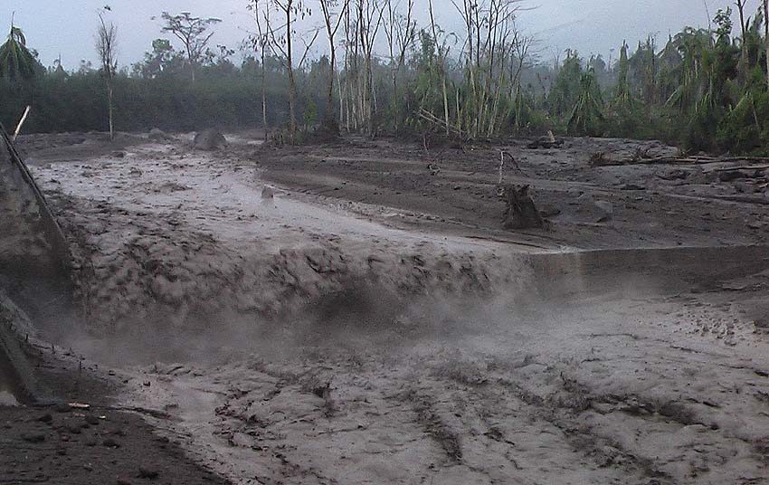
These lahars have the following characteristics: It is hot, generating steam columns, resulting in volcanic materials such as ash, sand and blocks 1 and 2 meters in diameter that vibrate the ground and generate shock sounds of rocks. Trained material has been deposited by constant eruptive activity and it is expected that similar events will continue, the probability that they may increase and become stronger in their downstream descent should not be ruled out.
As the rains continue, the probability that lahars can be generated in any of the canyons of the Fuego volcano is not excluded.
Source : Insivumeh.
Photo : Caroline Sarrazin , Rés-EAUx .