January 12 , 2019.
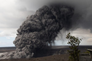
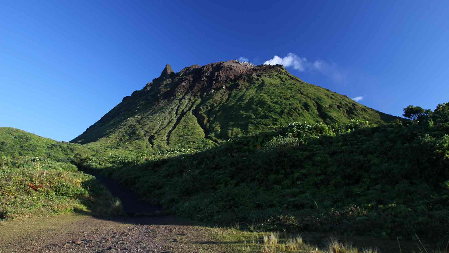
Chile , Nevados de Chillan :
Nuble Region, Nevados Volcano of Chillan, January 11, 2019, 5.30am Local Time (Continental Chile)
The National Geological and Mining Service of Chile (Sernageomin) publishes the following PRELIMINARY information, obtained from monitoring equipment of the National Volcanic Monitoring Network (NVRN), processed and analyzed at the Volcanological Observatory of the Southern Andes (OVDAS) :
Yesterday, Friday, January 11, 2019 at 05:00 local time (08:00 UTC 11 January), monitoring stations installed near the volcano Nevados de Chillan recorded an explosive event, associated with the occurrence of a long-term type of earthquake ( LP), which was associated with fluid dynamics within the volcanic system.
The characteristics of the earthquake after its analysis are as follows:
TIME OF ORIGIN: 5h00 Local time (08h0 UTC)
LATITUDE: 36,860 ° S
LONGITUDE: 71.372 ° W
DEPTH: 0.5 KM
REDUCED DISPLACEMENT: 915 cm2
ACOUSTIC SIGNAL: 19 Pa reduced to 1 KM
OBSERVATIONS:
The explosion was associated with the recording of a seismic signal with a reduced displacement value (seismic energy) of 915 cm2. Since the IP camera installed by the OVDAS, it has been possible to observe an incandescence associated with emissions of gas and particulate materials at high temperatures, falling on the surroundings of the active crater. The preceding events make it possible to envisage a partial destruction. dome located in the crater. At the time of this report, no other abnormal signals were recorded.
The level of volcanic technical alert remains at the level: ORANGE.
Sernageomin continues online monitoring and will inform in a timely manner about any changes observed.
Source : Sernageomin
Photo : losandes.com.ar
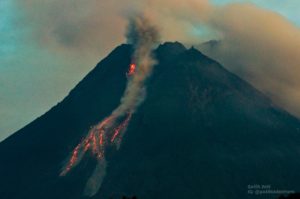
Indonesia , Merapi :
MERAPI ACTIVITY REPORT January 4 to 10, 2019.
I. RESULTS OF OBSERVATION.
Visual:
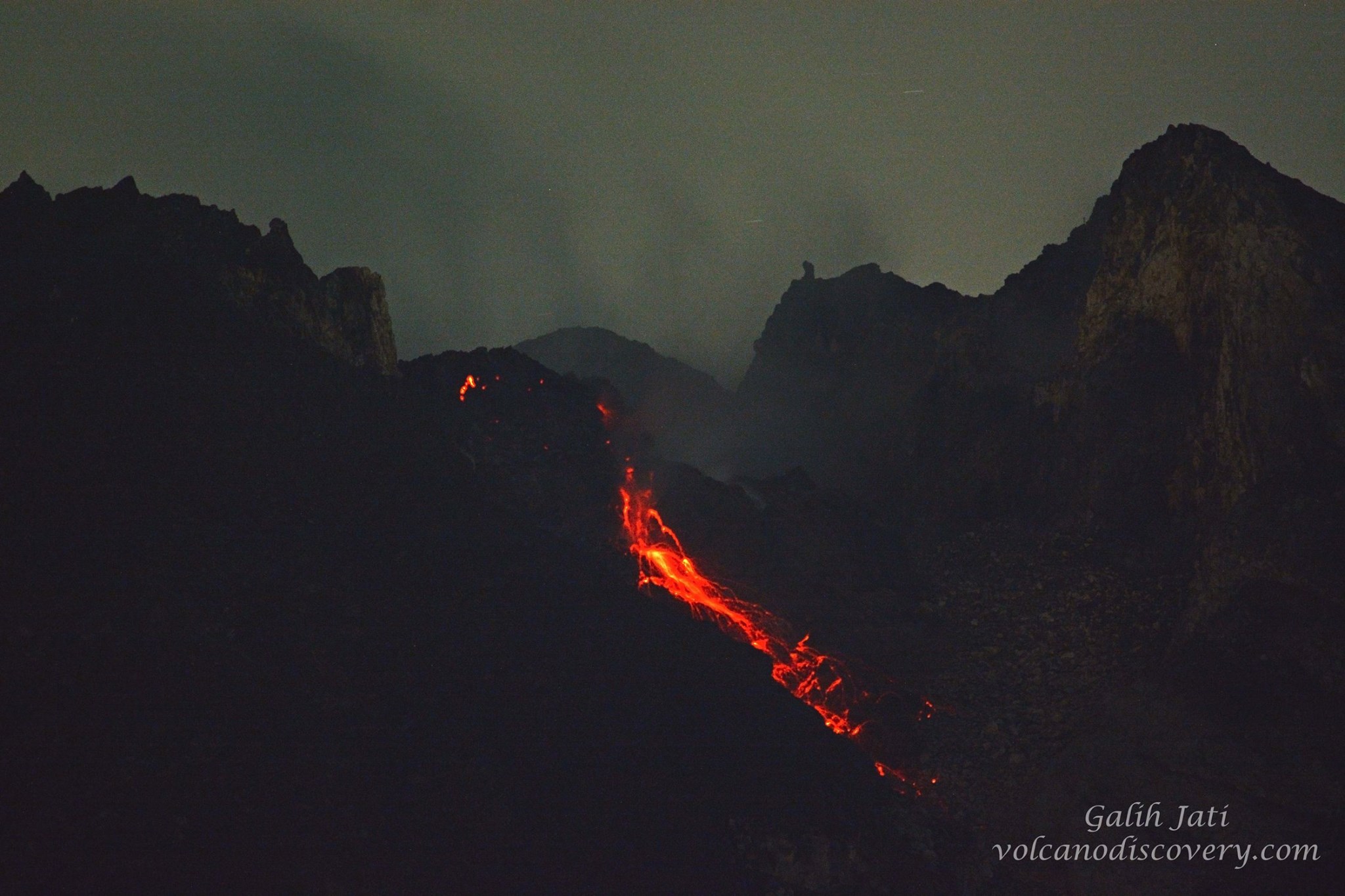
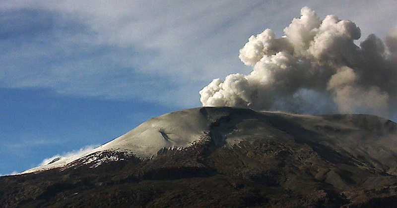
The weather is sunny in the morning and the evenings and afternoons are foggy. The observed smoke from the crater is white, thick, with low gas pressure. A maximum height of 450 m was observed from the Merapi observation post in Babadan on January 10, 2019.
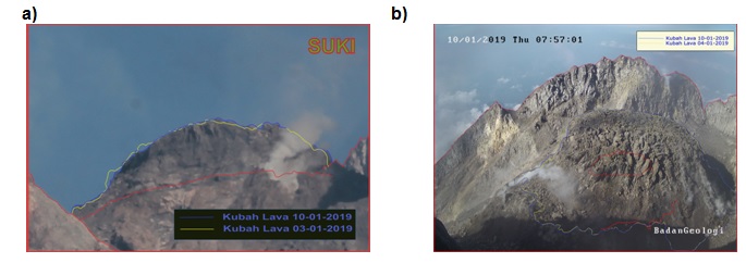
Dome of lava and morphology of the peak.
Morphological analysis based on photos of the Southeast sector showed morphological changes in the form of dome growth. Annex 1.a presents morphological analysis of the peak via the Deles camera station.
The volume of the lava dome on January 10, 2019 was 439,000 m3 with an average growth rate of 3,400 m3 / day, lower than the previous week. Currently, the lava dome is still stable with a low growth rate (<20,000 m3 / day). Appendix 1.b presents an analysis of the lava dome from the Puncak camera stations.
Seismicity.
During this week, Mount Merapi seismographs recorded 19 emission earthquakes (DGs), 2 shallow volcanic earthquakes (VTBs), 9 Multiple Phase (MP) earthquakes, 289 avalanche (RF) earthquakes, 7 earthquakes of low frequency type (LF) and 11 tectonic earthquakes (TT). DG and RF seismicity is higher this week than the previous week.
Deformation.
The deformation of G. Merapi, which was monitored by EDM and GPS this week, showed no significant change.
SO2 emissions.
During this week, the DOAS (Differential Optical Absorption Spectroscopy) measurement yielded an average value of maximum SO2 emissions from Mount Merapi of 89.57 tonnes / day, still within normal limits.
Rain and lahars.
This week, the Mt. Merapi observation post on January 7, 2019, enjoyed a rain intensity of 26 mm / hour for 69 minutes at Kaliurang Station. No cases of lahars or increased flow have been reported in the rivers downstream of Mount Merapi.
II. CONCLUSION AND ADVICE
Conclusion.
Based on the results of the visual and instrumental observations, it was concluded that:
1. The lava dome is currently in a stable state with a relatively low growth rate.
2. The volcanic activity of Mount Merapi is still quite high and is at the activity level « WASPADA ».
Suggestion.
With Mount Merapi’s WASPADA activity level, it is recommended to the Mount Merapi disaster management stakeholders as follows:
• An area with a radius of 3 km around the summit of Mount Merapi must be prohibited from activities of the population and climbing.
• If there is a significant change in Mount Merapi activity, Mount Merapi activity status will be re-examined.
• Regarding when the rainy season begins, people moving around the rivers below Mount Merapi should be aware of the danger of lahars.
• It is recommended that local authorities socialize the current state of Mount Merapi.
Source : a.n. Chef du centre de volcanologie et d’atténuation , BPPTKG , Yogyakarta, le 11 janvier 2019
Photos : BPPTKG , Yohannes Tyas Galih Jati/Volcanodiscovery via Facebook.
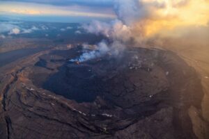
Colombia , Nevado del Ruiz :
Weekly activity bulletin of the Nevado del Ruiz volcano
The level of activity continues at the level: Yellow activity level or (III): changes in the behavior of volcanic activity.
With regard to monitoring the activity of the Nevado del Ruiz volcano, the COLOMBIAN GEOLOGICAL SERVICE announces that:
During the last week, seismicity caused by rock fracturing resulted in a slight decrease in the number of earthquakes and released seismic energy compared to the previous week. The earthquakes occurred in the North-West, South-South-East and North-East sections of the volcano and in the Arenas crater at depths between 0.2 and 7.8 km. The highest energy earthquake was recorded on January 5 at 02:05 local time, had a magnitude of 1.3 ML (local magnitude) and was located 4.0 km northeast of the Arenas crater, 2 km away. depth.
Seismicity related to the dynamics of the fluids within the ducts of the volcanic structure also showed a slight decrease in the number of earthquakes and released seismic energy compared to the previous week. This seismic activity was characterized by the presence of earthquakes of long period type, very long period and tremors. The earthquakes occurred mainly in the crater Arenas and its surroundings.
Volcanic deformation measured from electronic inclinometers recorded a slight inflationary change. GNSS (Global Navigation Satellite System) stations and radar images have so far shown stability behavior without recording significant deformation processes of the volcanic structure.
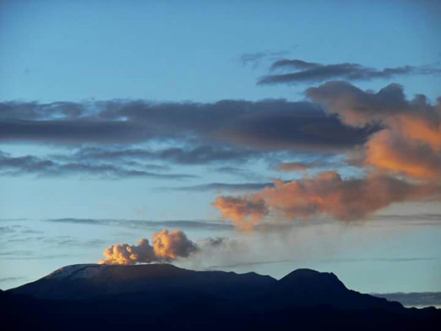
The volcano continues to emit water vapor and gases into the atmosphere, among which sulfur dioxide (SO2) is distinguished, as evidenced by the values obtained by the SCANDOAS stations installed in the region of the volcano. satellite image analysis. During the week, the NASA FIRMS and MIROVA portals reported several low-energy thermal anomalies.
The column of gas and steam reached a maximum height of 1800 m, measured at the top of the volcano on January 7th. The direction of dispersion of the column was governed by the direction of the wind in the region, which prevailed towards the northwest and west of the volcano. Strong winds in the volcano area, which are common at this time of the year, have re-mobilized the ashes in suspension and those that have settled around the volcano during past emissions. This phenomenon, the direction and speed of the winds caused the fall of ashes to Manizales and Villamaría. If these conditions persist, it is possible that these ash falls continue to occur.
The Nevado del Ruiz volcano continues at the level of yellow activity.
Source : SGC.
Photos : Uknown author.
Guadeloupe , La Soufrière :
Friday, January 11, 2019 at 18:45.
Sequence of earthquakes in the Soufrière area of Guadeloupe – Basse Terre.
The sequence of volcanic earthquakes that began on Tuesday, January 8, 2019 at 00:59 local time (January 8, 2019 04h59 UTC time *) in the La Soufrière volcano area, continues with the recording of 185 earthquakes since its inception.
Earthquakes are of very low magnitude (M <1). No earthquakes were reported. The events are located at a depth of <2.5 km under the summit of the dome of La Soufrière.
The alert level remains: yellow, vigilance.
Source : Directorate of the OVSG-IPGP.
Photo : aide-voyage.com
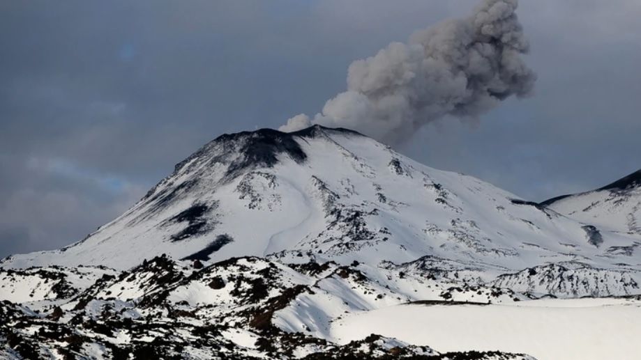
Guatemala , Fuego :
Type of activity: Vulcanian
Morphology: Composite Stratovolcano
Geographical location: 14 ° 28’54˝ N Latitude; 90 ° 52’54˝ Longitude O.
Height: 3,763msnm
Weather conditions: Clear weather
Wind: North East 2 km / h
Precipitation: 0.0 mm.
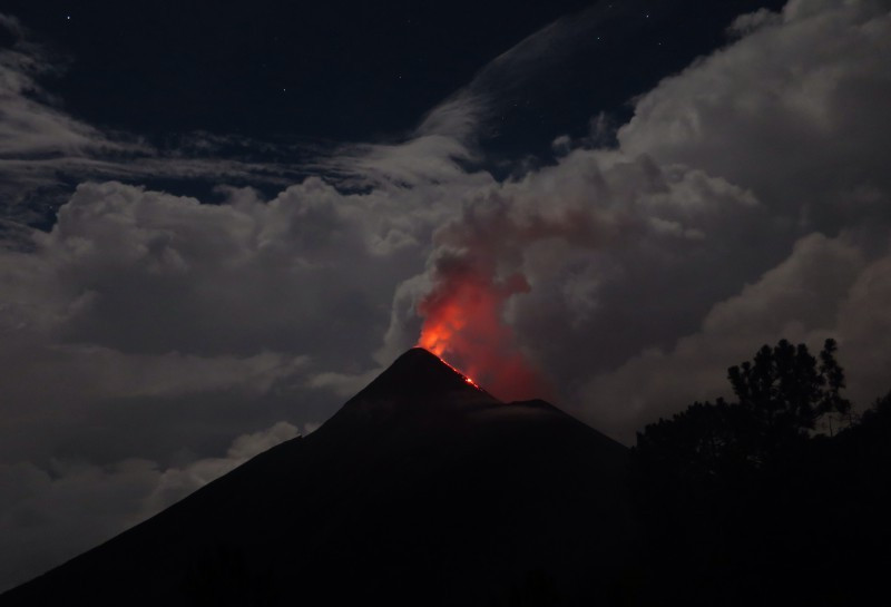
Activity:
Persistence of weak white degassing at a height of approximately 4,400 m above sea level dispersed to the south and southwest. There are 7 to 11 explosions per hour, with weak to moderate characteristics, emitting ash columns at heights of approximately 4,500 to 4,800 meters (14,764 to 15,748 feet), traveling 14 km to the south. and the Southwest. The explosions are accompanied by low to moderate rumblings and low to moderate shock waves, with weak sounds similar to those of a locomotive with delays of 3 to 7 minutes. At night and early in the morning, incandescence was observed at a height of approximately 150 to 200 meters above the crater, causing weak to moderate avalanches around the crater, some reaching long distances to the vegetation towards the Seca ravines. , Taniluyá, Ceniza, Trinidad and Las Lajas. Ashes fall on: San Pedro Yepocapa, Morelia, Santa Sofia, Panimaché, among others.
Source : Insivumeh.
Photo :Unknown author