January 09 , 2019.
Indonesia , Anak Krakatau :
VOLCANO OBSERVATORY NOTICE FOR AVIATION – VONA.
Issued: January 08 , 2019
Volcano: Anak Krakatau (262000)
Current Aviation Colour Code: ORANGE
Previous Aviation Colour Code: orange
Source: Anak Krakatau Volcano Observatory
Notice Number: 2019KRA27
Volcano Location: S 06 deg 06 min 07 sec E 105 deg 25 min 23 sec
Area: Lampung, Indonesia
Summit Elevation: 352 FT (110 M)
Volcanic Activity Summary:
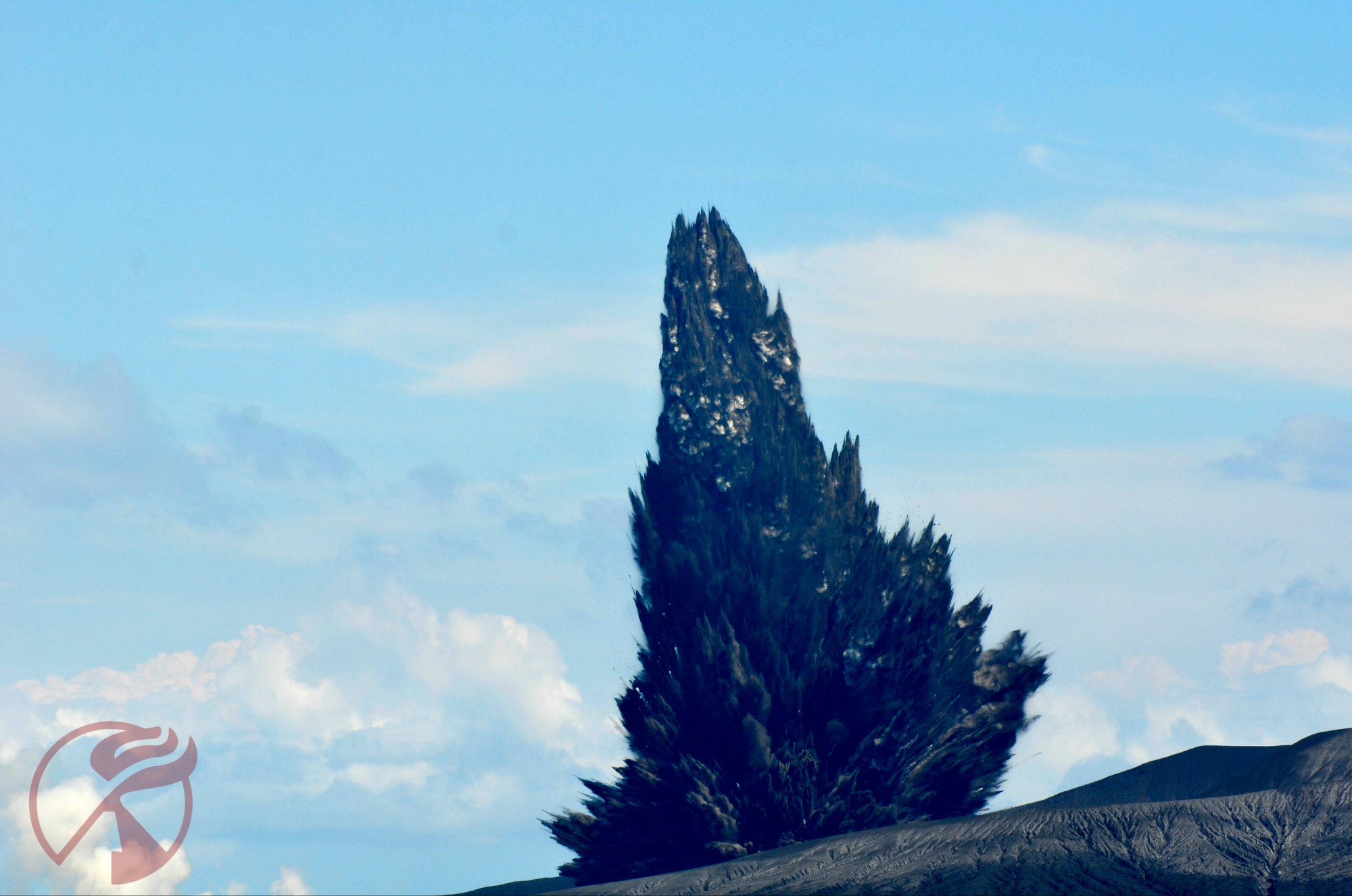
Eruption with volcanic ash cloud at 11:11 UTC (18:11 local). The eruption lasted for 45 seconds.
Volcanic Cloud Height:
Best estimate of ash-cloud top is around 3552 FT (1110 M) above sea level, may be higher than what can be observed clearly. Source of height data: ground observer.
Other Volcanic Cloud Information:
Ash-cloud moving to east.
Remarks:
Eruption recorded on seismogram with maximum amplitude 24 mm and maximum duration 45 second.
Level of activity at level III (SIAGA) since December 27, 2018. The Anak Krakatau volcano (110 m altitude) has increased its volcanic activity since June 18, 2018.
Since yesterday and until this morning, the volcano was clearly visible then covered with fog. The smoke from the crater was observed at a height of about 1000 meters above the peak, gray in color, with a thick intensity. The wind was blowing slightly east.
Thanks to the seismographs, on January 8, 2019, we recorded:
61 eruptions / explosions
11 emissions earthquakes
1 distant tectonic earthquake
A continuous tremor of amplitude 0.5 to 8 mm, and a dominant value of 4 mm.
Recommendation:
People / tourists are not allowed to approach the crater within 5 km.
Source : Magma Indonesia , PVMBG .
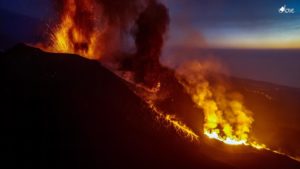
Photos : Sylvain Chermette / 80 jours voyages , which will take you to see a Surtseyan eruption up close. ( https://80joursvoyages.com/tours/eruption-express-krakatau-indonesie/ )
El Salvador , San Miguel ( Chaparrastique ) :
Special report 8. The Chaparrastique volcano continues its activity with emissions of gas and ash.
The Chaparrastique volcano continues its eruptive process by emitting pulses of gas (Figure 1). This degassing forms a column of gas with ashes moving towards the West, sometimes reaching 500 meters in height. These gases are associated with changes in the internal pressure of the volcano.
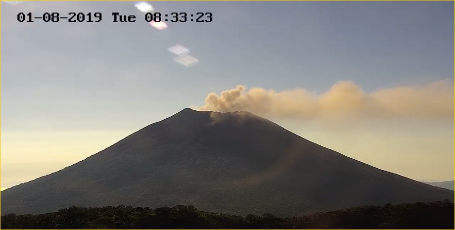
Figure 1. The gas and ash eruption of the Chaparrastique volcano continues (08h33: 23h23 du 01/08/209).
From 4 pm, January 7 and until 10 am yesterday, January 8, the degassing and seismicity of the volcano showed high and low periods (Figure 2). A sudden change in these parameters would be an indicator of a process of depressurization and relaxation of the volcanic system likely to induce a more intense eruptive activity. These changes in the Chaparrastique volcano can occur suddenly.
Seismicity of the Chaparrastique volcano in the last 24 hours
The seismic vibration (RSAM) values recorded over the past 24 hours have been maintained fluctuating between 123 and 201 units, with an average of 145 units per hour, considered higher than normal (Figure 2).
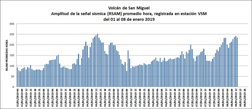
Figure 2. Behavior of seismic vibrations of the volcano during the last week.
The image captured yesterday at noon with a drone, by the MARN staff, shows a gas pulse coming out of the crater and an ash-laden atmosphere, typical of the magma degassing process without pressurization (Figure 3).
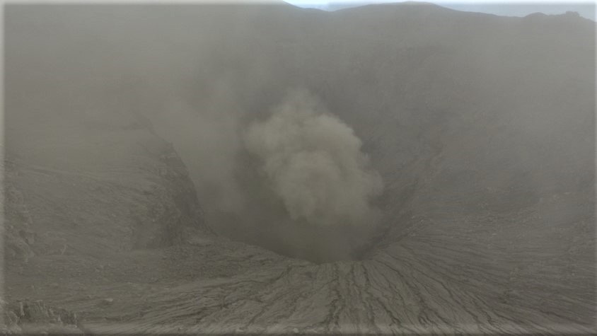
Figure 3. Situation of the activity of the volcano in the region of the central crater.
Local observers in the volcano area report emissions of gas and small ash emissions at the top of the volcano. There is no report of damage to the people of the place.
Analysis of the current situation indicates that the volcano continues its eruptive process launched Thursday, January 3, emitting gas and small amounts of ash transported in the direction of the prevailing wind, and can reach the populated areas to the west of the volcano . A smell of sulfur could reach the areas between El Carreto, La Piedra and Piedra Azul.
In the event of a sudden increase in activity, the most likely scenario is the generation of a higher eruptive column (about 2 km) whose ashes could fall in the municipalities of San Rafael Oriente, San Jorge and Chinameca. The production of ballistic projectiles is included in this scenario and could reach up to three kilometers around the crater. However, the possible production of lava flows from the flanks of the volcano is not excluded.
MARN continues the systematic monitoring of the volcano and maintains close communication with the Directorate General of Civil Protection and the network of local observers. In addition, he calls on locals, tourists and mountaineers to stay away from the crater because of the sudden changes that often occur in the activity.
In the event of a material change, an advance special report will be published.
Source : Marn.
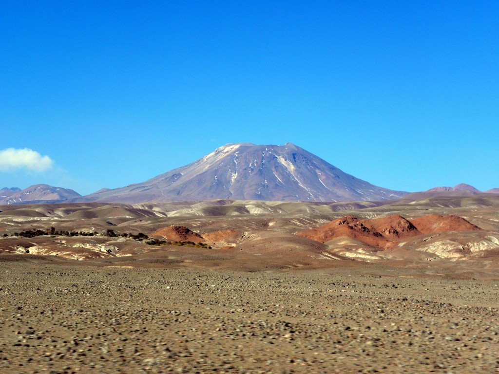
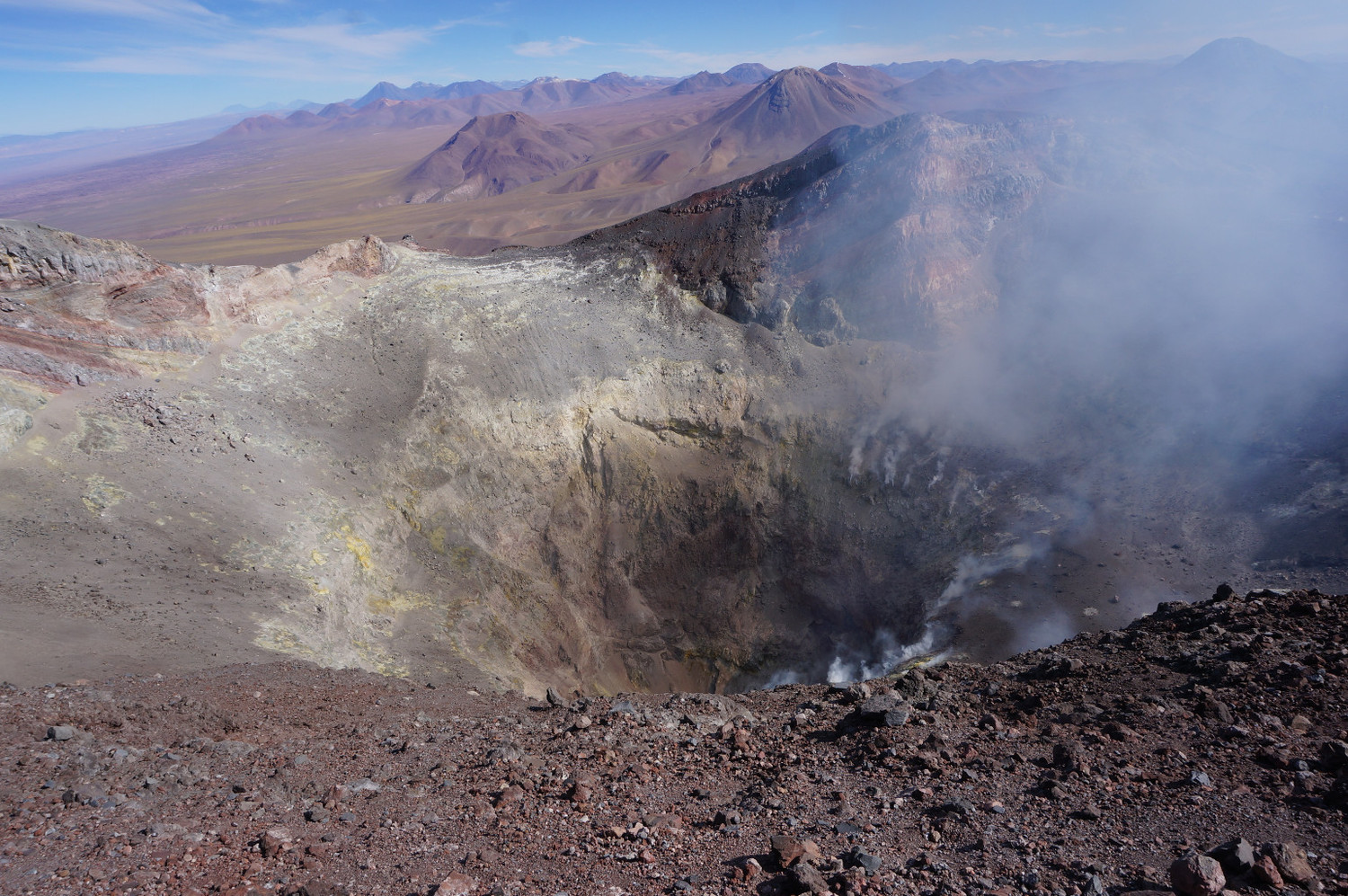
Chile , Lascar :
During the evaluated period, a total of 178 seismic events were recorded, of which 10 were classified as volcano-tectonic earthquakes (VT) in relation to rock fracturing processes within the volcanic edifice. with local magnitudes less than M 2.2. The event of greatest energy was located 0.7 km southwest of the active crater, at a depth of 4.2 km.
168 long-period (LP) earthquakes were also recorded in relation to fluid dynamics within the volcano with reduced displacement values (DRc) of less than 1.2 cm2.
The images provided by the IP cameras installed around the volcano show a recurrent degassing from the main crater, mainly white in color, reaching a maximum height of 900 m above the active crater. Through some images, there are periods of incandescence.
According to data provided by two GNSS stations, it is observed that an extension of approximately 0.5 cm is maintained from the line of surveillance that crosses the crater from north to south. The other stations show stability in the vertical components.
The sulfur dioxide (SO2) emissions recorded by the Differential Absorption Spectrometry (DOAS) equipment have a value for the evaluated period of 1225 +/- 143 T / day and a maximum value of 3390 t / d recorded on the November 30th. SO2 emissions are at moderate levels for this volcano.
There were 26 thermal warnings reported in the area associated with the volcanic complex during the period, with a maximum recorded MVP of 13 MW on December 06, values considered moderate, according to the data processed by the observation. infrared of volcanic activity (MIROVA) (http://www.mirovaweb.it/) and temporal thermal monitoring of global hot spots (MODVOLC) (http://modis.higp.hawaii.edu/).
The level of activity presented during the period under consideration indicates that the volcanic system maintains a state of equilibrium.
Because of the above, the volcanic warning is kept at the level:
GREEN LEVEL: Active volcano with stable behavior – Probable time for eruption: MONTH / YEARS.
Observation:
A zone of danger is considered as an area of 500 m around the crater.
Source : Sernageomin.
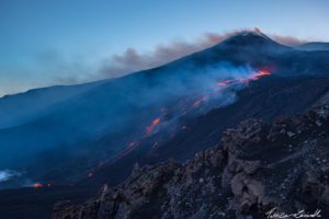
Photos : Radiosol , Sernageomin.
France / Guadeloupe , La Soufrière :
Tuesday, January 8, 2019 at 4:30 pm date: 2019-01-08
Sequence of earthquakes in the Soufrière area of Guadeloupe – Basse Terre.
A sequence of volcanic earthquakes began on Tuesday, January 8, 2019 at 00h59, local time (Tuesday, January 8, 04h59 universal time TU *) in La Soufrière volcano area. On January 8, 2019, at 16:30 local time, the OVSG-IPGP networks recorded 70 earthquakes of very low magnitude (M <1). No earthquake was reported as felt. The events are located at a depth of <2.5 km under the summit of the dome of La Soufrière.
The alert level remains: yellow, vigilance.
Source : Direction de l’OVSG-IPGP
Photo : P Giraud / ctig.
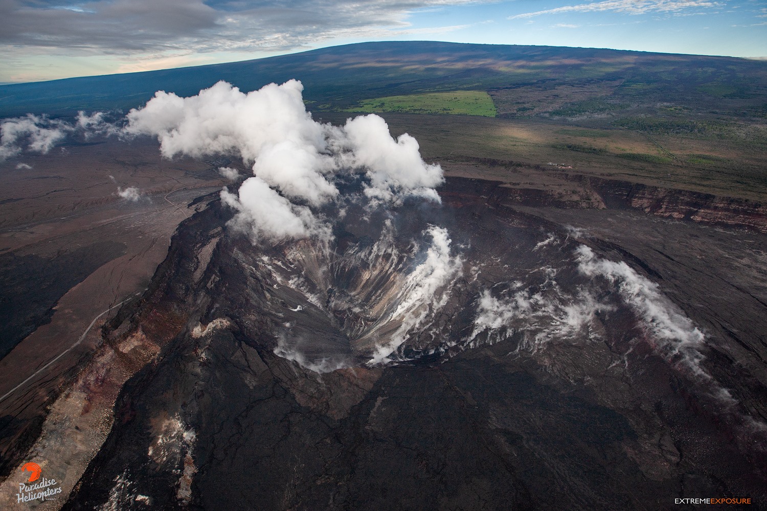
Hawaii , Kilauea :
Summit Elevation 4091 ft (1247 m)
Current Volcano Alert Level: ADVISORY
Current Aviation Color Code: YELLOW
Activity Summary:
Kīlauea Volcano is not erupting. Rates of seismicity, deformation, and gas release have not changed significantly over the past week. Deformation signals are consistent with slow magmatic recharge within the middle East Rift Zone (ERZ).
Observations:
Low rates of seismicity continue across the volcano, with events occurring primarily in the summit and south flank regions. In the ERZ, very slow inflationary tilt has been steady at the Puʻu ʻŌʻō cone tiltmeter. The inflationary trend recorded by GPS stations downrift of Puʻu ʻŌʻō has slowed. Sulfur dioxide emission rates have been below detection limits in the LERZ since early September, though minor amounts of volcanic gas are still present. Sulfur dioxide emission rates from the summit and Puʻu ʻŌʻō remain low.
Hazards remain in the LERZ eruption area and at the Kīlauea summit. Residents and visitors near recently active fissures and lava flows should heed Hawaii County Civil Defense and National Park warnings, and be prepared, if necessary, to self-evacuate in the unlikely event of renewed activity. Please note that Hawaii County maintains a closure of the entire lava flow field and vents and prohibits access unless authorized through Civil Defense.
The Hawaiian Volcano Observatory (HVO) continues to closely monitor Kīlauea’s seismicity, deformation, and gas emissions for any sign of reactivation. HVO maintains visual surveillance of the summit and the East Rift Zone with web cameras and occasional field visits.
HVO will continue to issue a weekly update (every Tuesday) and additional messages as warranted by changing activity.
Source : HVO
Photo : Bruce Omori / Paradise Helicopters