November 19 , 2018.
Indonesia , Merapi :
ACTIVITY REPORT OF MONT MERAPI, 9th – 15th November 2018.
I. RESULTS OF OBSERVATION
Visual
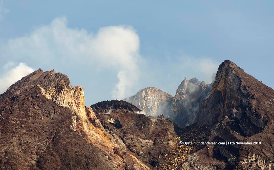
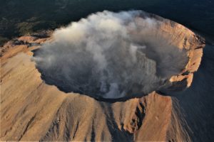
The weather is sunny in the morning and the afternoon, the evening is foggy The smoke observed is white, thick, with a low gas pressure. A maximum height of 200 m is observed from the Mount Merapi observation post in Kaliurang on November 10, 2018.
Dome of lava and morphology of the peak.
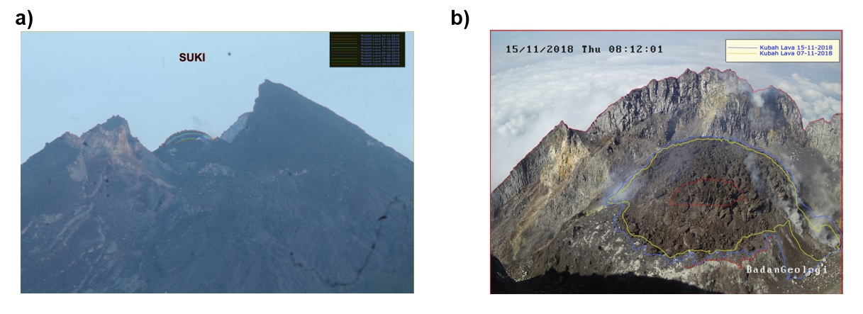
Morphological analysis based on photos of the Southeast sector showed morphological changes in the form of dome growth. Appendix 1.a presents the peak morphological analysis performed by the Deles camera station.
The volume of the lava dome at November 14, 2018 is 290,000 m3 with an average growth rate of 2,400 m3 / day, lower than the previous week. Currently, the lava dome is still stable with a low growth rate (<20,000 m3 / day). Annex 1.b presents an analysis of the lava domes of the Puncak camera station.
Seismicity:
During this week, Mount Merapi seismographs recorded 46 emission earthquakes (DGs), 1 superficial volcanic earthquake (VTB), 19 multiple-phase events (MPs), 302 avalanche events (RF), 28 tremor low frequency earth (LR) and 6 tectonic earthquakes (TT). This week’s DG, MP and RF seismicity is higher than the previous week. Annex 1.c presents a graph of the earthquake at Mount Merapi.
Deformation:
The deformation of G. Merapi controlled by EDM and GPS this week did not show any significant change. Annex 1.c points to the deformation graph in Merapi G.
SO2 emissions:
During this week, the DOAS (Differential Optical Absorption Spectroscopy) measurement gave an average value of maximum SO2 emissions from Mount Merapi at 79.14 tonnes / day, still within normal limits.
Rain and lahars:
On November 14, 2018, it was raining at the Mount Merapi observation post, with a rain intensity of 49 mm / hour for 35 minutes at Kaliurang Station. No cases of lahar and increased flow have been reported in the rivers downstream of Merapi G.
II. CONCLUSION AND ADVICE.
Conclusion:
Based on the results of the visual and instrumental observations, it was concluded that:
1. The lava dome is currently in a stable state with a relatively low growth rate.
2. The volcanic activity of Mount Merapi is still quite high and is at the activity level « WASPADA ».
Suggestions:
With the level of activity of G. Merapi, to stakeholders in disaster management on Mount Merapi, it is recommended to:
• An area with a radius of 3 km around the summit of Mount Merapi must be closed to population and climbing activities.
• In the event of a significant change in Mount Merapi activity, the status of Mount Merapi activity will be reviewed.
• It is recommended that local authorities socialize the current state of Mount Merapi.
Source : BPPTKG.
Photo : Oystein Lund Andersen.
Indonesia , Anak Krakatau :
Activities of Mount Anak Krakatau:
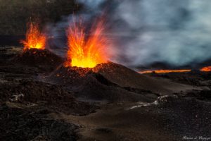
This week, the Strombolian explosive eruption is observed at night in the form of incandescent and incandescent material projections in all directions, which reach a height of 200 m above the summit. The eruptions are accompanied by lava flows down the southern slope that have reached the sea. The eruption was also accompanied by sounds of explosions that were heard at the PGA station in Pasauran-Banten. During the day, the mountain is often covered with fog, although the thick column of black eruptive ash reaches a maximum height of 500 m from the summit. The seismograph recorded 1259 eruptions, 508 emission earthquakes, 207 shallow volcanic earthquakes, 41 deep volcanic earthquakes, 5 harmonic earthquakes, and continuous tremors of 1 to 57 mm in amplitude.
Level II Activity Level (WASPADA). The volcano Krakatau (338 m) has developed its volcanic activity since June 18, 2018.
VOLCANO OBSERVATORY NOTICE FOR AVIATION – VONA.
Issued: November 16 , 2018
Volcano: Anak Krakatau (262000)
Current Aviation Colour Code: ORANGE
Previous Aviation Colour Code: orange
Source: Anak Krakatau Volcano Observatory
Notice Number: 2018KRA75
Volcano Location: S 06 deg 06 min 07 sec E 105 deg 25 min 23 sec
Area: Lampung, Indonesia
Summit Elevation: 1082 FT (338 M)
Volcanic Activity Summary:
Eruption with ash clouds at 22:32 UTC (05:32 local time). The eruption lasted for 207 seconds. Eruption and ash emission is continuing.
Volcanic Cloud Height:
Best estimate of ash-cloud top is around 2042 FT (638 M) above sea level, may be higher than what can be observed clearly. Source of height data: ground observer.
Other Volcanic Cloud Information:
Ash-cloud moving to northeast.
Remarks:
Eruption recorded on seismogram with maximum amplitude 56 mm and maximum duration 207 second.
Source : PVMBG , Magma Indonesia.
Video : Galih Jati ( www.volcanodiscovery.com).
Guatemala , Fuego :
SPECIAL BULLETIN VULCANOLOGICAL BEFGO N ° 209-2018. ERUPTION. Guatemala 18 November 2018, 22.30 (local time)
Type of activity: Vulcanian
Morphology: Composite Stratovolcan
Location: 14 ° 28’54˝ Latitude N; 90 ° 52’54˝Longitude W.
Height: 3,763msnm.
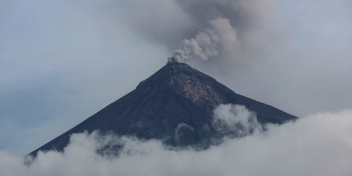
The eruption of the Fuego volcano continues, according to what the Sismo-volcanic stations show. OVFGO observations show an increase in moderate to heavy explosions with a column of ash at a constant height of 5000 meters (16405 feet) scattered in the west and southwest directions. The dispersion of the ashes reaches a distance of 20 to 30 km. Moderate to strong avalanches are generated towards the Ceniza, Taniluyá and Seca canyons with distances leading to the edge of the vegetation. An incandescent source rises 500 – 600 m above the crater, the ballistic materials reach heights of 800 meters in different directions. the explosions generate moderate to loud rumblings that rattle the houses on the west and southwest flanks. The sounds are constant, like those of a locomotive. Currently, the ash particles are falling heavily in the areas of Panimache II, Santa Sofia, Sangre de Cristo, Finca Palo Verde and others on this flank.
The lava flow has a length of 2500 m in the direction of Cenizas Canyon, and at the front generates avalanches that causes the ashes to start up again. Avalanches are generated towards the Taniluyá and Seca canyons, it is possible that lava flows are generated in these directions.
Due to the continuing increase in eruption, the possibility that pyroclastic flows, mainly falling in the Seca, Taniluyá, Cenizas, Las Lajas ravines and other Fuego volcano canyons are generated, is not excluded. You must not stay near or inside the ravines where volcanic products descend.
The Volcán de Fuego in Guatemala began erupting Sunday and its activity has increased, prompting evacuations and concern in the region, the National Institute of Seismology, Volcanology, Meteorology and Hydrology said in a release. According to the scientific agency of the Guatemalan government, the volcano has maintained ash columns reaching up to 16,404 feet above sea level, which has dispersed 15 miles to the west and southwest.
The increase in the explosions have gone from moderate to strong, the agency said, issuing an alert for the residents. The National Coordinator for Disaster Reduction (Conred) said warning systems will be implemented, mainly in the southwest of the volcano, as a precautionary measure. The Local Coordinators for Disaster Reduction also initiated evacuation processes amid the ongoing crisis.
According to a local report, communities in El Porvenir, La Reina and El Rodeo have been self-evacuated. Some 75 families were believed to have left their homes in El Porvenir.
Álvaro Flores living in the city of Escuintla told local media the residents were waiting for the Conred to inform them what they have to do before the eruption gets worse. He added some residents of the area decided to evacuate, but do not have a place to go.
« We are waiting for Conred to come, so he can say what shelter he can go to, because everyone is here with uncertainty, » Flores said.
The Guatemalan geologist and volcanologist, Rudiger Escobar Wolf, wrote on Twitter that since 1999, the Volcán de Fuego has had 76 eruptions, with the most catastrophic one being in June.
Source : Insivumeh , Ibtimes.com.
Photo: Auteur inconnu.
Philippines , Kanlaon :
KANLAON VOLCANO BULLETIN 19 November 2018 08:00 A.M.
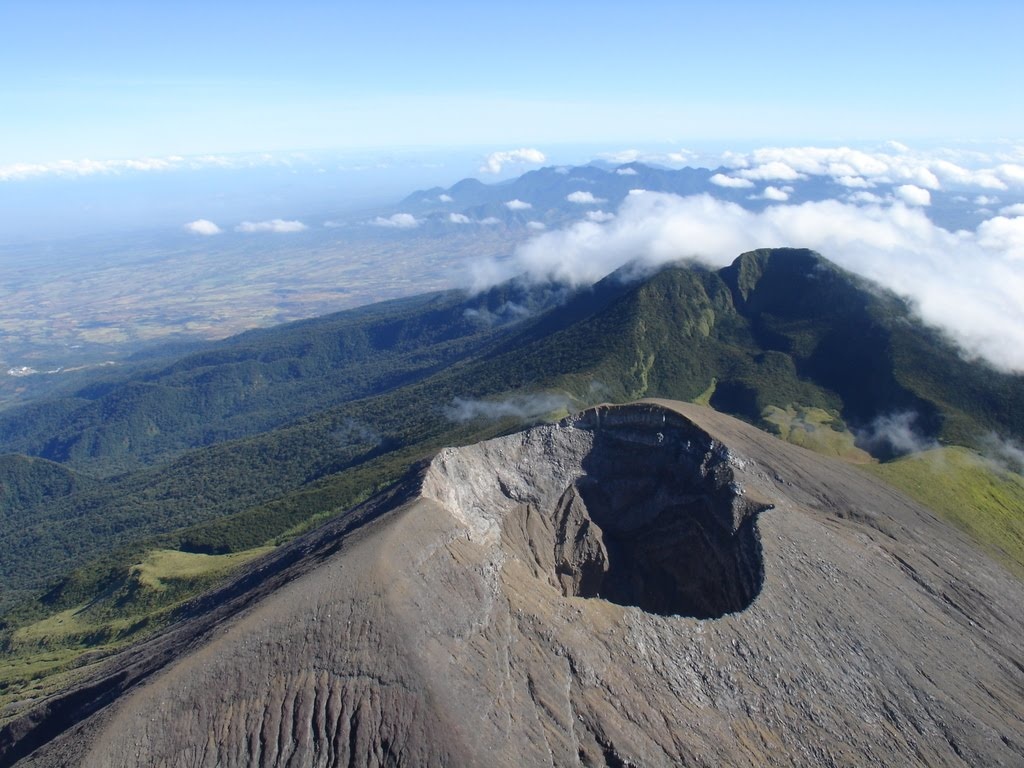
Kanlaon Volcano’s seismic monitoring network recorded four (4) volcanic earthquakes during the past 24 hours. Weak to moderate emission of white steam-laden plumes that rose 200 meters from the summit before drifting northwest was observed. Ground deformation data from continuous GPS measurements indicate pronounced inflation of the edifice since December 2017, signifying pressurization beneath the edifice. Sulfur dioxide (SO2) emission was measured at an average of 381 tonnes/day on 16 November 2018.
Alert Level 2 status prevails over Kanlaon Volcano, which means that the volcano is undergoing a moderate level of unrest due to probable intrusion of magma at depth that may or may not lead to a magmatic eruption. The local government units and the public are strictly reminded that entry into the 4-kilometer radius Permanent Danger Zone (PDZ) is strictly prohibited due to the further possibilities of sudden and hazardous steam-driven or phreatic eruptions. Civil aviation authorities must also advise pilots to avoid flying close to the volcano’s summit as ejecta from any sudden phreatic eruption can be hazardous to aircraft.
DOST-PHIVOLCS is closely monitoring Kanlaon Volcano’s activity and any new development will be relayed to all concerned.
Source : Phivolcs.

