November 01 , 2018 .
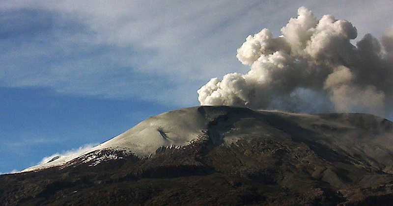
La Réunion , Piton de la Fournaise :
Activity Bulletin from Thursday, November 1, 2018 to 07:00 (local time).
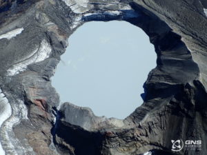
Since midnight UT, which is 4:00 local time, on 01 November 2018, no more signs of activity are recorded at Piton de La Fournaise.
The eruption started on September 15, 2018 at 4:25 am local time therefore stopped today, November 01, 2018, at 04:00 local time.
Alert Level Change Proposal: Backup.
Source : OVPF.http://www.ipgp.fr/fr/ovpf/bulletin-dactivite-jeudi-1-novembre-2018-a-0700-heure-locale
Photo : Fournaise info Facebook.
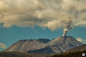
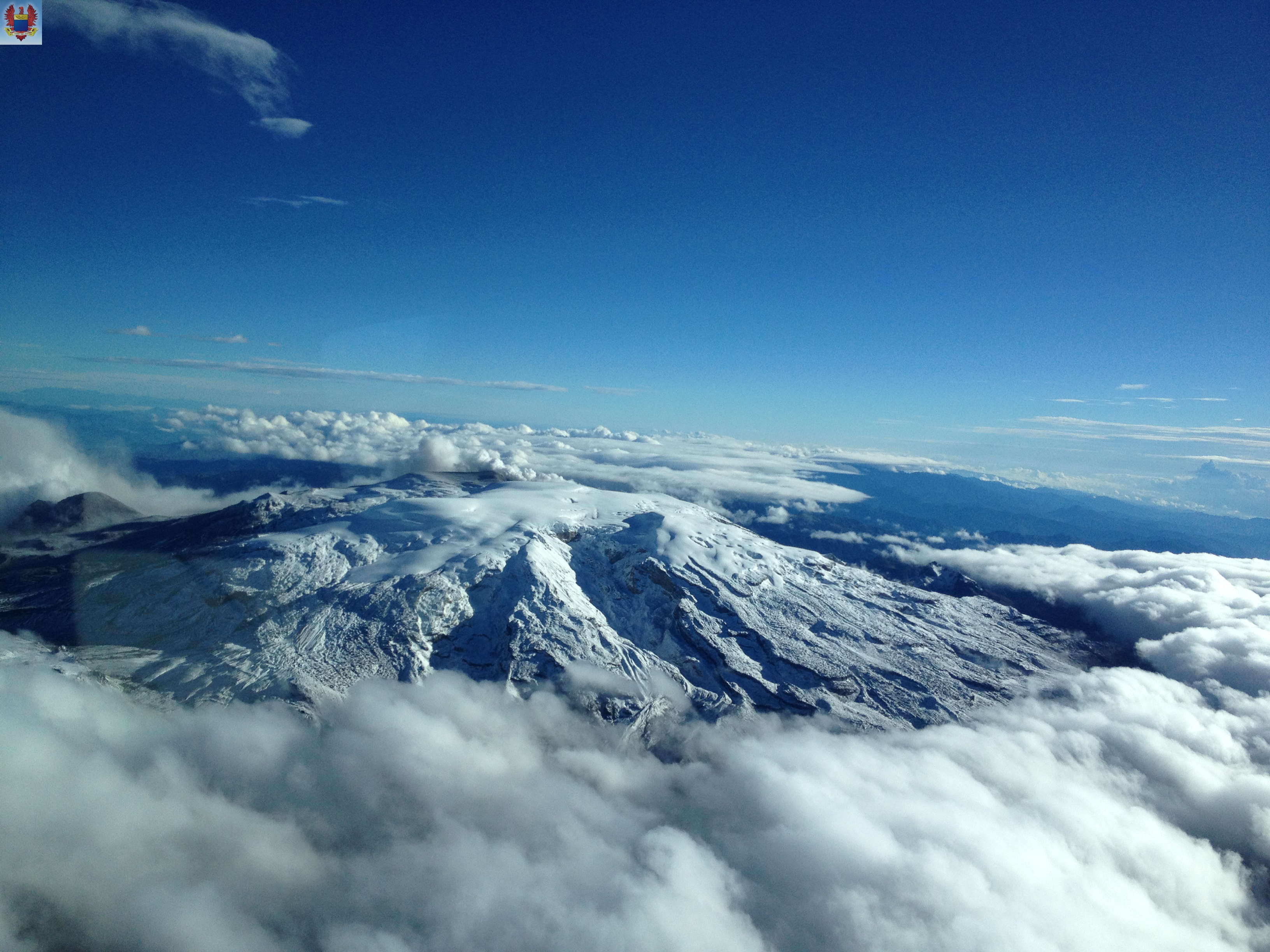
Colombia , Nevado del Ruiz :
4.892°N, 75.324°W
Elevation 5279 m
Servicio Geológico Colombiano’s (SGC) Observatorio Vulcanológico y Sismológico de Manizales reported that during 24-30 October seismicity at Nevado del Ruiz continued to indicate unrest.
Seismicity increased during 26-27 October, with signals concentrated in an area 4.6 km WSW of Arenas Crater at depths of 4-6 km. Plumes of water vapor, ash, and gas continued to rise from the volcano, and on 26 October a plume rose as high as 1.5 km above the crater rim. A weak thermal anomaly was identified in satellite data. The Alert Level remained at 3 (Yellow; the second lowest level on a four-color scale).
Subject: Activity bulletin of the Nevado del Ruiz volcano.
The level of activity continues at the level: Yellow activity level or (III): Changes in the behavior of volcanic activity.
With regard to monitoring the activity of the Nevado del Ruiz volcano, the COLOMBIAN GEOLOGICAL SERVICE announces that:
Over the past week, the seismicity caused by rock fracturing has resulted in an increase in the number of earthquakes and released seismic energy compared to the previous week. On 26 and 27 October, there was an increase in this seismicity which was located in the West-South-West sector 4.6 km from the Arenas crater at depths between 4.0 and 6.0 km. The maximum magnitude recorded during the week was 3.1 ML (local magnitude), corresponding to the earthquake recorded on October 26th at 8:11 pm (local time) during the said increase. This earthquake would have been felt by the officials of the Los Nevados National Park (PNNN). Other active sources during the week are the Southwest, Northeast and Arenas craters, at depths between 1.2 and 4.7 km.
Seismicity related to fluid dynamics, within the channels of the volcanic structure, showed a similar level of earthquake numbers and released seismic energy compared to the previous week. This activity was characterized by earthquakes with variable energy levels, long period (LP), very long period (VLP) and tremors. The earthquakes were mainly located in the crater Arenas and its surroundings.
The Nevado del Ruiz volcano continues its activity level Yellow.
Source: Servicio Geológico Colombiano (SGC) , GVP.
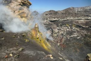
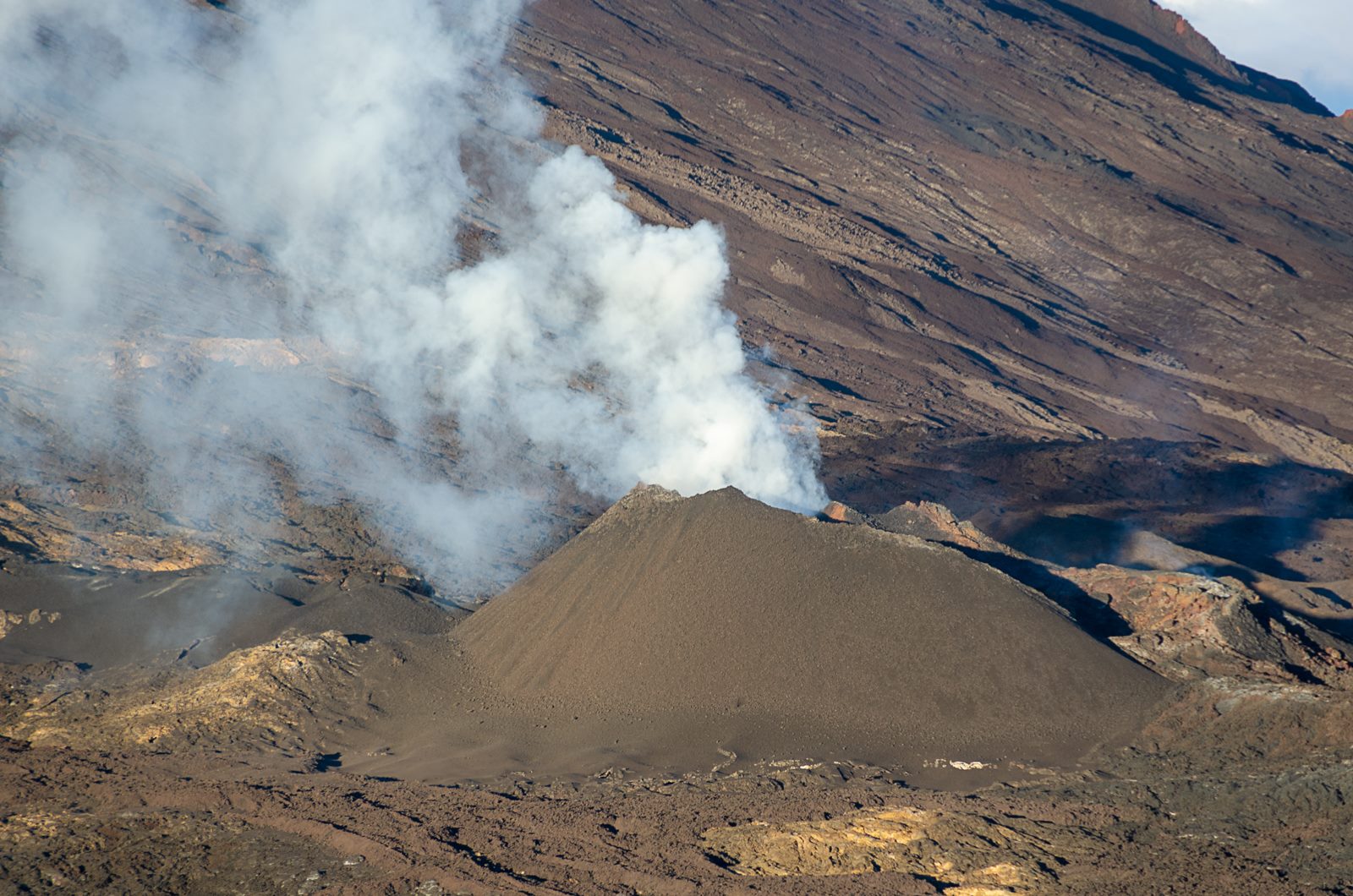
Hawaï , Kilauea :
19°25’16 » N 155°17’13 » W,
Summit Elevation 4091 ft (1247 m)
Current Volcano Alert Level: ADVISORY
Current Aviation Color Code: YELLOW
Activity Summary:
Kīlauea Volcano is not erupting. Rates of seismicity, deformation, and gas release have not changed significantly over the past week. Deformation signals are consistent with refilling of the middle East Rift Zone.
Observations:
HVO monitoring during the past week shows low rates of seismicity at the summit and East Rift Zone (ERZ). Earthquakes continue to occur primarily at Kīlauea’s summit area and south flank (magnitude-3.8 was the largest) with continued small aftershocks of the magnitude-6.9 quake on May 4, 2018. Seismicity remains low in the lower ERZ.
In the ERZ, tiltmeters near Puʻu ʻŌʻō and farther east continue to record an inflationary trend, consistent with refilling of the middle East Rift Zone. At the summit, tiltmeters have recorded a slight inflationary trend.
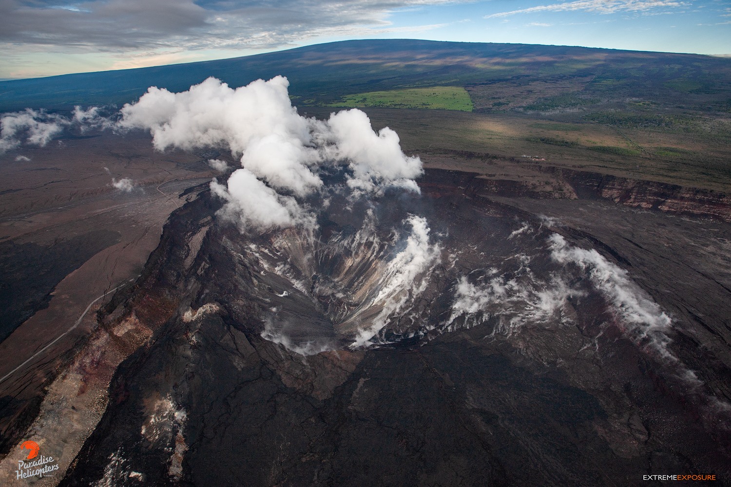
The 1/2 mile diameter Halema‘uma‘u crater has more than doubled in size as a result of collapses in May. Jaggar Museum and the HVO Observatory sit on the edge of the caldera, with Mauna Loa in the background.
Sulfur dioxide gas emissions at the summit averaged 50 tonnes/day as reported on October 24, and 75 tonnes/day at Puʻu ʻŌʻō on October 23. There was no sulfur dioxide detected by our instruments in the lower ERZ.
Hazards are still present in the lower East Rift Zone (LERZ) eruption area and at the Kīlauea summit. Residents and visitors near recently active fissures and lava flows should stay informed, heed Hawaii County Civil Defense and National Park warnings, and be prepared, if necessary, to self-evacuate in the unlikely event of renewed activity. Please note that Hawaii County maintains a closure of the entire flow field and the vents and prohibits access to the area unless authorized through Civil Defense.
The Hawaiian Volcano Observatory (HVO) continues to closely monitor Kīlauea’s seismicity, deformation, and gas emissions for any sign of reactivation, and maintains visual surveillance of the summit and the East Rift Zone. HVO will continue to issue a weekly update (every Tuesday) and additional messages as warranted by changing activity.
Source : HVO
Photo : Bruce Omori.
Japan , Ryukyu Islands , Kuchinoerabujima :
30.443°N, 130.217°E
Elevation 657 m
Based on satellite images and information from JMA, the Tokyo VAAC reported that during 24-28 October ash plumes from Kuchinoerabujima’s Shindake Crater rose to altitudes of 0.9-1.5 km (3,000-5,000 ft) a.s.l. and drifted in multiple directions.
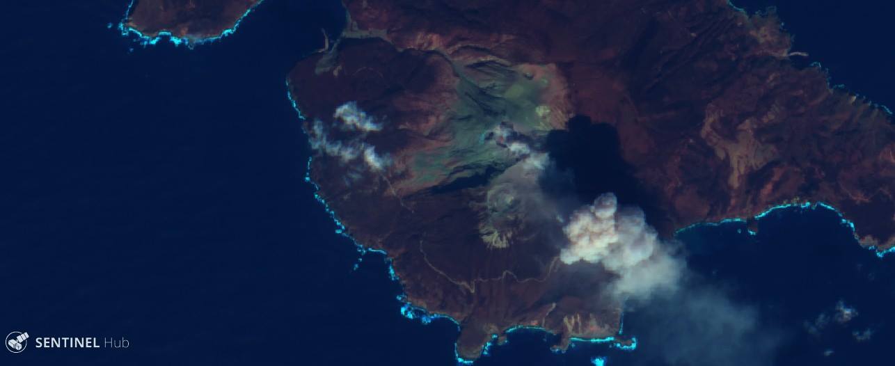
Kuchino-erabu-jima the 29/10/2018 by Sentinel2.
JMA scientists noted no changes in the thermal anomalies at the crater during a field observation on 28 October. The Alert Level remained at 3 (on a scale of 1-5).
Sources: Agence météorologique japonaise (JMA), Centre d’avis de cendres volcaniques de Tokyo (VAAC) , GVP.
Photo : Sentinel 2 via Sherine France.