October 11 , 2018.
Colombia , Chiles / Cerro Negro :
Weekly activity bulletin of volcanoes Chiles and Cerro Negro.
The activity level of the volcanoes is maintained at the level: YELLOW LEVEL ■ (III): CHANGES IN THE BEHAVIOR OF THE VOLCANIC ACTIVITY
Following the activity of the CHILE volcanoes and CERRO NEGRO, the COLOMBIAN GEOLOGICAL SERVICE (SGC) reports that:
During the period evaluated, between 2 and 8 October 2018, seismic activity in the Chile – Cerro Negro volcano region remained high, rising from 3,000 earthquakes in the previous week to 3 460 earthquakes for this week evaluated. The predominant seismicity remains related to fracturing processes located in different zones. The earthquakes were located in the South-South-West sector of the Chiles volcano, at a maximum distance of 6 km and at a depth of less than 6.4 km from the Chiles summit (4700 m altitude).
Some earthquakes were a little more dispersed to the south-east of the volcano, at a maximum distance of 11 km and at a depth of between 8 and 12 km, compared to the summit of the Chiles volcano. Two of the earthquakes that occurred on October 4 were reported as being felt by the inhabitants of the Chiles volcano’s influence zone, the first at 6:40 am with a magnitude of M3.3 and the second at 8:08 pm, with magnitude of M2.8 on the Richter scale.
The Colombian Geological Service and the Institute of Geology of the National Polytechnic School of Ecuador closely monitor the evolution of this seismic activity and the volcanic phenomenon and inform in a timely manner on the detected changes.
Source : SGC
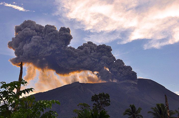
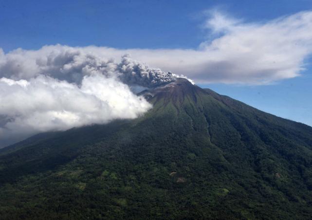
Italy / Sicily , Etna :
Seismic activity in the southwestern part of Mount Etna and other areas around the mountain is no sign of a larger impending earthquake (this can always be done and in any case, the seismic risk is always the same), and this is no sign that an eruption of Etna is imminent. Instead, it seems to be the expression of Etna’s flanking dynamics, which respond to deeper magmatic processes, yet lead to a gradual destabilization of the mountain. This, in turn, probably in the not-too-distant future (weeks, months?) May facilitate the movement of magma in one of the flanks of Etna and trigger an eruption on the side. We can not say when, where and how, because the mountain has not decided yet. Anyway, as we approach a flank eruption, we would see signals that are more and more clear and obvious, until there are hundreds or thousands of small earthquakes that mark the opening of an eruptive fracture on the side.
We consider that Etna’s last flank eruption dates back to 2008-2009, and it was an eruption, although voluminous, totally harmless because it occurred very high, above the Del Bove Valley. The last serious eruption was that of 2002-2003, but the last eruption to threaten an inhabited center is now more than 25 years apart (1991-1993). The last time an inhabited center was evacuated to Mount Etna was in 1979 (Fornazzo), and the last inhabited village destroyed by an eruption was Mascali, almost exactly 90 years ago. This for a historical perspective, in which fits the current and future activity of Etna.
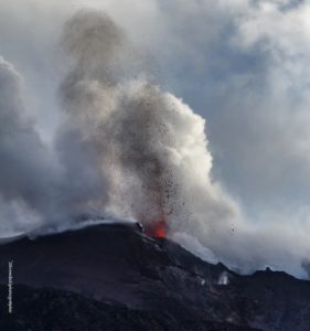
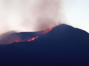
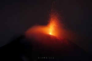
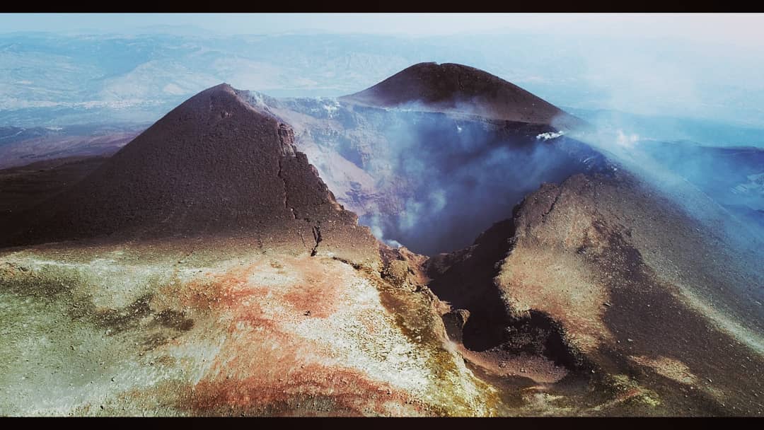
Voragina and Bocca del 64 (La Spagnola) of the Bocca Nuova. CRATERS summital of ETNA October 9, 2018
Anyway, please do not spread any alarming news, like that of a great earthquake imminent (note well, the risk of a great earthquake in eastern Sicily still exists and of anyway, no matter what seismic activity these days) or other stuff from « Ilmondofiniradomani.com » (no, this site luckily does not exist … yet) … We try to be always good informed, including seismic risk and how to act in the event of an earthquake. Of course, in the case of an eruption of Etna at low altitude, there would be no choice, it would evacuate areas directly threatened by lava flows.
Source : Boris Behncke , iononrischio.protezionecivile.it
Photos : Marco Neri , Gio Giusa .
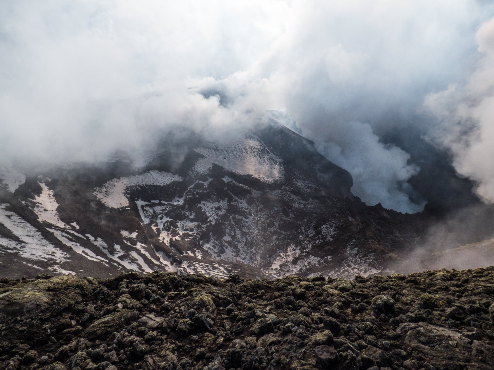
La Réunion , Piton de la Fournaise :
Activity Bulletin from Wednesday, October 10, 2018 at 3:00 pm (local time).
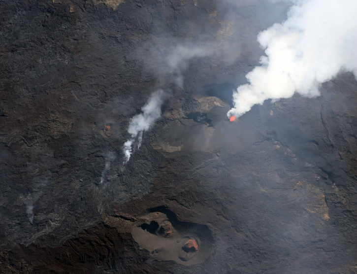
The eruption started on September 15th at 4:25 am local time continues. The intensity of the volcanic tremor (indicator of the eruptive intensity at the surface) is still gradually decreasing for five days, even this decline slowed down for 24 hours (Figure 1).
Piston gases (« gas flushes » or « tremor puffs ») at the eruptive site are always recorded by the OVPF seismometers.
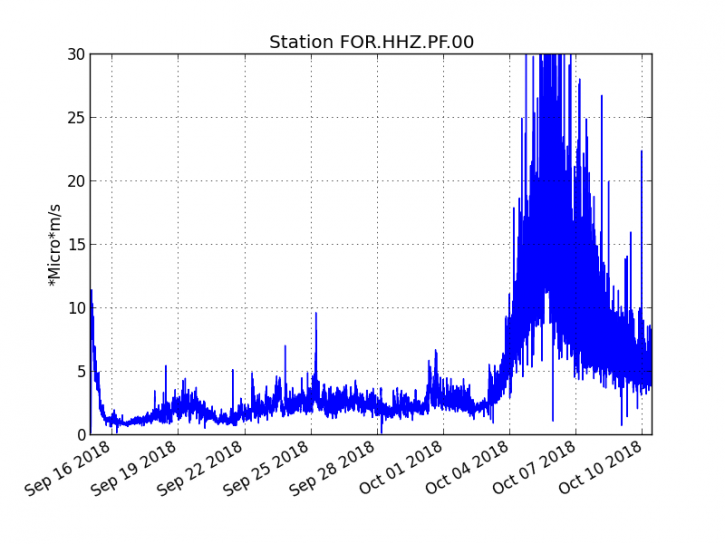
Figure 1: Evolution of the RSAM (indicator of the volcanic tremor and the intensity of the eruption) between 04h00 (00h UTC) on September 15th and 15h00 (11h00 UTC) on October 10th on the FOR seismic station, located near the crater Chateau Fort (2000 m altitude on the southeast flank of the terminal cone). (© OVPF / IPGP)
– No volcano-tectonic earthquake was recorded during the day of 9 October or during the current day.
– Inflation (swelling) of the building is still noticeable. This inflation is accompanied by an increase in the concentrations of CO2 in the soil in the area of the Volcano Cottage. This inflation is indicative of the pressurization of a localized source beneath the summit craters at a depth of 1-1.5 km, linked to the recharge of the superficial reservoir by deeper magma (increase in CO2 concentrations in the soil at higher temperatures). outside the Enclos).
– No land reconnaissance could be done today given the bad weather conditions on the volcano this day.
– The surface flows could not be estimated today because of lava flows that are too weak at the surface and poor weather conditions on the site.
Alert level: Alert 2-2 – Eruption in the Enclos
.
Source : OVPF . www.ipgp.fr/fr/ovpf/bulletin-dactivite-mercredi-10-octobre-2018-a-15h00-heure-locale
Indonesia , Gamalama :
PVMBG reported that an explosion from Gamalama at 1152 on 4 October was likely phreatic; it generated an ash plume that rose about 250 m above the summit and drifted NW. Eight volcanic earthquakes were recorded about an hour before the event. Based on satellite data and information from PVMBG, the Darwin VAAC reported that during 5-6 October ash plumes rose to 2.1 km (7,000 ft) a.s.l. and drifted W and NW. The Alert Level remained at 2 (on a scale of 1-4); visitors and residents were warned not to approach the crater within a 1.5-km radius.
VOLCANO OBSERVATORY NOTICE FOR AVIATION – VONA.
Issued: October 10 , 2018
Volcano: Gamalama (268060)
Current Aviation Colour Code: YELLOW
Previous Aviation Colour Code: orange
Source: Gamalama Volcano Observatory
Notice Number: 2018GML02
Volcano Location: N 0 deg 48 min 00 sec E 127 deg 19 min 48 sec
Area: North Maluku, Indonesia
Summit Elevation: 5488 FT (1715 M)
Volcanic Activity Summary:
Gas emission observed at 08h52 UTC (17h52 local). No sign of volcanic ash.
Volcanic Cloud Height:
Best estimate of ash-cloud top is around 5520 FT (1725 M) above sea level, may be higher than what can be observed clearly. Source of height data: ground observer.
Other Volcanic Cloud Information:
Gas emitted continuously, mostly contain water vapour.
Remarks:
Seismic activity is characterized by emission, tectonic, and continuous microtremor
Level of activity at Level II (WASPADA). The Gamalama (1715 m above sea level) experienced a minor eruption on October 4, 2018 at 11:52 am with a height of ash column observed reaching 250 meters above sea level or 1965 m above sea level. From yesterday and until this morning, the volcano was visually cleared until it was covered with fog, smoke from the crater is not observed above the summit. The wind is blowing weakly in the southeast – northwest.
By the seismographs of October 10, 2018, it was recorded:
13 emission earthquakes
3 deep volcanic earthquakes
1 local tectonic earthquake
15 distant tectonic earthquakes
2 vibrations of lahars .
A continuous tremor with a maximum amplitude of 0.5 to 1 mm and a dominant value of 0.5 mm.
Recommendation: People around Mt.Gamalama and visitors / tourists should not move within a radius of 1.5 km around the crater at the top of Mt.Gamalama. During the rainy season, residents of the downstream G. Gamalama River must be aware of the potential threat of secondary dangers in the form of lahars.
Sources : GVP , Magma , PVMBG.
Photos : Andy / Volcanodiscovery (2011) , Ibtimes.