September 19 , 2018.
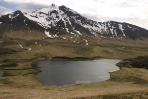
La Réunion , Piton de la Fournaise :
Activity Bulletin from Tuesday, September 18, 2018 at 17:00 (local time).
The eruption that began September 15 at 4:25 am local time continues. The volcanic tremor (indicator of surface eruptive intensity) has remained at a relatively stable and low level since 18:00 on 15 September (14:00 UT), despite some variations over the past few hours.
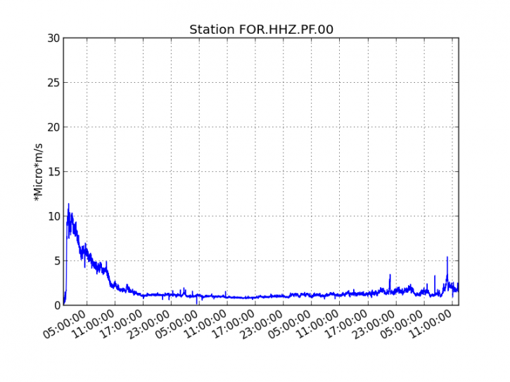
Figure 1: Evolution of the RSAM (indicator of the volcanic tremor and the intensity of the eruption) between 04:00 (00h UTC) September 15 and 16:30 (12:30 UTC) September 18 on the seismic station of FOR, located near the Château-fort crater (2000 m altitude to the southeast of the summit).
– Two volcano-tectonic earthquakes were recorded under the summit craters during the day of September 17, as well as three additional ones during the current day.
– The SO2 emissions recorded by the OVPF’s permanent sensors are much higher than the atmospheric background (linked to the volcanic gas plume), and are now mostly dispersed westwards since the beginning of the day.
– No deformation is noticeable since the beginning of the eruption.
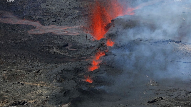
– The surface flows were estimated from the satellite data, via the platform MIROVA (University of Turin) and HOTVOLC (OPGC – University of Auvergne), and between 7 and 11 m3 / s on the day of September 17 . The flow front is still in the upper part of the Enclos and does not seem to have changed since yesterday. The flow arms to the east seems to have widened on its northern flank. Another arm flows south. His front does not seem to have progressed since yesterday. At the end of the morning, these two fronts of flows were maintained several hundred meters from the southern rampart of the Enclos . The easterly easter front is currently about 2km from the slope break.
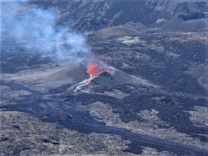
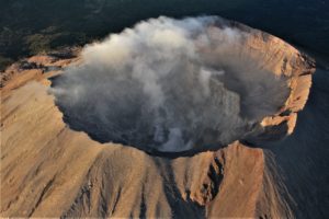
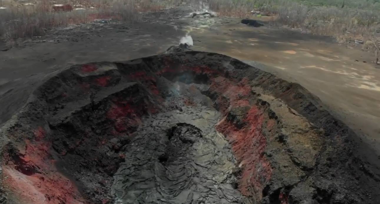
Figure 2: View of the cone being built around the active vent (18/09/2018 at 12:30 local time)
Source : OVPF
Colombia , Nevado del Ruiz :
Subject: Bulletin of extraordinary activity of the Nevado del Ruiz volcano. The level of yellow or (III) activity is maintained: changes in the behavior of volcanic activity.
With regard to monitoring the activity of the Nevado del Ruiz volcano, the COLOMBIAN GEOLOGICAL SERVICE informs that:
Since September 15, a new episode of continuous volcanic tremor began on the Nevado del Ruiz volcano, which continues to be recorded until the publication of this bulletin. This seismic signal is of low energy level and has been accompanied by pulses of volcanic tremor. These seismic events have been associated with several ash emissions. The broadcasts were confirmed on the images obtained by the web cameras, as well as the reports received from officials of the Los Nevados National Natural Park (PNNN), the inhabitants near the volcano, the civil aviation and the Center of opinion of Washington ash emission (W-VAAC).

These ash emissions have been reported to civil aviation through VONA notifications (Aviation Volcano Observatory Notice). The column reached a maximum height of 1400 meters, at the top of the volcano, and maintained a preferential direction of dispersion to the northwest of the volcanic structure. It is not excluded that new pulses of volcanic tremor are associated with ash emissions, which will eventually be dispersed depending on the wind speed and direction conditions, which are present at the time of each emission.
It is recommended that the community remain alert to changes that may occur in the activity of the volcano.
The Nevado del Ruiz volcano continues at the level of yellow activity. It is not excluded that there is an activity that can indicate an acceleration of the process, implying a greater instability of the volcano and, consequently, changes in its level of activity. Although the instability of the volcano has lasted for about eight years, it is vital not to get used to its behavior and to be attentive to the official information that will be published by the Colombian Geological Survey. It is reiterated to the authorities of the departments of Caldas and Tolima, extreme measures focused both on the processes of risk reduction and disaster management as readiness measures for the future activities of the Nevado del Ruiz volcano.
The COLOMBIAN GEOLOGICAL SERVICE is attentive to the evolution of the volcanic phenomenon and will continue to inform in a timely manner of any changes that may occur.
Source : SGC
Photo : Colprensa
Vidéo : La Patria.
Alaska , Veniaminof :
56°11’52 » N 159°23’35 » W,
Summit Elevation 8225 ft (2507 m)
Current Volcano Alert Level: WATCH
Current Aviation Color Code: ORANGE
Eruption of a lava flow from Veniaminof volcano’s summit cone likely continues, as suggested by continued observations of elevated seismic activity and elevated surface temperatures in thermal satellite data. Incandescence was not observed in nighttime webcam images, but views were likely obscured by clouds. No significant ash emissions have been observed.
Veniaminof Volcano is monitored with a local real-time seismic network, which will typically allow AVO to detect changes in unrest that may lead to an explosive eruption. Rapid detection of an ash-producing eruption would be accomplished using a combination of seismic, infrasound, lightning, and satellite data.
Source : AVO
Photo : Finley, Zachary , 14 Sept. 2018.
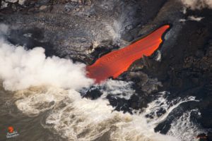
Hawaï , Kilauea :
19°25’16 » N 155°17’13 » W,
Summit Elevation 4091 ft (1247 m)
Current Volcano Alert Level: WATCH
Current Aviation Color Code: ORANGE
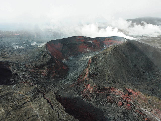
Kīlauea summit and lower East Rift Zone
On Kīlauea Volcano’s lower East Rift Zone (LERZ), the collapse pit is the central part of a slowly subsiding lava surface that previously filled the fissure 8 cone. No incandescence is visible overnight while minor fuming is visible during the day.
Seismicity and ground deformation remains low at the summit of Kīlauea. Aftershocks from the magnitude-6.9 earthquake in early May are still being generated on faults located on Kīlauea’s South Flank.
No collapses within Puʻu ʻŌʻō crater have been observed over the past few days. Rates of tilting throughout the East Rift Zone are much lower than those observed during the period of major eruptive activity. There has been no change in seismicity during the past week.
Sulfur dioxide (SO2) emission rates at the summit, Puʻu ʻŌʻō, and LERZ are drastically reduced; the combined rate is less than 1,000 tonnes/day, which is lower than at any time since late 2007. SO2 emission rates from LERZ vents were below the detection threshold of the measurement technique when last measured on Sept. 11. Minor amounts of H2S are being emitted at the summit and at Puʻu ʻŌʻō.
The Hawaiian Volcano Observatory (HVO) continues to closely monitor Kīlauea’s seismicity, deformation, and gas emissions for any sign of reactivation, and maintains visual surveillance of the summit and LERZ. HVO will continue to issue daily updates and additional messages as needed.
Source : HVO
Photos : USGS , Dana Du Pont.
Mexico , Popocatepetl :
In the last 24 hours, thanks to the surveillance systems of the Popocatépetl volcano, 196 exhalations have been identified, accompanied by water vapor, gas and small quantities of ash. In addition, eight explosions were recorded yesterday at noon and seven today at 03:33, 04:58, 04:59, 05:55, 07:44, 07:49 and 08:37. In addition, 204 minutes of low amplitude harmonic tremor and 3 volcano-tectonic events yesterday at 13:11 and 04:14, with respective magnitudes of M1,6, M1,8 and M1,6, were recorded.
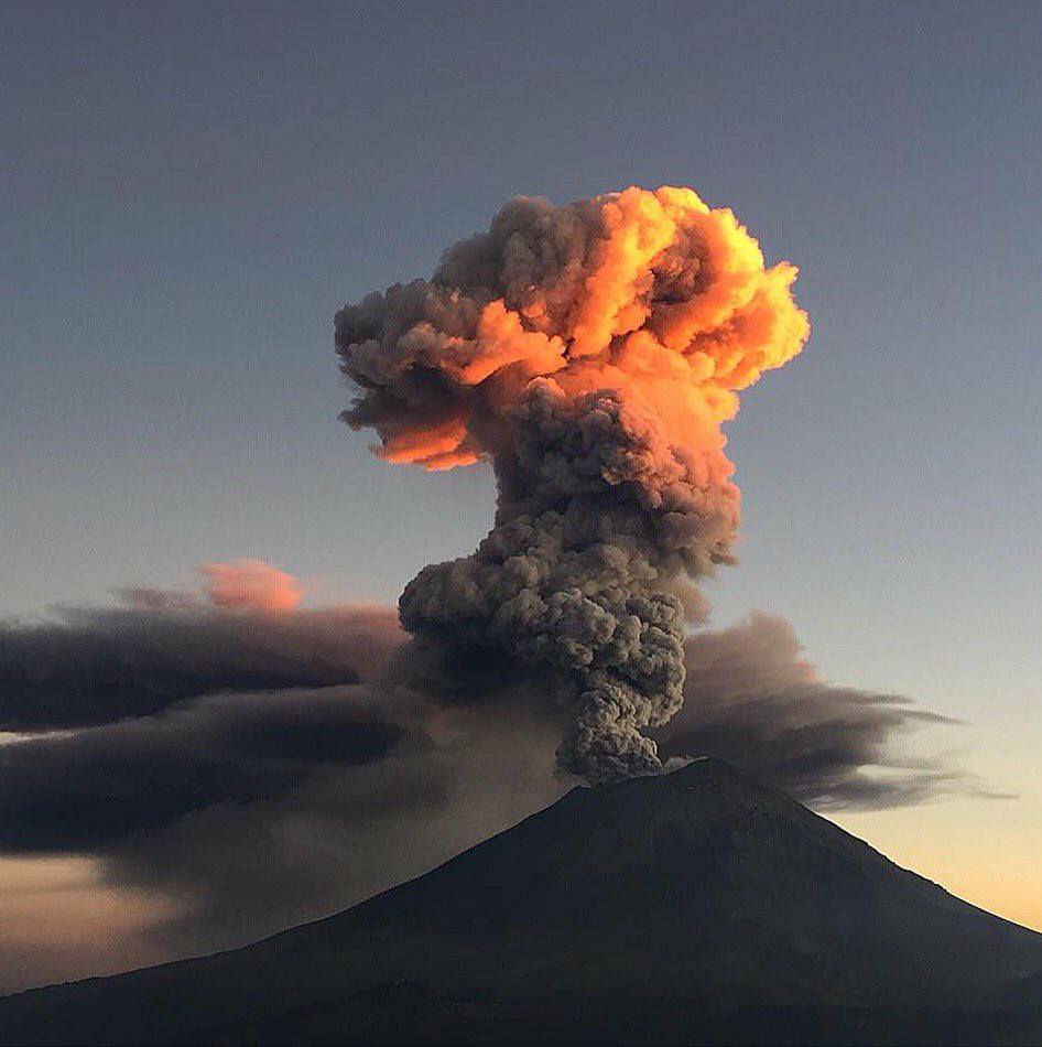
During the night, an incandescence was observed. At the time of writing this report, there was intermittent visibility of the volcano, it was observed that the emission of water vapor was dispersing towards the west.
CENAPRED urges not to approach the volcano and especially the crater, for the danger represented by the fall of ballistic fragments and in case of heavy rains to stay away from the bottoms of the ravines because of the danger of landslides and mudslides .
Source : Cenapred
Photo : Inconnue