September 05 , 2018.
Alaska , Veniaminof :
AVO/USGS Volcanic Activity Notice
Current Volcano Alert Level: WATCH
Previous Volcano Alert Level: ADVISORY
Current Aviation Color Code: ORANGE
Previous Aviation Color Code: YELLOW
Issued: Tuesday, September 4, 2018, 1:09 PM AKDT
Source: Alaska Volcano Observatory
Location: N 56 deg 11 min W 159 deg 23 min
Elevation: 8225 ft (2507 m)
Area: Alaska Peninsula
Volcanic Activity Summary:
Seismic activity remains elevated at Veniaminof. Low-level ash emissions have been observed in web camera images and have been confirmed by observers in Perryville. Thus, AVO is raising the Aviation Color Code to Orange and the Volcano Alert Level to Watch.
Recent Observations:
[Volcanic cloud height] 8000-10,000ft
[Other volcanic cloud information] Low-level ash emissions.
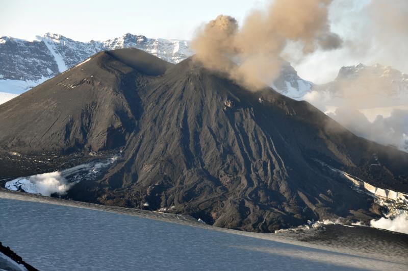
Low aerial view of the southwest flank of the intracaldera cinder cone in Veniaminof volcano. The first lava flow of the 2013 eruption forms a wide fan across the flank, descends to the ice floor of the caldera where several coalescing ice cauldrons are forming.
Remarks:
Mount Veniaminof volcano is an andesitic stratovolcano with an ice-filled 10-km diameter summit caldera located on the Alaska Peninsula, 775 km (480 mi) southwest of Anchorage and 35 km (22 mi) north of Perryville. Veniaminof is one of the largest (~300 cubic km; 77 cubic mi) and most active volcanic centers in the Aleutian Arc and has erupted at least 13 times in the past 200 years. Recent significant eruptions of the volcano occurred in 1993-95, 2005, and 2013. These were Strombolian eruptions that produced lava fountains and minor emissions of ash and gas from the main intracaldera cone. During the 1993-95 activity, a small lava flow was extruded, and in 2013, five small lava flows effused from the intracaldera cone over about five months. Minor ash-producing explosions occurred nearly annually between 2002 and 2010. Previous historical eruptions have produced ash plumes that reached 20,000 ft above sea level (1939 and 1956) and ash fallout that blanketed areas within about 40 km (25 mi) of the volcano (1939).
Source : AVO
Photo : McGimsey, R. G. , Aout 2013.
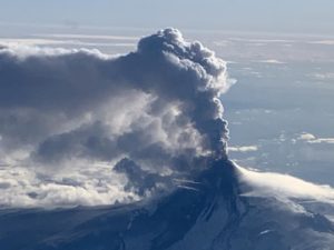
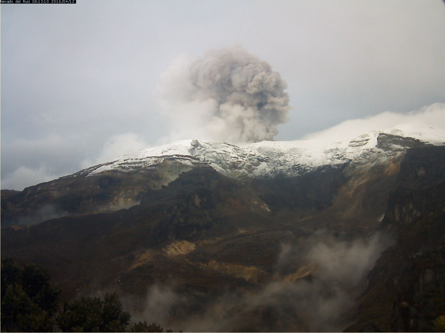
Colombia , Nevado Del Ruiz :
Subject: Bulletin of extraordinary activity of the Nevado del Ruiz volcano. The level of activity is maintained at Yellow (III) level: changes in the behavior of volcanic activity.
With regard to the monitoring of Nevado del Ruiz activity, the Colombian Geological Survey reported that:
As reported in the weekly bulletin published today, the Nevado del Ruiz volcano over the past week has seen an increase in the recording of seismic signals associated with fluid movements inside the volcano. Today, the day experienced a low-energy volcanic tremor, which was associated with ash emission and was confirmed by monitoring the surface activity achieved through webcams and reports received by residents of the city of Manizales, concordant with the direction of the wind, which has tended to head northwest of the volcanic structure.
It is recommended that the community remain alert to changes that may occur in the activity of the volcano.
The Nevado del Ruiz volcano remains at the level of yellow activity. It is not excluded that there is an activity that can indicate an acceleration of the process, implying a greater instability of the volcano and, consequently, changes in its level of activity. While the instability of the volcano has lasted nearly eight years, it is essential not to get used to its behavior and be attentive to official information published by the Colombian Geological Survey.
The COLOMBIAN GEOLOGICAL SERVICE is attentive to the evolution of the volcanic phenomenon and will continue to inform in good time about the changes that may occur.
Source : SGC
Photo : Ingeominas ( 2016)
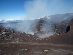
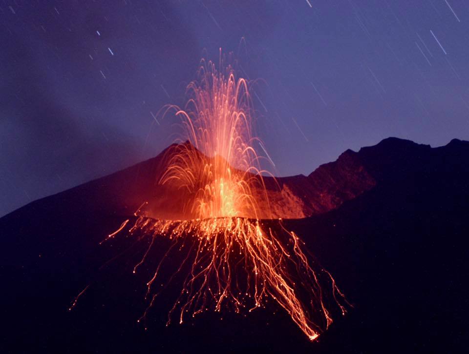
Japan , Aira ( Sakurajima ) :
31.593°N, 130.657°E
Elevation 1117 m
JMA reported that there were three events and 12 explosions at Minamidake crater (at Aira Caldera’s Sakurajima volcano) during 20-27 August, with ash plumes rising as high as 2.1 km above the crater rim and material ejected as far as 1.3 km. Crater incandescence was sometimes visible at night. The Alert Level remained at 3 (on a 5-level scale).
The Aira caldera in the northern half of Kagoshima Bay contains the post-caldera Sakurajima volcano, one of Japan’s most active. Eruption of the voluminous Ito pyroclastic flow accompanied formation of the 17 x 23 km caldera about 22,000 years ago. The smaller Wakamiko caldera was formed during the early Holocene in the NE corner of the Aira caldera, along with several post-caldera cones. The construction of Sakurajima began about 13,000 years ago on the southern rim of Aira caldera and built an island that was finally joined to the Osumi Peninsula during the major explosive and effusive eruption of 1914. Activity at the Kitadake summit cone ended about 4850 years ago, after which eruptions took place at Minamidake. Frequent historical eruptions, recorded since the 8th century, have deposited ash on Kagoshima, one of Kyushu’s largest cities, located across Kagoshima Bay only 8 km from the summit. The largest historical eruption took place during 1471-76.
Source: Agence météorologique japonaise (JMA) , GVP.
Photo : K Arima .
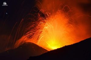
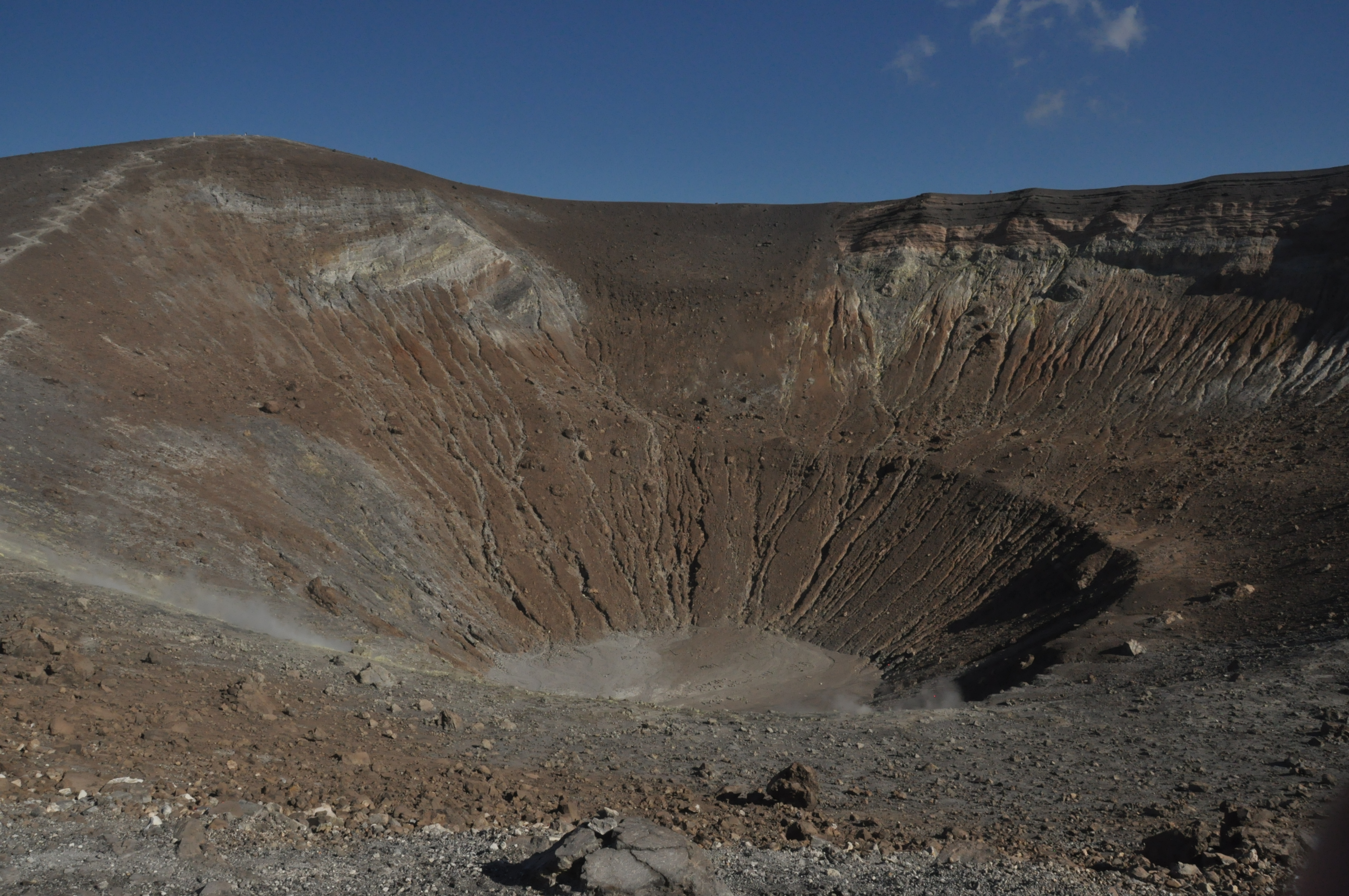
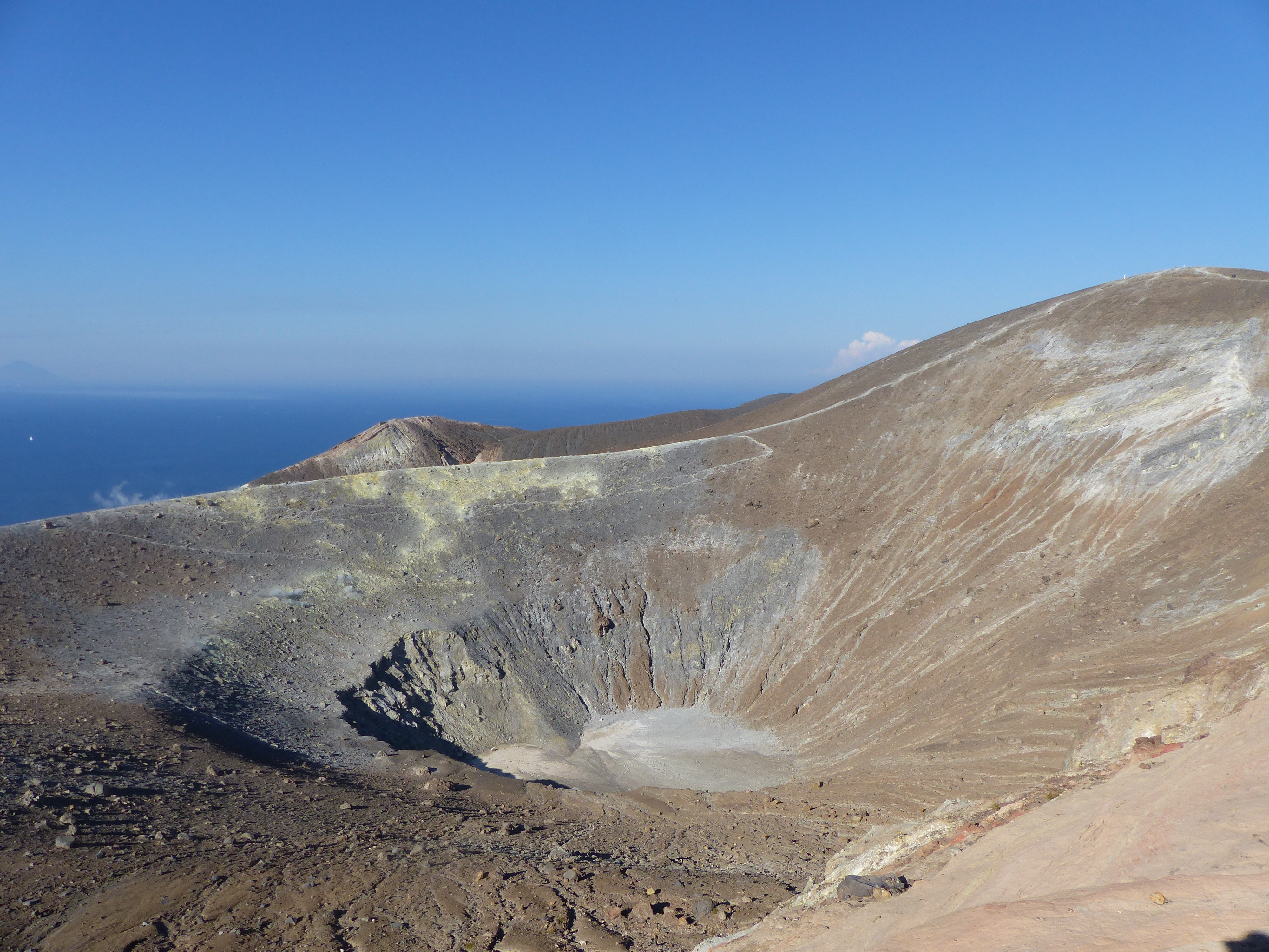
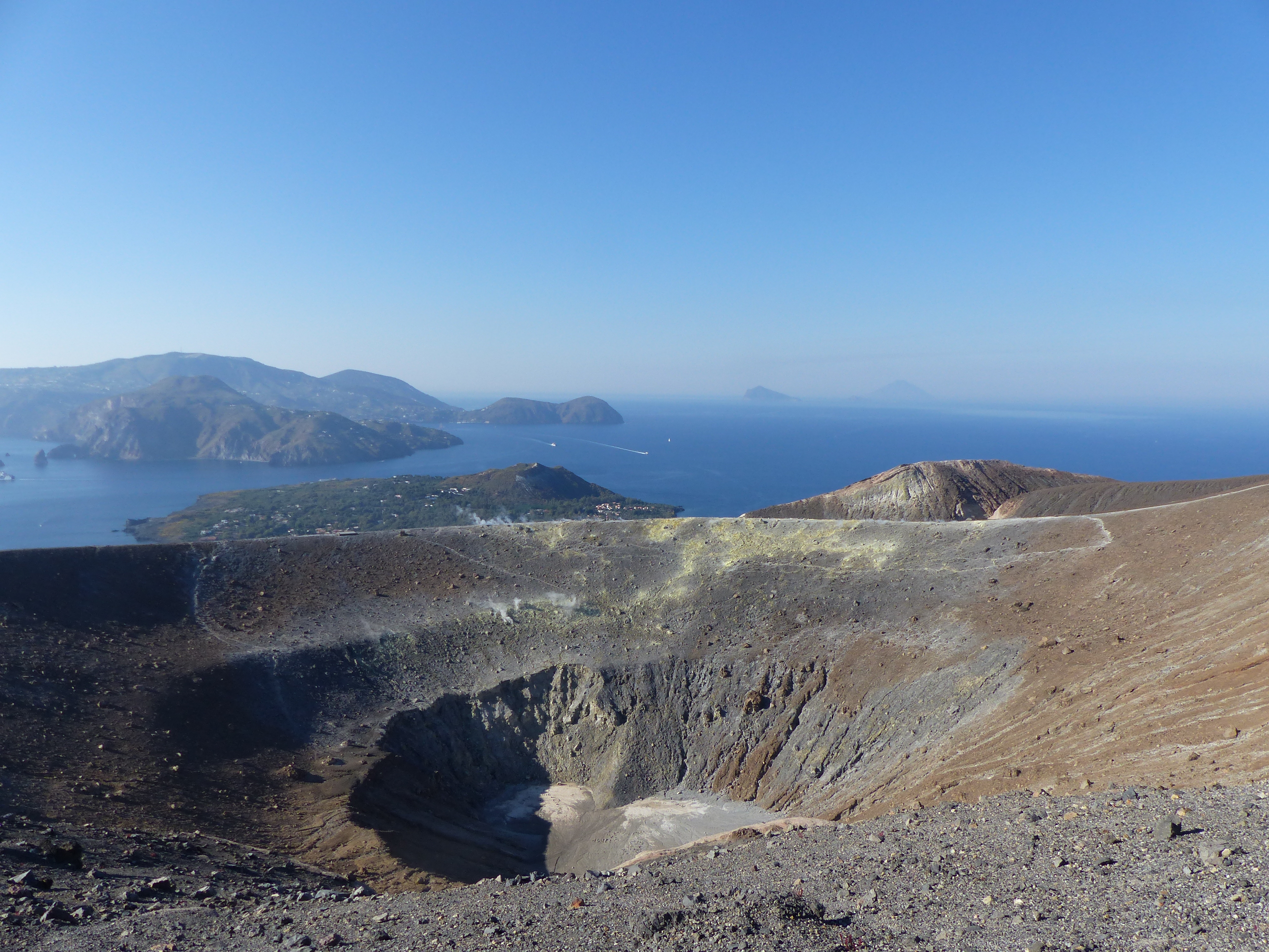
Eolian Islands / Italy , Vulcano :
Aeolian Islands, the few eruptions on the island of Vulcano, A study reveals new risk scenarios.
Vulcano, the first island in the Aeolian archipelago, produces fewer eruptions than one would expect, given its extremely explosive characteristics. This is the result of a study conducted by a group of researchers from the University of Catania in collaboration with the University of Calabria and the National Institute of Geophysics and Volcanology, which has just appeared on Lithos, a well-known Earth Science.
The starting point of the research was the historical analysis of Vulcano’s recent activity. The last eruption on the island took place in the two years 1888-1890 at the Gran Crater of La Fossa, the current main crater of Vulcano, and was documented in detail by the scholar Giuseppe Mercalli. The previous eruption, known as Colata delle Pietre Cotte, dates back to 1739. Going back in time, there was the eruption of Vulcanello III of the seventeenth century; the Commenda eruption of about 1250; the eruption of Punte Nere and Palizzi, respectively around 1170 and 1230; the Vulcanello I eruption around 1050-1220.
In short, over the past thousand years, Vulcano seems to have caused a few eruptions interspersed with about one hundred and two hundred years of rest. According to the researchers, there are too few events, especially as the island has extremely explosive characteristics and normally eruptions associated with similar volcanoes produce very catastrophic events. The few volcanic eruptions, on the other hand, were not particularly violent, at least not enough to justify such periods of silence. It is known, in fact, that eruptions are nothing more than the release on the surface of an enormous quantity of energy accumulated in the volcanic system as a result of a thermal imbalance. This energy may be released as a result of frequent eruptive events or extremely violent, unique or sporadic eruptions.
Just this contrast between the long rest periods of Vulcano and its mild eruptions was the starting point for the research coordinated by Marco Viccaro, professor of geochemistry and volcanology at the University of Catania. The study used the information provided by some crystals contained in Vulcano eroded lava over the past thousand years. The crystals, tiny solid fragments formed when the magma is still inside the volcanic system, are known to be able to record, during their growth, important information, especially with regard to the time they spend inside the the magmatic chamber.
The results revealed that the time spent by the magma in the earth’s crust is very long. « The magma is mainly confined to the deepest areas of the volcanic system, around 20-25 kilometers where it stays mostly between one eruption and another to return to the surface a few years ago a new eruption », explains MeridioNews Viccaro, who, in addition to being a lecturer, is also the coordinator of the university’s research team.
« Vulcano could therefore be considered a relatively empty system: when the magma begins to emerge from the deep zones, it activates residual magma levels that are more on the surface but can not alone trigger an eruption, » continues the researcher. « This means that the magma that feeds an eruption was fully mobilized just two years ago. This is an absolute novelty in terms of previous knowledge of Vulcano that could have very important implications for volcanic risk, « says Viccaro.
Vulcano, in fact, is a heavily watched island because of the potential risk associated with it, knowing that the island is a popular tourist destination, especially in summer. It is therefore obvious that the understanding of the time between precursor signs (the body of evidence that heralds the rise of magma) and the eruption are of fundamental importance for the evaluation and mitigation of volcanic risk. « It’s important to understand, across all surveillance systems, when the magma really begins to move deep. Having a forecast of a few years already means being able to do a lot of risk mitigation, « concludes the author of the study.
Source : meridionews.it / Marco Neri
Photos : G Vitton / LCDV , Sylvie Mallassenet .