July 03 , 2018.
Sierra Negra , Galapagos / Ecuador :
Special Report on Sierra Negra Volcano Nº 12 – 2018
Resurgence of the eruptive process on the Sierra Negra volcano
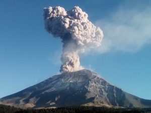
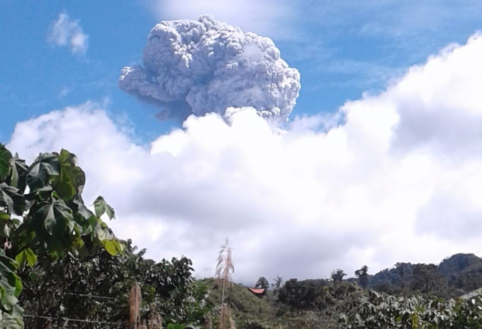
At 15:52 (Galapagos time), a small seismic event was recorded under the Sierra Negra volcano, after which a tremor-type seismic signal was recorded which has been maintained until now.
Galapagos National Park staff reported at 4 pm (Galapagos time) the glow and presence of lava flows on the northwest flank of the volcano. These signs suggest the resumption of the eruptive process of the Sierra Negra volcano.
It is not recommended to approach the area of activity. In the case of an ash fall or volcanic ash area, it is recommended that appropriate precautions be taken.
The IG-EPN maintains its vigilance and will report any significant change in volcanic activity.
Source : MR, JS , Institut de géophysique , École nationale polytechnique.
Photo : Carlos Romero
Reventador , Ecuador :
Emission and ash fall in the provinces of Pichincha and Napo
Yesterday, July 2, 2018, a fall of white volcanic ash was reported in the area of Cayambe and in the city of Juan Montalvo. The ash came from the Reventador volcano, which erupted from November 2002, with activity characterized by continuous emissions and explosions since 2012. The internal and external volcanic activity remains high, as the days and weeks before .
The VAAC Volcanic Ash Warning Center in Washington reported a cloud of ash as high as 6.7 km (3 km above crater level) today at 11:30 local time. This cloud of ash is associated with an explosion that occurred at 11:16 local time. Because of the height of this emission, with its high speed (5-8 m / s) and the direction of the wind (west), the ashes reached the mentioned area.
In the event of an ash fall, it is recommended that appropriate precautions be taken.
The IG-EPN maintains its vigilance and will report any significant change in volcanic activity.
Source : Institut de géophysique , École nationale polytechnique.
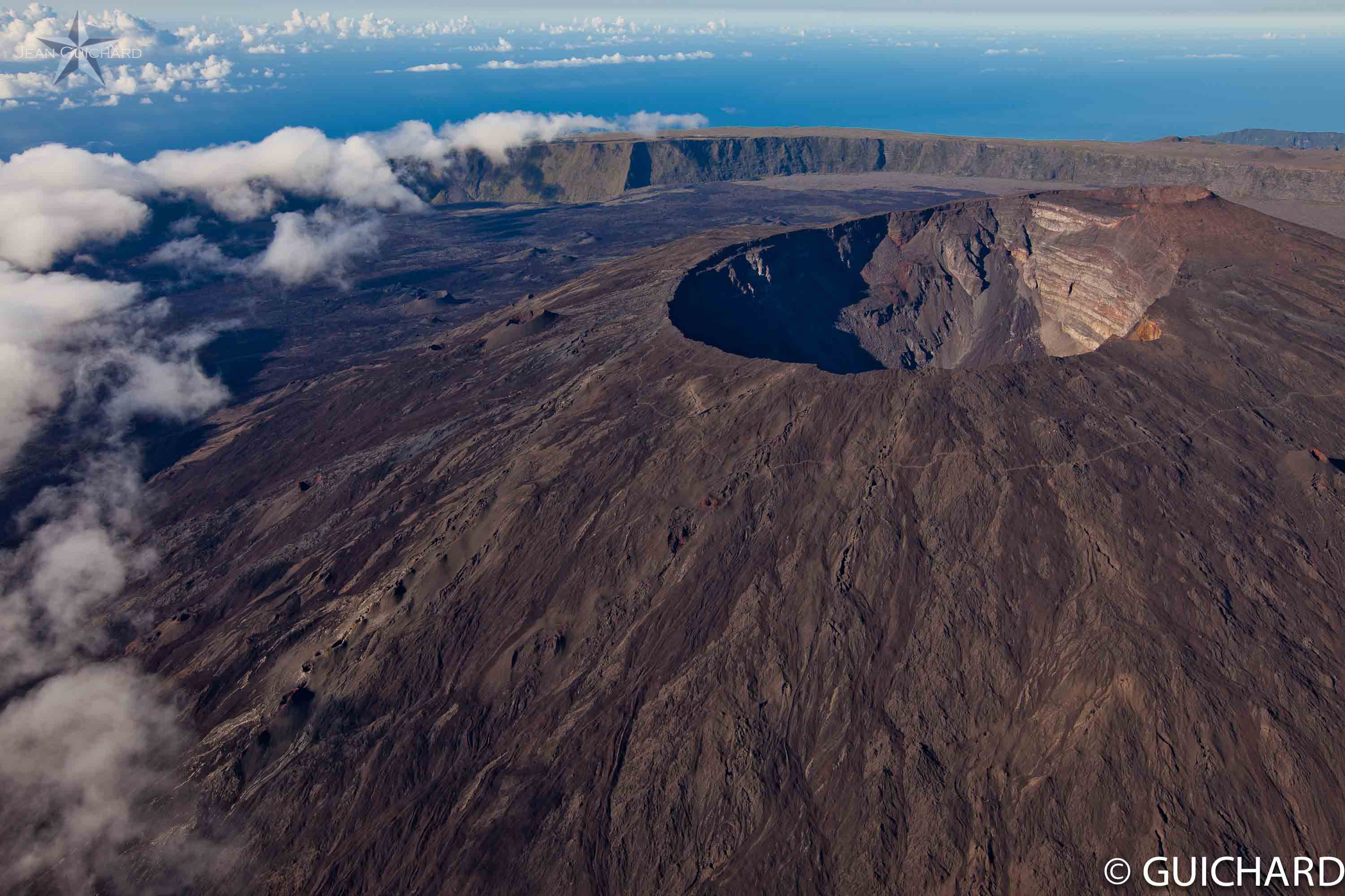
Piton de la Fournaise , La Réunion :
Seismicity:
In June 2018, the OVPF recorded in the Piton de la Fournaise massif in total:
• 23 superficial volcano-tectonic earthquakes (0 to 2 km deep) beneath the summit craters •
2 deep earthquakes (> 2 km deep)
• 336 collapses (in the Crater Dolomieu and the ramparts of Enclos Fouqué).
Following the end of the eruption of 27 April – 1 June 2018, volcano-tectonic activity under the Piton de la Fournaise remained relatively low with an average of less than one superficial volcano-tectonic earthquake per day and 2 earthquakes deep recorded throughout the month
Deformation:
Following the eruption eruption on June 1, 2018, the inflation of the building recorded since May 15 has stopped. Thus, the OVPF deformation measurement networks did not record any significant deformation in June.
Geochemistry of gases:
CO 2 concentration in the soil:
– In the far field (Plaine des Cafres and Plaine des Palmistes sectors): CO2 concentrations in the soil are stable at high values;
– In the near field (volcano area): the CO2 concentrations in the soil are stable at intermediate / low values.
Composition of the summit fumaroles:
– SO 2 content: below the detection limit.
– H 2 S content: low concentrations;
Since June 10, 2018, a new increase of CO2 background is noted; on the other hand, there is no evidence of enriched emissions at the same time in CO2 and SO2.
Concentration of SO 2 in the air in the Enclos Fouqué
Below the detection threshold.
Phenomenology :
Following the end of the eruption of April 27 – June 1, 2018, no eruptive activity is to report.
Balance sheet:
The month of June 2018 will have been marked at Piton de la Fournaise by a low seismicity under the summit craters and a stop in the inflation of the building.
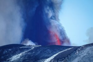
Source : OVPF
Photo : Guichard
Chaine des Puys , France :
The Chaîne des Puys and the Limagne fault classified by UNESCO!
Tectonic Mecca of the Chaîne des Puys – Limagne Fault
Located in the center of France, the site includes the long Limagne fault, the alignment of the volcanoes of the Chaîne des Puys and the inverted relief of the Montagne de la Serre. It is an emblematic element of the West European rift, created in the wake of the formation of the Alps, 35 million years ago.
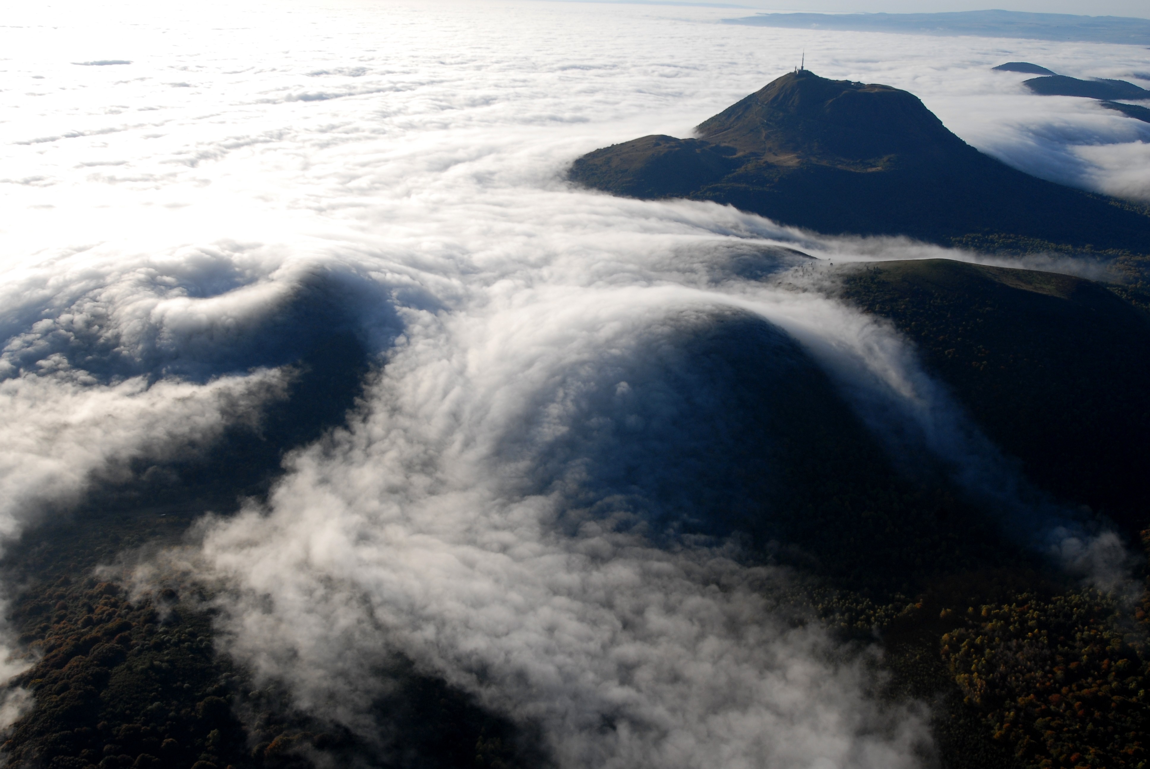
The geological features of the site demonstrate how the continental crust cracks and then collapses, allowing the deep magma to rise and causing the surface to rise. The site is an outstanding example of continental disruption – or rifting – which is one of the five main stages of plate tectonics.
Source : whc. Unesco.org.
Photo : Jodie Way
Agung , Indonesia :
VOLCANO OBSERVATORY NOTICE FOR AVIATION – VONA.
Issued: July 03 , 2018
Volcano: Agung (264020)
Current Aviation Colour Code: ORANGE
Previous Aviation Colour Code: orange
Source: Agung Volcano Observatory
Notice Number: 2018AGU40
Volcano Location: S 08 deg 20 min 31 sec E 115 deg 30 min 29 sec
Area: Bali, Indonesia
Summit Elevation: 10054 FT (3142 M)
Volcanic Activity Summary:
Eruption with volcanic ash cloud at 01h28 UTC (09h28 local). Eruption and ash emission is not continuing.
Volcanic Cloud Height:
Best estimate of ash-cloud top is around 16454 FT (5142 M) above sea level, may be higher than what can be observed clearly. Source of height data: ground observer.
Other Volcanic Cloud Information:
Ash-cloud moving to west.
Remarks:
Seismic activity is characterized by low frequency earthquakes. Eruption lasted for around 218 seconds.
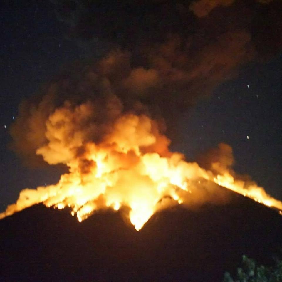
02 July 2018 21:04 WITA. Strombolian eruption occurs with a rumbling sound. The incandescent lava emissions observed on the crater reach a distance of 2 km.
An eruption of G. Agung, Bali occurred on 03 July 2018 at 04:13 WITA with a height of the ash column observed ± 2000 m above the peak (± 5,142 m above sea level) ). The gray columns are observed from white to gray with a strong intensity, dissipating towards the west. This eruption is recorded on the seismogram with a maximum amplitude of 21 mm and a duration of ± 7 minutes.
Currently, G. Agung is at Level III Status (SIAGA) with the recommendation:
Communities in general and mountaineers / visitors / tourists should not stand, climb or carry out any activity in the estimated danger zone within a radius of 4 km around the crater. The estimated area hazards are dynamic and continually evaluated and can be modified at any time based on the most recent observation data from G. Agung.
Communities living in and around the rivers that descend from Gunung Agung are aware of potential secondary hazards such as mudslides that may occur especially during the rainy season and if eruption materials are still deposited.
Source : KESDM, Agence géologique, PVMBG
Gunung Agung Poste d’observation
Photo : Alun Alun Genteng