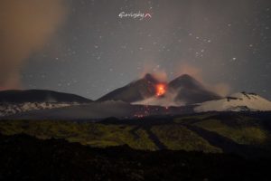
April 08 , 2018.
Sinabung , Indonesia :
VOLCANO OBSERVATORY NOTICE FOR AVIATION – VONA.
Issued: April 06 , 2018.
Volcano:Sinabung (261080)
Current Aviation Colour Code: RED
Previous Aviation Colour Code: orange
Source: Sinabung Volcano Observatory
Notice Number: 2018SIN92
Volcano Location: N 03 deg 10 min 12 sec E 98 deg 23 min 31 sec
Area: North Sumatra, Indonesia
Summit Elevation: 7872 FT (2460 M)
Volcanic Activity Summary:
Eruption with volcanic ash cloud at 09:07 UTC (16:07 local). Eruption and ash emission is continuing.
Volcanic Cloud Height:
Best estimate of ash-cloud top is around 23872 FT (7460 M) above sea level, may be higher than what can be observed clearly. Source of height data: ground observer.
Other Volcanic Cloud Information:
Ash-cloud moving to west – south.
Remarks:
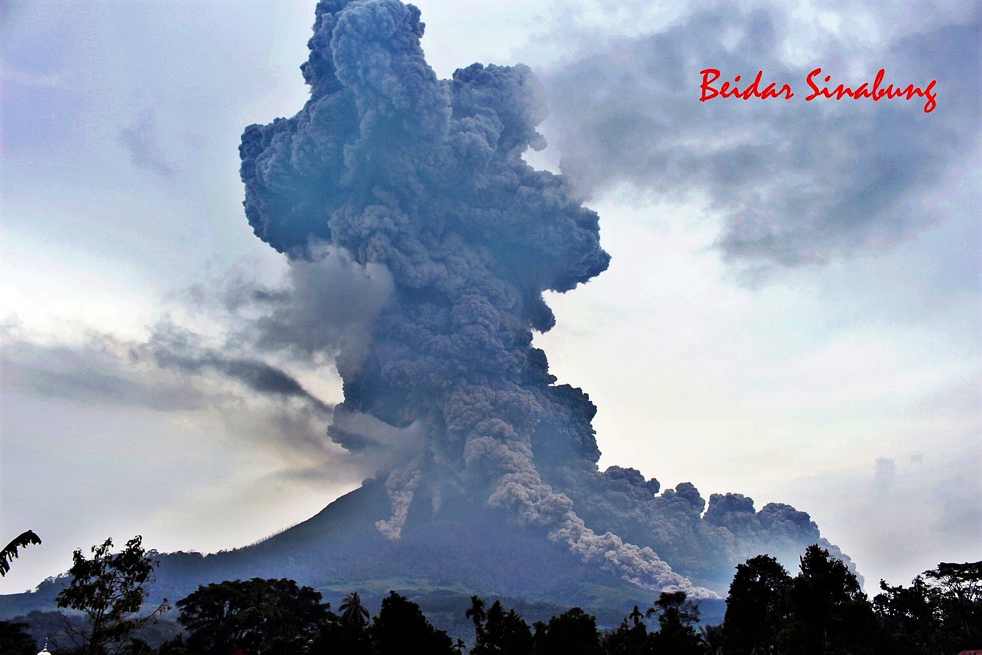
Hot could avalanches is observed through the East-Southeast and south-southeast slope and reaches a distance of 3500 meters from the summit.
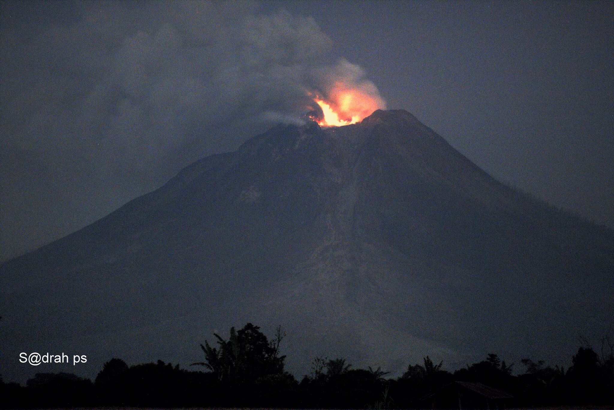
Activity Level of Level IV (AWAS). The Sinabung (2460 m altitude) has been erupting constantly since 2013.
On April 6, 2018 at 16.07, there was an eruption with a column of gray eruptive smoke, reaching the altitude of 7460 m above sea level or about 5000 m above the summit. This eruption is followed by a hot eruption cloud that has descended to the southwest for a distance of about 3500 m, with the ash cloud extending to the southwest. The eruption event was recorded from 16.07 to 19.55. Before the eruption, white smoke of low intensity and low pressure was observed up to 50-500 m above the peak. The wind is blowing slightly to moderately to the north and east.
According to the seismographs , on March 29, 2018, it was recorded:
1 earthquake of eruption.
85 earthquakes of emission.
1 low volcanic earthquake.
1 phase / hybrid earthquakes
1 shallow volcanic earthquake (VB)
1 local tectonic earthquake.
Recommendations:
Communities / visitors should not do activities within 3 km of the summit, and by sector, 7 km to the South-South-East, 6 km East-South-East and 4 km to the South-East. km northeast.
The deposits formed a dam upstream on the Laborus River. People living in downstream river basins and around the Laborus River need to be vigilant because these dams can collapse at any time and no longer retain water volume, resulting in downstream lahars / floods .
Source : Magma , VSI.
Photos : Firdaus Surbakti , Sadrah Peranginangin.
Lascar , Chile :
During this period, 65 seismic events were recorded, of which 47 were classified as volcano-tectonics (type VT), associated with fracturing processes of rocks. The larger earthquake had a local magnitude (ML) of 1.4, and was located 0.1 km north of the active crater, at a depth of 3.7 km. Similarly, 10 long period type (LP) earthquakes were recorded in relation to fluid dynamics within the volcanic edifice, with reduced displacement values of less than 9 cm2. Finally, 8 long-lived earthquakes, called « Tornillos », associated with the resonance of magmatic and hydrothermal fluids, have been recorded inside the volcanic edifice, with reduced displacement values of less than 2 cm2.
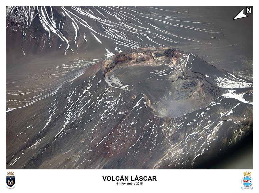
The images obtained by the IP camera showed recurrent degassing from the main crater, reaching a maximum height of nearly 600 m above the active crater.
From the data of three (3) GNSS stations located on the volcano, there were no significant changes in the position of the stations, which indicates that there is no displacement of the associated surface to the internal activities of the volcano.
Differential Absorption Spectrometry (DOAS) equipment was able to record only three days of sulfur dioxide (SO 2) emissions measurements, the daily average of which showed flow values of 776, 737 and 451 t / day, corresponding to days 24, 25 and 27 March, respectively. These values are at moderate levels for this volcano.
No thermal warning has been reported in the volcano-associated area according to the data processed by the infrared observation of volcanic activity (Mirova) (http://www.mirovaweb.it/) and thermal monitoring. global near-real-time MODVOLC (http://modis.higp.hawaii.edu/).

The activity recorded in recent weeks has shown similar characteristics to previous periods when minor phreatic explosions occurred, particularly during the years 2013 and 2015, showing a simultaneous occurrence of VT type earthquakes and Tornillos « as well as the lack of incandescence normally observed, suggesting small plugs of the magmatic column located in the crater at different depths.
Although the seismicity remains with energy levels considered low, it is considered that the above has increased the probability of minor explosions with a zone of assignment also minor.
As a result, an area of 2 km is considered dangerous around the main crater and its volcanic alert is changed to:
YELLOW LEVEL: Changes in the behavior of volcanic activity – Probable time for an eruption: WEEKS / MONTH.
Source : Sernageomin.
Copahue , Chile :
During this period, 83 seismic events classified as volcano-tectonic (VT) associated with rock fracturing processes were recorded. The most energetic event had a local magnitude (ML) of 2.2 and was located 8.3 km east (E) of the active El Agrio crater at a depth of 5.1 km.
Similarly, 204 earthquakes associated with fluid dynamics within the volcano, of which 98 have been classified as long period type events (LP), with a small recorded offset value (DRC) of 3, 2 cm2. In addition, 106 extremely long-lived earthquakes (VLPs) were recorded, with a maximum displacement value reduced by 12.8 cm2.
Since the explosion of March 24, an increase in the tremor signal line has been recorded, so that the alert level was changed on the same day (REAV_201740324_1950) to achieve a reduced maximum displacement value (DRC) of 11 cm2 (value considered high for this volcano). After this day, March 25, the tremor signal dropped to average base levels (1 cm2) with point increases correlating with smaller increases in the gas column. On March 26, the tremor signal showed a gradual increase, with fluctuations, but still with an upward trend, reaching a reduced displacement level close to 3 cm2 (moderate value).
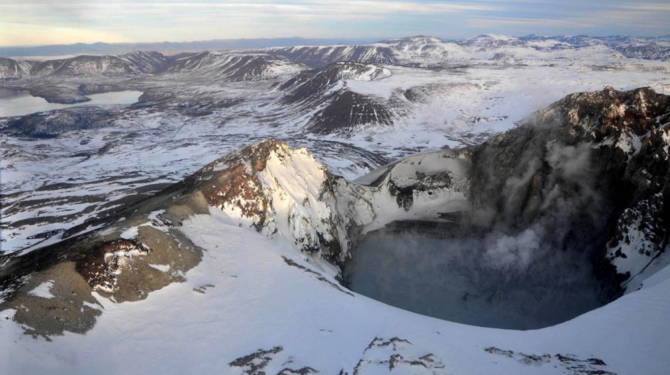
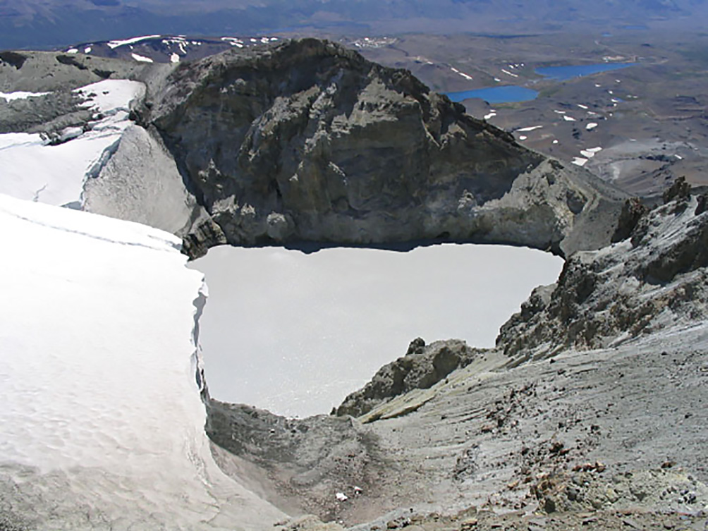
In order to visualize the morphological changes resulting from the increase of the activity or the recorded explosions and thanks to the collaboration with the regional ONEMI of Biobío, an overflight was carried out on April 3, during which the presence of the crater lake was observed, reconstituted at the end of 2017, as well as a constant column of whitish gas at heights close to 400 m. On the other hand, maximum recorded temperatures do not exceed 88 ° C in the main emission center inside the crater.
IP cameras installed near the volcano recorded a constant degassing of the active crater (El Agrio) with a maximum height of 1000 m. According to data provided by two active GNSS stations installed on the volcano, no superficial deformation is observed due to changes in the internal dynamics of the volcano.
Sulfur dioxide (SO2) emissions from the Differential Absorption Spectrometry (DOAS) equipment at Mellizas, located 5 km east-northeast (ENE) of the active crater, were average for the period of 641 ± 70 t / day, and a maximum daily value of 1686 t / day reported on March 28th. SO2 emissions are in normal levels for this volcano.
No thermal warnings were reported in the area associated with the volcanic structure in the second half of the year, based on data from the Medium Infrared Observation of Volcanic Activity (MIROVA) (http: // www.mirovaweb.it/) and temporal thermal monitoring data for global hot spots MODVOLC (http://modis.higp.hawaii.edu/).
The current activity is framed in a process that apparently began in November 2017 with the recording of VT type earthquakes and later during this year (activity still present) with the appearance of earthquakes type VLP and tremor signal increase, which suggests a contribution of magma with deep layers and the beginning of an interaction with the hydrothermal system, not yet with high caloric efficiency given the large amount of water present in the crater. This activity allows the occurrence of minor phreatic explosions, such as those of March 24th, which may affect the area near the El Agrio crater and, when the magmatic body reaches shallower layers, the process may turn into ash emissions. continued and finally to Strombolian activity as in previous years.
Therefore, the alert level is kept at:
YELLOW LEVEL: Changes in the behavior of volcanic activity – Probable time for an eruption: WEEKS / MONTH.
Observation: It is recommended to apply precautionary access restrictions in an area close to the crater with a radius of 1 kilometer.
Source : Sernageomin
Pacaya , Guatemala :
Type of activity: Strombolian
Morphology: Composite Stratovolcano
Location: 14 ° 22’50˝Latitude N; 90 ° 36’00˝Longitude W.
Altitude: 2,552msnm.
Weather conditions: Clear.
Wind: North
Precipitation: 0.0 mm.
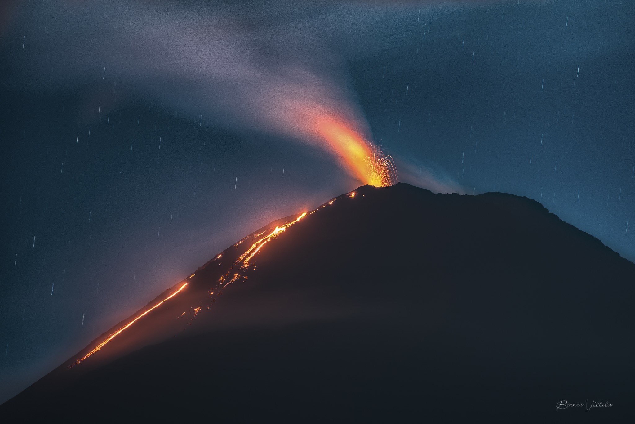
Activity:
White and blue fumaroles are observed, dissipating towards the South. The Mackenney crater has Strombolian explosions, ejecting incandescent material 40 meters above the crater. The activity maintains two lava flows, the first towards the south flank with a length of 200 meters, the second towards the south-west flank of 200 meters in length. The PCG seismic station records seismic tremor due to degassing and constant rise of magma and explosions.
Source : Insivumeh
Photo : Berner Villela
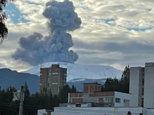
Nevados de Chillan , Chile:
Chile raises alert level following the threat of eruption on the Chillan volcano.
Since December, several ash eruptions have suggested an increase in activity, which has prompted the authorities to raise the alert to the orange level.
CHILLAN, Chile – A column of white smoke and a series of shocks on Nevados de Chillan have prompted authorities to raise the alert level in anticipation of a possible eruption on one of Chile’s most active volcanoes.
Surrounded by dense forest and rivers, this volcanic complex, which includes 17 craters, is located about 550 kilometers (300 miles) south of Santiago in the Bio Bio region in the Chilean Andes.
Since 2015, the alert level has remained yellow – the second lowest of the four levels – but since December, several ash eruptions have suggested increased activity, prompting officials to raise the alert by one ‘orange.
On Friday, April 6, police teams and experts from the National Geological and Mining Service (Sernageomin), deployed at 3,200 meters above sea level, saw a huge column of white smoke rising from one of the craters .
Sernageomin also detected an unusual lava flow in the crater that could overflow at any time, and data from 10 monitoring stations, which track the situation to the nearest minute, recorded about 4000 shocks and about 800 explosions.
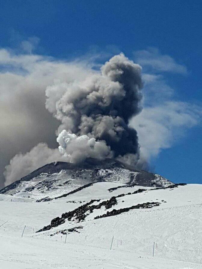
According to Alvaro Amigo, responsible of the Sernageomin volcanic monitoring network, the decision was made to raise the alert level to just below the highest level.
Unable to determine exactly when an eruption will be likely, experts are constantly monitoring the situation from the volcanic observatory in Temuco, a city in the southern Andes, some 600 kilometers south of Santiago.
Between 1861 and 2003, Nevados de Chillan erupted about 10 times, with varying amplitudes on the Volcanic Explosive Index.
The last case recorded was in 1973, although the eruption caused neither death nor major damage.
Source : Rappler.com