
November 02 , 2021.
Spain / La Palma , Cumbre Vieja :
November 01, 2021, 09:00 UTC. Eruptive activity continues on La Palma:
Since the last declaration, 136 earthquakes have been located in the area affected by the volcanic reactivation of Cumbre Vieja, 10 of these earthquakes were felt by the population, having reached maximum intensity in the epicentral zone IV (EMS98 ) in the earthquake that occurred at 5:52 p.m. (UTC) today, with a magnitude of 5.0 mbLg at a depth of 38 km.
Six earthquakes were located at depths of about 30 km, the rest of the hypocenters of the period are located at a shallower depth, about 12 km.
The amplitude of the volcanic tremor signal was maintained at high average levels, with intensifying pulses.
The island’s network of permanent GNSS stations does not show a clear tendency to warp from stations closest to eruptive centers, while at more distant stations a slight deflation is maintained, possibly related to deep seismicity.
In view of the calibrated image, an ash cloud of 3000 m is estimated at 08:45 UTC in a north-northwest direction.
Yesterday October 31 at 14:40 UTC, due to the decrease in the height of the eruptive column, the IGN issued a new VONA (Volcano Observatory Notice for Aviation) message informing that the maximum height of the eruptive column was 3500 m. above sea level.
The technical director of the Volcanic Emergency Plan of the Canary Islands (Pevolca), Miguel Ángel Morcuende, and the spokesperson for the Scientific Committee, Carmen López, underlined on Monday the strong ash emissions from the volcano of La Palma mainly in the West and in the northwest of the island. In this sense, Morcuende underlined that they had a « particular intensity » in Los Llanos de Aridane, which during this Sunday, October 31, forced the experts to make a series of differentiated recommendations concerning the municipalities of El Paso, Tazacorte, Tijarafe and Punta Gorda. Carmen López said that sulfur dioxide (SO2) emissions continue to decrease for the seventh consecutive day, and Sunday 4,990 tons were recorded, while that of carbon dioxide (CO2) increases, which was 1,500 tons.
They stressed on Monday that the number of earthquakes is still high, but with a tendency to decrease especially in terms of depth, although « it seems to have been observed a rebound in the last hours in the intermediate depth, in the 10 -11 kilometers deep ”.

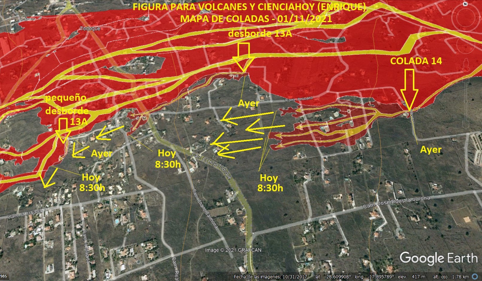
The area affected by the volcano’s lava is 967.85 hectares, 4.2 more than on Sunday. In addition, according to data from Copernicus, the 2,574 buildings / constructions that were devastated by the lava flows, while there are 142 at risk. Regarding the people accommodated, the technical director pointed out that 395 are in a hotel in Fuencaliente and 70 in one in Los Llanos, while 43 dependent people are in social health centers on the island. Of the crops affected by the lava, it is estimated that there are 281.99 hectares, of which 158.79 correspond to bananas, 58.76 to vines and 23.82 to avocados.
Source : IGN es , El Pais .
Carte : Volcanes y Ciencia Hoy
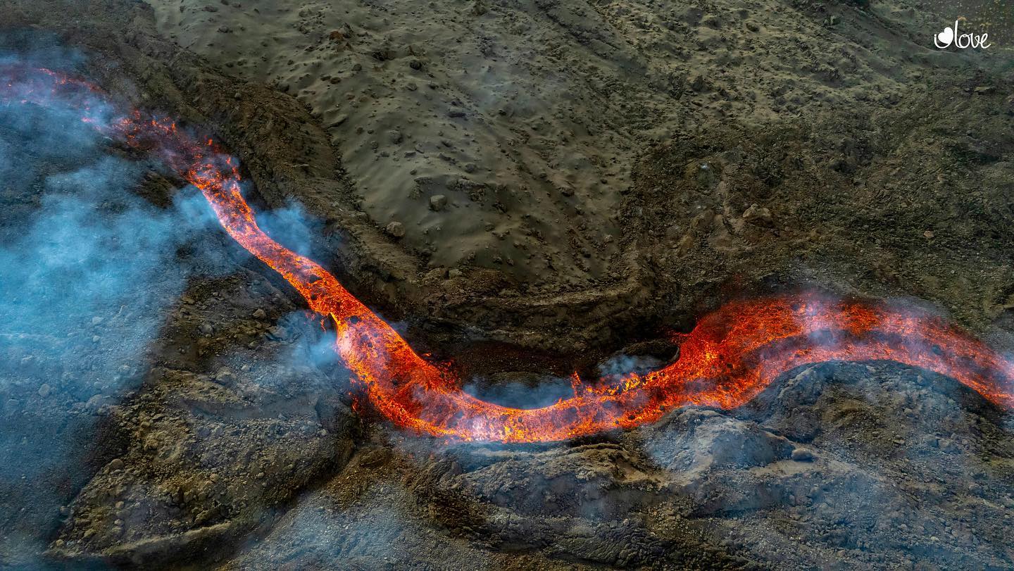
Photos : I love the world.
Colombia , Nevado del Ruiz :
The SERVICIO GEOLÓGICO COLOMBIANO informs the authorities and the community that during these last days, the Nevado del Ruiz volcano has continued to show seismic signals associated with the movements of fluids inside the volcanic building. It is highlighted a signal recorded at 6:22 a.m. on November 01, 2021, associated with an emission of ash and gas confirmed by web cameras.
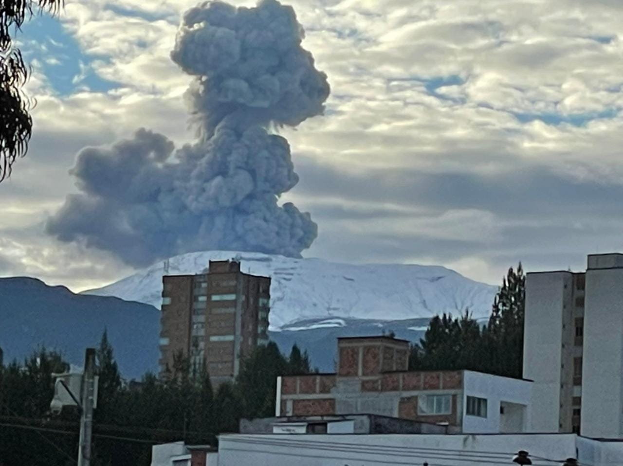
The column of gas and ash reached the altitude of 2500 m above the summit of the volcano, its direction of dispersion showed a tendency towards the northeast of the volcano. The possibility of ash falls on the localities of Letras, Herveo, Casabianca, Villahermosa, Libano, and Murillo is not ruled out.
At the time of publication of this report, the seismic signal has decreased, as has the height of the gas and ash column.
The Nevado del Ruiz volcano continues at the yellow activity level or (III): changes in the behavior of volcanic activity.
The SERVICIO GEOLÓGICO COLOMBIANO remains attentive to the evolution of the volcanic phenomenon and will continue to report any changes that may occur in due course.
Source : SGC
Photo : Ivan Jaramillo Nicholas.
United-States , Yellowstone :
44°25’48 » N 110°40’12 » W,
Summit Elevation 9203 ft (2805 m)
Current Volcano Alert Level: NORMAL
Current Aviation Color Code: GREEN
Recent work and news
Yellowstone Volcano Observatory scientists conducted typical year-end maintenance of monitoring stations during the month of October. In addition, geophysicists conducted a gravity survey, with the goal of tracking changes in gravity at Yellowstone over time. Gravity at Earth’s surface is influenced by mass beneath the surface, and so changes in gravity might reflect increases or decreases in subsurface magma or water. In November 2021, a multidisciplinary study of geyser activity in the Upper Geyser Basin will take place, with numerous instruments deployed to measure geyser behavior.
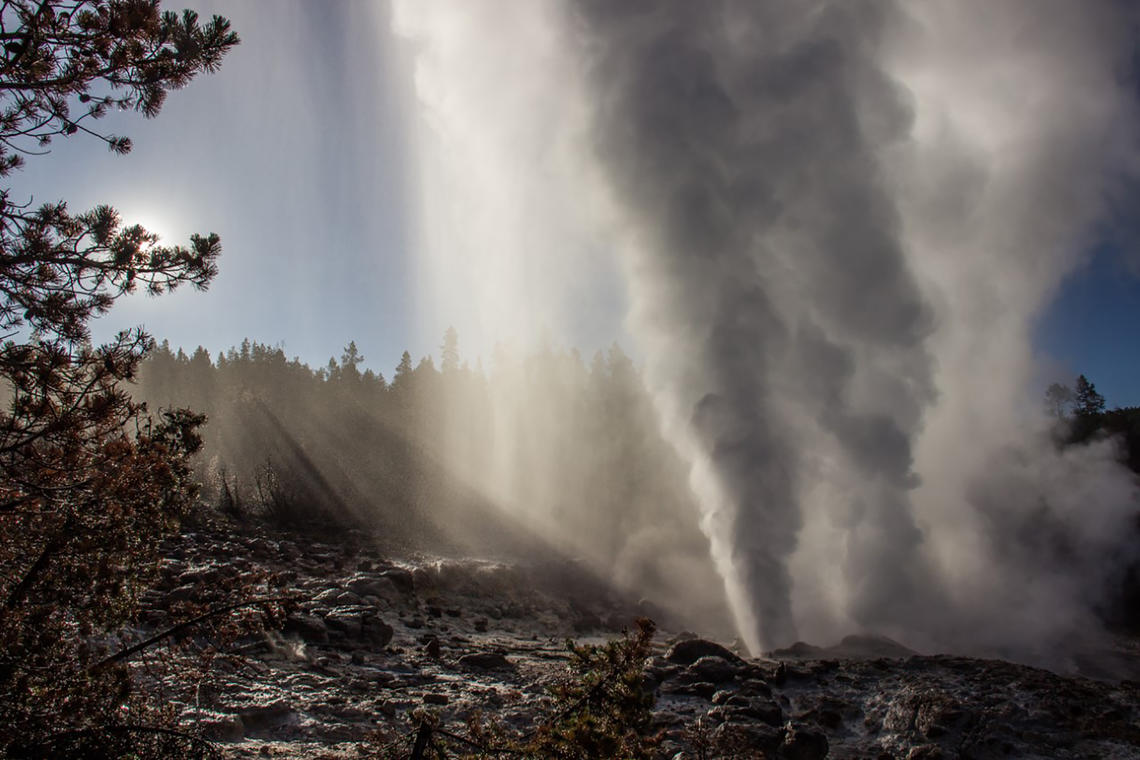
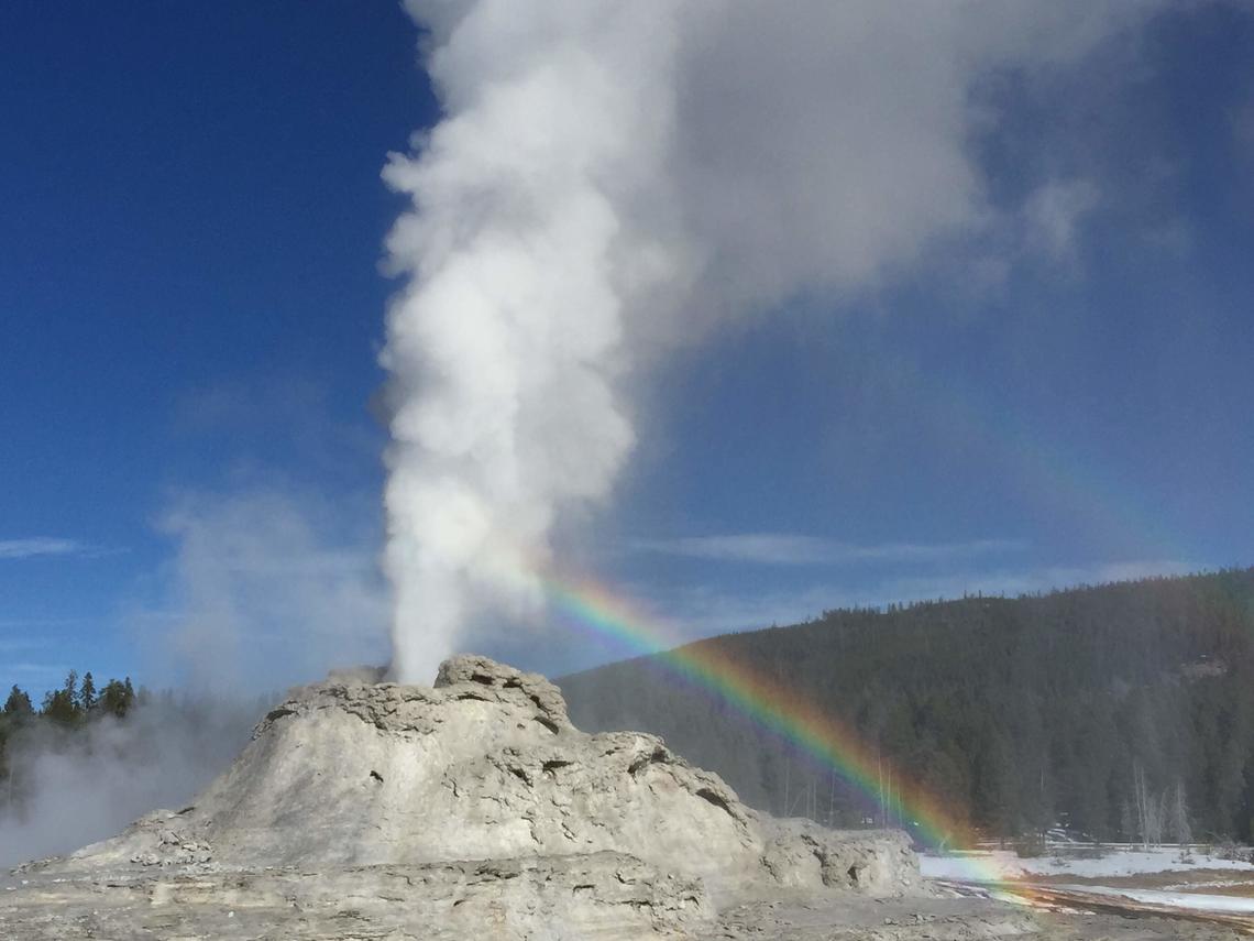
Steamboat Geyser continues to be active, with two eruptions in the past month: on October 13 and 25. This brings the total number of eruptions for the year to 17. As of the end of October, minor eruptive activity is occurring at the geyser, suggesting that the current period of major eruptions, which started in 2018, will continue into November.
Seismicity
During October 2021, the University of Utah Seismograph Stations, responsible for the operation and analysis of the Yellowstone Seismic Network, located 267 earthquakes in the Yellowstone National Park region. The largest event of the past month was a minor earthquake of magnitude 2.6 located ~4 miles east-northeast of Norris Geyser Basin, Yellowstone National Park, on October 4 at 5:30 PM MDT.
October seismicity in Yellowstone was marked by 3 earthquake swarms.
1) A series of 109 earthquakes occurred during October 1-15 located ~14 miles north-northeast of Old Faithful. These earthquakes continued from a sequence that began on September 16.
2) A small swarm of 29 earthquakes ~4 miles east-northeast of Norris Geyser Basin occurred during October 4-8. This swarm includes the largest event of the month (magnitude 2.6; detailed above).
3) A small swarm of 21 earthquakes occurred during October 1-8 about 8 miles north-northeast of West Yellowstone, MT. These earthquakes continued from a sequence that began on September 28.
Earthquake sequences like these are common and account for roughly 50% of the total seismicity in the Yellowstone region.
Yellowstone earthquake activity remains at background levels.
Ground deformation
Subsidence of Yellowstone Caldera has been ongoing since 2015, but that deformation typically pauses or turns to slight uplift during the summer months due to seasonal groundwater recharge. The summer pause in 2021 appears to have continued into October, with little overall caldera deformation since June. A GPS station near Norris Geyser Basin is now showing signs of uplift—the station has risen by about 1.5 cm (less than 1 in) over the past few months. It is as yet unclear if this is a seasonal signal or related to magmatic or hydrothermal processes at depth. The Norris GPS site typically does not record seasonal variations like those that are common in the caldera, so this may indicate a return to uplift of the area, which also occurred during 2013-2014 and 2015-2018 due to accumulation of hydrothermal fluids within a few kilometers of the surface.
Source : YVO.
Photos : steamboat Mara Reed , Shaul Hurwitz / USGS .
Alaska , Pavlof :
55°25’2″ N 161°53’37 » W,
Summit Elevation 8261 ft (2518 m)
Current Volcano Alert Level: WATCH
Current Aviation Color Code: ORANGE
Seismicity remains elevated, with tremor and small explosions detected over the past day. These explosions likely produced very small ash clouds, but no ash emissions were observed in web camera images or satellite data under clear viewing conditions. Minor steaming from the vent was observed in web camera images this morning and slightly elevated surface temperatures were observed in satellite data overnight.

Small explosions accompanied by low-level ash emissions could happen at any time, and are typically a hazard in the immediate vicinity of the summit. The level of unrest at Pavlof can change quickly and the progression to more significant eruptive activity can occur with little or no warning.
Pavlof is monitored by local seismic and infrasound sensors, satellite data, web cameras, and remote infrasound and lightning networks.
Source : AVO.
Photo : Jacob, Ben David
La Réunion , Piton de la Fournaise :
Seismicity
In October 2021, the OVPF recorded in the Piton de la Fournaise massif in total:
• 763 superficial volcano-tectonic earthquakes (0 to 2.5 km above sea level) below the summit craters;
• 49 deep earthquakes (below sea level);
• 261 long period type earthquakes;
• 382 collapses (in the Dolomieu Crater, the ramparts of the Enclos Fouqué , Piton de Crac and the East River).

Following the increase in surface seismicity (between 0 and 2 km above sea level) recorded between September 20 and 27, 2021, with an average of 4 events per day under the Dolomieu crater, this one continued in early October 2021 with a total of 97 superficial volcano-tectonic earthquakes and 9 deep earthquakes recorded between October 1 and 17, 2021 (Figures 1 and 2).
This resumption of seismicity preceded the seismic crisis of October 18, 2021, which began at 4:33 a.m. (local time; 12:33 a.m. UT) and which ended on the morning of October 19 (Figure 1). During this seismic crisis, 660 shallow top volcano-tectonic earthquakes, 26 deep volcano-tectonic earthquakes, 255 long periods and 24 shallow landslides / collapses were recorded by the OVPF.
This seismicity was localized under the summit and under the northeast flank of the volcano in the Plaine des Osmondes sector, west northwest of Piton de Crac (between 0.7 km above sea level and 1.4 km below sea level).
Following this seismic crisis, linked to a deep magma intrusion towards the north northeast flank of the volcano, the seismicity gradually decreased until it reached an average of 1 earthquake / day at the end of October.
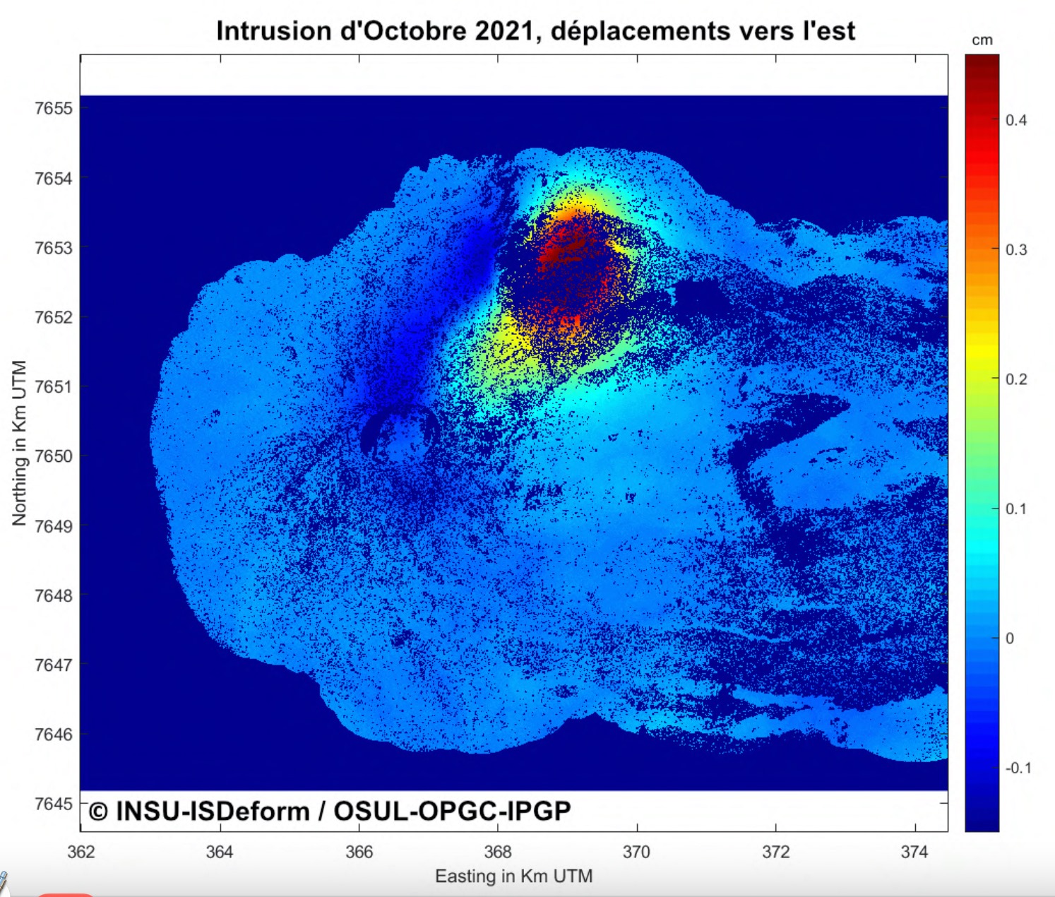
Map of eastward movements deduced from InSAR data, linked to the intrusion of October 18, 2021. The intensity of movements is given by the colored bar.
Deformation
The inflation (swelling) of the building, which began in April 2021, continued until October 18, 2021. This inflation showed a pressurization of the superficial magmatic reservoir located around 1.5-2 km deep. This pressurization of the most superficial storage system is at the origin of the seismic crisis and the intrusion of October 18, 2021.
This seismic crisis was accompanied by rapid deformations of the ground, from around ten cm at the top of the volcano to around sixty cm on the north-northeast flank, reflecting the migration of a source of pressure to the northeast, at the origin of a displacement of the upper part of the Grandes Pentes towards the East.
The displacement map from radar interferometric data (InSAR) shows on the northeast flank a maximum displacement of 45 cm to the east and 60 cm in uplift.
Following the magmatic intrusion of October 18, inflation of the edifice is again observed.
Source : OVPF.
Read the full article : http://www.ipgp.fr/sites/default/files/ovpf_20211101_bullmensu.pdf
Carte : ©INSU-ISDeform / OSUL-OPGC-IPGP
Photo : OVPF
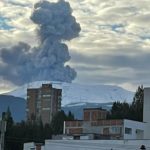
Ecuador , Sangay :
DAILY REPORT ON THE STATE OF SANGAY VOLCANO.
Surface activity level: High, Surface trend: No change.
Internal activity level: High, Internal trend: No change.
Seismicity: From October 31, 2021, 11:00 to November 01, 2021, 11:00:
Long period type events (LP) 120
Explosions (EXP) 140
Emission Tremors (TREMI) 9
Rains / Lahars:
In the early hours of the morning, moderate rains were recorded without generating lahars.

Emission column / ash:
Ash emissions were observed at altitudes above 2000 meters above crater level, with directions west, southwest and northwest. So far, there has been no national ash fall.
Other monitoring parameters:
The MIROVA satellite recorded 1 high thermal alert (135 MW) in the last 24 hours.
Observation:
In the afternoon of yesterday, the descent of incandescent material was observed on the south-eastern flank. At the moment the area of the volcano is cloudy.
Alert level: yellow.
Source et photo : IGEPN.


No comment yet, add your voice below!