March 07 , 2021
Indonesia , Merapi :
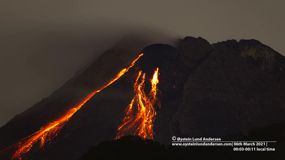
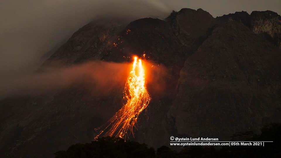
Mount Merapi activity report, February 26 to March 4, 2021.
I. OBSERVATION RESULTS
Visual
The weather around Mount Merapi is generally sunny in the morning, while the afternoon until evening is foggy. There is white smoke, thin to thick with low pressure. A maximum smoke height of 300m is observed from the Kaliurang observation post on February 27, 2021 at 4:00 p.m. WIB.
Hot cloud avalanches occurred 10 times with an estimated maximum slide distance of 1900 m to the southwest and recorded on a seismogram with a maximum amplitude of 60 mm and a duration of 171 seconds. Hot avalanche clouds were observed from CCTV Pangukrejo.
Morphological analysis of the summit area based on the photo of the southwest sector from March 5 to February 25, 2021 shows a change in the morphology of the area due to the effusion and growth activity of the dome. The volume of the lava dome in the southwest sector is 711,000 m3 with a growth rate of 13,900 m3 / day. Morphological analysis of the summit area based on photos of the Southeast sector from March 1 to March 5, 2021 shows a change in the height of the dome. The height of the dome at the center of the crater is measured at 45 m.
Seismicity
This week, the seismicity of Mount Merapi recorded:
10 hot cloud avalanches (AP),
1 shallow volcanic earthquake (VTB),
4 multi-phase earthquakes (MP),
1,135 avalanche earthquakes (RF),
71 emission earthquakes (DG)
3 tectonic earthquakes (TT).
In general, internal seismicity this week was lower than last week, while surface earthquakes such as avalanche earthquakes and avalanche clouds increased.
Deformation
The deformation of Mount Merapi which was monitored using EDM and GPS this week showed no significant changes.
Rain and lahars
This week, there was rain at Mount Merapi Observation Post with the highest rainfall intensity of 83mm / hour for 45 minutes at Kaliurang Post on March 2, 2021. There was no rain. lahars or additional flow in the rivers that descend from Mount Merapi.
Conclusion
Based on the results of visual and instrumental observations, it is concluded that:
The volcanic activity of Mount Merapi is still quite high in the form of effusive eruption activity. The activity status is defined at the « SIAGA » level.
Source : BPPTKG
Photos : Oystein Lund Andersen.
Iceland , Reykjanes Peninsula :
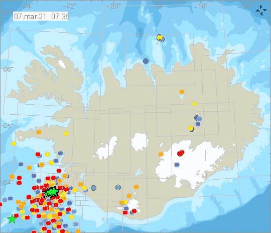
Just after midnight at 00:22 tremor was detected which lasted for 20 minutes. This tremor was similar to the one measured on the 3rd of March, however that tremor lasted several hours. Following these events the seismicity intensified with earthquakes larger than 4. The larges earthquake of the night was of M5 at 02:02 about 3 km WSW of Fagradalsfjall. From midnight over 30 earthquakes over M3 have been located and 5 larger than M4.
An intense earthquake swarm started on the Reykjanes Peninsula on February 24th with an earthquake M5.7 and M5.0. Since then two earthquakes over M5.0 have been detected. They occurred on Feb. 27th and March 1st. Over 22 000 earthquakes have been detected in the area since the activity started.
Source : Vedur Is
Italy / Sicily , Etna :
Continuation of the serial .
Press release on ETNA’s activity, March 07, 2021.
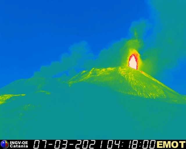
– 02:45 (01:45 UTC): The National Institute of Geophysics and Volcanology, Osservatorio Etneo, announces that from around 1:00 UTC a small lava flow is observed from the Southeast Crater.
– 03:04 (02:04 UTC): From around 1:00 UTC, a small lava flow is observed emitted by the effusive vent that opened on March 4, 2021 at the base of the South Crater. East .. At the same time, the resumption of Strombolian activity at the level of the Southeast Crater. is also observed. Strombolian intracrater activity continues at the level of the Voragine, Bocca Nuova and Northeast craters.
Also from 1:00 UTC there is an increase in volcanic tremor which is currently on medium-high values. The source of the tremor is located near the Southeast Crater. The infrasound events are few and low energy.
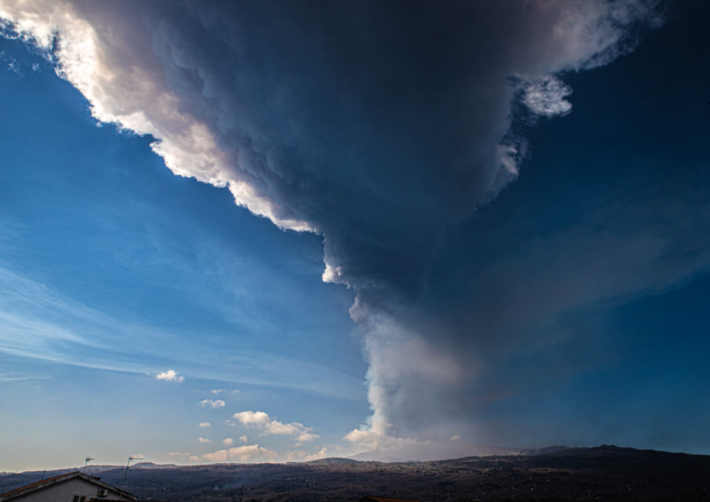
– 04:50 (03:50 UTC): From around 03:30 UTC, there is an increase in Strombolian activity at the Southeast Crater. The activity forms an eruptive cloud which reaches a height of about 5000 m above sea level, dispersing to the east. Regarding the lava flow, the front is about 2900 m above sea level.
From 01:30 UTC there is a further rapid increase in the amplitude of the volcanic tremor which is currently at high values. The source of the tremor is located near the Southeast Crater.
The infrasound events are few and low energy, mainly located in correspondence with the craters of Bocca Nuova and Northeast. The inclinometric and GNSS network data do not show any significant changes related to the current activity.
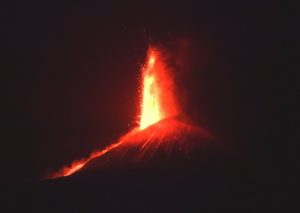
– 07:54 (06:54 UTC): From approximately 06:00 UTC, the Strombolian activity at the Southeast Crater (CSE) has passed to the lava fountain stage and from 06:20 UTC it has formed a eruptive column which has now exceeded the height of 10,000 m above sea level. Regarding the lava flows that extend into the Valle del Bove, due to cloud cover, it is not possible to make observations to estimate the position of the fronts.
The volcanic tremor of the last half hour reached a very high average amplitude and is constantly located near the Southeast Crater.
The number and energy of infrasound events are high and their locations are in the Southeast Crater.
The data from the GNSS network does not show significant variations, while the inclinometric network shows limited variations (0.1 – 1 microradians) concomitant with the current activity.
– 08:24 (07:24 UTC): The National Institute of Geophysics and Volcanology, Osservatorio Etneo, reports that the lava fountain in the Southeast Crater has ceased.
Source : INGV.
Photo : Guide Alpine Vulcanologiche Etna
Philippines , Taal :
TAAL VOLCANO BULLETIN 07 March 2021 08:00 A.M.
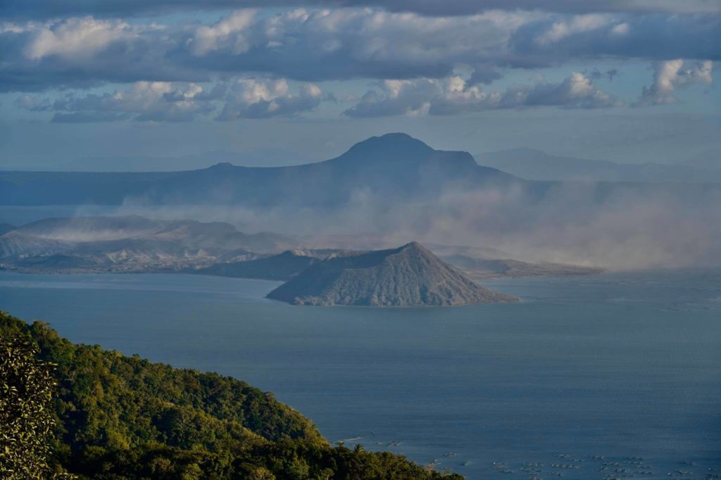
In the past 24-hour period, the Taal Volcano Network recorded fourteen (14) volcanic earthquakes, including nine (9) episodes of volcanic tremor having durations of two (2) to three (3) minutes and low-level background volcanic tremor that began at 5:15 PM on March 6, 2021 and lasted approximately four (4) hours. Activity at the Main Crater consisted of weak emission of steam-laden plumes from fumarolic vents that rose 10 meters high.
Temperature highs of 71.8°C and pH of 1.59 were last measured from the Main Crater Lake respectively on 04 March and 12 February 2021. Ground deformation parameters from electronic tilt, continuous GPS and InSAR data analysis indicated a very slow and steady inflation and expansion of the Taal region since after the January 2020 eruption.
Source : Phivolcs .
Photo : Raffy Tima

