February 04, 2024. EN. Hawaii : Kilauea , Indonesia : Awu , Vanuatu : Ambrym , Chile : Villarica , Ecuador : Reventador .

February 04 ,  2024.


Hawaii , Kilauea :

HVO/USGS Volcanic Activity Notice

Current Volcano Alert Level: ADVISORY
Previous Volcano Alert Level: WATCH
Current Aviation Color Code: YELLOW
Previous Aviation Color Code: ORANGE

Issued: Saturday, February 3, 2024, 8:10 AM HST
Source: Hawaiian Volcano Observatory
Notice Number: 2024/H53
Location: N 19 deg 25 min W 155 deg 17 min
Elevation: 4091 ft (1247 m)
Area: Hawaii

Volcanic Activity Summary:
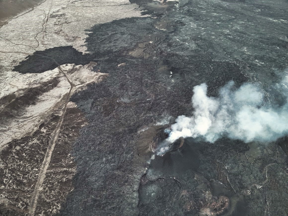
Earthquake and ground deformation rates extending from Kīlauea summit southwest along the Koa‘e fault system have decreased significantly over the past 24 hours. The intrusion of magma into this area appears to have slowed, and the likelihood of an eruption has decreased.

Accordingly, the USGS Hawaiian Volcano Observatory (HVO) is lowering the Volcano Alert Level for ground-based hazards from WATCH to ADVISORY and the Aviation Color Code from ORANGE to YELLOW.

In total, more than 3,000 earthquakes were recorded over the past week during this event, which coincided with ground deformation patterns indicative of magma moving from beneath the summit to the southwest under the Koa‘e fault system. More information on this intrusive activity will be available in the Kīlauea daily update published later today.

HVO continues to closely monitor Kīlauea for signs of renewed activity. Should volcanic activity change significantly, a new Volcanic Activity Notice will be issued.

Saturday, February 3, 2024, 11:06 AM HST (Saturday, February 3, 2024, 21:06 UTC)

Current Volcano Alert Level: ADVISORY
Current Aviation Color Code: YELLOW

Activity Summary: 
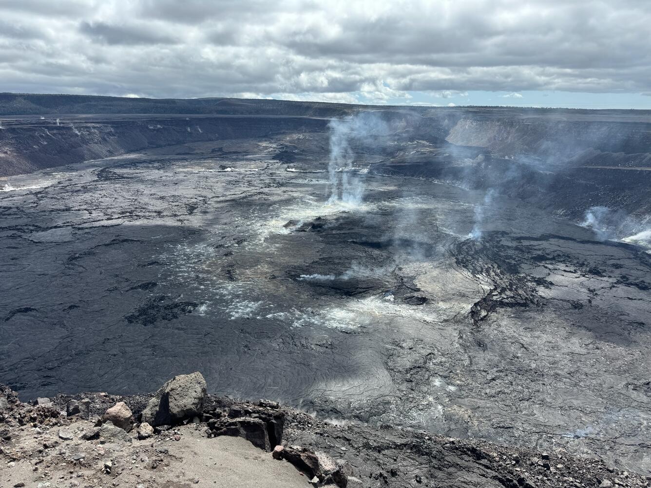
Kīlauea volcano is not erupting. Seismicity in the summit and along the Koa‘e fault system southwest of the summit has decreased significantly over the past 24 hours. The intrusion of magma into this area appears to have slowed, and the likelihood of an eruption has decreased. A VAN/VONA was issued earlier this morning, lowering the Alert level from Orange/Watch to Yellow/Advisory.

 Summit Observations: 
Seismicity and ground deformation beneath the summit and extending 5-7 miles (8-11 km) southwest of the caldera under the Koa‘e fault zone have decreased significantly in the past 24 hours. Earthquake counts have dropped from 20-30 events per hour to 5-10 events per hour and earthquakes are no longer clustering in the vicinity of Pu‘ukoa‘e, but are dispersed more widely from the summit to the southwest. Depths remain consistent, 1–4 km (less than a mile–2.5 mi) below the surface and magnitudes range a maximum of 3+ to less than 1. In total, less than 300 earthquakes have been recorded across this region over the past 24 hours, reflecting the continued decrease in seismicity.

Over the past day, tiltmeters near Sand Hill and Uēkahuna bluff have recorded very little change after the steep deflation of the past 2 days related to magma moving southwest.

Global Positioning System (GPS) instruments have recorded up to 8 inches (20 cm) of horizontal motion at stations around the SWRZ and immediately to the south along the Koa‘e fault zone.

Sulfur dioxide (SO2) gas emission rates remain low. Field measurements indicated an SO2 emission rate of approximately 70 tonnes per day, on January 17, which was similar to measurements in October, November, and early December.

Patterns of earthquakes and ground deformation indicate that magma intruded beneath the south end of the caldera beginning on the morning of January 27th. This activity waxed and waned until Wednesday, January 31, when greatly increased seismicity and tilt indicated a dike was being emplaced, triggering episodic felt earthquakes and rockfalls within Halema‘uma‘u. By 5 p.m. HST on January 31st, seismicity migrated southwest of the caldera towards the Ko‘ae fault system and tiltmeters in the south caldera area began to record strong deflation. Modeling of tiltmeter, GPS, and satellite radar interferometry (INSAR) images suggest that magma within the initial dike migrated southwest into the new intrusion as it opened beneath the Ko‘ae fault zone. The overall decrease in seismicity and deformation over the past 24 hours suggests that this event is waning. However, renewed episodes of activity remain a possibility and an eruption could occur with little advanced warning.

 Rift Zone Observations: 
Seismicity in Kīlauea’s upper East Rift Zone and Southwest Rift Zone remained low in the past 24 hours.   No unusual activity has been noted along the middle and lower sections of Kīlauea’s East Rift Zone. We continue to closely monitor both rift zones.

Source : HVO

Photos :  USGS / M. Patrick , USGS .


Indonesia , Awu :

PRESS RELEASE on the volcanic activity of Mount Awu, February 1, 2024.

Geographically, Mount Awu is located at coordinates 3.6828460o N and 125.455980o E. The summit of Mount Awu is 1,320 m above sea level. Administratively, Mount Awu is located on Sangihe Island, part of Sangihe Islands Regency, North Sulawesi Province. Awu Volcano was observed visually and instrumentally from the Volcano Observation Post (PGA) located at Jl. Radar Tahuna.

Awu Volcano has an eruption interval ranging from 1 to 101 years. The last eruption occurred in June 2004, as a magmatic eruption producing an eruptive column reaching 3,000 m above the summit. G. Awu’s activity level has been Level II (WASPADA) since August 25, 2022.

The latest developments in the activity of the Awu volcano until January 31, 2024 are as follows:

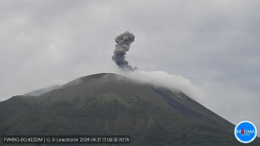
Current visual observations show that surface activity is still in the form of gas releases, no rocky material or ash has been brought to the surface. In January 2024, thanks to video surveillance observations installed in the summit area, gas emissions were observed only on January 2, 2024. The mountain peak was often covered in fog and on clear days no gas emissions was not observed.
There has been an increase in seismicity which is believed to be due to the movement of magma to shallower depths. This is characterized by an increase in the number of superficial volcanic earthquakes (VB). From January 29 to 31, 2024 (3 days), 62 VB earthquakes were recorded and 9 VA earthquakes were recorded. The energy of earthquakes has increased, as shown in the RSAM graph. On January 31, 2024, at 6:59 p.m. WITA, a low-frequency tremor was recorded with a dominant frequency of approximately 1.5 Hz and a seismic duration of 91 seconds, indicating an increase in surface earthquakes.


By observing deformation using GNSS monitoring on Mount Awu between June 1, 2023 and January 31, 2024, inflation was detected, which indicated the presence of a volume of magma moving toward the surface .
Potential Mount Awu hazards that may occur include explosive magmatic eruptions producing incandescent material and/or pyroclastic flows, effusive lava flows producing magma, or phreatic eruptions dominated by steam, volcanic gas, or volcanic material. previous eruptions. The potential for dismantling of the lava dome could occur if the pressure in the magma system increases significantly. Another potential danger is emissions of volcanic gases such as CO, CO2, H2S, N2 and CH4. These gases can be life threatening if the concentration inhaled exceeds the safety threshold value.

The community is aware of the danger posed by lava flows in the rivers that originate at the top of Mount Awu during the rainy season.
Based on visual and instrumental monitoring until February 1, 2024, the Geological Agency declared that the activity level of Mount Awu is still at Level II (WASPADA).
At Level II Activity Level (WASPADA), the public and visitors/tourists should not approach and conduct activities within a 3 km radius of the summit crater of Mount Awu due to the potential danger of high concentrations of volcanic gas and rock projections if a sudden phreatic eruption occurs, without prior warning, with symptoms of a marked increase in activity. The recommended radius and distance will continue to be evaluated to anticipate symptoms of evolving danger. The activity level of Mount Awu will be reviewed in the event of significant visual and seismic changes.

Source et photos : PVMBG.


Vanuatu , Ambrym :

16°15’00”S 168°07’00”E
Summit Elevation 4377ft (1334m)
Current Volcano Alert Level: Level 2

Ambrym volcano activity is continuing in the major unrest state. The Volcanic Alert Level remains at Level 2.

Ambrym volcano activity is continuing in the major level of unrest, consistent with the Volcanic Alert Level 2. Latest seismic analysis and observation confirmed ongoing steam emissions from the active craters of Ambrym volcano. Earlier this month, the Benbow crater underwent a short lived (4 days) eruption producing lava flow within the Benbow crater.

.

With the ongoing activity and the associated hazards, the danger zone at the summit is maintained at Danger Zone B (See Ambrym caldera safety map below). These danger zones are about 2 km around Benbow and 4 km around Marum craters including Maben-Mbwelesu, Niri-Mbwelesu and Mbwelesu. Additional danger zone is at the South-East of Ambrym within 500 meters from major cracks (Opened during the 2018 Eruption).

The level of risk for visitors accessing areas from the caldera is high. People on Ambrym especially, villages close to the volcano are expected to experience acid rain and are advised to follow the Ambrym key messages for volcanic ash, gas and acid rain, to protect water supply sources.

Source : Geohazard

Photo : G Vitton / Le Chaudron de Vulcain


Chile , Villarica :

Special Report on Volcanic Activity (REAV), La Araucanía and Los Ríos regions, Villarrica volcano, February 3, 2024, 2:42 p.m. local time (mainland Chile)

The National Geology and Mining Service of Chile (Sernageomin) announces the following PRELIMINARY information, obtained through the monitoring equipment of the National Volcanic Monitoring Network (RNVV), processed and analyzed at the Southern Andean Volcano Observatory (Ovdas):

On Saturday February 3, 2024, at 1:55 p.m. local time (4:55 p.m. UTC), monitoring stations installed near the Villarrica volcano recorded an earthquake associated with fluid dynamics inside the volcanic system (long period type).

The characteristics of this earthquake after its analysis are as follows:

ORIGINAL TIME: 1:55 p.m. local time (4:55 p.m. UTC)
REDUCED DISPLAY: 71.2 (cm*cm)
ACOUSTIC SIGNAL: 4.9 Pascals (Pa) reduced to 1 km

Observation :
After the long-term earthquake mentioned in this report, no changes were recorded in the seismic behavior of the volcano. In addition, no surface activity associated with this earthquake was observed.

The technical volcanic alert is maintained at YELLOW level.

Source et photo : Sernageomin.


Ecuador , Reventador :

DAILY REPORT ON THE STATE OF THE REVENTADOR VOLCANO, Saturday February 3, 2024.
Information Geophysical Institute – EPN.

Surface activity level: Moderate, Surface trend: No changes
Internal activity level: Moderate, Internal trend: No changes

Seismicity: From February 2, 2024, 11:00 a.m. to February 3, 2024, 11:00 a.m.:

The following table shows the number of seismic events from the reference station in the last 24 hours.

Explosion (EXP) 37
Long Period (LP) 6
Transmitting tremor (TREMI) 5
Tremor Harmonic (TRARM): 2

Precipitation/Lahars:
Rainfall is not recorded. **In the event of heavy rains, these could remobilize the accumulated materials, generating mud and debris flows which would descend the sides of the volcano and flow into adjacent rivers.

Emissions/ash column:
Since yesterday evening, thanks to the surveillance camera system, emissions have been recorded with heights between 400 and 1,100 meters above the level of the crater in the West, North-West and West-North-West direction. Additionally, associated with these events, the Washington VAAC released four emissions reports with heights between 700 and 1,100 meters above the crater level in a northwest direction.

Other monitoring parameters:
The FIRMS satellite system recorded 1 thermal anomaly in the last 24 hours.

Observation:
Since yesterday evening, thanks to the camera system, it has been observed that the volcano has remained clear most of the time, which is why several episodes of incandescence have been observed accompanied by the descent of the same material on its flanks at more than 800 meters below the level of the crater. At the time of this report, the volcano is cloudy.

Alert level: Orange.

Source : IGEPN.

Photo :  volcan reventador/FB


04 Février 2024. FR. Hawaii : Kilauea , Indonésie : Awu , Vanuatu : Ambrym , Chili : Villarica , Equateur : Reventador .

04 Février 2024.


Hawaii , Kilauea :

Avis d’activité volcanique HVO/USGS

Niveau d’alerte volcanique actuel : AVIS
Niveau d’alerte volcan précédent : ATTENTION
Code couleur aviation actuel : JAUNE
Code couleur aviation précédent : ORANGE

Émis : samedi 3 février 2024, 8 h 10 HST
Source : Observatoire des volcans hawaïens
Numéro d’avis : 2024/H53
Localisation : N 19 degrés 25 min W 155 degrés 17 min
Altitude : 4 091 pieds (1 247 m)
Région : Hawaï

Résumé de l’activité volcanique :
Les taux de tremblement de terre et de déformation du sol s’étendant du sommet du Kīlauea au Sud-Ouest le long du système de failles de Koa’e ont considérablement diminué au cours des dernières 24 heures. L’intrusion du magma dans cette zone semble avoir ralenti et la probabilité d’une éruption a diminué.

En conséquence, l’Observatoire des volcans hawaïens de l’USGS (HVO) abaisse le niveau d’alerte volcanique pour les dangers au sol de ATTENTION à AVIS et le code couleur de l’aviation d’ORANGE à JAUNE.

Au total, plus de 3 000 tremblements de terre ont été enregistrés au cours de la semaine dernière lors de cet événement, qui a coïncidé avec des schémas de déformation du sol indiquant un déplacement du magma du dessous du sommet vers le Sud-Ouest sous le système de failles de Koa’e. Plus d’informations sur cette activité intrusive seront disponibles dans la mise à jour quotidienne du Kīlauea publiée plus tard dans la journée.

Le HVO continue de surveiller de près le Kilauea à la recherche de signes de reprise d’activité. Si l’activité volcanique change de manière significative, un nouvel avis d’activité volcanique sera émis.

Samedi 3 février 2024, 11h06 HST (samedi 3 février 2024, 21h06 UTC)

Niveau d’alerte volcanique actuel : AVIS
Code couleur aviation actuel : JAUNE

Résumé de l’activité :
Le volcan Kīlauea n’est pas en éruption. La sismicité au sommet et le long du système de failles de Koa’e au Sud-Ouest du sommet a considérablement diminué au cours des dernières 24 heures. L’intrusion du magma dans cette zone semble avoir ralenti et la probabilité d’une éruption a diminué. Un message VAN/VONA a été émis plus tôt ce matin, abaissant le niveau d’alerte d’Orange/Attention à Jaune/Avis.

Observations du sommet :
La sismicité et la déformation du sol sous le sommet et s’étendant sur 8 à 11 km au Sud-Ouest de la caldeira sous la zone de faille de Koa’e ont considérablement diminué au cours des dernières 24 heures. Le nombre de tremblements de terre est passé de 20 à 30 événements par heure à 5 à 10 événements par heure et les tremblements de terre ne se concentrent plus à proximité de Pu’ukoa’e, mais sont plus largement dispersés depuis le sommet vers le Sud-Ouest. Les profondeurs restent constantes, 1 à 4 km (moins d’un mile à 2,5 mi) sous la surface et les magnitudes varient d’un maximum de 3+ à moins de 1. Au total, moins de 300 tremblements de terre ont été enregistrés dans cette région au cours des 24 dernières heures, reflétant la diminution continue de la sismicité.

Au cours de la dernière journée, les inclinomètres près de Sand Hill et de la falaise d’Uēkahuna ont enregistré très peu de changement après la forte déflation des 2 derniers jours liée au déplacement du magma vers le Sud-Ouest.

Les instruments du système de positionnement global (GPS) ont enregistré jusqu’à 8 pouces (20 cm) de mouvement horizontal dans les stations autour de la SWRZ et immédiatement au Sud le long de la zone de faille de Koa’e.

Les taux d’émission de dioxyde de soufre (SO2) restent faibles. Les mesures sur le terrain ont indiqué un taux d’émission de SO2 d’environ 70 tonnes par jour, le 17 janvier, ce qui était similaire aux mesures d’octobre, novembre et début décembre.

Les schémas de tremblements de terre et de déformation du sol indiquent que du magma s’est introduit sous l’extrémité Sud de la caldeira à partir du matin du 27 janvier. Cette activité a augmenté et diminué jusqu’au mercredi 31 janvier, lorsque la sismicité et l’inclinaison considérablement accrues ont indiqué qu’un dyke était en cours de mise en place, déclenchant des tremblements de terre épisodiques ressentis et des chutes de pierres dans le cratère Halema’uma’u. Vers 17 heures le 31 janvier, la sismicité a migré au Sud-Ouest de la caldeira vers le système de failles de Ko’ae et les inclinomètres dans la zone Sud de la caldeira ont commencé à enregistrer une forte déflation. La modélisation des images d’inclinomètre, de GPS et d’interférométrie radar satellite (INSAR) suggère que le magma contenu dans le dyke initial a migré vers le Sud-Ouest dans la nouvelle intrusion alors qu’elle s’ouvrait sous la zone de faille de Ko’ae. La diminution globale de la sismicité et de la déformation au cours des dernières 24 heures suggère que cet événement est en train de s’atténuer. Cependant, de nouveaux épisodes d’activité restent possibles et une éruption pourrait se produire sans préavis.

Observations de la zone de rift :
La sismicité dans la zone supérieure du rift Est et la zone du rift Sud-Ouest du Kīlauea est restée faible au cours des dernières 24 heures. Aucune activité inhabituelle n’a été notée le long des sections moyennes et inférieures de la zone du rift Est du Kīlauea. Nous continuons de surveiller de près les deux zones de fracture.

Source : HVO

Photos :  USGS / M. Patrick , USGS .


Indonésie , Awu :

COMMUNIQUÉ DE PRESSE sur l’activité Volcanique du Mont Awu ,1er février 2024 .

Géographiquement, le mont Awu est situé aux coordonnées 3,6828460o N et 125,455980o E. Le sommet du mont Awu se situe à 1 320 m d’altitude. Sur le plan administratif, le mont Awu se trouve sur l’île de Sangihe, qui fait partie de la régence des îles Sangihe, dans la province de Sulawesi du Nord. Le volcan Awu a été observé visuellement et instrumentalement depuis le poste d’observation du volcan (PGA) situé à Jl. Radar Tahuna.

Le volcan Awu a un intervalle d’éruption allant de 1 à 101 ans. La dernière éruption s’est produite en juin 2004, sous la forme d’une éruption magmatique produisant une colonne éruptive atteignant 3 000 m au-dessus du sommet. Le niveau d’activité de G. Awu est de niveau II (WASPADA) depuis le 25 août 2022.

Les derniers développements de l’activité du volcan Awu jusqu’au 31 janvier 2024 sont les suivants :

Les observations visuelles actuelles montrent que l’activité en surface se fait toujours sous forme de dégagements de gaz, aucun matériau rocheux ni cendre n’a été ramené à la surface. En janvier 2024, grâce aux observations de vidéosurveillance installées dans la zone du sommet, des émissions de gaz n’ont été observées que le 2 janvier 2024. Le sommet de la montagne était souvent couvert de brouillard et par temps clair, aucune émission de gaz n’a été observée.
Il y a eu une augmentation de la sismicité qui serait due au mouvement du magma vers des profondeurs moins profondes. Ceci se caractérise par une augmentation du nombre de séismes volcaniques superficiels (VB). Du 29 au 31 janvier 2024 (3 jours), 62 séismes VB ont été enregistrés et 9 séismes VA ont été enregistrés. L’énergie des séismes a augmenté, comme le montre le graphique RSAM . Le 31 janvier 2024, à 18h59 WITA, une secousse de basse fréquence a été enregistrée avec une fréquence dominante d’environ 1,5 Hz et une durée sismique de 91 secondes, ce qui indique une augmentation des tremblements de terre en surface.


En observant la déformation à l’aide de la surveillance GNSS sur le mont Awu entre le 1er juin 2023 et le 31 janvier 2024, une inflation a été détectée, ce qui a indiqué la présence d’un volume de magma se déplaçant vers la surface .
Les dangers potentiels du mont Awu qui peuvent survenir incluent des éruptions magmatiques explosives produisant des matériaux incandescents et/ou des coulées pyroclastiques, des coulées de lave effusives produisant du magma ou des éruptions phréatiques dominées par de la vapeur, du gaz volcanique ou des matériaux d’éruptions antérieures. Le potentiel de démantèlement du dôme de lave pourrait se produire si la pression dans le système magmatique augmente de manière significative. Un autre danger potentiel concerne les émissions de gaz volcaniques tels que CO, CO2, H2S, N2 et CH4. Ces gaz peuvent mettre la vie en danger si la concentration inhalée dépasse la valeur seuil de sécurité.

La communauté est consciente du danger que représentent les coulées de lave dans les rivières qui prennent leur source au sommet du mont Awu pendant la saison des pluies.
Sur la base d’une surveillance visuelle et instrumentale jusqu’au 1er février 2024, l’Agence géologique a déclaré que le niveau d’activité du mont Awu est toujours au niveau II (WASPADA).
Au niveau d’activité de niveau II (WASPADA), le public et les visiteurs/touristes ne doivent pas s’approcher et mener des activités dans un rayon de 3 km du cratère sommital du mont Awu en raison du danger potentiel de concentrations élevées de gaz volcanique et de projections de roches si une éruption phréatique soudaine se produit, sans avertissement préalable, par des symptômes d’une nette augmentation de l’activité. Le rayon et la distance recommandés continueront d’être évalués pour anticiper les symptômes d’évolution du danger. Le niveau d’activité du mont Awu sera réexaminé en cas de changements visuels et sismiques significatifs.

Source et photos : PVMBG.


Vanuatu , Ambrym :

16°15’00″S 168°07’00″E
Altitude du sommet :4 377 pieds (1 334 m)
Niveau d’alerte volcanique actuel : niveau 2

L’activité du volcan d’Ambrym se poursuit dans un état de troubles majeurs. Le niveau d’alerte volcanique reste au niveau 2.

L’activité du volcan d’Ambrym se poursuit avec un niveau d’agitation majeur, conforme au niveau d’alerte volcanique 2. Les dernières analyses et observations sismiques ont confirmé les émissions de vapeur en cours provenant des cratères actifs du volcan Ambrym. Plus tôt ce mois-ci, le cratère du Benbow a subi une éruption de courte durée (4 jours) produisant une coulée de lave à l’intérieur du cratère du Benbow.

Avec l’activité en cours et les dangers associés, la zone de danger au sommet est maintenue . Ces zones dangereuses s’étendent sur environ 2 km autour du Benbow et 4 km autour des cratères du Marum, notamment Maben-Mbwelesu, Niri-Mbwelesu et Mbwelesu. Une zone de danger supplémentaire se trouve au Sud-Est d’Ambrym, à moins de 500 mètres des fissures majeures (ouvertes lors de l’éruption de 2018).
Le niveau de risque pour les visiteurs accédant aux zones depuis la caldeira est élevé. Les habitants d’Ambrym en particulier et les villages proches du volcan devraient subir des pluies acides et il est conseillé de suivre les messages clés d’Ambrym concernant les cendres volcaniques, les gaz et les pluies acides, afin de protéger les sources d’approvisionnement en eau.

Source : Geohazard

Photo : G Vitton / Le Chaudron de Vulcain


Chili , Villarica :

Rapport spécial sur l’activité volcanique (REAV), régions de La Araucanía et Los Ríos, volcan Villarrica, 03 Février 2024, 14 h42 heure locale (Chili continental)

Le Service national de géologie et des mines du Chili (Sernageomin) annonce les informations PRÉLIMINAIRES suivantes, obtenues grâce à l’équipement de surveillance du Réseau national de surveillance volcanique (RNVV), traitées et analysées à l’Observatoire des volcans des Andes du Sud (Ovdas) :

Le samedi 03 Février 2024 , à 13h55 heure locale (16h55 UTC) , les stations de surveillance installées à proximité du volcan Villarrica ont enregistré un séisme associé à la dynamique des fluides à l’intérieur du système volcanique ( type longue période).

Les caractéristiques de ce séisme après son analyse sont les suivantes :


HEURE D’ORIGINE : 13h55 heure locale (16h55 UTC)
AFFICHAGE RÉDUIT : 71,2 (cm*cm)
SIGNAL ACOUSTIQUE : 4,9 Pascals (Pa) réduit à 1 km

Observation :

Postérieurement au séisme de longue période mentionné dans ce rapport , il n’a pas été enregistré de changements dans le comportement sismique du volcan . De plus , Il n’a pas été  observé d’activité superficielle associée à ce séisme .

L’alerte technique volcanique est maintenue au niveau JAUNE.

Source et photo : Sernageomin.


Equateur , Reventador :

RAPPORT QUOTIDIEN DE L’ETAT DU VOLCAN REVENTADOR , Samedi 03 Février 2024.
Information Geophysical Institute – EPN.

Niveau d’activité Superficiel: Modéré , Tendance de surface : Sans changements
Niveau d’activité interne: Modéré , Tendance interne : Sans changements

Sismicité : Du 02 Février 2024 , 11:00h au 03 Février 2024 , 11:00h : 

Le tableau suivant montre le nombre d’événements sismiques de la station de référence au cours des dernières 24 heures.

Explosion (EXP) 37
Longue Période (LP) 6
Tremor d’émission (TREMI ) 5
Tremor Harmonique ( TRARM) : 2


Précipitations / Lahars :
Les pluies ne sont pas enregistrées. **En cas de fortes pluies, celles-ci pourraient remobiliser les matériaux accumulés, générant des coulées de boue et de débris qui descendraient les flancs du volcan et se déverseraient dans les rivières adjacentes.

Colonne émissions/cendres :
Depuis hier soir, grâce au système de caméras de surveillance, des émissions ont été enregistrées avec des hauteurs comprises entre 400 et 1 100 mètres au-dessus du niveau du cratère en direction Ouest, Nord-Ouest et Ouest-Nord-Ouest. De plus, associés à ces événements, le VAAC de Washington a publié quatre rapports d’émissions avec des hauteurs comprises entre 700 et 1 100 mètres au-dessus du niveau du cratère dans une direction Nord-Ouest.

Autres paramètres de surveillance :
Le système satellite FIRMS a enregistré 1 anomalie thermique au cours des dernières 24 heures.

Observation:
Depuis hier soir, grâce au système de caméras, on a observé que le volcan est resté dégagé la plupart du temps, c’est pourquoi plusieurs épisodes d’incandescence ont été observés accompagnés de la descente du même matériau sur ses flancs à plus de 800 mètres sous le niveau du cratère . Au moment de ce rapport , le volcan est nuageux.

Niveau d’alerte: Orange.

Source : IGEPN.

Photo :  volcan reventador/FB


January 26, 2024. EN. Kamchatka : Sheveluch , Chile : Villarica , Colombia : Galeras , Hawaii : Kilauea , Guatemala : Fuego .

January 26 , 2024.


Kamchatka , Sheveluch :

56.64 N, 161.32 E;
Elevation 3283 m (10768 ft), the dome elevation ~2500 m (8200 ft)
Aviation Colour Code is ORANGE

An extrusive-effusive eruption of the volcano continues. A danger of ash explosions up to 6 km (19,700 ft) a.s.l. remains. Ongoing activity could affect low-flying aircraft.

An extrusive-effusive eruption of the volcano continues: a lava is extruded in the explosive crater of the Young Sheveluch, it is accompanied by powerful gas-steam activity, and sometimes an incandescence of the lava dome. A powerful gas-steam activity is also observed at the area of the Karan dome. Satellite data by KVERT showed a thermal anomaly over the volcano on 20-25 January, the volcano was obscured by clouds during other days of the week.

Source : Kvert

Photo : Yu. Demyanchuk. IVS FEB RAS, KVERT


Chile , Villarica :

Seismology
The seismological activity of the period was characterized by the recording of:
A continuous tremor signal associated with the fluid dynamics inside the volcano, which during the period presented an energy variation, evaluated with the RSAM parameter, between 1.1 and 3.3 µm/s, values considered above their baseline level.
1028 seismic events of type VT, associated with the fracturing of rocks (Volcano-Tectonics). The most energetic earthquake had a Local Magnitude (ML) value equal to 3.9, located 3.3 km east-northeast of the volcanic edifice, at a depth of 3.3 km relative to to the crater.
17,402 LP-type seismic events, associated with fluid dynamics inside the volcanic system (Long Period). The size of the largest earthquake evaluated from the Reduced Displacement (RD) parameter was equal to 70 cm2.
2304 seismic events of type TR, associated with the dynamics maintained over time of fluids inside the volcanic system (TRemor). The size of the largest earthquake evaluated from the Reduced Displacement (RD) parameter was equal to 51 cm2.

Fluid geochemistry
The sulfur dioxide (SO2) emissions data obtained by the differential optical absorption spectroscopy (DOAS) equipment, corresponding to the Tralco station, installed 6 km east-southeast of the active crater, presented an average value of 886 ± 124 t/d, which is within the usual values for this volcanic system. The maximum daily value was 2,364 t/d on January 5.

Thermal anomalies by satellites
During the period, 37 thermal alerts were recorded in the area associated with the volcano, with a maximum volcanic radiative power (VRP) of 188 MW on January 8, a value considered high according to data processed by the Mid-Infrared Observation of volcanic activity. (MIROVA).
Through the analysis of Sentinel 2-L2A satellite images, radiance anomalies were detected in the area associated with the crater, reaching a maximum of 79,200 m2 on January 6, then decreasing to values close to 31,500 m2 towards the end of the fortnight.

During the period evaluated, the seismic behavior persists above its basic threshold, characterized by a large variability in the value of the average amplitude of the continuous seismic signal, with moderate to high values. For their part, discrete LP type signals have high productivity; in turn, increased energy and VT-like activity occurrence levels were recorded, some of them with an ML above 3.0, which merited the publication of special reports.
These changes in seismic behavior were associated with the appearance of explosive activity with Strombolian characteristics, which disperse incandescent materials in the near-crater area, permanent nocturnal incandescence and satellite thermal anomalies of moderate to high levels.
All of the above suggests a very active surface volcanic system with abrupt changes in behavior, linked to an unstable lava lake located at shallow levels. Therefore, the technical alert is maintained in yellow and a possible impact radius of 1 km measured from the center of the crater.

Source : Sernageomin

Photo : Marcela P Elgueda C


Colombia , Galeras :

Galeras Volcano Weekly Activity Bulletin

From the monitoring of the activity of the GALERAS VOLCANO, the MINISTRY OF MINES AND ENERGY through the COLOMBIAN GEOLOGICAL SERVICE (SGC) reports that:
Between January 16 and 22, 2024, seismicity maintained low levels, both in number and in energy released, similar to those recorded last week.
The seismicity linked to the fracturing of rocks in the volcanic edifice was located in a dispersed manner in different sectors of the Galeras volcanic complex, at distances up to 8 km from the active cone and with a maximum magnitude of 1.0. No earthquakes were reported as felt.

Few gas emissions were observed, which mainly come from the main crater and the fumarole fields of Las Chavas and El Paisita (located respectively to the West and North of the crater).
These emissions had white columns, low outlet pressure, and variable dispersion due to wind action.
Other volcanic monitoring areas showed stability in their recordings.

Volcanic activity remains on YELLOW ALERT Status: Active volcano with changes in baseline behavior of monitored parameters and other manifestations.

Source et photo : SGC


Hawaii , Kilauea :

Thursday, January 25, 2024, 9:01 AM HST (Thursday, January 25, 2024, 19:01 UTC)

19°25’16 » N 155°17’13 » W,
Summit Elevation 4091 ft (1247 m)
Current Volcano Alert Level: ADVISORY
Current Aviation Color Code: YELLOW

Activity Summary: 
Kīlauea volcano is not erupting. Over the past day seismicity has been low and no unusual activity has been observed at the summit or the Southwest and East Rift Zones. Kīlauea summit remains pressurized; in recent months unrest has escalated quickly, and an eruption could occur in the future with little warning.

Summit Observations: 
During yesterday’s partial telemetry outage, remaining instruments indicated no change in seismicity in Kīlauea’s summit region. After the return of the full network around 7pm HST, the seismicity rate continued to be low and show no change from the previous days. However, periods of increased seismicity can be expected to continue during repressurization of the summit magma reservoir, which has been ongoing since the end of the September 2023 eruption.

Kīlauea’s summit region remains at a high level of inflation. Summit tiltmeters at Uēkahuna and Sand Hill have shown little change in tilt over the past day.

Source : HVO

Photo : USGS


Guatemala , Fuego :

Weather conditions: Clear weather
Wind: North-East
Precipitation: 0.0 mm.

Activity:
The Observatory reports volcanic activity, which consists of weak, moderate, and a few strong explosions, which occur at a frequency of 4 to 7 per hour, raising columns of gas and gray ash to heights between 4,500 and 4,800 meters above sea level (14,763 to 15,748 meters). feet), which move towards the South and Southwest, carrying the ashes up to 20 kilometers or more.

Due to the wind direction, weak falls of fine ash particles can occur on La Rochela, San Andrés Osuna, Finca Ceilan, El Porvenir and Panimache I. The explosions produce weak avalanches around the crater towards the Seca gullies , Taniluya and La Lajas. where some of the expelled material reached the vegetation. A pulse of incandescent material was also observed up to 400 meters above the crater. The activity is accompanied by low to moderate rumbling and shock waves. It must be taken into account that strong explosions expel ballistics towards the board.

Source : Insivumeh

Photo : Diego Rizzo


26 Janvier 2024. FR. Kamchatka : Sheveluch , Chili : Villarica , Colombie : Galeras , Hawaii : Kilauea , Guatemala : Fuego .

26 Janvier 2024.


Kamchatka , Sheveluch :

56,64 N, 161,32 E;
Altitude 3 283 m (10 768 pi), élévation du dôme ~ 2 500 m (8 200 pi)
Code couleur aviation : ORANGE

L’éruption extrusive-effusive du volcan se poursuit. Un risque d’explosions de cendres jusqu’à 6 km (19 700 pieds) d’altitude persiste. L’activité en cours pourrait affecter les avions volant à basse altitude.

L’éruption extrusive-effusive du volcan se poursuit : de la lave est extrudée dans le cratère explosif du Young Sheveluch, elle s’accompagne d’une puissante activité gaz-vapeur, et parfois d’une incandescence du dôme de lave. Une puissante activité gaz-vapeur est également observée au niveau du dôme de Karan. Les données satellite du KVERT ont montré une anomalie thermique au-dessus du volcan du 20 au 25 janvier, le volcan étant obscurci par les nuages les autres jours de la semaine.

Source : Kvert

Photo : Yu. Demyanchuk. IVS FEB RAS, KVERT


Chili , Villarica :

Sismologie
L’activité sismologique de la période a été caractérisée par l’enregistrement de :
Un signal de tremor continu associé à la dynamique des fluides à l’intérieur du volcan, qui pendant la période a présenté une variation d’énergie, évaluée avec le paramètre RSAM, entre 1,1 et 3,3 µm/s, valeurs considérées au-dessus de leur niveau de base.
1028 événements sismiques de type VT, associés à la fracturation des roches (Volcano-Tectonique). Le séisme le plus énergétique avait une valeur de Magnitude Locale (ML) égale à 3,9, situé à 3,3 km à l’Est-Nord-Est de l’édifice volcanique, à une profondeur de 3,3 km par rapport au cratère.
17 402 événements sismiques de type LP, associés à la dynamique des fluides à l’intérieur du système volcanique (Longue Période). La taille du plus grand séisme évalué à partir du paramètre Déplacement Réduit (DR) était égale à 70 cm2.
2304 événements sismiques de type TR, associés à la dynamique entretenue dans le temps des fluides à l’intérieur du système volcanique (TRemor). La taille du plus grand séisme évalué à partir du paramètre Déplacement Réduit (DR) était égale à 51 cm2.

Géochimie des fluides
Les données d’émissions de dioxyde de soufre (SO2) obtenues par l’équipement de spectroscopie d’absorption optique différentielle (DOAS), correspondant à la station Tralco, installée à 6 km à l’est-sud-est du cratère actif, ont présenté une valeur moyenne de 886 ± 124 t/j, ce qui est dans les valeurs habituelles pour ce système volcanique. La valeur journalière maximale était de 2 364 t/j le 5 janvier.

Anomalies thermiques par les satellites
Au cours de la période, 37 alertes thermiques ont été enregistrées dans la zone associée au volcan, avec une puissance radiative volcanique (VRP) maximale de 188 MW le 8 janvier, une valeur considérée comme élevée selon les données traitées par l’Observation infrarouge moyen de l’activité volcanique. (MIROVA).
Grâce à l’analyse des images satellite Sentinel 2-L2A, des anomalies de radiance ont été détectées dans la zone associée au cratère, atteignant un maximum de 79 200 m2 le 6 janvier, puis diminuant jusqu’à des valeurs proches de 31 500 m2 vers la fin de la quinzaine.

Durant la période évaluée, le comportement sismique persiste au-dessus de son seuil de base, caractérisé par une grande variabilité de la valeur de l’amplitude moyenne du signal sismique continu, avec des valeurs modérées à élevées. De leur côté, les signaux discrets de type LP présentent une productivité élevée ; à leur tour, une augmentation de l’énergie et des niveaux d’occurrence d’activité de type VT ont été enregistrés, certains d’entre eux avec une ML supérieur à 3,0, ce qui a mérité la publication de rapports spéciaux.
Ces changements dans le comportement sismique ont été associés à l’apparition d’une activité explosive avec des caractéristiques stromboliennes, qui dispersent des matériaux incandescents dans la zone proche du cratère, une incandescence nocturne permanente et des anomalies thermiques satellites de niveaux modérés à élevés.
Tout ce qui précède suggère un système volcanique de surface très actif avec des changements brusques de comportement, liés à un lac de lave instable situé à des niveaux peu profonds. De ce fait, l’ alerte technique est maintenue en jaune et un rayon d’impact possible de 1 km mesuré à partir du centre du cratère.

Source : Sernageomin

Photo : Marcela P Elgueda C


Colombie , Galeras :

Bulletin d’activité hebdomadaire du volcan Galeras

Du suivi de l’activité du VOLCAN GALERAS, le MINISTÈRE DES MINES ET DE L’ÉNERGIE à travers le SERVICE GÉOLOGIQUE COLOMBIEN (SGC) rapporte que :
Entre le 16 et le 22 janvier 2024, la sismicité a maintenu de faibles niveaux, tant en nombre qu’en énergie libérée, similaires à ceux enregistrés la semaine dernière.
La sismicité liée à la fracturation des roches dans l’édifice volcanique était localisée de manière dispersée dans différents secteurs du complexe volcanique de Galeras, à des distances allant jusqu’à 8 km du cône actif et avec une magnitude maximale de 1,0. Aucun tremblement de terre n’a été signalé comme ressenti.


Peu d’émissions de gaz ont été observées, qui proviennent principalement du cratère principal et des champs de fumerolles de Las Chavas et El Paisita (situés respectivement à l’Ouest et au Nord du cratère).
Ces émissions présentaient des colonnes blanches, une faible pression de sortie et une dispersion variable due à l’action des vents.
Les autres zones de surveillance volcanique ont montré une stabilité dans leurs enregistrements.

L’activité volcanique reste en ALERTE JAUNE Statut : Volcan actif avec des changements dans le comportement du niveau de base des paramètres surveillés et d’autres manifestations.

Source et photo : SGC


Hawaii , Kilauea :

Jeudi 25 janvier 2024, 9h01 HST (jeudi 25 janvier 2024, 19h01 UTC)

19°25’16 » N 155°17’13 » O,
Altitude du sommet : 4091 pieds (1247 m)
Niveau d’alerte volcanique actuel : AVIS
Code couleur aviation actuel : JAUNE

Résumé de l’activité :
Le volcan Kīlauea n’est pas en éruption. Au cours de la dernière journée, la sismicité a été faible et aucune activité inhabituelle n’a été observée au sommet ou dans les zones de rift Sud-Ouest et Est. Le sommet du Kīlauea reste sous pression ; Au cours des derniers mois, les troubles se sont rapidement intensifiés et une éruption pourrait se produire à l’avenir sans avertissement.

Observations du sommet :
Lors de la panne partielle de télémétrie d’hier, les instruments restants n’ont indiqué aucun changement dans la sismicité dans la région sommitale du Kīlauea. Après le retour du réseau complet vers 19h HST, le taux de sismicité reste faible et ne montre aucun changement par rapport aux jours précédents. Cependant, on peut s’attendre à ce que des périodes de sismicité accrue se poursuivent pendant la re-pressurisation du réservoir magmatique sommital, qui se poursuit depuis la fin de l’éruption de septembre 2023.

La région au sommet du Kīlauea reste à un niveau d’inflation élevé. Les inclinomètres du sommet d’Uēkahuna et de Sand Hill ont montré peu de changement d’inclinaison au cours de la dernière journée.

Source : HVO

Photo : USGS


Guatemala , Fuego :

Conditions atmosphériques : Temps clair
Vent : Nord-Est
Précipitations : 0,0 mm.

Activité:
L’Observatoire rapporte une activité volcanique, qui consiste en des explosions faibles, modérées et quelques fortes, qui se produisent à une fréquence de 4 à 7 par heure, soulevant des colonnes de gaz et de cendres grises à des hauteurs comprises entre 4 500 et 4 800 mètres au-dessus du niveau de la mer (14 763 à 15 748 mètres). pieds), qui se déplacent vers le Sud et le Sud-Ouest, transportant les cendres jusqu’à 20 kilomètres ou plus.

En raison de la direction du vent, de faibles chutes de fines particules de cendres peuvent se produire sur La Rochela, San Andrés Osuna, Finca Ceilan, El Porvenir et Panimache I. Les explosions produisent de faibles avalanches autour du cratère en direction des ravines Seca, Taniluya et La Lajas. où une partie des matériaux expulsés a atteint la végétation. Une impulsion de matière incandescente a également été observée jusqu’à 400 mètres au-dessus du cratère. L’activité s’accompagne de grondements et d’ondes de choc faibles à modérés. Il faut tenir compte du fait que les fortes explosions expulsent la balistique vers le plateau.

Source : Insivumeh

Photo : Diego Rizzo


January 23, 2024. EN. Philippines : Bulusan , Peru : Sabancaya , Vanuatu : Ambrym , Chile : Villarica , Guatemala : Fuego .

January 23 , 2024.


Philippines , Bulusan :

BULUSAN VOLCANO ADVISORY , 23 January 2024 , 01:30 AM
This is a notice of increased seismic activity at Bulusan Volcano.

A total of ninety-one (91) volcano-tectonic (VT) earthquakes associated with rock fracturing at 2 to 4 kilometers depth beneath the southwestern flanks have been recorded by the Bulusan Volcano Network (BVN) since 1:38 AM of 22 January 2024. The southwestern as well as southeastern flanks of Bulusan Volcano have been inflated since February 2023 based on ground deformation data from continuous GPS and electronic tilt monitoring. In contrast, degassing activity from the summit crater and active vents has been very weak to moderate when the volcano summit has been visible. Nonetheless, increased seismic activity and pressurization of the volcano edifice may indicate that hydrothermal processes may be occurring beneath the volcano and may lead to steam-driven eruptions at any of the summit vents.

The public is reminded that Alert Level 1 prevails over Bulusan Volcano, which means it is currently at low-level unrest with increased chances of steam-driven or phreatic eruptions. Local government units and the public are reminded that entry into the 4-kilometer radius Permanent Danger Zone (PDZ) should be prohibited and that vigilance in the 2-kilometer Extended Danger Zone (EDZ) on the southeast sector must be exercised due to the possibilities of sudden and hazardous phreatic eruptions. Civil aviation authorities must also advise pilots to avoid flying close to the volcano’s summit as ash from any sudden phreatic eruption can be hazardous to aircraft. Furthermore, people living within valleys and along river/stream channels should be vigilant against sediment-laden stream flows and lahars in the event of heavy and prolonged rainfall occurring simultaneous with phreatic eruption.

DOST-PHIVOLCS is closely monitoring Bulusan Volcano’s condition and any new development will be relayed to all concerned.

Source et photo : Phivolcs


Peru , Sabancaya :

Analysis period: from January 15, 2024 to January 21, 2024, Arequipa, January 22, 2024
Alert level: ORANGE

The Geophysical Institute of Peru (IGP) reports that the eruptive activity of the Sabancaya volcano remains at moderate levels, that is, with the recording of an average of 52 daily explosions, with columns of ash and of gas up to 2500 m altitude above the summit of the volcano. Consequently, the volcanic alert level remains at the ORANGE level

The IGP recorded and analyzed the occurrence of 320 earthquakes of volcanic origin, associated with the circulation of magmatic fluids inside the Sabancaya volcano, as well as earthquakes linked to the fracturing of rocks. An average of 52 explosions were recorded daily.


Columns of ash and gas have been observed at an altitude of up to 2500 m above the summit of the volcano. The predominant direction of these emissions was towards the West and South West sectors of the volcano over a distance of less than 10 KM.

We continue to record a slight inflation process in the northern sector (around the Hualca Hualca volcano).

Satellite recordings identified the presence of 11 thermal anomalies, with a maximum value of 17 MW, associated with the presence of a lava body on the surface of the volcano crater.

RECOMMENDATIONS
• Keep the volcano alert level in orange.
• Do not approach within a radius of less than 12 km from the crater.

Source : Cenvul

Photo : Zintia Roxana Fernández Licla


Vanuatu , Ambrym :

16°15’00”S 168°07’00”E
Summit Elevation 4377ft (1334m)
Current Volcano Alert Level: Level 2

Ambrym volcano activity has decreased from minor eruption to major unrest state. The Volcanic Alert Level degraded from Level 3 to Level 2.

Latest seismic analysis and observation has confirmed a decrease of the Ambrym volcano activity. The volcanic Alert now has degraded to Level 2. Ambrym volcano is now in the Major Unrest State. The current activity still consists of reduced emission of steam/gas and dimmer to no night glow compared to the past three (3) days.

Ground observation and our volcano monitoring system (webcam and seismic data) analysis from the 15th-17th January 2024 confirms the decrease of seismic activity and the emission of sulfur gas, ash and steam. This current volcanic activity shows that Ambrym volcano is currently in the major unrest state, consistent with the Alert Level 2.

With the ongoing activity and the associated hazards, the danger zone at the summit is maintained at Danger Zone B .These danger zones are about 2 km around Benbow and 4 km around Marum craters including Maben-Mbwelesu, Niri-Mbwelesu and Mbwelesu. Additional danger zone is at the South-East of Ambrym within 500 meters from major cracks (Opened during the 2018 Eruption). It is a useful reminder that eruptions can occur at any level of unrest with little or no warnings.

Source : Geohazard.

Photo : G Vitton


Chile , Villarica :

Special Report on Volcanic Activity (REAV), La Araucanía and Los Ríos regions, Villarrica volcano, January 22, 2024, 04:40 local time (mainland Chile)

The National Geology and Mining Service of Chile (Sernageomin) announces the following PRELIMINARY information, obtained through the monitoring equipment of the National Volcanic Monitoring Network (RNVV), processed and analyzed at the Southern Andean Volcano Observatory (Ovdas):

From Monday January 18, 2024, at 2:21 a.m. local time (5:21 a.m. UTC), monitoring stations installed near the Villarrica volcano recorded a swarm of earthquakes associated with the fracturing of rocks (Volcano-tectonics) inside the system volcanic. This increase in seismicity occurs after the 3.9 magnitude earthquake reported in the previous bulletin.


Observation :

At the time of issuing this report, approximately 160 seismic events of the Volcano-tectonic (VT) type have been recorded in the last 3 hours, which remain ongoing, with a decreasing occurrence.

The locations are mainly concentrated in an area located around 4 to 5 km east-southeast of the main crater, with depths between 4 and 5.5 km.

No changes in the behavior of the fluid-type seismic activity of the volcano have been recorded, nor any associated surface activity observed.

The technical volcanic alert is maintained at YELLOW level.

Source : Sernageomin.

Photo : Auteur inconnu ( archive).


Guatemala , Fuego :

Weather conditions: Clear weather.
Wind: South and South-West.
Precipitation: 0.0 mm.

Activity:
The Fuego Volcano Observatory reports volcanic activity, which consists of small to moderate explosions, which occur at a frequency of 1 to 6 per hour, raising columns of gas and gray ash to heights between 4,400 and 4,700 meters above sea level (14,763 to 15,748). feet), which move variably toward the West, Northwest, North, and Northeast, carrying ash over distances of up to 30 kilometers or more.

Due to wind direction, low ash particle fall may occur over Yepocapa, Acatenango, Parramos and La Antigua Guatemala. The accelerated winds move the ashes into the upper part of the ravines and form ash curtains on the southwest, south and southeast flanks. The explosions lift incandescent material up to 100 meters above the crater and produce weak avalanches around the crater towards the Seca, Taniluyá, Ceniza and La Lajas ravines. The activity is occasionally accompanied by low rumbles and shock waves, as well as faint aircraft turbine sounds lasting less than a minute.

Source : Insivumeh

Photo : Conred.


23 Janvier 2024. FR. Philippines : Bulusan , Pérou : Sabancaya , Vanuatu : Ambrym , Chili : Villarica , Guatemala : Fuego .

23 Janvier 2024.


Philippines , Bulusan :

AVIS D’ACTIVITE SUR LE VOLCAN BULUSAN, 23 janvier 2024, 01h30.

Ceci est un avis d’activité sismique accrue sur le volcan Bulusan.

Au total, quatre-vingt-onze (91) tremblements de terre volcano-tectoniques (VT) associés à la fracturation des roches à 2 à 4 kilomètres de profondeur sous les flancs Sud-Ouest ont été enregistrés par le réseau de capteurs du volcan Bulusan (BVN) depuis 01h38 du matin le 22 janvier 2024. Les flancs Sud-Ouest et Sud-Est du volcan Bulusan ont été gonflés depuis février 2023 sur la base des données de déformation du sol provenant du GPS continu et de la surveillance électronique de l’inclinaison. En revanche, l’activité de dégazage du cratère sommital et des évents actifs a été très faible à modérée lorsque le sommet du volcan était visible. Néanmoins, l’augmentation de l’activité sismique et la pressurisation de l’édifice volcanique peuvent indiquer que des processus hydrothermaux peuvent se produire sous le volcan et conduire à des éruptions provoquées par la vapeur au niveau de l’un des évents sommitaux.

Il est rappelé au public que le niveau d’alerte 1 prévaut sur le volcan Bulusan, ce qui signifie qu’il se trouve actuellement dans une situation de troubles de faible intensité avec des risques accrus d’éruptions phréatiques ou provoquées par de la vapeur. Il est rappelé aux collectivités locales et au public que l’entrée dans la zone de danger permanente (PDZ) d’un rayon de 4 kilomètres doit être interdite et que la vigilance dans la zone de danger étendue (EDZ) de 2 kilomètres sur le secteur Sud-Est doit être exercée en raison des possibilités d’éruptions phréatiques soudaines et dangereuses. Les autorités de l’aviation civile doivent également conseiller aux pilotes d’éviter de voler à proximité du sommet du volcan, car les cendres provenant de toute éruption phréatique soudaine peuvent être dangereuses pour les avions. En outre, les personnes vivant dans les vallées et le long des canaux des rivières et des ruisseaux doivent être vigilantes contre les écoulements et les lahars chargés de sédiments en cas de pluies abondantes et prolongées se produisant simultanément avec une éruption phréatique.

Le DOST-PHIVOLCS surveille de près l’état du volcan Bulusan et tout nouveau développement sera relayé à toutes les personnes concernées.

Source et photo : Phivolcs


Pérou , Sabancaya :

Période d’analyse: du 15 Janvier 2024 au 21 Janvier 2024 , Arequipa, 22 Janvier 2024
Niveau d’alerte: ORANGE

L’Institut géophysique du Pérou (IGP) rapporte que l’activité éruptive du volcan Sabancaya reste à des niveaux modérés, c’est-à-dire avec l’enregistrement d’une moyenne de 52 explosions quotidiennes , avec des colonnes de cendres et de gaz jusqu’à 2500 m d’altitude au-dessus du sommet du volcan . Par conséquent, le niveau d’alerte volcanique se maintien au niveau ORANGE

L’IGP a enregistré et analysé l’occurrence de 320 tremblements de terre d’origine volcanique, associés à la circulation de fluides magmatiques à l’intérieur du volcan Sabancaya, ainsi que des séismes liés à la fracturation des roches. Une moyenne de 52 explosions a été enregistrée quotidiennement .


Il a été observé des colonnes de cendres et de gaz jusqu’à 2500 m d’altitude au-dessus du sommet du volcan. La direction prédominante de ces émissions a été vers les secteurs Ouest et Sud Ouest du volcan sur une distance inférieure à 10 KM.

On continue à enregistrer un léger processus d’inflation dans le secteur Nord ( environs du volcan Hualca Hualca ).

Les enregistrements par satellites ont identifiés la présence de 11 anomalies thermiques , avec une valeur maximale de 17 MW , associées à la présence d’un corps de lave à la superficie du cratère du volcan.

RECOMMANDATIONS
• Garder le niveau d’alerte volcanique en orange.
• Ne pas s’ approcher dans un rayon de moins de 12 km du cratère.

Source : Cenvul

Photo : Zintia Roxana Fernández Licla


Vanuatu , Ambrym :

16°15’00″S 168°07’00″E
Altitude du sommet :4 377 pieds (1 334 m)
Niveau d’alerte volcanique actuel : niveau 2

L’activité du volcan Ambrym est passée d’une éruption mineure à un état de troubles majeurs. Le niveau d’alerte volcanique est passé du niveau 3 au niveau 2.

Les dernières analyses et observations sismiques ont confirmé une diminution de l’activité du volcan Ambrym. L’alerte volcanique est désormais dégradée au niveau 2. Le volcan Ambrym est désormais dans un état de troubles majeurs. L’activité actuelle consiste toujours à  une diminution des émissions de vapeur/gaz et de la lueur nocturne par rapport aux trois (3) derniers jours.

L’observation au sol et l’analyse de notre système de surveillance du volcan (webcam et données sismiques) du 15 au 17 janvier 2024 confirment la diminution de l’activité sismique et l’émission de gaz sulfureux, de cendres et de vapeur. Cette activité volcanique actuelle montre que le volcan Ambrym est actuellement dans un état de troubles majeurs, conforme au niveau d’alerte 2.

Avec l’activité en cours et les dangers associés, la zone de danger au sommet est maintenue à la zone de danger B . Ces zones dangereuses s’étendent sur environ 2 km autour du Benbow et 4 km autour des cratères du Marum, notamment Maben-Mbwelesu, Niri-Mbwelesu et Mbwelesu. Une zone de danger supplémentaire se trouve au Sud-Est d’Ambrym, à moins de 500 mètres des fissures majeures (ouvertes lors de l’éruption de 2018). C’est un rappel utile que des éruptions peuvent se produire à n’importe quel niveau de troubles avec peu ou pas d’avertissements.

Source : Geohazard.

Photo : G Vitton


Chili , Villarica :

Rapport spécial sur l’activité volcanique (REAV), régions de La Araucanía et Los Ríos, volcan Villarrica, 22 Janvier 2024, 04 h40 heure locale (Chili continental)

Le Service national de géologie et des mines du Chili (Sernageomin) annonce les informations PRÉLIMINAIRES suivantes, obtenues grâce à l’équipement de surveillance du Réseau national de surveillance volcanique (RNVV), traitées et analysées à l’Observatoire des volcans des Andes du Sud (Ovdas) :

A partir du Lundi 18 Janvier 2024 , à 02h21 heure locale (5h21 UTC) , les stations de surveillance installées à proximité du volcan Villarrica ont enregistré un essaim de séismes associé à la fracturation des roches ( Volcano-tectonique) à l’intérieur du système volcanique . Cette augmentation de la sismicité survient après le séisme de magnitude 3,9 relaté dans le bulletin précédent.


Observation :

Au moment de l’émission de ce rapport , il a été enregistré environ 160 évènements sismiques de type Volcano-tectonique ( VT) dans les dernières 3 heures, lesquels restent toujours en cours, avec une occurrence qui va en diminution.

Les localisations se concentrent principalement dans une zone située aux environs de 4 à 5km à l’Est-Sud-Est du cratère principal , avec des profondeurs comprises entre 4 et 5,5 km.

Il n’a pas été enregistré de changements dans le comportement de l’activité sismique de type fluides du volcan , ni observé d’activité superficielle associée.

L’alerte technique volcanique est maintenue au niveau JAUNE.

Source : Sernageomin.

Photo : Auteur inconnu ( archive).


Guatemala , Fuego :

Conditions atmosphériques : Temps clair.
Vent : Sud et Sud-Ouest.
Précipitations : 0,0 mm.

Activité:
L’Observatoire du Volcan Fuego rapporte une activité volcanique, qui consiste en des explosions faibles à modérées, qui se produisent à une fréquence de 1 à 6 par heure, soulevant des colonnes de gaz et de cendres grises à des hauteurs comprises entre 4 400 et 4 700 mètres au-dessus du niveau de la mer (14 763 à 15 748). pieds), qui se déplacent de manière variable vers l’Ouest, le Nord-Ouest, le Nord et le Nord-Est, transportant les cendres sur des distances allant jusqu’à 30 kilomètres ou plus.

En raison de la direction du vent, une faible chute de particules de cendres peut se produire sur Yepocapa, Acatenango, Parramos et La Antigua Guatemala. Les vents accélérés déplacent les cendres dans la partie supérieure des ravins et forment des rideaux de cendres sur les flancs Sud-Ouest, Sud et Sud-Est. Les explosions soulèvent des matériaux incandescents jusqu’à 100 mètres au-dessus du cratère et produisent de faibles avalanches autour du cratère en direction des ravins Seca, Taniluyá, Ceniza et La Lajas. L’activité s’accompagne occasionnellement de faibles grondements et d’ondes de choc, ainsi que de faibles bruits de turbine d’avion durant moins d’une minute.

Source : Insivumeh

Photo : Conred.


January 22, 2024. EN. Alaska : Kanaga , Indonesia : Ibu , Chile : Villarica , Northern Mariana Islands : Ahyi Seamount , Mexico : Popocatepetl .

January 22 , 2024.


Alaska , Kanaga :

Satellite images over the past this week show no change at the volcano’s summit following the December 18 (December 19 UTC) steam-driven explosive event.

Local monitoring data have been off-line since January 2 due to a storm-related power failure.

This new unrest indicates a possibility for sudden explosions to occur at any time. These explosions may produce ash clouds exceeding 20,000 feet above sea level.

Prior to the current activity, the last unrest at Kanaga Volcano was in February 2012 when a steam-driven explosion occurred together with the opening of a large fissure on the southern crater rim.

Kanaga Volcano is monitored by local seismic and infrasound sensors (when operational), regional infrasound and lightning networks, and satellite data.

Source : AVO

Photo : Loewen, M. W./ AVO / U.S. Geological Survey


Indonesia , Ibu :

Mount Ibu erupted on Monday, January 22, 2024, at 11:57 p.m. WIT. The height of the eruptive column was observed to be ±500 m above the summit (±1,825 m above sea level). The ash column was gray in color with a thick intensity, oriented towards the South-East. The eruption was recorded on a seismograph with a maximum amplitude of 28 mm and a duration of 73 seconds.

SEISMICITY OBSERVATIONS
32 eruption earthquakes with an amplitude of 15 to 28 mm and a duration of 21 to 129 seconds.
56 emission earthquakes with an amplitude of 2 to 14 mm and earthquake duration of 15 to 50 seconds.
11 harmonic tremors with an amplitude of 2 to 14 mm and an earthquake duration of 35 to 335 seconds.
171 shallow volcanic earthquakes with amplitude of 2 to 14 mm and duration of 4 to 14 seconds.
6 deep volcanic earthquakes with an amplitude of 3 to 10 mm, and an earthquake duration of 5 seconds.
14 distant tectonic earthquakes with an amplitude of 2 to 17 mm,  the duration of the earthquakes was 36 to 115 seconds.

RECOMMENDATION
Communities around Mount Ibu and visitors/tourists are advised not to carry out activities within a radius of 2.0 km with a sectoral extension of 3.5 km towards the opening of the crater in the northern part of the crater active Mount Ibu.

Source et photo : Magma Indonesie.


Chile , Villarica :

Special Report on Volcanic Activity (REAV), La Araucanía and Los Ríos regions, Villarrica volcano, January 22, 2024, 02:48 local time (mainland Chile)

The National Geology and Mining Service of Chile (Sernageomin) announces the following PRELIMINARY information, obtained through the monitoring equipment of the National Volcanic Monitoring Network (RNVV), processed and analyzed at the Southern Andean Volcano Observatory (Ovdas):

On Monday, January 18, 2024, at 02:21 local time (5:21 UTC), monitoring stations installed near the Villarrica volcano recorded an earthquake associated with the fracturing of rocks (Volcano-tectonic) inside the volcanic system.


The characteristics of the earthquake after its analysis are as follows:

ORIGINAL TIME: 02:21 local time (05:21 UTC)
LATITUDE: 39.421°S
LONGITUDE: 71.875°E
DEPTH: 5.2 km
LOCAL MAGNITUDE: 3.9 (ML)

Observation :

In the hours preceding the event mentioned in this report, an increase in the occurrence of volcano-tectonic seismicity was recorded, which remains sustained for the moment.

Reports have been received from localities in the vicinity of Pucon mentioning the perception of this earthquake.

No changes in the behavior of the fluid-type seismic activity of the volcano have been recorded, nor any associated surface activity observed.

The technical volcanic alert is maintained at YELLOW level.

Source : Sernageomin.

Photo : ameriquedusud.org.


Northern Mariana Islands , Ahyi Seamount :

NMI/USGS Volcanic Activity Notice

Current Volcano Alert Level: ADVISORY
Previous Volcano Alert Level: UNASSIGNED

Current Aviation Color Code: YELLOW
Previous Aviation Color Code: UNASSIGNED

Issued: Sunday, January 14, 2024, 8:50 AM ChST
Source: U.S. Geological Survey
Notice Number: 2024/N5
Location: N 20 deg 25 min E 145 deg 1 min
Elevation: -259 ft (-79 m)
Area: Northern Mariana Islands

Volcanic Activity Summary:
Signs of unrest at Ahyi Seamount have been observed in satellite data over the past few weeks. Plumes of discolored water were observed drifting 1.5–6.2 miles (2.4–10 km) away from the volcano in satellite images on December 24 and 31, 2023 and January 4 and 10, 2024. Nothing significant has been detected from the direction of Ahyi in hydroacoustic array data at Wake Island; however, submarine plumes have been observed at Ahyi in the past without clear hydroacoustic signals. Due to the increased likelihood of an underwater eruption occurring at Ahyi Seamount, the Aviation Color Code and Volcano Alert Level are being raised to YELLOW and ADVISORY. We will continue to monitor satellite and distal hydroacoustic data for additional evidence of volcanic activity.

An undersea eruption at Ahyi Seamount was last detected starting mid-October 2022. The activity appeared to pause beginning in early April 2023 but briefly resumed in late May 2023.

Hazard Analysis:
[Other hazards] Shallow submarine eruptions may present hazards to mariners in the water above the vent.

Remarks:
Ahyi seamount is a large conical submarine volcano that rises to within 450 ft (137 m) of the sea surface about 11 miles (18 km) southeast of Farallon de Pajaros (Uracas) Island in the northern Marianas, about 370 miles (600 km) north of the island of Saipan. In the past, discolored water has been observed over the submarine volcano. In 1979, the crew of a fishing boat felt shocks over the summit area and then observed upwelling of sulfur-bearing water. On April 24-25, 2001 an explosive submarine eruption was detected seismically from a seismic station on Rangiroa Atoll, Tuamotu Archipelago. The event was well constrained (+/- 9 miles or 15 km) at a location near the southern base of Ahyi.

Source : U.S. Geological Survey

Photo : Susan Merle (Oregon State University/NOAA Vents Program). GVP.


Mexico , Popocatepetl :

January 21, 11:00 a.m. (January 21, 5:00 p.m. GMT)

Activity from the last 24 hours

1255 minutes of high frequency, low amplitude tremors (20.91 h) were recorded, in addition to 27 low intensity expirations. Both volcanic events were accompanied by water vapor, other gases and ash.

During this morning, a continuous emission of water vapor, volcanic gases and ash was observed, which dispersed towards the North.

The Popocatépetl volcanic warning fire is in yellow phase 2.

The scenarios planned for this phase are:

A few small to moderate explosions
Appearance of tremors of variable amplitude
Light to moderate ash rain in surrounding towns and some more distant towns
Ejection of incandescent fragments within the exclusion radius of 12 kilometers
The occurrence of lahars can be expected to descend into the ravines, due to the accumulation of ash on the slopes and its interaction with the rains expected in the coming weeks.
Possibility of pyroclastic flows not reaching populations

Source : Cenapred.


January 19, 2024. EN. Iceland : Reykjanes Peninsula , Alaska : Great Sitkin , Indonesia : Dukono , Chile : Villarica , Colombia : Nevado del Ruiz .

January 19 , 2024.


Iceland , Reykjanes Peninsula :

Land rise continues near Svartsengi . High risk remains within Grindavík
Updated 18 January 15:30 UTC

As reported in the news yesterday, clear signs of land rise persist beneath Svartsengi, but it is still too early to determine the rate of the uplift due to the recent volcanic activity in the area. GNSS measurements are being evaluated to provide a comprehensive assessment of the situation. However, it appears that the deformation remains similar to that observed after the volcanic eruption on December 18.

Around 200 earthquakes have been recorded near the magma conduit since yesterday, with the largest measuring 1.4 in magnitude. Since midnight, approximately 70 small earthquakes have occurred, which is fewer than measured the day before. The weather has impacted the number of earthquakes detected in recent days, but the number of earthquakes seems to have decreased overall.

A significant risk remains in Grindavík due to fissures and the potential for ground collapse into them.

Source : IMO

Photo : Sigurður Ólafur Sigurðsson


Alaska , Great Sitkin :

Slow eruption of lava in the summit crater of Great Sitkin Volcano continues as seen in high-resolution satellite imagery collected earlier this week. Weakly elevated surface temperatures consistent with lava were also observed in satellite images overnight. Local web cameras and seismic data remain temporarily offline due to a storm-related power failure.

The current lava flow began erupting in July 2021. No explosive events have occurred since a single event in May 2021.

Oblique view of Great Sitkin Volcano looking west at the active lava flows in the crater. Photo taken on September 1, 2023 during a helicopter overflight by AVO geologists. The currently active lobe of the flow field is visible moving into the crater ice field on the lower left side of the image.

Local seismic and infrasound sensors and web cameras are used to monitor Great Sitkin, when available. We are currently using regional infrasound and lightning networks as well as satellite data.

Source : AVO

Photo : Loewen, Matt


Indonesia , Dukono :

The volcano is clearly visible. White/gray smoke is observed above the main crater with high intensity around 100-1800 meters from the summit. The weather is sunny to cloudy, the wind is weak to moderate from the south.

Seismicity presents:

31 eruption earthquakes with an amplitude of 4 to 34 mm and an earthquake duration of 31.57 to 57.62 seconds.

21 deep tectonic earthquakes with amplitude of 4 to 34 mm, and earthquake duration of 60.34 to 190.94 seconds.

1 Continuous tremor with an amplitude of 1 to 6 mm, dominant value of 2 mm.

An eruption of Mount Dukono occurred on Thursday, January 18, 2024 at 09:18 WIT with the height of the ash column observed at ±1800 m above the summit (±2887 m above sea level). The ash column was observed to be white to gray in color with thick intensity, oriented towards the South. At the time of writing, the eruption was still ongoing.

PVMBG reported that Dukono’s eruption continued from January 10 to 16. Plumes of gray and white ash generally rose 100 to 700 m above the summit and drifted south from January 10 to 15; no emissions were observed on January 11. Plumes of white and gray ash rose 1.7 km above the summit and drifted southwest on January 16. The alert level remained at level 2 (on a scale of 1 to 4) and the public was warned to stay outside the 2km exclusion zone.

Source : Magma Indonésie , GVP.

Photo : Magma Indonésie


Chile , Villarica :

Special Report on Volcanic Activity (REAV), La Araucanía and Los Ríos regions, Villarrica volcano, January 15, 2024, 11:30 a.m. local time (mainland Chile)

The National Geology and Mining Service of Chile (Sernageomin) announces the following PRELIMINARY information, obtained through the monitoring equipment of the National Volcanic Monitoring Network (RNVV), processed and analyzed at the Southern Andean Volcano Observatory (Ovdas):

On Thursday, January 18, 2024, at 12:17 p.m. local time (3:17 p.m. UTC), monitoring stations installed near the Villarrica volcano recorded an earthquake associated with the fracturing of rocks (Volcano-tectonic) inside the volcanic system.


The characteristics of the earthquake after its analysis are as follows:

ORIGINAL TIME: 12:17 local time (15:17 UTC)
LATITUDE: 39.423°S
LONGITUDE: 71.887°W
DEPTH: 4.0 km
LOCAL MAGNITUDE: 3.5 (ML)

Observation :
After this event, a second event with similar characteristics, of lower energy, was recorded. No changes in fluid seismic activity or associated surface activity were observed.

The technical volcanic alert is maintained at YELLOW level.

Source : Sernageomin.

Photo : minutoneuquen.com


Colombia , Nevado del Ruiz :

Weekly bulletin on the activity of the Nevado del Ruiz volcano

From the monitoring of the activity of the NEVADO DEL RUIZ VOLCANO, the MINISTRY OF MINES AND ENERGY through the COLOMBIAN GEOLOGICAL SERVICE (SGC) reports that:

During the week of January 9 to 15, 2024, the volcano maintained unstable behavior with low levels of activity, which was mainly manifested by the decrease in seismic and energetic activity of thermal anomalies detected at the bottom from the Arenas crater. Compared to the previous week, the main variations in the parameters monitored were:
– Seismicity associated with the fracturing of rocks within the volcanic edifice has decreased in the number of earthquakes recorded and in the seismic energy released. The earthquakes were located mainly in the Arenas crater and, scatteredly, on different flanks of the volcano at distances less than 7 km from the crater. The events were of low energy level (magnitudes less than 1) and had a depth between 1 and 6 km relative to the summit of the volcano. In addition, seismicity was recorded linked to the activity of the lava dome (protrusion or mound) located at the bottom of the crater with a low energy level and a short duration.
– Seismic activity linked to pulsatile emissions of ash and gas into the atmosphere has reduced the number of earthquakes recorded and increased the seismic energy released. Seismic signals of this type mainly had low to moderate and sometimes high energy levels.

The signals of January 10 are distinguished by their duration and of January 15 at 06:53 for its energy. Thanks to the cameras used to monitor the volcano, it was possible to confirm several emissions of ash or changes in the relative temperature of the material emitted associated with certain seismic signals.
– Sulfur dioxide (SO2) outgassing rates are variable and increasing slightly. The maximum height of the gas or ash column was 2,200 m vertically and 2,400 m dispersed.
These values were measured at the summit of the volcano on January 10, 2024 and were associated with the emission of ash recorded at 12:13 p.m. The direction of dispersion of the column was towards the western flank of the volcano, from northwest to southwest, generating ash falls in areas close to the volcano and in the municipalities of Manizales and Villamaría.
– When monitoring thermal anomalies at the bottom of Arenas Crater, from satellite monitoring platforms, a decrease was observed in the number of detections and maximum energy levels recorded. The detected anomalies had low to moderate energy levels.

Source et photo : SGC


19 Janvier 2024. FR. Islande : Péninsule de Reykjanes , Alaska : Great Sitkin , Indonésie : Dukono , Chili : Villarica , Colombie : Nevado del Ruiz .

19 Janvier 2024.


Islande , Péninsule de Reykjanes :

L’élévation des terres se poursuit près de Svartsengi. Un risque élevé reste à Grindavík
Mise à jour du 18 janvier à 15h30 UTC

Comme indiqué hier dans les informations, des signes clairs de soulèvement des terres persistent sous Svartsengi, mais il est encore trop tôt pour déterminer le taux de soulèvement dû à la récente activité volcanique dans la région. Les mesures GNSS sont en cours d’évaluation pour fournir une évaluation complète de la situation. Il apparaît cependant que la déformation reste similaire à celle observée après l’éruption volcanique du 18 décembre.

Environ 200 tremblements de terre ont été enregistrés près du conduit magmatique depuis hier, le plus important mesurant une magnitude de 1,4. Depuis minuit, environ 70 petits tremblements de terre se sont produits, ce qui est moins que celui mesuré la veille. La météo a eu un impact sur le nombre de tremblements de terre détectés ces derniers jours, mais le nombre de tremblements de terre semble avoir globalement diminué.

Un risque important demeure à Grindavík en raison des fissures et du risque d’effondrement du sol.

Source : IMO

Photo : Sigurður Ólafur Sigurðsson


Alaska , Great Sitkin :

La lente éruption de lave dans le cratère sommital du volcan Great Sitkin se poursuit, comme le montrent les images satellite à haute résolution collectées plus tôt cette semaine. Des températures de surface légèrement élevées, comparables à celles de la lave, ont également été observées sur les images satellite pendant la nuit. Les caméras Web locales et les données sismiques restent temporairement hors ligne en raison d’une panne de courant liée à une tempête.

La coulée de lave actuelle a commencé à être émise en juillet 2021. Aucun événement explosif ne s’est produit depuis un seul événement en mai 2021.

Vue oblique du volcan Great Sitkin en regardant vers l’Ouest les coulées de lave actives dans le cratère. Photo prise le 1er septembre 2023 lors d’un survol en hélicoptère par les géologues de l’AVO. Le lobe actuellement actif du champ d’écoulement est visible en train de se déplacer dans le champ de glace du cratère sur le côté inférieur gauche de l’image.

Des capteurs sismiques et infrasons locaux et des caméras Web sont utilisés pour surveiller le Great Sitkin, lorsqu’ils sont disponibles. Nous utilisons actuellement des réseaux régionaux de capteurs d’infrasons et de foudre ainsi que des données satellitaires.

Source : AVO

Photo : Loewen, Matt


Indonésie , Dukono :

Le volcan est clairement visible. Une fumée blanche / grise est observée au dessus du cratère principal avec une forte intensité à environ 100-1800 mètres du sommet. Le temps est ensoleillé à nuageux, le vent est faible à modéré de secteur Sud.

La sismicité présente :

31 séismes d’éruption d’une amplitude de 4 à 34 mm et d’une durée de séisme de 31,57 à 57,62 secondes.

21 tremblements de terre tectoniques profonds d’une amplitude de 4 à 34 mm, et durée du tremblement de terre de 60,34 à 190,94 secondes.

1 Tremor continu d’une amplitude de 1 à 6 mm, valeur dominante de 2 mm.

Une éruption du mont Dukono s’est produite le jeudi 18 janvier 2024 à 09h18 WIT avec la hauteur de la colonne de cendres observée à ± 1800 m au-dessus du sommet (± 2887 m au-dessus du niveau de la mer). La colonne de cendres a été observée comme étant de couleur blanche à grise avec une intensité épaisse , orientée vers le Sud. Au moment de la rédaction de ce rapport, l’éruption était toujours en cours.

Le PVMBG a signalé que l’éruption du Dukono s’est poursuivie du 10 au 16 janvier. Les panaches de cendres grises et blanches s’élevaient généralement de 100 à 700 m au-dessus du sommet et dérivaient vers le Sud du 10 au 15 janvier ; aucune émission n’a été observée le 11 janvier. Des panaches de cendres blanches et grises se sont élevés à 1,7 km au-dessus du sommet et ont dérivé vers le Sud-Ouest le 16 janvier. Le niveau d’alerte est resté au niveau 2 (sur une échelle de 1 à 4) et le public a été averti de rester en dehors de la zone d’exclusion de 2 km.

Source : Magma Indonésie , GVP.

Photo : Magma Indonésie


Chili , Villarica :

Rapport spécial sur l’activité volcanique (REAV), régions de La Araucanía et Los Ríos, volcan Villarrica, 15 Janvier 2024, 11 h30 heure locale (Chili continental)

Le Service national de géologie et des mines du Chili (Sernageomin) annonce les informations PRÉLIMINAIRES suivantes, obtenues grâce à l’équipement de surveillance du Réseau national de surveillance volcanique (RNVV), traitées et analysées à l’Observatoire des volcans des Andes du Sud (Ovdas) :

Le Jeudi 18 Janvier 2024 , à 12h17 heure locale (15h17 UTC) ,   les stations de surveillance installées à proximité du volcan Villarrica ont enregistré  un séisme associé à la fracturation des roches ( Volcano-tectonique) à l’intérieur du système volcanique .


Les caractéristiques du séisme après son analyse sont les suivantes :

HEURE D’ORIGINE : 12h17 heure locale (15h17 UTC)
LATITUDE : 39,423° S
LONGITUDE: 71,887°O
PROFONDEUR : 4,0 km
MAGNITUDE LOCALE : 3,5 (ML)

Observation :

Postérieurement à cet évènement , Il a été enregistré un second évènement de caractéristiques similaires , de plus faible énergie . Il n’a pas été observé de changements dans l’activité sismique des fluides ni d’activité superficielle associée.

L’alerte technique volcanique est maintenue au niveau JAUNE.

Source : Sernageomin.

Photo : minutoneuquen.com


Colombie , Nevado del Ruiz :

Bulletin hebdomadaire sur l’activité du volcan Nevado del Ruiz

Du suivi de l’activité du VOLCAN NEVADO DEL RUIZ, le MINISTÈRE DES MINES ET DE L’ÉNERGIE à travers le SERVICE GÉOLOGIQUE COLOMBIEN (SGC) rapporte que :

Au cours de la semaine du 9 au 15 janvier 2024, le volcan a maintenu un comportement instable avec de faibles niveaux d’activité, ce qui s’est principalement manifesté par la diminution de l’activité sismique et énergétique des anomalies thermiques détectées au fond du cratère Arenas. Par rapport à la semaine précédente, les principales variations des paramètres surveillés ont été :
– La sismicité associée à la fracturation des roches à l’intérieur de l’édifice volcanique a diminué dans le nombre de tremblements de terre enregistrés et dans l’énergie sismique libérée. Les tremblements de terre ont été localisés principalement dans le cratère Arenas et, de manière dispersée, sur différents flancs du volcan à des distances inférieures à 7 km du cratère. Les événements étaient de faible niveau d’énergie (magnitudes inférieures à 1) et avaient une profondeur comprise entre 1 et 6 km par rapport au sommet du volcan. De plus, une sismicité a été enregistrée liée à l’activité du dôme de lave (protubérance ou monticule) situé au fond du cratère avec un faible niveau d’énergie et une courte durée.
– L’activité sismique liée aux émissions pulsatiles de cendres et de gaz dans l’atmosphère a diminué le nombre de tremblements de terre enregistrés et augmenté l’énergie sismique libérée. Les signaux sismiques de ce type présentaient principalement des niveaux d’énergie faibles à modérés et parfois élevés.

Les signaux du 10 janvier se distinguent par leur durée et du 15 janvier à 06h53 pour son énergie. Grâce aux caméras utilisées pour surveiller le volcan, il a été possible de confirmer plusieurs émissions de cendres ou des changements dans la température relative du matériau émis associés à certains signaux sismiques.
– Les taux de dégazage du dioxyde de soufre (SO2) sont variables et augmentent légèrement. La hauteur maximale de la colonne de gaz ou de cendres était de 2 200 m en vertical et de 2 400 m en dispersion.
Ces valeurs ont été mesurées au sommet du volcan le 10 janvier 2024 et ont été associées à l’émission de cendres enregistrée à 12h13. La direction de dispersion de la colonne était vers le flanc Ouest du volcan, du Nord-Ouest au Sud-Ouest, générant des chutes de cendres dans les zones proches du volcan et dans les municipalités de Manizales et Villamaría.
– Lors du suivi des anomalies thermiques au fond du cratère Arenas, depuis les plateformes de surveillance satellitaire, une diminution a été observée du nombre de détections et des niveaux d’énergie maximaux enregistrés. Les anomalies détectées présentaient des niveaux d’énergie faibles à modérés.

Source et photo : SGC


January 16, 2024. EN. Iceland : Reykjanes Peninsula , Peru : Sabancaya , Chile : Villarica , Alaska : Shishaldin , Indonesia : Lewotobi Laki Laki .

January 16 , 2024.


Iceland , Reykjanes  Peninsula :

The intensity of the eruption decreases . New fissures may emerge on the surface of Grindavík in the coming days. The hazard assessment map has been updated . Updated 15 January at 16:40 UTC

Based on webcam footage, it is evident that the lava flow has decreased from the eruptive fissures that opened yesterday. Flow from the southern eruptive fissure, which emerged around noon yesterday near the town‘s border, seems to have ceased. The majority of the remaining lava flow is now directed southwest along the protective barriers, and its trajectory seems to have stabilized.

It is difficult to estimate how long this eruption will last. Seismic activity has decreased, and GPS measurements indicate that the rate of deformation in the area has reduced. However, deformation is still detected near the southernmost part of the magma conduit beneath Grindavík.

Measurements indicate that there has been a displacement of up to 1.4 meters in the past 24 hours, distributed across numerous fissures within the town‘s boundaries. Fresh fissures have developed, and existing ones have expanded. It is possible that additional fissures may emerge on the surface in the next few days.

As previously stated, the eruption sites are extremely hazardous, and the possibility of new fissures emerging without warning cannot be dismissed. This was demonstrated by the eruptive fissure that appeared near the border of Grindavík yesterday, which provided no recognizable warning signs on the monitoring equipment.

Today, there is a mild wind from the northeast at the eruption sites, but it will pick up speed later in the day. Therefore, gas pollution is drifting southwest towards the ocean. Tomorrow, the area will experience winds from the north reaching 10-18 m/s, causing the gas to drift south. Refer to the weather service’s forecast for gas dispersion details.


The Icelandic Meteorological Office continues to monitor the area and is in direct contact with civil protection and response teams in the region about the progression of the event.

Scientists met this morning for a consultation meeting organized by the Icelandic Meteorological Office. They reviewed the most recent data related to the eruption.

In the upcoming days, there will be ongoing measurements and the collection of additional data, followed by analysis. These data are being utilized, among other things, to construct models that enhance comprehension of the pre-eruptive indicators that led up to this event and to evaluate the most likely progression of the eruption. Comparisons are also being made between the December 18 eruption and the eruption that began yesterday to enhance understanding of changes in the area and to evaluate the most likely scenarios going forward.

Map exhibiting the thickness of the lava flow based on measurements at 13:50 yesterday.

The Icelandic Meteorological Office has issued an updated hazard assessment map based on the latest data. It remains unchanged from the last update. The map is valid until 19:00 on Wednesday, January 17, unless new developments arise.

Source : IMO

Photos : Auteur inconnu , RAX – Ragnar Axelsson  , IMO


Peru , Sabancaya :

Analysis period: from January 8, 2024 to January 14, 2024, Arequipa, January 15, 2024
Alert level: ORANGE

The Geophysical Institute of Peru (IGP) reports that the eruptive activity of the Sabancaya volcano remains at moderate levels, that is, with the recording of an average of 50 daily explosions, with columns of ashes and of gas up to 2000 m altitude above the summit of the volcano and their subsequent dispersion. Consequently, the volcanic alert level remains at the ORANGE level

The IGP recorded and analyzed the occurrence of 280 earthquakes of volcanic origin, associated with the circulation of magmatic fluids inside the Sabancaya volcano, as well as earthquakes linked to the fracturing of rocks. An average of 50 explosions were recorded daily.

Columns of ash and gas have been observed at an altitude of up to 2000 m above the summit of the volcano. The predominant direction of these emissions was towards the West and North West sectors of the volcano over a distance of less than 10 KM.

We continue to record a slight inflation process in the northern sector (around the Hualca Hualca volcano).

Satellite recordings identified the presence of 20 thermal anomalies, with a maximum value of 15 MW, associated with the presence of a lava body on the surface of the volcano crater.

RECOMMENDATIONS
• Keep the volcano alert level in orange.
• Do not approach within a radius of less than 12 km from the crater.

Source : Cenvul.

Photo :  Ingemmet


Chile , Villarica :

Special Report on Volcanic Activity (REAV), La Araucanía and Los Ríos regions, Villarrica volcano, January 15, 2024, 11:30 a.m. local time (mainland Chile)

The National Geology and Mining Service of Chile (Sernageomin) announces the following PRELIMINARY information, obtained through the monitoring equipment of the National Volcanic Monitoring Network (RNVV), processed and analyzed at the Southern Andean Volcano Observatory (Ovdas):

On Monday January 15, 2024, at 8:30 a.m. local time (11:30 a.m. UTC), through monitoring stations installed near the Villarrica volcano, Strombolian-type explosions of maximum height were visualized at around 200 m above the crater with distribution of metric-sized pyroclasts in the zone proximal to this one. It should be noted the pulsatile nature, with a recurrence of 2-3 minutes and a duration of approximately 20 seconds per event. Activity continues at the time of writing this report.


Observation :

Activity continues at the time of writing this report.

The technical volcanic alert is maintained at YELLOW level.

Source et photo : Sernageomin.


Alaska , Shishaldin :

Low-level unrest continues at Shishaldin Volcano. Seismic activity has been low over the past day. No exposive activity was detected in infrasound data. Weakly elevated surface temperatures were observed in clear satellite views. Weak steaming was observed from the summit in clear web camera views.

Thirteen significant explosive events occurred at Shishaldin from July 12 through November 3, 2023. These events were preceded by increases in seismicity in the hours to days before they occurred. It is unknown how long this period of ongoing activity will last. However, previous eruptions of Shishaldin Volcano have lasted weeks to months with repeated cycles of eruptive activity like those seen since July.

Local seismic and infrasound sensors, web cameras, and a geodetic network monitor Shishaldin Volcano. In addition to the local monitoring network, AVO uses nearby geophysical networks, regional infrasound and lighting data, and satellite images to detect eruptions.

Source : AVO

Photo : Nick Enloe.


Indonesia , Lewotobi Laki Laki :

The Lewotobi Laki-Laki volcano on the Indonesian island of Flores erupted on Monday around 1:20 p.m. local time, throwing ash up to 1,500 meters above its peak, the country’s Center for Volcanology and Geological Hazard Mitigation (PVMBG) said in a statement on Monday.

Mount Lewotobi Laki-Laki has been at Level IV, the country’s highest danger level for a volcano since Tuesday last week, indicating that an eruption could threaten settlements around the volcano.

The PVMBG has called on the public not to carry out any activities within a radius of 4 kilometers from the center of the eruption, with an expanded sector of 5 km in the northwest and north. It has also warned of the potential for cold lava surging into rivers upstream from the peak in case of intense rain.

Standing as high as around 1,584 meters above sea level, Lewotobi Laki-Laki is a twin volcano with the other one called Lewotobi Perempuan, located in the southeast part of Flores island.

Since early this month, the PVMBG has recorded 25 eruptions of Lewotobi Laki-Laki, making it the volcano with the most eruptions this year in the Southeast Asian country.

Amid the volcano’s eruption, more than 6,500 villagers living near the volcano were evacuated for their safety.

15- 16th Jan 2024. Lewetobi volcano, Flores, Indonesia.
Remain produce lava flows mostly to the east and ash explosions in its crater.
Lava flows reached until 2 km and burned some forest. Rumbling could be heard 5 km from the crater and ash spread might shut the airport in Larantuka city ( 68 km) and even to Maumere ( 74 km).
Viewed Left side is Lewetobi perempuan ( female) is dorman level II and right side is Lewetobi Laki-laki erupting since 23th Dec 2023

Sources : news cgtn.com , Andi Volcanist

Photo : Andi Volcanist