April 21 , 2024.
Indonesia , Ruang :
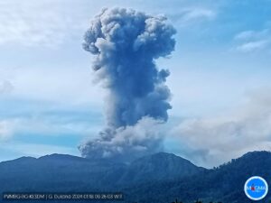
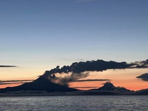
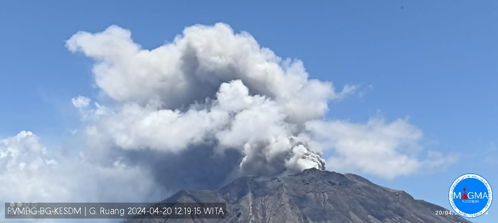
An eruption of Mount Ruang occurred on Saturday, April 20, 2024 at 12:15 WITA with the height of the ash column observed at ±250 m above the summit (±975 m above sea level). The ash column was observed to be gray with thick intensity, oriented towards the South. At the time of writing, the eruption was still ongoing.
Observation of seismicity:
20 shallow volcanic earthquakes with an amplitude of 5 to 15 mm and a seismic duration of 8 to 19 seconds.
6 deep volcanic earthquakes with an amplitude of 10 to 30 mm, and duration of the earthquake 9 to 22 seconds.
RECOMMENDATION
1. Communities around Mount Ruang and visitors/tourists should remain vigilant and not enter the area within a 6 km radius around the center of the active crater of Mount Ruang.
2. People living in the P. Tagulandang area within 6 km radius should be immediately evacuated to a safe place outside the 6 km radius.
3. Residents of Tagulandang Island, especially those living near the coast, should be aware of the risk of incandescent rock eruptions, hot clouds (surges), and tsunamis caused by the collapse of volcanic bodies into the sea.
Source et photo : Magma Indonésie
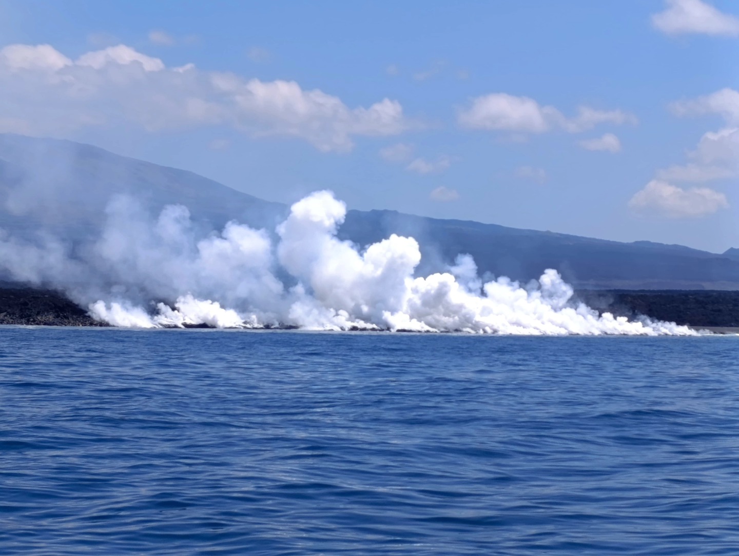
Hawaii , Kilauea :
Saturday, April 20, 2024, 11:28 AM HST (Saturday, April 20, 2024, 21:28 UTC)
19°25’16 » N 155°17’13 » W,
Summit Elevation 4091 ft (1247 m)
Current Volcano Alert Level: ADVISORY
Current Aviation Color Code: YELLOW
Activity Summary:
Kīlauea volcano is not erupting. Increased seismicity over the past three weeks, indicates heightened activity. Updates will be provided daily while at a heightened state of unrest.
Summit Observations:
Earthquake activity has been increasing over the past three weeks beneath the summit of Kīlauea. Activity has alternated between typical shallow, 0.5-2.5 miles (1-4 km) deep earthquakes beneath the south caldera region and 3-6 miles (5-10 km) deep earthquakes directly beneath Kīlauea caldera. Last night, between approximately 9:40 pm and 10:40 pm HST on April, 19, 2024, a moderate swarm of earthquakes occurred 5-6 miles (8-10 km) beneath the summit. This activity indicated movement of magma in the subsurface. Seismicity has returned to a lower level this morning.
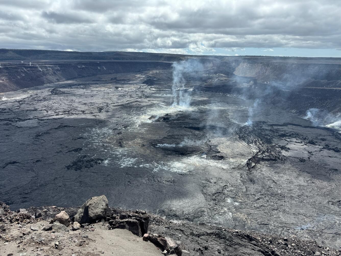
Weak, wispy gas plumes rise vertically in the slack winds from the central portion of Halema‘uma‘u, at the summit of Kīlauea. Nothing unusual was observed today at the summit.
Kīlaueaʻs summit remains inflated, but recent ground deformation remains low with tiltmeters near Sand Hill and Uēkahuna showing no significant changes in the past day. Sulfur dioxide (SO2) gas emission rates have remained low since October 2023. An SO2 emission rate of approximately 96 tonnes per day was recorded on April 8.
Rift Zone Observations:
Seismicity in Kīlauea’s upper East Rift Zone and Southwest Rift Zone remain low. No unusual activity has been noted along the middle and lower sections of Kīlauea’s East Rift Zone. We continue to closely monitor both rift zones.
Source : HVO
Photo : USGS / M. Patrick.
Ecuador / Galapagos , Fernandina :
DAILY REPORT ON THE ACTIVITY OF THE FERNANDINA VOLCANO. Quito, Saturday April 20, 2024.
From April 19, 2024 11:00:00 to April 20, 2024 11:00:00
Activity level:
Surface: Moderate; Surface trend: No changes
Internal: Moderate; Internal trend: No changes
Gas:
The Mounts satellite system detected 533 tons of sulfur dioxide (SO2) recorded yesterday at 7:45 p.m. TL.
Other monitoring parameters:
During the last 24 hours, the FIRMS satellite system recorded 238 thermal anomalies, the MIROVA-MODIS system recorded 4 high thermal anomalies, while the MIROVA-VIIRS system recorded 4 high thermal anomalies and 1 moderate thermal anomaly.
Observation:
With satellite images from GOES-16, permanent thermal anomalies are observed due to the activity of the volcano. Currently, the lava flows have reached the coast and are in contact with the sea, which allows emissions of water vapor and gas to be observed. It is recommended to take precautions regarding tourism, fishing and research activities, among others .
Source : IGEPN
Photo : Parque Nacional Galapagos
Chile , Villarica :
Seismology
The seismological activity of the period was characterized by the recording of:
16 seismic events of type VT (Volcano-Tectonic), associated with the fracturing of rocks. The most energetic earthquake had a Local Magnitude (ML) value equal to 1.6, located 4.5 km east-southeast of the volcanic edifice, at a depth of 4.6 km relative to to the crater.
9,604 LP (Long Period) seismic events, associated with fluid dynamics inside the volcanic system. The size of the largest earthquake evaluated from the Reduced Displacement (RD) parameter was equal to 36 cm2.
1,993 seismic events of type TR (TRemor), associated with the dynamics maintained over time of fluids inside the volcanic system. The size of the largest earthquake evaluated from the Reduced Displacement (RD) parameter was equal to 30 cm2.
Fluid geochemistry
The sulfur dioxide (SO2) emissions data obtained by the differential optical absorption spectroscopy (DOAS) equipment, corresponding to the Los Nevados and Tralco stations, installed respectively at 10 km in an East-North-East direction and 6 km East-South-East of the active crater, presented an average value of 1,365 t/d, which represents moderate values for this volcanic system. The maximum daily value was 3,176 t/d on April 7, considered an abnormal value for this system. 3 satellite anomalies were reported in SO2 emissions into the atmosphere in the area near the volcano, on April 1, 5 and 11, according to data published by Tropopheric Monitoring Instrument (TROPOMI).
Thermal anomalies by satellites
During the period, 17 thermal alerts were recorded in the area associated with the volcano, with a maximum volcanic radiative power (VRP) of 41 MW on April 5, 11 and 12, a value considered moderate according to data processed by Observation in the mid-infrared of volcanic activity (MIROVA). Thanks to the analysis of Sentinel 2-L2A satellite images, 3 radiance anomalies were detected in the area associated with the crater during the evaluated period. The NHI tools platform detected a maximum area of anomalous radiation in the crater area of 34,840 m2 on April 12.
The seismicity that defines fluid dynamics continues (LP and Tremor events) and fewer occurrences of volcano-tectonic (VT) earthquakes above their baseline threshold. The RSAM values (measurement of the average amplitude over time intervals) show a trend towards stabilization with average values between 1.3 and 1.5 um/s. At the same time, we continue to observe degassing and minor explosions reaching the interior and immediate surroundings of the crater, incandescence and a decrease in the abnormal values recorded for SO2 fluxes. The monitoring parameters suggest the activity of a lava lake with variations in its level and its exposed area, with potential generation of explosive activity. In accordance with this context, the volcanic technical alert is maintained in:
YELLOW TECHNICAL ALERT: Changes in the behavior of volcanic activity
Source : IGEPN
Photo : Aton
La Guadeloupe , La Soufrière :
Report of volcanic activity
Sequence of earthquakes in the area of La Soufrière of Guadeloupe – Basse Terre.
The sequence of volcanic earthquakes that began in the area of La Soufrière volcano on Thurday, April 11th 2024 at 11:10 pm local time (Friday, April 12th, 03:10, Universal Time UT*) ended on Sunday, April 14th 2024 at 05:00 pm local time (Sunday, April 14th 21:00, Universal Time UT*) .
During this sequence, the OVSG-IPGP networks have recorded 98 earthquakes of very low magnitude (M<1). No earthquake have been reported felt by the population. The events are located at a depth of <2.5 km under the summit of the dome of La Soufrière.
The alert level remains: yellow, vigilance.
Source et photo :OVSG-IPGP directorship