January 19 , 2024.
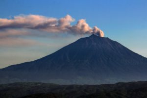
Iceland , Reykjanes Peninsula :
Land rise continues near Svartsengi . High risk remains within Grindavík
Updated 18 January 15:30 UTC
As reported in the news yesterday, clear signs of land rise persist beneath Svartsengi, but it is still too early to determine the rate of the uplift due to the recent volcanic activity in the area. GNSS measurements are being evaluated to provide a comprehensive assessment of the situation. However, it appears that the deformation remains similar to that observed after the volcanic eruption on December 18.
Around 200 earthquakes have been recorded near the magma conduit since yesterday, with the largest measuring 1.4 in magnitude. Since midnight, approximately 70 small earthquakes have occurred, which is fewer than measured the day before. The weather has impacted the number of earthquakes detected in recent days, but the number of earthquakes seems to have decreased overall.
A significant risk remains in Grindavík due to fissures and the potential for ground collapse into them.
Source : IMO
Photo : Sigurður Ólafur Sigurðsson
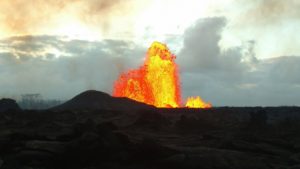
Alaska , Great Sitkin :
Slow eruption of lava in the summit crater of Great Sitkin Volcano continues as seen in high-resolution satellite imagery collected earlier this week. Weakly elevated surface temperatures consistent with lava were also observed in satellite images overnight. Local web cameras and seismic data remain temporarily offline due to a storm-related power failure.
The current lava flow began erupting in July 2021. No explosive events have occurred since a single event in May 2021.
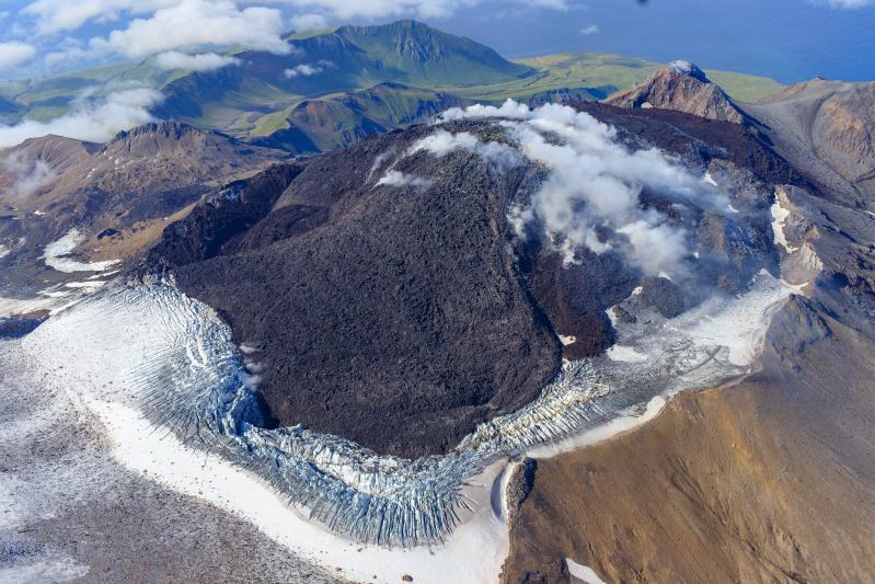
Oblique view of Great Sitkin Volcano looking west at the active lava flows in the crater. Photo taken on September 1, 2023 during a helicopter overflight by AVO geologists. The currently active lobe of the flow field is visible moving into the crater ice field on the lower left side of the image.
Local seismic and infrasound sensors and web cameras are used to monitor Great Sitkin, when available. We are currently using regional infrasound and lightning networks as well as satellite data.
Source : AVO
Photo : Loewen, Matt
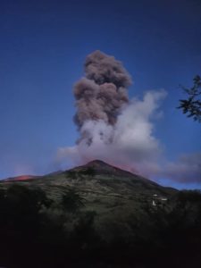
Indonesia , Dukono :
The volcano is clearly visible. White/gray smoke is observed above the main crater with high intensity around 100-1800 meters from the summit. The weather is sunny to cloudy, the wind is weak to moderate from the south.
Seismicity presents:
31 eruption earthquakes with an amplitude of 4 to 34 mm and an earthquake duration of 31.57 to 57.62 seconds.
21 deep tectonic earthquakes with amplitude of 4 to 34 mm, and earthquake duration of 60.34 to 190.94 seconds.
1 Continuous tremor with an amplitude of 1 to 6 mm, dominant value of 2 mm.
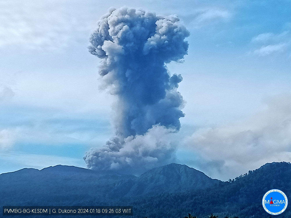
An eruption of Mount Dukono occurred on Thursday, January 18, 2024 at 09:18 WIT with the height of the ash column observed at ±1800 m above the summit (±2887 m above sea level). The ash column was observed to be white to gray in color with thick intensity, oriented towards the South. At the time of writing, the eruption was still ongoing.
PVMBG reported that Dukono’s eruption continued from January 10 to 16. Plumes of gray and white ash generally rose 100 to 700 m above the summit and drifted south from January 10 to 15; no emissions were observed on January 11. Plumes of white and gray ash rose 1.7 km above the summit and drifted southwest on January 16. The alert level remained at level 2 (on a scale of 1 to 4) and the public was warned to stay outside the 2km exclusion zone.
Source : Magma Indonésie , GVP.
Photo : Magma Indonésie
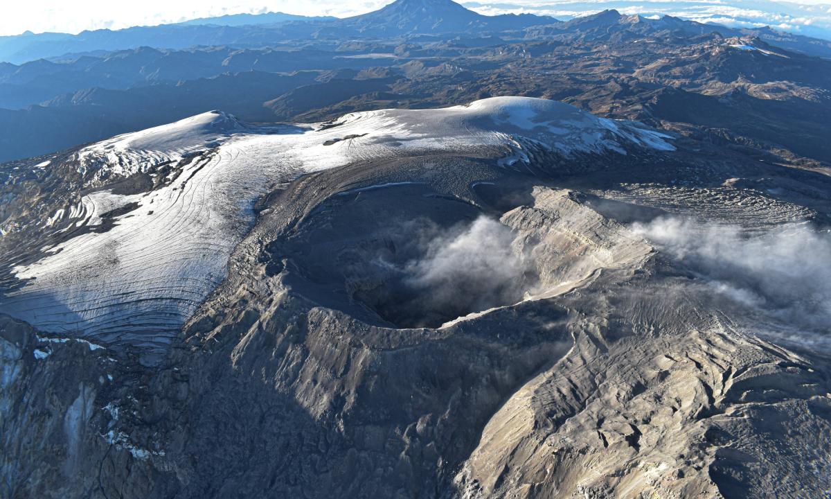
Chile , Villarica :
Special Report on Volcanic Activity (REAV), La Araucanía and Los Ríos regions, Villarrica volcano, January 15, 2024, 11:30 a.m. local time (mainland Chile)
The National Geology and Mining Service of Chile (Sernageomin) announces the following PRELIMINARY information, obtained through the monitoring equipment of the National Volcanic Monitoring Network (RNVV), processed and analyzed at the Southern Andean Volcano Observatory (Ovdas):
On Thursday, January 18, 2024, at 12:17 p.m. local time (3:17 p.m. UTC), monitoring stations installed near the Villarrica volcano recorded an earthquake associated with the fracturing of rocks (Volcano-tectonic) inside the volcanic system.

The characteristics of the earthquake after its analysis are as follows:
ORIGINAL TIME: 12:17 local time (15:17 UTC)
LATITUDE: 39.423°S
LONGITUDE: 71.887°W
DEPTH: 4.0 km
LOCAL MAGNITUDE: 3.5 (ML)
Observation :
After this event, a second event with similar characteristics, of lower energy, was recorded. No changes in fluid seismic activity or associated surface activity were observed.
The technical volcanic alert is maintained at YELLOW level.
Source : Sernageomin.
Photo : minutoneuquen.com
Colombia , Nevado del Ruiz :
Weekly bulletin on the activity of the Nevado del Ruiz volcano
From the monitoring of the activity of the NEVADO DEL RUIZ VOLCANO, the MINISTRY OF MINES AND ENERGY through the COLOMBIAN GEOLOGICAL SERVICE (SGC) reports that:
During the week of January 9 to 15, 2024, the volcano maintained unstable behavior with low levels of activity, which was mainly manifested by the decrease in seismic and energetic activity of thermal anomalies detected at the bottom from the Arenas crater. Compared to the previous week, the main variations in the parameters monitored were:
– Seismicity associated with the fracturing of rocks within the volcanic edifice has decreased in the number of earthquakes recorded and in the seismic energy released. The earthquakes were located mainly in the Arenas crater and, scatteredly, on different flanks of the volcano at distances less than 7 km from the crater. The events were of low energy level (magnitudes less than 1) and had a depth between 1 and 6 km relative to the summit of the volcano. In addition, seismicity was recorded linked to the activity of the lava dome (protrusion or mound) located at the bottom of the crater with a low energy level and a short duration.
– Seismic activity linked to pulsatile emissions of ash and gas into the atmosphere has reduced the number of earthquakes recorded and increased the seismic energy released. Seismic signals of this type mainly had low to moderate and sometimes high energy levels.
The signals of January 10 are distinguished by their duration and of January 15 at 06:53 for its energy. Thanks to the cameras used to monitor the volcano, it was possible to confirm several emissions of ash or changes in the relative temperature of the material emitted associated with certain seismic signals.
– Sulfur dioxide (SO2) outgassing rates are variable and increasing slightly. The maximum height of the gas or ash column was 2,200 m vertically and 2,400 m dispersed.
These values were measured at the summit of the volcano on January 10, 2024 and were associated with the emission of ash recorded at 12:13 p.m. The direction of dispersion of the column was towards the western flank of the volcano, from northwest to southwest, generating ash falls in areas close to the volcano and in the municipalities of Manizales and Villamaría.
– When monitoring thermal anomalies at the bottom of Arenas Crater, from satellite monitoring platforms, a decrease was observed in the number of detections and maximum energy levels recorded. The detected anomalies had low to moderate energy levels.
Source et photo : SGC