February 26 , 2022.
Alaska , Pavlof :
55°25’2″ N 161°53’37 » W,
Summit Elevation 8261 ft (2518 m)
Current Volcano Alert Level: WATCH
Current Aviation Color Code: ORANGE
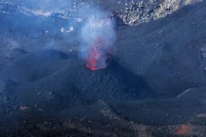
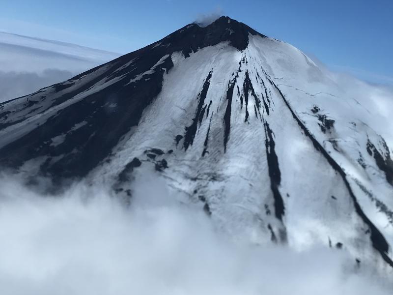
The eruption of Pavlof Volcano continues. Lava effusion continues from the vent just east of the volcano’s summit, sending a flow a short distance down the northeast flank of the volcano. The volcano was obscured by cloudy weather in satellite and web camera images for much of the week. Nevertheless, elevated surface temperatures were observed in satellite data on several days through cloud cover. Elevated seismicity, consisting of nearly continuous tremor, was detected throughout the week with an increase in tremor energy and small explosions observed in seismic and infrasound data early Thursday morning. Data from several seismic and infrasound stations on the south side of the volcano stopped flowing yesterday due to a telemetry issue. Data from stations on the north side of the volcano continue to be received.
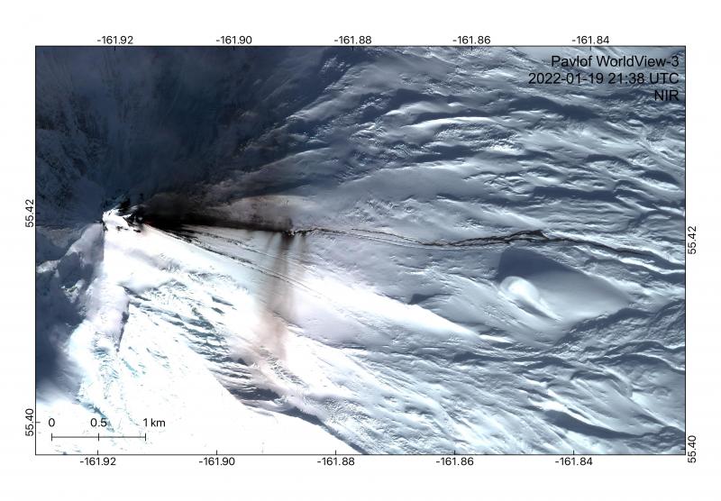
Eruption of lava at Pavlof captured in this WorldView-3 image from January 19, 2022. A scoria cone is visible and steaming in a vent on the eastern flank of the volcano. An active lava flow is spilling out, extending 1.3 km east. Meltwater from interaction between the lava and snow and ice is then producing lahars that extend beyond the lava flow up to 4.4 km east from the vent. Minor ash deposits are also visible as dark streaks on the snow emanating from near the front of the lava flow, where steam generation is likely producing weak explosive activity.
Periods of lava fountaining from the vent on the volcano’s upper east flank have been occurring since mid-November 2021. This activity has built a small cone and sent flows down the flank that melt the snow and ice and produce variable amounts of meltwater. The meltwater typically incorporates loose debris on the flank of the volcano and forms thin (less than 2 m thick) lahars. The lahar deposits extend down the east-southeast flank for several kilometers, not quite to the base of the volcano.
Previous eruptions of Pavlof indicate that the level of unrest can change quickly and the progression to more significant eruptive activity can occur with little or no warning.
Pavlof is monitored by local seismic and infrasound sensors, satellite data, web cameras, and remote infrasound and lightning networks.
Source : AVO.
Photos : Dietterich, Hannah , Mulliken, Katherine (2018).
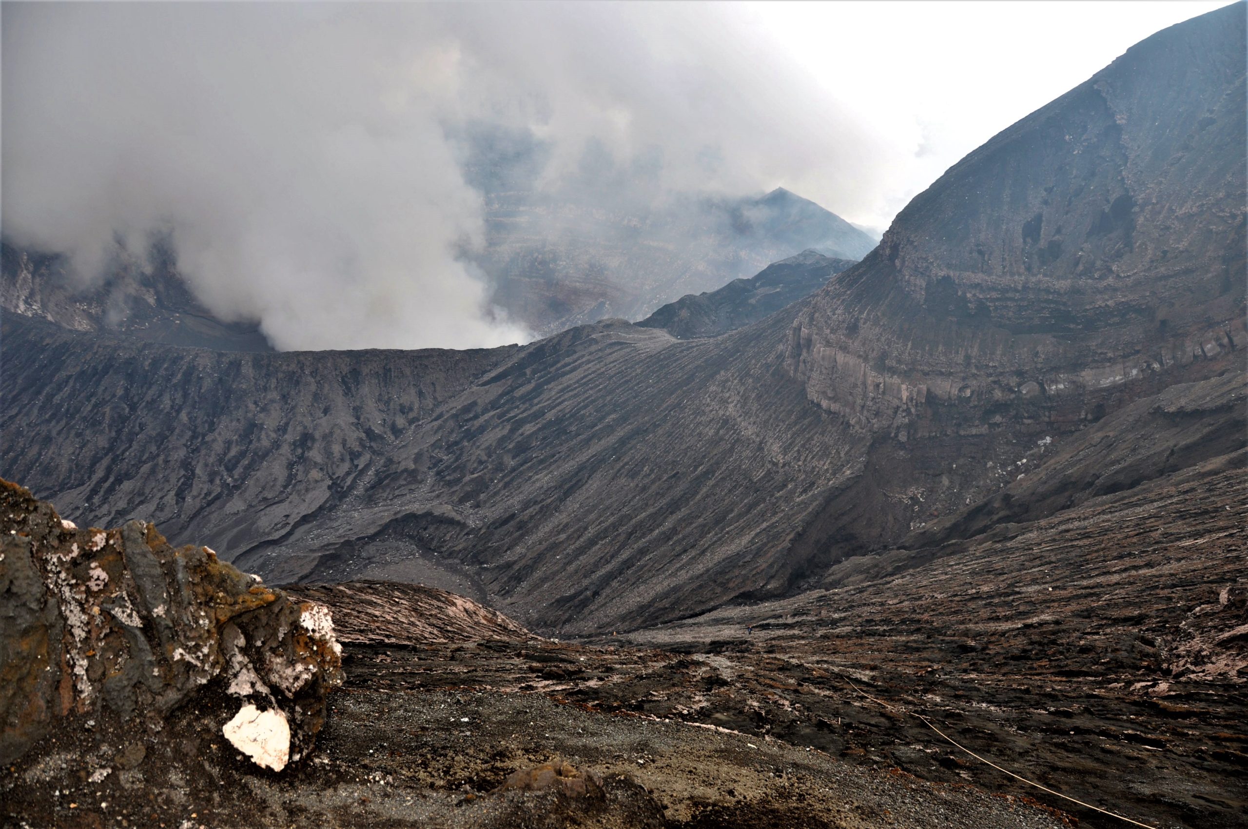
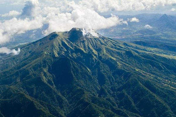
Indonesia , Merapi :
Merapi activity report from February 18 to 24, 2022.
– The weather around Mount Merapi is generally sunny in the morning and evening, while foggy in the afternoon.
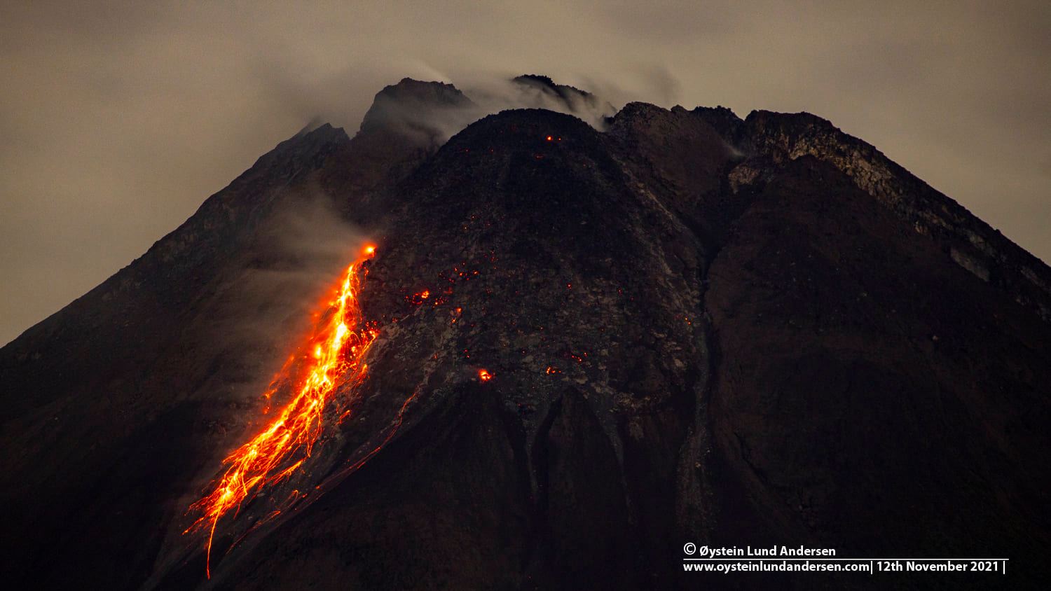
– This week, a hot cloud was observed descending to the southwest, upstream of the Bebeng River with a slip distance of 1,800 m. It was reported that there was a fine ash rain in Pakem district on February 18, 2022. 173 lava avalanches were observed in the South West, dominating the Bebeng River with a maximum slip distance of 2,000 m .
– Drone data analysis showed that there were morphological changes in the southwestern and central domes of the crater due to extrusion activity in the form of avalanches and growth of the lava dome . The volume of the Southwest lava dome is 1,578,000 m3 and the central dome is 3,228,000 m3.
– The intensity of seismicity this week is still quite high. Mount Merapi’s deformation, which was monitored using EDM this week, showed a distance shortening rate of 0.2 cm/day.
– The rainfall intensity was 31 mm/hour for 50 minutes at Pos Babadan on February 18, 2022. No lahar or additional flow was reported in the rivers that originate on Mount Merapi.
Conclusion:
1. The volcanic activity of Mount Merapi is still quite high in the form of effusive eruption activity. The state of the activity is defined at the « SIAGA » level.
2. The current potential danger is lava avalanches and hot clouds in the South-South-West sector covering the Boyong River for a maximum of 5 km, the Bedog River, Krasak, Bebeng for a maximum of 7 km. The Southeast sector covers the Woro River for a maximum of 3 km and the Gendol River for a maximum of 5 km. Finally, the ejection of volcanic material in the event of an explosive eruption can reach a radius of 3 km around the summit.
Source : BPPTKG
Photo : Oystein Lund Andersen.
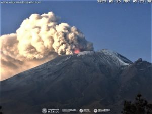
Guatemala , Santiaguito :
Activity:
The Observatory of the Santa María-Santiaguito Volcanic Complex indicates weak degassing 400 meters above the Caliente dome, as well as the descent of weak, moderate and strong avalanches. These boulder avalanches descend from the dome and lava flows on the western, southwest and southern flanks quite often, reaching the base of the dome. During the night and early in the morning, constant incandescence was observed in the Caliente dome and in the lava flows on the western flank.
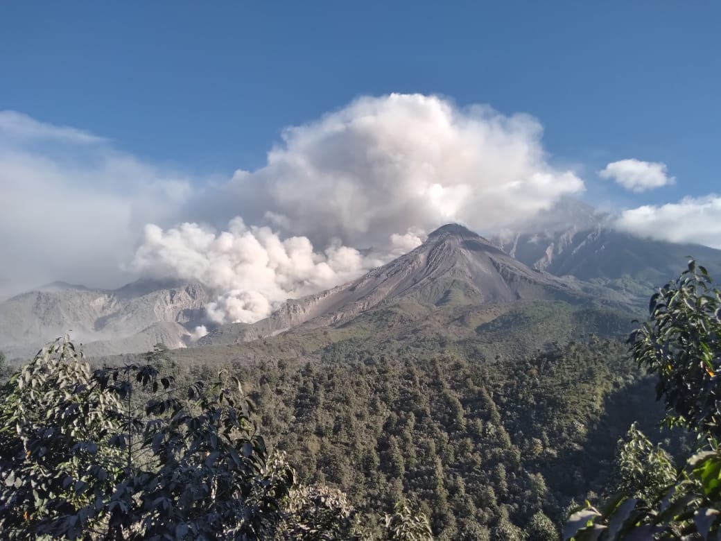
Avalanche descent and wind remobilization are dispersing ash to the west and southwest, so there is a possibility of ashfall on Loma Linda, San Marcos Palajunoj and the San Luis area. Extrusion activity remains at a high level and continues to unstably pile material on the west flank lava flow as well as on the Caliente dome, thus maintaining the possibility that some of this material may collapse and disintegrate generating pyroclastic flows over long distances to the South-West, South and East. BESAN bulletin 003-2022 remains in effect.
Source : Insivumeh
Photo : Noticias Red GT San José del Golfo .
La Martinique , Mount Pelée :
Weekly report on the activity of Mount Pelée for the period from February 18 to 25, 2022.
Between February 18, 2022 at 4 p.m. (UTC) and February 25, 2022 at 4 p.m. (UTC), the OVSM recorded at least 35 volcano-tectonic earthquakes of magnitude less than or equal to 0.5. These earthquakes were located inside the volcanic edifice between 0.5 and 1.2 km deep below the surface. This superficial volcano-tectonic seismicity is associated with the formation of micro-fractures in the volcanic edifice.
During this period, the OVSM also recorded 1 hybrid type earthquake. This signal containing low frequencies is associated with the presence of fluids (gas, hydrothermal waters) in the volcanic edifice. None of these earthquakes were felt by the population.
The zone of degassing at sea at shallow depth between St Pierre and le Prêcheur is still observed. The IGP took fluid samples in order to understand the origin of this degassing and to assess its possible relationship with the Mount Pelée hydrothermal system.
An extension of two areas of degraded vegetation located between Morne Plume and the Rivière Chaude was observed during a helicopter flight carried out on February 9, with the support of Dragon 972, and confirmed by analysis of satellite images.
The alert level remains YELLOW: vigilance.
Source : Direction de l’OVSM IPGP.
Photo : Parc naturel Martinique
Hawaii , Kilauea :
19°25’16 » N 155°17’13 » W,
Summit Elevation 4091 ft (1247 m)
Current Volcano Alert Level: WATCH
Current Aviation Color Code: ORANGE
Activity Summary:
Lava effusion resumed at the summit eruption of Kīlauea Volcano beginning approximately 9:15 pm HST yesterday, about 6.5 hours after inflationary tilt started and less than 15 minutes after an increase in volcanic tremor. All activity remains confined to the active lava lake and west vent area within the western part of Halemaʻumaʻu with minor ooze outs along the margins of the Halemaʻumaʻu crater floor. All recent lava activity has been confined to the crater, and there are no indications of activity migrating elsewhere on Kīlauea.
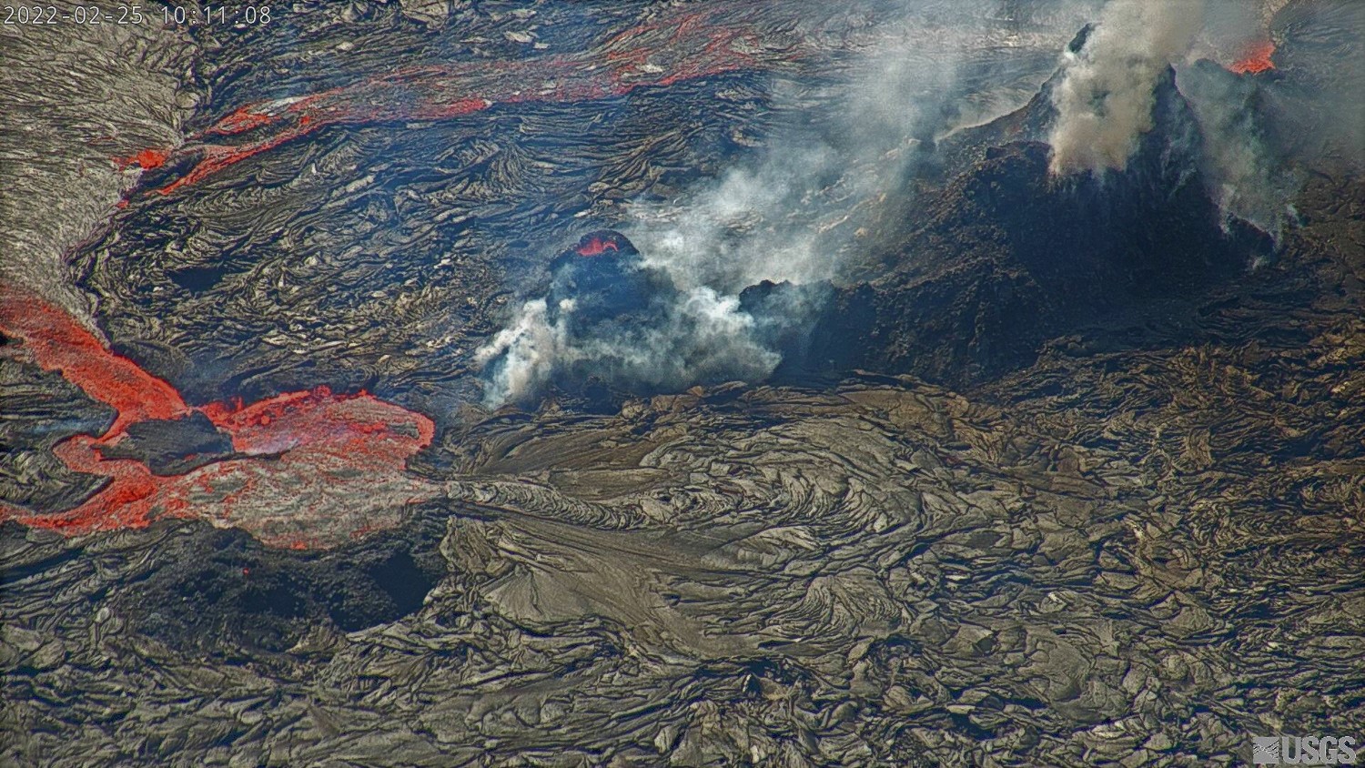
Halemaʻumaʻu Lava Lake Observations:
Eruption of lava from the western vent into the active lava lake within Halemaʻumaʻu crater resumed at approximately 9:15 pm HST last night. Continuous flows of active lava are erupting from the west vent and flowing to the south, west, and into the western active lava lake. There were no significant ooze outs along the margins of the lava lake over the past 24 hours. This resumption of effusive activity corresponds with an increase in summit tilt of approximately 3.2 microradians with corresponding increase in tremor at the summit. The high point on the floor of Halema’uma’u crater has risen approximately 15 meters (49 feet) over the last 24 hours. The active lava lake is now approximately 96 meters (315 feet) deep relative to when lava emerged on September 29, 2021. The erupted volume is 45 million cubic meters (59 million cubic yards) of lava as measured on January 25, 2021.
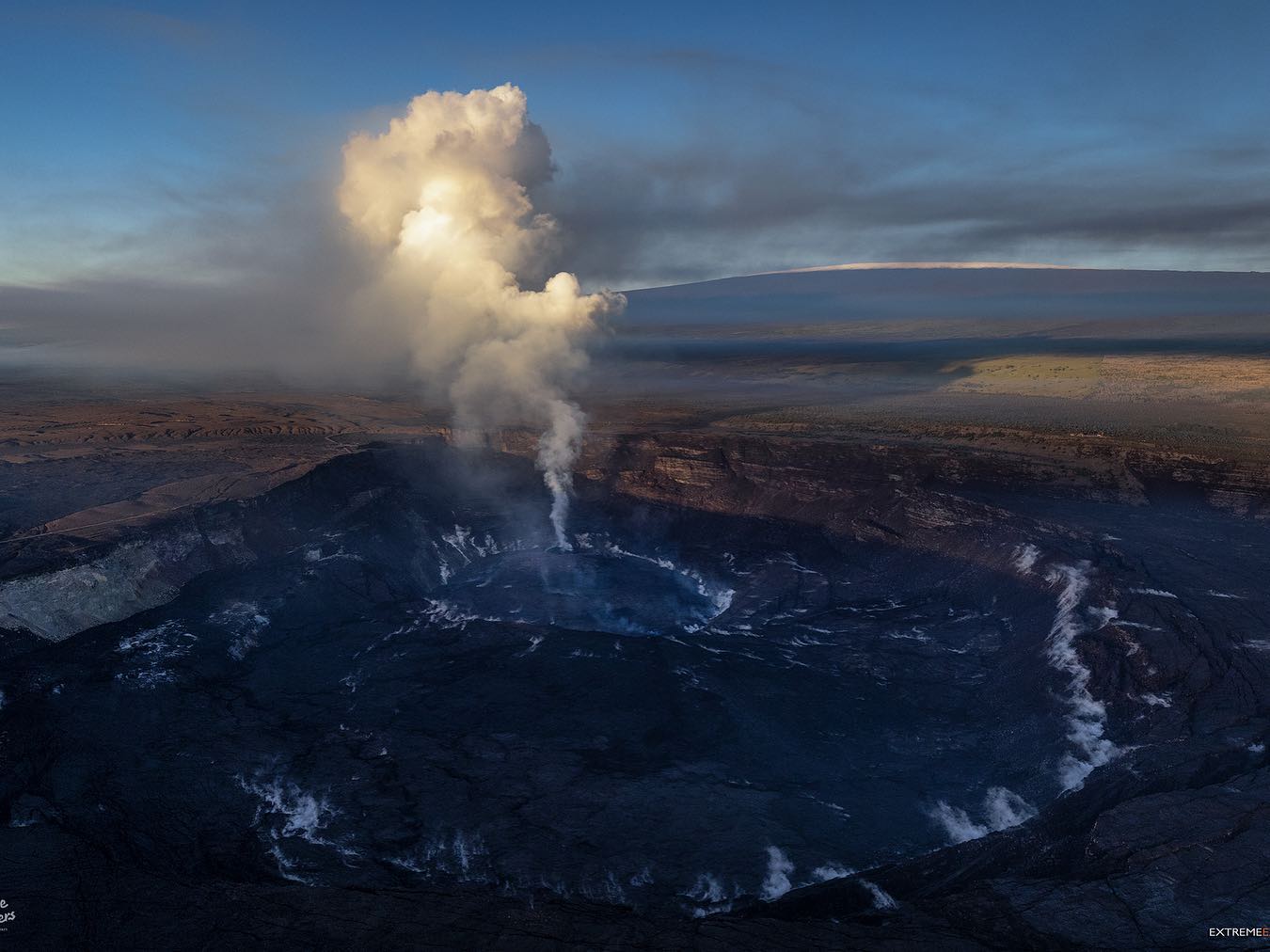
Summit Observations:
At approximately 2:45 pm HST on February 24, 2022, tilt started to sharply increase by a total of approximately 3.2 microradians by 11:30 pm HST. At 11:30 pm HST yesterday tilt rates slowed and have since been steady. Seismic data shows that the volcanic tremor signal started to increase around 15 minutes (9:00 pm HST on February 24) before the resumption of effusive lava activity within the western part of the lava lake. Tremor now remains elevated and steady. Earthquake activity at the summit remains below background levels. A sulfur dioxide (SO2) emission rate of approximately ~340 tonnes per day (t/d) was measured on February 24.
Source : HVO.
Photos : HVO , Bruce Omori / Paradise Hélicopters .
Vanuatu Archipelago , Ambrym :
AMBRYM volcano ALERT BULLETIN, February 24, 2022, 12:57 p.m.
This is a reminder that volcanic activity at Ambrym continues at the major unrest level. The Volcanic Alert Level remains at Level 2.
The activity of the volcano consists of steam emission but the lava glow observed at night on the crater of Benbow has disappeared again since the beginning of February. A new scientific analysis suggests that the activity of the Ambrym volcano is likely to continue at the level of major unrest. Residents of Ambrym and neighboring islands will not see the volcanic glow at night. With this current volcanic activity, it’s a helpful reminder that eruptions can occur at any level of unrest without warning.