January 10 , 2022 .
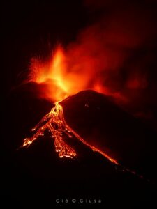
Ecuador / Galapagos , Wolf :
VOLCAN WOLF DAILY ACTIVITY REPORT, Sunday January 09, 2022.
From: January 08, 2022, 11:00 a.m. To: January 09, 2022, 11:00 a.m.
Surface activity level: very high
Surface trend: no change
Internal: high
Internal trend: no change
Seismicity:
Volcano-Tectonics (VT) 12
Tremors of emissions (TREMI) 1
Hybrids (HB): 2
Emission / ash column:
Satellite images (Source: GOES-16) show the gas emission column heading southwest. The Washington VAAC reported four alerts, mostly of gas, with altitudes up to 700 meters above sea level and heading southwest.
Other monitoring parameters:
The WORLDVIEW satellite system has reported hundreds of thermal alerts over Wolf Volcano in the past 12 hours. Likewise, the MIROVA system reported 1 very high (2756 MW), 1 high (572 MW) and 1 moderate thermal anomaly in the last 24 hours.
Observation:
Satellite images (Source: GOES 16; 11: 20UTC; TL GALÁPAGOS = UTC-6) show that the thermal anomaly associated with the lava flows has slightly altered its course from South-South-East to East. The lava flows maintain their advance with the direction towards the sea until the time of publication of this report.
Sources from the Galapagos National Park said a flyby is planned for Saturday afternoon through the Wolf Volcano region, home to the unique pink iguanas.
The volcano erupted in the early hours of Friday, January 7, and first official reports indicated that the pink iguana living area was far from the eruption area and the Wolf Volcano impact area.
Therefore, the Galapagos National Park Authority (GNPD) has not considered taking additional measures to protect pink iguanas.
The eruption of the Wolf volcano, north of Isabela Island, was observed by rangers who were near the area carrying out various management activities of the protected area, as well as by tour operators who sailed in the surrounding area.
Danny Rueda, director of PNG, said during his overflight on Friday, they found the lava flow was heading south of the crater of Wolf volcano.
« This means that our iconic populations such as turtles, land iguanas and mainly the pink iguana, are out of the lava flow that could affect their population in one way or another, » he said. declared Friday.
Source : IGEPN , elcomercio.com.
Photo : Parque Nacional Galápagos ,
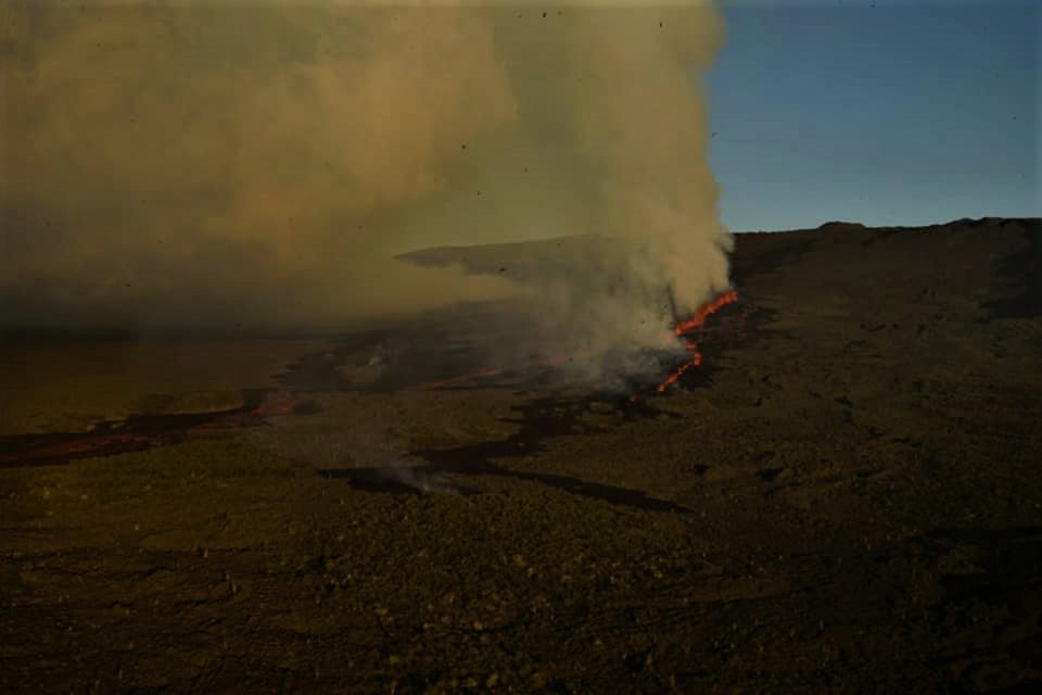
La Réunion Island , Piton de la Fournaise :
Press release from 09/10 January 2022 – 3:00 p.m.
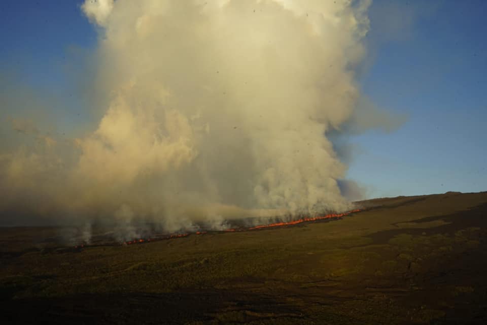
The eruption that began on December 22, 2021 at around 3:30 a.m. local time continues. The slight decrease in the amplitude of the tremor observed since yesterday continues. Nevertheless, the amplitude of the tremor remains generally stable over the last 24 hours (Figure 1).
Fluctuations in the amplitude of the tremor may occur; they are partly linked to the level of the lava lake which varies according to the degassing mode, and the sporadic openings of the tunnels which allow emptying of the cone.
Observations of the eruptive site through our cameras show occasional overflows from the lava lake. As the overflows observed over the past 24 hours are not persistent, they create new flows that quickly freeze when the overflow stops.
Lava projections at the level of the cone are always present and occasionally exceed the height of the cone. Numerous resurgences of lava flows are still visible at the roof of the lava tunnel downstream of the cone.
Given the low slope downstream of the eruptive site and the lava flows currently observed, no advance of the flow front could be seen. These observations were confirmed by
InSAR (radar interferometry) coherence satellite data dated 01/07/2021 which show that the flow front had not changed between the end of December and the day before yesterday. It was still then at:
. 400 m from the southern rampart,
. 7.6 km from the national road 2,
. 8.6 km from the ocean.
Given the low flows and the relief, with slightly inclined slopes in the area, the lava field continues to extend mainly laterally and by thickening at the level of the network of lava tunnels set up on the plateau downstream of the cone. eruptive.
Over the last 24 hours:
– Fourteen low magnitude (<1.2) volcano-tectonic earthquakes were recorded under the summit.
– No significant level deformation of the summit area was observed.
– Lava flows could be estimated by satellite method with the HOTVOLC platform (OPGC – Clermont Auvergne University). They were between 2 and 17 m3 / sec. These variations are explained by the method, which relies on the infrared radiation of the flow, the perception of which by satellites can be largely influenced by the weather conditions above the flows as well as the surface conditions of the flows. The particularly bad weather conditions on the eruptive site over the past 24 hours have only allowed the acquisition of four measurements (the acquisitions being made every 15 minutes).
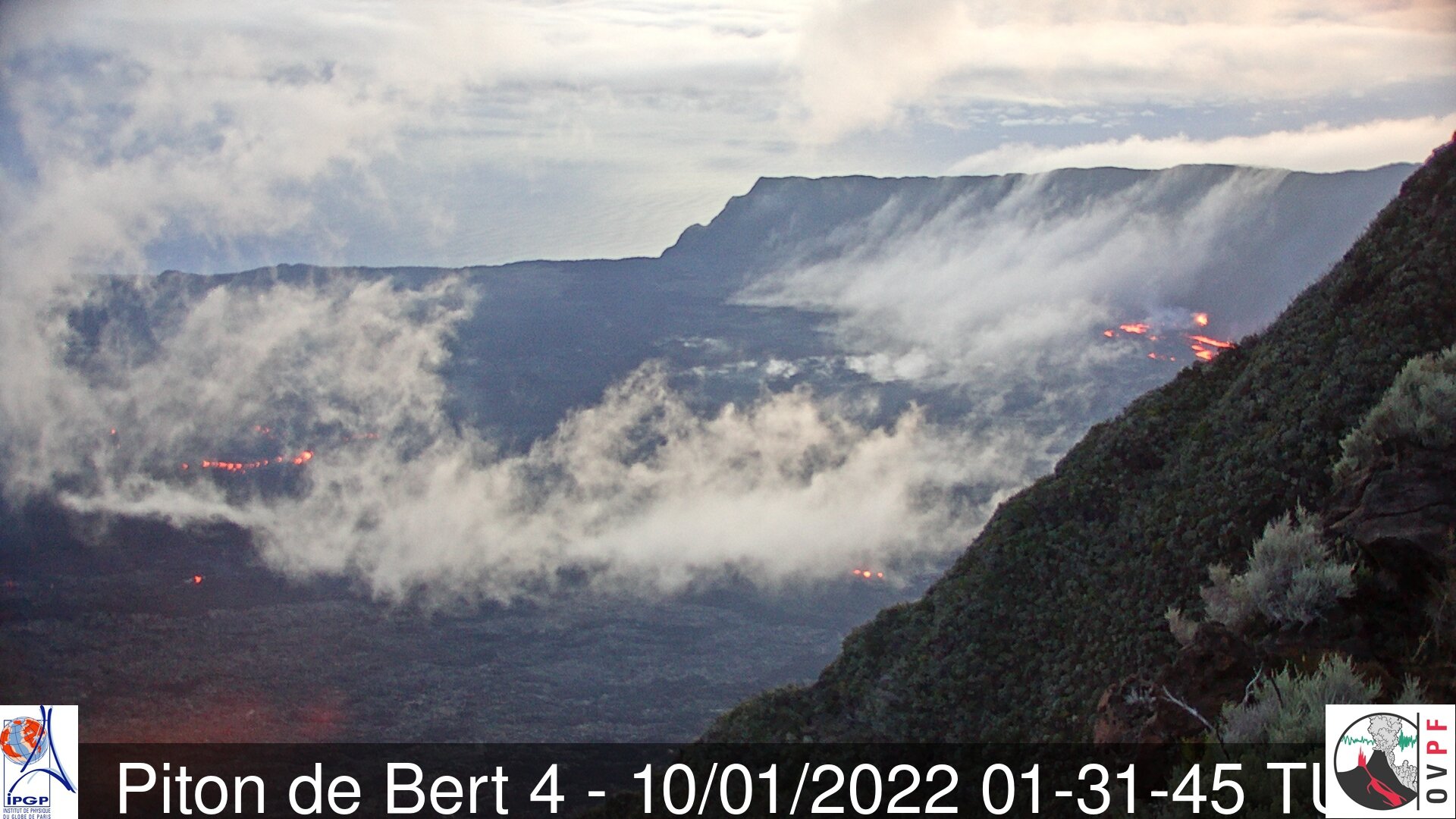
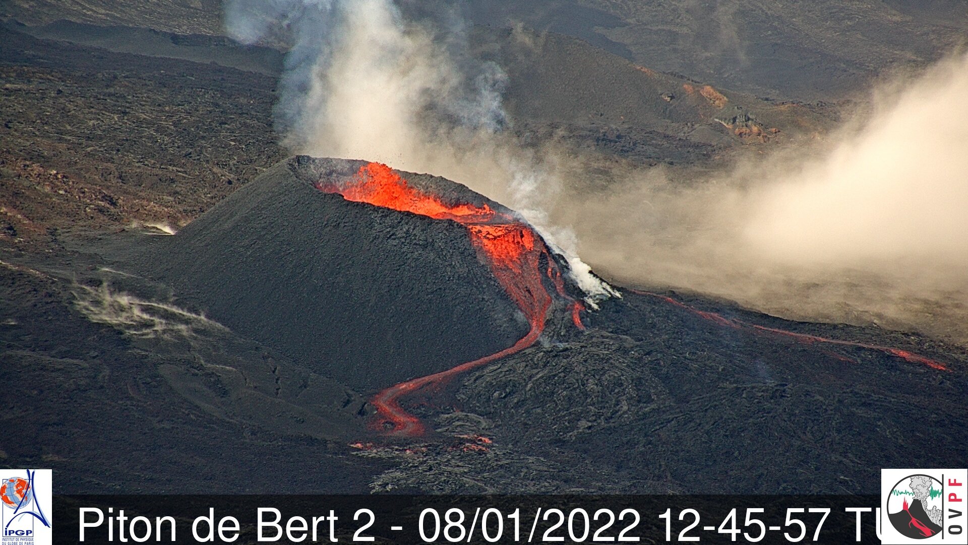
The images from the OVPF-IPGP-IRT webcam located at Piton de Bert show that a new lava flow tongue has taken place over the past 24 hours and runs along the southern rampart.
Hikers early this morning reported the presence of smoke at the foot of the southern rampart, certainly linked to the start of a fire in the heavily vegetated rampart. According to the images, the front of this lava tongue is around 1800 m above sea level.
Unfortunately, given the very bad weather conditions in the volcano area at the moment, no aerial reconnaissance could be carried out.
Alert level: Alert 2-1 (eruption in the Enclos )
Source et photos : OVPF
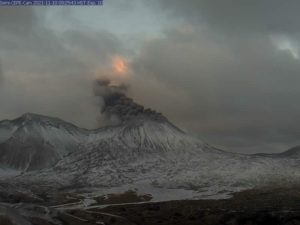
Kamchatka , Sheveluch :
VOLCANO OBSERVATORY NOTICE FOR AVIATION (VONA)
Issued: Januray 10 , 2022
Volcano: Sheveluch (CAVW #300270)
Current aviation colour code: ORANGE
Previous aviation colour code: orange
Source: KVERT
Notice Number: 2022-04
Volcano Location: N 56 deg 38 min E 161 deg 18 min
Area: Kamchatka, Russia
Summit Elevation: 3283 m (10768.24 ft), the dome elevation ~2500 m (8200 ft)
Volcanic Activity Summary:
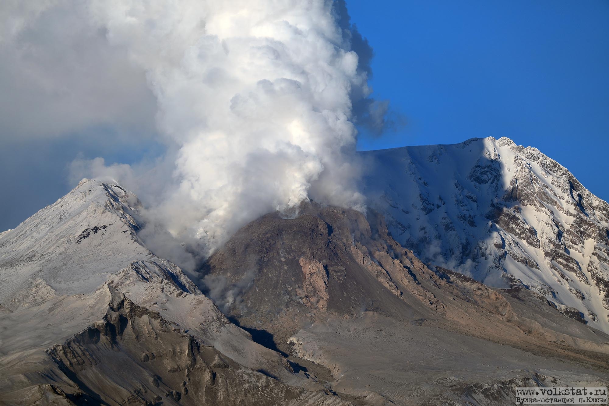
A growth of the lava dome continues, a strong fumarolic activity, and an incandescence of the lava dome and hot avalanches accompanies this process. Satellite data by KVERT show a strong gas-steam activity of the volcano. A gas-steam plume containing some amount of ash extend for 140 km to the west-northwest of the volcano.
The extrusive eruption of the volcano continues. Ash explosions up to 10-15 km (32,800-49,200 ft) a.s.l. could occur at any time. Ongoing activity could affect international and low-flying aircraft.
Volcanic cloud height:
4000 m (13120 ft) AMSL Time and method of ash plume/cloud height determination: 20220110/0240Z – Himawari-8
Other volcanic cloud information:
Distance of ash plume/cloud of the volcano: 140 km (87 mi)
Direction of drift of ash plume/cloud of the volcano: WNW / azimuth 287 deg
Time and method of ash plume/cloud determination: 20220110/0240Z – Himawari-8
Source: Kvert
Photo : Volkstat . ru / Yu. Demyanchuck.
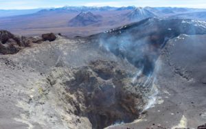
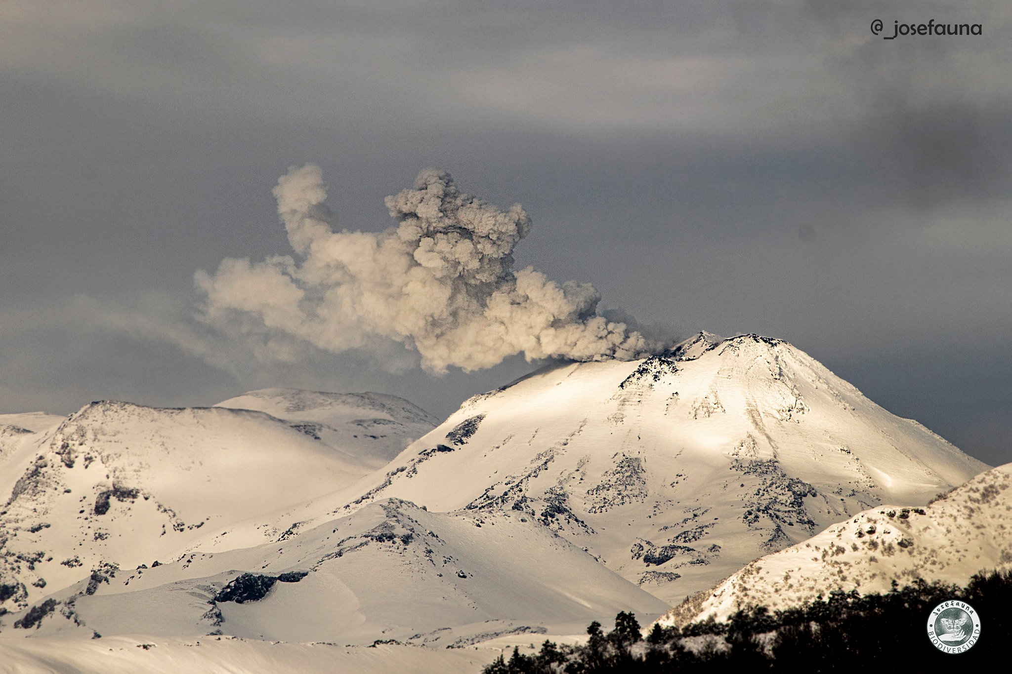
Chile , Nevados de Chillan :
Special Report on Volcanic Activity (REAV), Region of Ñuble, Nevados de Chillán Volcanic Complex, January 09, 2022, 09:55 local time (Continental Chile)
The National Service of Geology and Mines of Chile (Sernageomin) publishes the following PRELIMINARY information, obtained thanks to the monitoring equipment of the National Volcanic Monitoring Network (RNVV), processed and analyzed in the Volcanological Observatory of the Southern Andes (Ovdas) :
On Sunday January 09, the monitoring stations installed near the Nevados de Chillán volcanic complex recorded two major earthquakes, associated with the fracturing of the rock (volcano-tectonic type).
The first occurred at 9:18 a.m. local time (12:18 p.m. UTC), and its characteristics are as follows:
TIME OF ORIGIN: 09:18 local time (12:18 UTC)
LATITUDE: 36.837 ° S
LONGITUDE: 71.339 ° W
DEPTH: 3.4 km
LOCAL MAGNITUDE: 3.5 (ML)
The second occurred at 09:24 local time (12:24 UTC), its characteristics are as follows:
TIME OF ORIGIN: 09:24 local time (12:24 UTC)
LATITUDE: 36.831 ° S
LONGITUDE: 71.343 ° W
DEPTH: 2.8 km
LOCAL MAGNITUDE: 3.0 (ML)
OBSERVATIONS:
At the time of issuing this report, other events with similar characteristics have been recorded, showing less energy. The camera images do not record any superficial activity following these events.
The volcanic technical alert remains at the yellow level.
Source : Sernageomin.
Photo : josefauna.
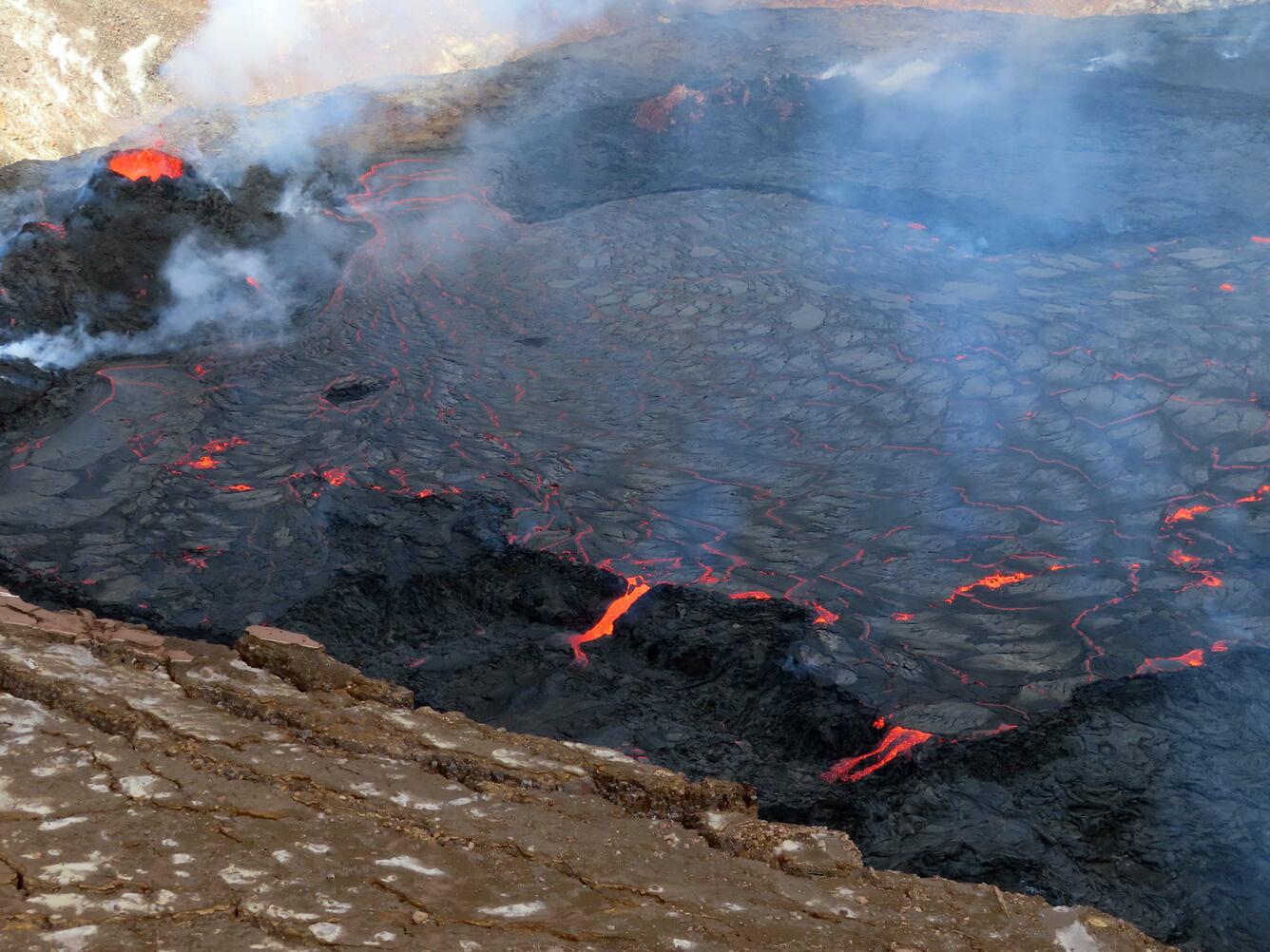
Hawaii , Kilauea :
19°25’16 » N 155°17’13 » W,
Summit Elevation 4091 ft (1247 m)
Current Volcano Alert Level: WATCH
Current Aviation Color Code: ORANGE
Activity Summary:
The summit eruption of Kīlauea volcano, within Halemaʻumaʻu crater, has continued over the past 24 hours. All recent lava activity has been confined to the crater, and there are no indications of activity migrating elsewhere on Kīlauea.
Summit Observations:
Summit tiltmeters recorded low levels of change over the past day, with one small deflation-inflation (DI) event. Volcanic tremor associated with the eruption—as recorded by nearby seismometers—remains elevated. Earthquake activity in the summit region remains below background level. A sulfur dioxide (SO2) emission rate of approximately 3,300 tonnes per day was measured on the morning of January 6, in the summit region while the lava lake was active.
Halemaʻumaʻu Lava Lake Observations:
Lava returned to the western vent within Halemaʻumaʻu crater at about 9:30 p.m. on January 7. The surface of the lava lake remains active in the western side of the crater. The lake has seen a total rise of about 70 meters (230 feet) since lava emerged on September 29. Measurements on December 30 indicated that the total lava volume effused since the beginning of the eruption was approximately 40 million cubic meters (10.5 billion gallons) at that time.
Source : HVO.
Photo : USGS / E. Gallant.