March 22 , 2021 .
Iceland , Fagradalsfjall :
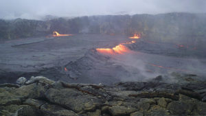
A minor eruption underway , Updated 21.03 13:40
The Scientific Advisory Board of the Icelandic Civil Protection met yesterday afternoon, 20 March, to evaluate the latest developments of the volcanic eruption in Geldingardalur on the Reykjanes Peninsula. The conclusion of the meeting was that the following developments are possible:
The eruption will decrease gradually and end in the coming days or weeks.
New volcanic fissures could open at the eruption site or along the magma dike near to Mt. Fagradalsfjall.
The likelihood of a large earthquake close to Mt. Fagradalsfjall has reduced due to the ongoing volcanic activity.
An earthquake up to magnitude 6.5 could be triggered in the Brennisteinsfjöll volcanic system, located east of Mt. Fagradalsfjall.
The Scientific Advisory Board of the Icelandic Civil Protection warns of dangers in the area of the eruption site.
It is important to keep in mind that the vicinity of the eruption site is dangerous as sudden changes can be expected. The Scientific Advisory Board of the Icelandic Civil Protection outlined the following hazards close to the ongoing eruption:
New volcanic fissures could form in the area without notice.
Glowing pieces of lava could fall from the edges of the lava front, and sudden lava outbreaks can be expected where new lava tongues find their way out of the lava stream. This can happen very quickly, making it difficult for people to get out of the way, even when running.
The volcanic craters are now several meters high and can therefore be unstable and crumble without notice with the consequences that the lava flow can suddenly change direction.
Explosions can happen where the lava flows over water-logged ground, resulting in lava being thrown in different directions.
The lava is streaming into a closed valley. Therefore, lethal volcanic gases, many of which are heavier than air, can accumulate in low-lying areas. The danger increases in calm weather conditions.

The IMO continues to monitor gas dispersion from the eruption. It is unlikely that gas pollution will seriously affect people living in the capital region and the towns of the Reykjanes Peninsula in the coming days. However, weather conditions and the concentration of gases (e.g. SO2 and CO2) will affect the dispersion and concentration of gas pollution.
22/03 : The eruption is still ongoing. Lava fountain activity is low and mapping of the lava flow is in progress. No volcanic ash has been detected but high level of volcanic gases has been measured close to the eruption site.
IMO’s specialists performed gas measurements at the eruption site. There are indications that gas emission from the eruption is slightly lower than yesterday, however gas concentration close to the lava flow were measured above danger threshold.
Source : Vedur Is.
Photos : Vilhelm Gunnarsson
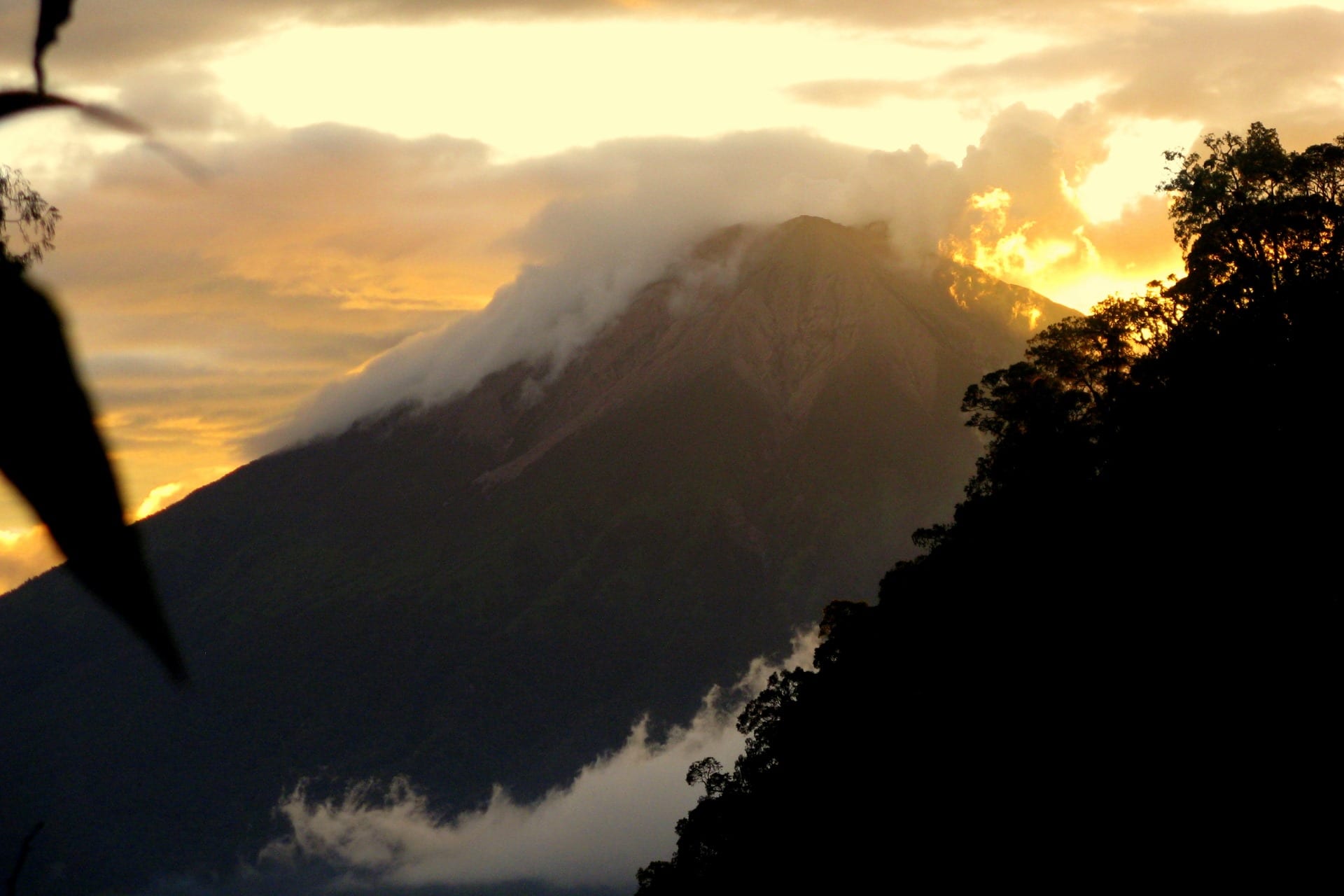
Kamchatka , Klyuchevskoy :
VOLCANO OBSERVATORY NOTICE FOR AVIATION (VONA)
Issued: March 22 , 2021
Volcano: Klyuchevskoy (CAVW #300260)
Current aviation colour code: YELLOW
Previous aviation colour code: orange
Source: KVERT
Notice Number: 2021-37
Volcano Location: N 56 deg 3 min E 160 deg 38 min
Area: Kamchatka, Russia
Summit Elevation: 4750 m (15580 ft)
Volcanic Activity Summary:
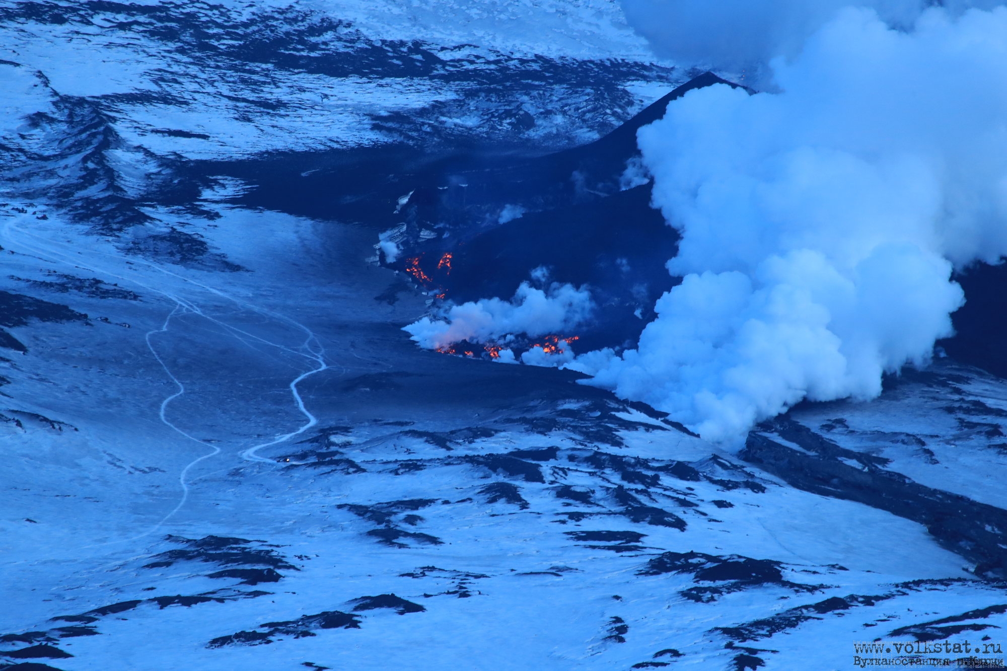
The flank eruption (lateral break) on the northwestern slope of Klyuchevskoy volcano gradually ends. A weak incandescence over cinder cone and lava flows still continues to observing on video images, but its intensity has dropped significantly. A temperature of thermal anomaly on the satellite images significantly decreased too. KVERT continues to monitor Klyuchevskoy volcano.
A moderate gas-steam activity of the volcano continues. Ongoing activity could affect low-flying aircraft.
Volcanic cloud height: NO ASH CLOUD PRODUSED
Other volcanic cloud information: NO ASH CLOUD PRODUSED
Source : Kvert.
Photo : Yu Demyanchuk / Volkstat ru .
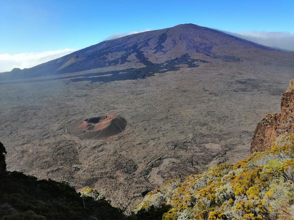
La Réunion , Piton de la Fournaise :
Activity bulletin for Monday, March 22, 2021 at 10:00 (local time).
Following the resumption of seismicity on March 13 under the Piton de la Fournaise, it continues. Thus between March 13 and March 21, 90 volcano-tectonic earthquakes, of magnitude between <1 and 1.8, were recorded and located under the Dolomieu crater between 0.2 and 0.9 km above the level of the sea (ie between 1.6 and 2.3 depth; Figure 2).
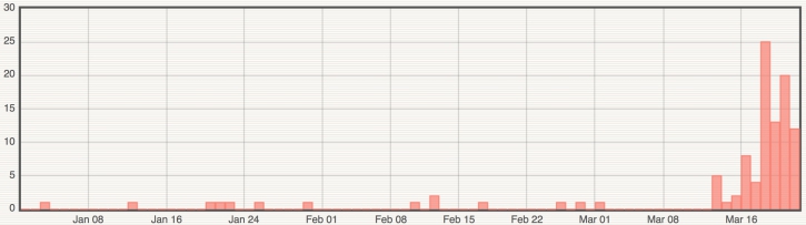
Figure 1: Histogram representing the number of superficial volcano-tectonic earthquakes recorded between January 1 and March 21, 2021 (© OVPF-IPGP).
This seismicity is accompanied by a resumption of inflation (swelling) of the Piton de la Fournaise building. The source at the origin of this inflation is located about 2 km deep under the Dolomieu crater, at the level of the superficial magmatic reservoir (Figure 3).
The CO2 fluxes in the ground are still increasing, especially on the sides of the volcano in the far field (Plaine des Cafres and Plaine des Palmistes sectors). Since CO2 is the first gas to be released from magma at great depth (from the mantle), its detection in the far field is often associated with a deep rise of magma.
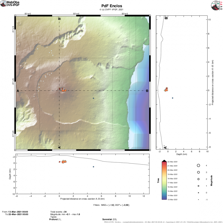
Figure 2: Location map (epicenters) and north-south and east-west sections (showing the location in depth, hypocenters) of the earthquakes recorded and located by the OVPF-IPGP between March 13 and 21, 2021 under the Massif du Piton de la Fournaise. Only localizable earthquakes have been shown on the map (© OVPF-IPGP).
This deep rise of magma is at the origin of the pressurization of the superficial magmatic reservoir, and the seismicity and inflation associated with it.
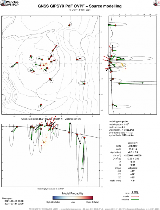
Figure 3: Source of deformation model pCDM) deduced from a Bayesian inversion of surface displacement data recorded between March 13 and March 21, 2021, in cartographic views and vertical sections. The color level indicates the maximum probability level combined with the volume change sign (yellow-orange-red for inflation, green-cyan-blue for deflation). The black, red and green arrows are respectively the observed displacements, the modeled displacements and the residuals. Ellipses represent errors. The best model is indicated in the form of yellow plans (© OVPF-IPGP).
This recharging process from the depths to the shallow reservoir can take several days to several weeks before the reservoir roof weakens and breaks, resulting in an injection of magma to the surface and an eruption, but can also stop without giving rise to an eruption in the short term.
Source : OVPF
Read the article : https://www.ipgp.fr/fr/ovpf/bulletin-dactivite-lundi-22-mars-2021-a-1000-heure-locale
Photo : Nath Duverlie
Indonesia , Kerinci :
VOLCANO OBSERVATORY NOTICE FOR AVIATION – VONA
Issued : March 21 , 2021 .
Volcano : Kerinci (261170)
Current Aviation Colour Code : YELLOW
Previous Aviation Colour Code : unassigned
Source : Kerinci Volcano Observatory
Notice Number : 2021KER01
Volcano Location : S 01 deg 41 min 49 sec E 101 deg 15 min 50 sec
Area : Jambi, West Sumatra, Indonesia
Summit Elevation : 12176 FT (3805 M)
Volcanic Activity Summary :
Eruption with volcanic gas emission at 22h15 (06h15 local). Eruption and gas emission is not continuing
Volcanic Cloud Height :
Best estimate of ash-cloud top is around 14096 FT (4405 M) above sea level, may be higher than what can be observed clearly. Source of height data: ground observer.
Other Volcanic Cloud Information :
Gas emission moving to southwest
Remarks :
Seismic activity is characteriszed by earquake gust
Level of activity level II (WASPADA).
The volcano was clearly visible until it was covered in fog. The crater emits white smoke with a low intensity, at an altitude of about 150-200 meters above the summit. The weather is sunny to rainy, weak to moderate winds to the west and northwest. Another visual: there was a heavy drizzle.
According to the seismographs of March 21, 2021, it was recorded:
87 emissions earthquakes.
Source : Magma Indonésie , PVMBG.
Photo : Wild Sumatra.
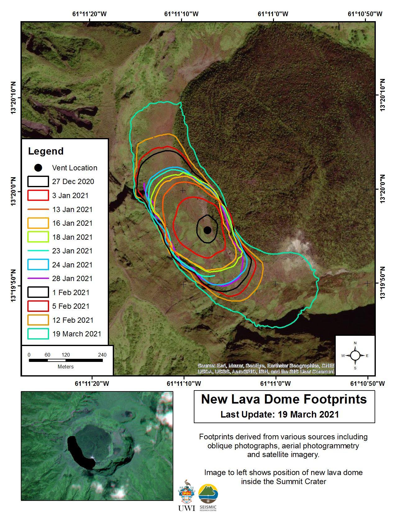
Saint Vincent , Soufrière Saint Vincent :
LA SOUFRIÈRE BULLETIN, MARCH 20, 2021, 8:00 PM.
1. The Seismic Research Center and the Soufrière Monitoring Unit team visited the volcano on Friday March 19, 2021 to conduct an aerial survey by drone and to make general observations of any physical changes.
2. Satellite radar imagery and photographs acquired on March 19, 2021 showed that the lava dome continues to grow, advancing north and south since the last radar image obtained on March 13, 2021.
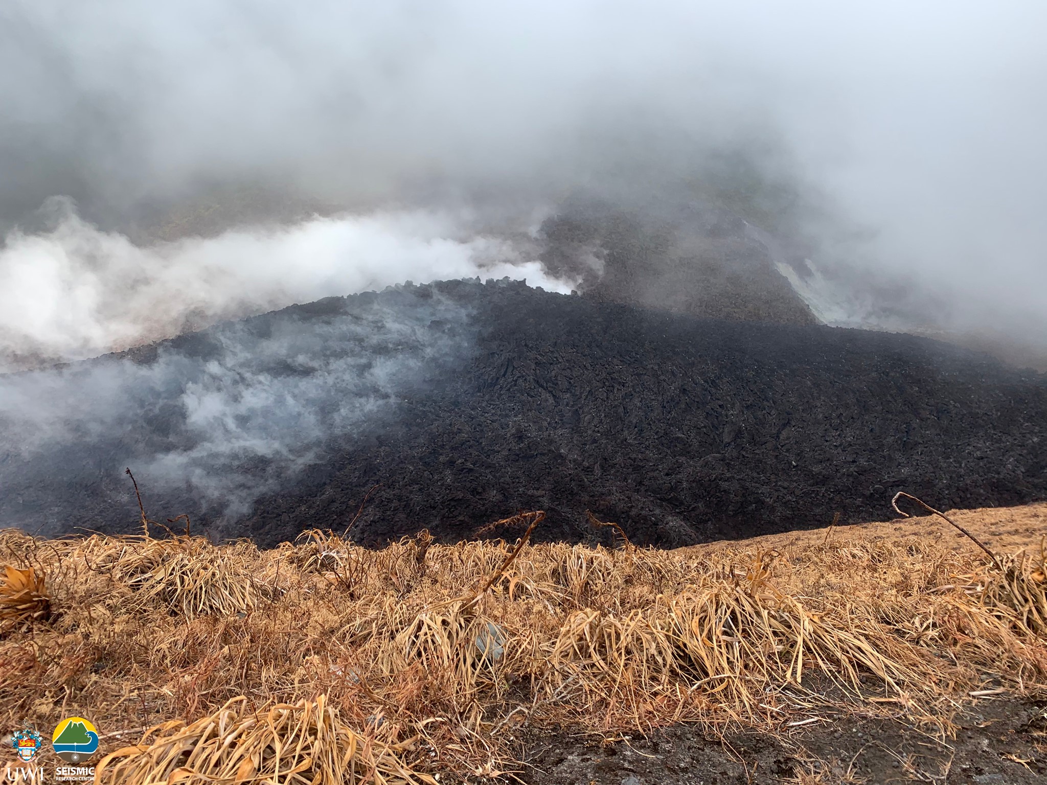
3. The new dome continues to grow northwest and southeast, with the most active gas emissions occurring at the top of the new dome, as well as in the contact areas between the pre-existing 1979 dome and the dome. from 2020-2021. Its approximate dimensions are 921 m long x 243 m wide and 105 m high. The volume of material ejected is now estimated at 13.13 million m3
4. Two field GPS stations were installed in Jacob’s Well and Table Rock on Friday March 19, 2021.
5. Work continues on the preparation and testing of a multigas monitoring instrument that will be installed on the volcano.
6. The gases from the new dome are acidic and can cause respiratory damage to humans. They can also cause unconsciousness and difficulty breathing. The gases can also have a corrosive effect on the skin and eyes, even with short exposure.
7. NEMO continues to call on the public to refrain from visiting the La Soufrière volcano, in particular entering the crater, as this is extremely dangerous.
8. The National Emergency Management Organization reminds the public that no evacuation order or notice has been issued.
Source : Nemo .
Photos : UWI.