July 25 , 2020.
Argentina / Chile , Copahue :
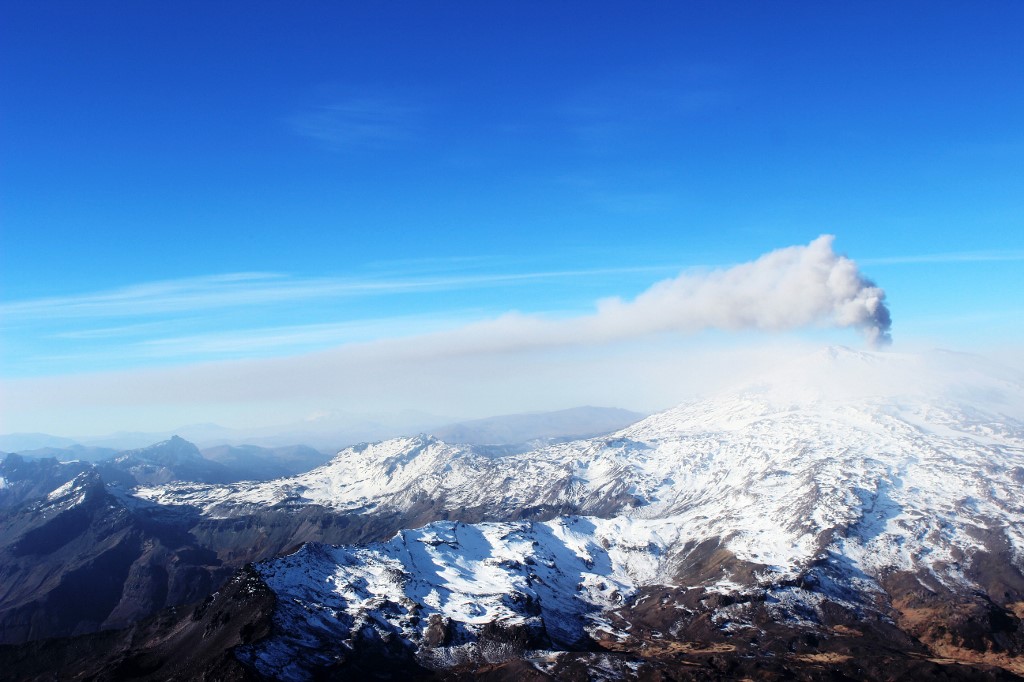
The Argentine Geological Mining Service (SEGEMAR) through its Argentine Volcanic Monitoring Observatory (OAVV) and jointly with the Volcanological Observatory of the Southern Andes (OVDAS) of Chile, report that from July 23, the level of technical alert for the Copahue volcano is raised to YELLOW level.
Although the Copahue volcano has exhibited low levels of seismic activity over the past 15 days, the increase in the continuous tremor seismic signal recorded on July 16, which was accompanied at the surface by the emission of low ash magnitude, which continues to this day, to which is added the apparent increase in gas emission (SO2) that the volcano manifests, suggest an instability of the volcanic system associated with an underlying heat source that destabilizes the system hydrothermal inducing a possible collapse of the crater lake.
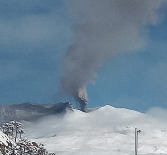
In this context, there is a high probability that the volcanic system can generate new episodes of gas emissions and low-rise ash columns. This does not mean an impending major eruption, but an increase in surface activity and certain monitoring parameters, which are above its baseline level, implying that more careful monitoring of the activity of the volcano must be performed.
The Copahue volcano is the most active volcano in the Republic, according to the Relative Risk Classification of the Argentine Republic, prepared by SEGEMAR, and is a volcano that constantly presents this type of activity, without this implying a direct risk for them. nearby populations. For this reason, monitoring the volcano and permanent communication with the civil protection authorities of the province and the municipality are of vital importance.
It is recommended to stay informed by the official media of the preventive measures taken by the civil protection authorities of the towns near the volcano in Argentinian territory.
Joint monitoring and cooperation tasks will continue with the Volcanological Observatory of the Southern Andes (OVDAS) in Chile, as well as with local and provincial authorities, and any changes will be reported.
Source : Segemar .
Photos : Segemar , Sernageomin .
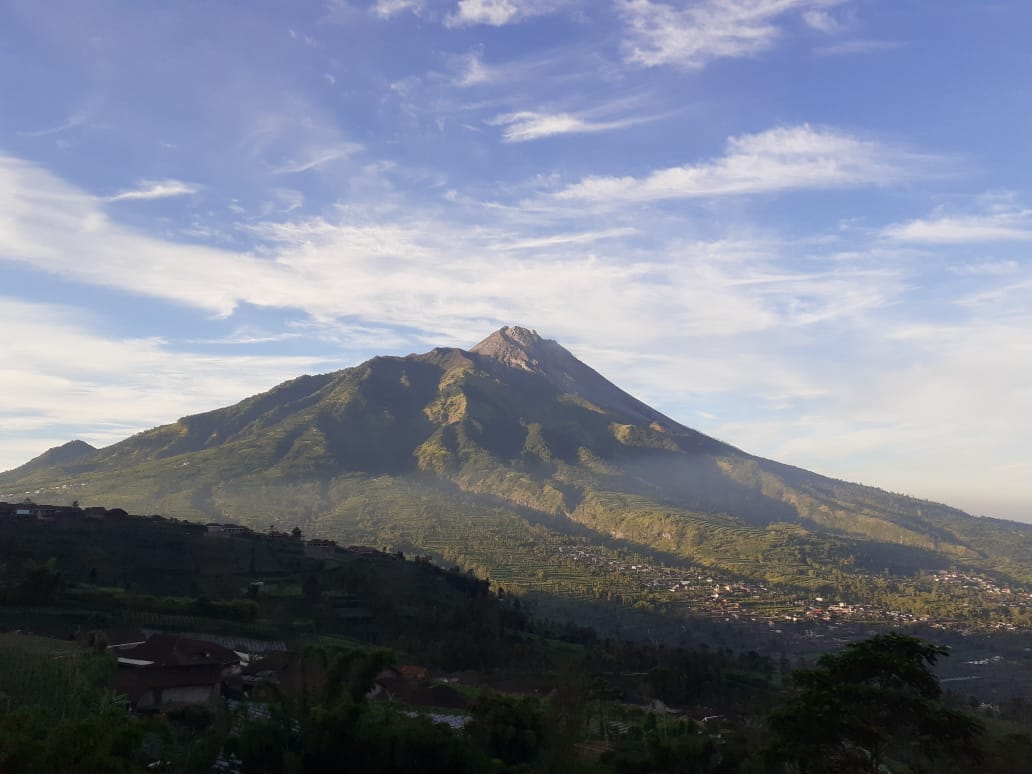
Indonesia , Merapi :
Activity report of the Merapi volcano, from July 17 to 23, 2020.
OBSERVATION RESULTS.
Visual
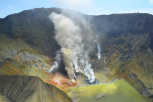
The weather around Mount Merapi is generally sunny in the morning and night, while the day until evening is foggy. There is white smoke, thin to thick with low pressure. A maximum of 200 m in height of smoke was observed from the Mount Merapi observation post in Kaliurang on July 22, 2020 at 9:37 a.m.
Morphological analysis of the crater area based on photos of the southeast sector did not show any change in the morphology of the dome. The volume of the lava dome based on measurements using aerial drone photography on July 11, 2020 is estimated at 200,000 m3.
Seismicity:
During this week, the seismicity of the Merapi recorded:
13 earthquakes of emissions (DG),
12 shallow volcanic earthquakes (VTB),
55 Multiple Phase (MP) earthquakes,
4 low frequency earthquakes (LF),
28 avalanche earthquakes. (RF),
20 tectonic earthquakes (TT).
The seismic intensity this week is relatively lower than last week.
Deformation:
The deformity of G. Merapi which was monitored using EDM this week showed a distance shortening of about 1 cm.
Rain and lahars:
This week there have been no reports of rain and lahars, nor additional flows in the rivers flowing down from Mount Merapi.
Conclusion
Based on the results of visual and instrumental observations, it was concluded that:
1. The lava dome is currently in stable condition.
2. The volcanic activity of Mount Merapi is still quite high and determined by the level of “WASPADA” activity.
3. The danger potential today is in the form of hot clouds from the collapse of the lava dome and explosion of volcanic material from explosive eruptions.
Source : BPPTKG.
Photos : Magma Indonesia , Martin Fontaine.
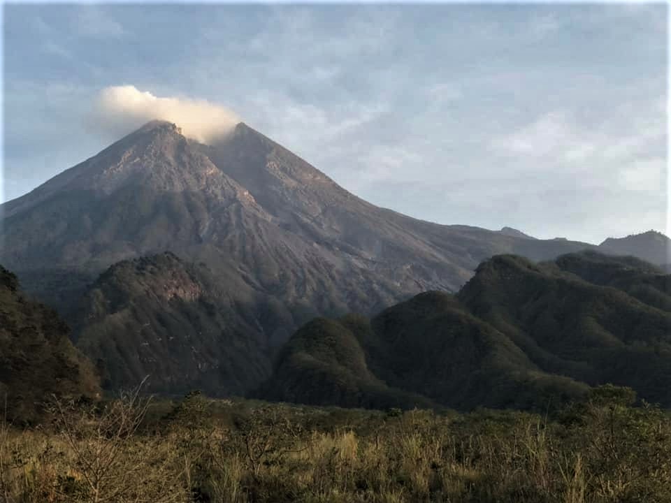
Guatemala , Pacaya :
Type of activity: Strombolian.
Morphology: composite stratovolcano
Geographical location: latitude 14 ° 22’50˝ N; 90 ° 36’00˝ west longitude
Height: 2,552 m.
Atmospheric conditions: clear
Wind: North-West at 2 km / h
Precipitation: 0.0 mm.
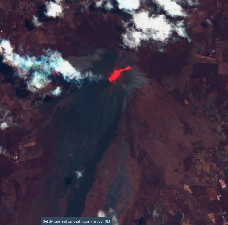
Activity:
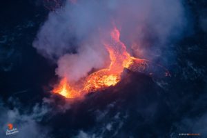
The Mackenney crater is observed, with a blue / white degassing fumarole that the wind moves south and southwest over a distance of up to 3 kilometers. This is accompanied by Strombolian explosions which expel incandescent materials to heights of 50, 75 and 100 meters above the crater. The seismic stations of INSIVUMEH constantly record tremors and explosions, with a tendency to increase energy in the last hours. This is due to the rise and extrusion of magma and gas to the surface. Three lava flows with a length of between 200 and 300 meters are observed located at the base of the Mackenney cone in a northwest direction. The recommendations of the special BEPAC bulletin n ° 47-2020 remain in force.
Source : Insivumeh .
Photo : Sentinel .
La Réunion , Earthquake felt :
Bulletin for Friday July 24, 2020 at 7:00 p.m. (local time) – felt earthquake
On Friday July 24, 2020, 4:19 p.m. (local time – 12:19 GMT), an earthquake was felt by residents of the island, mainly in the North.
This earthquake was recorded by the seismometers of the Volcanological Observatory of Piton de la Fournaise. The first analyzes of this earthquake made it possible to locate it, 11 km below sea level, 7 km west southwest of Sainte-Clotilde. Its magnitude was measured at 1.9 on the Richter scale.
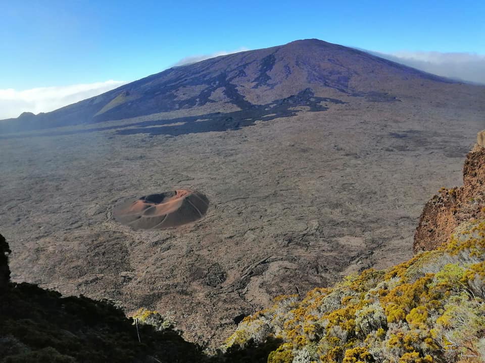
This type of event, felt by the population, is recorded several times a year. This event is isolated and is of tectonic origin.
Call for testimonies on felt earthquakes: the real intensities (effects of an earthquake in a given location) can only be correctly determined by collecting testimonies. If you have felt this earthquake, even weakly, you are invited to report it to the BCSF (Bureau Central Sismologique Français) on the site http://www.franceseisme.fr/
Source : OVPF
Photo : Nath Duverlie