May 16 , 2020.
Indonesia , Merapi :
Activity report of the Merapi volcano, May 8 to 14, 2020
RESULTS OF OBSERVATIONS.
Visual
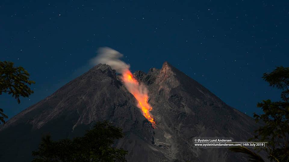
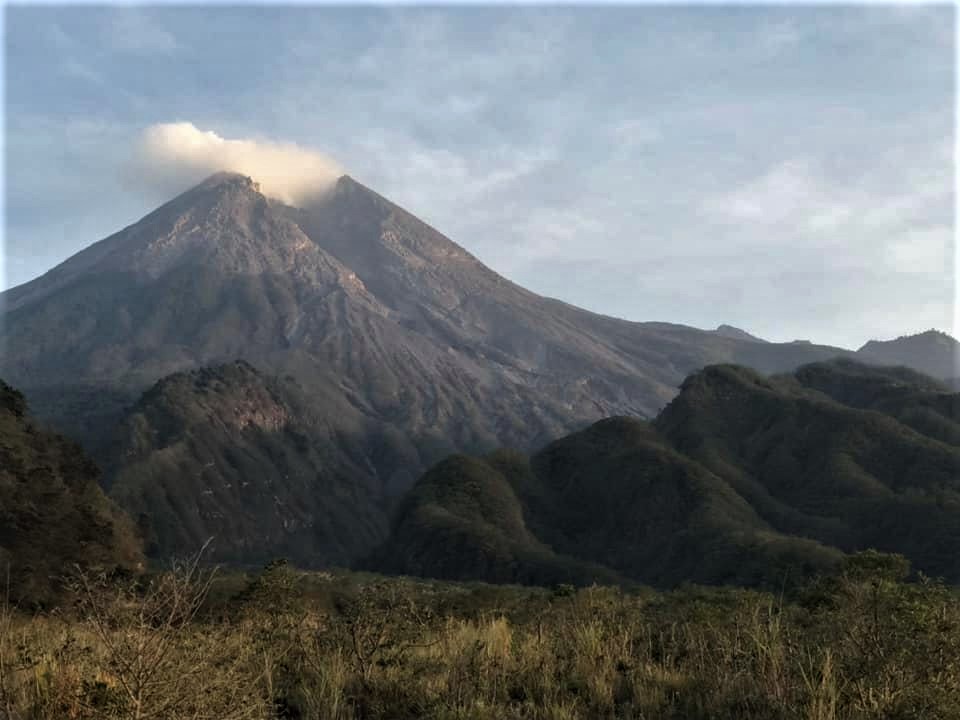
The weather around Mount Merapi is generally sunny in the morning and at night, while the day until evening is foggy. There is a white smoke, from thin to thick with low pressure. A maximum smoke height of 50 m was observed from the Mount Merapi observation post in Babadan on May 8, 2020 at 6:00 a.m.
A morphological analysis of the crater area based on photographs of the Southeast sector did not show any morphological change in the dome. The volume of the lava dome based on measurements using aerial photography with drones on February 19, 2020 amounted to 291,000 m3.
Seismicity:
This week, the seismicity of Mount Merapi recorded:
24 emission earthquakes (DG),
40 multiple phase (MP) earthquakes,
1 low frequency earthquake (LF),
47 avalanche earthquakes (RF),
13 tectonic earthquakes (TT).
This week’s seismic intensity is lower than last week.
Deformation:
The deformation of G. Merapi which was monitored by EDM and GPS this week did not show any significant change.
Rain and lahars:
This week, there was rain at the Mount Merapi observation post with the highest rain intensity of 42 mm / hour for 30 minutes at the Kaliurang post on May 9, 2020. There were no lahars no additional flow in the rivers that descend from Mount Merapi.
Conclusions:
Based on the results of the visual and instrumental observations, it was concluded that:
1. The lava dome is currently in a stable state.
2. The volcanic activity of Mount Merapi is still quite high and is determined by the level of activity « WASPADA ».
Source : BPPTKG.
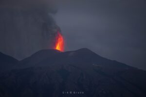
Photos : Oystein Lund Andersen , Martin Fontaine .
Hawaii , Kilauea :
19°28’30 » N 155°36’29 » W,
Summit Elevation 13681 ft (4170 m)
Current Volcano Alert Level: ADVISORY
Current Aviation Color Code: YELLOW
Activity Summary:
Mauna Loa Volcano is not erupting. Rates of deformation and seismicity have not changed significantly over the past week and remain above long-term background levels.
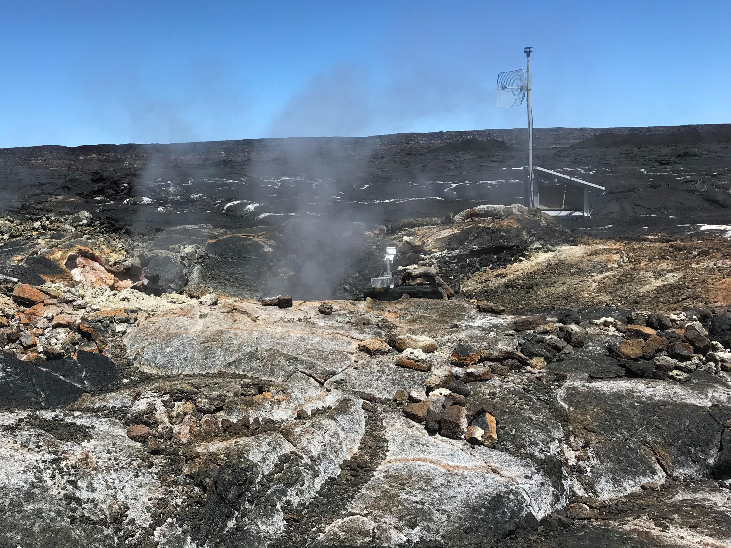
HVO’s new Mauna Loa summit MultiGAS station after installation on April 27, 2020. The station is next to a gas-emitting vent or fumarole, within Moku‘āweoweo—Mauna Loa’s summit caldera. The site is an important addition to HVO’s volcano-monitoring network and could provide HVO with early signs of increased unrest. Mauna Loa is not currently erupting, though it is at an elevated Alert Level/Aviation Color Code (ADVISORY/YELLOW) due to seismicity and ground deformation being above background levels. USGS photo by T. Elias.
Observations:
During the past week, HVO seismometers recorded 92 small-magnitude earthquakes on the volcano’s summit and upper-elevation flanks. Most of these earthquakes occurred at shallow depths of less than 8 kilometers (~5 miles) below sea level.
Global Positioning System (GPS) measurements show slowly increasing summit inflation, consistent with magma supply to the volcano’s shallow storage system.
Gas concentrations at the Sulphur Cone monitoring site on the Southwest Rift Zone remain stable. Fumarole temperatures as measured at both Sulphur Cone and the summit have not changed significantly.
Source : HVO.
Russia / Kurile Islands , Ebeko :
VOLCANO OBSERVATORY NOTICE FOR AVIATION (VONA).
Issued: May 15 , 2020.
Volcano: Ebeko (CAVW #290380)
Current aviation colour code: ORANGE
Previous aviation colour code: orange
Source: KVERT
Notice Number: 2020-85
Volcano Location: N 50 deg 41 min E 156 deg 0 min
Area: Northern Kuriles, Russia
Summit Elevation: 3791.68 ft (1156 m)
Volcanic Activity Summary:
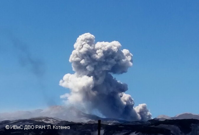
A moderate eruptive activity of the volcano continues. According to visual data by volcanologists from Severo-Kurilsk, explosion sent ash up to 1.7 km a.s.l., an ash cloud is drifting to the northwest of the volcano.
This activity continues. Ash explosions up to 19,700 ft (6 km) a.s.l. could occur at any time. Ongoing activity could affect low-flying aircraft and airport of Severo-Kurilsk.
Volcanic cloud height:
4920-5576 ft (1500-1700 m) AMSL Time and method of ash plume/cloud height determination: 20200515/2335Z – Visual data
Other volcanic cloud information:
Distance of ash plume/cloud of the volcano: 3 mi (5 km)
Direction of drift of ash plume/cloud of the volcano: NW
Time and method of ash plume/cloud determination: 20200515/2335Z – Visual data
Source : Kvert.
Photo : L. Kotenko, IVS FEB RAS , 2017.
Costa Rica , Rincon de la Vieja :
Activity report of the Rincón de la Vieja volcano, May 15, 2020.
On May 15, 2020 at 11:27 local time, an eruption was recorded on the Rincón de la Vieja volcano, with a column which rose to 600 meters above the height of the crater and to 2516 meters above from sea level. (8,252.48 ft).
Duration of activity: 1 minute.
Ash falls reported in: no report
Sulfur odor reported in: no report.
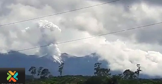
Comments: Residents north of the volcano estimate a height of plume of water vapor and gas of nearly 1000 meters and a column of gray sediment of about 400 m above the crater.
The volcano continues with small frequent eruptions observed by seismic data and the web camera – we observe columns of water vapor which do not reach more than 1000 m above the height of the crater. There have been no reports from lahars in the past few days. The 4:27 eruption was identified by its seismic signal, it was not observed by webcam due to the darkness.
Source : Ovsicori .
Guatemala , Santiaguito :
LAHAR in the ravines of the Río San Isidro, tributary of the Río El Tambor
VOLCAN SANTIAGUITO (1402-03)
Activity type: Pelean
Morphology: Complex of dacitic domes
Location: 14 ° 44 ’33 ˝ Latitude N; 91 ° 34’13˝ Longitude W.
Height: 2500 m above sea level.
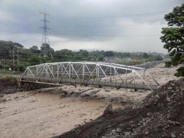
The INSIVUMEH seismic network located on the Santiaguito volcano, records high frequency seismic tremors, generated by volcanic materials which descend through the canyon of the San Isidro river due to the rain that is currently occurring near the building volcanic. 23.4 mm of precipitation is currently recorded.
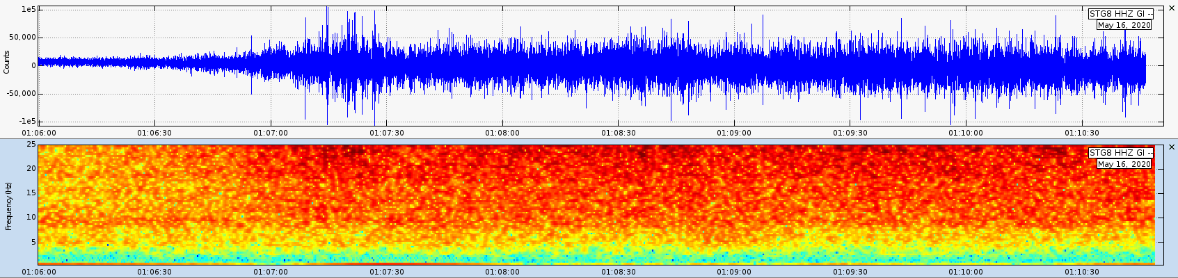
Figure 1: Seismic wave recorded by the STG8 station. The high frequency content reflects the activity of the lahars.
Heavy rains in the upper domes of the volcanic complex generate the descent of weak to moderate lahars. These can transport tree branches and volcanic materials such as ashes and blocks 1 to 2 meters in diameter that vibrate the ground. .
If the rain persists, the generation of more lahars in this or other ravines of the volcanic complex is not excluded.
Source : Insivumeh .