
May 03 , 2020.
Indonesia , Merapi :
Activity report of the Merapi volcano from April 24 to 30, 2020
OBSERVATION RESULTS
Visuals
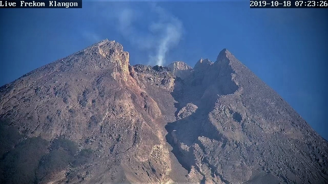
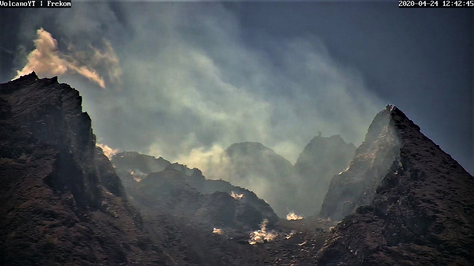
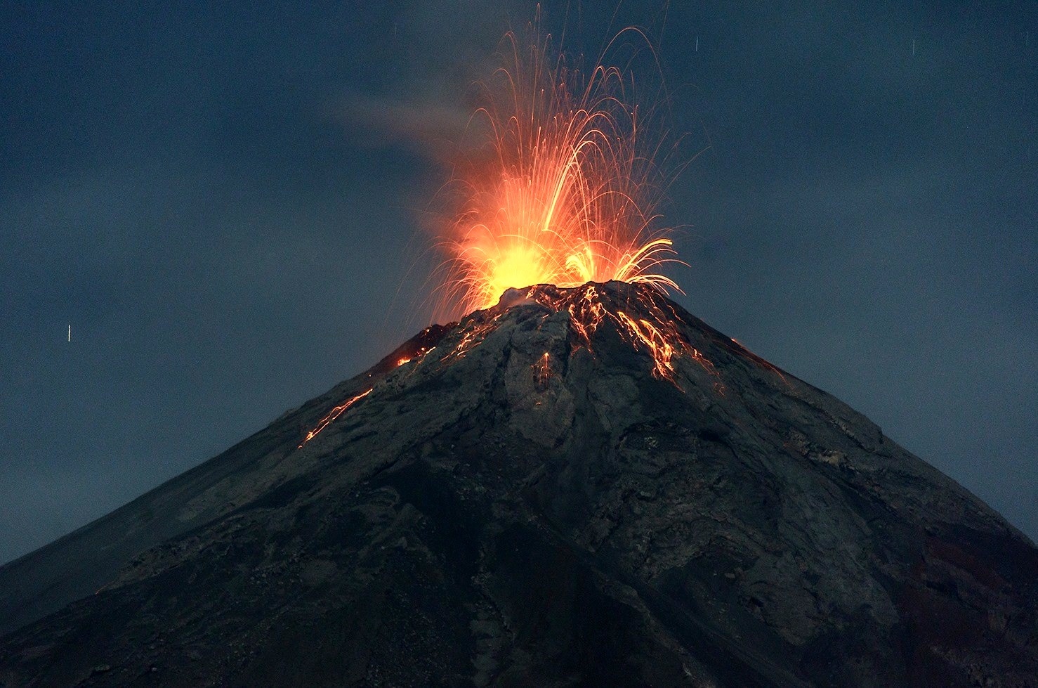
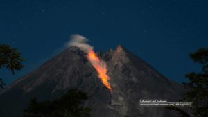
The weather around Mount Merapi is generally sunny in the morning and at night, while the day until the afternoon is foggy. There is a white smoke, of low thickness to thick with low pressure. A maximum smoke height of 500 m was observed from the Mount Merapi observation post in Kaliurang on April 30, 2020 at 9:30 a.m.
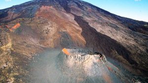
Morphological analysis of the crater area based on photos of the Southeast sector did not show any change in the morphology of the dome. The volume of the lava dome based on measurements using aerial photos with drones on February 19, 2020 was 291,000 m3.
Seismicity:
This week, the seismicity of Mount Merapi recorded:
10 emission earthquakes (DG),
47 multiple phase earthquakes (MP),
16 avalanche earthquakes (RF),
8 tectonic earthquakes (TT).
This week’s seismic intensity is lower than last week.
Deformation:
The deformation of G. Merapi who was monitored by EDM this week did not show any significant change.
Rain and lahars:
This week, April 29, 2020, there was rain at the Mount Merapi observation post with the highest intensity of rain of 26 mm / hour at the Babadan post. There were no lahars or additional flows in the rivers that descend from Mount Merapi.
Conclusion:
Based on the results of the visual and instrumental observations, it was concluded that:
1. The lava dome is currently in a stable state.
2. The volcanic activity of Mount Merapi is still quite high and is determined by the level of activity « WASPADA ».
3. The current potential danger is in the form of hot clouds from the collapse of the lava dome and projections of volcanic material from explosive eruptions.
Source : BPPTKG .
Photos : Live frekom.
Earthquake Crète :
Earthquake off Crete, May 2 at 2:51 p.m., with local tsunami alert
A magnitude 6.7 earthquake was located by the INGV Tsunami Warning Center (CAT) at 2:51 p.m. (Italian time) today, May 2, 2020. The epicenter was located in the sea, at about 80 km south of the island of Crete. Due to the large scale, a red tsunami warning (ATTENTION) was issued by the CAT-INGV for the island of Crete, while the alert level is orange (Warning) for the other regions of the Greece, for Turkey, Libya and Egypt. The warning message was issued by CAT-INGV eight minutes after the earthquake.
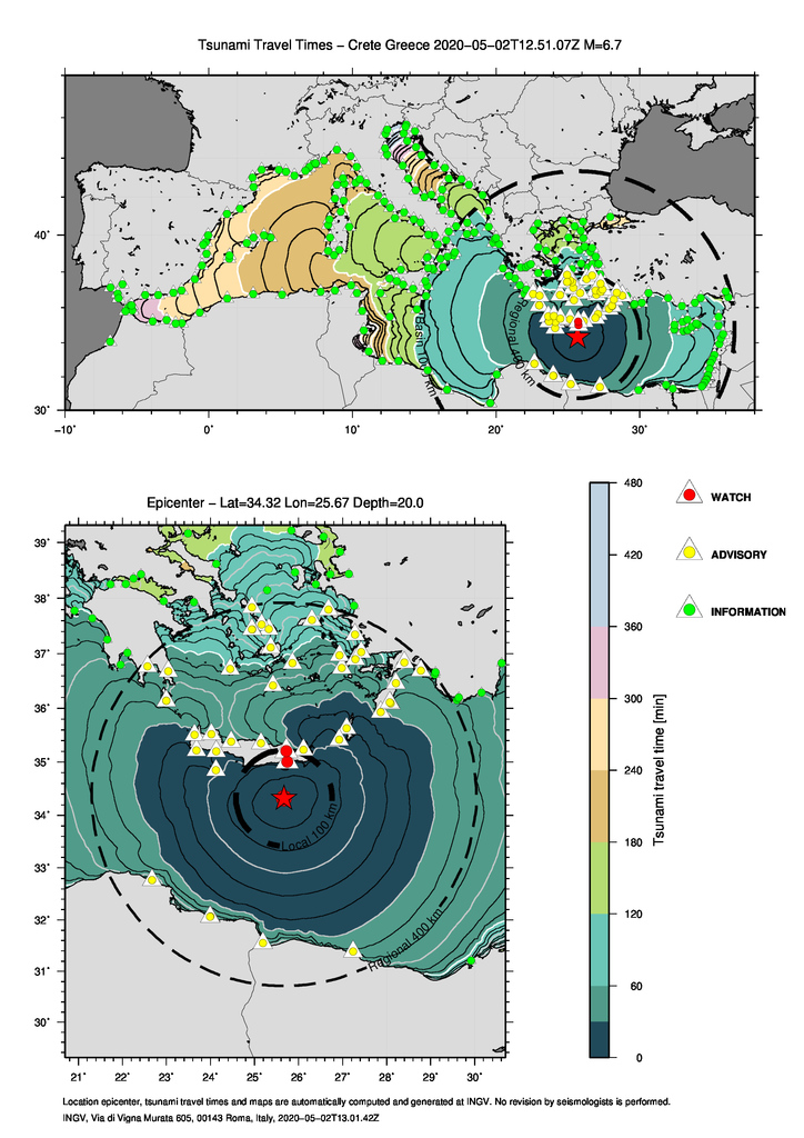
Given the remoteness of our coasts, no alert has been issued for the Italian coasts or for the other Mediterranean countries. The figure shows the isochrones (lines of equal propagation time) of the potential tsunami and the « forecast points », the points where the arrival times of the first wave are estimated and the alert level (red, yellow and green according to the estimated alert level). At the time of the earthquake (3:45 p.m.), the CAT-INGV issued a message confirming the tsunami, which was observed at the tide gauge of Ierapetra on the island of Crete, although with a width so far limited ( about 15 cm, or about 35 cm peak to peak).
Source : INGV Terremoti
Philippines , Taal / Mayon / Kanlaon
TAAL VOLCANO BULLETIN 03 May 2020 08:00 A.M.

In the past 24-hour period, the Taal Volcano Network recorded eight (8) volcanic earthquakes that are associated mainly with rock-fracturing processes beneath and around the edifice. Weak steaming or fumarolic activity was observed from vents on the Main Crater and from fissure vents along the Daang Kastila Trail.
MAYON VOLCANO BULLETIN 03 May 2020 08:00 A.M.
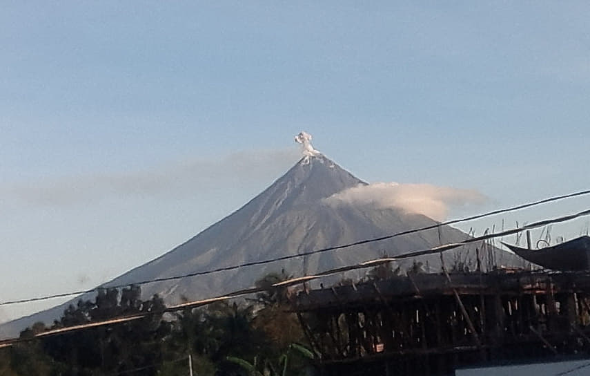
Mayon Volcano’s seismic monitoring network recorded one (1) rockfall event during the 24-hour observation period. Moderate emission of white steam-laden plumes that crept downslope before drifting west-northwest was observed. Faint crater glow from the summit could be observed at night. Sulfur dioxide (SO2) emission was measured at an average of 407 tonnes/day on 28 April 2020. Recent electronic tilt data showed inflation of the middle to upper portions of the volcanic edifice that began in the last quarter of 2019. This follows an inflationary trend that began in February 2019 as recorded by continuous GPS monitoring.
KANLAON VOLCANO BULLETIN 03 May 2020 08:00 A.M.

Kanlaon Volcano’s seismic monitoring network recorded one (1) volcanic earthquake during the 24-hour observation period. Sulfur dioxide (SO2) emission was measured at an average of 86 tonnes/day on 17 April 2020. Ground deformation data from continuous GPS measurements indicate a period of long-term slow inflation of the edifice since 2017, while short-term electronic tilt monitoring on the southeastern flanks recorded slow inflation of the lower slopes since May 2019 and pronounced inflation of the upper slopes at the end of January 2020. These parameters indicate that hydrothermal or magmatic activity is occurring deep beneath the edifice.
Source : Phivolcs.
Photos : Tomasz Lepich , manilla bulletin , wikipedia .
Guatemala , Fuego :
Atmospheric conditions: partly cloudy
Wind: northeast.
Precipitation: 28.4 mm.
Activity:
Presence of white / gray degassing fumaroles at an altitude of 4400 m above sea level moving towards the South and the South-West. It is reported 11 to 16 weak and moderate explosions per hour which eject columns of ash at a height of 4500 to 4800 m above sea level (14765-15750 feet) which disperse in a south and southwest direction. Incandescent pulses from 200 to 300 m in height were observed at night in the crater, with weak, moderate and strong avalanches around the crater, towards the Seca, Taniluya, Ceniza, Trinidad and Las Lajas ravines. The explosions generated low and moderate rumblings which cause shock waves causing vibrations in the houses of the volcanic perimeter. Locomotive type noises are heard for periods of 2 to 5 minutes. There are falls of fine particles of ash in Panimaché I, Morelia, Ceylon, Rochela and other communities. No lava flow is observed on the volcanic building.
Source : Insivumeh .
Photo : Conred.

Beautiful photos, lots of info.
Merci à vous.