January 24 , 2020 .
Alaska , Takawangha :
51°52’1″ N 178°1’37 » W,
Summit Elevation 4754 ft (1449 m)
Current Volcano Alert Level: NORMAL
Current Aviation Color Code: GREEN
The USGS National Earthquake Information Center (NEIC) detected a large magnitude 6.2 earthquake 14 km east of Takawangha volcano and 22 km east of Tanaga volcano, north of Tanaga Island. The shallow (10 km depth) earthquake occurred at 05:53 UTC January 23 and followed a series of smaller magnitude 2-3 earthquakes in the same region earlier in the day. There is no clear evidence at this time that the M6.2 earthquake or earlier earthquakes are volcanic in nature, nor is there any indication that this seismic activity has any direct implications for future eruptive activity at Takawangha or Tanaga volcanoes. Numerous aftershocks have been recorded, and more are anticipated for a shallow earthquake of this magnitude. AVO will continue to closely monitor the seismic data from Tanaga Island for signs of volcanic unrest.
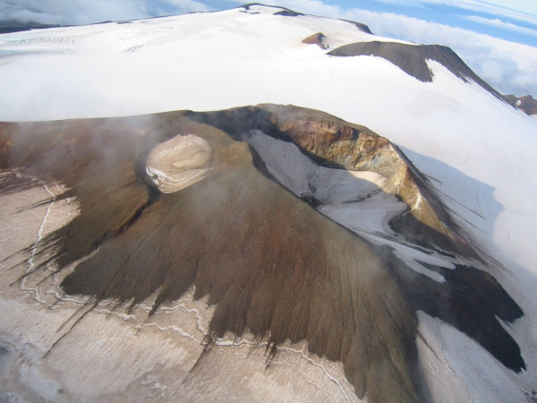
Craters atop Takawangha’s summit, looking west.
Takawangha is a remote, 1,449 m (4,754 ft)-high stratovolcano located on the northern portion of Tanaga Island, roughly 95 km (59 miles) west of Adak in the Andreanof Islands. Takawangha’s summit is mostly ice-covered, except for four young craters that have erupted ash and lava flows in the last few thousand years. Parts of Takawangha’s edifice are hydrothermally altered and may be unstable, possibly leading to localized debris avalanches from its flanks. Takawangha lies across a saddle from historically active Tanaga volcano to the west. No historical eruptions are known from Takawangha; however, field work shows that recent eruptions have occurred and it is possible that historic eruptions attributed to Tanaga may instead have come from Takawangha.
Source : AVO.
Photo : Coombs, M. L.
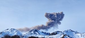
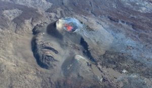
Philippines , Taal :
TAAL VOLCANO BULLETIN 24 January 2020 8:00 A.M.
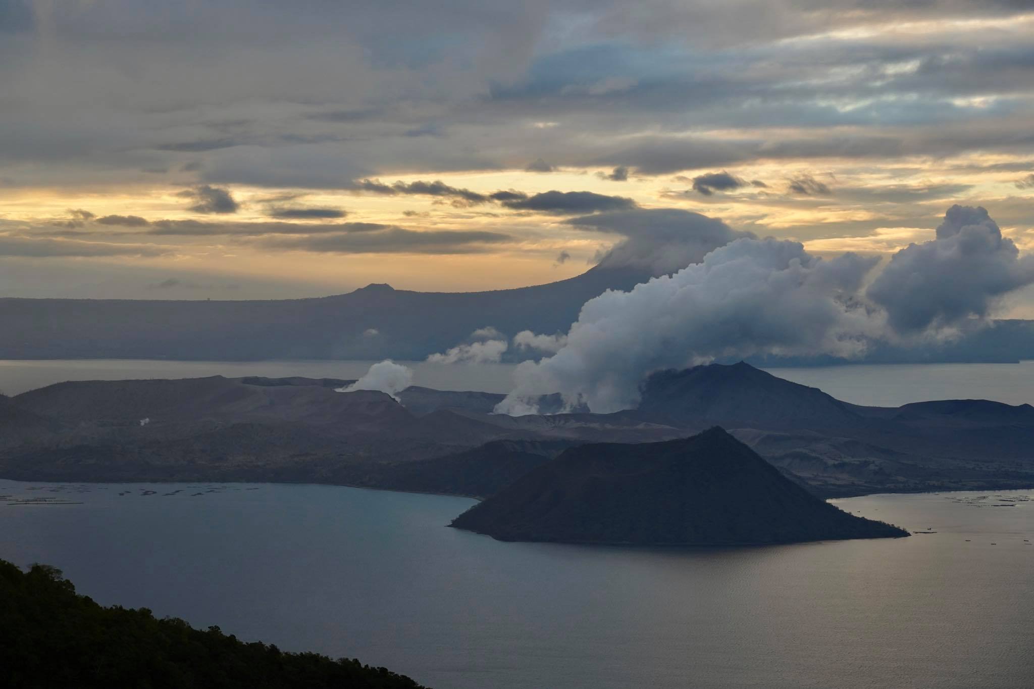
Activity in the Main Crater in the past 24 hours has been characterized by weak to moderate emission of white steam-laden plumes 50 to 500 meters high from the Main Crater that drifted southwest. Sulfur dioxide (SO2) emission was measured at an average of 224 tonnes/day.
The Philippine Seismic Network (PSN) plotted a total of seven hundred thirty-eight (738) volcanic earthquakes since 1:00 PM, January 12, 2020. One hundred seventy-six (176) of these registered at magnitudes M1.2-M4.1 and were felt at Intensities I-V. Since 5:00 AM on January 23, 2020 until 5:00 AM today, there were seven (7) volcanic earthquakes plotted that registered at magnitudes M1.2-M2.7 with no felt event.
For the past 24 hours, the Taal Volcano Network, which can record small earthquakes undetectable by the PSN, recorded four hundred eighty-six (486) volcanic earthquakes including four (4) low-frequency earthquakes. Such intense activity likely signifies continuous magmatic intrusion beneath the Taal edifice, which may lead to further eruptive activity.
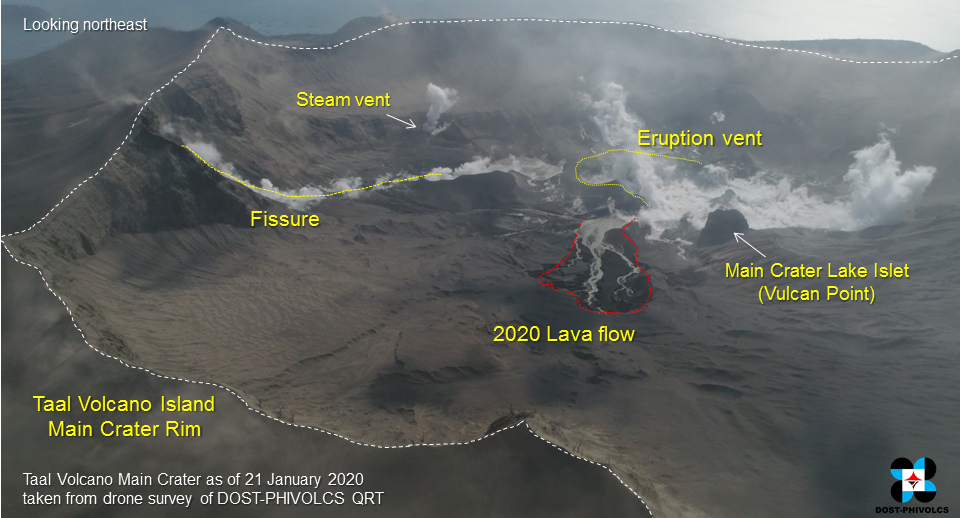
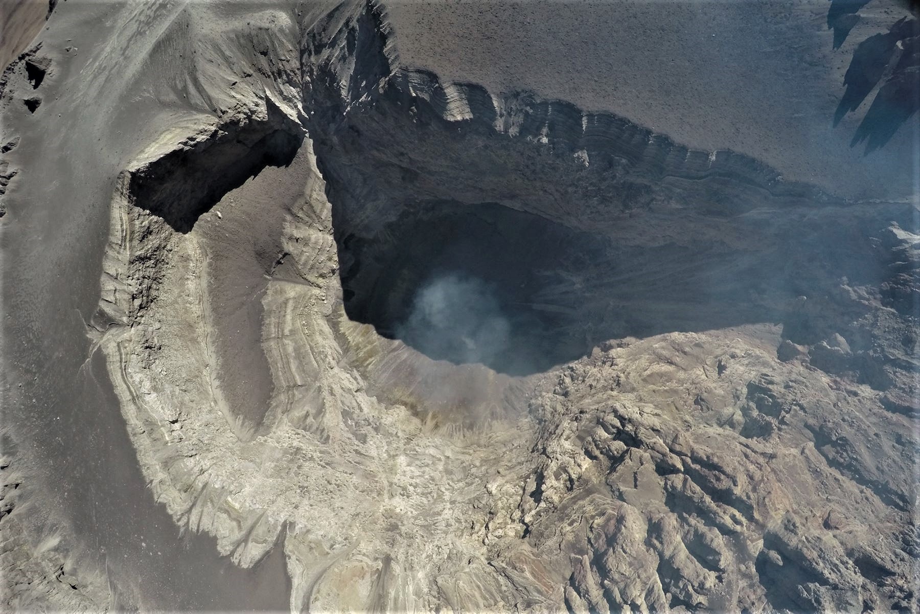
The main crater after the explosion on January 12, 2020. New volcanic deposits of ash and lava from the eruption are now visible in the lower part of the main crater. There are newly formed blowout vents from which the vapor is constantly coming out. The main island of Crater Lake (Vulcan Point) survived the explosion. Continued volcanic activity will result in a constantly evolving volcanic appearance.
Alert Level 4 still remains in effect over Taal Volcano. This means that hazardous explosive eruption is possible within hours to days. DOST-PHIVOLCS strongly reiterates total evacuation of Taal Volcano Island and high-risk areas as identified in the hazard maps within the 14-km radius from Taal Main Crater and along the Pansipit River Valley where fissuring has been observed. Based on PAGASA wind forecast, if the eruption plume remains below five (5) km, ash will be drifted to the municipalities west and northwest of the Main Crater; however, if a major eruption occurs during the day and the eruption column exceeds 7 km, ash will also be drifted over the western parts of Laguna and Quezon provinces. Residents around the volcano are advised to guard against the effects of heavy and prolonged ashfall. Civil aviation authorities must advise pilots to avoid the airspace around Taal Volcano as airborne ash and ballistic fragments from the eruption column pose hazards to aircraft.
DOST-PHIVOLCS is continually monitoring the eruption and will update all stakeholders of further developments.
Source : Phivolcs .
Photos : Raffy Tima
Peru , Ubinas :
Analysis period: January 13-19, 2020. Arequipa, January 20, 2020.
Alert level: ORANGE
The Geophysical Institute of Peru (IGP) reports that the eruptive activity of the Ubinas volcano remains at low levels. To date, the energy of earthquakes associated with the rise of magma to the surface has decreased considerably. There are weak and sporadic emissions of bluish gases (of magmatic origin) and water vapor, observed through surveillance cameras. According to this scenario, the possibility of volcanic explosions and / or ash emissions is low.
During the period from January 13 to 19, 2020, the IGP recorded and analyzed a total of 79 seismic events associated with the dynamic behavior of the Ubinas volcano, with the predominance of seismic signals of the Volcano-Tectonic type (VT) related to the fracturing of rocks inside the volcano which, on average, recorded 7 earthquakes per day, all with magnitudes less than M2.9. The seismic signals linked to the rise of magma (hybrid type) have decreased, both in number of events (2 daily earthquakes) and in energy.
Visual surveillance, although limited by cloud cover at this time of the year, records very slight emissions of volcanic gases and water vapor that have reached heights of up to 300 m above the summit of the volcano. Monitoring the deformation of the volcanic structure, using GNSS data (processed with fast orbits), does not record any anomalies. MIROVA satellite surveillance also did not record thermal anomalies on the volcano.
Source : IGP .
Photo : IGP .
Indonesia , Kerinci :
VOLCANO OBSERVATORY NOTICE FOR AVIATION – VONA.
Issued: January 24 , 2020.
Volcano: Kerinci (261170)
Current Aviation Colour Code: YELLOW
Previous Aviation Colour Code: yellow
Source: Kerinci Volcano Observatory
Notice Number: 2020KER03
Volcano Location: S 01 deg 41 min 49 sec E 101 deg 15 min 50 sec
Area: Jambi, West Sumatra, Indonesia
Summit Elevation: 12176 FT (3805 M)
Volcanic Activity Summary:
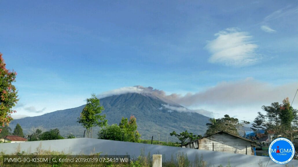
On 24 january 2020, observed brown ash emission at 01:06 UTC (08:06 Local Time).
Volcanic Cloud Height:
Best estimate of ash-cloud top is around 13776 FT (4305 M) above sea level, may be higher than what can be observed clearly. Source of height data: ground observer.
Other Volcanic Cloud Information:
Ash emission moving northwest
Remarks:
Seismic activity is dominated by gas emission and continuous vulcanic tremor with amplitude 0,5-2 mm (Dominan 1 mm).
Source : Magma Indonésie .
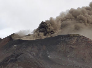
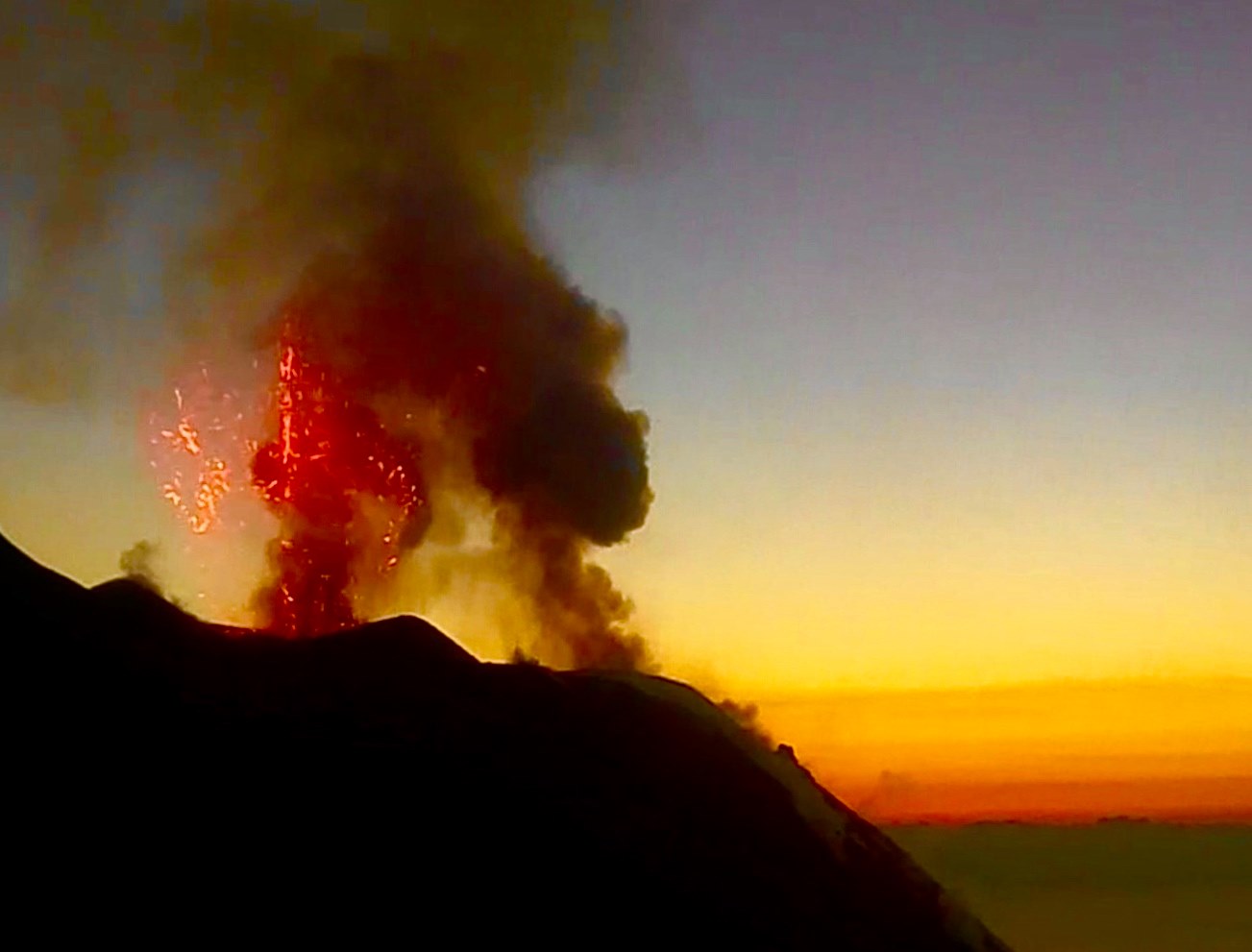
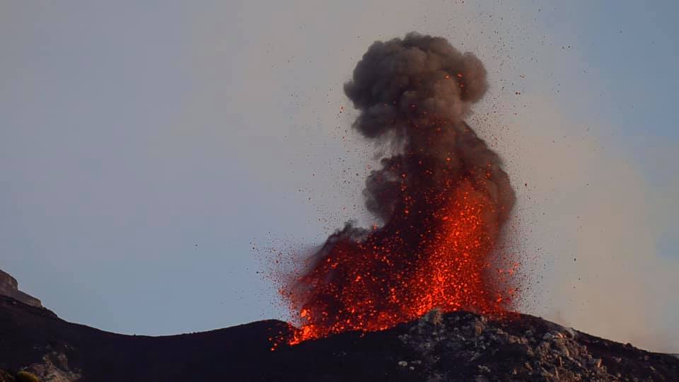
Italy , Stromboli :
Weekly bulletin from 13/01/2020 to 19/01/2020 (date of issue 21/01/2020)
SUMMARY OF ACTIVITY STATUS
In light of the monitoring data, it is highlighted:
1) VOLCANOLOGICAL OBSERVATIONS: During this period, a normal Strombolian type explosive activity was observed, accompanied by degassing and splashing activities interrupted by an overflow of lava which stopped within a few hours. The hourly frequency of explosions fluctuated between average values (13 events / h on January 19) and high values (23 events / h on January 16). The intensity of the explosions was mainly medium-low in the area of the North crater and medium-high in the area of the Center-South crater.
2) SEISMOLOGY: The seismological parameters do not show significant variations.
4) DEFORMATIONS: No change to report.
5) GEOCHEMISTRY: The flow of SO2 is at an average level. The CO2 / SO2 ratio in the plume (data from 19/01/2020) is at an average value. The values of the isotopic ratio of helium dissolved in the thermal aquifer, relative to the sampling of 01/14/2020, are low-average values.
VOLCANOLOGICAL OBSERVATIONS
The analysis of the images recorded by the cameras placed at an altitude of 400m, at an altitude of 190m and at Punta dei Corvi made it possible to characterize the eruptive activity of Stromboli. During the reporting period, the explosive activity was mainly produced by at least 3 (three) eruptive vents located in the North crater area and by at least 3 (three) eruptive vents located in the South Central crater area . All the vents are located inside the depression which occupies the crater terrace.
In the morning of January 13, 2020, INGV-OE personnel carried out an inspection in the summit area during which it was possible to monitor the explosive activity and document the morphological changes in the crater terrace. In particular, it has been observed that in the area of the North crater, the mouth N1 is located inside a flared cone, slightly open on the North-East side. During the hours of observation, it produced explosions of medium intensity (less than 150 m high) of coarse materials (lapilli and bombs), with abundant fallout on the sides of the cone. The N2 cone has a regular shape and has two mouths, an intra-crater and one placed on the southeast side of the cone. The first produced an explosive activity of low intensity (height less than 80 m), with emission of coarse matter, while the second produced mainly swelling activities with sporadic emission of certain pyroclasts. In the area of the Center-South crater, crater C has a pit crater which has produced no activity. The crater S1, overlooking the Sciara del Fuoco, has a small terrace on which a cone grows which has produced an explosion of coarse materials mixed with the ends (ashes), of medium to low intensity (less than 120 m in height). The crater S2 has two mouths: one produced an intermittent and sometimes intense projection activity and the other an explosive activity of medium to high intensity (sometimes the products exceed 200 m in height), with the emission of materials mainly coarse mixed for purposes.
In the North zone, the explosions were mainly of low intensity (less than 80 m high) and medium (less than 150 m high), sometimes high (more than 150 m high), with emission of coarse material (lapilli and bombs). During numerous explosions, the fallout covered the upper slope of the Sciara and certain blocks were rolled for a few hundred meters before the mesa in place along the slope. During the period analyzed, the average frequency of explosions in the North zone varied between 2 and 12 events / h. The explosive activity of the Center-South zone produced explosions of coarse coarse material, of medium intensity (less than 150 m high) and high (the products reached 200 m high). In some explosions, the products fell in the upper part of the Sciara. In addition, splashes were observed at the southern mouth of the CS zone, which was sometimes intense. The frequency of explosions in the Center-South zone varied between 11 and 13 events / h.
On January 18, 2020 at 9:39 pm UTC, a modest lava overflow started from the northern area of the crater terrace. The flow did not exceed the middle-high part of the Sciara del Fuoco. Glowing blocks rolled down the steep slope of the casting front. At 00:45 UTC, the lava flow was no longer supplied and seemed to gradually cool… / …
Source : INGV.
Read the article : file:///C:/Users/Utilisateur/AppData/Local/Packages/Microsoft.MicrosoftEdge_8wekyb3d8bbwe/TempState/Downloads/BollettinoStromboli20200121%20(1).pdf